
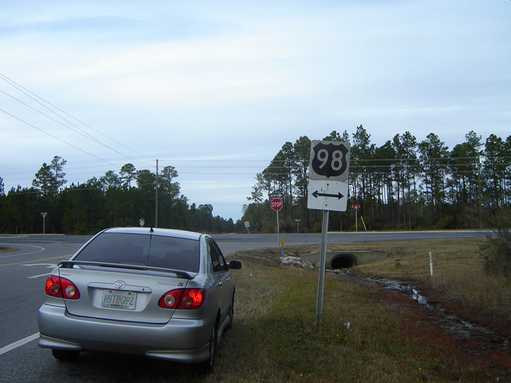
Photo taken 12/13/08
Well, the masterminds over at Google Maps have done it again. Upon going on Google Maps on Monday night, it was discovered that one of their features, Street View, has been drastically modified. First off, Street View can now take up your entire screen, whereas the previous version displayed it in a pop-up window. Second, there is now more extensive coverage, especially in rural areas in the southeast. So, one might think, wow, this is great news! Thanks, Google!
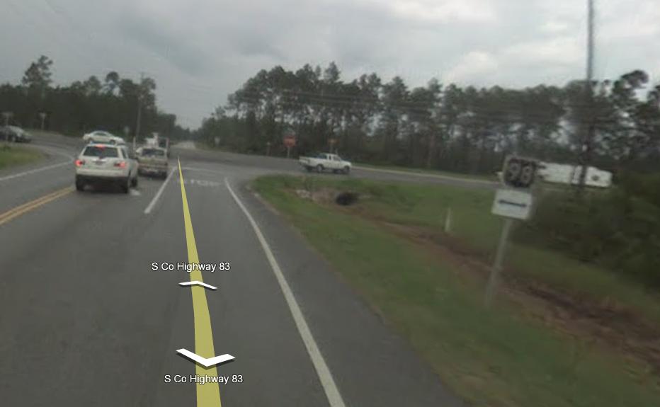
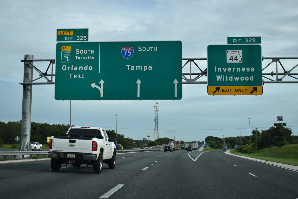
Photo from Google Maps, dated 2008
Well, from a roadgeek’s standpoint (meaning mine) this is NOT great news. Now thanks to the enhanced Street View, one can virtually go on road trips without ever leaving the comfort of their own home. So you want to take some back roads over in the Tallahassee area, well, just go on the PC or laptop, go to Google Maps, find your area, drag the little Street View icon onto the road you want, and away you go!
I personally feel that this enhanced mapping product is going to be the end all to end all for some roadgeeks out there. For some, no, but for others who are not as inclined to jump in a car and take a trip due to the current state of the economy, yes. They will no longer have to spend money on gas to take a road trip. Nope, they can go just about anywhere from their living room. For any roadgeeks in Florida they no longer have to drive endlessly trying to find that one last colored U.S. Highway shield or that Key shield. With just a couple of clicks and pans with the mouse, you can check out most intersections in Florida now and see if those rare but cherished road markers are in place.
Granted, there are still some flaws with Street View, such as the resolution in some areas, the age of the photography used (most is still at least a year behind, if not more), the fact that they travel east in the morning and west in the evening so the sun is in full view and you can’t see anything of importance, the problem areas where the road numbers and road names are STILL incorrect, and the fact that they still do not have Street View in all areas, but the Google guys are probably working hard to resolve those issues.
Needless to say, it’s my personal belief that Google Maps is well on its way, if not already there, to replacing the exploration and fun in roadding. When one sits at the computer and virtually roads where ever they want, you lose that aspect of maybe finding some rare piece of road history or that rare sign that should no longer exist when you can go online and see it before actually field checking. I understand some may not agree with me on this and may feel that this updated Street View on Google Maps is yet another tool in the roadding tool belt, and that is fine. I do agree that it could be, but I strongly feel that it is NOT an end all to end all. But for me personally, I still love the aspect of actually getting in my car, driving somewhere and stumbling across some rare colored Florida U.S. Highway shield or that old alignment alongside a new roadbed.
As I said, this is my personal opinion, so any comments on this are suggested and welcomed by my fellow roadgeeks.


Right on, Alex!!!
Although my “real job” is in IT, I firmly believe that computers can never replace (and should never replace) human interaction in any aspect.
Right on Brent actually, he’s the author. I’m right there with him in his opinion though.
It’s one thing to see something like that on Street View. It’s another to go and see it for yourself, and photograph it yourself.
I don’t think this will kill roadgeeking… it may even have the potential to do the opposite.
I spent all day at work “driving” around New Zealand on street view – I can’t find any reassurance markers for the life of me.
But yeah, I dont think anything will take down the thrill of a new A-city.
WOW! I never thought of it like that. Personally, I would still love to see how these roads look in person and tell all my friends, “Yeah, I’ve been there!”. Good post.