Arizona

Antelope Canyon I

Photos from late August of this year, when Daniel Brim and I drove from California to New Mexico … in a moving van. Always fun doing three-point turns on narrow old alignments. We stopped at Antelope Canyon along the way – and this set will not include any pictures from there, as it ends just as we get there. The next batch will be the canyon itself. Part of the [...]

By |2018-01-17T14:28:13-05:00November 29th, 2009|Arizona, California, Interstate Highways, Nevada, U. S. Highways, Utah|4 Comments

New Mexico (like Utah, only different)

More from my New Mexico trip of November 2008, including some actual New Mexico this time. On the mountain pass between Chama, New Mexico, and Cumbres, Colorado – both states call this one highway 17. The sky was dark blue, just after sunrise – the snow is that bright, and there is just that little atmosphere, at 10,000 feet. Sunset over the plains of northeast New Mexico. Old US-64 (now [...]

A ranch style home in the desert

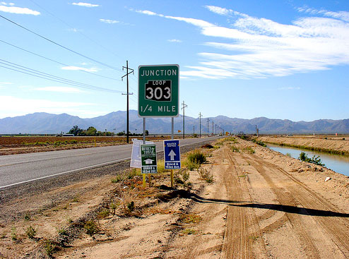
It's no secret that Phoenix is one of the sprawliest urban areas in the nation. Arizona's DOT is responding to this need for infrastructure with Loop 303, a third freeway loop around Phoenix. The road has been around in a two-lane highway form for several years now, but groundbreaking took place last week on the first section of freeway for Loop 303 stretching from I-17 north of Phoenix west and [...]

By |2018-01-17T14:36:49-05:00May 17th, 2009|Arizona|1 Comment

Coronado Trail

U.S. Highway 191 travels along the eastern boundary of Arizona between Arizona 80 near Douglas and U.S. Highway 160 at Mexican Water. AARoads recently took a trip on the road from Interstate 10 to U.S. 60 in Springerville, encompassing the Coronado Trail. The Coronado Trail was constructed between Clifton and Alpine in 1926, and added to the state highway system as U.S. 666 in 1938. The road remained essentially unpaved [...]

By |2018-01-17T15:19:18-05:00December 3rd, 2007|Arizona|1 Comment

Arizona Updates

The Arizona Pages have been undergoing a number of changes. Pictures have been replaced and added throughout the site, and additional background information is being researched and added to the site. New to the Arizona Pages are Historical Road Maps of Arizona, dating as far back as 1919. Check them out!

By |2018-01-17T15:38:35-05:00April 16th, 2007|Arizona, Maps|0 Comments

Arizona/Utah I-15 Update

I-15 in Arizona has been completely resigned. The changes noted: Exit 9 is now "Desert Springs" instead of Farm Road. An increase in the number of distance signs. There are at least 3 distance signs each way pointing to St. George, Cedar City and Salt Lake northbound - southbound to Cedar Pocket, Mesquite, and Las Vegas. The advance signs for Business Loop 15 in Mesquite on southbound I-15 are now [...]

By |2018-01-17T15:36:56-05:00July 10th, 2006|Arizona, Utah|1 Comment
Go to Top