| California 1 north |
|
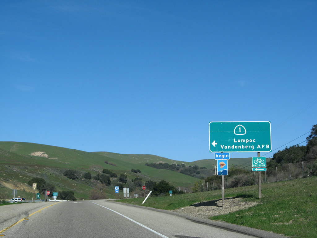
U.S. 101 and California 1 share alignment through most of Santa Barbara County, until the two routes divide at U.S. 101 Exit 132. At that point, U.S. 101 travels north toward Buellton and Santa Maria, while California 1 follows Cabrillo Highway northwest toward Lompoc and Vandenberg Air Force Base. Photo taken 02/02/08. |
|
Now on the off-ramp from U.S. 101 Exit 132 to California 1 northwest, motorists should turn left at the top of the ramp to follow Cabrillo Highway to Lompoc and Vandenberg Air Force Base. Photo taken 02/02/08. |
|
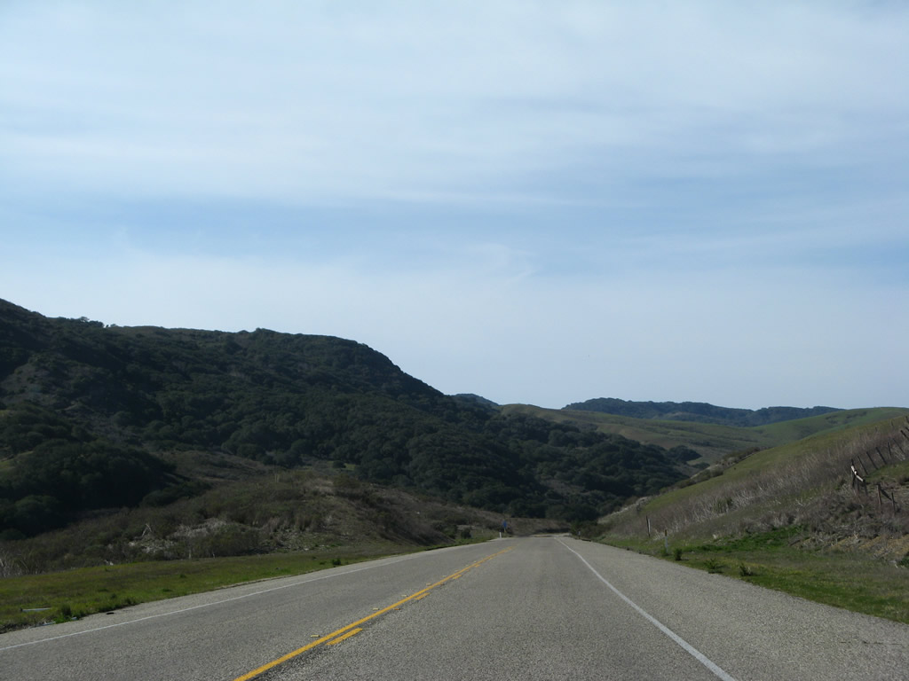
From here, California 1 (Cabrillo Highway) will proceed northwest and uphill between the Santa Ynez Mountains and Santa Rosa Hills, then descend into the Santa Ynez River valley near the city of Lompoc. Photo taken 02/02/08. |
|
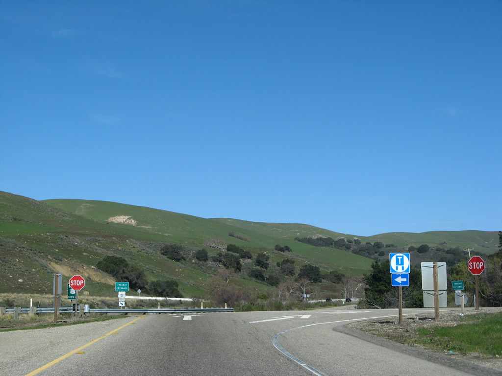
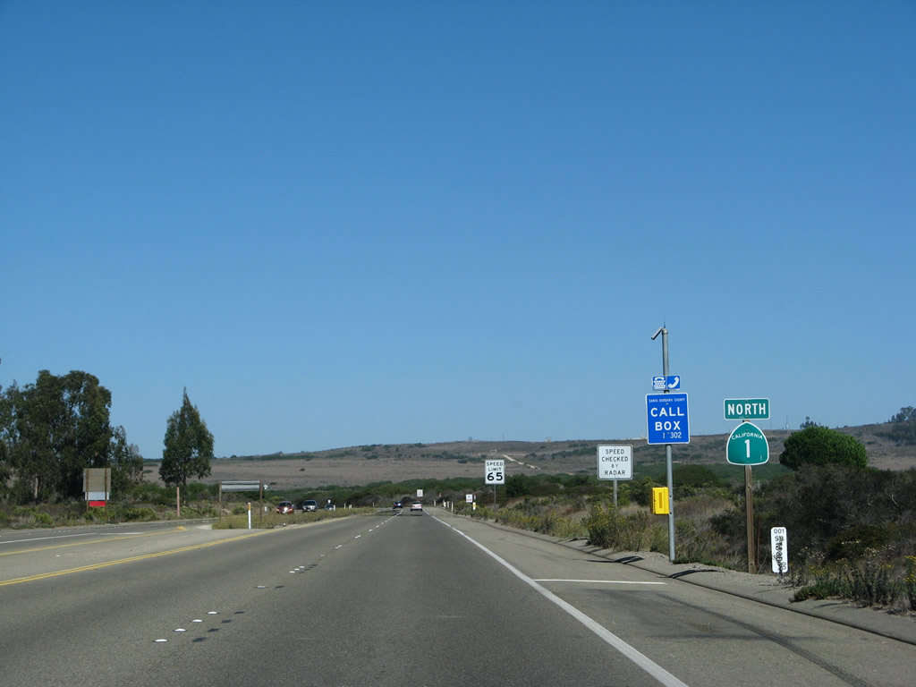
At the top of the ramp are these signs for U.S. 101 north (freeway entrance) and to U.S. 101 (and California 1) south. Turn right here to Las Cruces, a small unincorporated community located at this interchange. A hot springs resort is also located east of the freeway interchange. Photo taken 02/02/08. |
|
Two-lane California 1 proceeds west across U.S. 101 (El Camino Real). The highway will widen out briefly for the climb uphill. Photo taken 02/02/08. |
|
Turn left here to connect to U.S. 101 south and California 1 south. The highway widens to four lanes ahead. Provisions were made to allow for future widening of this interchange into freeway-to-freeway standards in the future (look at this area from an aerial perspective to see currently unused roadways). Photo taken 02/02/08. |
|
The first California 1 north reassurance shield is posted shortly thereafter. From here, California 1 (Cabrillo Highway) travels generally west toward a summit, then will descend into a valley formed by El Jaro Creek. Photo taken 02/02/08. |
|
California 1 passes over a park road that serves the northern section of Gaviota State Park. Photo taken 02/02/08. |
|
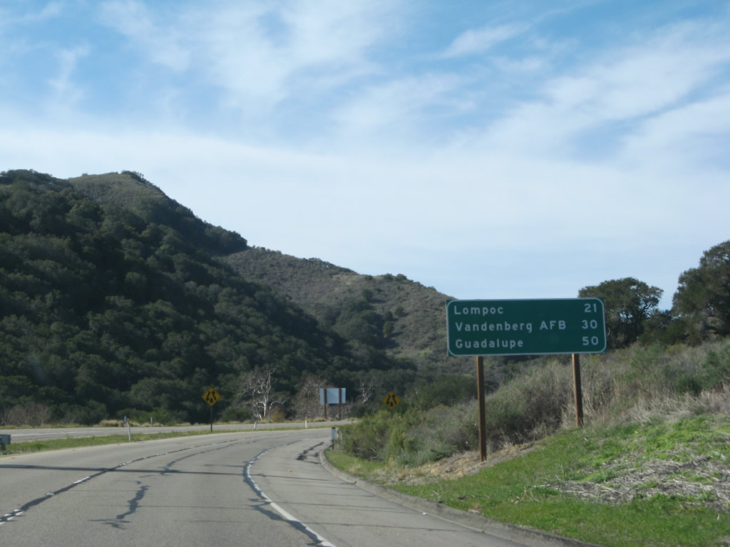
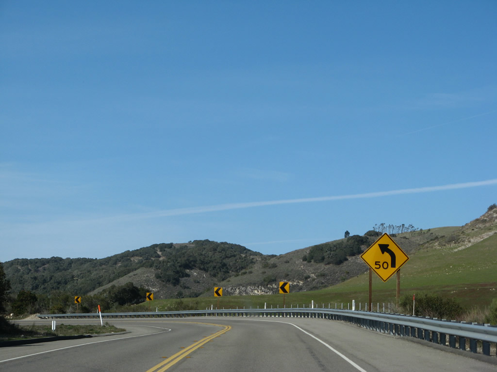
This mileage sign provides the distance to Lompoc (21 miles), Vandenberg Air Force Base (30 miles), and Guadalupe (50 miles). Photo taken 02/02/08. |
|
Northbound California 1 (Cabrillo Highway) approaches San Julian Road southeast to Gaviota State Park. The highway is now three lanes, with two uphill (northwestbound) lanes and one downhill (southeastbound) lane. Photo taken 02/02/08. |
|
|
|
|
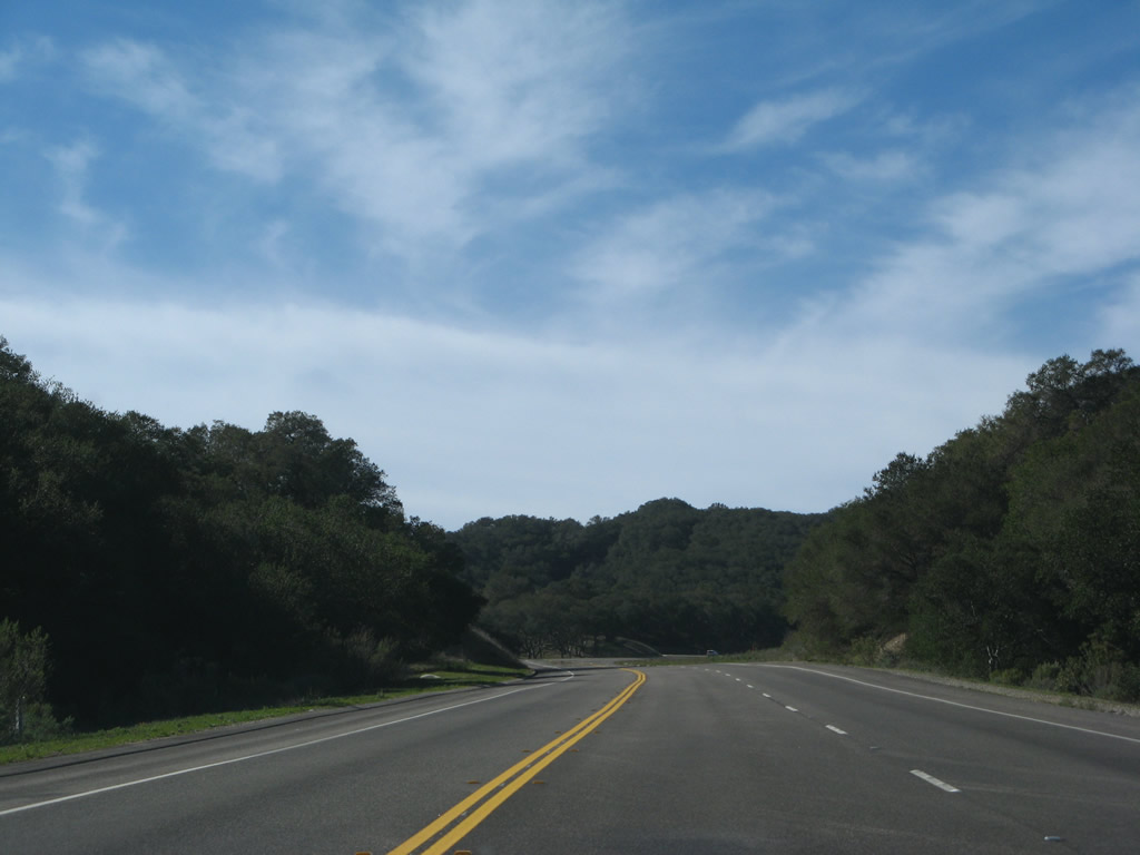
Traveling uphill to a summit, California 1 continues with two westbound lanes until the top. From here, California 1 will parallel El Jaro Creek northwest to Lompoc. Photos taken 02/02/08. |
|
|
|
|
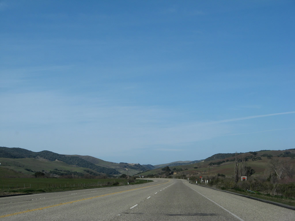
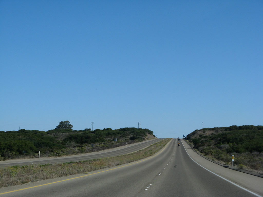
For the next several miles, California 1 (Cabrillo Highway) narrows to two lanes, except for occasional passing lanes. The highway generally follows El Jaro Creek on this side of the summit en route to Lompoc. Photos taken 02/02/08. |
|
|
|
|
|
This mileage sign provides the distance to Lompoc (10 miles) and Vandenberg Village (15 miles). Omitted is the control city of Guadalupe. Photo taken 02/02/08. |
|
|
|
California 1 continues northwest along El Jaro Creek, then moves into the watershed of Salispuedes Creek southeast of Lompoc. Most of this area is ranchland, with limited development and few intersections between U.S. 101 and Jalama Road. Photos taken 02/02/08. |
|
|
|
|
The next major intersection along California 1 (Cabrillo Highway) north is with Jalama Road. Use Jalama Road southwest to Jalama Beach County Park and Point Conception (alternately Point Concepcion). Photo taken 02/02/08. |
|
Northbound California 1 (Cabrillo Highway) meets Jalama Road at this intersection. Use Jalama Road southwest to Point Conception, which is the point where the Santa Barbara Channel meets the Pacific Ocean. Considered to be the point where the California coastline turns from generally east-west to generally north-south (making a corner between Southern and Central California), Point Conception juts out into the ocean. A lighthouse is located on Point Conception, and is the only place along the U.S. west coast where the sun can be seen to rise and set over the Pacific Ocean. Photo taken 02/02/08. |
|
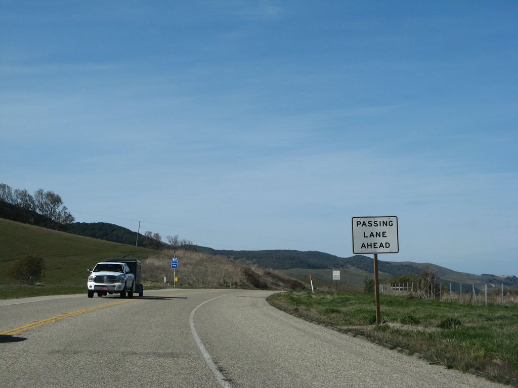
Another set of passing lanes is located northwest of the Jalama Road intersection. Photo taken 02/02/08. |
|
California 1 has this four-lane section for passing along Salispuedes Creek southeast of Lompoc. Photo taken 02/02/08. |
|
Northbound California 1 (Cabrillo Highway) approaches Santa Rosa Road east to Buellton (connecting with U.S. 101 at Exit 139). Photo taken 02/02/08. |
|
This California 1 north reassurance shield is posted after the Santa Rosa Road intersection. Photo taken 02/02/08. |
|
|
|
|
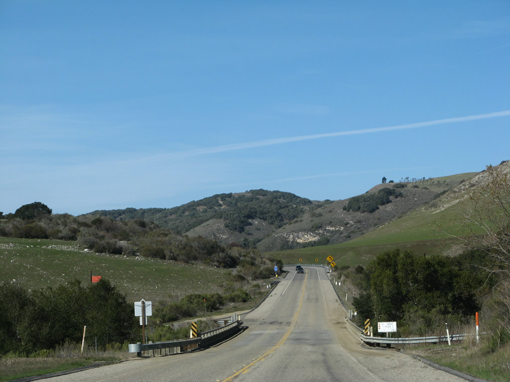
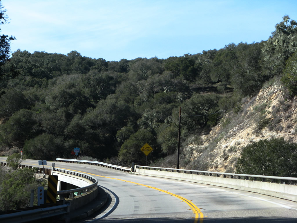
Two-lane Cabrillo Highway winds through valleys en route to Lompoc. Upon making a final set of turns, civilization appears with the backs of homes fronting California 1. Lompoc lies ahead. Photos taken 02/02/08. |
|
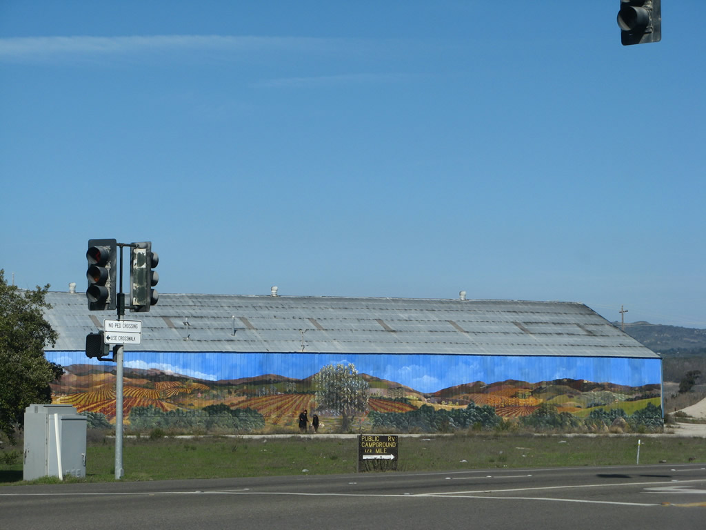
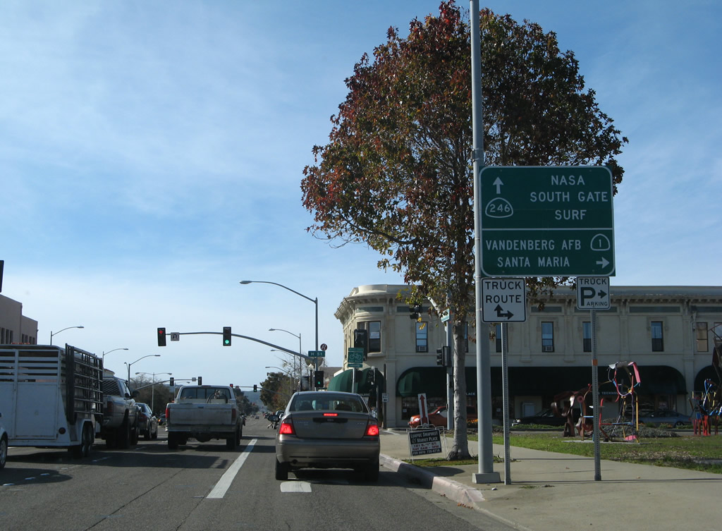
Northbound California 1 (Cabrillo Highway) approaches California 246. This is the first traffic signal found along California 1 (Cabrillo Highway) since leaving U.S. 101 in Las Cruces. Around this point, California 1 enters the city of Lompoc ("The City of Arts and Flowers"), with a population of 41,103 as of the 2000 Census. The city was settled in the mission era in 1787 and was incorporated in 1888. The city gained significant population through the late 1950s and 1960s with the development of Vandenberg Air Force Base, which brought military jobs to the region. The name of the city of "Lompoc" is derived from a Chumash (Native American) word "Lum Poc" that means "little lake" or "lagoon." Turn east on California 246/Buellton-Lompoc Road to Mission La Pur-sima Concepci-n, which was established in 1787 and moved to its present site northeast of downtown Lompoc in 1812 after an earthquake damaged the original mission complex. Preserved as part of a state historical park, the 1812 mission is no longer a functioning Catholic church but instead was restored between 1934 and 1941 by the Civilian Conservation Corps and corporate donors. Since then, the mission is part of the historic park. Photos taken 02/02/08. |
|
|
|
|
California 246 is an east-west state route that originates in western Lompoc and extends east through the city toward Buellton. After interchanging with U.S. 101 in Buellton, California 246 continues east through Solvang and Santa Ynez before ending at California 154 near Lake Cachuma. California 1 will turn left at this traffic signal to join California 246 west into downtown Lompoc. An agricultural mural is painted on the side of a building near this intersection, noting the importance of agriculture to this Santa Ynez River valley community. Note the entry monument sign for the city of Lompoc. Photos taken 02/02/08. |
|
|
| California 1 north & 246 west |
|
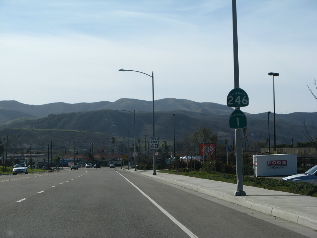
Immediately after merging together, California 1 north and California 246 west have a pair of reassurance shields. A Home Depot is located on the north side of California 1 and California 246; this area was undeveloped in 2002. From here, California 246 west will remain cosigned with California 1 north from east of Lompoc into the city center. Then California 1 splits north, while California 246 continues due west. The state route ends at the western city limits of Lompoc, and the county has taken over maintenance of former California 246 from Lompoc west to Surf. Surf is basically a stop for the Surfliner Amtrak rail route that follows the California coastline from San Diego to San Francisco. Photo taken 02/02/08. |
|
Northbound California 1 and westbound California 246 (now called Ocean Avenue) approach Seventh Street (traffic signal). Plans once called for a bypass of Lompoc that would take California 1 out of downtown, but such plans have not come to fruition. Photo taken 02/02/08. |
|
The next signalized intersection along California 1 north and California 246 (Ocean Avenue) west is with Third Street. Photo taken 02/02/08. |
|
Northbound California 1 and westbound California 246 (Ocean Avenue) approaches A Street. Photo taken 02/02/08. |
|
A set of California 1 north and California 246 west reassurance shields are found on westbound Ocean Avenue at C Street, but they are obscured by a street light pole. Photo taken 02/02/08. |
|
The next signalized intersection along California 1 north and California 246 (Ocean Avenue) west is with H Street in downtown Lompoc. The routes will divide in one block. Photo taken 02/02/08. |
|
A California 1 north trailblazer is posted prior to the H Street intersection. Turn right to follow California 1 (H Street) north to Vandenberg Village, the main gate for Vandenberg Air Force Base, and Guadalupe. California 246 will continue west along Ocean Avenue into western Lompoc. Photo taken 02/02/08. |
|
California 246 (Ocean Avenue) travels west to the south gate of Vandenberg Air Force Base and the Amtrak stop at Surf. The state route extends west to the Lompoc city limits, and the rest of the route is county maintained all the way to Surf. This sign was replaced between 2002 and 2008. Photo taken 02/02/08. |
| California 1 north |
|
After turning north on H Street and leaving California 246 (Ocean Avenue) in downtown Lompoc, California 1 passes by the Lompoc Theater. Photo taken 03/18/06. |
|
California 1 follows H Street due north through northern Lompoc. The first traffic signal on northbound California 1 (H Street) is with Walnut Avenue. Photo taken 02/02/08. |
|
Northbound California 1 (H Street) meets Chestnut Avenue at this signalized intersection. Photo taken 02/02/08. |
|
The next signalized intersection along California 1 (H Street) north is with Laurel Avenue. Flooding is possible along this section of California 1. Photo taken 02/02/08. |
|
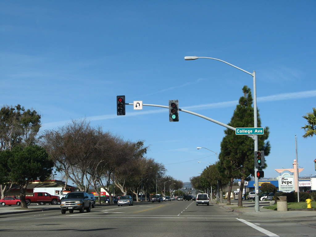
Both sides of H Street are lined with strip malls, restaurants, gas stations, and other commercial establishments. Here H Street meets College Avenue. Turn west on College Avenue to Lompoc High School and College Park. Photo taken 02/02/08. |
|
Northbound California 1 (H Street) meets Pine Avenue at this traffic signal in northern Lompoc. Photo taken 02/02/08. |
|
Northbound California 1 (H Street) approaches North Avenue. Photo taken 02/02/08. |
|
H Street has five lanes, with two lanes in each direction and a center turn lane. Photo taken 02/02/08. |
|
Northbound California 1 (H Street) meets Barton Avenue at this traffic signal in northern Lompoc. Photo taken 02/02/08. |
|
This California 1 reassurance shield is posted on H Street after the Central Avenue intersection. After the next traffic signal (for a shopping center), California 1 will leave the urban area of Lompoc. Photo taken 02/02/08. |
|
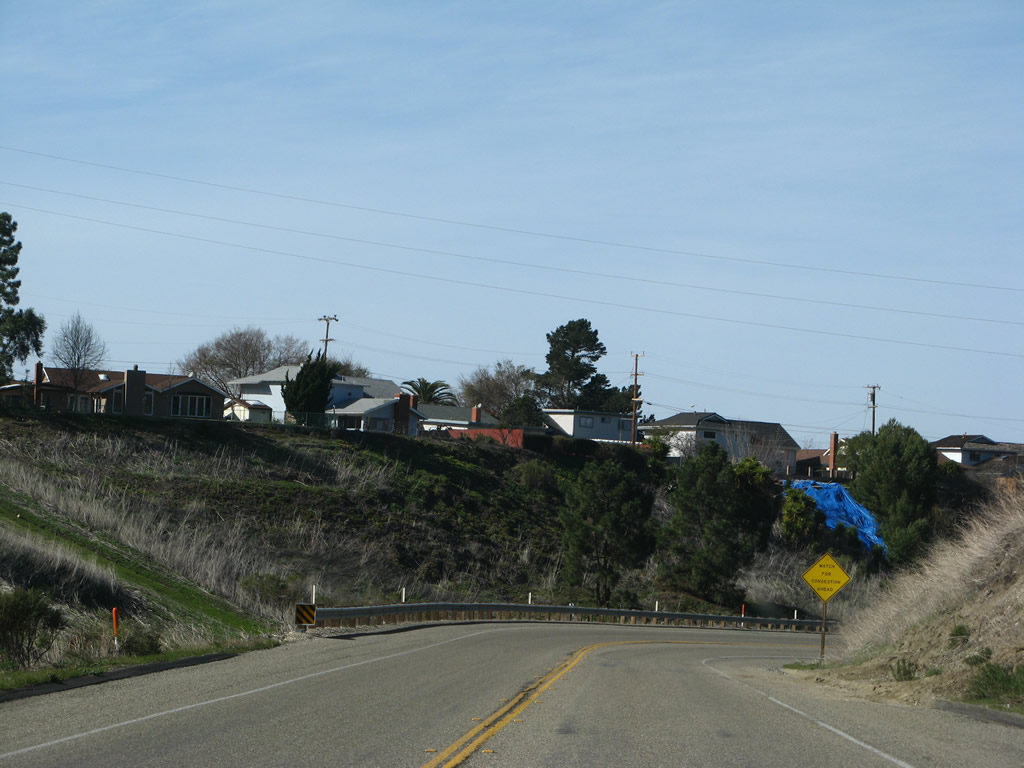
Widening to a four-lane expressway, California 1 approaches George Miller Drive west to the Lompoc Municipal Airport. Soon, California 1 will cross over the Santa Ynez River. The state route does not leave the city of Lompoc until the split between Lompoc Casmalia Road, Harris Grade Road (Cabrillo Highway), and La Purisima Road. Photo taken 02/02/08. |
|
This mileage sign along California 1 north provides the distance to Orcutt (19 miles), Santa Maria (25 miles), and Guadalupe (31 miles). Photo taken 02/02/08. |
|
|
|
|
Northbound California 1 (H Street) crosses the Santa Ynez River. This pony truss bridge was built in 1944 and widened in 1953. The southbound span was constructed in 1967 and widened in 2000, so for a bit more than two decades (1944 to 1967) the northbound bridge served both directions. Photos taken 03/18/06, 09/29/07, and 02/02/08. |
|
The Valley Drive-In Theater is located on the west side of California 1 (H Street). The movie theater was closed in 2002 and now serves as a recycling center. However, the towering movie screen is still in place as of 2008. Photo taken 02/02/08. |
|
California 1 (H Street) approaches a major intersection: the split between Lompoc Casmalia Road, Harris Grade Road (Cabrillo Highway), and La Purisima Road. At this intersection, California 1 will turn left onto Lompoc Casmalia Road (former Santa Barbara County S-20) toward the main gate of Vandenberg Air Force Base. Prior to 1988, California 1 followed Harris Grade Road (Old Cabrillo Highway) north toward Santa Maria, bypassing the Air Force Base to the east. Continue straight to transition from H Street onto Harris Grade Road. To the right, La Purisima Road travels east to La Purisima Mission State Historic Park and merges into California 246 east of there, and California 246 continues east to Buellton, U.S. 101, Solvang, and California 154. Photo taken 09/29/07. |
|
Turn left on California 1 (Lompoc Casmalia Road) to continue along the historic auto tour route for Juan Bautista de Anza. Photo taken 02/02/08. |
|
California 1 was realigned onto Lompoc Casmalia Road in 1988. Lompoc Casmalia Road was formerly designated as Santa Barbara County S-20 until the state route was realigned to serve the main gate of Vandenberg Air Force Base directly. Prior to 1988, California 1 followed Harris Grade Road (Old Cabrillo Highway) north toward Santa Maria, bypassing the Air Force Base to the east. The Harris Grade alignment is very winding and twisting, so the current alignment (mostly expressway and freeway) is probably faster, but the old alignment is more direct. Photo taken 09/29/07. |
|
A mileage sign (distance to Vandenberg Air Force Base and Santa Maria) is posted at the intersection where California 1 turns from H Street onto Lompoc Casmalia Road. Continue straight to follow Harris Grade Road (old California 1) north. To the east, turn right to La Purisima Road to the mission and points east via California 246. Photo taken 02/02/08. |
|
|
The California 1 north reassurance shield assembly is posted after the split from Harris Grade Road. The California 1 shield was there in 2006 and was missing in 2008. Photos taken 03/18/06 and 02/02/08. |
|
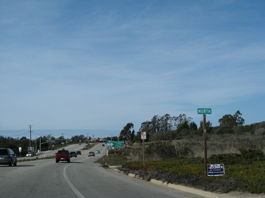
The next intersection along California 1 north is with Hancock Drive west into Allan Hancock College (Lompoc Campus). Photo taken 02/02/08. |
|
After the Hancock Drive traffic signal, California 1 widens out into freeway configuration, and the speed limit increases to 65 miles per hour. Photo taken 02/02/08. |
|
The only interchange on this brief segment of California 1 (Lompoc Casmalia Road) freeway is with Exit 211, Constellation Road to Vandenberg Village. Photo taken 02/02/08. |
|
All motorist services are available at Exit 211, Constellation Road to Vandenberg Village. Continue northwest on California 1 (Lompoc Casmalia Road) to the main ("Santa Maria") gate to Vandenberg Air Force Base. Photo taken 02/02/08. |
|
Northbound California 1 (Lompoc Casmalia Road) meets Exit 211, Constellation Road to Vandenberg Village. Photo taken 03/18/06. |
|
The freeway will continue a bit further northwest of here, but California 1 (Lompoc Casmalia Road) will downgrade to expressway standards prior to the main gate for the Air Force Base. Photo taken 02/02/08. |
|
A California 1 north reassurance shield assembly is posted on the on-ramp from Constellation Road. California 1 continues northwest along Lompoc Casmalia Road toward the Vandenberg main gate. Photo taken 02/02/08. |
|
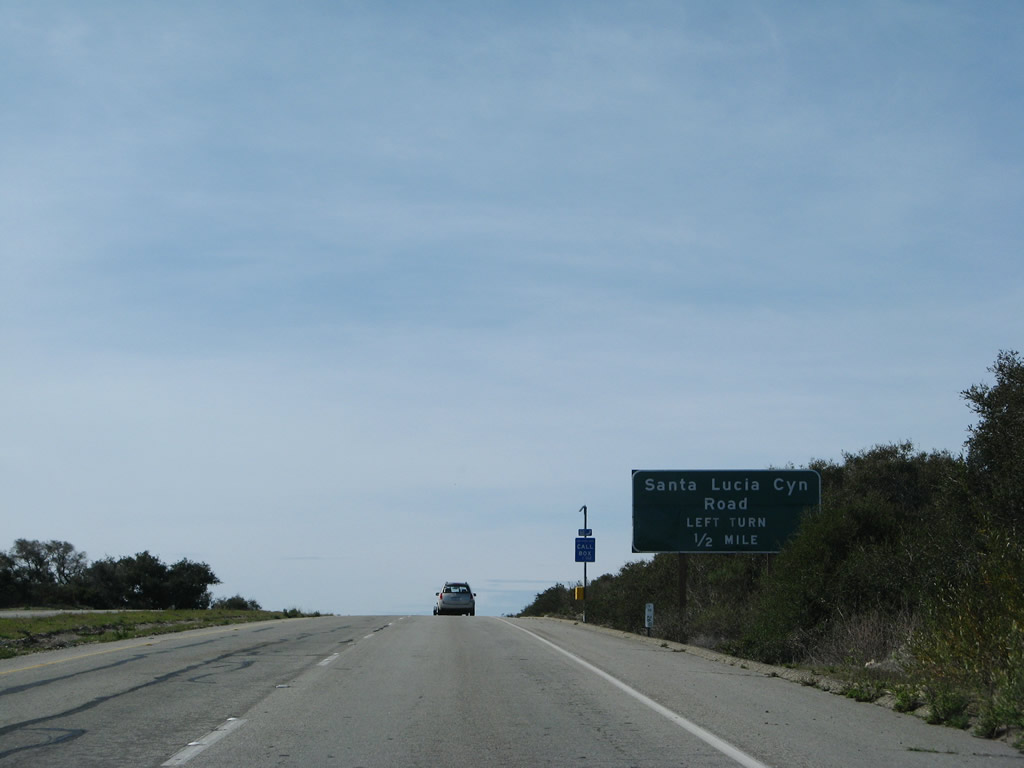
The next at-grade intersection along California 1 north is with Santa Lucia Canyon Road south back to Lompoc. Photo taken 02/02/08. |
|
Northbound California 1 enters Vandenberg Air Force Base (Air Force Space Command). Photo taken 02/02/08. |
|
Use Santa Lucia Canyon Road south to the Vandenberg Air Force Base Lompoc Gate and U.S. Penitentiary. Continue straight ahead to the main gate. Photo taken 02/02/08. |
|
Northbound California 1 (Lompoc Casmalia Road) meets Santa Lucia Canyon Road at this left turn. Photo taken 02/02/08. |
|
California 1 continues north with two lanes in each direction. Photo taken 02/02/08. |
|
Northbound California 1 (Lompoc Casmalia Road) approaches Azalea Lane (next left). Photo taken 02/02/08. |
|
The next intersection along California 1 (Lompoc Casmalia Road) north is with Mountain View Boulevard (next right). Photo taken 02/02/08. |
|
A tall stand of eucalyptus trees lines the east side of California 1; this stand will follow the state highway all the way to the Vandenberg Air Force Base turnoff. Photo taken 02/02/08. |
|
Northbound California 1 (Lompoc Casmalia Road) approaches Timber Lane (next right). Photo taken 02/02/08. |
|
Northbound California 1 (Lompoc Casmalia Road) meets Timber Lane at this traffic signal. Photo taken 02/02/08. |
|
The next left from California 1 (Lompoc Casmalia Road) north onto California Boulevard southwest leads to Vandenberg Air Force Base and its space program. A visitors center is located on the northwest corner of the upcoming signalized intersection for anyone wanting to enter the base. Photo taken 02/02/08. |
|
Northbound California 1 (Lompoc Casmalia Road) approaches California Boulevard. Photo taken 02/02/08. |
|
The right lane continues north on California 1, which will turn northeast toward Casmalia, Orcutt, and Santa Maria. At the upcoming intersection, California 1 will leave Lompoc Casmalia Road and turn onto Cabrillo Highway. Lompoc Casmalia Road continues north and will lead to Casmalia as well, but the connection involves an unimproved road not fit for all vehicles. Photo taken 02/02/08. |
|
California 1 turns right at the traffic signal ahead, while Vandenberg Air Force Base traffic turns left at California Boulevard. Lompoc Casmalia Road continues north, but will change into an unimproved road at Corral Road (Utah Avenue) near the Utah Gate to the Air Force Base. Photo taken 02/02/08. |
|
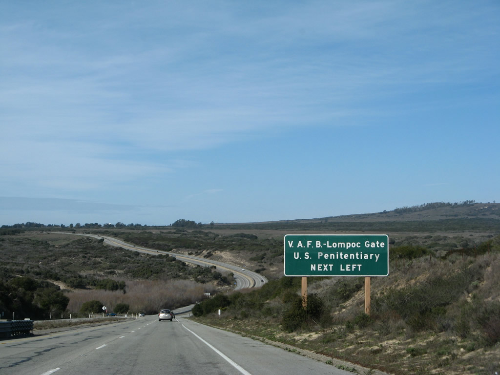
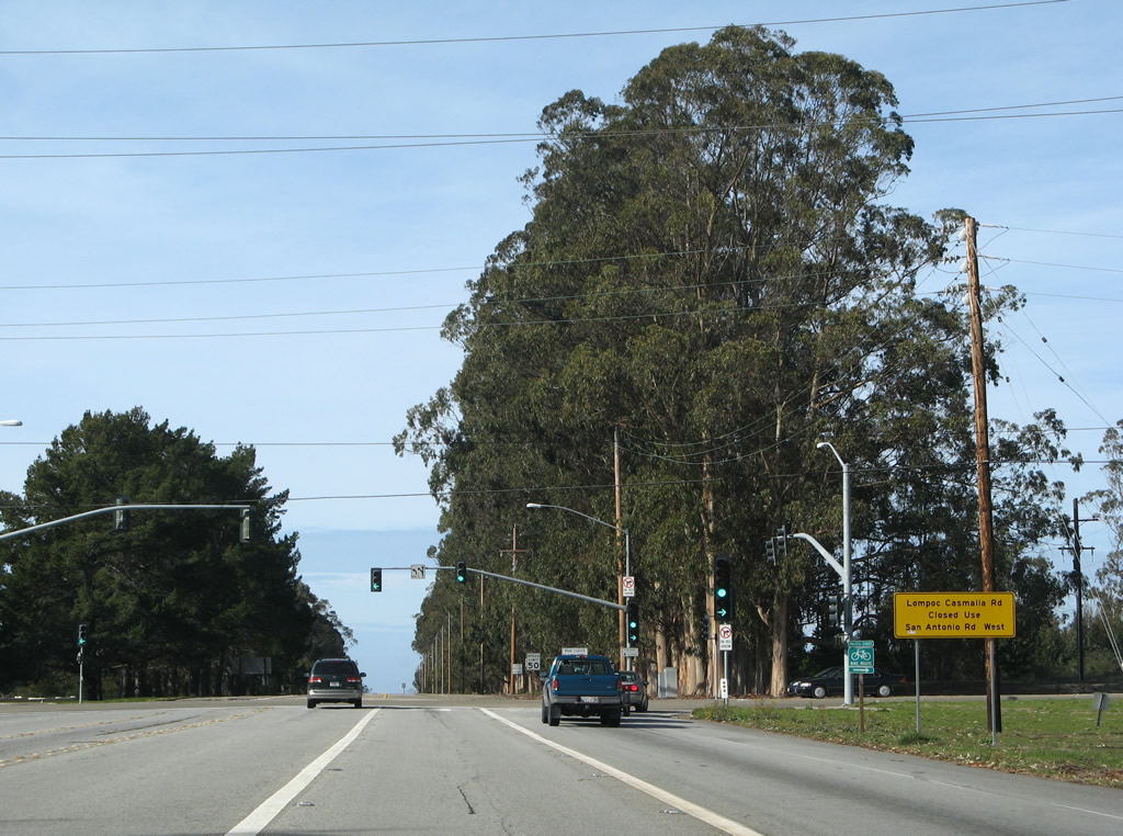
At the time this picture was taken, Lompoc Casmalia Road north was closed. All traffic to Casmalia need to use California 1 north to San Antonio Road west. Photo taken 02/02/08. |
|
Northbound California 1 (Lompoc Casmalia Road) meets California Boulevard at this traffic signal. Turn left to California Boulevard into Vandenberg Air Force Base and right to California 1 (Cabrillo Highway) to Casmalia, Orcutt, and Santa Maria. Photo taken 02/02/08. |
|
After leaving Lompoc Casmalia Road, northbound California 1 turns northeast toward Orcutt and Santa Maria. California 1 again meets Mountain View Boulevard at the next intersection. Continuing as a four-lane expressway from the Vandenberg Air Force Base main gate, California 1 is a busy route especially near shift changes at the base. Photo taken 09/30/07. |
|
A California 1 north reassurance shield is posted after Mountain View Boulevard. Photo taken 09/30/07. |
|
|
The California 1 expressway is 65 miles per hour and travels generally downhill for the next several miles until the junction with California 135. Photos taken 09/29/07. |
|
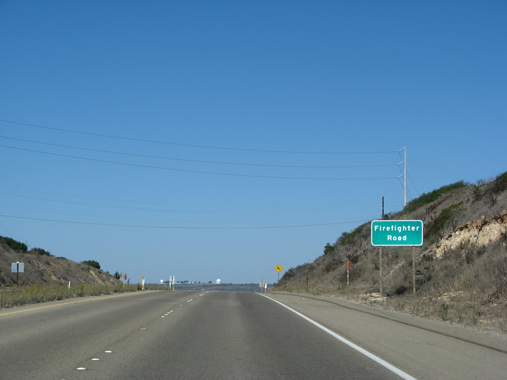
The next intersection along California 1 north is with Firefighter Road west to VAFB's Utah Gate. Continue straight ahead to Casmalia. Photo taken 09/30/07. |
|
|
|
After the Firefighter Road intersection, California 1 again turns downhill and offers a stunning view of the valley and hills in the distance. Photos taken 09/29/07. |
|
The next intersection along California 1 (Cabrillo Highway) north is with San Antonio Road west to Casmalia. Photo taken 09/30/07. |
|
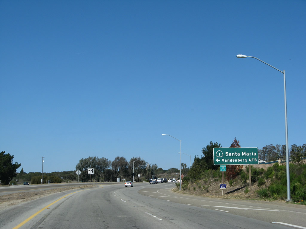
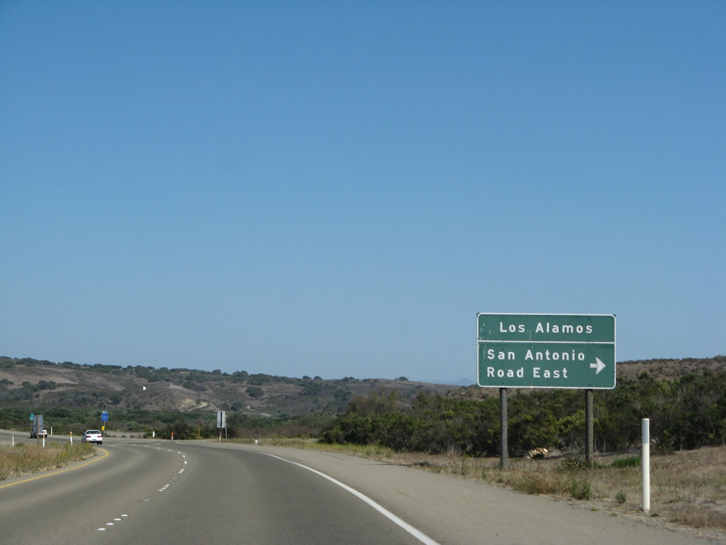
Shortly thereafter, northbound California 1 (Cabrillo Highway) approaches San Antonio Road east to California 135 east to Los Alamos and U.S. 101 (El Camino Real). Photo taken 09/30/07. |
|
This California 1 north shield is posted after the San Antonio Road east intersection. Photo taken 09/30/07. |
|
California 1 retains four lanes as it proceeds north toward its merge with California 135 north. Photo taken 09/29/07. |
|
Rolling hills give way to farmland as California 1 proceeds toward Orcutt and the Santa Maria Valley. Photo taken 09/29/07. |
|
|
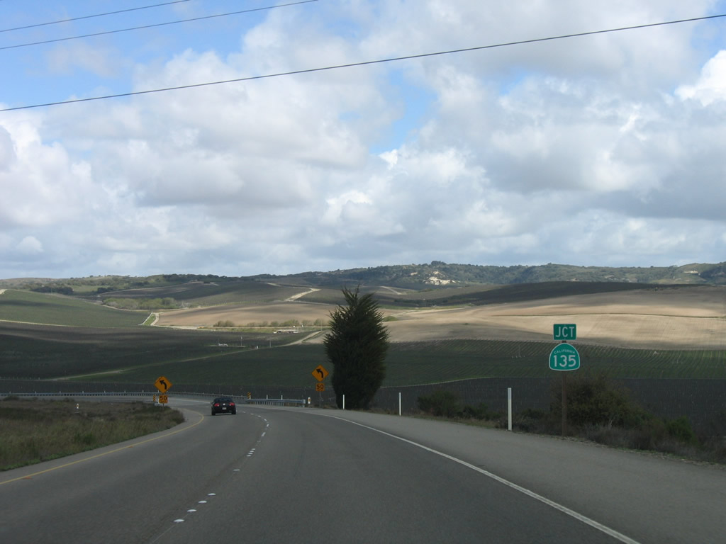
Northbound California 1 (Cabrillo Highway) approaches California 135. There is no access from California 1 north to California 135 south. Photos taken 09/29/07 and 03/18/06. |
|
California 1 north will merge into California 135 north as if part of a directional freeway interchange, and California 1 merges into California 135 from the right. Photo taken 09/29/07. |
|
This photo looks north on the California 135 freeway as seen from the California 1 overpass. Photo taken 09/29/07. |
|
Since this interchange is the northern end of former Santa Barbara County S-20 (until 1988), it is logical to assume that this interchange was built back when California 1 was using Harris Grade Road rather than its current alignment (California 1 used to follow Harris Grade Road north to California 135 north). Photo taken 09/29/07. |
|
Northbound California 1 and California 135 merge together at this point. Photo taken 09/29/07. |
| California 1 & 135 north |
|
Immediately after merging together, California 1 & 135 approach Graciosa Road, which provides local and farm access from the expressway. Photo taken 03/18/06. |
|
After the Graciosa Road intersection, California 1 & 135 gain freeway status. Photo taken 03/18/06. |
|
This section of freeway has a wider median than the California 1 expressway segment closer to Vandenberg Village. Photo taken 09/29/07. |
|
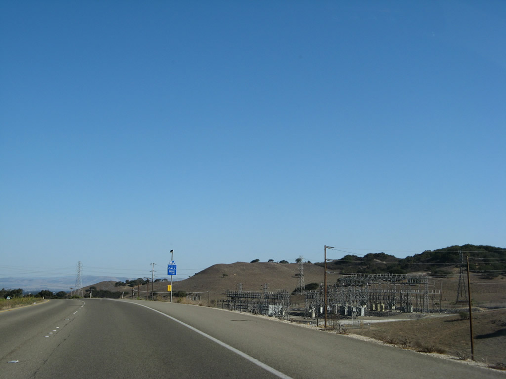
A Pacific Gas and Electric (PG&E) substation is located east of the California 1 and California 135 freeway. Photo taken 09/29/07. |
|
A pair of PG&E power lines cross over the freeway. Photo taken 09/29/07. |
|
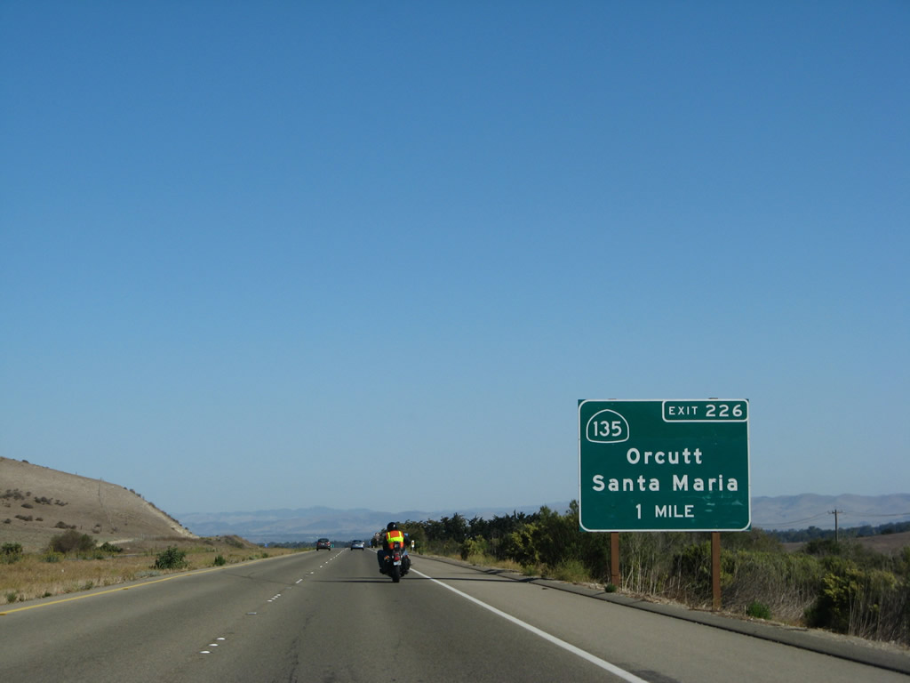
The next exit along California 1 and California 135 north is with Exit 226, California 135 (Orcutt Expressway) north to Orcutt and Santa Maria (one mile). Photo taken 09/29/07. |
|
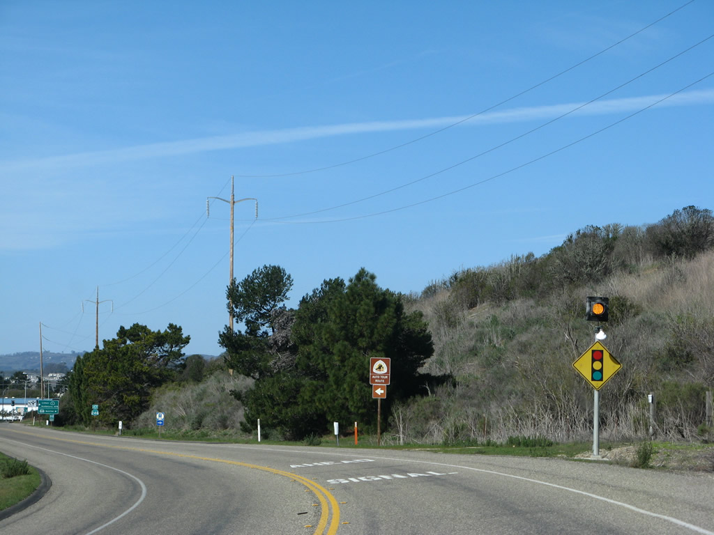
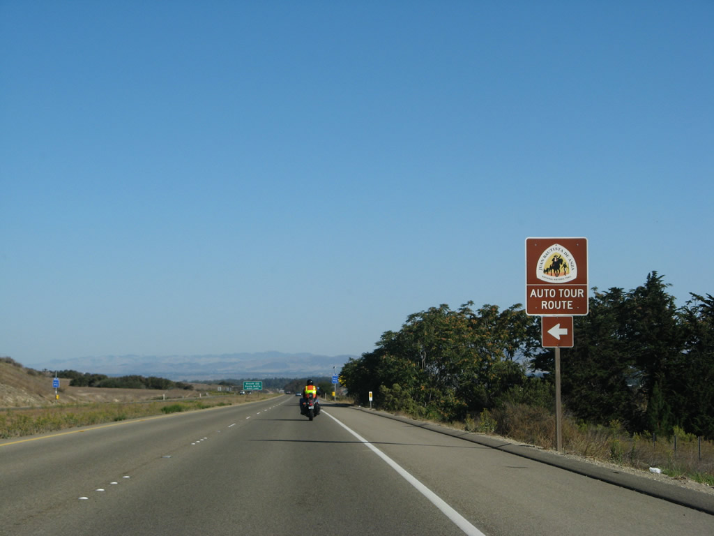
Use California 1 north to continue along the Juan Bautista de Anza trail. Photo taken 09/29/07. |
|
At Exit 226, California 1 and California 135 will split. Stay right for California 135 and left for California 1. Photo taken 09/29/07. |
|
|
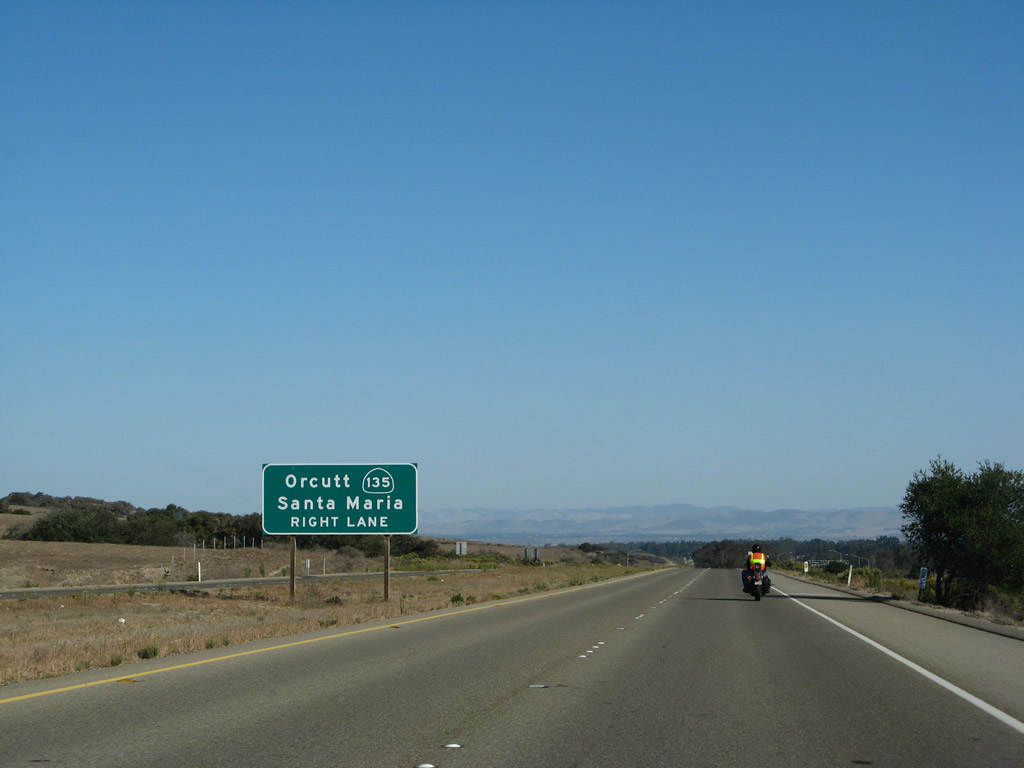
Northbound California 1 (Cabrillo Highway) reaches Exit 226, California 135 (Orcutt Expressway) north to Orcutt and Santa Maria. Photos taken 03/18/06 and 09/29/07. |
| California 1 north |
|
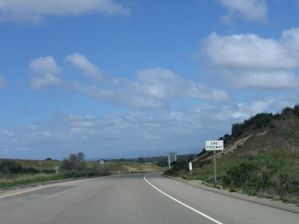
For the first time since leaving Lompoc, California 1 will reduce to only one lane in each direction. The freeway segment will end shortly. Photo taken 03/18/06. |
|
An end freeway sign is posted soon thereafter. Photo taken 03/18/06. |
|
California 1 resumes having two lanes, one in each direction. Photo taken 03/18/06. |
|
Northbound California 1 approaches Clark Avenue, which travels east into downtown Orcutt (an unincorporated community located south of the city of Santa Maria). Photo taken 03/18/06. |
|
After the Clark Avenue intersection, California 1 (Cabrillo Highway) continues as a two-lane expressway with access controlled (limited driveways and cross streets). The state route avoids downtown Orcutt and downtown Santa Maria by staying to the west of the urban area. Photo taken 09/29/07. |
|
This mileage sign provides the distance to Guadalupe (12 miles) and Pismo Beach (28 miles). Photo taken 09/29/07. |
|
Northbound California 1 (Cabrillo Highway) approaches Solomon Road east to Orcutt. Photo taken 09/29/07. |
|
The highway narrows significantly after the Solomon Road intersection. Photo taken 03/18/06. |
|
Flooding is possible along this section of California 1. Photo taken 03/18/06. |
|
This section of California 1 passes by a variety of farms and agricultural interests. Photo taken 03/18/06. |
|
A California 1 north reassurance shield is posted soon thereafter, prior to the Black Road intersection. Photo taken 03/18/06. |
|
Northbound California 1 (Cabrillo Highway) meets Black Road at this intersection. Turn left to follow Black Road southwest to Casmalia (the name changes to Lompoc Casmalia Road) and north to western Santa Maria. Black Road ends at California 166 (Main Street) west of downtown Santa Maria. Photo taken 03/18/06. |
|
|
|
|
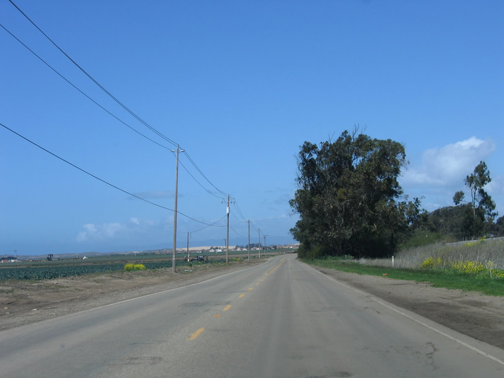
For the next several miles, northbound California 1 (Cabrillo Highway) passes through mostly agricultural areas west of Santa Maria. Photos taken 03/18/06. |
|
|
|
|
|
Northbound California 1 (Cabrillo Highway) meets Brown Road at this intersection. Turn left (west) on Brown Road to Point Sal and right (east) to Betteravia and Santa Maria. Photo taken 03/18/06. |
|
|
|
|
Northbound California 1 (Cabrillo Highway) continues to pass through mostly agricultural areas prior to entering Guadalupe. Photos taken 03/18/06. |
|
Entering the city of Guadalupe, northbound California 1 (Cabrillo Highway) approaches California 166 (Main Street) east to Santa Maria. From here, California 166 travels east through Santa Maria, Cuyama, and Maricopa before ending at Interstate 5 and California 99 near Wheeler Ridge. Photo taken 03/18/06. |
|
Northbound California 1 (Cabrillo Highway) meets California 166 (Main Street) at this stop sign. This intersection marks the western terminus of California 166. Photo taken 03/18/06. |
|
The city of Guadalupe consists of 1.4 square miles, had a population of 5,659 in the 2000 Census, and was incorporated on May 19, 1946. Agriculture is the primary economic driver here, as well as the military-based economy of the greater Santa Maria Valley. Photo taken 03/18/06. |
|
Stiff winds blew on this day after a storm came through the region. California 1 remains with just two lanes through Downtown Guadalupe. Photo taken 03/18/06. |
|
An Amtrak Station is located on the east side of California 1 in Downtown Guadalupe. Photo taken 03/18/06. |
|
|
|
|
Northbound California 1 (Cabrillo Highway) is locally known as Guadalupe Street in the city of Guadalupe. This series of pictures shows the main line of California 1 as it passes through downtown's central business district. Photos taken 03/18/06. |
|
Leaving downtown Guadalupe, the final stop sign in Santa Barbara County is with 11th Street. Use 11th Street southeast to Main Street (California 166) and points south via Simms Street. Photo taken 03/18/06. |
|
As the speed limit increases, California 1 prepares to leave Santa Barbara County and enter San Luis Obispo County. Photo taken 03/18/06. |
|
Northbound California 1 (Cabrillo Highway) leaves Santa Barbara County and enters San Luis Obispo County. Ahead, California 1 crosses the Santa Maria River. Photo taken 03/18/06. |
Page Updated June 29, 2009.