| California 14 - Antelope Valley Freeway - north |
|
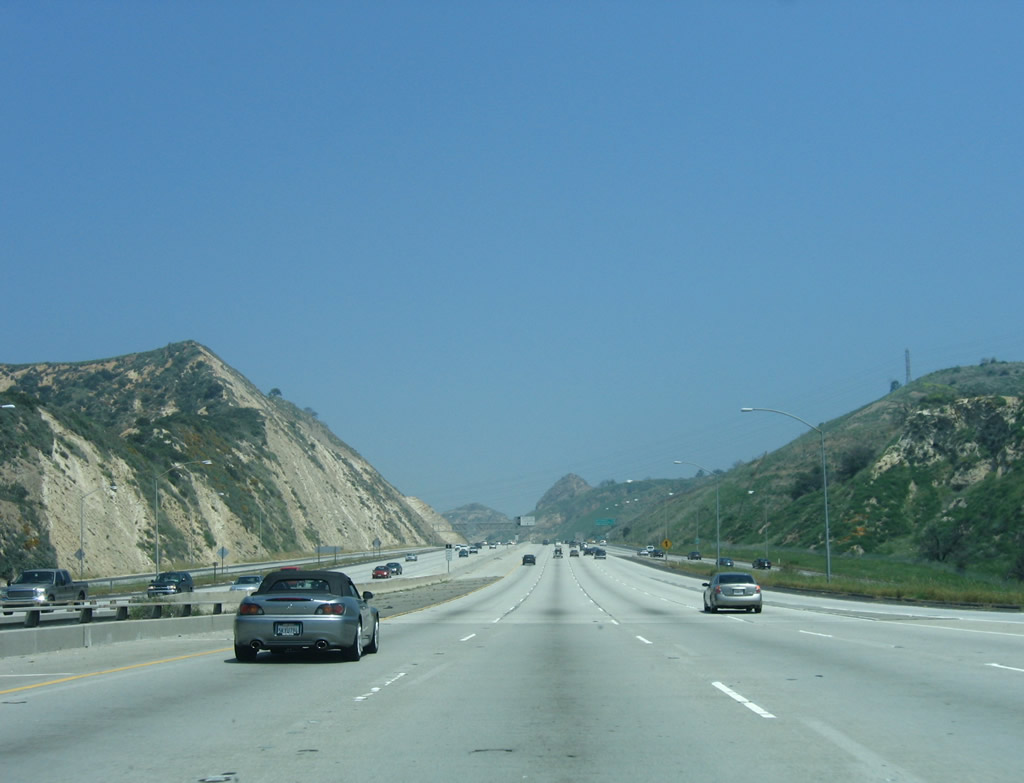
Since Interstate 5 is split between truck and main lanes, there are two approaches to California 14. This view is taken on the transition from the main lanes of Interstate 5 to the main lanes of California 14. Photo taken 04/30/06. |
|
At this point, the main lanes and the truck lanes merge together. The first California 14 reassurance shield is visible to the right; the next photo shows the shield at a much closer range. Photo taken 04/30/06. |
|
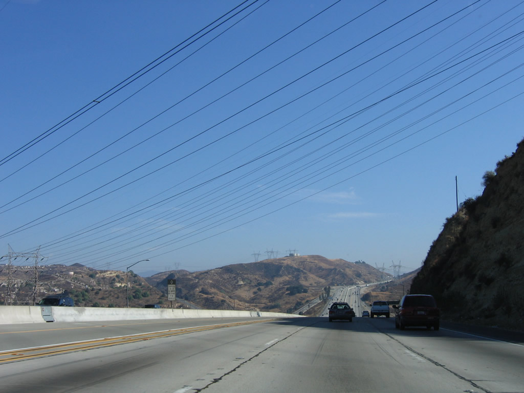
This is the first reassurance shield posted on California 14 (Antelope Valley Freeway) north as seen from the transition from the Interstate 5 north truck lanes. Photo taken 07/04/07. |
|
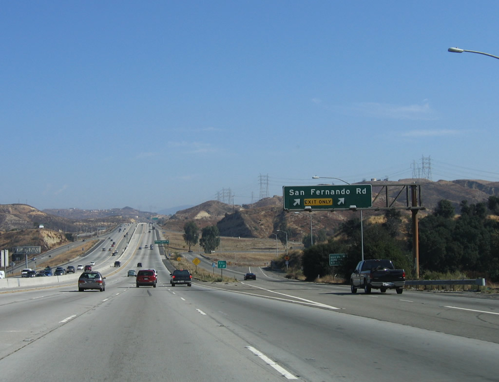
The first northbound California 14 (Antelope Valley Freeway) interchange sequence sign provides the distance to the next three exits: Exit 2, Newhall Avenue (U.S. 99/San Fernando Road); Exit 3, Placerita Canyon Road; and Exit 5, Golden Valley Road. Note the green cover next to the San Fernando Road entry; this green overlay covers a California 126 shield. California 126 was truncated and does not extend east of Interstate 5 through Santa Clarita anymore. Most of the shields and postmiles for old California 126 between California 14 and Interstate 5 have been removed. Photo taken 07/04/07. |
|
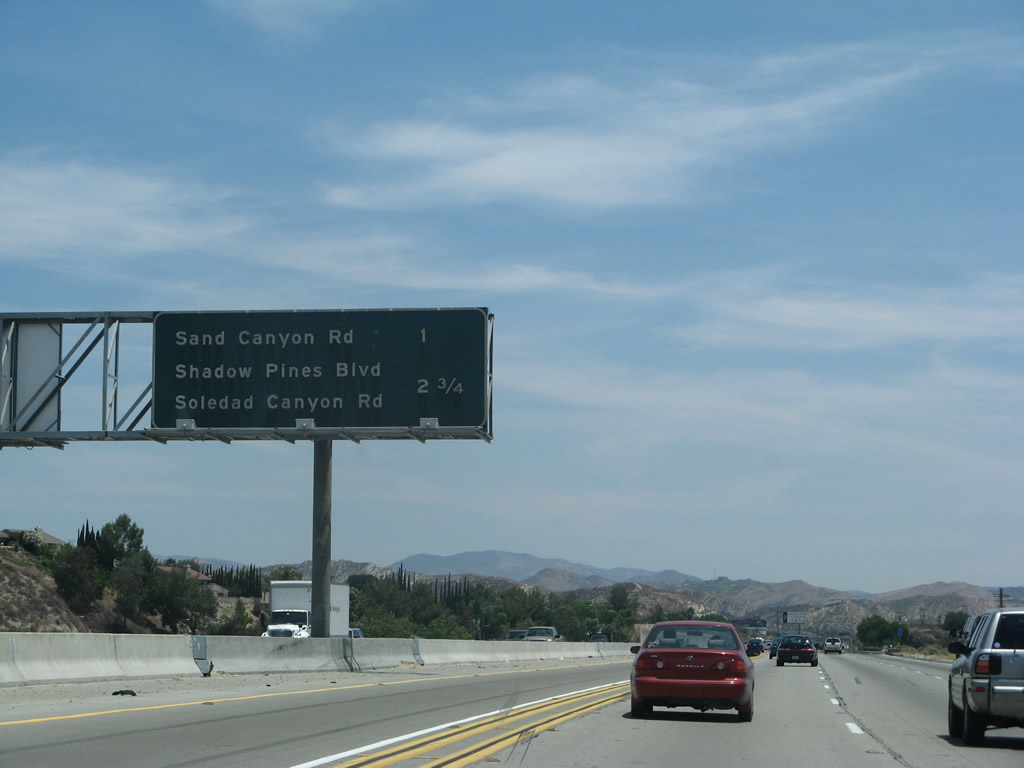
The next seven exits from northbound California 14 (Antelope Valley Freeway) serve the city of Santa Clarita: Exit 2, Newhall Avenue (U.S. 99/San Fernando Road and former California 126); Exit 3, Placerita Canyon Road; Exit 5, Golden Valley Road; Exit 6A, Sierra Highway (U.S. 6); Exit 6B, Via Princessa; Exit 9, Sand Canyon Road; and Exit 11, Soledad Canyon Road and Shadow Pines Boulevard. Photo taken 07/04/07. |
|
California 14 enters the city of Santa Clarita, which has grown substantially through the 1980s, 1990s, and 2000s as it has annexed nearby lands to create more suburban living. With the creation of new housing tracts in formerly rural areas, large tract home developments and commercial areas have grown along with traffic congestion. Santa Clarita incorporated on December 15, 1987, as a consolidation of the previously unincorporated communities of Canyon Country, Newhall, Saugus, and Valencia. New communities are commonly seen along the California 14 corridor as the land becomes more highly coveted for residential development. Photo taken 10/07/06. |
|
As is typical for the signing of freeway names in Caltrans District 7, northbound California 14 is signed as the Antelope Valley Freeway at the beginning of its route just after the Sylmar Interchange (located at Newhall Pass) with Interstate 5. Photo taken 07/04/07. |
|
The next exit along California 14 (Antelope Valley Freeway) north is Exit 2, San Fernando Road and Newhall Avenue (right lane exit only) to Lyon Avenue. This interchange has previously been signed for California 126 and U.S. 99/San Fernando Road. Photo taken 07/04/07. |
|
Northbound California 14 (Antelope Valley Freeway) reaches Exit 2, San Fernando Road to Newhall Avenue (former California 126). San Fernando Road follows historic U.S. 99 north into Santa Clarita and south through Sylmar into the San Fernando Valley and Los Angeles. Previously, California 126, which was decommissioned between Interstate 5 and California 14 in 2002, used to follow San Fernando Road (Railroad Avenue) north to Magic Mountain Parkway west through Santa Clarita. Old U.S. 6, which parallels California 14 along Sierra Highway, is located just north of here via San Fernando Road. Photo taken 10/07/06. |
|
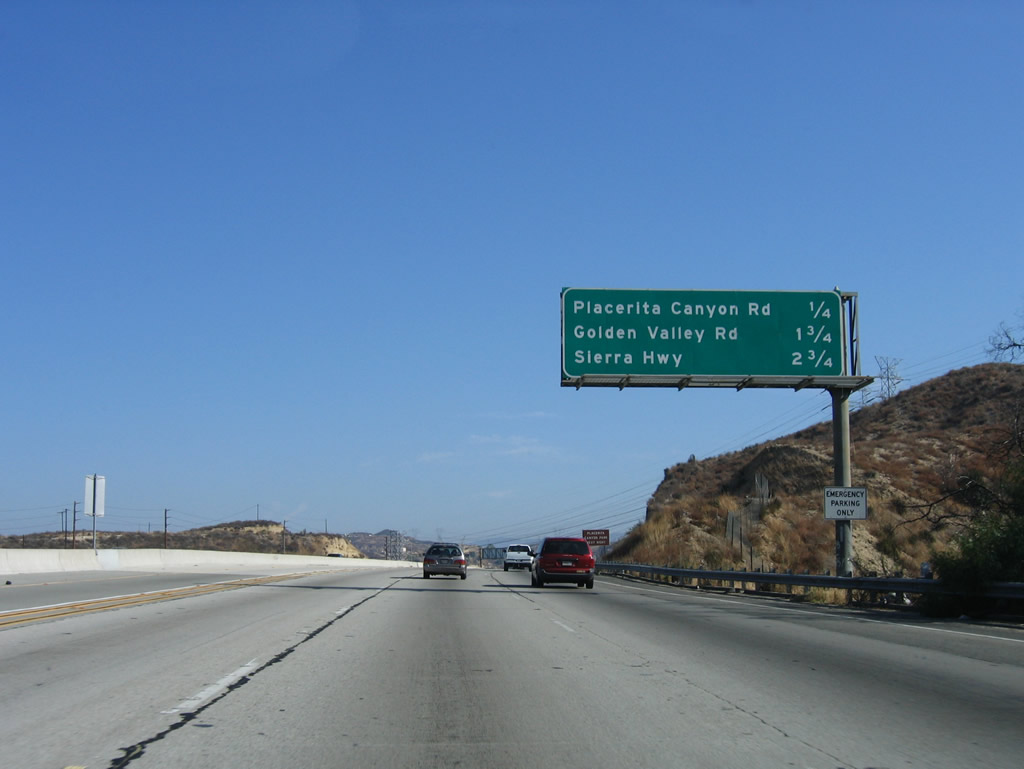
The next exit along California 14 (Antelope Valley Freeway) north is Exit 3, Placerita Canyon Road (one mile). This section of California 14 was reconstructed and expanded in the late 1990s to include a high occupancy vehicle lane. Photo taken 07/04/07. |
|
This mileage sign provides the distance to the next several exits along northbound California 14 (Antelope Valley Freeway): Exit 3, Placerita Canyon Road; Exit 5, Golden Valley Road; and Exit 6A, Sierra Highway (old U.S. 6) to Canyon Country. Photo taken 10/07/06. |
|
Use Exit 3 (Placerita Canyon Road) to Placerita Canyon Park. Placerita Canyon Road ends at Sand Canyon Road. Photo taken 10/07/06. |
|
|
A set of Los Angeles Department of Water and Power (LADWP) power lines cross over California 14. The larger of the two lines carries electricity south from the Owens River Valley. The other line is a high-voltage direct current transmission line (Pacific DC Intertie, which is designated as Path 65) that originates in the Columbia River Valley near The Dalles, Oregon. Photos taken 10/07/06 and 04/30/06. |
|
Northbound California 14 (Antelope Valley Freeway) reaches Exit 3, Placerita Canyon Road. Photo taken 10/07/06. |
|
|
After the Placerita Canyon Road interchange, a set of 500kV power transmission lines crosses over California 14. These lines are most likely owned by the Los Angeles Department of Water and Power. Photos taken 10/07/06. |
|
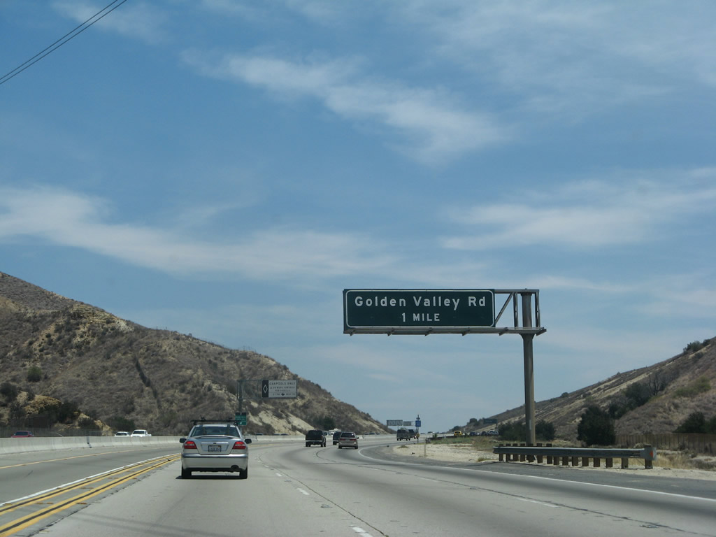
The next exit along California 14 (Antelope Valley Freeway) north is Exit 5, Golden Valley Road, one mile. Photo taken 07/04/07. |
|
This mileage sign along northbound California 14 (Antelope Valley Freeway) is indicative of the age of some of the highway signs around Los Angeles. Very difficult to read, even in good lighting, it is ready for replacement. The next three exits are Exit 5, Golden Valley Road; Exit 6A, Sierra Highway-Canyon Country; and Exit 6B, Via Princessa. Photo taken 07/04/07. |
|
Northbound California 14 (Antelope Valley Freeway) reaches Exit 5, Golden Valley Road. The next interchange along northbound is Exit 6A, Sierra Highway (old U.S. 6). Photo taken 07/04/07. |
|
Another mileage sign is mounted on the overpass for Golden Valley Road along northbound California 14 (Antelope Valley Freeway) as it approaches Exit 6A, Sierra Highway/Canyon Country (three-quarters of a mile). Photo taken 07/04/07. |
|
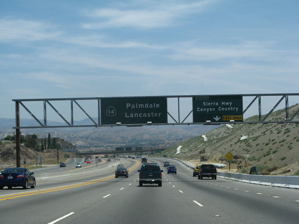
The next exit along California 14 (Antelope Valley Freeway) north is Exit 6A, Sierra Highway/Canyon Country (next right). Canyon Country is a development located near the intersection of Sierra Highway and Soledad Canyon Road just east of Santa Clarita. Old U.S. 6 follows Sierra Highway south to Los Angeles or north to Palmdale-Lancaster. Photo taken 07/04/07. |
|
Northbound California 14 (Antelope Valley Freeway) reaches Exit 6A, Sierra Highway/Canyon Country. This interchange was to be the eastern end of the unconstructed California 126 freeway; the freeway was canceled in the 1970s. Sierra Highway is the original route for U.S. 6. Many extant sections of this old highway remain, including this section and another stretch in the Antelope Valley. The next exit is Exit 6B, Via Princessa (0.25 mile). Photo taken 07/04/07. |
|
Northbound California 14 (Antelope Valley Freeway) reaches Exit 6B, Via Princessa. Photo taken 11/13/05. |
|
The flyover ramp that carries traffic from California 14 north to the Sierra Highway (Exit 6A) used to be signed as the Route 14-126 Separation). Since California 126's freeway was never extended to its intended eastern terminus here, the white bridge sign and the flyover ramp are among the few remnants of the once-planned but now-canceled freeway. Photo taken 11/13/05. |
|
A weigh station is located along northbound California 14 (Antelope Valley Freeway) between Exit 6B, Via Princessa and Exit 9, Sand Canyon Road. Photo taken 11/13/05. |
|
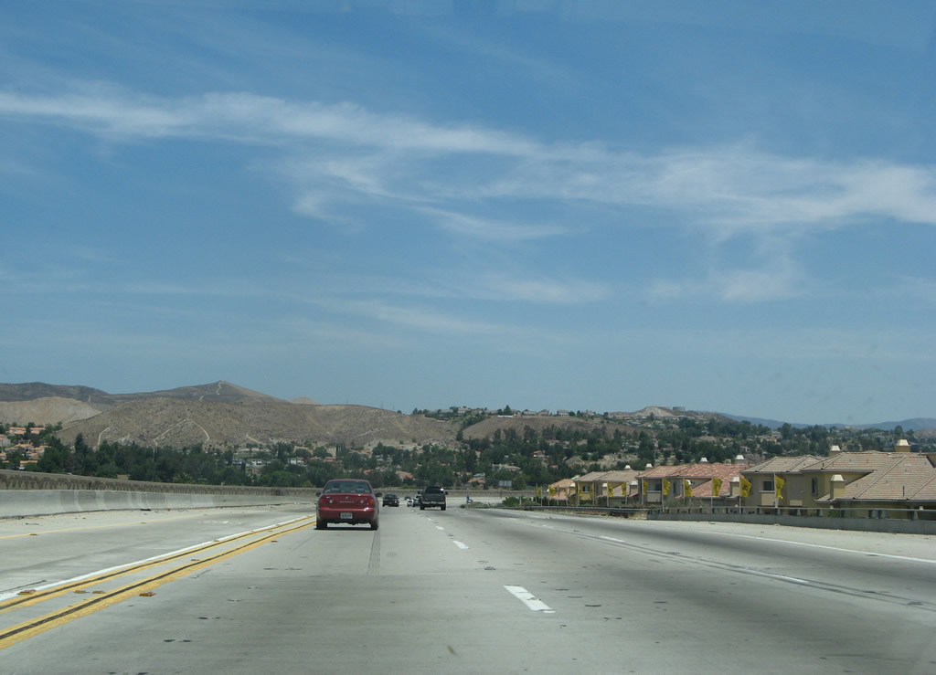
At the time this photo was taken, this was a new housing development on the southeast side of freeway. Photo taken 07/04/07. |
|
The next exit along California 14 (Antelope Valley Freeway) north is Exit 9, Sand Canyon Road (one mile). Use Sand Canyon Road north to Sierra Highway (old U.S. 6), which travels on an alignment separate from California 14 through Mint Canyon and Sleepy Valley. Photo taken 07/04/07. |
|
This mileage sign along northbound California 14 (Antelope Valley Freeway) provides the distance to the next two exits: Exit 9, Sand Canyon Road and Exit 11, Soledad Canyon Road and Shadow Pines Boulevard. Photo taken 07/04/07. |
|
Northbound California 14 (Antelope Valley Freeway) reaches Exit 9, Sand Canyon Road to Historic Sierra Highway (old U.S. 6) east. Photo taken 10/07/06. |
|
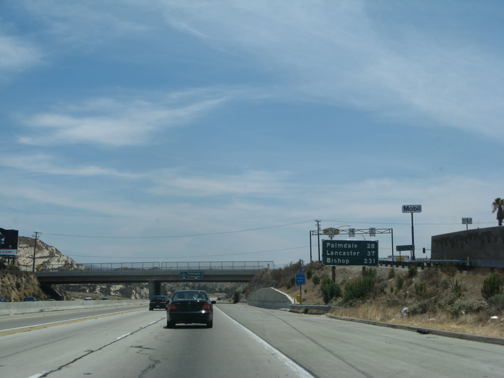
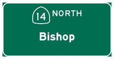
This mileage sign along northbound California 14 (Antelope Valley Freeway) provides the distance to Palmdale (28 miles), Lancaster (37 miles), and the new control city of Bishop (231 miles). The western terminus of U.S. 6, which is in the city of Bishop, is still quite a ways northeast of here. However, the old alignment of U.S. 6 (Sierra Highway) closely parallels the California 14 freeway from Santa Clarita northeast to Palmdale and Lancaster. Photo taken 07/04/07. |
|
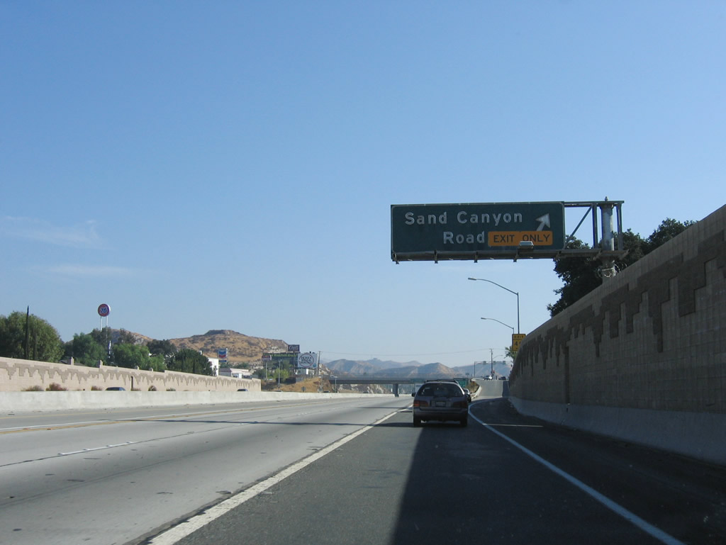
The pull-through sign for California 14 north to Palmdale and Lancaster is posted on the Sand Canyhon Road overpass. Photo taken 07/04/07. |
|
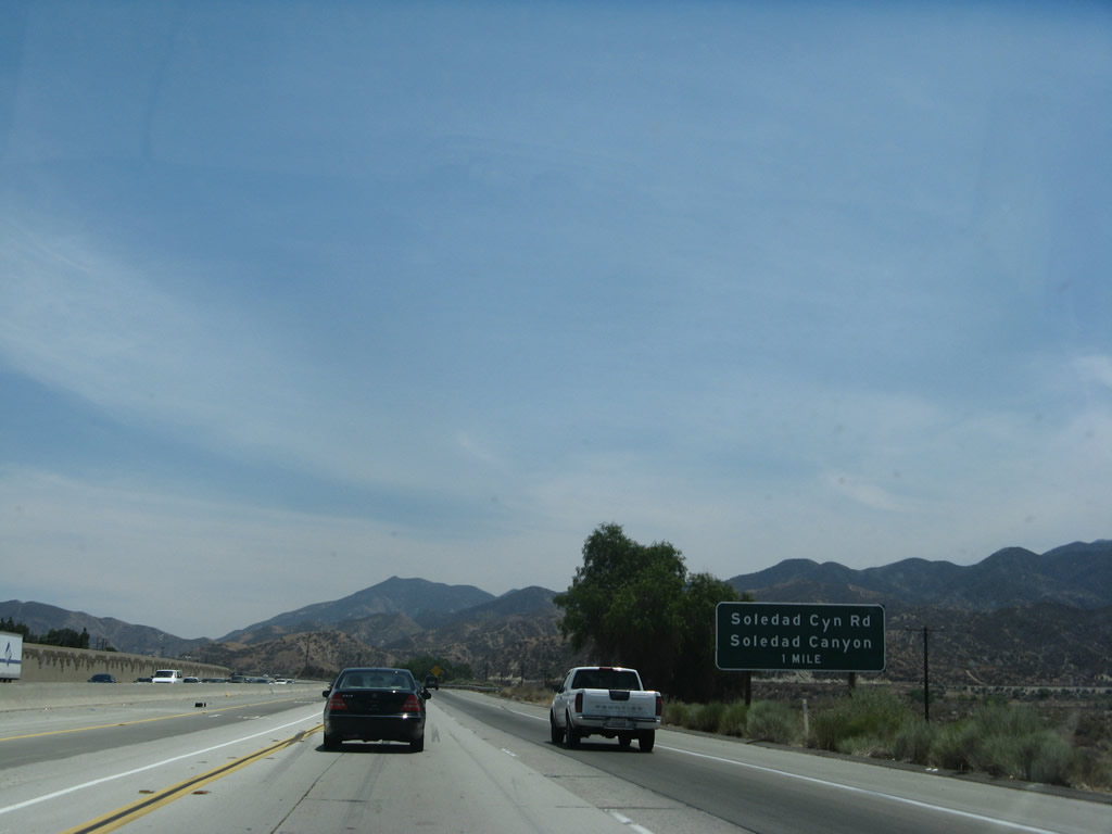
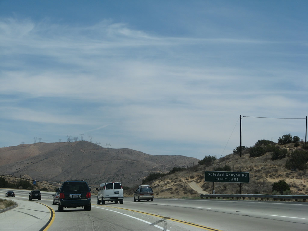
The next exit along California 14 (Antelope Valley Freeway) north is Exit 11, Soledad Canyon Road (one mile). Photo taken 07/04/07. |
|
After the Sand Canyon Road interchange, California 14 (Antelope Valley Freeway) has two main lanes and one high occupancy vehicle (HOV) lanes. The next exit is Exit 11, Soledad Canyon Road (one-half mile). Photo taken 07/04/07. |
|
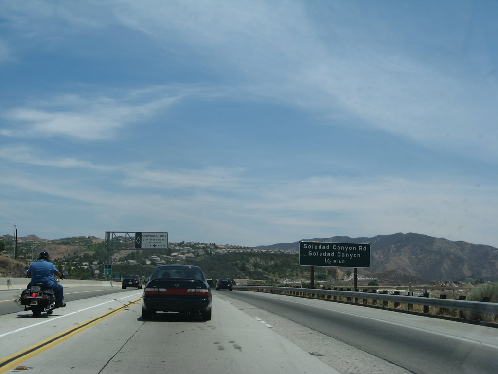
California 14 approaches Exit 11, Soledad Canyon Road to the Soledad Canyon community. Photo taken 07/04/07. |
|
Northbound California 14 (Antelope Valley Freeway) reaches Exit 11, Soledad Canyon Road. Photo taken 07/04/07. |
|
A California 14 reassurance shield is posted after the on-ramp from Soledad Canyon Road. Photo taken 07/04/07. |
|
|
|
For the next four miles (between the Soledad Canyon interchange and the Agua Dulce interchange), California 14 steadily gains elevation and passes through some rocky cuts. Climbing lanes are provided for uphill traffic. California 14 will reach its highest point at Escondido Summit (3,258 feet). Photos taken 07/04/07. |
|
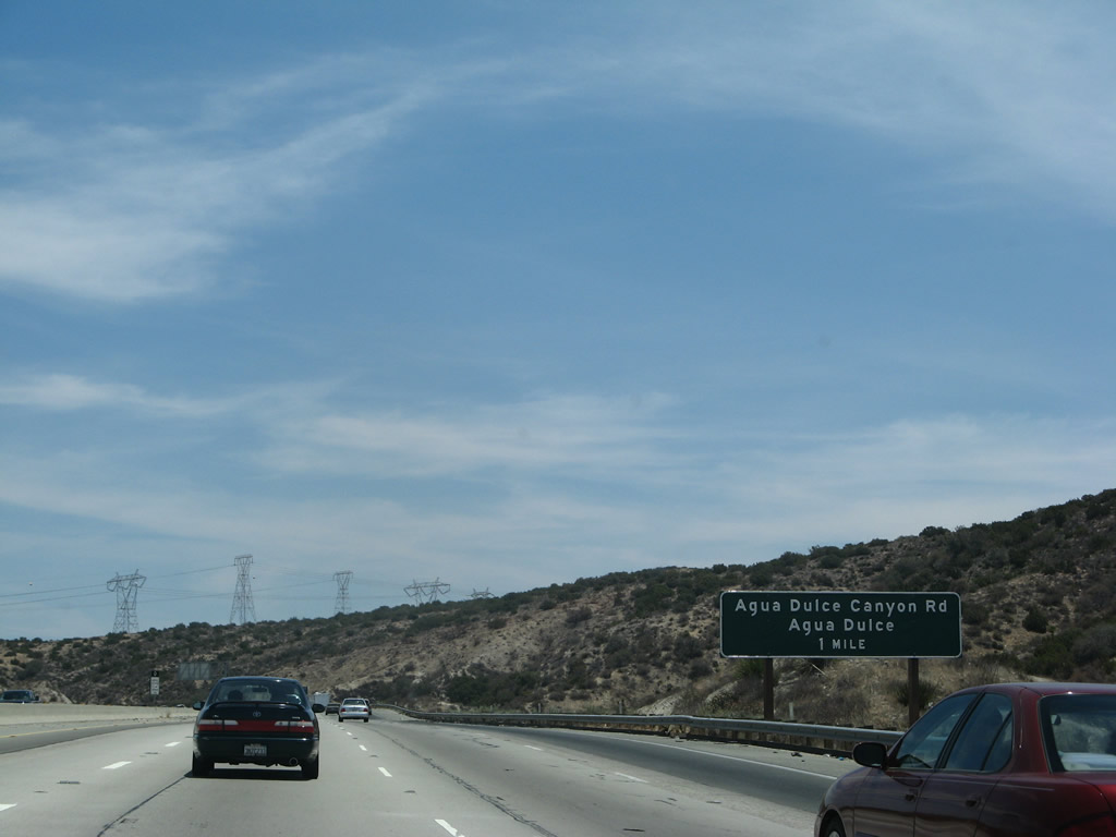
The next exit along California 14 (Antelope Valley Freeway) north is posted at Exit 15, Agua Dulce Canyon Road (one mile). Photo taken 07/04/07. |
|
Use Exit 15 to Agua Dulce Airport. A set of Southern California Edison power lines crest above California 14 on the hillside ahead. Photo taken 07/04/07. |
|
Agua Dulce Canyon Road travels north into the unincorporated community of Agua Dulce and south into Soledad Canyon. Photo taken 07/04/07. |
|
A third advance sign for Exit 15 is posted shortly thereafter. Photo taken 07/04/07. |
|
To Vasquez Rocks County Park, follow Agua Dulce Canyon Road north to Escondido Canyon Road east. Photo taken 07/04/07. |
|
Northbound California 14 (Antelope Valley Freeway) reaches Exit 15, Agua Dulce Canyon Road. "Agua Dulce" is Spanish for "Sweet Water." Photo taken 07/04/07. |
|
Another set of Southern California Edison power lines (including a 500kV line) rides the ridges above the California 14 freeway. Photo taken 07/04/07. |
|
|
|
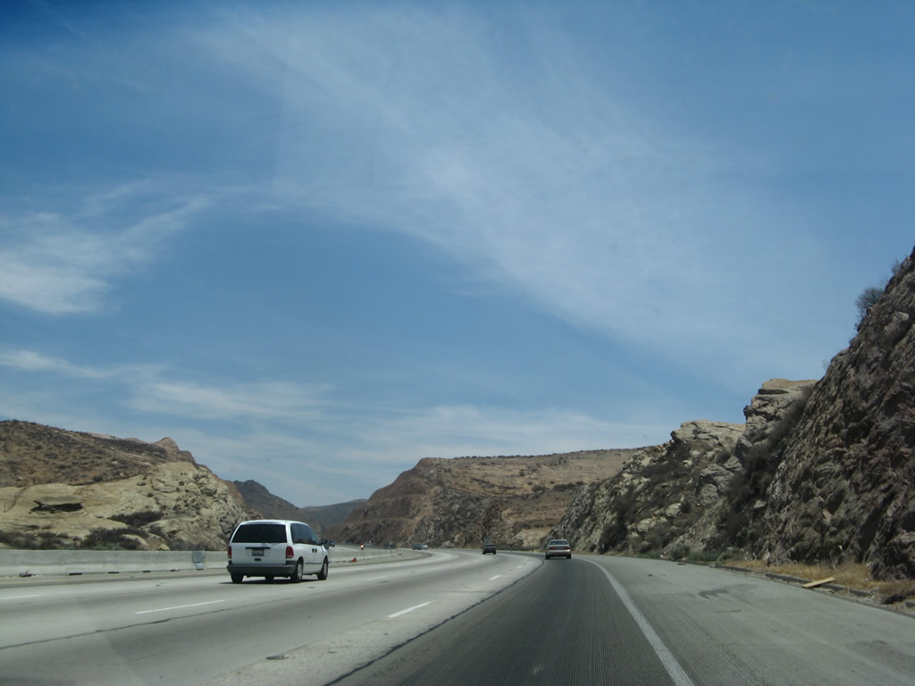
This series of photos follows California 14 as it continues to gain elevation en route to Escondido Summit. Photos taken 07/04/07. |
|
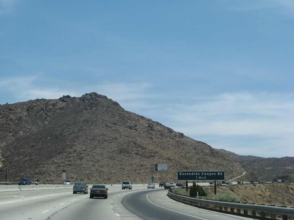
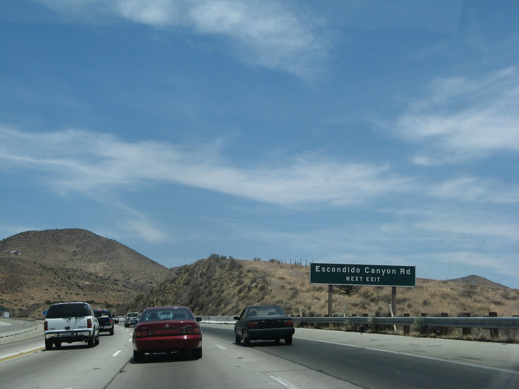
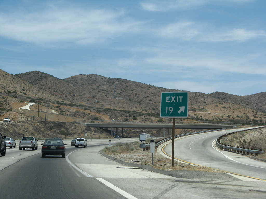
The next exit along California 14 (Antelope Valley Freeway) is Exit 19, Escondido Canyon Road (one mile). Photo taken 07/04/07. |
|
The left lane remains dedicated for high occupancy vehicles during commuting hours. Photo taken 07/04/07. |
|
Use Escondido Canyon Road west to Vasquez Rocks County Park and Agua Dulce. Photo taken 07/04/07. |
|
No motorist services are available at Exit 19. Photo taken 07/04/07. |
|
Northbound California 14 (Antelope Valley Freeway) reaches Exit 19, Escondido Canyon Road. "Escondido" is Spanish for "hidden." Photo taken 07/04/07. |
|
The ramp to Exit 19 (Escondido Canyon Road) widens to a two-lane exit. Photo taken 07/04/07. |
|
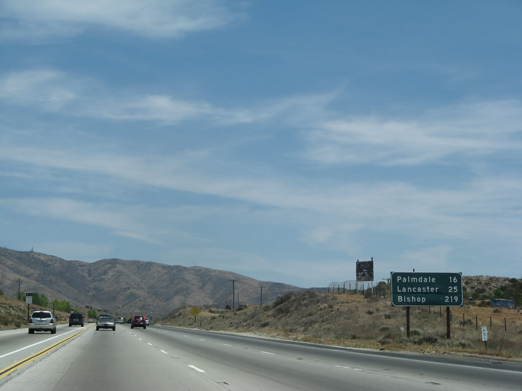
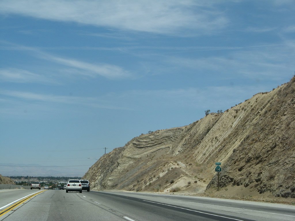
This mileage sign along California 14 (Antelope Valley Freeway) north provides the distance to Palmdale (16 miles), Lancaster (25 miles), and Bishop (219 miles). Photo taken 07/04/07. |
|
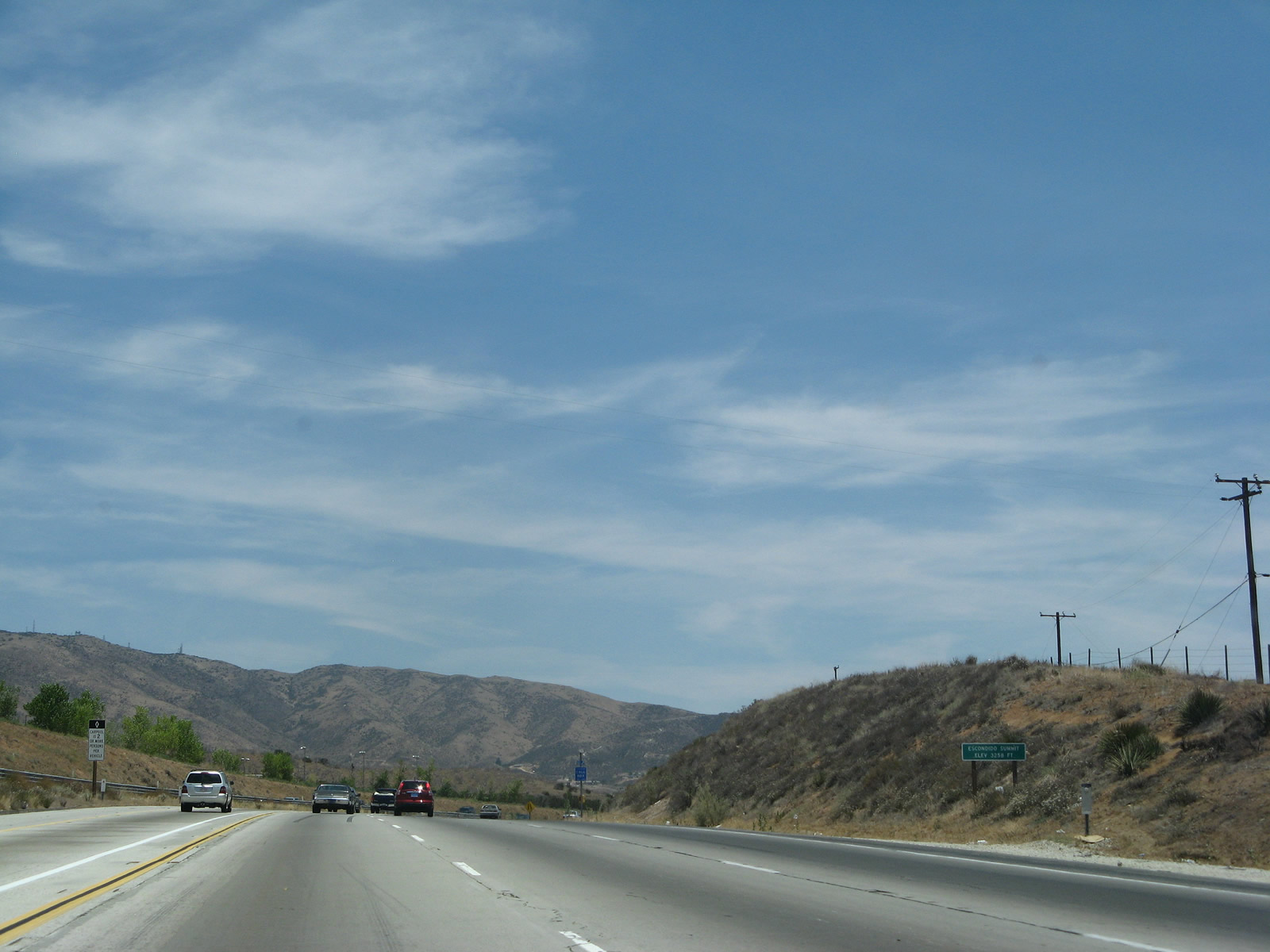
At elevation 3,258 feet, northbound California 14 (Antelope Valley Freeway) crosses Escondido Summit. This is the first of two crests along California 14 between Interstate 5 and Palmdale. Photo taken 07/04/07. |
|
The next exit along California 14 (Antelope Valley Freeway) north is Exit 22, Red Rover Mine Road (one mile). The freeway again reduces to 2+1 configuration (two main lanes and one HOV lane). Photo taken 07/04/07. |
|
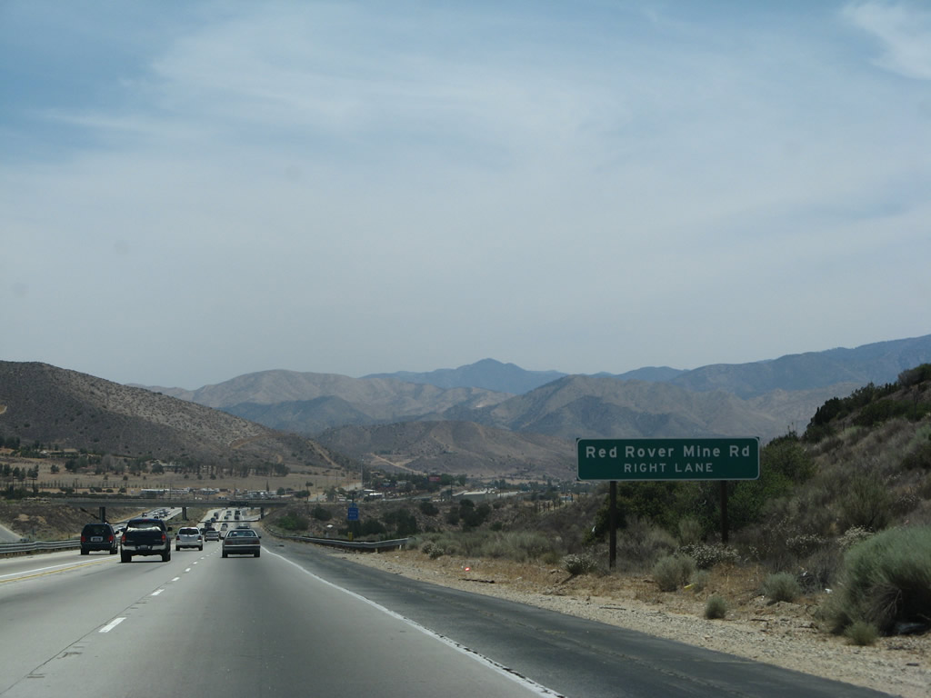
Northbound California 14 (Antelope Valley Freeway) approaches Exit 22, Red Rover Mine Road (next right). Photo taken 07/04/07. |
|
Northbound California 14 (Antelope Valley Freeway) reaches Exit 22, Red Rover Mine Road. Photo taken 07/04/07. |
|
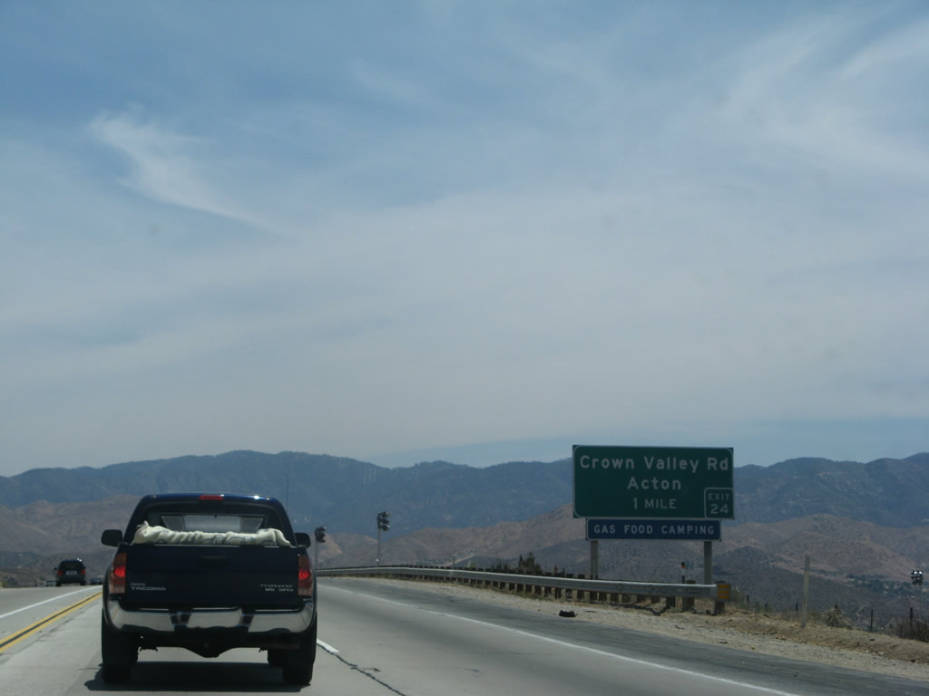
The next exit along northbound California 14 (Antelope Valley Freeway) is Exit 24, Crown Valley Road to Acton (one mile). Note the unusual placement of the exit number (lower right corner of the sign). Photo taken 07/04/07. |
|
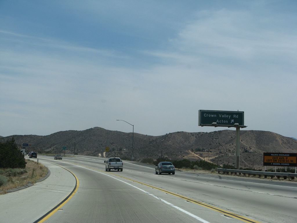
Northbound California 14 (Antelope Valley Freeway) reaches Exit 24, Crown Valley Road to Acton. Photo taken 07/04/07. |
|
The next exit along northbound California 14 (Antelope Valley Freeway) is Exit 26, Santiago Road. Photo taken 07/04/07. |
|
Northbound California 14 (Antelope Valley Freeway) reaches Exit 26, Santiago Road. Santiago Road leads south into Acton, where Santiago Road meets Santiago Canyon Road. Photo taken 07/04/07. |
|
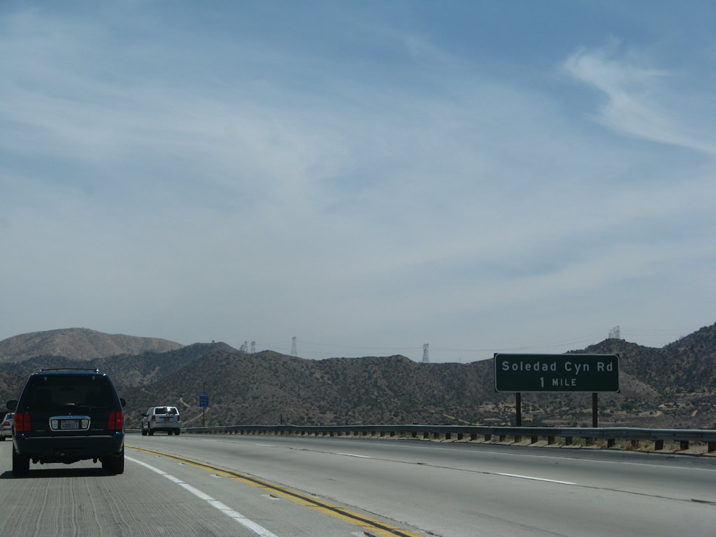
The next exit along northbound California 14 (Antelope Valley Freeway) is Exit 27, Soledad Canyon Road (one mile). Photo taken 07/04/07. |
|
Exit 27 is the second interchange between California 14 (Antelope Valley Freeway) and Soledad Canyon Road. Photo taken 07/04/07. |
|
Northbound California 14 (Antelope Valley Freeway) reaches Exit 27, Soledad Canyon Road. Soledad Canyon Road, which had been paralleling California 14 to the south on an alignment closer to the railroad tracks, rejoins the freeway here. Photo taken 07/04/07. |
|
The next exit along northbound California 14 (Antelope Valley Freeway) is Exit 30, Los Angeles County N-3 (Angeles Forest Highway) south and Sierra Highway (old U.S. 6) to Pearblossom Highway (1.50 miles). Photo taken 07/04/07. |
|
|
|
A series of Southern California Edison (SCE) and Los Angeles Department of Water and Power (LADWP) power lines criss-cross this area as the SCE lines converge on the Vincent Substation, which sits southeast of California 14 and west of the Angeles Forest Highway. California 14 crosses a second summit (Soledad Pass, elevation 3,179 feet). From there, California 14 will descend into the Antelope Valley. Photos taken 07/04/07. |
|
Poorly signed, Los Angeles County N-3 (Angeles Forest Highway) travels south from this interchange to California 2 (Angeles Crest Highway) near Big Tujunga. Sadly, much of the forest along this route was burned during the September 2009 Station Fire. Photo taken 07/04/07. |
|
Northbound California 14 (Antelope Valley Freeway) reaches Exit 30, Los Angeles County N-3 (Angeles Forest Highway) south and Pearblossom Highway east. Los Angeles County N-3 connects with California 2 (Angeles Crest Highway) via the Angeles Forest Highway. Pearblossom Highway, meanwhile, travels east to join California 138 near Pearland and also connects to another section of old U.S. 6. This particular stretch of old U.S. 6 follows the Sierra Highway through the cities of Palmdale and Lancaster; it is signed with brown historic markers. Photo taken 07/04/07. |
|
The ramp to Exit 30 splits, with one ramp leading to the Pearblossom Highway east and the other to Angeles Forest Highway south. Photo taken 07/04/07. |
|
A California 14 north reassurance shield is posted after the on-ramp from the Angeles Forest Highway and Pearblossom Highway. Photo taken 07/04/07. |
|
The HOV lane continues along California 14 north all the way to the Antelope Valley (Palmdale-Lancaster). Photo taken 07/04/07. |
|
The next exit along northbound California 14 is the Lamont Odett Vista Point (one mile). This vista point shows the San Andreas Fault as well as the California Aqueduct, which travels southeast toward the San Bernardino Mountains. Photo taken 07/04/07. |
|
Continuing northeast is this view as the Antelope Valley comes into view along California 14 north. Photo taken 07/04/07. |
|
The vista point has no facilities or restrooms. Photo taken 07/04/07. |
|
Northbound California 14 (Antelope Valley Freeway) reaches Exit 32, Lamont Odett Vista Point. Photo taken 07/04/07. |
|
The next exit along California 14 (Antelope Valley Freeway) north is Exit 33, Avenue S, one mile. Right around this sign, the freeway finally turns north after heading east-northeast since Sylmar. Photo taken 07/04/07. |
|
Passing over the California Aqueduct, northbound California 14 (Antelope Valley Freeway) will pass by Lake Palmdale before descending into the Antelope Valley. The aqueduct continues southeast toward San Bernardino, roughly paralleling California 138 and the San Andreas Fault. Photo taken 07/04/07. |
|
Now approaching Palmdale, northbound California 14 (Antelope Valley Freeway) passes over the San Andreas Fault as it leaves the rural, mountainous areas of the national forest and enters a sprawling, high desert community. The next five exits all serve the city of Palmdale: Exit 33, Avenue S; Exit 35, California 138 east and Los Angeles County N-2/Palmdale Boulevard west; Exit 37, Rancho Vista Boulevard and Avenue P; Exit 39, Avenue N; and Exit 40, Avenue M. Photo taken 07/04/07. |
|
Northbound California 14 (Antelope Valley Freeway) reaches Exit 33, Avenue S, and we enter the city of Palmdale. The first city along California 14 since leaving Santa Clarita and crossing the San Gabriel Mountains, the city of Palmdale incorporated on August 24, 1962, and had a population of 116,670 as of the 2000 Census. Photo taken 07/04/07. |
|
|
The next exit along California 14 (Antelope Valley Freeway) north is Exit 35, California 138 east and Los Angeles County N-2/Palmdale Boulevard west (1.25 miles). The high occupancy lane was not here in 2003; it was fully in use by 2007. Photos taken 07/04/07 and 08/16/03. |
|
A California 14 north reassurance shield is posted shortly thereafter. Photo taken 07/04/07. |
|
Houses and other signs of civilization come into view as California 14 crosses the San Andreas Fault and resumes urban freeway characteristics. Photo taken 07/04/07. |
|
California 138 is a major east-west corridor that generally follows the San Andreas Fault between Interstate 5 and Interstate 15. It acts as a bypass of the Los Angeles metropolitan area, but it has seen significant increases in traffic as a result of new development in areas such as Lancaster-Palmdale and the need for alternate routes to bypass the city. Photo taken 07/04/07. |
|
Northbound California 14 (Antelope Valley Freeway) reaches Exit 35, California 138 east and Los Angeles County N-2 west. While Los Angeles County N-2 ends here, California 138 merges with northbound California 14. The high occupancy lane, which extends from Santa Clarita to this point, ends here and changes into a general purpose lane. Photo taken 07/04/07. |
Page Updated July 7, 2010.