| California 62 east |
|
The first shield for eastbound California 62 is found on the transition ramp from eastbound Interstate 10 to northbound California 62. This interchange is built for a high speed connection between Interstate 10 and California 62. Photo taken 02/25/06. |
|
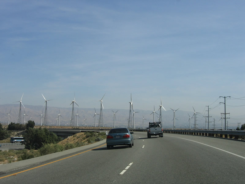
Wind turbines, a fixture of San Gorgonio Pass, dominate the view as the transition ramp from eastbound Interstate 10 turns north onto California 62. Photo taken 02/25/06. |
|
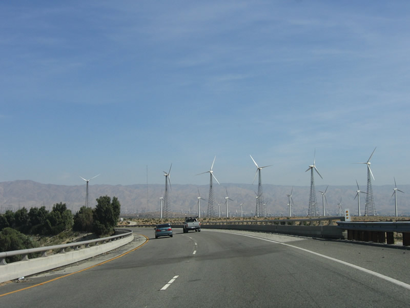
Northbound California 62 travels over the westbound lanes of Interstate 10. Photo taken 02/25/06. |
|
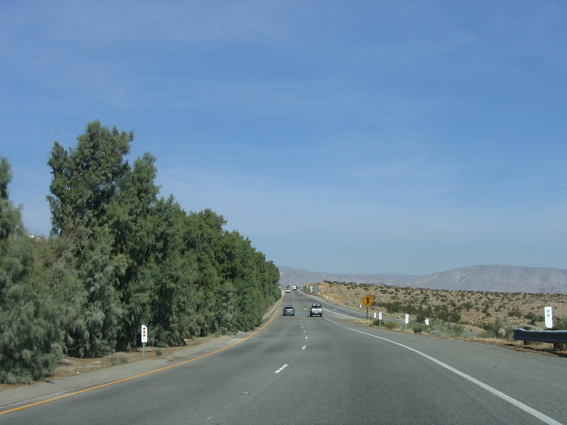
Desert bushes separate the two directions of California 62. The speed limit is 65 miles per hour. Photo taken 02/25/06. |
|
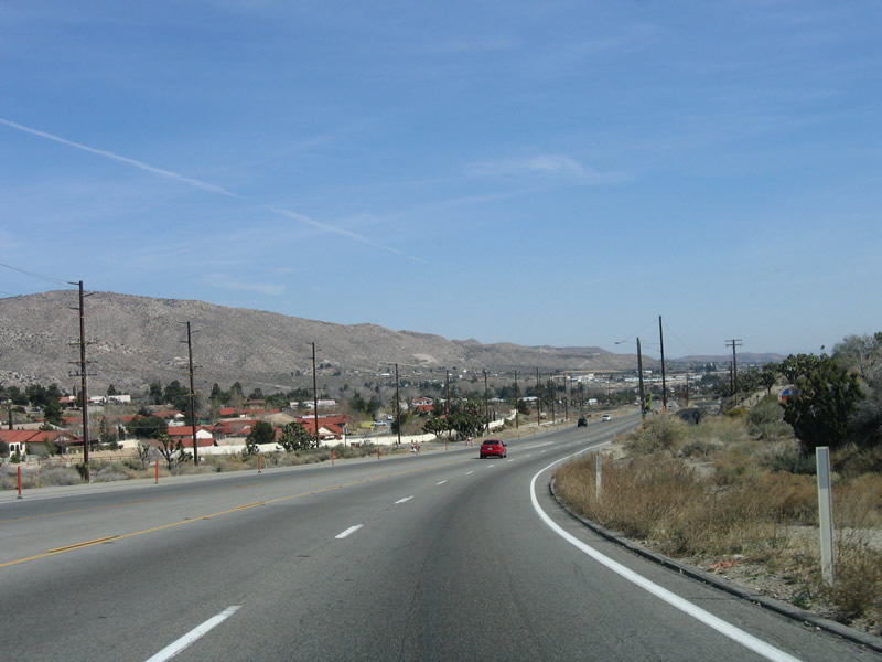
California 62 is the Twentynine Palms Highway; it begins to gain elevation immediately, since it must go from North Palm Springs (el. 860 feet) to Yucca Valley (el. 3,279 feet). Photo taken 02/25/06. |
|
Initially, California 62 seems like a freeway, but it quickly downgrades to an expressway. The expressway is still limited access, with intersections only with major roads. Photo taken 02/25/06. |
|
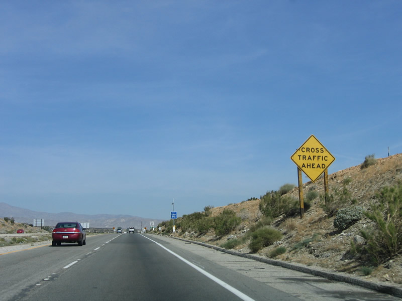
The first intersection along northbound California 52 is with Dillon Road. This road turns east-southeast through Fun Valley, serving the communities of North Palm Springs, Sky Valley, and Indio Hills. Dillon Road ultimately connects with Interstate 10 at Exit 146 (Business Loop I-10) in the vicinity of Indio and Coachella. Photo taken 02/25/06. |
|
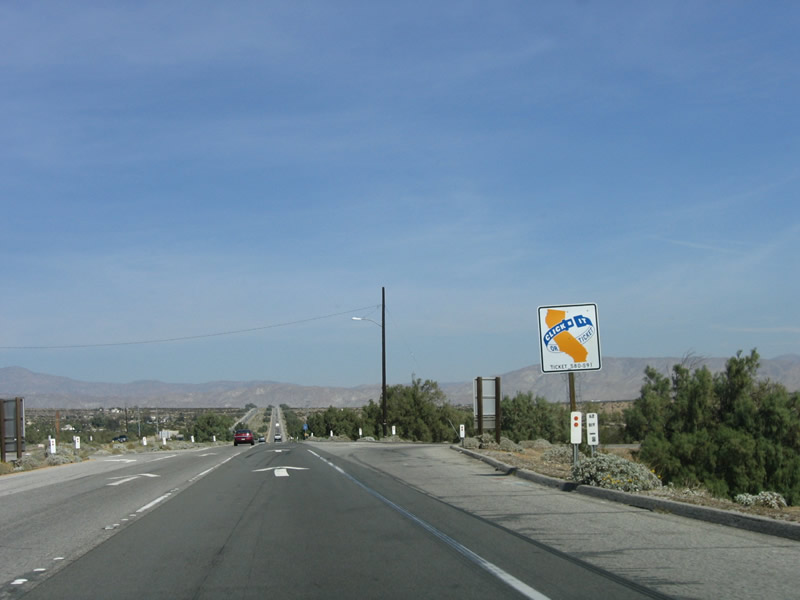
In late 2005, signs reminding drivers to "Click It or Ticket" appeared throughout the state. While it's likely these signs were funded by a grant, it is too bad some of this money could not be diverted to improve other signs that are in need of replacement, especially those over 45 years old. Photo taken 02/25/06. |
|
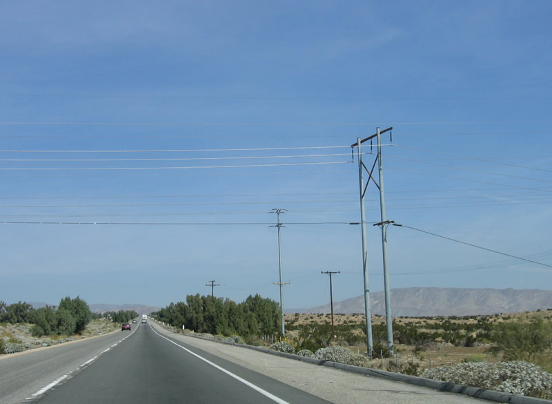
A power transmission line passes over California 62; it generally parallels Dillon Road east southeast toward Indio. Photo taken 02/25/06. |
|
This cramped mileage sign provides the distance to Joshua Tree National Park (visitors center and west entrance). The west entrance is in the town of Joshua Tree just east of Yucca Valley, while the visitors center is located in Twentynine Palms. Photo taken 02/25/06. |
|
The next intersection along northbound California 62 is with Painted Hills Road. Turn left (west) on Painted Hills Road to enter the community of Painted Hills. Photo taken 02/25/06. |
|
California 62 is a designated state scenic highway. Photo taken 02/25/06. |
|
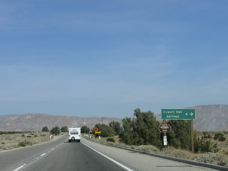
The next intersection is with Pierson Boulevard. Follow Pierson Boulevard west for about four miles to the city center of Desert Hot Springs. Photo taken 02/25/06. |
|
Upon crossing the Pierson Boulevard intersection, California 62 leaves unincorporated Riverside County and enters the city of Desert Hot Springs, even though most of this land is not developed. Photo taken 02/25/06. |
|
This reassurance shield is posted after the Pierson Boulevard intersection in Desert Hot Springs. A mileage sign provides the distance to Morongo Valley, Yucca Valley, and 29 Palms. Photo taken 02/25/06. |
|
The next intersection along northbound California 62 is with Mission Creek Road. Photo taken 02/25/06. |
|
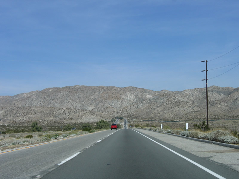
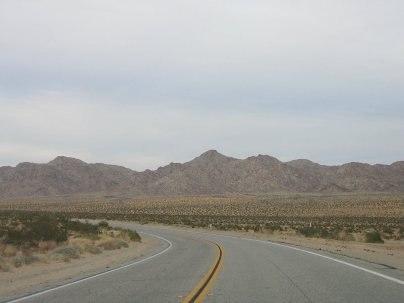
The Little San Bernardino Mountains lie ahead. California 62 will navigate through these mountains via Morongo Valley as the highway gains elevation. Photo taken 02/25/06. |
|
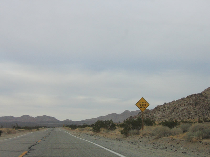
Unlike parts of California 62 east of Twentynine Palms, the expressway section has bridges to carry the highway over lower valleys that might flood during storms. Photo taken 02/25/06. |
|
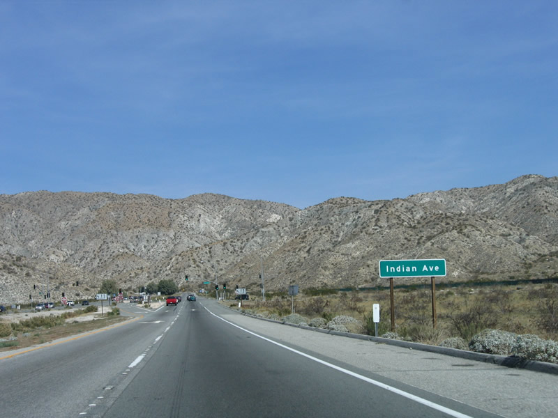
The next intersection along northbound is with Indian Avenue. California 62 leaves the city of Desert Hot Springs and again enters unincorporated Riverside County. Photo taken 02/25/06. |
|
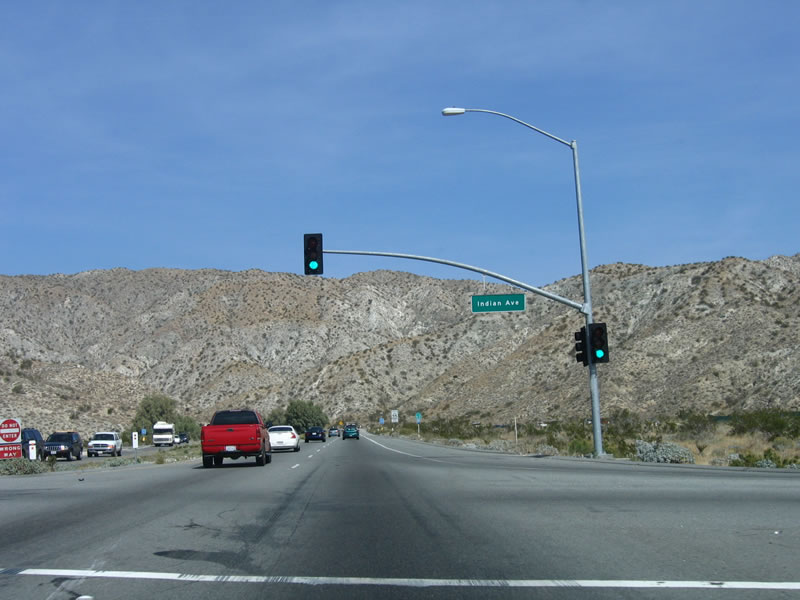
Unlike the previous several intersections, this particular junction is governed by a traffic signal. Turn right to the city center of Desert Hot Springs. Photo taken 02/25/06. |
|
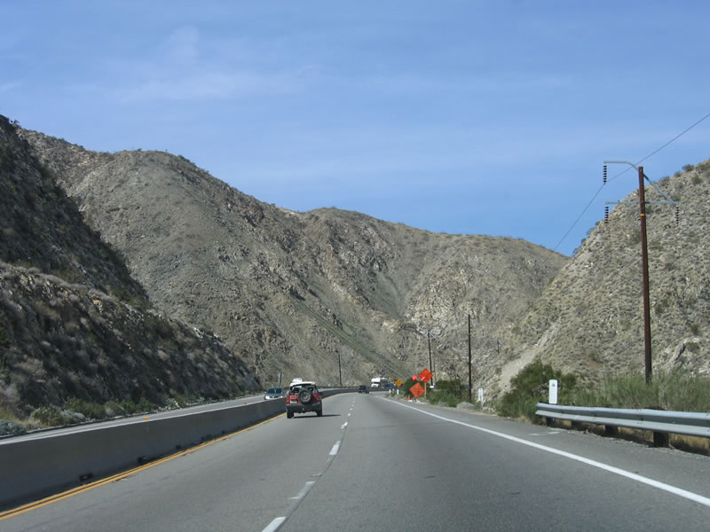
Northbound California 62 (Twentynine Palms Highway) continues to gain elevation as it approaches the Little San Bernardino Mountains. Photo taken 02/25/06. |
|
The wide median ends after the Indian Avenue intersection, and the two directions are now separated by a jersey barrier. Photo taken 02/25/06. |
|
Northbound California 62 leaves Riverside County and enters San Bernardino County. Photo taken 02/25/06. |
|
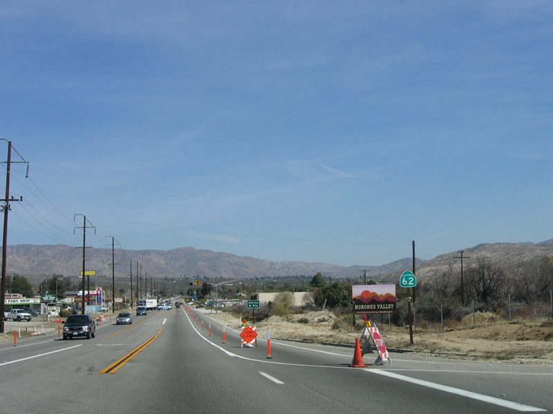
Almost immediately after entering San Bernardino County, the four-lane highway is restricted to one lane in each direction due to a construction project. California 62 enters unincorporated Morongo Valley. Photo taken 02/25/06. |
|
The first intersection is with Hess Boulevard, which together with Pioneer Drive acts as an unofficial business route through downtown Morongo Valley. Photo taken 02/25/06. |
|
A lone California 62 shield is posted along northbound after the Hess Boulevard intersection. Photo taken 02/25/06. |
|
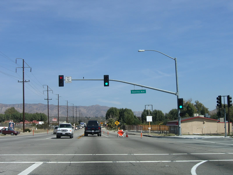
The next intersection is served by a traffic signal. San Jacinto Street travels north-south, while Senilis Avenue travels east-west. The intersection is aligned so that all directions can be accommodated. Photo taken 02/25/06. |
|
Northbound California 62 reaches the Senilis Avenue intersection. Photo taken 02/25/06. |
|
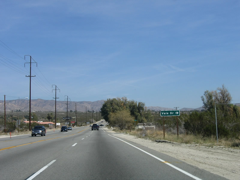
The construction zone comes to an end, and all expressway characteristics of California 62 come to an end. The road is more like a conventional highway now, with multiple access points and intersecting roads. Here, California 62 approaches Vale Drive. Photo taken 02/25/06. |
|
This mileage sign provides the distance to Yucca Valley, Joshua Tree, and Twentynine Palms. Photo taken 02/25/06. |
|
Continuing northeast through the Morongo Valley, California 62 approaches Big Morongo Canyon Road. Photo taken 02/25/06. |
|
At the Canyon Road/Lanning Lane intersection, the distant incline that carries California 62 northeast toward Yucca Valley comes into view. Photo taken 02/25/06. |
|
Most of the roads that intersect the state route are dirt or gravel roads, including Rose Eden Drive. Photo taken 02/25/06. |
|
Hoopa Trail departs California 62 here, following a substandard alternate route toward the town of Yucca Valley. Photo taken 02/25/06. |
|
Now on the incline, turn left to the Morongo Valley Park. Photo taken 02/25/06. |
|
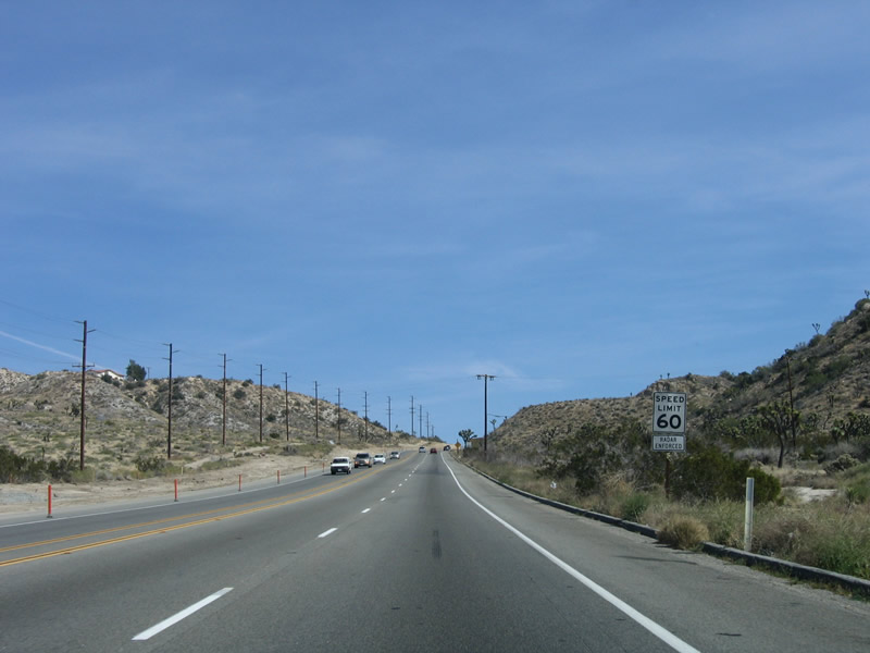
The speed limit is 60 miles per hour through this rural stretch of highway. Photo taken 02/25/06. |
|
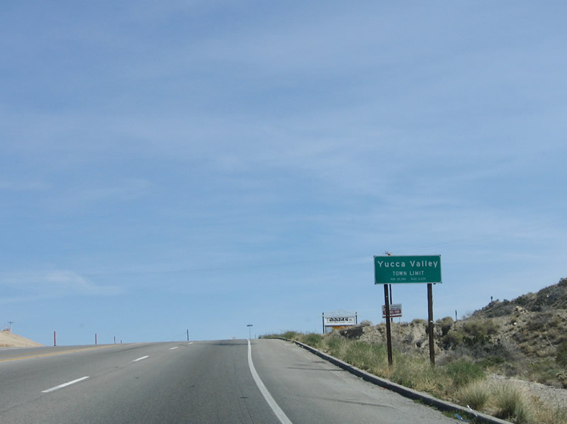
Continuing east, California 62 enters the town of Yucca Valley. At 3,300 feet, Yucca Valley lies in the Mojave Desert. Photo taken 02/25/06. |
|
Yucca Valley incorporated in 1991 and today is a town of 16,865 people as of the 2000 Census. Photo taken 02/25/06. |
|
Several roads intersect California 62 as the Twentynine Palms Highway enters the town of Yucca Valley. Camino del Cielo is the third such road encountered along eastbound California 62. Photo taken 02/25/06. |
|
An official California Welcome Center is located in Yucca Valley about two miles east of here, at the chamber of commerce. Photo taken 02/25/06. |
|
This traffic signal serves Kickapoo Trail, which is one of several named north-south trails. Some of the others (in order from east to west, A to J) are Apache, Bannock, Cherokee, Deer, Elk, Fox, Geronimo, Hopi, (Mariposa), Inca, (Shawnee), and Jimenez. Photo taken 02/25/06. |
|
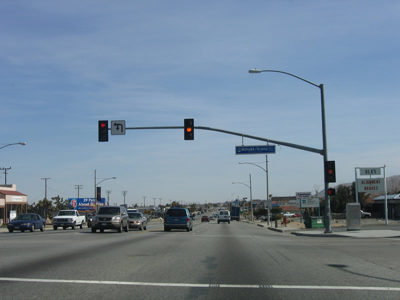
The next traffic signal along eastbound California 62 is Deer Trail. Photo taken 02/25/06. |
|
Following that, the next traffic signal is located at Acoma Trail. Photo taken 02/25/06. |
|
Most motorist services are available in Yucca Valley, including motels, restaurants, and gas. Here, eastbound California 62 approaches Barberry Avenue. Photo taken 02/25/06. |
|
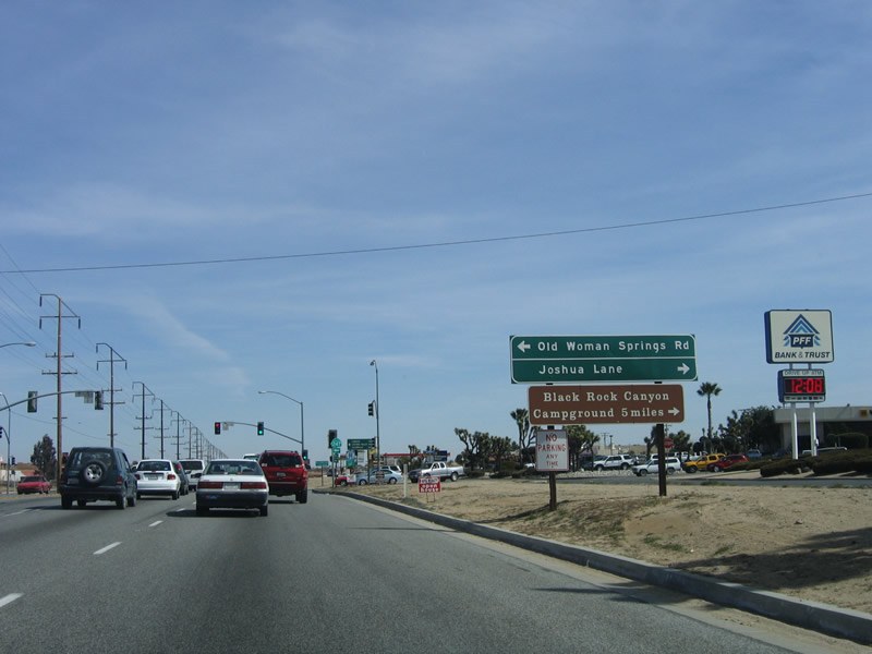
Eastbound California 62 approaches California 247 (Old Woman Springs Road). Photo taken 02/25/06. |
|
California 247 travels north from Yucca Valley to Lucerne and Barstow, with a connection to Victorville via California 18. Photo taken 02/25/06. |
|
California 247 is named Old Woman Springs Road, while the local road to the south is known as Joshua Lane. Use Joshua Lane to Black Rock Canyon Campground. Photo taken 02/25/06. |
|
Eastbound California 62 (Twentynine Palms Highway) reaches California 247 (Old Woman Springs Road) in Yucca Valley. Photo taken 02/25/06. |
|
This mileage sign provides the distance to the west entrance of Joshua Tree National Park and the visitors center for the park. Since the visitor center is located in Twentynine Palms, it is further east than the west entrance to the park. Photo taken 02/25/06. |
|
This reassurance shield for California 62 is posted east of the California 247 intersection. Photo taken 02/25/06. |
|
Now leaving Yucca Valley, this mileage sign provides the distance to Joshua Tree, Twentynine Palms, and Amboy. Amboy is not on California 62, but there is a secondary road that travels north from California 62 in 29 Palms to Amboy. Photo taken 02/25/06. |
|
The intersection with La Contenta Road (Yucca Mesa Road) is the eastern boundary of the town of Yucca Valley. California 62 now enters the unincorporated community of Joshua Tree. Photo taken 02/25/06. |
|
Joshua Tree is a small community that serves as the western entrance to Joshua Tree National Park. Photo taken 02/25/06. |
|
A local welcome sign is posted after the state's boundary signage. Photo taken 02/25/06. |
|
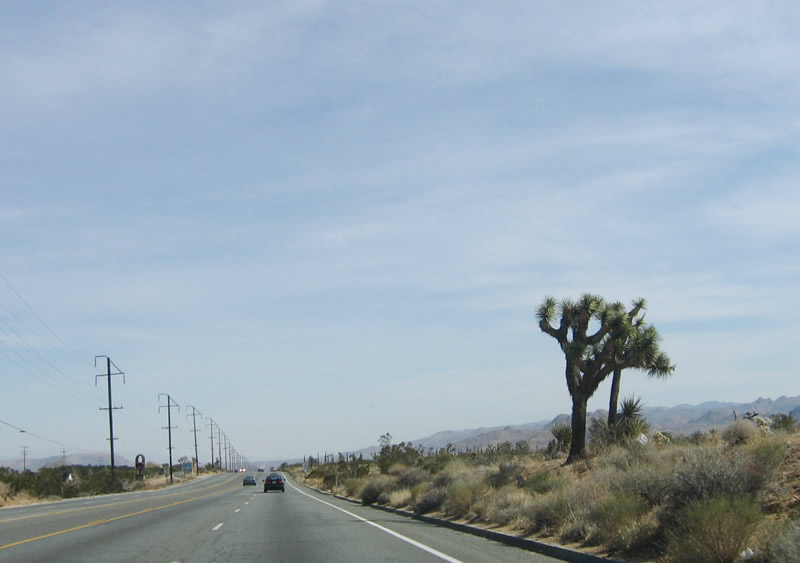
Joshua Trees grow and thrive at higher elevations in the Mojave Desert, and several of them appear next to California 62 (including this one). Photo taken 02/25/06. |
|
As we approach the turnoff to Joshua Tree National Park, the speed limit is 55 miles per hour. Photo taken 02/25/06. |
|
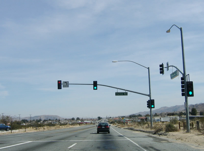
The Joshua Tree post office is located at the intersection with Hallee Road. Photo taken 02/25/06. |
|
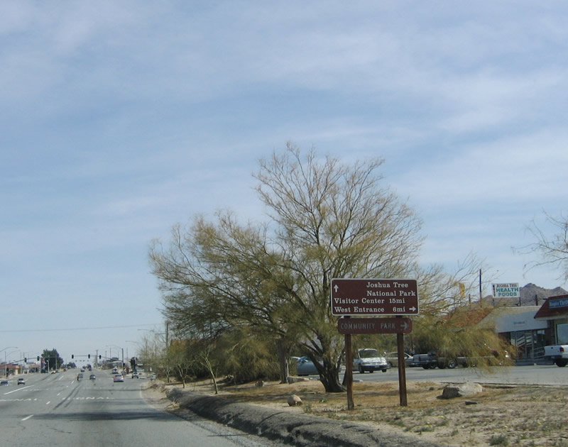
Eastbound California 62 approaches Park Boulevard, which travels south toward Joshua Tree National Park. This mileage sign provides the distances to park destinations. Photo taken 02/25/06. |
|
Entering downtown Joshua Tree, California 62 widens. Photo taken 02/25/06. |
|
Eastbound California 62 reaches Park Boulevard, which provides the connection to Joshua Tree National Park. Photo taken 02/25/06. |
|
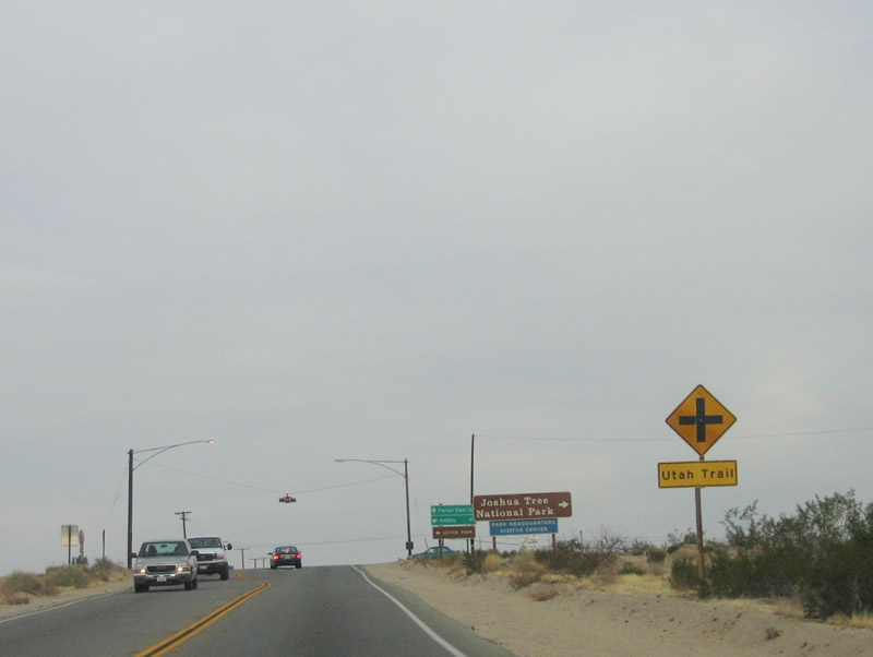
After leaving the community of Joshua Tree, California 62 continues east, entering the city of Twentynine Palms. East of downtown Twentynine Palms, California 62 approaches Utah Trail. Follow Utah Trail south into Joshua Tree National Park, where it connects to Park Boulevard and Pinto Basin Road en route to Cottonwood Spring and Interstate 10 near Chiriaco Summit. Photo taken 02/25/06. |
|
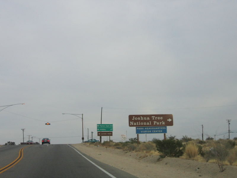
Turn south on Utah Trail to Joshua Tree National Park's eastern entrance and visitor center. Photo taken 02/25/06. |
|
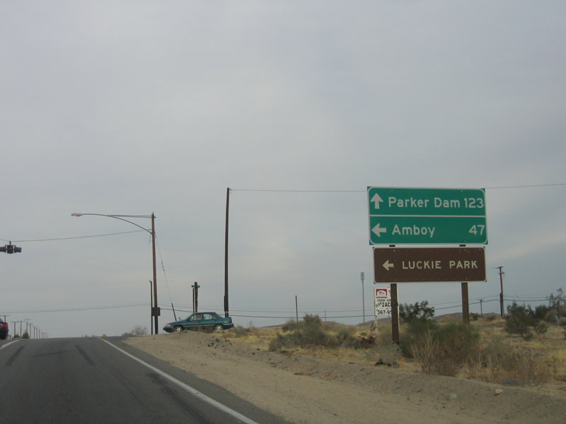
East of here, there are virtually no services on eastbound California 62. It is 123 miles from here to Parker Dam, which is near Parker, Arizona. The only other towns of consequence along this desolate stretch of gorgeous California 62 are Rice and Vidal Junction. Turn left on Utah Trail to Amboy. Photo taken 02/25/06. |
|
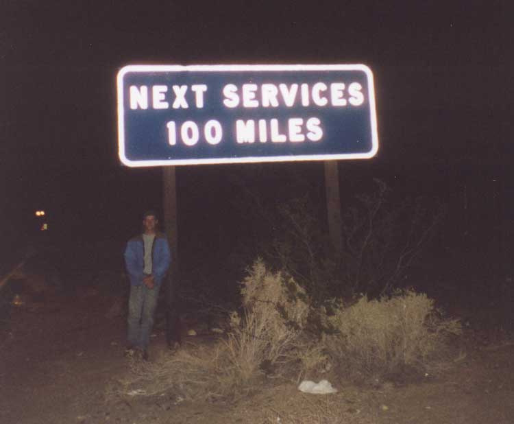
The next services are 100 miles east of here at Vidal Junction. In fact, there is not much of anything on California 62 between here and U.S. 95, and that adds to the rural highway's rustic beauty. Be sure to check water, gas, and tire pressure before embarking too far away from civilization, especially in the hot summer months. Photo taken 02/25/06. |
|
Here is a view of the old button copy "no services" sign along eastbound California 62 east of Twentynine Palms. (Say hello to fellow California-based webmaster Mike Ballard, who provides scale to the sign in this photograph and has his own webpage on California 62.) Photo taken 11/12/00. |
|
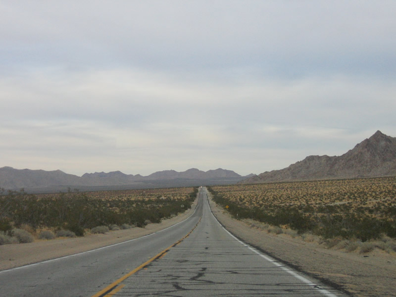
The speed limit along California 62 remains 65 miles per hour despite the fact the road is only two lanes wide and has a soft shoulder. Traffic volumes decrease after the highway leaves the city limits of Twentynine Palms. Photo taken 02/25/06. |
|
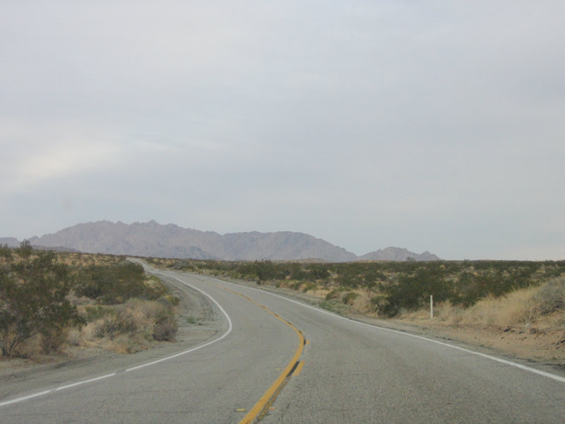
California 62 adjusts a bit to the southeast via this gentle curve east of Twentynine Palms and west of Old Dale. Photo taken 02/25/06. |
|
For recreation information, tune the radio to 1610 am. Photo taken 02/25/06. |
|
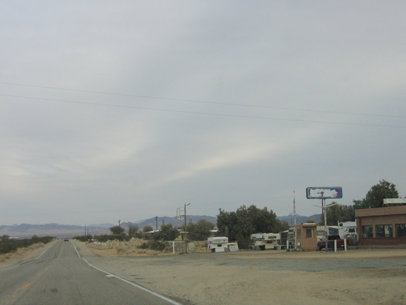
There is not much left of Old Dale, except for several trailers and the remains of a gas station. Photo taken 02/25/06. |
|
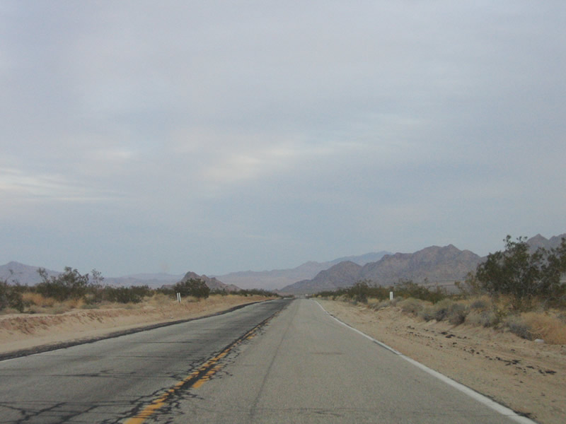
California 62 undulates with the landscape as it approaches Ironage Road. Photo taken 02/25/06. |
|
A few turnouts, which allow for slower vehicles to pull off the highway, are located along California 62. Photo taken 02/25/06. |
|
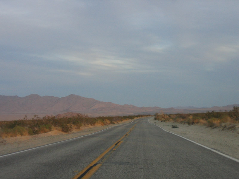
Eastbound California 62 crosses over scenic Clarks Pass. Photo taken 02/25/06. |
|
Sunset in Sheephole Valley is amazing, as the sun hits the Coxcomb Mountains just north of Pinto Basin in Joshua Tree National Park. The national park lies just south of state route. Photo taken 02/25/06. |
|
California 62 briefly departs San Bernardino County and reenters Riverside County, where it has been named the Officer Muehlhausen Highway. Photo taken 02/25/06. |
|
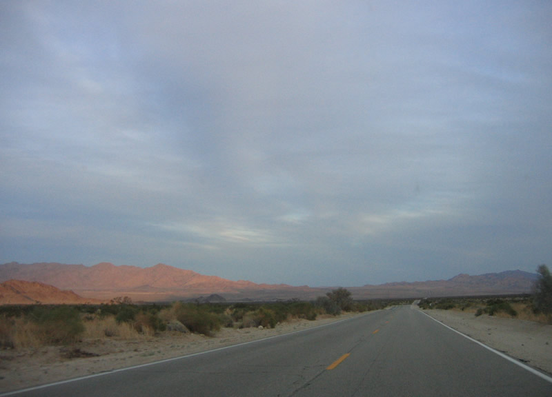
As California 62 passes over the Colorado River Aqueduct, the highway gains elevation. Photo taken 02/25/06. |
|
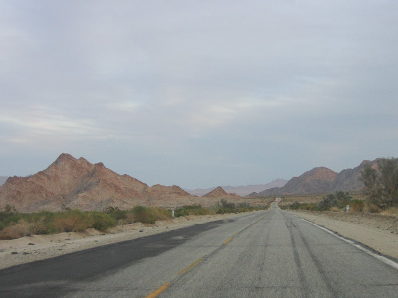
The Granite Mountains frame eastbound California 62 as it approaches the junction with California 177. Photo taken 02/25/06. |
|
California 177 connects California 62 with Interstate 10 on an alignment that generally parallels the Colorado River Aqueduct. Both California 177 and California 62 were originally constructed to service the canal. Photo taken 02/25/06. |
|
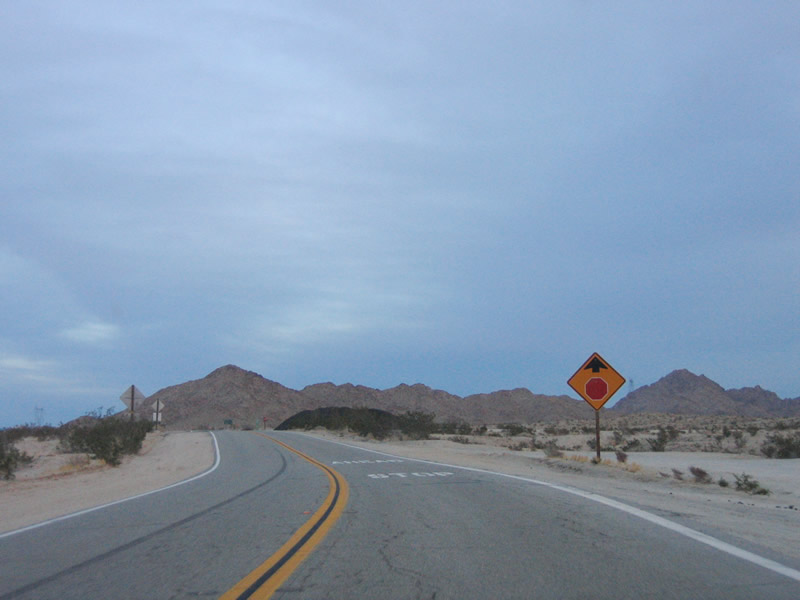
Only eastbound California 62 traffic must stop at the California 62 - California 177 intersection. Photo taken 02/25/06. |
|
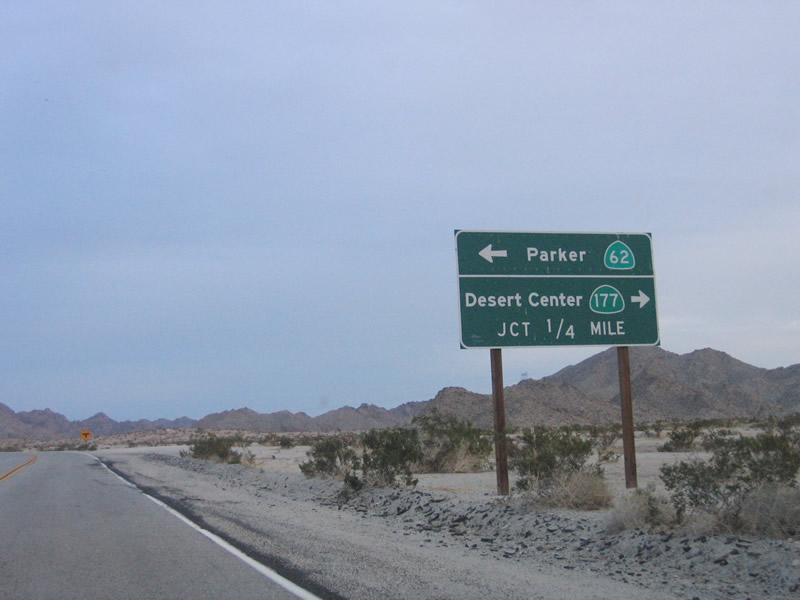
Turn left to continue east along California 62; turn right to follow California 177 south to Desert Center and Interstate 10. Photo taken 02/25/06. |
|
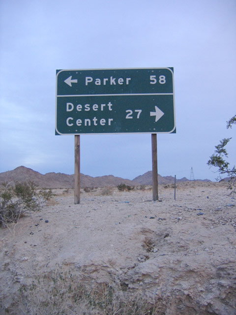
This sign provides the distance to Vidal Junction on eastbound California 62 and Desert Center on California 177 southbound. Photo taken 02/25/06. |
|
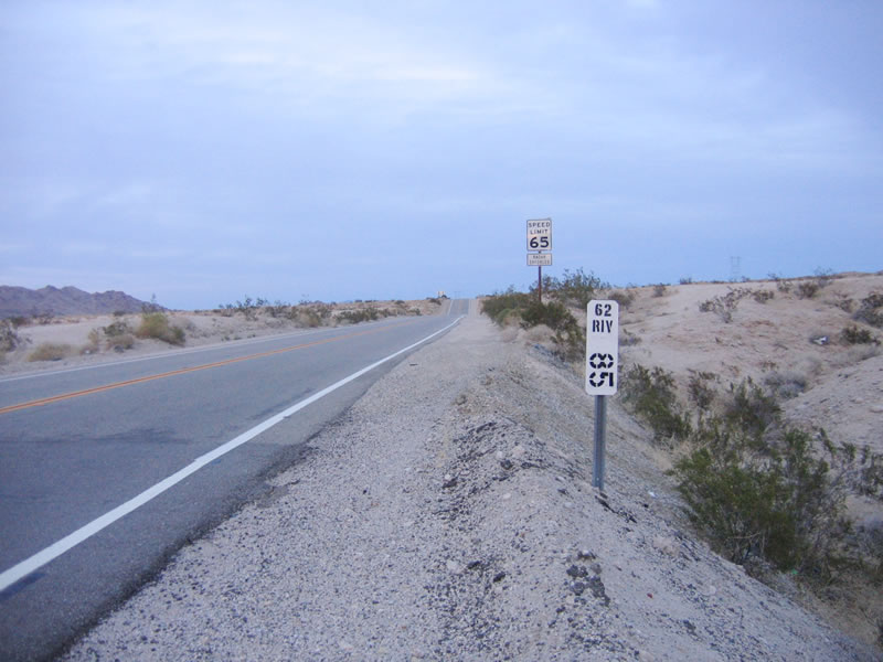
This postmile for Riverside Mile 85 is located after the California 177 intersection. Continue east along California 62 through Rice to Vidal Junction. Photo taken 02/25/06. |
|
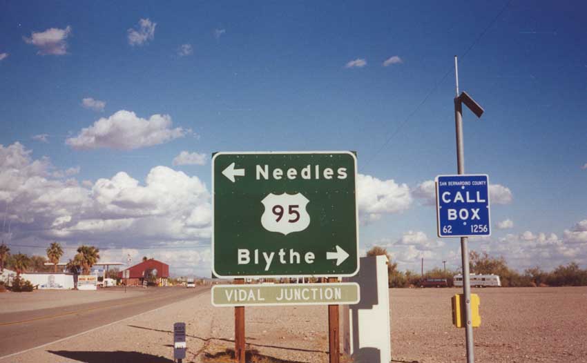
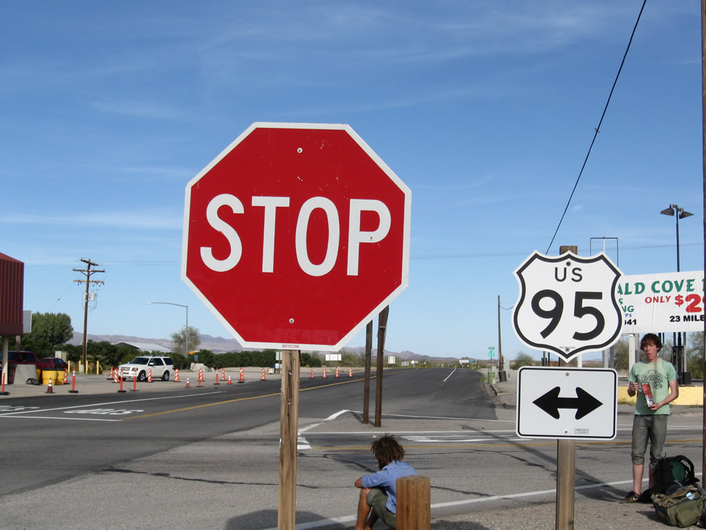
Some distance east of the California 177 intersection, eastbound California 62 meets U.S. 95 at Vidal Junction. The town of Vidal is located south of this intersection along U.S. 95. Photo taken 11/13/00. |
|
The large, red building ahead is the California Agricultural Inspection Station for westbound traffic leaving Parker, Arizona, en route for points west along California 62. In the foreground is the intersection with U.S. 95 in Vidal Junction. Photo taken 03/14/09. |
|
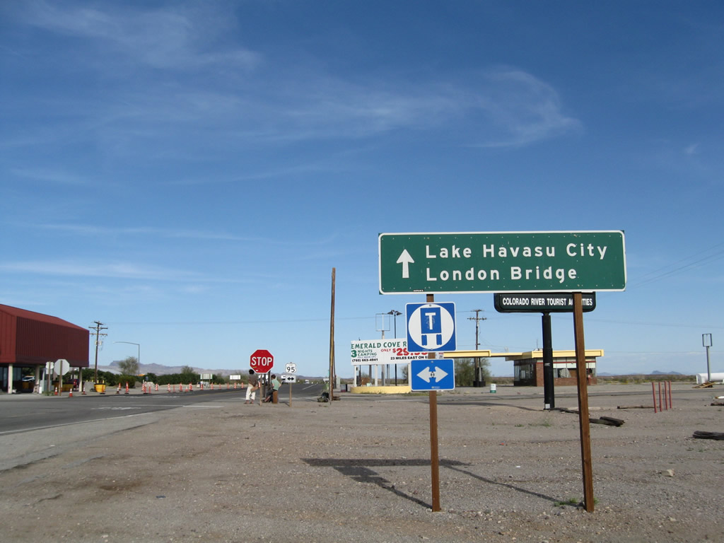
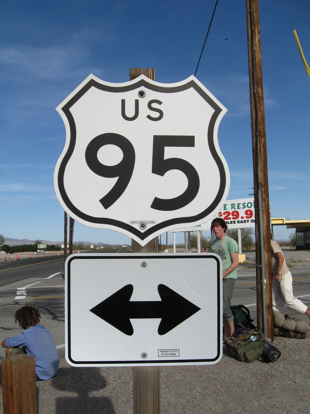
Eastbound California 62 approaches U.S. 95 in Vidal Junction. Follow California 62 east to Earp and Parker and Lake Havasu in Arizona. To Lake Havasu City and London Bridge, follow California 62 east to Arizona 95 north. Photo taken 03/14/09. |
|
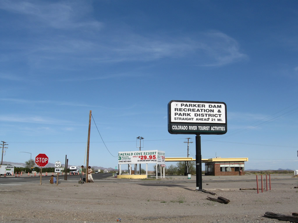
The Parker Dam Recreation and Park District is 21 miles ahead; river activities including a marina are located off of California 62. Photo taken 03/14/09. |
|
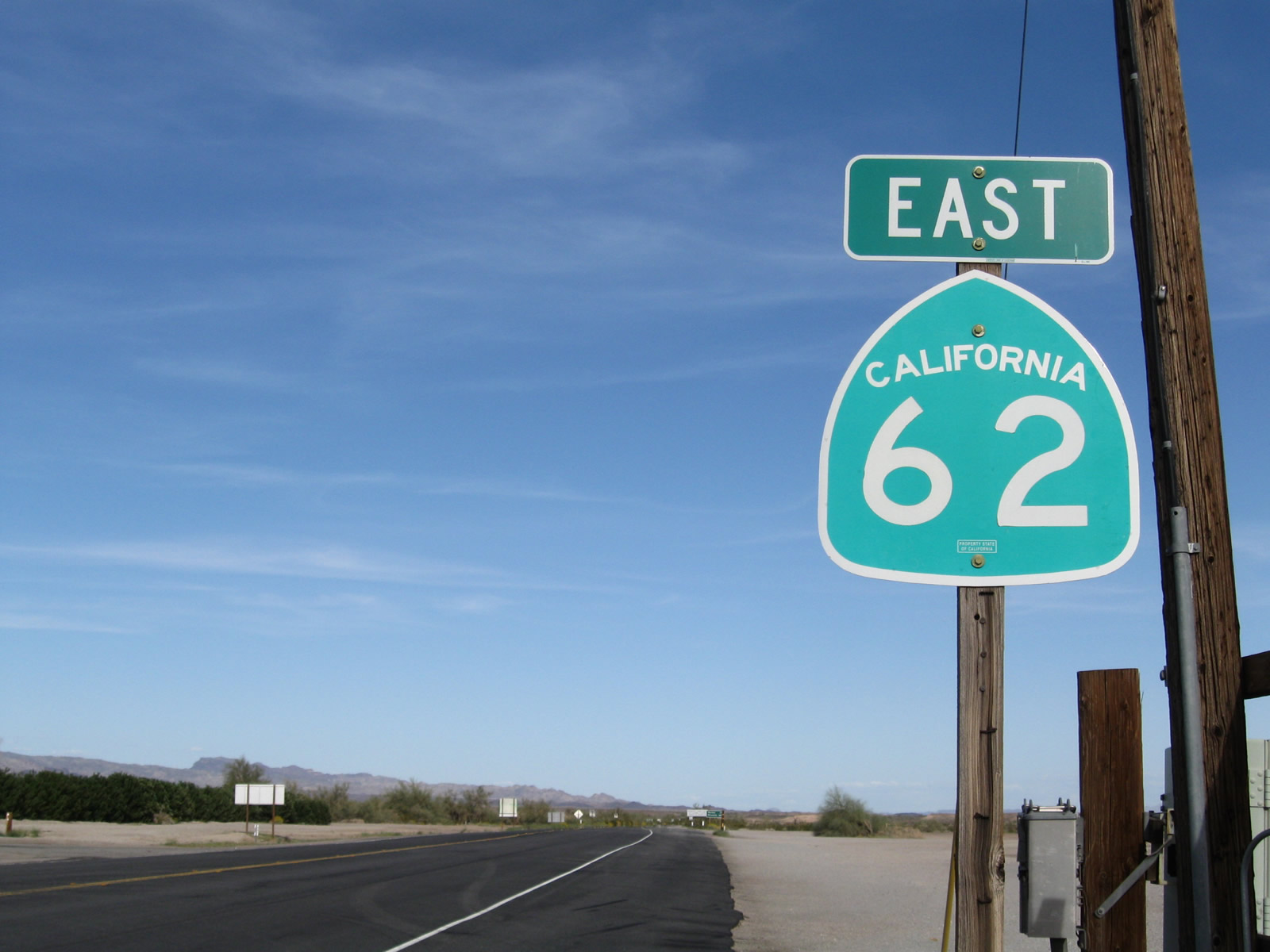
This California 62 east shield is posted after the intersection with U.S. 95 in Vidal Junction. Photo taken 03/14/09. |
|
Some distance east of Vidal Junction, eastbound California 62 splits. Turn right to follow California 62 east to Parker or continue straight to follow Parker Dam Road northeast to Cross Roads or Parker Dam. Photo taken 02/20/05. |
|
|
This old button-copy sign lists the various vacation resorts, marinas, and related sites along Parker Dam Road northeast of here. Parker Dam Road is closed across Parker Dam overnight (check for closure times before traveling at night), and trucks are restricted. Photos taken 02/20/05. |
|
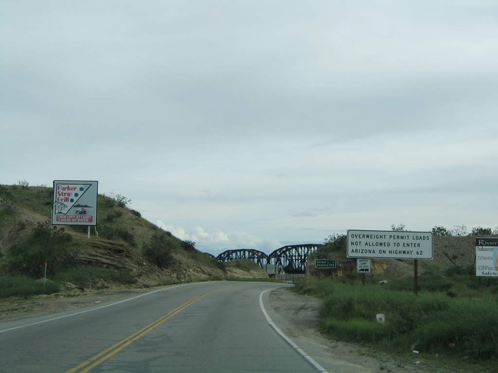
Overweight permit loads are not permitted to cross into Arizona via California 62. Photo taken 02/20/05. |
|
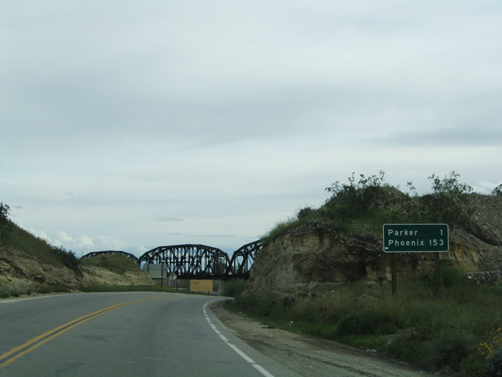
This mileage sign provides the distance to Parker (one mile) and Phoenix (153 miles via Arizons 95 south, Arizona 72 east, and U.S. 60 east). Photo taken 02/20/05. |
|
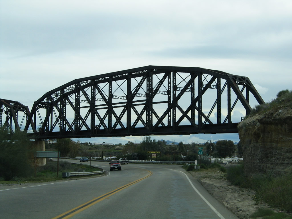
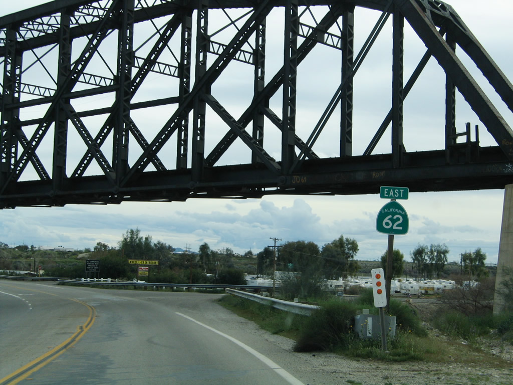
California 62 passes under a railroad bridge, which carries the railroad over both the highway and the Colorado River. Photo taken 02/20/05. |
|
A California 62 east reassurance shield (with tilted numeral "6") is posted under the railroad bridge. Photo taken 02/20/05. |
|
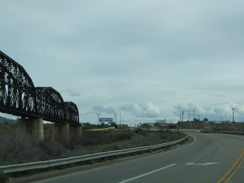
The railroad bridge passes over California 62 and then east over the Colorado River, which is visible to the left of the state route. Photo taken 02/20/05. |
|
Eastbound California 62 meets Rio Vista Drive south, which leads to several riverside properties. All commercial vehicles must stop at the Port of Entry once in Arizona. Photo taken 02/20/05. |
|
This view places the railroad bridge and highway bridge into context as they both cross the Colorado River. Photo taken 02/20/05. |
|
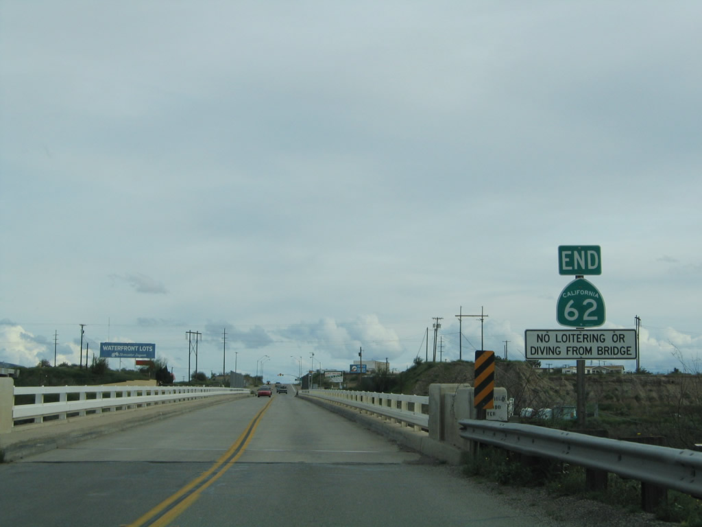
An end California 62 shield assembly is posted prior to crossing the Colorado River; the highway changes into Spur Arizona 95 upon entering the state of Arizona. The state line is at the bridge's mid-span. Photo taken 02/20/05. |
|
A Spur (Truck) Arizona 95 shield assembly is posted at the east end of the Colorado River bridge. The state route enters Parker, Arizona. Photo taken 02/20/05. |
Page Updated May 19, 2014.