

California 75 North
| Palm Avenue west | ||
|---|---|---|
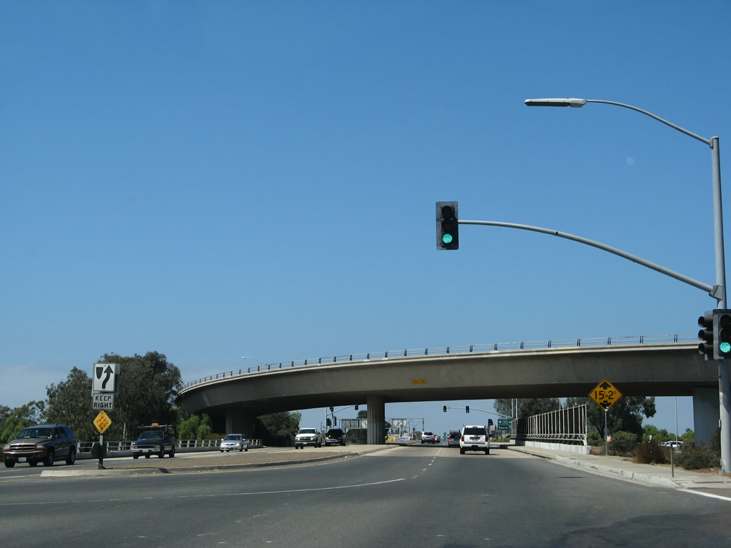 |
In the Otay-Nestor community of the city of San Diego, westbound Palm Avenue meets Interstate 5 at this interchange. A direct flyover ramp connects California 75 east with Interstate 5 north, which crosses over what would otherwise be a diamond interchange. Continue straight from this point to follow California 75 west into Imperial Beach then north to the Silver Strand and Coronado. Photo taken 09/01/07. | |
 |
A freeway entrance shield assembly is posted for the ramp from westbound Palm Avenue onto Interstate 5 (Montgomery Freeway) north to Chula Vista, National City, and downtown San Diego. Photo taken 09/01/07. | |
| California 75 north | ||
|---|---|---|
 |
 |
A wide grassy median lines California 75 (Orange Avenue) from Adella Avenue near the Hotel del Coronado all the way north to Centennial Park at the First Street intersection near the Coronado Ferry Landing. After the intersection with Fifth Street, California 75 will turn right onto Fourth Street toward the San Diego-Coronado Bay Bridge. Photos taken 01/18/09. |
 |
 |
The wide grassy median continues along northbound Orange Avenue prior to the Fourth Street intersection. Photos taken 01/18/09. |
 |
An end truck route sign is posted prior to the Fourth Street intersection, perhaps due to truck restrictions on the San Diego-Coronado Bay Bridge. Photo taken 01/18/09. |
 |
Northbound California 75 turns right onto Fourth Street at the next traffic signal. Follow Fourth Street east to San Diego and Interstate 5. Continue straight ahead along Orange Avenue (spur California 75) north to the Coronado Ferry Landing. Photo taken 01/18/09. |
 |
At this intersection, California 75 turns right onto Fourth Street. Continue north along Orange Avenue to the Coronado Ferry Landing. Photo taken 01/18/09. |
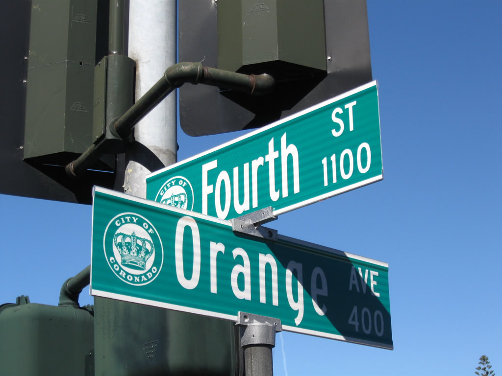 |
The street blades in Coronado feature a city seal as well as the street name on a green sign. This sign assembly is located at the intersection of Orange Avenue and Fourth Avenue. Photo taken 01/18/09. |
 |
After the Orange Avenue intersection, "northbound" California 75 turns southeast toward the approach of the bay bridge. The next intersection is with C Avenue. The state route carries three lanes in one direction. Watch your speed (25 miles per hour speed limit); this is a targeted enforcement zone for speeding. Photo taken 01/18/09. |
 |
A few blocks further east is this trailblazer signage for California 75 east to San Diego. Photo taken 01/18/09. |
 |
Prior to Glorietta Boulevard, the two directions of California 75 merge back together as Fourth Street. The approach to the bridge is just ahead. Photo taken 01/18/09. |
 |
Northbound California 75 prepares to leave the city of Coronado and cross the San Diego Bay to enter San Diego via the San Diego-Coronado Bay Bridge. Photo taken 08/08/04. |
 |
The San Diego-Coronado Bay Bridge is constantly patrolled, both by city police and Highway Patrol. This overpass was originally part of the toll plaza. Photo taken 08/08/04. |
 |
As it ascends the San Diego-Coronado Bay Bridge, California 75 becomes a freeway, but it does not have Interstate-standard shoulders. Additionally, the median adjusts to allow for configurations of either two or three lanes in each direction; there are five lanes available in total. Photo taken 08/08/04. |
 |
At the time this photo was taken, the San Diego-Coronado Bay Bridge was configured with two lanes northbound and three lanes southbound. Note that the bridge actually travels east-west; "northbound California 75" is actually due east across the bridge. Photo taken 08/08/04. |
 |
A striking feature of the San Diego-Coronado Bay Bridge is the way it curves as it ascends to its highest point. Photo taken 08/08/04. |
 |
Northbound California 75 departs Coronado and enters San Diego. Photo taken 01/18/09. |
 |
Even without walkways and pedestrian areas, the San Diego-Coronado Bay Bridge still sees a fair number of people threatening suicide. These signs are designed to help those with suicidal tendencies to call the 24-hour hotline to receive counseling and help. Note that there are no fences on either side of the bridge, so jumpers can drive to the top, stop their car, and jump. Photo taken 01/18/09. |
 |
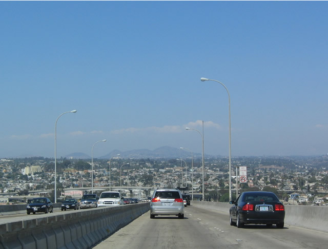 |
The city of San Diego and distant mountains spread into view as the San Diego-Coronado Bay Bridge reaches its apex and begins to descend toward the Barrio Logan and Logan Heights neighborhoods of the city of San Diego. Photos taken 01/18/09 and 08/08/04. |
 |
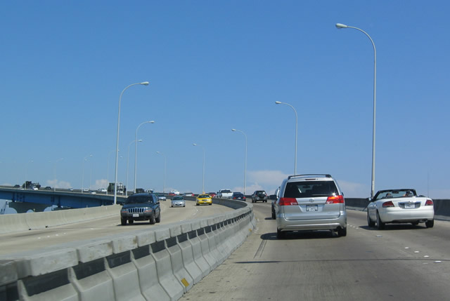
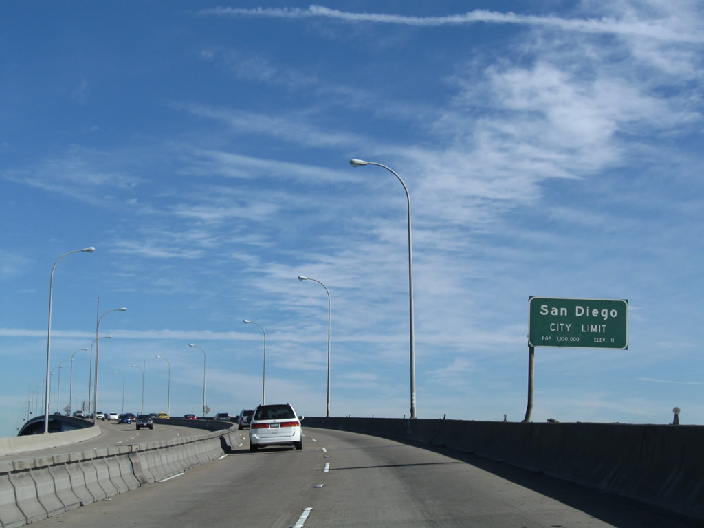
Northbound California 75 splits into north and south Interstate 5 as the bridge descends onto a viaduct above the Logan Heights community of San Diego. Use the right lanes for southbound and the left lanes for northbound. Photo taken 01/18/09. |
 |
An end shield is posted for the official state scenic route; an end California 75 shield assembly is not posted. Photo taken 01/18/09. |
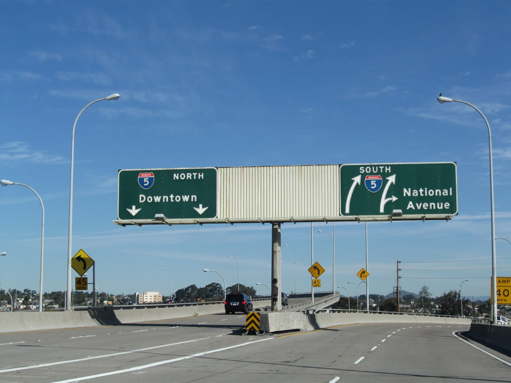 |
The two left lanes head north to downtown along north Interstate 5, while the two right lanes head south toward Tijuana, with an off-ramp for National Avenue. Use Interstate 5 south to California 15 north. This interchange marks the northern terminus of California 75; there is no end shield (except for the scenic route endpoint). Photo taken 01/18/09. |
 |
The National Avenue off-ramp is located immediately after the main split from the bridge; the exit ramp is only marked with an EXIT gore point. Photo taken 01/18/09. |
| Spur California 75 (Orange Avenue) north | |
|---|---|
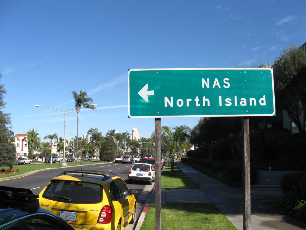 |
After the Fourth Street intersection, Orange Avenue northbound approaches Third Street. Turn left to follow California 282/Third Street west to the North Island Naval Air Station, and continue straight ahead to follow Orange Avenue for another three blocks to the Coronado Ferry Landing. Photo taken 01/18/09. |
 |
Northbound Orange Avenue meets Third Street at this signalized intersection. Photo taken 01/18/09. |
 |
Northbound Orange Avenue meets Second Street and approaches First Street, which parallels the bayshore. Orange Avenue terminates into Centennial Park, which includes a focal view of the downtown San Diego skyline, the U.S. Naval Air Station at North Island, and the San Diego-Coronado Bay Bridge. Photo taken 01/18/09. |
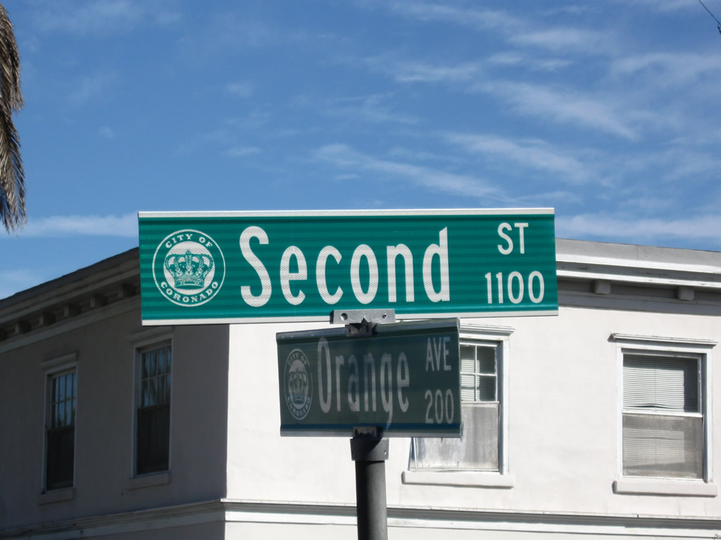 |
This street sign blade assembly shows Orange Avenue and Second Street in Coronado. Photo taken 01/18/09. |
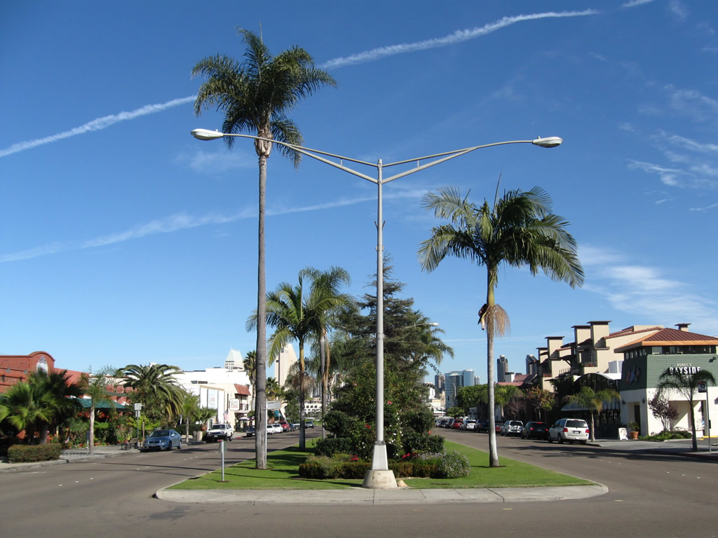 |
The wide grassy median features evergreen and palm trees along with grass. During the holiday season, the pine trees are decorated with holiday lights. Photo taken 01/18/09. |
 |
The skyline of downtown San Diego looms in the distance as Orange Avenue ends at First Street in Coronado. Turn right to follow First Street to the Coronado Ferry Landing. Centennial Park, a popular place for skyline viewing and weddings, is the greenbelt between this intersection and the bayshore. Photo taken 01/18/09. |

Page Updated June 23, 2009.
|
About Contact Glossary |
In The News Testimonials Interstate Guide |
Social Media:
 |
|
© 2000-23 AARoads.com | All Rights Reserved | Privacy Policy / Terms of Use
|
||