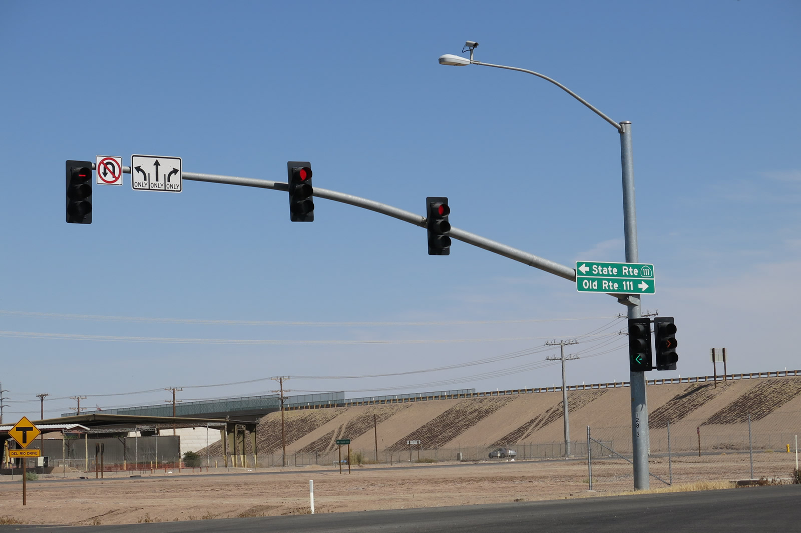
| Business Loop I-10 & California 78 west |
|
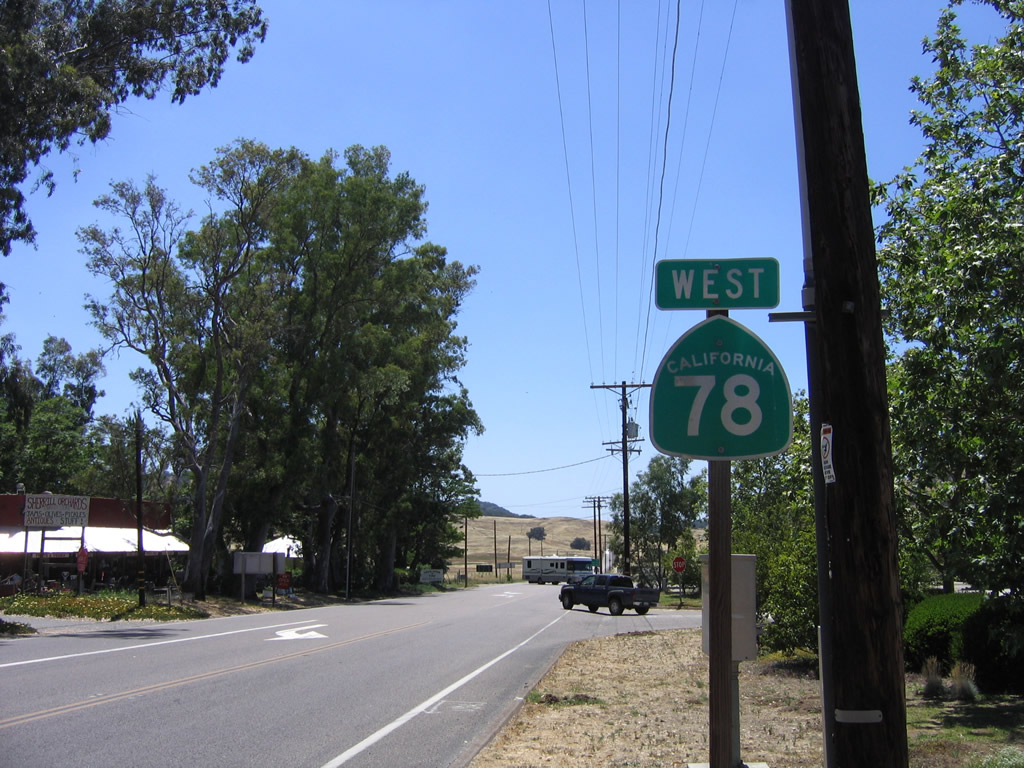
Business Loop I-10 west as it approaches its western terminus with Interstate 10 in Blythe. At this interchange, Business Loop I-10 will transition directly onto California 78 west by traveling south on Neighbors Boulevard from Hobson Way. The first westbound California 78 shield is posted along westbound Business Loop I-10 just prior to the interchange with Interstate 10 in western Blythe. Photo taken 03/14/09. |
|
|
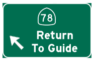
An end Business Loop I-10 shield assembly is posted in Blythe as it approaches Interstate 10 and California 78. From this point, traffic along westbound Business Loop I-10 is defaulted onto westbound California 78 unless it takes Interstate 10 east or westbound from this interchange. An end shield is posted for the west end of this business route. Photos taken 03/14/09. |
| California 78 west |
|
|
|
|
|
| This series of pictures shows the Algodones (Imperial) Sand Dunes (also called the "Sand Hills") through which California 78 passes near Glamis. These dunes extend south into Mexico, and Interstate 8 passes through them as well. These dunes are popular with drivers of off-ramp vehicles, and parts of the dunes are open to this sort of recreation. Photos taken 11/10/00. |
| California 78 west & 111 north |
|
The Brawley Bypass leads California 78 west and California 111 north along an expressway alignment that initially opened in June 2011 and completed all the way to California 86 northwest of Brawley on October 30, 2012. The bypass is designated as the Victor V. Veysey Expressway. Photo taken 04/20/13. |
|
|
|
|
|
| This series of pictures follows the section of the Brawley Bypass that is cosigned as California 78 west and California 111 (Victor V. Veysey Expressway) north. The four-lane, concrete expressway opened between California 78 east and California 111 north in June 2011, and the remaining stretch west to California 86 opened in October 2012. The highway is designed for a 65-mile-per-hour speed limit. Access is allowed at an at-grade intersection with Best Road, a folded diamond interchange with California 111 north and Old Highway 111 (Imperial County S-31) south, and at-grade intersections with Hovley Road / Western Avenue and Brandt Road. Access is not provided at Slider Road (Brawley Beef Way Avenue) and Kalin Road. Photos taken 04/20/13. |
|
|
|
|
|
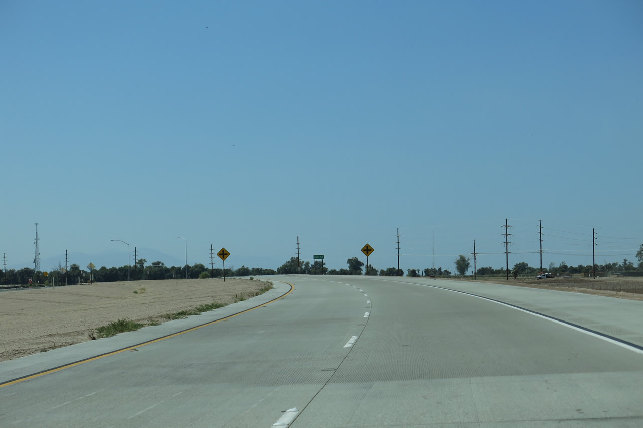
| California 78 and California 111 (Victor V. Veysey Expressway) curve northwest and then west. After the Best Road intersection, the expressway gains elevation for three grade separations: Slider Road (Brawley Beef Way Avenue), the Union Pacific Railroad, and Old Highway 111 (Imperial County S-31). The routes divide at the California 111 north and Old Highway 111 south interchange. This interchange is not numbered officially, but it would be somewhere around Exit 133 using the mileage of California 78 (originating in Oceanside) as listed in the Caltrans District XI Bridge Log. Photos taken 04/20/13. |
|
Reaching what would be Exit 133, California 78 west and California 111 north split. California 111 exits here, turning north on its two-lane alignment toward Calipatria and the eastern shore of the Salton Sea en route to Coachella and Indio. However, through traffic to Coachella and Indio are encouraged to use the all-four-lane-expressway combination of California 78 west and California 86 north for a faster trip to those cities as well as I-10. The Victor V. Veysey Expressway continues ahead as solely California 78. Photo taken 04/20/13. |
|
Old Highway 111 heads south as Imperial County S-31 from the freeway off-ramp into Brawley. Photo taken 04/20/13. |
| California 78 west |
|
After the two routes divide and back on the mainline, California 78 proceeds west on an elevated segment that passes over Old Highway 111. Note the bridge identification sign, which describes this undercrossing as R-78/R-111 Separation. The remainder of the Brawley Bypass (from here west to California 86) opened to traffic on October 30, 2012. Photo taken 04/20/13. |
|
Immediately thereafter, westbound California 78 uses the Douglas B. Dunaway Memorial Bridge to cross the New River. This river, which travels from Mexicali north through the irrigated fields of the Imperial Valley, empties into the Salton Sea north of here. A combination of urban and agricultural runoff has made this river flow perenially in the arid desert, and the river contains pollutants as a result. Photo taken 04/20/13. |
|
Westbound California 78 returns to grade and proceeds toward its next intersection, this time with Hovley Road. Photo taken 04/20/13. |
|
Hovley Road travels south into Brawley, becoming Western Avenue. Photo taken 04/20/13. |
|
A mirage beckons in the distance as westbound California 78 (Victor V. Veysey Expressway) approaches Brandt Road. Photo taken 04/20/13. |
|
California 78 (Brawley Bypass) proceeds west toward its final junction, with California 86. Photo taken 04/20/13. |
|
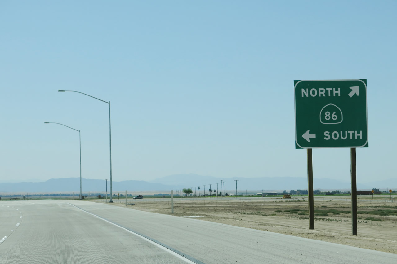
The end of the Brawley Bypass as of April 2013 is the at-grade intersection between California 78 and California 86. A high-speed ramp links California 78 west with California 86 north; California 78 will join California 86 for about 23 miles. A traffic signal allows for a connection from California 78 west to California 86 south. At this intersection, California 78 will also join the Historic U.S. 99 corridor. Photo taken 04/20/13. |
|
Westbound California 78 passes over Kalin Road on this bridge; there is no direct access between the expressway and Kalin Road. Photo taken 04/20/13. |
|
The Victor V. Veysey Expressway ends in one-half mile, at the junction with California 86. Photo taken 04/20/13. |
|
Westbound California 78 meets California 86. The first right turn connects to a ramp connecting to California 78 west and California 86 north to Westmorland. Stay in the left lanes to connect to California 86 south. Eventually, this termination point will connect to the as-yet unconstructed Westmorland Bypass. Photo taken 04/20/13. |
|
Through traffic on westbound California 78 should depart at this exit ramp; unfortunately, there were no signs in April 2013 that stated clearly that California 78 west merges onto California 86 north. Photo taken 04/20/13. |
|
A single lane transitions California 78 west to California 86 north. Photo taken 04/20/13. |
|
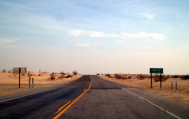
After splitting from California 86, westbound California 78 crosses the San Diego-Imperial County Line and proceeds toward Anza-Borrego Desert State Park and the unincorporated desert community of Borrego Springs. Not much development exists along this stretch of California 78. Photo taken 12/15/02. |
|
Skipping ahead to the vicinity of Borrego Springs, we find a "snow chains ahead" sign that is posted prior to the first San Diego County S-2 intersection. This sign was posted sideways. Note the use of button copy; this sign was placed in 1964. Photo taken 04/19/08. |
|
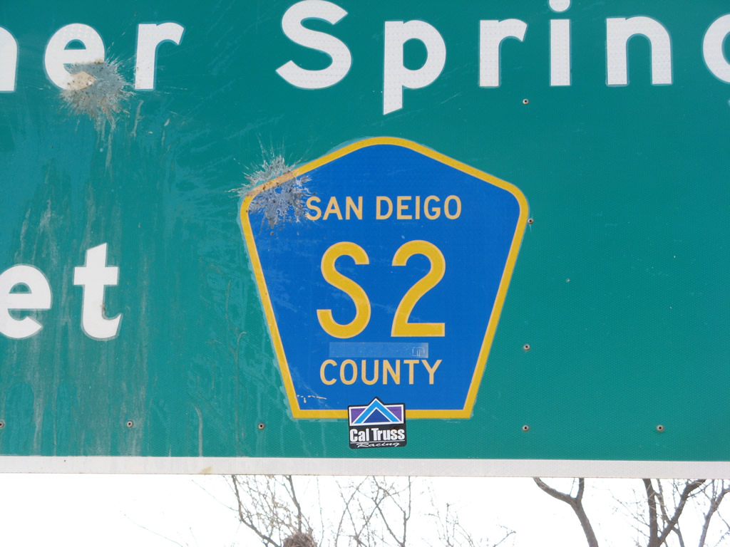
Passing through the badlands, westbound California 78 approaches San Diego County S-2 north to Warner Springs and Hemet via California 79. Continue west on California 78 to Julian at the top of Banner Grade. Photo taken 04/19/08. |
|
San Diego is misspelled within the CR S-2 pentagon shield. Photo taken 04/19/08. |
|
A second San Diego County S-2 trailblazer is posted after the mileage sign; the intersection is located just ahead. Briefly, California 78 west and County Route S-2 south will merge together. Photo taken 04/19/08. |
|
Westbound California 78 merges briefly with San Diego County S-2, then splits with the county route. Turn south to follow County Route S-2 southeast to Ocotillo and Interstate 8. Photo taken 05/04/02. |
| California 78 west & 79 north |
|
|
Westbound California 78 and northbound California 79 enter the historic district of Julian, an unincorporated community of San Diego County, via Main Street. Home to 1,502 people as of the 2010 Census, Julian has its roots in mining starting with a discovery of gold in 1869. Over time, the community has evolved to a mountain resort offering an alternative to the big-city bustle found closer to the coast. Due to its historical mining past, Julian is an official California Historical Landmark. Photos taken 04/19/08. |
|
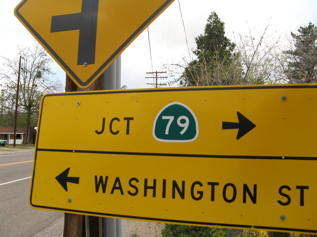
Westbound California 78 and northbound California 79 prepare to turn at a four-way stop from Main Street onto Washington Street in downtown Julian. Photo taken 04/19/08. |
|
A mileage sign prior to the Washington Street intersection provides the distance to Santa Ysabel (seven miles), Ramona (22 miles), and Oceanside (60 miles). Distance to Escondido, Vista, and San Marcos is not provided on this sign. Photo taken 04/19/08. |
|
A second set of California 78 west and California 79 north shields are posted at the Main-Washington intersection in downtown Julian. Photo taken 04/19/08. |
|
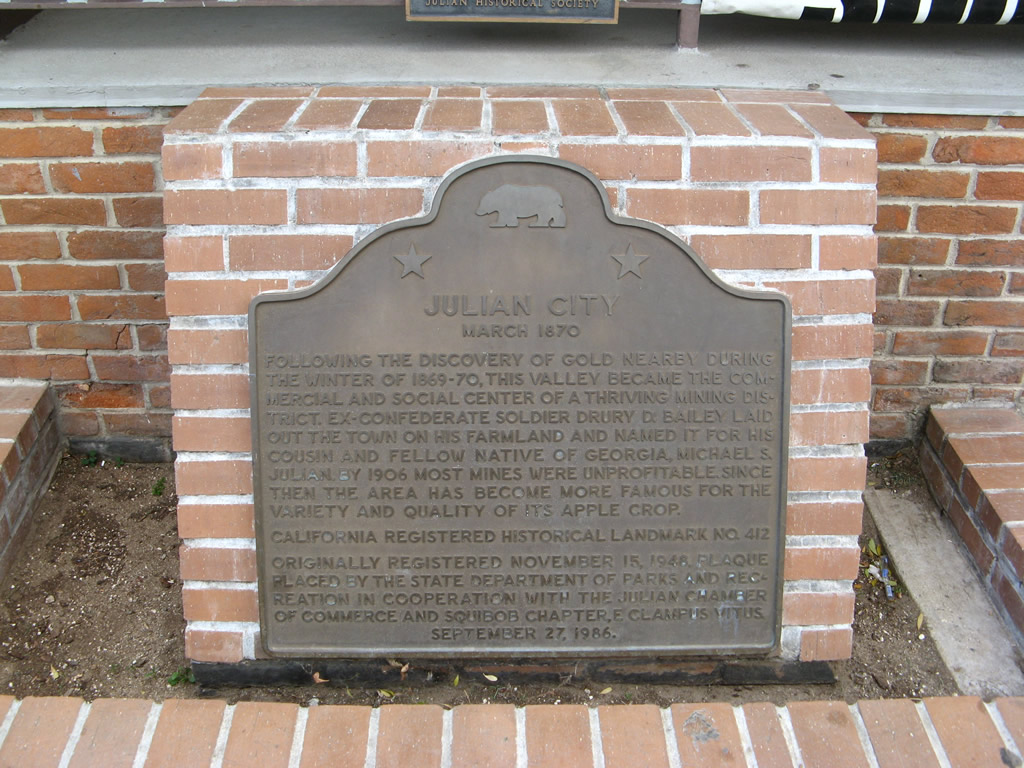
In front of the Julian town hall is this historic plaque that provides a brief history of the former mining town. Photo taken 04/19/08. |
|
Several restaurants and shops line California 78 and California 79 in the small unincorporated community of Wyonola, which is located just west of Julian. Photo taken 11/11/10. |
|
California 78 west and California 79 south lose elevation as they approach Santa Ysabel. Photo taken 04/19/08. |
|
|
Westbound California 78 and southbound California 79 prepare to split in the unincorporated community of Santa Ysabel. Turn right to follow California 79 north to Warner Springs and Temecula; continue straight ahead to follow California 78 west to Ramona, Escondido, and Oceanside. Note the use of a green California 79 shield on a yellow blade sign. Photos taken 04/19/08. |
| California 78 west |
|
This California 78 west reassurance shield is posted along westbound after the California 79 north intersection in Santa Ysabel. Photo taken 06/16/06. |
|
Westbound California 78 meets Vista Village Drive in Vista. Photo taken 06/30/01. |
|
This California 78 west reassurance shield is posted prior to Exit 4B, Emerald Drive. Photo taken 06/30/01. |
|
Westbound California 78 (Ronald Packard Freeway) reaches Exit 4B, Emerald Drive. Photo taken 06/30/01. |
|
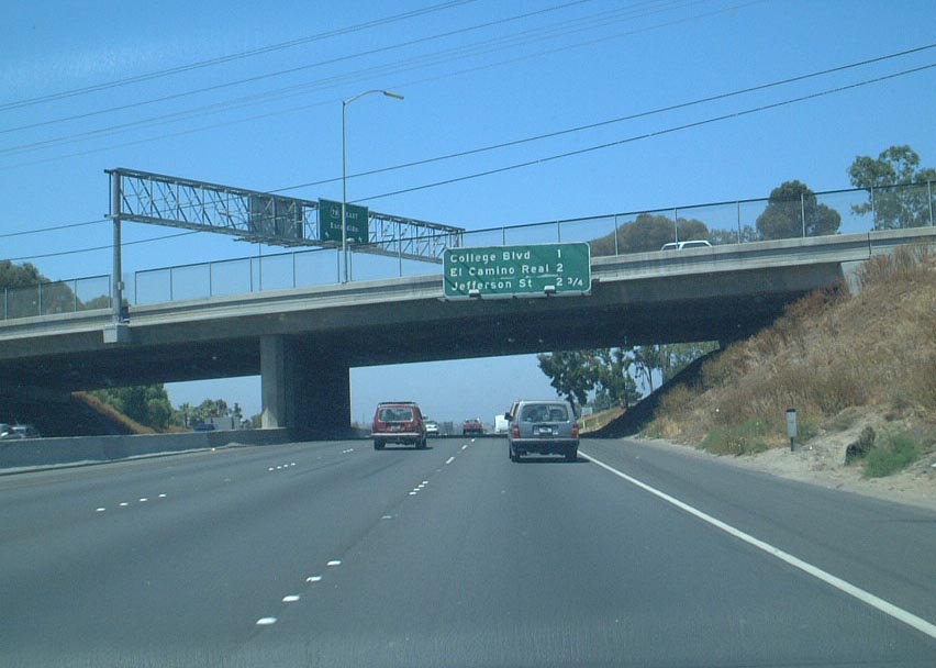
The next exit along California 78 west is Exit 3, College Boulevard, one mile. The next exits are for El Camino Real (San Diego County S-11) and Jefferson Street. Photo taken 06/30/01. |
|
The next exit along California 78 (Packard Freeway) west is Exit 3, College Boulevard (one-half mile). Photo taken 06/30/01. |
|
Westbound California 78 reaches Exit 3, College Boulevard. This road leads north through the eastern portion of Oceanside to connect with California 76. Photo taken 06/30/01. |
|
The next exit along California 78 west is Exit 2, San Diego County S-11 (El Camino Real) (one mile). Photo taken 06/30/01. |
|
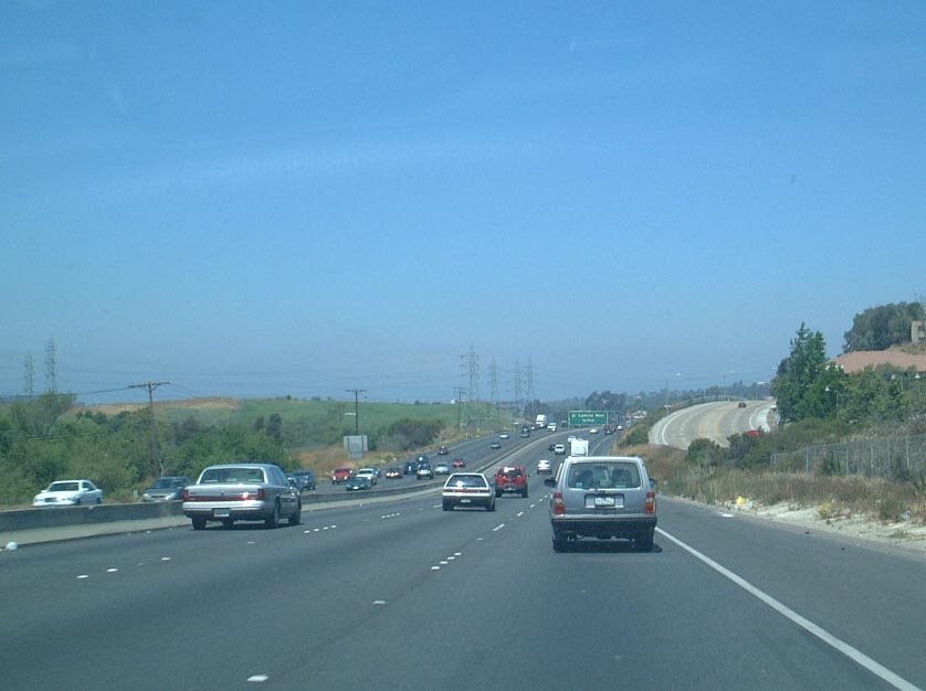
Westbound California 78 approaching Exit 2, San Diego County S-11, El Camino Real. The power lines in the distance are the main transmission lines from Orange County, and they connect to the San Onofre nuclear power plant near San Clemente. From here, the power lines connect to the Carlsbad Encina natural gas electricity generation plant, and then split into a variety of transmission lines that serve various locales in San Diego County. The only other transmission line to enter San Diego County roughly parallels Interstate 8 from the Imperial Valley. Photo taken 06/30/01. |
|
Westbound California 78 approaching Exit 2, San Diego County S-11, El Camino Real, one-half mile. Photo taken 06/30/01. |
|
Now at the top of the El Camino Real off-ramp, a San Diego County S-11 trailblazer sign is posted prior to the traffic signal. Unfortunately, San Diego County S-11 is poorly shielded for much of its length through Carlsbad. Photo taken 06/30/01. |
|
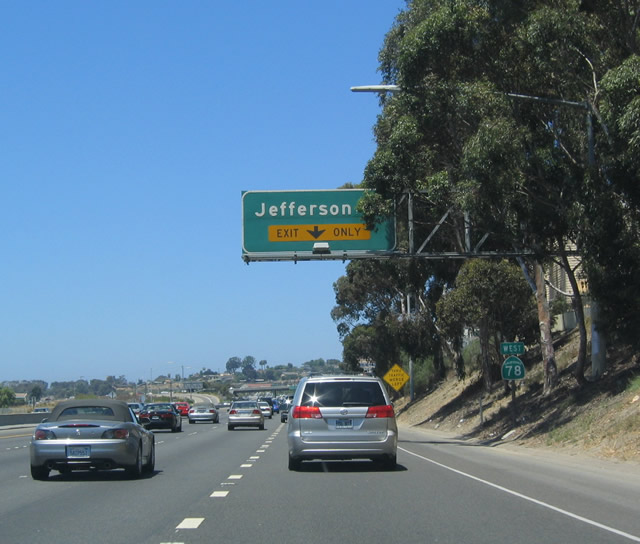
After the El Camino Real interchange, the next exit is Exit 1C, Jefferson Street. Photo taken 07/17/04. |
|
Westbound California 78 (Packard Freeway) reaches Exit 1C, Jefferson Street. Photo taken 07/17/04. |
|
The final two exits along westbound California 78 are Exits 1B-A, Interstate 5 north to Orange County/Los Angeles and south to San Diego. Photo taken 07/17/04. |
|
Westbound California 78 approaches Exit 1B, Interstate 5 north to Los Angeles. The right lane is exit-only. Photo taken 07/17/04. |
|
This interchange marks the western terminus of California 78. Use the left two lanes for Exit 1A, south Interstate 5; the middle lane connects to Vista Way and downtown Oceanside; and the right lane is Exit 1B for north Interstate 5. Photo taken 07/17/04. |
|
California 78 approaches the western end of its freeway as it reaches Interstate 5 in Oceanside. Photo taken 07/17/04. |
|
Westbound California 78 reaches Exit 1A, southbound Interstate 5 in Oceanside. Photo taken 07/17/04. |
Page Updated May 28, 2013.