

California 89 South - Emerald Bay to South Lake Tahoe
| California 89 south | |
|---|---|
 |
Following Emerald Bay Road, southbound California 89 reaches the entrance to Vikingsholm, which is part of Emerald Bay State Park. This scenic state park, located at the southwest corner of Lake Tahoe, offers a variety of activities including tours of Vikingsholm on the shore of Emerald Bay, hiking trails around the historic estate and bay, and views of Eagle Falls with access to nearby forest service trails. Photo taken 07/21/09. |
 |
This view looks northwest at the mountains above the north shore of Emerald Bay as seen from the Vikingsholm parking lot. The next several pictures look south and east from the parking lot toward the bay and surrounding mountains. Photo taken 07/21/09. |
 |
A massive landslide destroyed a section of California 89 on the southwest side of Emerald Bay; the road has been repaired, but the factors that led to the landslide could be triggered again in the future under the right conditions. Photo taken 07/21/09. |
 |
This view looks west from the Vikingsholm parking lot toward the Desolation Wilderness in Tahoe National Forest. Photo taken 07/21/09. |
 |
A portion of lower Eagle Falls can be seen from the Vikingsholm parking lot. Photo taken 07/21/09. |
 |
The Vikingsholm parking lot offers terrific views of Emerald Bay and the scars left by the aforementioned landslide. Photo taken 07/08/07. |
 |
This postmile marker is located prior to the Eagle Creek bridge near the Eagle Falls trailhead parking. Photo taken 07/08/07. |
 |
Shortly thereafter, southbound California 89 crosses Eagle Creek and proceeds generally east toward Inspiration Point and Eagle Point. Photo taken 07/08/07. |
 |
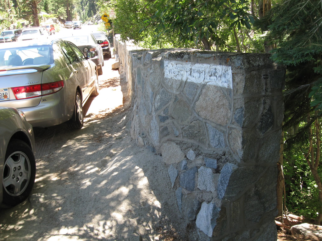
Southbound California 89 (Emerald Bay Road) passes through the slide area between the Eagle Falls trailhead and Inspiration Point vista area. Photo taken 07/08/07. |
 |
This view looks east from California 89 (Emerald Bay Road) toward Emerald Bay and Lake Tahoe. Photo taken 07/08/07. |
 |
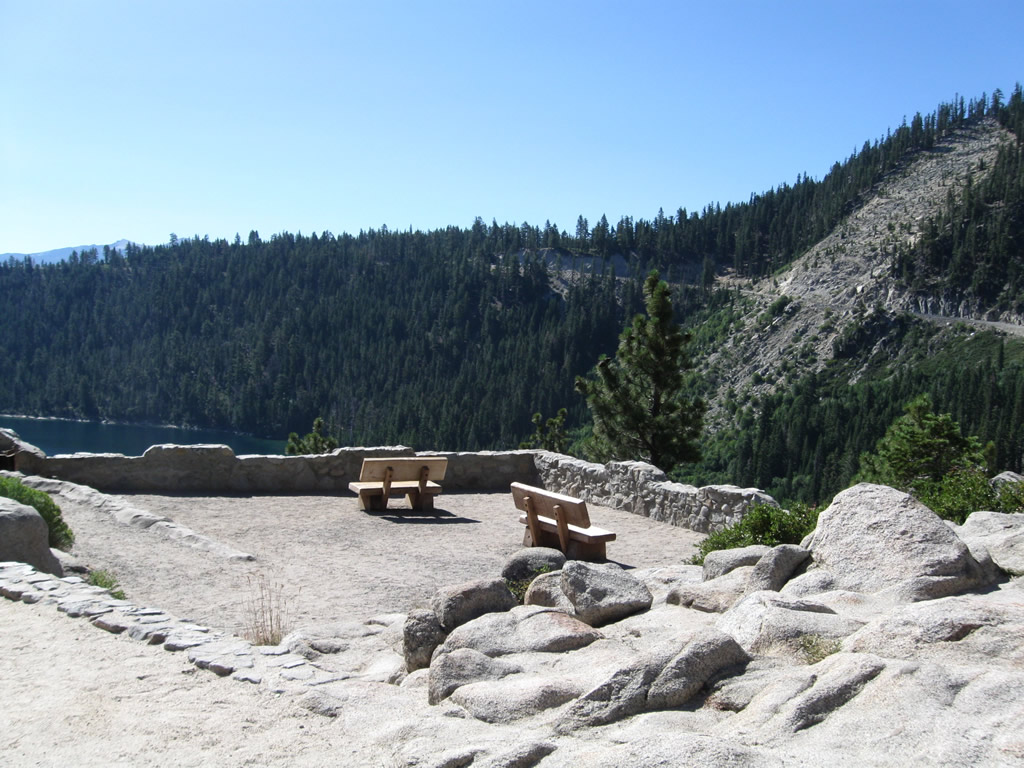
Southbound California 89 (Emerald Bay Road) approaches the Inspiration Point vista area, which looks down on Emerald Bay and Fanette Island. Photo taken 07/21/09. |
 |
From here, California 89 begins a long and winding descent from this vista point down to Taylor Creek and Fallen Leaf Lake. Photo taken 07/08/07. |
 |
Now in Camp Richardson, southbound California 89 meets the driveway for Camp Richardson, which includes a full service marina, restaurant/bar, camping, and lodging. Photo taken 07/20/09. |
 |
Southbound California 89 approaches the turnoff to Pope Beach. Photo taken 07/20/09. |
 |
A Route 89 post mile paddle marker is posted after the Pope Beach turnoff. Photo taken 07/20/09. |
 |
California 89 is known as Emerald Bay Road into South Lake Tahoe. Photo taken 07/20/09. |
 |
California 89 widens into four lanes as it approaches the city limits of South Lake Tahoe. Photo taken 07/20/09. |
 |
California 89 enters the city of South Lake Tahoe. Sitting at an elevation of 6,260 feet at the south shore of Lake Tahoe, the city of South Lake Tahoe was incorporated on November 30, 1965. The population of the city was 23,609 as of the 2000 Census. Rapid growth and redevelopment have fueled massive changes to South Lake Tahoe through the years. With new hotels and resorts recently built and constructed near the Nevada casinos, downtown South Lake Tahoe has become quite cosmopolitan. The city plans more changes in the future, with a large convention center and realignment of U.S. 50 out of downtown (near Stateline, Nevada) in the coming years. Photo taken 07/20/09. |
 |
 |
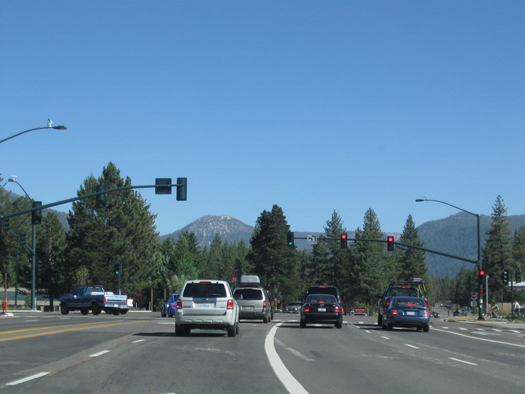
California 89 approaches U.S. 50 in South Lake Tahoe. This intersection is locally known as the "Y," and its shopping center contains a grocery store used by locals as well as vacationers staying in the various resorts, camps, and cabins at the southeast corner of Lake Tahoe. In addition, this intersection carries the main U.S. 50 traffic from the Central Valley and Bay Area into the Lake Tahoe vicinity. Traffic at this intersection can get a bit tedious at times, especially during the busy summer weekends. Photos taken 07/20/09 and by Jeff Royston (01/00). |
 |
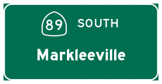
The left two lanes turn onto U.S. 50 (Lake Tahoe Boulevard) east toward downtown South Lake Tahoe and Stateline, Nevada. Continue straight ahead to follow California 89 south and U.S. 50 west to Markleeville, Jackson/Stockton (via California 88), and Sacramento. Photo taken 07/20/09. |

Page Updated October 12, 2009.
|
About Contact Glossary |
In The News Testimonials Interstate Guide |
Social Media:
 |
|
© 2000-23 AARoads.com | All Rights Reserved | Privacy Policy / Terms of Use
|
||