

California 99 South - Butte County
| California 99 south | |
|---|---|
 |
Southbound California 99 meets the turnoff to California 99 Business (Esplanade) south, which is the old alignment of U.S. 99E until the current freeway bypass became the preferred through route. This is the penultimate at-grade intersection along California 99 before entering the city of Chico (a signalized intersection with Garner Lane is about a mile or so south of here). Photo taken 05/24/08. |
 |
Now in the city of Chico on the California 99 freeway bypass, the next exit along California 99 south is Exit 386, East First Avenue (one mile). Photo taken 01/20/03. |
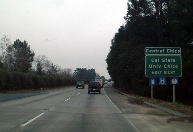 |
East First Avenue is the most direct route from the freeway into downtown, as evidenced by this sign. Taking East First Avenue west to Warner Street south will lead to the California State University at Chico. First Avenue also intersects with California 99 Business (The Esplanade) north of downtown Chico. Photo taken 01/20/03. |
 |
Southbound California 99 meets Exit 386, East First Avenue. Photo taken 01/20/03. |
 |
The next exit along California 99 south is Exit 385, California 32, three-quarters of a mile. Photo taken 01/20/03. |
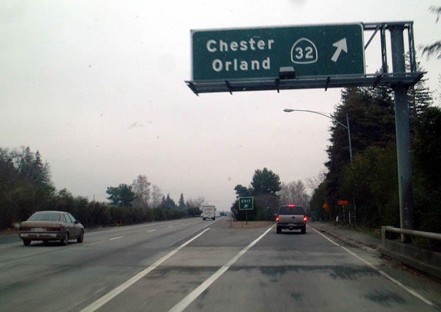 |
Southbound California 99 meets Exit 385, California 32 in Chico. California 32 leads northeast toward Lassen National Volcanic Park and Lake Almanor. Westbound California 32 leads into downtown Chico, then connects to Interstate 5 at Orland. Photo taken 01/20/03. |
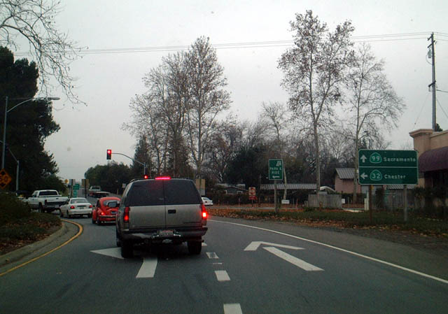 |
View of the off-ramp from southbound California 99 onto Exit 385, California 32 in Chico. This interchange is basically a traffic circle with a freeway going through the middle. It is possible to drive in a circle infinite times through this interchange. Photo taken 01/20/03. |
 |
After a brief gap in coverage (Exit 384, 20th Street; Exit 383, Skyway Road east to Paradise; and at-grade intersections with Southgate Avenue, Estates Drive, and Neal Road) southbound California 99 approaches Exit 376, Durham-Dayton Highway west and Durham-Pentz Road east (next right). Photo taken by Dominic Ielati (01/03/09). |
 |
Southbound California 99 meets Exit 376, Durham-Dayton Highway west to Durham and Durham-Pentz Road east to Butte College and Pentz. Photo taken by Dominic Ielati (01/03/09). |
 |
A California 99 south reassurance shield is posted after the on-ramp from Durham-Dayton Highway. Photo taken by Dominic Ielati (01/03/09). |
 |
The next exit along California 99 south is Exit 375, California 149 south to California 70 to Quincy and Oroville. Stay left for California 149 south or right for the continuation of California 99 south to Yuba City. Note that California 99 more or less exits from itself at this major interchange. Photo taken by Dominic Ielati (01/03/09). |
 |
California 149 is a five-mile long connecting route that primarily serves to link Chico and Oroville via a high-speed, four-lane expressway. South of Oroville, California 70 reverts to a two-lane highway, as does California 99 from here south to Biggs, Gridley, and Live Oak. Eventual plans call for California 70 to become the four-lane route and preferred route over California 99 between Oroville and Marysville-Yuba City. Photo taken by Dominic Ielati (01/03/09). |
 |
Southbound California 99 meets Exit 375, California 149 south to California 70 to Quincy and Oroville. Photo taken by Dominic Ielati (01/03/09). |
 |
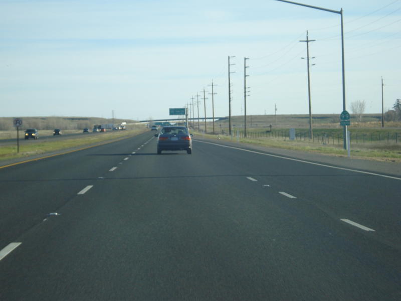
Leaving the California 149 interchange, a California 99 south reassurance shield is posted after the ramp from California 149 north to California 99 south merges onto the highway. The freeway will end, and California 99 will revert to a two-lane alignment. Photo taken 05/24/08. |
 |
 |
The freeway alignment for California 99 ends after the California 149 interchange, and the right lane also ends. California 99 will continue from here south as a two-lane, busy state route. Photos taken 05/24/08. |

Page Updated January 9, 2012.
|
About Contact Glossary |
In The News Testimonials Interstate Guide |
Social Media:
 |
|
© 2000-23 AARoads.com | All Rights Reserved | Privacy Policy / Terms of Use
|
||