| California 125 north |
|
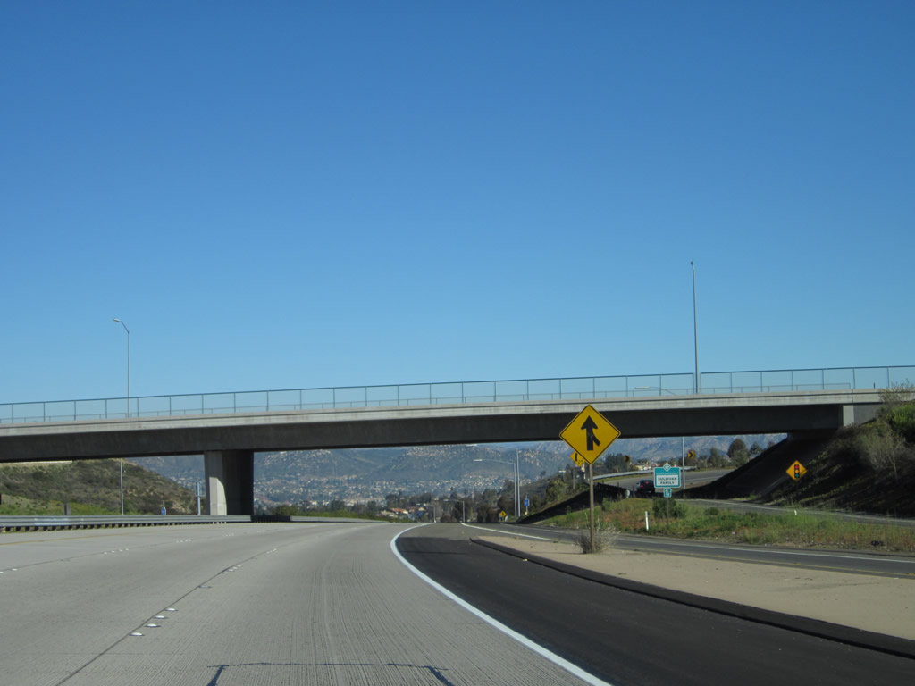
Upon crossing under the last California 94 overpass, northbound California 125 enters the city of La Mesa. Founded in 1869 and incorporated in 1912, La Mesa (Spanish for "The Table" due to its position on Grossmont Summit and is known as the "Jewel of the Hills") is a suburb of San Diego and sits at an elevation of 540 feet. Home to 54,749 people as of the 2000 Census, La Mesa (like El Cajon) has been seeing population growth as the region expands; however, La Mesa is landlocked and does not have as many developable acres as its neighbors to the north and east. Photo taken 12/02/07. |
|
|
This mileage sign provides the distance to the next four exits along California 125 north: Exit 17A, Lemon Avenue; Exit 17B, Grossmont Boulevard; and Exits 18A-B, Interstate 8 east to El Cajon and west to San Diego. Photos taken 12/02/07 and 07/14/02. |
|
Prior to the Lemon Avenue off-ramp (Exit 17A), this sign (posted on the Mariposa Street overpass) provides the distance to Exit 18A, Interstate 8 (one mile). This overpass would have to be widened or removed in order to accommodate anticipated expansion of this portion of California 125 to eight lanes plus two high occupancy vehicle lanes. Photo taken 03/06/02. |
|
Northbound California 125 reaches Exit 17A, Lemon Avenue. The next exit along northbound is Exit 17B, Grossmont Boulevard. Photo taken 12/02/07. |
|
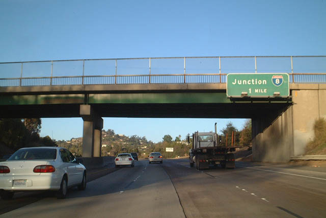
This mileage sign provides the distance to the next three exits along California 125 north: Exit 17B, Grossmont Boulevard; Exit 18A, Interstate 8 east to El Cajon and El Centro; and Exit 18B, Interstate 8 west to San Diego. Use Exit 17B to Grossmont Summit, which is a community of the city of La Mesa. The summit is known as a shopping destination and includes Grossmont Center, a large regional shopping center in the northwestern quadrant of the Interstate 8/California 125 interchange. Photo taken 12/02/07. |
|
Northbound California 125 reaches Exit 17B, Grossmont Boulevard. This overhead sign also provides the lane allocation for Exits 18A-B, Interstate 8. There is a three-lane exit from northbound onto eastbound Interstate 8, primarily to accommodate traffic using eastbound California 94 to northbound California 125 to eastbound Interstate 8. Photo taken 03/30/07. |
|
Immediately thereafter, California 125 north splits with Exit 18A, Interstate 8 (Kumeyaay Highway) east to El Cajon and El Centro. The right three lanes connect to Interstate 8 east, and the left two lanes continue north on California 125 to Interstate 8 west. Photo taken 03/30/07. |
|
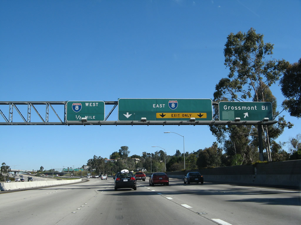
Northbound California 125 next reaches Exit 18B, Interstate 8 (Kumeyaay Highway) west to San Diego. The next exit along northbound is Exit 19, Amaya Drive to Fletcher Parkway (one-half mile). The pull-through sign used to have a "left lane ends" sign until the southbound bridge over Fletcher Parkway opened in 2001. Once that span opened, the capacity of California 125 doubled between Interstate 8 and Amaya Drive. Photo taken 03/30/07. |
|
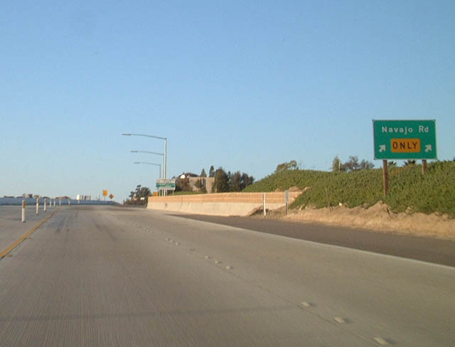
Now departing the Intestate 8 interchange, this mileage sign provides the distance to the next three exits along northbound California 125: Exit 19, Amaya Drive to Fletcher Parkway; Exit 20, Navajo Road; and Exit 21, Grossmont College Drive. Cowles Mountain, which is the highest point in the city of San Diego, can be seen to the northwest of the freeway. Photo taken 03/30/07. |
|
|
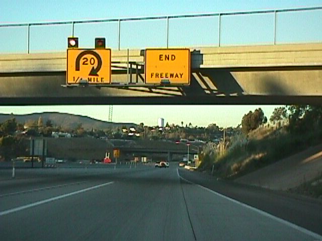
The right two lanes of California 125 north connect to Exit 19, Amaya Drive to Fletcher Parkway. The left three lanes will continue north on California 125. The 1999 photo shows the temporary "End Freeway" signage that was in place prior to the 2003 opening of the segment between Fletcher Parkway and Navajo Road. Photo taken 03/30/07 and 06/06/99. |
|
California 125 passes over Fletcher Parkway on a pair of five-lane bridges between Interstate 8 and Amaya Drive. The northbound bridge is known as the Benjamin E. Polak Memorial Bridge, built in 1991. Photo taken 12/02/07. |
|
Northbound California 125 reaches Exit 19, Amaya Drive to Fletcher Parkway. At this point, the northbound side narrows to three through lanes. Photo taken 12/28/11. |
|
The next three exits along California 125 north are Exit 20A, Navajo Road; Exit 20B, Grossmont College Drive; and Exit 22, California 52 (Soledad Freeway) west to La Jolla. Photo taken 03/30/07. |
|
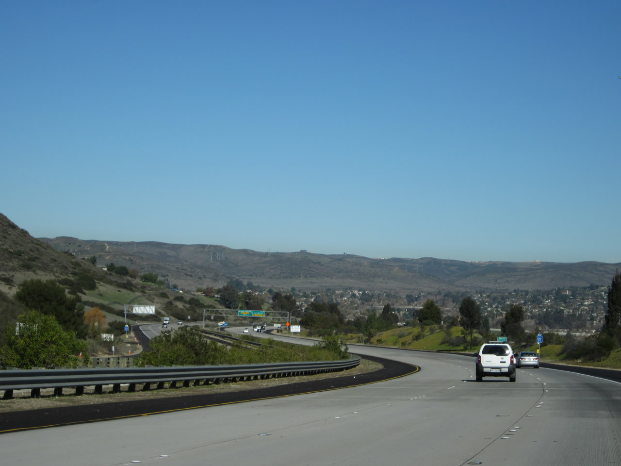
California 125 climbs through Fletcher Hills. Leaving La Mesa, the freeway now enters the city of El Cajon. Another bustling and booming suburb of San Diego County, El Cajon is home to 94,869 people as of the 2000 Census and consists of 14.6 square miles at an elevation of 435 feet. The city of San Diego lies just west of the freeway alignment, as the properties just east of East Lake Drive is on the approximate boundary between the community of San Carlos in the city of San Diego on the west and the city of El Cajon on the east. The next interchange (Navajo Road) serves both cities. Follow Navajo Road west through San Carlos to the Cowles Mountain unit of Mission Trails Regional Park and Del Cerro. To the east, Navajo Road travels into the Fletcher Hills community of El Cajon. Photo taken 03/30/07. |
|
|
This view shows California 125 traveling uphill between Exits 19 and 20A. The 1999 picture shows the freeway, then under construction, as seen from near the current Dallas Street underpass looking north toward Navajo Road in the Fletcher Hills area. Photos taken 12/28/11 and 06/06/99. |
|
|
Northbound California 125 reaches Exit 20A, Navajo Road. The next exit along northbound is Exit 21, Grossmont College Drive. The 2002 photo shows the barricades in place when the freeway was still incomplete between Navajo Road and Grossmont Center Drive. Photos taken 03/30/07 and 03/06/02. |
|
|
This roadside guide sign for Exit 20A was briefly posted on the off-ramp from California 125 north to Navajo Road (until 2003). Photos taken 07/14/02 and 03/06/02. |
|
|
Prior to the completion of California 125 through Fletcher Hills, these two photos show the future location of the California 125 interchange with Navajo Road. At that time, grading for the southern freeway approach and ramps was nearing completion, but more work was needed at the northern end of the same interchange. Photos taken 06/06/99. |
|
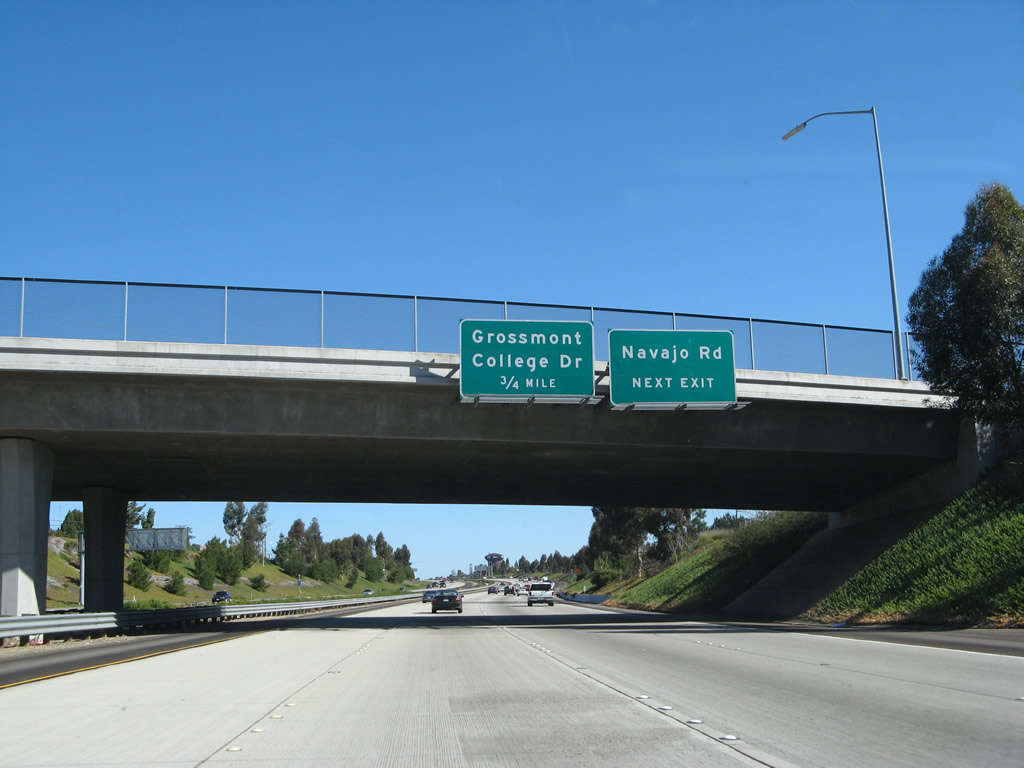
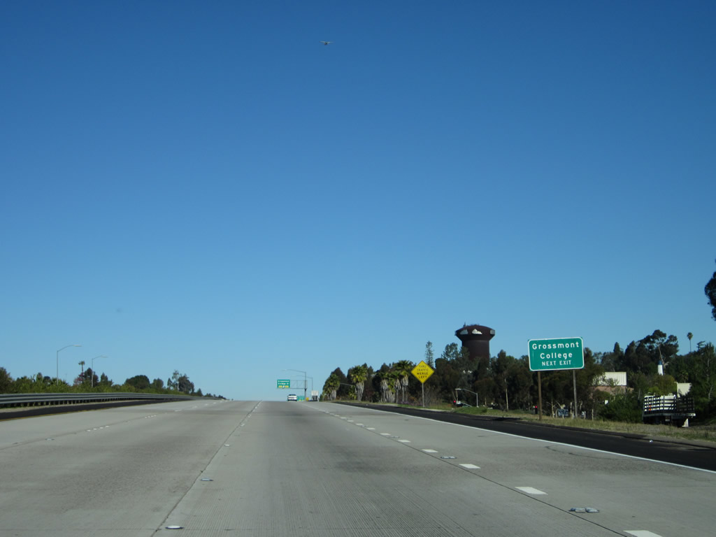
The next exit along California 125 north is Exit 20B, Grossmont College Drive. Photo taken 12/02/07. |
|
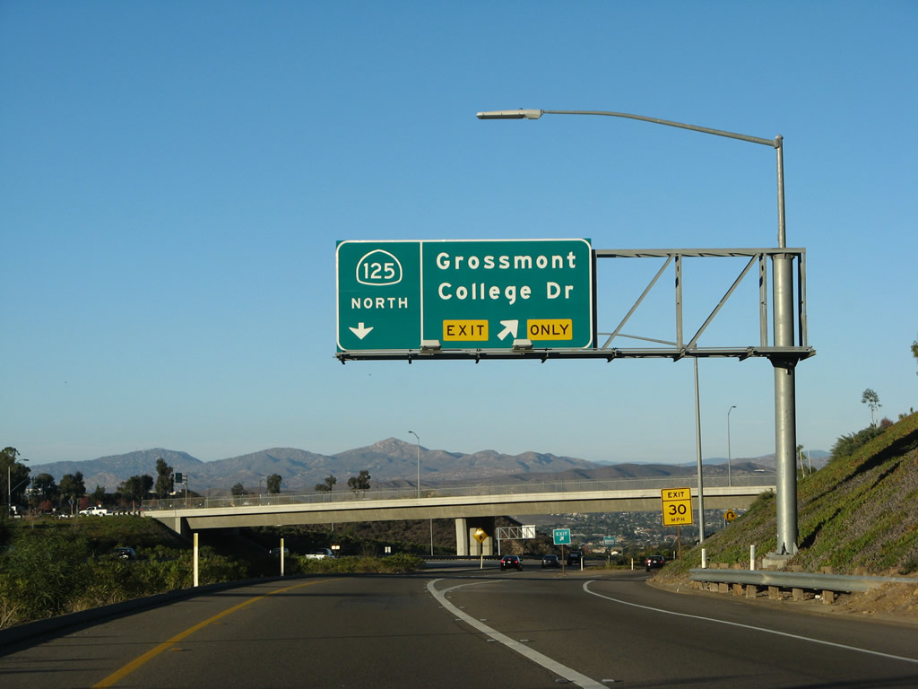
Northbound California 125 reaches Exit 20B, Grossmont College Drive. A collector distributor lane departs the freeway to serve Exit 21. Photo taken 12/02/07. |
|
Looking to the past, this view shows Temporary California 125 (Fanita Drive) north prior to the Grossmont College Drive traffic signal. The California 125 segment between Navajo Road and Grossmont College Drive was opened to traffic in December 2002. Photo taken 03/06/02. |
|
|
Now on the collector distributor lanes for the Grossmont College Drive exit, a new lane merges onto the northbound freeway from Navajo Road. Through traffic to California 125 north should merge left; departing traffic for Grossmont College Drive should exit right. To Fanita Drive, use Exit 20B. Photos taken 03/30/07 and 12/02/07. |
|
This mileage sign provides the distance to Exit 22, California 52 (Soledad Freeway) west and Exit 23, Mission Gorge Road to Santee. Photo taken 03/30/07. |
|
|
Back on the collector distributor lanes, the right lane departs for Exit 20B, Grossmont College Drive. The left lane will reconnect to California 125 north. Photos taken 12/28/11 and 12/02/07. |
|
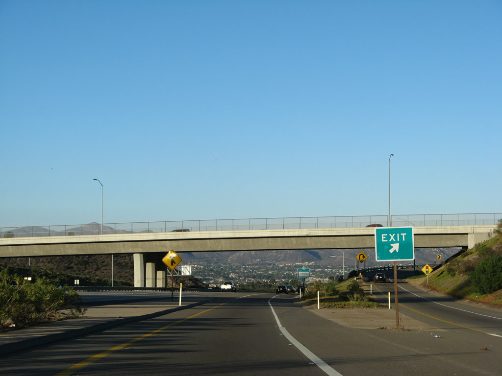
The ramp from the collector distributor lane to Grossmont College Drive is a loop ramp. In the distance, California 125 descends toward the San Diego River valley and the city of Santee. Photo taken 12/02/07. |
|
The collector distributor lane merges back onto the main lanes of California 125 north. Photo taken 12/28/11. |
|
A California 125 north reassurance shield is posted after the collector distributor lane rejoins the mainline. Photo taken 12/02/07. |
|
|
The next exit along northbound California 125 is Exit 22, California 52 (one mile). This sign was placed after the Grossmont College Drive interchange was opened to traffic in mid-December 2002. The California 125 north shield and one-mile advance sign for Exit 22 are placed next to each other. Photos taken 12/28/11 and 12/02/07. |
|
California 125 descends from Grossmont Summit and El Cajon into the Mission Gorge area/San Diego River area of western Santee. Photo taken 12/28/11. |
|
|
Leaving El Cajon, northbound California 125 finally enters the city of Santee. Incorporated on December 1, 1980, Santee consists of 16.56 square miles, sits at an elevation of 350 feet, and had a population of 52,975 as of the 2000 Census. Continuing construction of new homes has brought rapid growth to this city, which lies northeast of the city of San Diego. A portion of Mission Trails Regional Park lies within the city limits of Santee, while the majority of the park is within the city of San Diego. Increased residential traffic has impacted California 125. High occupancy vehicle (carpool) lanes are slated for construction along both directions of California 125 between Interstate 8 and California 52 by 2011; the project would be funded by TransNet II. Photos taken 12/28/11 and 03/31/07. |
|
|
Continuing to descend toward the San Diego River, norhbound California 125 approaches its final two exits: Exit 22, California 52 west to La Jolla and Exit 23, Mission Gorge Road. In the 2007 picture, notice room was provided on the sign for the future connection to the eventual California 52 east extension to California 67. However, when that link was opened to traffic, a brand new sign was in place by 2011. Prior to the completion of the Grossmont College Drive interchange south of here, there was a brief time where northbound California 125 had this isolated freeway segment between Grossmont College Drive and California 52 between 1998 and 2002 (until the connecting segments to the south fully opened by early 2003). Photos taken 12/28/11 and 03/31/07. |
|
|
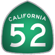
Northbound California 125 meets Exit 22, California 52 (Soledad Freeway) west to La Jolla. (The 2011 picture shows the California 52 interchange as Exit 21, while the Calnexus site shows it as Exit 22.) A connection to California 52 east was added here to the freeway extension east by late 2010. California 52 was lengthened east in segments from California 125 to Cuyamaca Street and then to California 67. Photo taken 03/31/07. |
|
This view of the gore point at Exit 22 shows the temporary jersey barriers installed on the off-ramp to California 52 that will eventually become the connection to California 52 east. Photo taken 12/02/07. |
|
|
Now on the transition ramp from California 125 north, the left two lanes connect to California 52 west to San Diego, while the right lane connects to California 52 east to Santee and California 67, The 2004 picture shows the area before the eastbound connector ramp was built. A high flyover directly connects the California 125 north with California 52 west. There are provisions here for a future ramp to California 52 east. This ramp, along with California 52's eastern extension, was under construction as of 2009 and completed by 2011. Photos taken 12/28/11 and 08/21/04. |
|
The off-ramp to California 52 splits at this point: left/west to San Diego and right/east to Santee. Photo taken 12/28/11. |
|
Returning to the main lanes of California 125 north, the left three lanes continue north on California 125 for the final distance to Mission Gorge Road. Photo taken 12/02/07. |
|
The transition flyover ramp from California 125 north to California 52 west carries two lanes of traffic. Photo taken 12/02/07. |
|
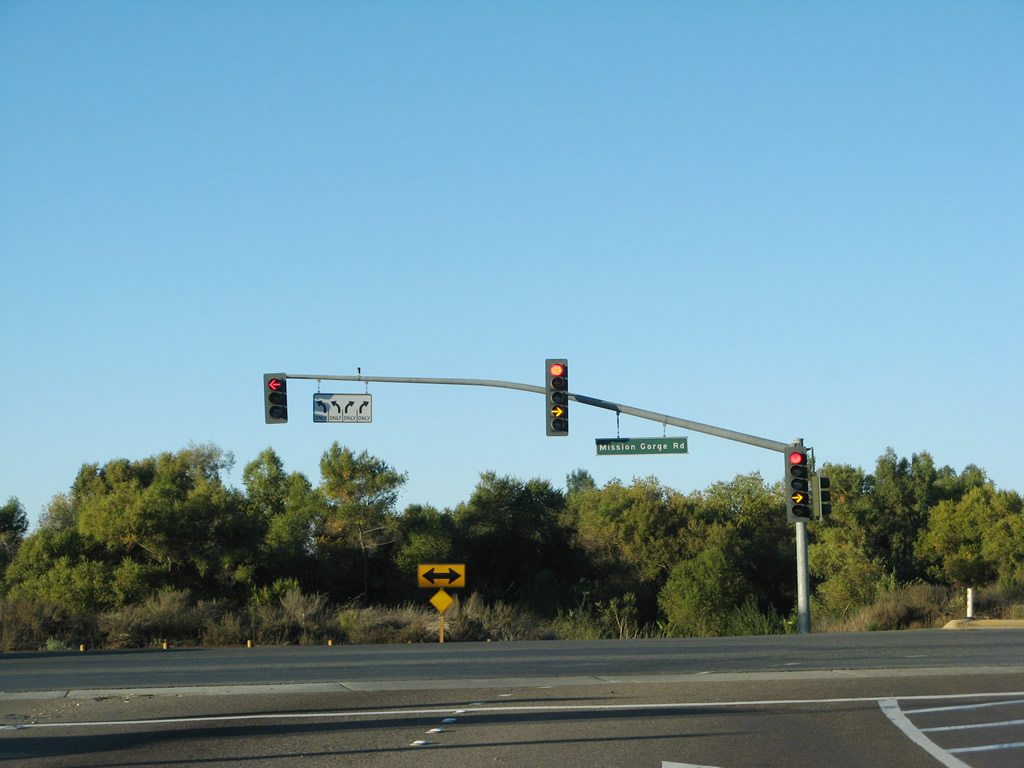
All traffic should prepare to stop for the Mission Gorge Road traffic signal. The freeway ends. Photo taken 12/02/07. |
|
|
|
A pair of end California 125 shields flank the northbound lanes as the freeway prepares to end at Mission Gorge Road. The left two lanes turn west on Mission Gorge Road to Mission Trails Regional Park, and the right two lanes turn east on Mission Gorge Road to Santee. Photos taken 03/31/07 and 12/02/07. |
|
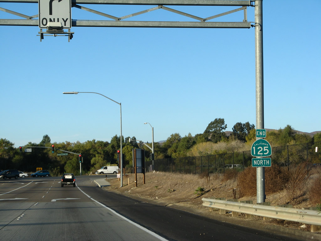
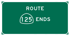
Northbound California 125 ends at the traffic signal with Mission Gorge Road in Santee. At this point, the freeway ends. Photo taken 12/02/07. |
Page Updated January 27, 2013.