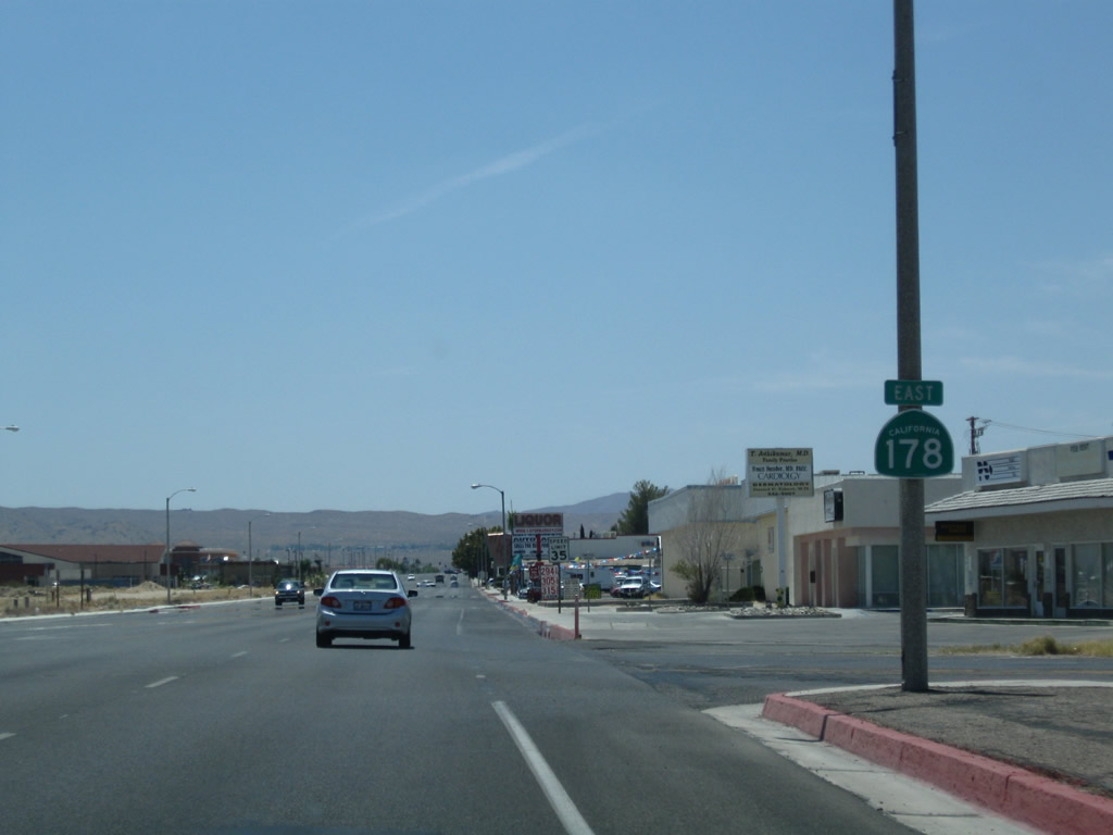
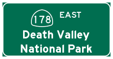
| California 178 east |
|
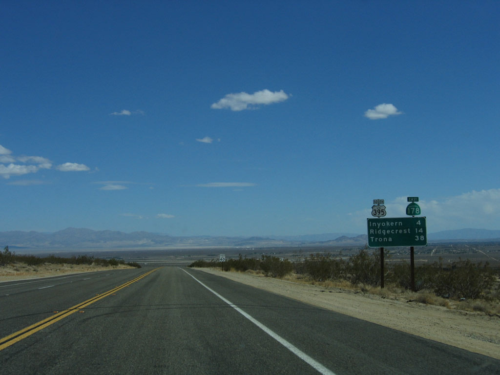
After splitting from California 14, this mileage sign along California 178 east provides the distance to Inyokern (four miles), Ridgecrest (14 miles), and Trona (38 miles). A U.S. 395 south shield is also posted here. Photo taken 10/08/06. |
|
California 178 has one eastbound lane and two westbound lanes to facilitate the climb back to California 14. Inyokern is visible in the distance. Photo taken 10/08/06. |
|
Eastbound California 178 enters the community of Inyokern, the "Sunshine Capital of America." This unincorporated community had a population of 984 in the 2000 Census. Photo taken 10/08/06. |
|
At Red Inyokern Road is another community entrance sign for Inyokern, the "Sunshine Capital of America." Photo taken 10/08/06. |
|
|
|
A California 178 east reassurance shield (along with a U.S. 395 trailblazer) is posted shortly thereafter. Photos taken 10/08/06. |
|
Services in Inyokern include food, gas, and lodging. California 178 passes through downtown Inyokern, then meets Old U.S. 395 (Brown Road). Photo taken 10/08/06. |
|
Eastbound California 178 meets Brown Road, which is the original alignment of U.S. 395. With the construction of the Super Two freeway east of here, U.S. 395 was relocated onto the faster route. Brown Road travels south, merging with U.S. 395 near the southern U.S. 395 Business intersection. To the north, Brown Road travels under U.S. 395, then passes through ranch and farmland before reconnecting with U.S. 395 near the unincorporated community of Brown. Ahead is a pair of shields for California 178 east to U.S. 395. Photo taken 10/08/06. |
|
Soon thereafter, eastbound California 178 approaches U.S. 395. A sign indicates that California 178 will widen out to four lanes on the east side of U.S. 395. Photo taken 10/08/06. |
|
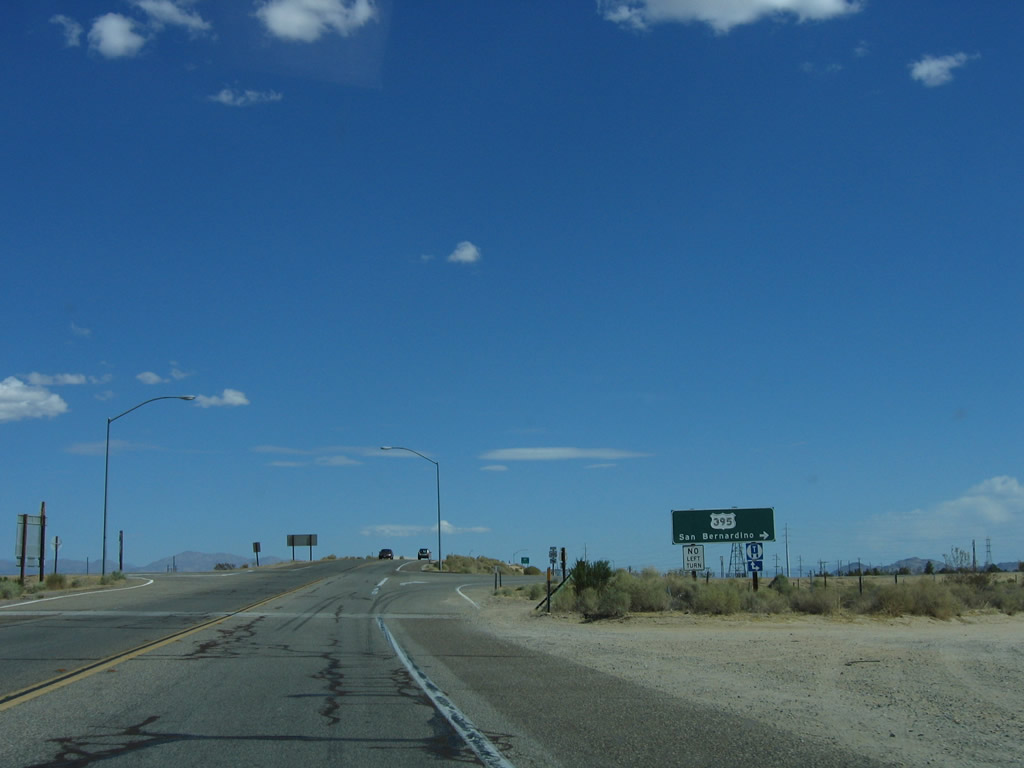
U.S. 395 the Three Flags Highway, so named for its intended connection between Mexico, United States, and Canada. From this interchange, use U.S. 395 north to Independence, Big Pine, Lone Pine, Bishop, and Reno. Use U.S. 395 south to Adelanto, Hesperia, and Interstate 15 south to San Bernardino, Riverside, and San Diego. Photo taken 10/08/06. |
|
Eastbound California 178 meets the ramp to U.S. 395 south to San Bernardino and San Diego. At this point, U.S. 395 Business south joins California 178 east toward Ridgecrest. The next left connects to U.S. 395 north to Bishop and Reno. Photo taken 10/08/06. |
| California 178 east and U.S. 395 Business (Inyokern Road) south |
|
A two-lane bridge carries California 178 over the two-lane U.S. 395 freeway. Photo taken 10/08/06. |
|
The next left connects eastbound California 178 with U.S. 395 north to Bishop. Ahead, California 178 and U.S. 395 Business motor east toward China Lake and Ridgecrest. Photo taken 10/08/06. |
|
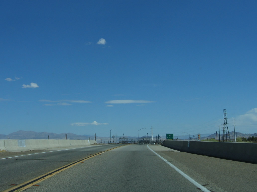
This view looks east along California 178 and U.S. 395 Business toward the power substation. There are no motorist services at this interchange; one must travel east into Ridgecrest or west to Inyokern. Photo taken 10/08/06. |
|
A California 178 east and U.S. 395 Business south reassurance shield assembly is posted as we travel east toward China Lake and Ridgecrest. To the north of the road is a large power substation. Photo taken 10/08/06. |
|
A bevy of power lines criss-cross California 178 and U.S. 395 Business east of the U.S. 395 interchange. Photo taken 10/08/06. |
|
A mileage sign along California 178 east and U.S. 395 Business south provides the distance to Ridgecrest (9 miles) and Trona (34 miles). Photo taken 10/08/06. |
|
California 178 and U.S. 395 Business carry four lanes east en route to Ridgecrest. This route is at expressway standards with intersections evenly spaced and a 65 mile per hour speed limit. Photo taken 10/08/06. |
|
|
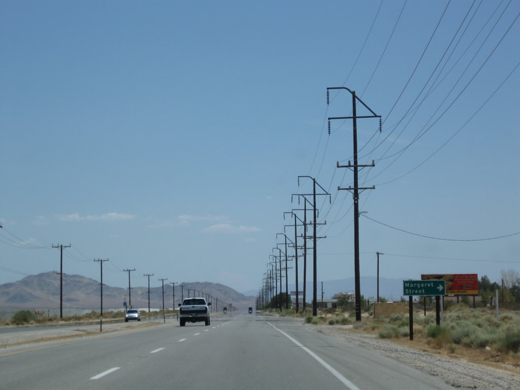
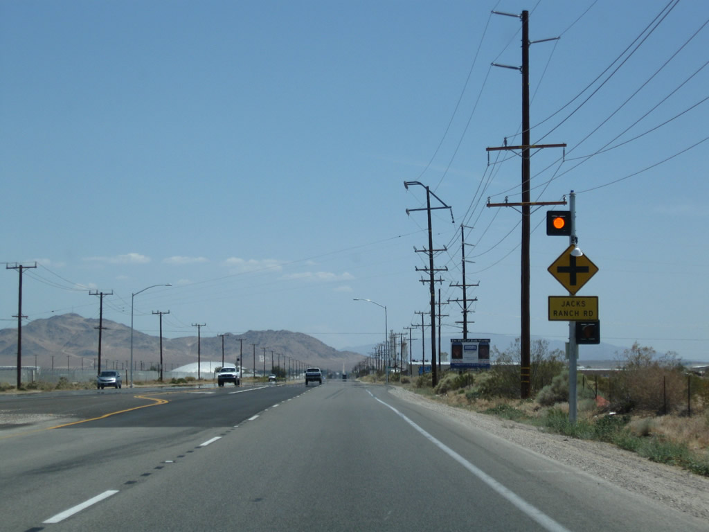
Eastbound California 178 and U.S. 395 Business (Inyokern Road) approach and pass by several intersections, including Saguaro Street, Calvert Boulevard, Margaret Street, and Jacks Valley Road. Photos taken 07/26/09. |
|
|
|
|
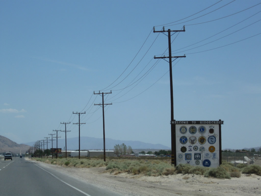
Eastbound California 178 and U.S. 395 Business enter the city of Ridgecrest, nestled in the sprawling Indian Wells Valley. Incorporated on November 29, 1963, Ridgecrest was originally known as Crumville and sits at an elevation of 2,290 feet. The city had a population of 24,927 people as of the 2000 Census. With its high desert location, summers are hot and winters are cool; precipitation is uncommon through much of the year. One of the main employers of the region is the Naval Air Weapons Station China Lake. Photos taken 07/26/09. |
|
A U.S. 395 Business reassurance shield is posted after the Downs Street intersection. No companion California 178 shield is posted here. Photo taken 07/26/09. |
|
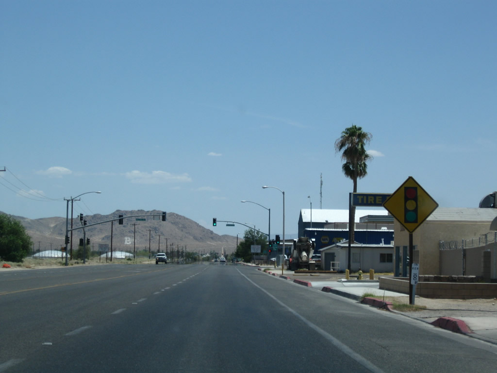
Eastbound California 178 and southbound U.S. 395 Business approach Norma Street (next traffic signal) in Ridgecrest. Photo taken 07/26/09. |
|
Coming close to the entrance to Naval Air Weapons Station China Lake, California 178 and U.S. 395 Business will turn south onto China Lake Boulevard. Photo taken 07/26/09. |
|
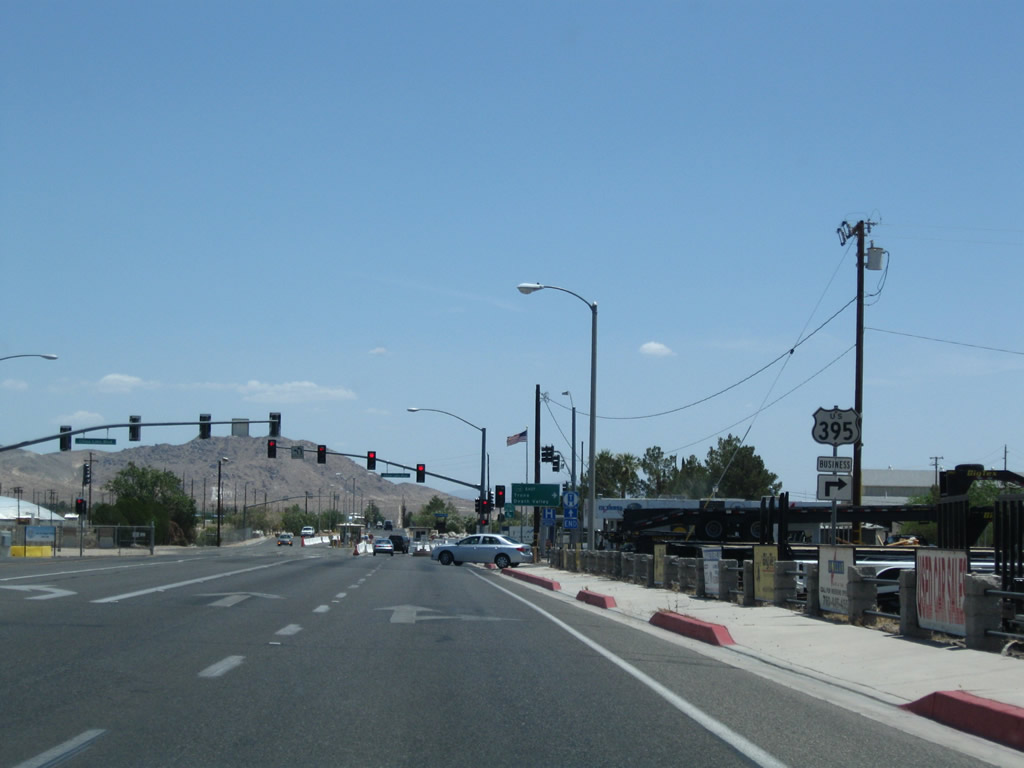
A separate U.S. 395 Business trailblazer is posted after the initial California 178 guide sign. All non-military traffic must turn right; continue straight ahead into the naval base guard station. Photo taken 07/26/09. |
|
U.S. 395 Business and California 178 turn right (south) onto China Lake Boulevard, leaving Inyokern Road behind. Photo taken 07/26/09. |
| California 178 east and U.S. 395 Business (China Lake Boulevard) south |
|
Now on southbound China Lake Boulevard, a California 178 east reassurance shield is posted. U.S. 395 Business also follows along silently. Photo taken 07/26/09. |
|
Most services (gas, food, lodging, and shopping) are located along this segment of China Lake Boulevard between the naval base entrance at Inyokern Road and Ridgecrest Boulevard. Photo taken 07/26/09. |
|
California 178 and U.S. 395 Business split at the Ridgecrest Boulevard and China Lake Boulevard intersection. This sign is posted in the median of China Lake Boulevard southbound prior to French Avenue three blocks north of Ridgecrest Boulevard. Photo taken 07/26/09. |
|
A pair of trailblazers are posted between French Avenue and Ridgecrest Boulevard. Turn left for the continuation of California 178 east to Trona and Death Valley; continue straight to follow U.S. 395 Business (China Lake Boulevard) to return to U.S. 395 south to San Bernardino. Photo taken 07/26/09. |
| California 178/Ridgecrest Boulevard east |
|
|
Views of eastbound California 178 leaving Ridgecrest on the way toward Trona. The state route does not make it all the way to the town of Trona, home of one of two trona mining facilities in the United States (the other being near Green River, Wyoming, along Interstate 80/U.S. 30). Photos taken 01/19/02. |
|
|
End eastbound California 178 at the Trona Pinnacles National Natural Landmark turnoff. The paved road continues straight ahead as a county-maintained route (Trona-Wildrose Road). Photos taken 01/19/02. |
|
Signage for the turnoff from eastbound California 178 to Trona Pinnacles National Natural Landmark, which is located seven miles south of California 178 along a gravel road. Photo taken 01/19/02. |
Page Updated May 22, 2010.