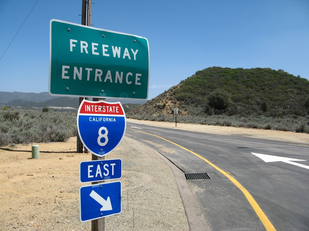
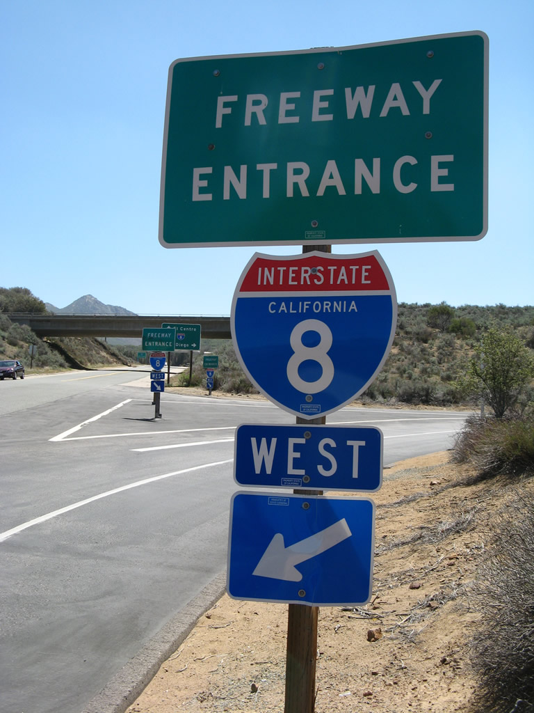
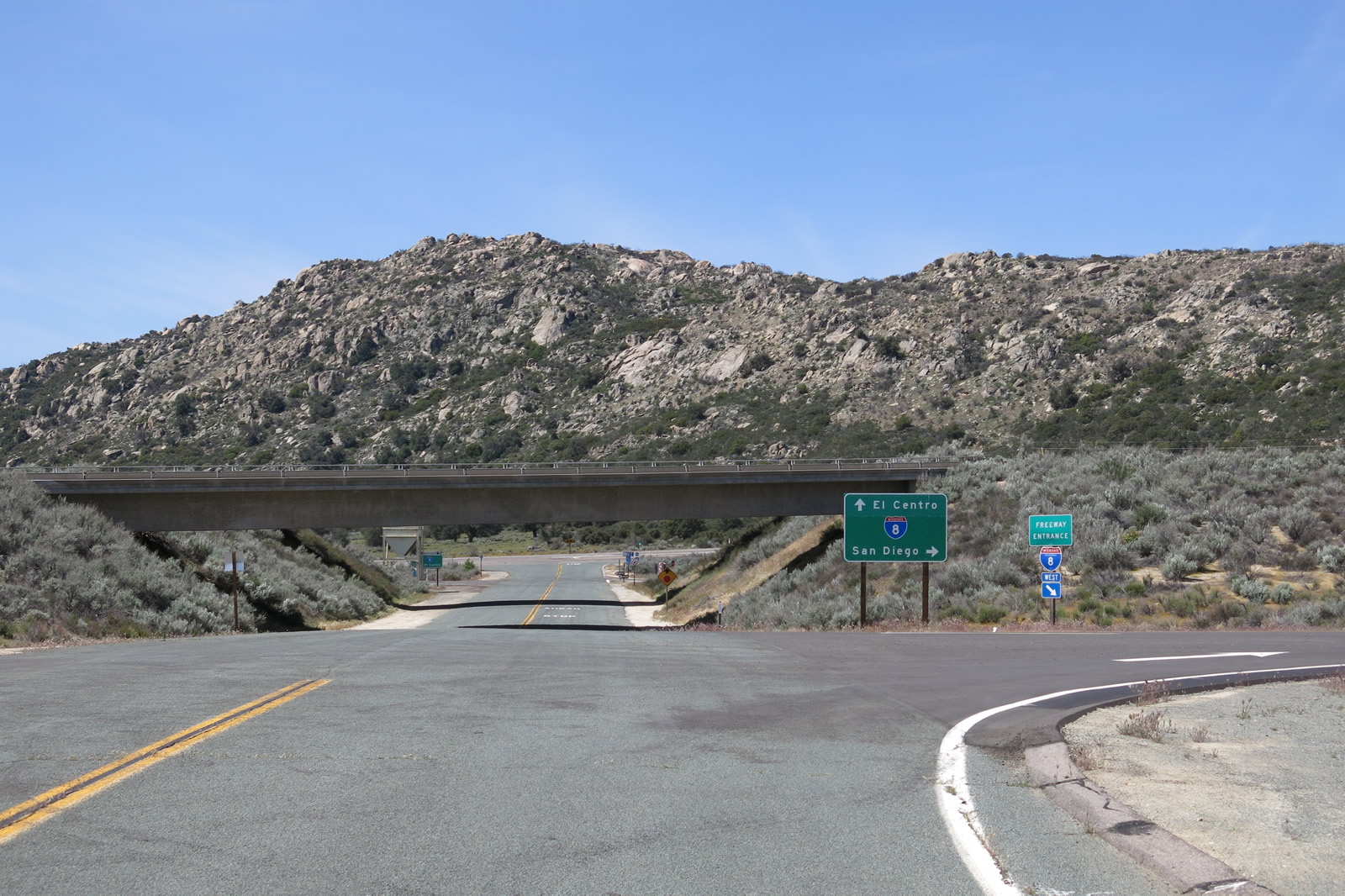
This freeway entrance shield assembly for Interstate 8 east is posted on Pine Valley Road near the unincorporated community of Pine Valley. 04/19/08
I-8 is the main Interstate highway serving the San Diego metropolitan area from west to east. It begins at the foot of the San Diego River at Sunset Cliffs Boulevard, and it leads east across the Imperial Desert into Arizona. For most of its route, Interstate 8 replaced U.S. 80, which used to extend all the way to San Diego, but was eventually truncated in stages to Mesquite, Texas.
Interstate 8 California Guides
San Diego County
The following is a synopsis of the history of Interstate 8 in the San Diego metropolitan area:
- 1954. U.S. 80 routed along El Cajon Boulevard and Washington Street through the City of San Diego. U.S. 80 merges with the new Cabrillo Freeway (Old U.S. 395/SR 163) at the Washington Street-Cabrillo Freeway interchange.
- Around 1957. Construction began on U.S. 80 freeway between U.S. 395 (SR 163) and Ward Road (Future Interstate 15) and Mission Gorge Road.
- 1958. Six lane U.S. 80 freeway completed between 70th Street and Baltimore Avenue, with plans to extend the highway to the Grossmont Summit and SR 67 (now SR 125).
- 1958-1959. Contract let to construct U.S. 80 freeway between U.S. 101 (Pacific Highway, now Interstate 5) and U.S. 395 (SR 163) at a projected cost of $1,214,000 for 1.3 miles of eight lane freeway. Due to the rapid rise of motels in this section of Mission Valley, land prices begin to climb.
- 1959. With rights of way acquisition completed, construction is underway for U.S. 80 freeway between Chase and Magnolia Avenues.
- 1959-1960. The Grossmont Summit section of the U.S. 80 freeway is completed at a cost of $3,594,000 between La Mesa Boulevard and Chase Avenue in El Cajon. This segment includes one section with 18 lanes side-by-side, which was unprecedented in the early 1960s. At the same time, the budget for Fiscal Year 1960 includes appropriation for the 2.32 mile long section between Baltimore Drive and La Mesa Boulevard.
- Early 1960s. Most sections of U.S. 80 freeway are completed between U.S. 101 and the City of El Cajon. The Alvarado Canyon section of U.S. 80, 2.6 miles of six lane freeway between Waring Drive and Lake Murray Drive (70th Street), replaced a City arterial street. The City planned that Alvarado Canyon Road would be replaced with a freeway, so it acquired much of the necessary rights of way (ROW) through this stretch.
- 1962. U.S. 80 Business routed along El Cajon Boulevard (old U.S. 80) according to 1962 Texaco map of San Diego.
- 1964. Great Renumbering of 1964. U.S. 80 freeway is officially renamed to Interstate 8, although U.S. 80 signs would remain along the freeway until 1972. A 1966 Mobil Map illustrates Interstate 8 and U.S. 80 as cosigned along the Mission Valley and Alvarado Freeways.
- 1967. U.S. 80 Business (El Cajon Boulevard) now known as Business Loop I-8 between U.S. 395 freeway and La Mesa. The now-constructed Ocean Beach Freeway is shown on a 1967 Thomas Brothers Guide as SR 109, a designation that went away by 1971.
- 1971. Interstate 8 extended west to meet Sunset Cliffs and Nimitz Boulevards over SR 109 (the Ocean Beach Freeway). Some maps still carried the SR 109 designation over this freeway as late as 1975, but most maps showed this route as part of Interstate 8 in 1971.
- 1972. Last vestiges of U.S. 80 are removed from the Interstate 8 freeway.
- 1975. Interstate 8 freeway completed as far east as Pine Valley.
- 1996. Asphalt freeway between SR 163 and Interstate 5 rehabilitated.
- 1997-1998. Concrete freeway rehabilitated from the City of El Cajon east to SR 163. This was accomplished by removing a thin layer of concrete off the top of the roadway, which promoted a smoother, quieter freeway.
- January 1999. Overhead sign for Business Loop I-8 (Washington Street) exit from northbound SR 163 removed as part of construction project. It is unlikely that this sign will be replaced.
- Summer 1999. New transition ramp constructed from westbound Interstate 8 to southbound SR 15.
- December 2000. Work continues to expand Interstate 8 by one lane in each direction east of El Cajon.
- August 2002. First numbered exit at Hotel Circle (Exit 4A) along eastbound Interstate 8 is placed.
Many thanks to Merle F. McClelland for his assistance in creating this historical chronology.
Statewide Opening Dates of Interstate 8
- Sunset Cliffs Boulevard to Midway Avenue (Sports Arena Boulevard) - December 1st, 1969
- Midway Drive to Presido Park - July 21st, 1969
- Presido Park to SR 163 - Circa 1959
- SR 163 to Interstate 15 - Circa 1960
- Interstate 15 to Fairmount Avenue - Circa 1958
- Fairmount Avenue to College Avenue - Circa 1960
- College Avenue to Spring Street - Circa 1961
- Spring Street to El Cajon Boulevard (Business 8) - Circa 1962
- El Cajon Boulevard (Business 8) to East Main Street - Circa 1961
- East Main Street to Los Coches Creek Road - July 28th, 1965
- Los Coches Creek Road to Harbison Canyon Road - June 20th, 1966
- Harbison Canyon Road to Viejas Creek - May 22nd, 1969
- Viejas Creek to Japtual Valley Road - October 7th, 1970
- Japtual Valley Road to Sunrise Highway - November 25th, 1974
- Sunrise Highway to Cameron Road (between Kitchen Creek Road and La Posta Road) - July 7th, 1975
- Cameron Road to Crestwood Road - January 23rd, 1974
- Crestwood Road to Imperial County - August 8th, 1967
- Imperial County to SR 98 - May 4th, 1965
- SR 98 to Drew Road - December 5th, 1968
- Drew Road to La Brucherie Road - June 9th, 1967
- La Brucherie Road to Calfornia 111 - July 31st, 1967
- SR 111 to Highline Canal - July 1st, 1971
- Highline Canal to All American Canal - June 5th, 1969
- All American Canal to SR 186 - August 17th, 1970
- SR 186 to Arizona state line - May 18th, 1973
|
| These Interstate 8 route markers are posted on eastbound Taylor Street and the Hotel Circle bridge connecting Taylor Street with Hotel Circle North. 05/21/12 |
|
| In the Mission Valley community of the city of San Diego, these freeway entrance shields sign the route from eastbound Camino del Rio North to Interstate 8 west. 07/24/10, 10/10/05 |
|
| Leaving the Mission Valley Center shopping center at Camino del Rio, this small guide sign shows the direction to the on-ramp for Interstate 8 and Interstate 15. 07/24/10 |
|
| The Interstate 8 freeway entrance from Jackson Drive in La Mesa. July 2000 |
|
| Spring Street north in La Mesa at the eastbound on-ramp to Interstate 8 for El Cajon and El Centro. 05/08/05 |
|
| Passing under a ramp connecting to Interstate 8, northbound Spring Street splits between I-8 west to San Diego and Center Street north to Grossmont in La Mesa. 02/21/05 |
|
| Westbound Commercial Street meets Center Street in La Mesa. Follow Commercial Street straight ahead to connect to Interstate 8 west to San Diego, Spring Street south to downtown La Mesa, and Business Loop I-8 (El Cajon Boulevard) west. 05/08/05 |
|
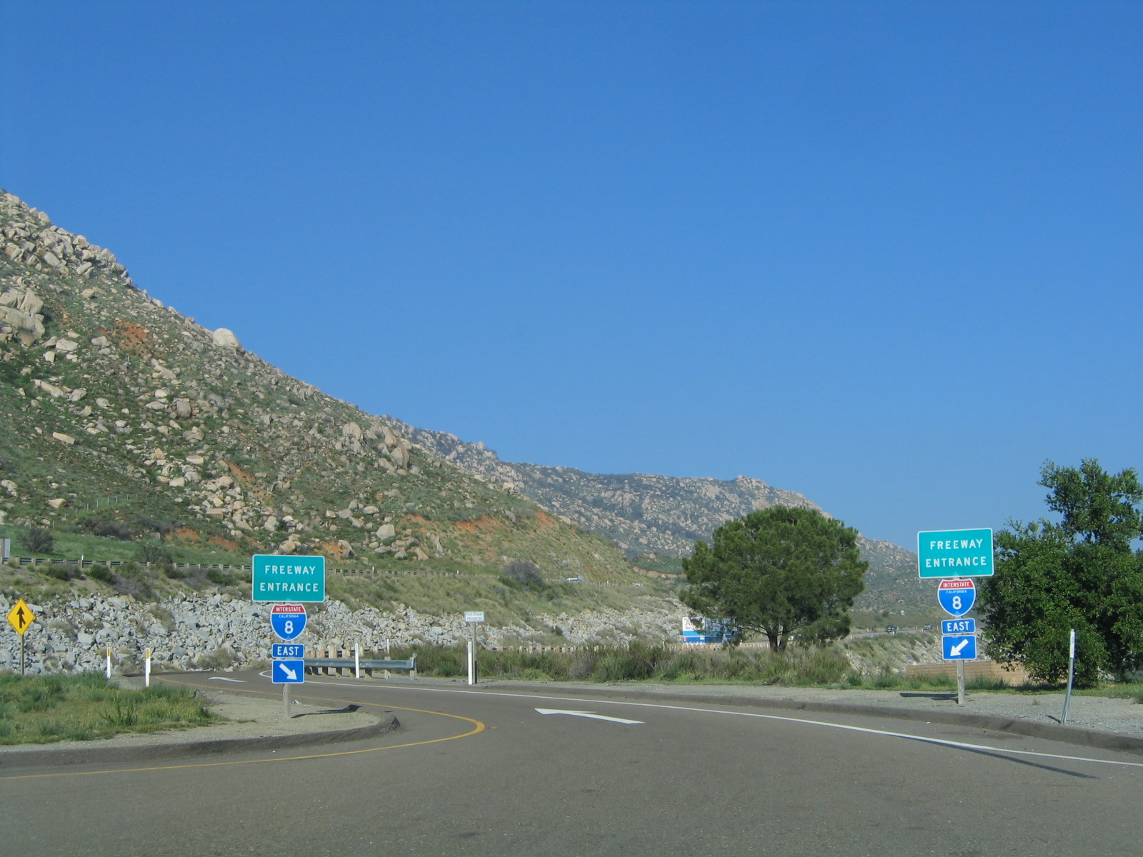
| This set of freeway entrance shields is posted at the Vista Point located at Exit 34 (just east of the East Willows Road interchange). The Vista Point here is notable for being part of the original alignment of U.S. 80 before it was superseded by the freeway. 03/12/05 |
|
| Interstate 8 button copy sign located along Second Street (SR 54) south in El Cajon. July 2000 |
|
| Although a rare occurrence, snow sometimes falls on Interstate 8 as it traverses higher elevations near Pine Valley and Laguna Summit. 03/12/06 |
|
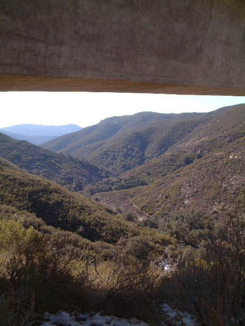
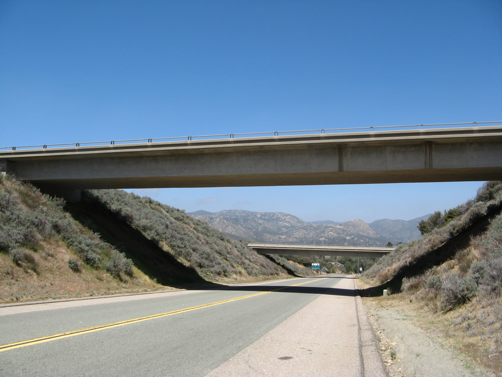
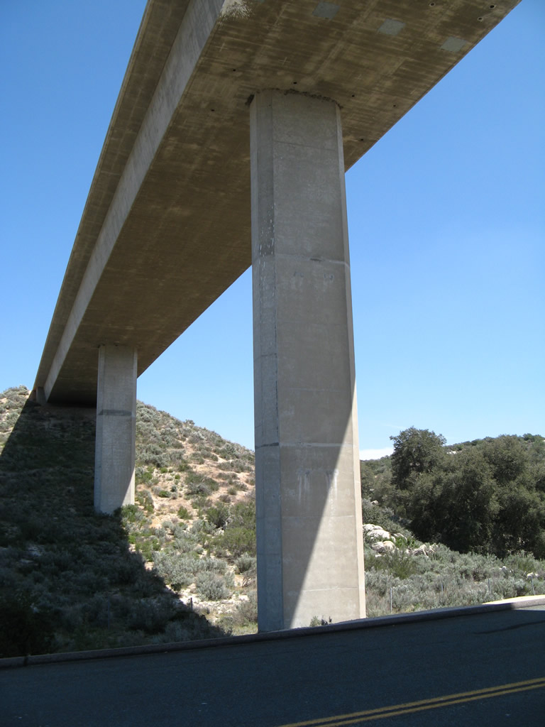
| The Pine Valley Creek Bridge, also known as the Nello Irwin Greer Memorial Bridge, is a reinforced concrete box girder span located between Exits 40 and 45. The bridge is approximately 450 feet above ground level at its highest point, and around 1,700 feet long. It was built in 1974 as part of the realigned Interstate 8, which originally slated to travel through Pine Valley. 01/19/01 |
|
| This series of pictures shows the Nello Irwin Greer Memorial Bridge as seen from several vantage points. Y-shaped pillars support the bridge from valley floor, carrying both roadways of Interstate 8. Prior to the construction of this span, plans outlined I-8 entering enter Pine Valley along what is now SR 79 and Historic U.S. 80. 01/19/01 |
|
| The Pine Valley Creek Bridge was named in 2007 after Mr. Greer, the project engineer for Caltrans who was involved in designing the span and rerouting Interstate 8 out of Pine Valley and onto the ridge. The span closes occasionally during strong winter storms and dangerous during high wind conditions, such as Santa Ana Winds. 01/19/01 |
|
| These pictures also show the substructure and towers that support the Pine Valley Creek Bridge (Nello Irwin Greer Memorial Bridge) along Interstate 8. 01/19/01 |
|
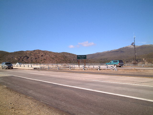
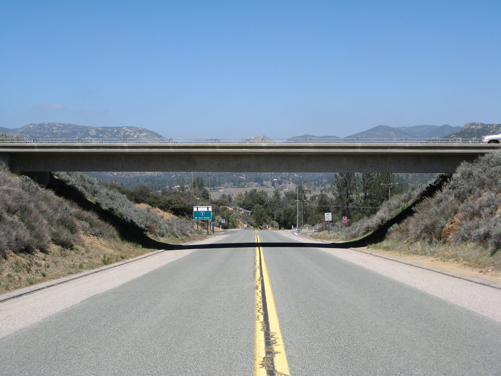
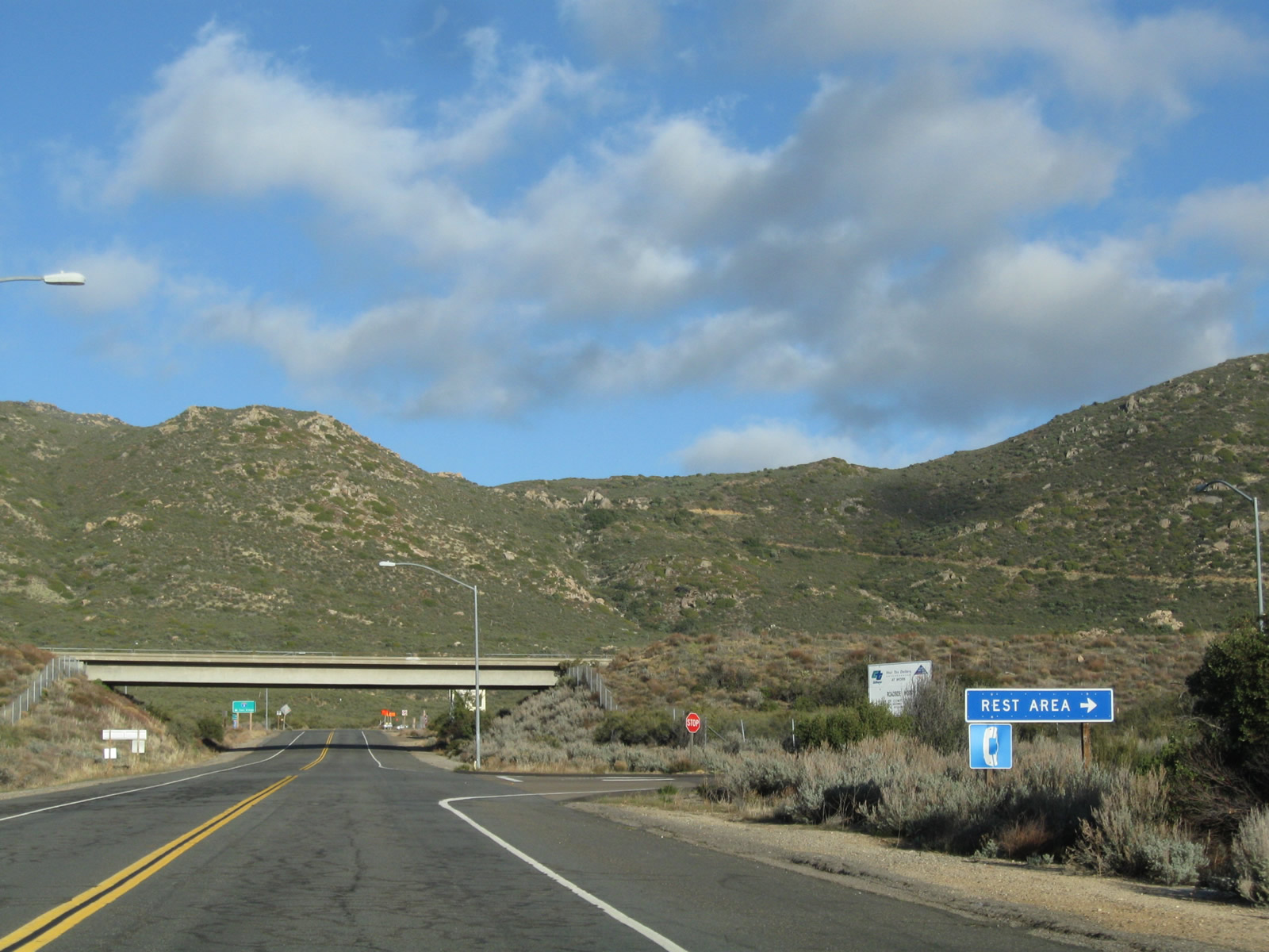
| In the unincorporated community of Pine Valley, this sign stands on northbound Pine Valley Road. El Centro and San Diego are the control cities for most of Interstate 8 across San Diego and Imperial Counties. 04/19/08 |
|
| Pine Valley Road north passes below the spans of the Interstate 8 mainline. 04/19/08 |
|
| Northbound Pine Valley Road at the westbound off-ramp to I-8. 04/19/08 |
|
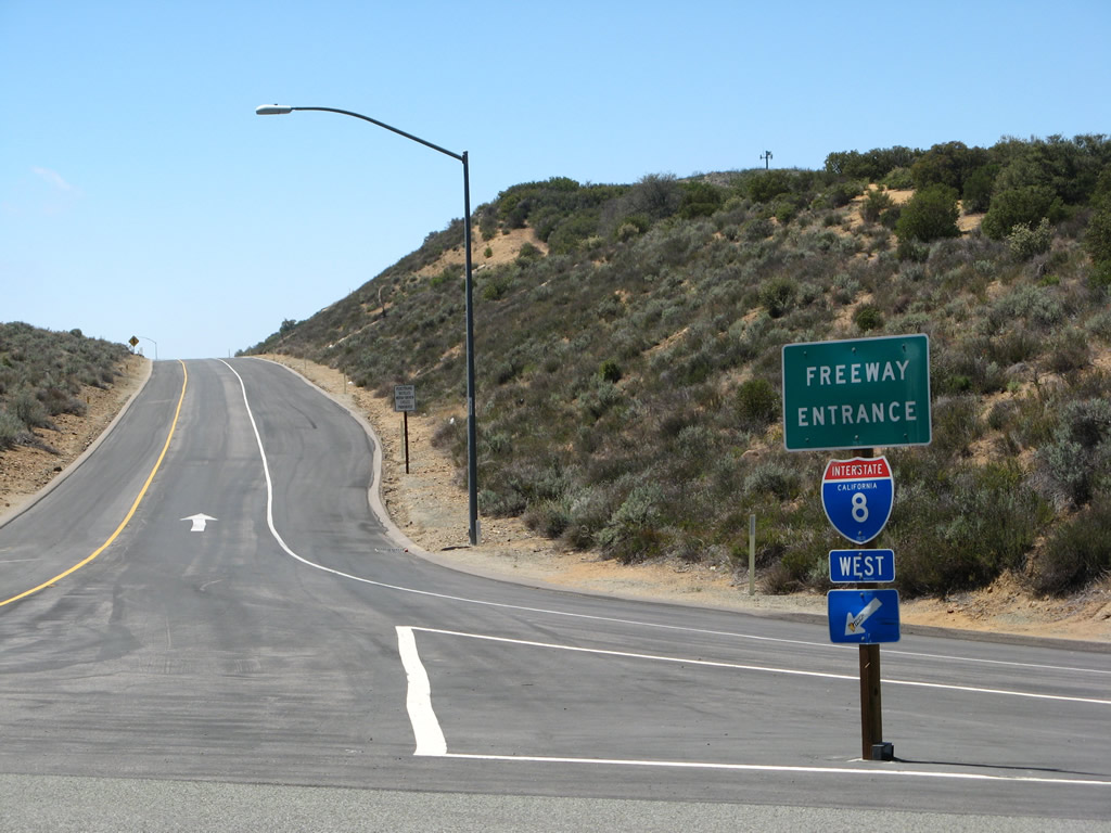
| Pine Valley Road south at the westbound on-ramp for I-8 to San Diego. 04/19/08 |
|
| This guide sign on Pine Valley Road south was probably placed in the 1990s before the retroreflective sheeting became standard for all new Caltrans signs in 1999. 04/19/08 |
|
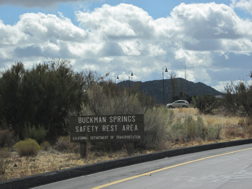
| The Buckman Springs Rest Area is located in the median of Interstate 8 at the Buckman Springs Road interchange (Exit 51). The rest area was refurbished and renovated in 2010-2011, reopening on July 1, 2011. 02/11/02, 11/10/02 |
|
| This Interstate 8 guide sign is posted at the exit from Buckman Springs Rest Area. Buckman Springs Road south connects with I-8 east to El Centro and CR S-1 south to Campo. Buckman Springs Road north links with I-8 west to San Diego. 02/11/02 |
|
| Northbound Buckman Springs Road approaches the on-ramp for Interstate 8 east to El Centro. The entrance to the Buckman Springs Rest Area follows. 02/11/02 |
|
| Continuing beyond the I-8 eastbound overpass, northbound Buckman Springs Road intersects the entrance to Buckman Springs Rest Area. The rest area lies between the I-8 roadways within a diamond interchange. 02/11/02 |
|
| This view looks north on Buckman Springs Road near the entrance to the Buckman Springs Rest Area toward the bridge carrying westbound Interstate 8 over Buckman Springs Road. A left turn connects to Interstate 8 west to San Diego. 02/11/02 |
|
| The Kitchen Creek Road interchange (Exit 54) with Interstate 8 is located southeast of the Buckman Springs Road interchange near Cameron Station. To the north, Kitchen Creek Road travels to Cameron Fire Station and a locked gate near Sheephead Mountain. Bicyclists commonly use this lightly traveled road, mostly because it concludes at a dead end. If not for the gate, motorists could ascend to the Sunrise Highway via northbound Kitchen Creek Road, but the road is too narrow for through traffic. To the south, Kitchen Creek Road connects with Old Highway 80. This series of pictures shows the signage in and around the diamond interchange between Interstate 8 and Kitchen Creek Road. 04/20/13 |
|
| La Posta Road travels under Interstate 8 near the unincorporated community of Cameron Corners just north of Old U.S. 80. This bridge was constructed along with the Interstate highway on January 23, 1974. Seismic retrofit work was completed on June 16, 1997. This photo shows both the eastbound and westbound bridges 04/19/08 |
|
| Traveling north on La Posta Road, this view shows the west end of the long westbound Interstate 8 bridge over La Posta Road. North of this bridge, La Posta Road changes names to Thing Valley Road. 04/19/08 |
|
| Looking south, this view shows La Posta Road traveling under the eastbound lanes of Interstate 8. The stop sign in the distance is for Old Highway 80 (U.S. 80). 04/19/08 |
|
| The west end of the eastbound Interstate 8 bridge looking south along La Posta Road. 04/19/08 |
|
| This view looks at the under structure for the bridge carrying eastbound lanes over La Posta Road. 04/19/08 |
|
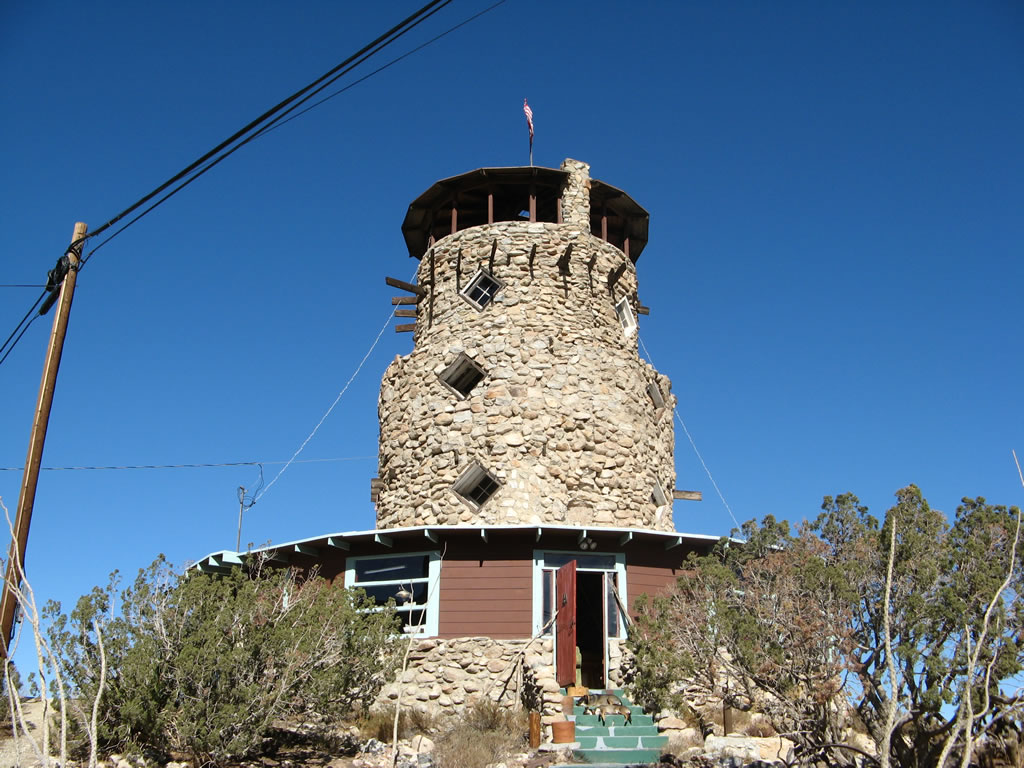
| The Desert View Tower looks over the vast desert horizon from its perch above Interstate 8 and the In-Ko-pah Gorge. Built between 1922 and 1928 by Bert Vaughn (who at that time owned the nearby town of Jacumba), the Desert View Tower is a well-known landmark for travelers along Historic U.S. 80, the Boulevard of America. The tower is open for visitors for a nominal fee. 01/15/07 |
|
| Built between 1922 and 1928 by Bert Vaughn (who at that time owned the nearby town of Jacumba), the Desert View Tower is a well-known landmark for travelers along Historic U.S. 80, the Boulevard of America. The tower was built to honor the railroad and highway builders who opened this area for travelers. Nearby rock sculptures were carved by W.T. Ratcliffe, an engineer, during the 1930s. 01/15/07 |
|
| Viewing Desert View Tower from the south. 04/19/08 |
|
| Looking north at the tower. The wind was howling on this day, after a winter storm passed through the area. 01/15/07 |
|
| The "desert view" promised by the aptly named Desert View Tower can be seen in nearly all directions from the tower, but the most dramatic and compelling views look east toward In-Ko-Pah Gorge and the Imperial Valley. Since Interstate 8 passes directly below the tower, a fence prevents people from accidentally traveling too far away from the tower and falling to the freeway below. Affixed to one of these safety fences is this old 3,000-foot elevation sign, which was probably located along Old U.S. 80 at some point in the past. By 2011, the 3,000-foot elevation sign had been moved inside the Tower and is no longer posted on the fence. 04/19/08 |
|
| Looking east from the Desert View Tower, the alignments of Interstate 8 east and west split after the Mountain Springs Road interchange (Exit 80). In the distance is the Salton Sea. 01/15/07 |
|
| Looking north from the Desert View Tower, Interstate 8 west climbs uphill to In-Ko-Pah Park Road, while the eastbound lanes descend toward Mountain Springs. 01/15/07 |
|
| The Mountain Springs Road interchange (Exit 80) as seen from the Desert View Tower overlook. Old alignments of U.S. 80 (single and twin slab concrete) can be found at this interchange, but not all of it runs on public land. 01/15/07 |
|
| An abandoned rest area overlooking In-Ko-Pah Gorge is located along Interstate 8 eastbound at Milepost 79. There were no facilities to this location. October 2000 |
|
| This freeway entrance for Interstate 8 is posted at the Mountain Springs Road interchange west of Ocotillo and east of the Desert View Tower. Mountain Springs Road provides local and ranch access, and it connects to several extant segments of Historic U.S. 80 that are no longer in active use. This is the lone interchange between In-Ko-Pah Road near the top of the In-Ko-Pah Canyon grade and SR 98 at the bottom of the grade. 04/20/13 |
|
| This freeway entrance shield for Interstate 8 east is posted on Imperial County S-2 (Imperial Highway) near the unincorporated community of Ocotillo at Exit 89. 04/19/08 |
|
| This cylindrical building located in El Centro on the south side of Interstate 8 near the interchange (Exit 116) with CR S-31 (Dogwood Road) shows Sea Level. A shopping center was eventually developed behind this tank between 2000 and 2010. 04/20/13 |
|
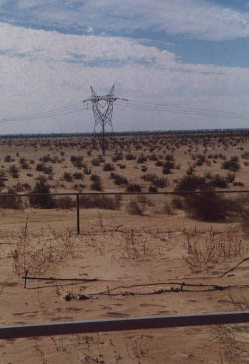
| The Imperial Sand Dunes are located along Interstate 8 near Gray's Well between Exits 151 and 159. The dunes are popular with sports enthusiasts and off-road riders. A campground is located near the base of dunes, and it is not uncommon to spot riders of all-terrain vehicles up at daybreak taking their four-wheelers into the dune sea. October 2000 |
|
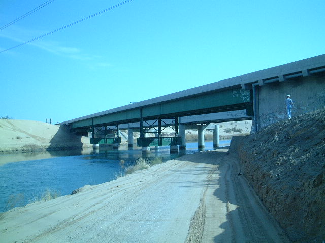
| This suite of photos provides views of the All-American Canal Bridge near Milepost 153 just east of Grays Well Road. This bridge features a unique steel superstructure that is only visible to those on foot or using the canal service road. Without water, the Imperial Valley would not be able to produce one-seventh of the nation's table vegetables. The All-American Canal carries water from the Colorado River west into the valley, providing farmers with the resources they need to grow a wide variety of crops in the hot desert. 01/19/01 |
Photo Credits:July 2000, October 2000, 01/19/01, 02/11/02, 11/10/02, 02/21/05, 03/12/05, 05/08/05, 10/10/05, 03/12/06, 01/15/07, 04/19/08, 07/24/10, 05/21/12, 04/20/13 by AARoads
Connect with:
Interstate 5
Interstate 805
Page Updated 05-10-2009.