

Interstate 10 East - San Gorgonio Pass to Dillon Road
| Interstate 10 east | |
|---|---|
 |
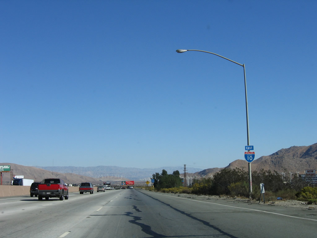
After the on-ramp from Main Street in Cabazon, this Interstate 10 east reassurance shield (angular style) is posted. The next exit along Interstate 10 east is Exit 106, Main Street (old U.S. 60-70-99), which is the last to serve Cabazon (el. 1,791 feet). Photo taken 11/10/06. |
 |
The short extant stretch of U.S. 60-70-99 through the community of Cabazon is Main Street, which connects to Interstate 10 at Exits 104 and 106. The 1.75-mile segment through Cabazon parallels the freeway to the south. Photo taken 11/10/06. |
 |
Eastbound Interstate 10 reaches Exit 106, Main Street (East Cabazon). At this point, the Colorado (Sonora) Desert comes into view as Interstate 10 continues to descend from San Gorgonio Pass toward Palm Springs. Photo taken 11/10/06. |
 |
A reassurance shield for Interstate 10 east is posted after the on-ramp from Main Street. Old U.S. 60-70-99 remain under the freeway from here until Indio, with some notable exceptions. Photo taken 11/10/06. |
 |
This mileage sign provides the distance to Palm Springs (16 miles) and Indio (38 miles). Photo taken 11/10/06. |
 |
Another reassurance shield (traditional specifications) for Interstate 10 east is posted soon thereafter. Photo taken 11/10/06. |
 |
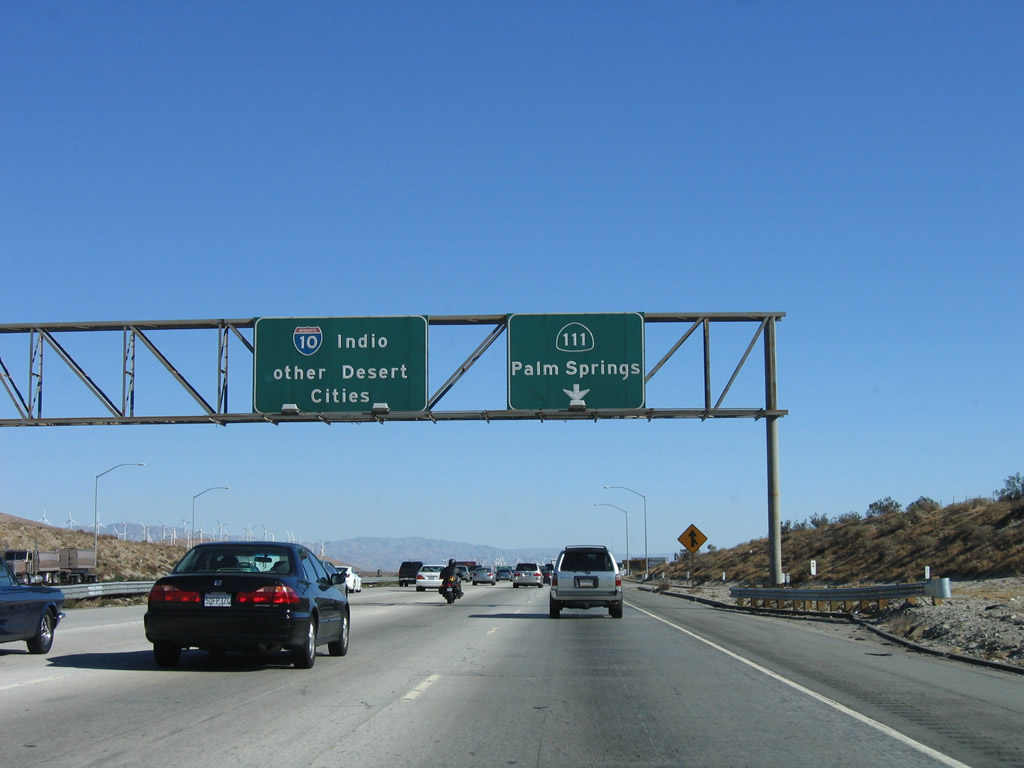
An interchange sequence sign provides the distance to the next two exits along Interstate 10 east: Exit 110, Haugen-Lehmann Way and Exit 111, California 111 southeast to Palm Springs. Photo taken 11/10/06. |
 |
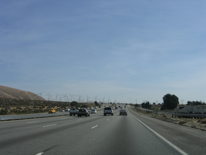
Due to the high wind that regularly blows through San Gorgonio Pass, wind turbines are strategically placed through the valley and on the mountain ridges to maximize power generation capacity. These turbines will become more prevalent along Interstate 10 as the freeway continues east. The next exit is Exit 110, Haugen-Lehmann Way. Photo taken 11/10/06. |
 |
The flip sign advises of high winds ahead. Photo taken 11/10/06. |
 |
Eastbound Interstate 10 reaches Exit 110, Haugen-Lehmann Way north to the unincorporated community of San Gorgonio. Photo taken 11/10/06. |
 |
Prior to passing under the Haugen-Lehmann Way overpass, this sign advises motorists en route to the cities of Cathedral City and Rancho Mirage to use Exit 126, Date Palm Drive (15 miles ahead). Photo taken 11/10/06. |
 |
The next exit along Interstate 10 east is Exit 111, California 111 east to Palm Springs (0.75 miles). The initial section of California 111 is an expressway, and it reverts to a city street (Palm Canyon Drive) after entering the city of Palm Springs. While California 111 is signed for through traffic, the alignment of California 111 through Palm Springs is maintained by the city rather than the state. This kind of situation exists along much of California 111 as it passes through several of the cities between Palm Springs and Indio. Photo taken 11/10/06. |
 |
 |
 |
The right lane connects to Exit 111, California 111 (Palm Canyon Drive) east to Palm Springs. Another view of the same signage comes from the Haugen Lemann Way overpass. The on-ramp view shows traffic merging onto eastbound Interstate 10 near the split with southeastbound California 111. The pull-through sign is locally famous for omitting Phoenix as an eastbound control city in favor of the more ambiguous "Other Desert Cities." Photos taken 11/10/06 and 02/26/06. |
 |
Interstate 10 through the Coachella Valley is known as the Sonny Bono Memorial Freeway. Photo taken 11/10/06. |
 |
Use California 111 east to the DaVinci Museum and the Palm Springs Air Museum. Photo taken 11/10/06. |
 |
Eastbound Interstate 10 reaches Exit 111, California 111 (Palm Canyon Drive) southeast to Palm Springs. California 111 travels through the Coachella Valley, servings the cities that line the valley between Palm Springs and Indio. For the most part, this section of California 111 parallels Interstate 10. At Indio, California 111 abruptly turns south toward the Salton Sea, Brawley, El Centro, and Calexico. At no time was California 111 part of U.S. 60, 70, or 99; the U.S. highways continued along the path of Interstate 10 east. Photo taken 11/10/06. |
 |
A mileage sign provides the distance to the cities of Indio (32 miles) and Blythe (129 miles). Omitted are any Arizona destinations such as Quartzsite, Buckeye, and Phoenix. The bridge carries traffic from California 111 northwest onto Interstate 10 west. Since this is a directional interchange, there is no direct access from Interstate 10 west to California 111 southwest. Photo taken 11/10/06. |
 |
The next exit is Exit 113, Rest Area (one-half mile). Photo taken 11/10/06. |
 |
After the rest area, the next exit along Interstate 10 east is Exit 114, Whitewater (Historic U.S. 60-70-99). Photo taken 11/10/06. |
 |
Eastbound Interstate 10 reaches Exit 113, Rest Area. The billboard behind the rest area sign advises of one of the several casinos located in the Coachella Valley. Photo taken 11/10/06. |
 |
Despite its location in the semi-populated desert, Interstate 10 retains four lanes in each direction. This is due to the nearby populations in Palm Springs and adjacent cities. After reaching Indio, Interstate 10 will narrow to two lanes in each direction (plus climbing and auxiliary lanes). Photo taken 02/25/06. |
 |
Due to the windy conditions through the San Gorgonio Pass, wind turbines are located on both sides of Interstate 10. Photo taken 02/25/06. |
 |
Eastbound Interstate 10 reaches Exit 114, Whitewater. Use Exit 114 to see an extant section of old U.S. 60-70-99, including double-slab concrete and an older bridge. Photo taken 11/10/06. |
 |
At the top of the off-ramp, turn left to follow Whitewater Road to the old alignment of U.S. 60-70-99. Turn right to Tipton Road. Photo taken 02/25/06. |
 |
Back on the mainline, an extra-wide Interstate 10 reassurance shield is posted prior to passing under the Whitewater overpass. Photo taken 11/10/06. |
 |
On the way to the California 62 interchange, note the wind turbine farm in the background. The next three exits serve the city of Desert Hot Springs. Home to 16,582 people as of the 2000 Census, Desert Hot Springs is located north of Interstate 10, and the freeway does not pass through the city limits. Founded on July 12, 1941, Desert Hot Springs incorporated in 1963. Photo taken 02/25/06. |
 |
The next exit along Interstate 10 east is Exit 117, California 62 north to Yucca Valley and Twenty-Nine Palms. California 62 travels north from Interstate 10 to Yucca Valley (via Desert Hot Springs and Morongo Valley), then turns east to Joshua Tree and Twenty-Nine Palms. East of Twenty-Nine Palms, California 62 travels across the desert to meet U.S. 95 at Vidal Junction and crosses the Colorado River into Parker, Arizona. Photo taken 02/25/06. |
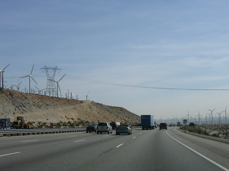 |
A 500kV power line crosses Interstate 10; this line is part of Path 46, which connects a variety of power generating facilities in Nevada, Arizona, and New Mexico with customers in Southern California. This particular 500kV line (Palo Verde-Devers Number 1), which interconnects the Southern California Edison grid with the Palo Verde Nuclear Power Generating Station in Arizona, is planned to be doubled in capacity (with a second set of towers) in the coming years. Wind turbines turn continuously in an effort to generate electricity. Photo taken 02/25/06. |
 |
Westbound Interstate 10 approaches Exit 117, California 62 north to Desert Hot Springs, Morongo Valley, Yucca Valley, and Twenty-Nine Palms. Photo taken 02/25/06. |
 |
Morongo Valley is an unincorporated community located along California 62 between Desert Hot Springs and Yucca Valley. Photo taken 02/25/06. |
 |
Follow California 62 north to Joshua Tree National Park. A tranquil environment located north of Interstate 10 and southeast of California 62, Joshua Tree National Park separates the Mojave Desert to the north from the Sonora (Colorado) Desert to the south. The park is known for its unique Joshua Trees, which bloom annually in February and March. Rock climbing is a popular activity within the park, as is hiking. Most facilities are located in nearby Twentynine Palms, which is home to a Marine base. Photo taken 02/25/06. |
 |
An official State of California Welcome Center is located in Yucca Valley along California 62 east. Photo taken 02/25/06. |
 |
Eastbound Interstate 10 reaches Exit 117, California 62 north to Morongo Valley, Yucca Valley, Joshua Tree, and Twentynine Palms. Photo taken 02/25/06. |
 |
After the California 62 interchange, Interstate 10/Sonny Bono Memorial Freeway enters the city of Palm Springs. The freeway remains well north of the urbanized sections of the city, but several routes travel south from the freeway into Palm Springs. Settled by the first non-Indian in 1884 by Judge John Guthrie McCallum, Palm Springs grew gradually through the early part of the 20th Century, then grew rapidly prior to World War II, incorporating as a city in 1938. Unlike cities in the Imperial County along California 111, Palm Springs is 487 feet. However, the city is dwarfed by massive Mount San Jacinto (el. 10,831 feet), which is visible on northbound California 111 (Palm Canyon Drive) as the highway continues northwest toward downtown Palm Springs. The year-round population (according to the 2000 Census) is 42,807 year-round, with an additional 30,000 visiting in the winter months. Photo taken 11/10/06. |
 |
The next exit along Interstate 10 east is Exit 120, Indian Canyon Drive south to Palm Springs and Indian Avenue north to the unincorporated community of North Palm Springs. Interstate 10 retains four eastbound lanes through this area; the freeway was constructed on top of the old U.S. 60-70-99 expressway. Photo taken 11/10/06. |
 |
Use Indian Avenue north to the city of Desert Hot Springs and ultimately California 62. All motorist services are available at this interchange. Photo taken 11/10/06. |
 |
Eastbound Interstate 10/Sonny Bono Memorial Freeway reaches Exit 120, Indian Canyon Drive south to Palm Springs and Indian Avenue north to the unincorporated community of North Palm Springs and the city of Desert Hot Springs. Photo taken 11/10/06. |
 |
Old style concrete bridge railing is used on the Indian Avenue overpass. Photo taken 11/10/06. |
 |
The next exit along Interstate 10 east is Exit 123, Gene Autry Trail south to Palm Springs and to California 111 east and Palm Drive north to the city of Desert Hot Springs (two miles). The freeway turns a bit to the southeast at this point. Photo taken 11/10/06. |
 |
While Exit 123 serves Gene Autry Trail south to Palm Springs, this advance sign only refers to the connection to Palm Drive north to the city of Desert Hot Springs. Photo taken 11/10/06. |
 |
A roadside sign advises of the next exit connecting to Gene Autry Trail south to Palm Springs. Photo taken 11/10/06. |
 |
Eastbound Interstate 10 reaches Exit 123, Gene Autry Trail south to Palm Springs and to the Palm Springs International Airport. Palm Drive travels north to the city of Desert Hot Springs. Photo taken 11/10/06. |
 |
The next exit along Interstate 10 east is Exit 126, Date Palm Drive south to Cathedral City and Rancho Mirage (two miles). Photo taken 11/10/06. |
 |
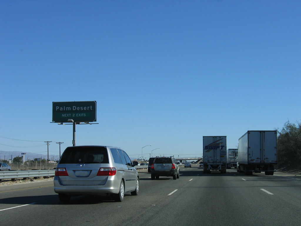
A mileage sign provides the distance to Palm Desert (seven miles) and Indian Wells (13 miles). Photo taken 11/10/06. |
 |
Prior to Exit 126 (Date Palm Drive), Interstate 10 enters the city of Cathedral City (population 42,647 as of the 2000 Census). Cathedral City is named for the Cathedral Canyon south of the city, and it was founded in 1925 and incorporated in 1981. Photo taken 11/10/06. |
 |
Eastbound Interstate 10 reaches Exit 126, Date Palm Drive south to Cathedral City. Photo taken 11/10/06. |
 |
Another mileage sign provides the distance to Indio (16 miles) and Blythe (113 miles). Photo taken 11/10/06. |
 |
Continuing southeast, the next exit along Interstate 10 is Exit 130, Ramon Road east to the unincorporated community of Thousand Palms and west to Palm Springs. This exit also connects to Bob Hope Drive south to Rancho Mirage. Photo taken 11/10/06. |
 |
Thousand Palms is an unincorporated community located north and east of Interstate 10. Home to 5,120 people as of the 2000 Census, Thousand Palms consists of approximately four square miles. To the south, Interstate 10 skirts the north edge of Rancho Mirage. The third incorporated city along the California 111 corridor in the Coachella Valley, Rancho Mirage was home to 13,249 people as of the 2000 Census. Photo taken 11/10/06. |
 |
All motorist services are available at Exit 130. To California 111, use Bob Hope Drive south from this interchange. Photo taken 11/10/06. |
 |
An advance sign for Exit 131, Monterey Avenue is posted prior to the off-ramp for Exit 130, Ramon Road and Bob Hope Drive. Photo taken 11/10/06. |
 |
Use Ramon Road west to the Agua Caliente Indian Reservation casino and Palm Springs International Airport. Photo taken 11/10/06. |
 |
Eastbound Interstate 10/Sonny Bono Memorial Freeway reaches Exit 130, Ramon Road and Bob Hope Drive. Photo taken 11/10/06. |
 |
The next exit along Interstate 10 east is Exit 131, Monterey Avenue south to the cities of Rancho Mirage and Palm Desert. Interstate 10 passes under the Ramon Road overpass. Photo taken 11/10/06. |
 |
Both Exit 131 (Monterey Avenue) and Exit 134 (Cook Street) serve the city of Palm Desert. The next city in a chain along the California 111 corridor, Palm Desert is home to 41,155 people as of the 2000 Census. Sitting at an elevation of 220 feet, Palm Desert brings Interstate 10 to a much lower elevation than the 2,600-foot elevation seen at the summit of San Gorgonio Pass. Interstate 10 does not get as low in elevation as Interstate 8 does in the Imperial Valley, but it still sees significant elevation difference between the pass and the Coachella Valley. Photo taken 11/10/06. |
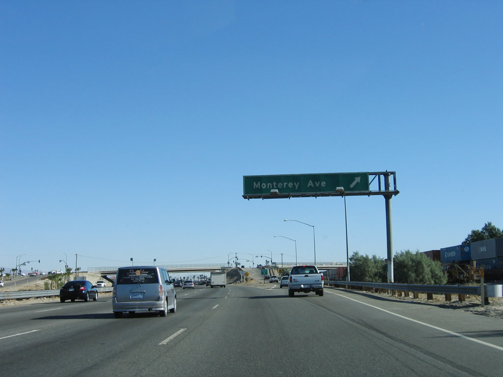 |
Eastbound Interstate 10/Sonny Bono Memorial Freeway reaches Exit 131, Monterey Avenue south to the cities of Rancho Mirage and Palm Desert. Use Monterey Avenue south to California 74 (Pines to Palms Highway). While California 74 does not currently connect to Interstate 10, Monterey Avenue is most direct path between the freeway and that scenic mountain highway. Photo taken 11/10/06. |
 |
At the top of the off-ramp to Exit 131, Monterey Avenue is this traffic signal. Turn right to Rancho Mirage and Palm Desert. Photo taken 11/10/06. |
 |
After the Monterey Avenue interchange, this mileage sign provides the distance to the cities of Indio (11 miles), Blythe (108 miles), and Phoenix (256 miles). This is the first mileage sign to list Phoenix as a control city along Interstate 10 east. Photo taken 11/10/06. |
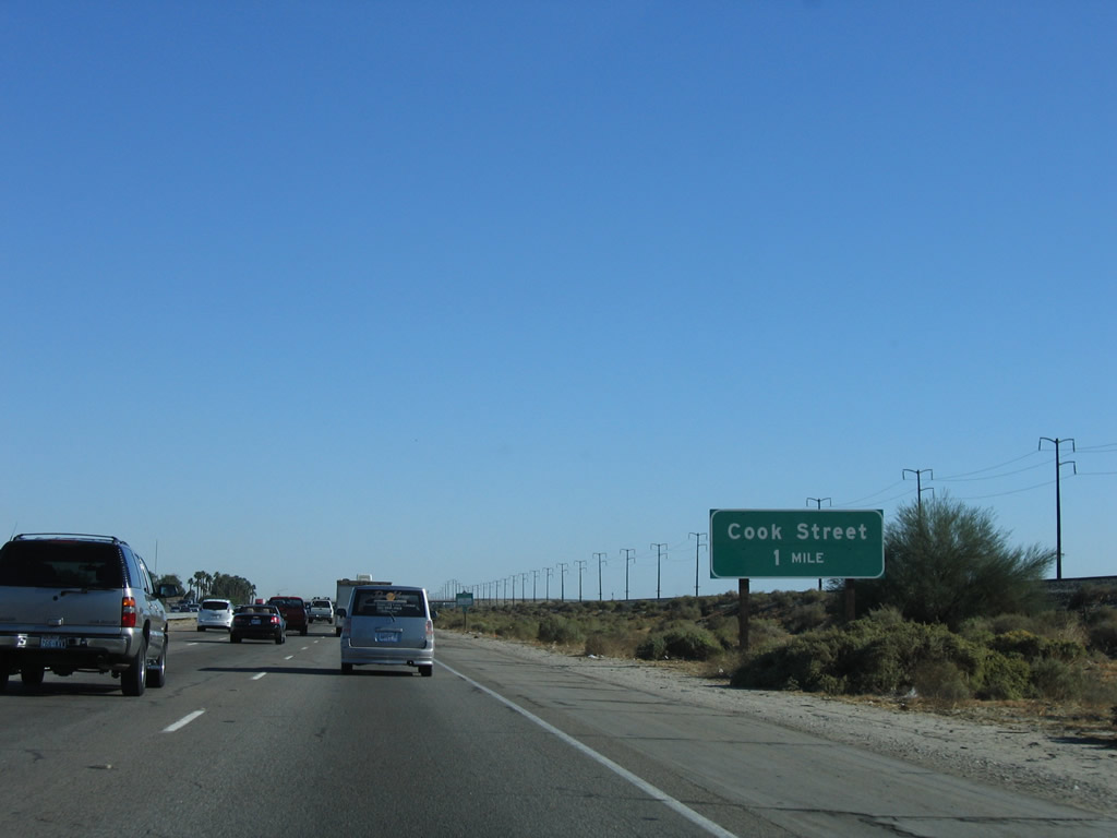 |
The next exit along Interstate 10 east is Exit 134, Cook Street (one mile). Photo taken 11/10/06. |
 |
Cook Street travels south through the city of Palm Desert, then enters the city of Indian Wells after crossing Fred Waring Drive (44th Avenue). The street (the former Avenue 44) is named after big band leader Fred Waring (of "Fred Waring & His Pennsylvanians" fame). Photo taken 11/10/06. |
 |
The right two lanes of Interstate 10 east connect to Exit 134, Cook Street; the left three lanes continue east toward Indio. Photo taken 11/10/06. |
 |
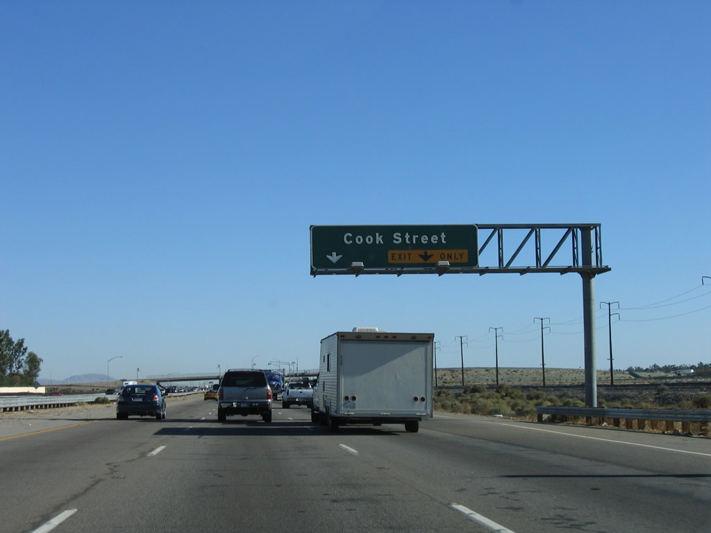
Eastbound Interstate 10/Sonny Bono Memorial Freeway reaches Exit 134, Cook Street. Photo taken 11/10/06. |
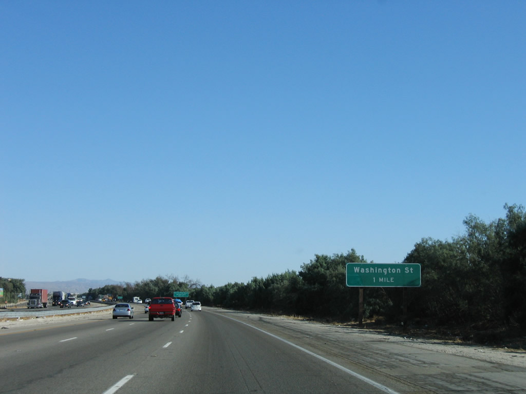 |
The next exit along Interstate 10/Sonny Bono Memorial Freeway east is Exit 137, Washington Street (one mile). Photo taken 11/10/06. |
 |
Use Exit 137, Washington Street to the eastern edge of the city of Palm Desert, and the unincorporated communities of Sun City Palm Desert and Bermuda Dunes Washington Street travels south to meet California 111 in the city of La Quinta. Photo taken 11/10/06. |
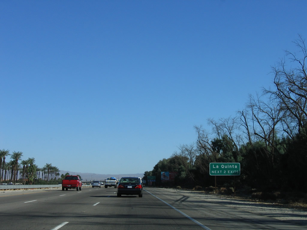 |
The next two exits serve the city of La Quinta. Incorporated in 1982, La Quinta has an estimated population of 30,450 in 2005, but it is growing rapidly. Photo taken 11/10/06. |
 |
Use Washington Street south to the city of Indian Wells. Photo taken 11/10/06. |
 |
Eastbound Interstate 10 reaches Exit 137, Washington Street north to Sun City Palm Desert and south to Palm Desert, Bermuda Dunes, La Quinta, and Indian Wells. Photo taken 11/10/06. |
 |
An Interstate 10 reassurance shield is posted after the on-ramp from Washington Street. Photo taken 11/10/06. |
 |
The next exit along Interstate 10/Sonny Bono Memorial Freeway east is Exit 139, Business Loop I-10 (Indio Boulevard) and U.S. 99 (one mile). Photo taken 05/07/06. |
 |
The next four exits along Interstate 10 east serve the city of Indio: Exit 139, Business Loop I-10 (Indio Boulevard) (Historic U.S. 99) and Jefferson Street; Exit 142, Monroe Street; Exit 143, Jackson Street; and Exit 144, Spur California 111/Golf Center Parkway south to California 111. Photo taken 05/07/06. |
 |
Business Loop I-10 follows Old U.S. 99 along Indio Boulevard southeast into downtown Indio. The business route parallels the railroad and passes under the Golf Center Parkway (Spur California 111) viaduct. After the viaduct, Business Loop I-10 and U.S. 99 meet California 111 and California 86 at the intersection with Avenue 46. Together, the four routes travel south on Indio Boulevard, then split at Dillon Road. Business Loop I-10 follows Dillon Road back to Interstate 10 at Exit 146, while U.S. 99, California 86, and California 111 enter the city of Coachella and eventually split within that city. As for Jefferson Street, that street plies due south from this interchange through Indio into La Quinta. Photo taken 05/07/06. |
 |
After following Business Loop I-10 (Indio Boulevard) southeast through Indio and Coachella, Historic U.S. 99 aims south along the California 86 corridor toward Brawley, Imperial, and El Centro. South of El Centro, old U.S. 99 transitions onto California 111 south, and then ends in downtown Calexico near the border crossing into Mexicali, Baja California Norte. Photo taken 05/07/06. |
 |
Jefferson Street travels due south, while Indio Boulevard travels southeast from this interchange. The railroad, which has paralleled Interstate 10 since leaving Los Angeles, will divert southeast from Indio toward Yuma, using a path roughly parallel to California 111. Photo taken 05/07/06. |
 |
Eastbound Interstate 10 reaches Exit 139, Business Loop I-10 and U.S. 99 (Indio Boulevard) southeast to Indio and Jefferson Street south to La Quinta. While Old U.S. 60-70 also departed at this interchange to follow Indio Boulevard and Dillon Road (and prior to that, Indio Boulevard and former California 195/Box Canyon Road), neither former U.S. route is signed with historical designation here. Photo taken 05/07/06. |
 |
At the time we took this series of pictures, the gore point did not indicate the exit number for Exit 139, Indio Boulevard (Business Loop 10) and Jefferson Street. Photo taken 05/07/06. |
 |
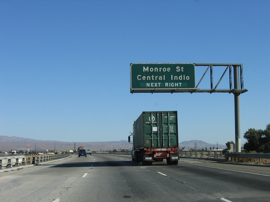
The next exit along Interstate 10 east is Exit 142, Monroe Street. For the first time, the pull-through overhead sign for Interstate 10 east includes the destinations of Blythe and Phoenix, Arizona (as opposed to "other Desert Cities"). Photo taken 11/10/06. |
 |
At this point, Interstate 10 enters the city of Indio, which became one of 12 townships within newly formed Riverside County in 1893. Settlers came to the Coachella Valley and grew slowly through the early 20th Century. In 1930, Indio incorporated with 1,875 residents; it was the first city formed in the Coachella Valley. Agriculture grew in the 1960s with the construction of the Coachella branch of the All-American Canal system, which conveys water from the Colorado River. Population continued to grow with the advent of air conditioning and as "snowbirds" and others relocated to this region. The population of Indio was 49,116 as the 2000 Census, and the city sits at an average elevation of -13 feet (or 13 feet below sea level). Photo taken 11/10/06. |
 |
Use Monroe Street south into downtown Indio, with a link to Business Loop I-10, U.S. 99, and Indio Boulevard. Photo taken 11/10/06. |
 |
To the Riverside County Fairgrounds, County Center, and Date Festival Grounds, take Monroe Street south to Avenue 46 (California 111) east or Dr. Carreon Boulevard east. Photo taken 11/10/06. |
 |
Eastbound Interstate 10 reaches Exit 142, Monroe Street to downtown Indio. The left three lanes continue east on Interstate 10. Photo taken 11/10/06. |
 |
The next exit along Interstate 10 east is Exit 143, Jackson Street. Photo taken 11/10/06. |
 |
Eastbound Interstate 10 reaches Exit 143, Jackson Street. Photo taken 11/10/06. |
 |
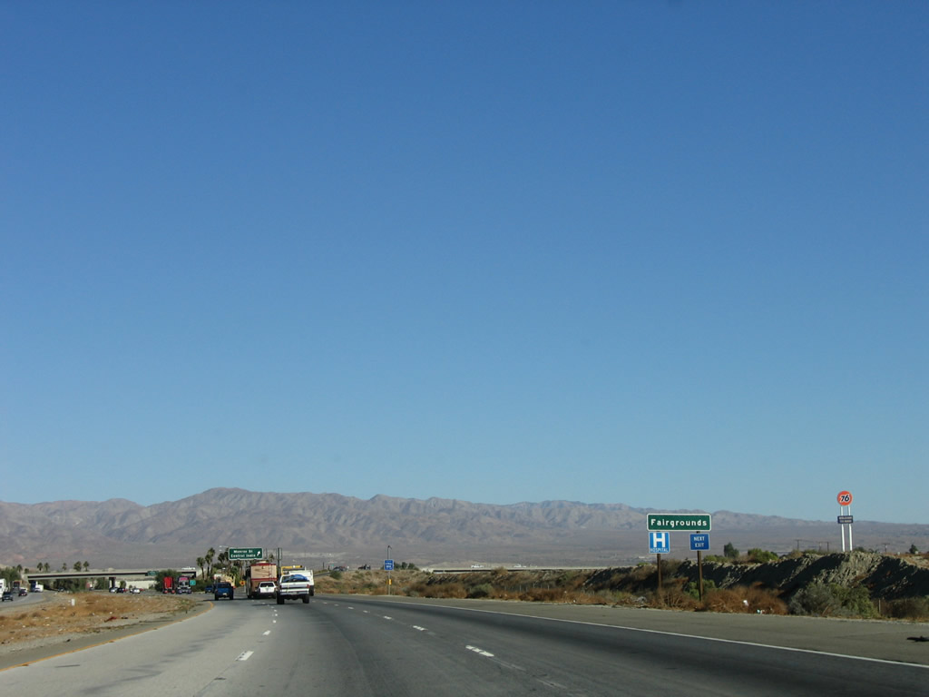
The next two exits along Interstate 10 east are Exit 144, Golf Center Parkway (To California 111) and Exit 145, California 86 Expressway south to Brawley and El Centro. Photo taken 11/10/06. |
 |
Golf Center Parkway is a short connector from Interstate 10 to California 111 in downtown Indio. Use this exit to the Cabazon Indian Reservation. Photo taken 11/10/06. |
 |
Eastbound Interstate 10 reaches Exit 144, Golf Center Parkway (Spur California 111). Golf Center Parkway travels south to California 111 (Indio Boulevard) through downtown Indio. California 111 eventually becomes Grapefruit Boulevard upon entering the city of Coachella. For through traffic on California 86 south, use Exit 145. Photo taken 11/10/06. |
 |
This mileage sign provides the distance to Blythe (96 miles) and Phoenix (245 miles). There's still plenty of desert to traverse en route to Phoenix. Photo taken 11/10/06. |
 |
The right two lanes of Interstate 10 east will connect to Exit 145, California 86 Expressway south to Brawley and El Centro. California 86 was officially shifted to the expressway alignment in December 2012 when the California 86S ("S" stood for "Supplemental Route") was renamed as California 86, and all of the original California 86 mileage through Indio and Coachella had been successfully turned over to the local municipalities and Riverside County. By 2012, an exit number tab was affixed to this sign, and the guide sign again changed in December 2012 with the shift of California 86S to California 86. Photo taken 11/10/06. |
 |
Use Exit 145 to follow California 86 south to California 111 south to the east shore of the Salton Sea and the state recreation area. California 86 offers a high-speed connection between the Coachella Valley and Imperial Valley along the west shore of the Salton Sea, maintaining at least two lanes in each direction throughout its route to Brawley and directly connecting to California 78 (Brawley Bypass) to connect with the California 111 Expressway. California 86 follows a path previously tread by U.S. 99. Photo taken 11/10/06. |
 |
Eastbound Interstate 10 reaches Exit 145, California 86 Expressway south to Brawley and El Centro. Interstate 10 continues traveling east toward Blythe and Phoenix generally along the path of Old U.S. 60-70. Photo taken 11/10/06. |
 |
The bridge connecting northbound California 86 with westbound Interstate 10 passes over the eastbound freeway. Photo taken 11/10/06. |
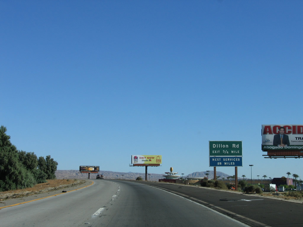 |
The next exit along Interstate 10 east is Exit 146, Business Loop I-10 (Dillon Road) (0.75 mile) west to Coachella and Dillon Road north to unincorporated Indio Hills. Photo taken 11/10/06. |
 |
All motorist services (food, gas, lodging) and a casino are located at Exit 146. Photo taken 11/10/06. |
 |
Interstate 10 leaves Indio and enters the city of Coachella. Most of Coachella lies southwest of Interstate 10 on California 86 and Avenue 52. Coachella had 22,724 people as of the 2000 Census and has an estimated 30,764 residents as of a 2005 estimate. The city's area consists of 32 square miles. Photo taken 11/10/06. |
 |
Eastbound Interstate 10 reaches Exit 146, Business Loop I-10 (Dillon Road) west to Coachella and Dillon Road north to unincorporated Indio Hills. This is the last interchange with services for 28 miles. Photo taken 11/10/06. |

Page Updated March 17, 2013.
|
About Contact Glossary |
In The News Testimonials Interstate Guide |
Social Media:
 |
|
© 2000-23 AARoads.com | All Rights Reserved | Privacy Policy / Terms of Use
|
||