

Interstate 10 West - Kellogg Interchange to California 19
| Interstate 10 (San Bernardino Freeway) west | |
|---|---|
 |
After Exit 41 (Kellogg Drive) and leaving Kellogg Hill and the Kellogg Interchange (California 57 and California 71) behind, the next exit along Interstate 10 (San Bernardino Freeway) west is Exit 40, Via Verde east to the city of San Dimas. Interstate 10 skirts the southern edge of San Dimas (population 34,980 as of 2000 Census and incorporated on August 4, 1960). Via Verde crosses California 57 then ends at Frank G. Bonelli Regional County Park. Photo taken 06/17/06. |
 |
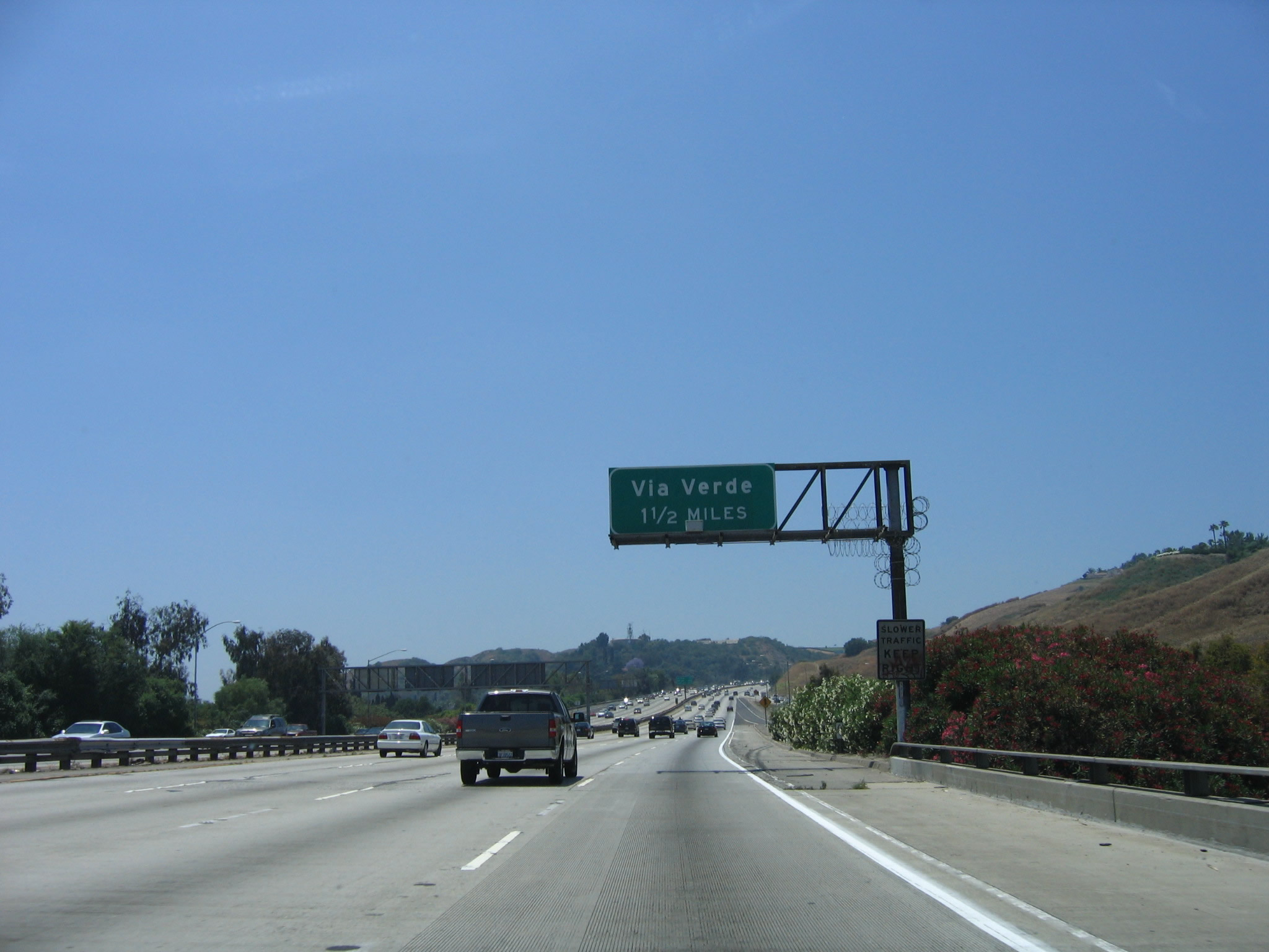
As traffic from California 57 and California 71 merge onto Interstate 10 west, this mileage sign provides the distance to the next three exits: Exit 40, Via Verde; Exit 38B, Holt Avenue; and Exit 38A, Grand Avenue. Interstate 10 now enters the San Gabriel Valley, and it will remain in this valley until near the Interstate 710 interchange. Photo taken 06/17/06. |
 |
The next exit along Interstate 10 (San Bernardino Freeway) is Exit 40, Via Verde. The right lane ends. Photo taken 06/17/06. |
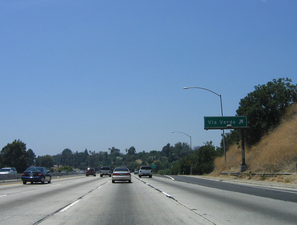 |
Westbound Interstate 10 (San Bernardino Freeway) reaches Exit 40, Via Verde. Photo taken 06/17/06. |
 |
This mileage sign provides the distance to the next three exits along westbound Interstate 10 (San Bernardino Freeway): Exit 38B, Holt Avenue; Exit 38A, Grand Avenue; and Exit 37B, Barranca Street. Photo taken 06/17/06. |
 |
The next five exits along Interstate 10 west serve the city of Covina. The population was 46,837 as of the 2000 Census and was incorporated on August 14, 1901. While Interstate 10 only skirts the southern edge of Covina, it will soon enter the city of West Covina. Photo taken 06/17/06. |
 |
And so, the next nine exits along Interstate 10 west serve the city of West Covina. The population was 105,080 as of the 2000 Census and was incorporated on February 17, 1923. Interstate 10 will enter West Covina at Exit 38B and depart near Exit 33. Photo taken 06/17/06. |
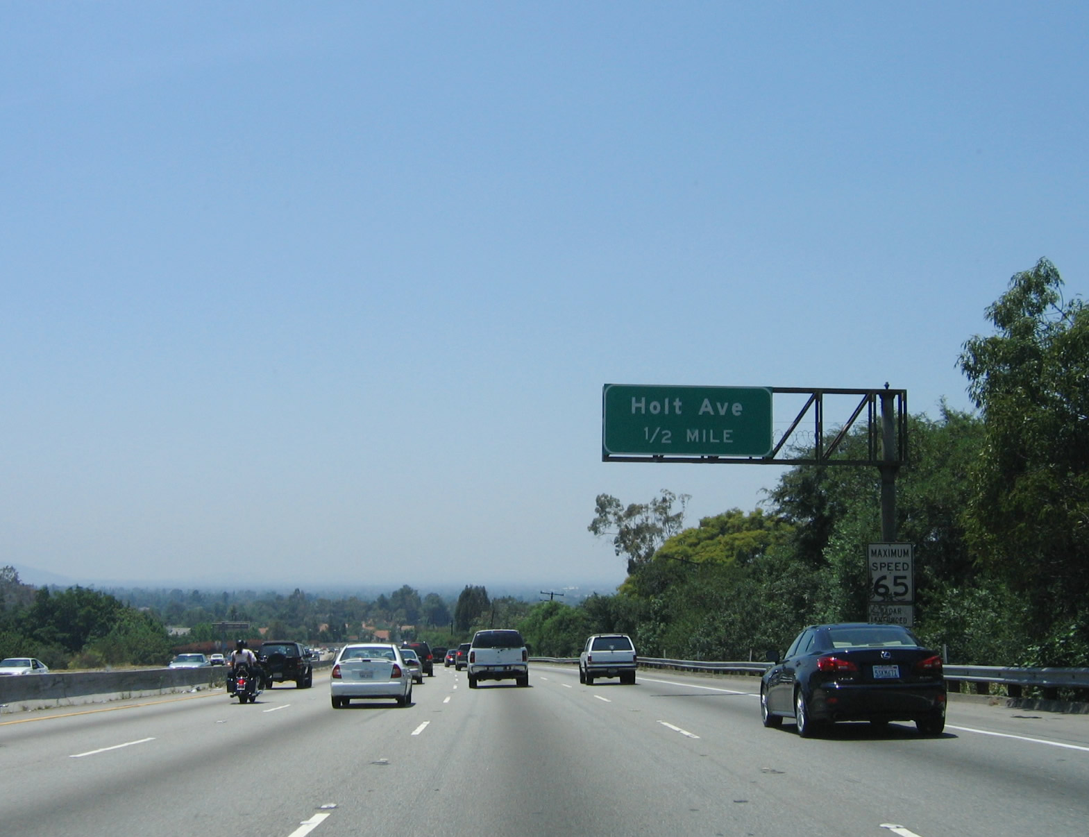 |
The next exit along Interstate 10 (San Bernardino Freeway) is Exit 38B, Holt Avenue (one-half mile). Photo taken 06/17/06. |
 |
Westbound Interstate 10 (San Bernardino Freeway) reaches Exit 38B, Holt Avenue. This east-west city street connects to Garvey Avenue, which parallels the freeway west toward Los Angeles. Photo taken 06/17/06. |
 |
The next exit along Interstate 10 (San Bernardino Freeway) is Exit 38A, Grand Avenue. Use Grand Avenue south to the city of Walnut. Photo taken 06/17/06. |
 |
This mileage sign provides the distance to the next three exits along westbound Interstate 10 (San Bernardino Freeway): Exit 38A, Grand Avenue; Exit 37B, Barranca Street; and Exit 37A, Citrus Street. Photo taken 06/17/06. |
 |
Westbound Interstate 10 (San Bernardino Freeway) reaches Exit 38A, Grand Avenue. The next exit is Exit 37B, Barranca Street. Photo taken 06/17/06. |
 |
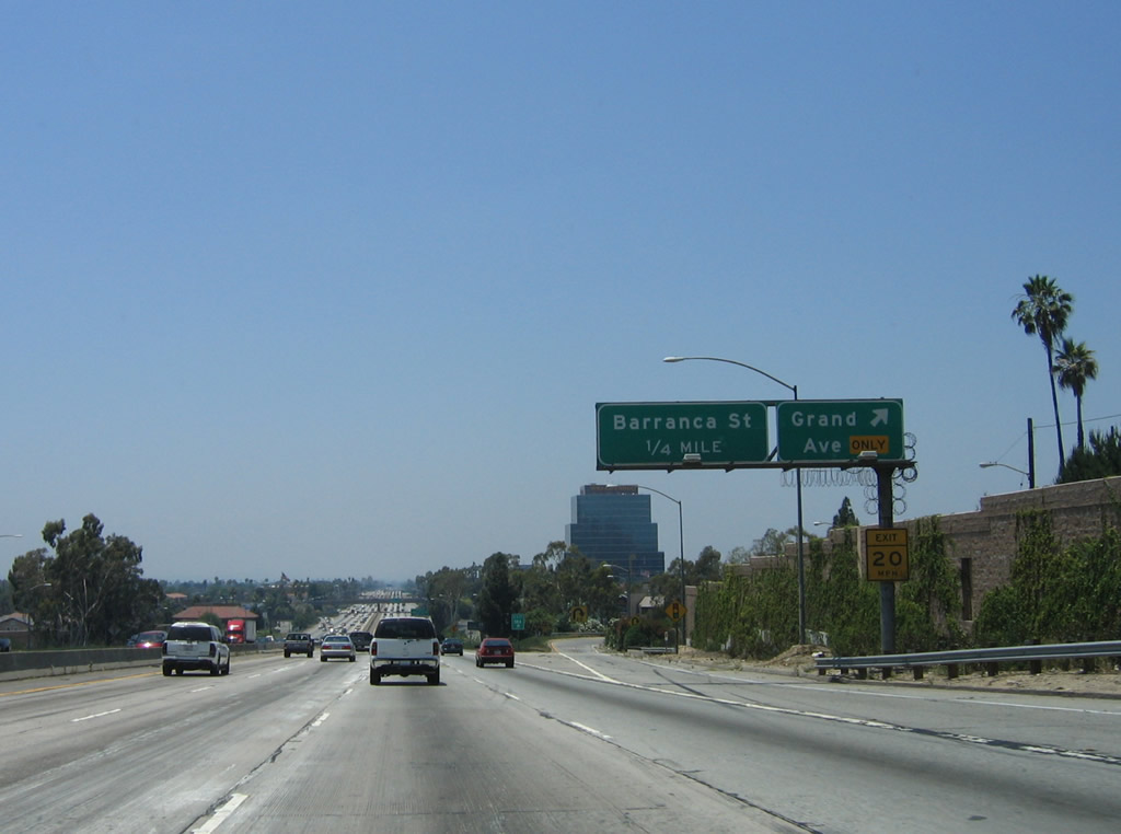
Immediately thereafter, westbound Interstate 10 (San Bernardino Freeway) reaches Exit 37B, Barranca Street, still in the city of West Covina. Photo taken 06/17/06. |
 |
This mileage sign along Interstate 10 (San Bernardino Freeway) west provides the distance to the next three exits: Exit 37A, Citrus Street; Exit 36, California 39/Azusa Avenue; and Exit 35, Vincent Avenue. Photo taken 06/17/06. |
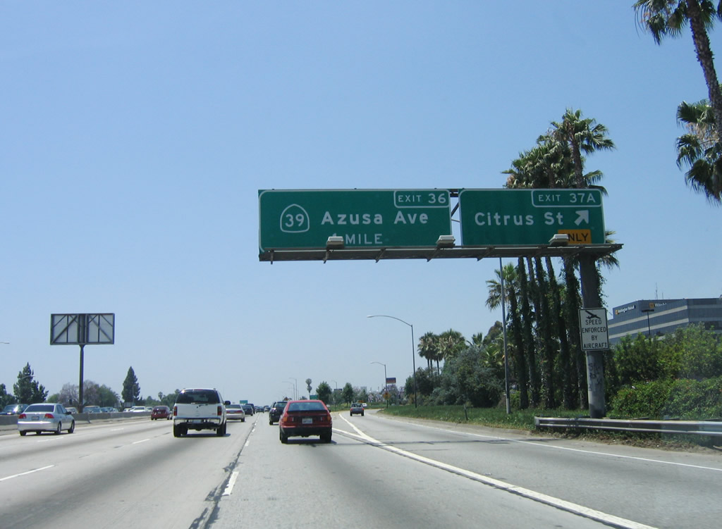 |
Westbound Interstate 10 (San Bernardino Freeway) reaches Exit 37A, Citrus Street. The next exit along westbound is Exit 36, California 39/Azusa Avenue. Photo taken 06/17/06. |
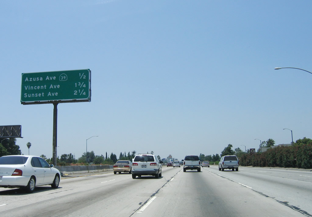 |
This mileage sign along Interstate 10 (San Bernardino Freeway) west provides the distance to the next three exits: Exit 36, California 39/Azusa Avenue; Exit 35, Vincent Avenue; and Exit 34B, Sunset Avenue. Photo taken 06/17/06. |
 |
The right lane becomes exit only for Exit 36, California 39/Azusa Avenue. California 39 travels north from this interchange along Azusa Avenue into the city of Azusa and then north into San Gabriel Canyon in the Angeles National Forest. Although California 39 was intended to continue north all the way to California 2 (Angeles Crest Highway), the steep terrain and landslides have prevented the two state routes from linking. Therefore, California 39 is not a through route and dead ends before meeting California 2. Another section of California 39 is signed south of La Habra in Orange County; that segment does not connect with this northern segment. While plans call for the two segments to connect eventually, it is doubtful that will ever happen. Photo taken 06/17/06. |
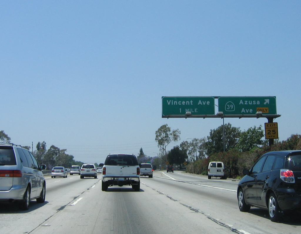 |
Westbound Interstate 10 (San Bernardino Freeway) reaches Exit 36, California 39/Azusa Avenue. The next exit along westbound is Exit 35, Vincent Avenue. Photo taken 06/17/06. |
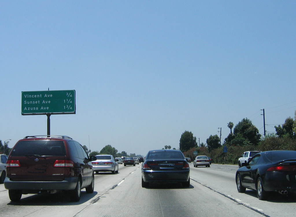 |
This mileage sign along Interstate 10 (San Bernardino Freeway) west provides the distance to the next three exits: Exit 35, Vincent Avenue; Exit 34B, Sunset Avenue; and Exit 34A, Pacific Avenue, West Covina Parkway, and Orange Avenue. Despite what this sign says, the third exit is not for Azusa Avenue, as we just passed that interchange! Photo taken 06/17/06. |
 |
The right lane becomes exit only for Exit 35, Vincent Avenue. Photo taken 06/17/06. |
 |
Westbound Interstate 10 (San Bernardino Freeway) reaches Exit 35, Vincent Avenue. The next exit along westbound is Exit 34B, Sunset Avenue. Traffic continued to thicken as the morning led into early afternoon. Photo taken 06/17/06. |
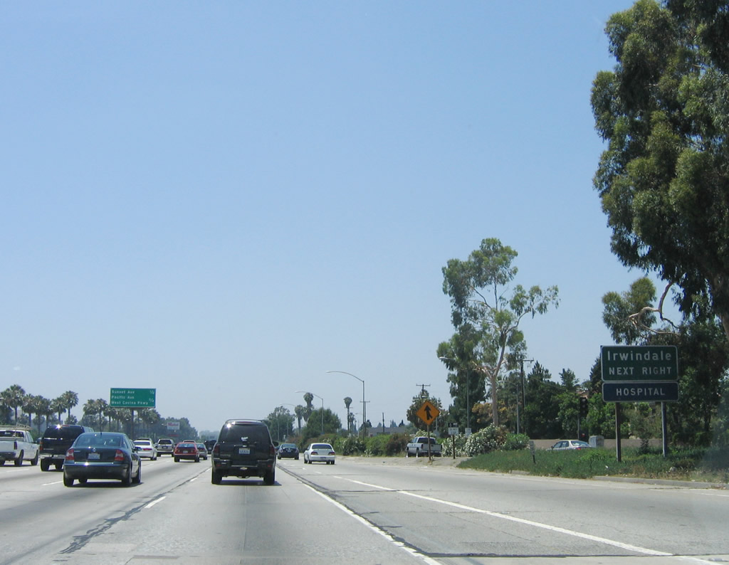 |
The next exit along Interstate 10 west is Exit 34B, Sunset Avenue. Use Sunset Avenue north to the city of Irwindale. (Upon entering Irwindale, Sunset Avenue changes names to Irwindale Avenue.) Photo taken 06/17/06. |
 |
This mileage sign along Interstate 10 (San Bernardino Freeway) west provides the distance to the next two exits: Exit 34B, Sunset Avenue and Exit 34A, Pacific Avenue, West Covina Parkway, and Orange Avenue. Photo taken 06/17/06. |
 |
Westbound Interstate 10 reaches Exit 34B, Sunset Avenue. The next exit along westbound is Exit 34A, Pacific Avenue, West Covina Parkway, and Orange Avenue. Photo taken 06/17/06. |
 |
This mileage sign along Interstate 10 (San Bernardino Freeway) west provides the distance to the next two exits: Exit 34A, Pacific Avenue, West Covina Parkway, and Orange Avenue and Exit 33, Merced Avenue and Puente Avenue. Photo taken 06/17/06. |
 |
Westbound Interstate 10 (San Bernardino Freeway) reaches Exit 34A, Pacific Avenue, West Covina Parkway, and Orange Avenue. The exit ramp connects directly to a traffic signal. Turn left to follow Pacific Avenue northwest to the city of Baldwin Park. Turn right to follow West Covina Parkway east. Continue straight to connect to Garvey Avenue east or Orange Avenue north. The next off-ramp from westbound is Exit 33, Merced Avenue and Puente Avenue. Photo taken 06/17/06. |
 |
This mileage sign along Interstate 10 (San Bernardino Freeway) west provides the distance to the next three exits: Exit 33, Merced Avenue and Puente Avenue; Exit 32B, Francisquito Avenue; and Exit 32A, Baldwin Park Boulevard. A green overlay covers the former state route designation for Puente Avenue: California 35. Prior to 1964, Puente Avenue was designated as California 35, and that designation was moved to the San Gabriel Freeway. The freeway today is known as Interstate 605, and the California 35 designation was transferred to Skyline Boulevard in the San Francisco Bay Area. Photo taken 06/17/06. |
 |
The right lane becomes exit only for Exit 33, Puente Avenue. The former state route only traveled south from this interchange. California 35 follows Puente Avenue, Workman Mill Road, Norwalk Boulevard, San Antonio Drive, Pioneer Boulevard, Norwalk Boulevard, and Los Alamitos Boulevard to its end at California 22 near Seal Beach between Long Beach and Westminster. With the construction of Interstate 605 (San Gabriel River Freeway), California 35 transferred from the surface streets to the new freeway ... and then promptly renumbered to match the then-new Interstate highway designation. Photo taken 06/17/06. |
 |
The next four exits serve the city of Baldwin Park. Baldwin Park had a population of 75,837 as of the 2000 Census. The city was incorporated on January 25, 1956, and consists of 6.8 square miles. Around Exit 33, Interstate 10 leaves West Covina and enters Baldwin Park. Photo taken 06/17/06. |
 |
Westbound Interstate 10 (San Bernardino Freeway) reaches Exit 33, Merced Avenue and Puente Avenue. The next exit along westbound is Exit 32B, Francisquito Avenue. Photo taken 06/17/06. |
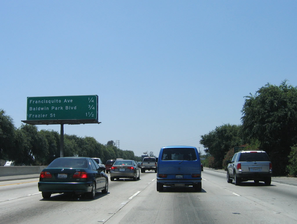 |
This mileage sign along Interstate 10 (San Bernardino Freeway) west provides the distance to the next three exits: Exit 32B, Francisquito Avenue; Exit 32A, Baldwin Park Boulevard; and Exit 31B, Frazier Street. Photo taken 06/17/06. |
 |
Westbound Interstate 10 (San Bernardino Freeway) reaches Exit 32B, Francisquito Avenue. Photo taken 06/17/06. |
 |
The next exit along Interstate 10 (San Bernardino Freeway) west is Exit 32A, Baldwin Park Boulevard (one-quarter mile). Photo taken 06/17/06. |
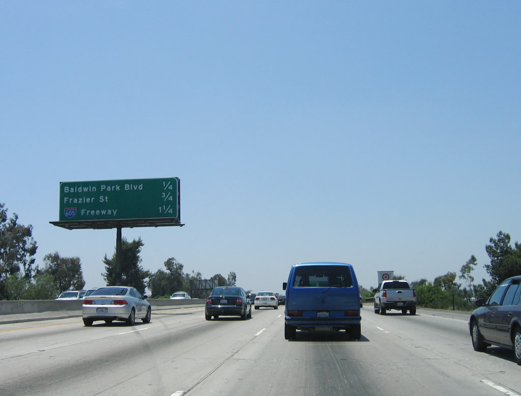 |
Another interchange sequence sign along Interstate 10 (San Bernardino Freeway) west provides the distance to the next three exits: Exit 32A, Baldwin Park Boulevard; Exit 31B, Frazier Street; and Exit 31A, Interstate 605 (San Gabriel River Freeway). Photo taken 06/17/06. |
 |
Westbound Interstate 10 (San Bernardino Freeway) reaches Exit 32A, Baldwin Park Boulevard. The next exit is Exit 31B, Frazier Street. Photo taken 06/17/06. |
 |
This interchange sequence sign along Interstate 10 (San Bernardino Freeway) west provides the distance to the next three exits: Exit 31B, Frazier Street; Exit 31A, Interstate 605 (San Gabriel River Freeway); and Exit 30, Garvey Avenue (old U.S. 60-70-99) to Durfee Avenue. Photo taken 06/17/06. |
 |
Westbound Interstate 10 (San Bernardino Freeway) reaches Exit 31B, Frazier Street. The next interchange along westbound is Exit 31A, Interstate 605 (San Gabriel River Freeway). Photo taken 06/17/06. |
 |
The right two lanes of Interstate 10 west connect to Exit 31A, Interstate 605 (San Gabriel River Freeway). Use Interstate 605 north to Duarte and south to Seal Beach. Interstate 605 was constructed in stages between 1964 and 1971. Prior to 1971, this interchange served as the northern terminus. In 1971, the freeway was extended north, initially designated as California 243 and later added to the Interstate Highway System as a northern extension of Interstate 605. Photo taken 06/17/06. |
 |
The next three exits along Interstate 10 west are Exit 31A, Interstate 605 (San Gabriel River Freeway); Exit 30, Garvey Avenue to Durfee Avenue in El Monte; and Exit 29C, Stewart Street to Peck Road north. Photo taken 06/17/06. |
 |
Westbound Interstate 10 (San Bernardino Freeway) reaches Exit 31A, Interstate 605 (San Gabriel River Freeway). This freeway to freeway connection includes flyover ramps to both directions of Interstate 605. After this interchange, set of Southern California Edison (SCE) power lines will cross over Interstate 10; these lines generally parallel Interstate 605 south toward the Whittier Narrows. After passing through the Interstate 605 interchange, Interstate 10 will cross over the San Gabriel River, which is the namesake for the San Gabriel Valley. The valley extends from Kellogg Hill west to Monterey Pass in the city of Monterey Park. Photo taken 06/17/06. |
 |
The next exit along Interstate 10 west is Exit 30, Garvey Avenue to Durfee Avenue in El Monte. Garvey Avenue, which is Old U.S. 60-70-99, was considered to be a "superhighway" in late 1930s along certain sections in the city of Monterey Park. According to Casey Cooper's excellent Historic U.S. Highways/California U.S. 99 page: "The new alignment (now Interstate 10) was called Garvey Ave and it lasted until 1956, when the freeway was paved over it and Garvey Ave was relegated to the status of frontage road. This continues to the Garvey Ave separation, just west of the San Gabriel River (this is now known as Exit 30). US 99 followed Garvey Ave to what was then Ramona Blvd which is now under I-10 east of Los Angeles. There is an interesting old concrete arch bridge which dates from the 1932 that creates the separation of Garvey Ave and Monterey Pass Rd/Fremont Ave in Monterey Park. Just beyond this, Garvey Ave merges with the I-10 freeway. The sharp curve along Garvey Ave just to the east of the intersection with the I-10 frontage road (near the modern Interstate 710 interchange) was part of the original alignment. Before the freeway, it was a left turn onto Ramona Blvd., which has since been covered by the freeway." Photo taken 06/17/06. |
 |
Westbound Interstate 10 (San Bernardino Freeway) reaches Exit 30, U.S. 60-70-99/Garvey Avenue west to Durfee Avenue. Old U.S. 60-70-99 follows Garvey Avenue between Exits 30 and 21. At this point, Interstate 10 leaves Baldwin Park and enters the city of El Monte, which had a population of 115,965 as of the 2000 Census, sits at an elevation of 299 feet, consists of 9.7 square miles, and was incorporated on November 18, 1912. The next exit along westbound Interstate 10, which now follows the original Ramona Parkway (predecessor to the San Bernardino Freeway), is Exit 29C, Stewart Street to Peck Road north. Photo taken 06/17/06. |
 |
The next three exits along Interstate 10 west are Exit 29C, Stewart Street to Peck Road north; Exit 29B, Valley Boulevard; and Exit 29A, Peck Road south. Each of these exits serve the city of El Monte. Photo taken 06/17/06. |
 |
Westbound Interstate 10 (San Bernardino Freeway) reaches Exit 29C, Stewart Street to Peck Road north. The next exit is Exit 29B, Valley Boulevard and Exit 29A, Peck Road south. Photo taken 06/17/06. |
 |
Quickly thereafter, Interstate 10 (San Bernardino Freeway) meets Exit 29B, Valley Boulevard. The next off-ramp is Exit 29A, Peck Road south in El Monte. Photo taken 06/17/06. |
 |
And then Interstate 10 (San Bernardino Freeway) west reaches Exit 29A, Peck Road south. Photo taken 06/17/06. |
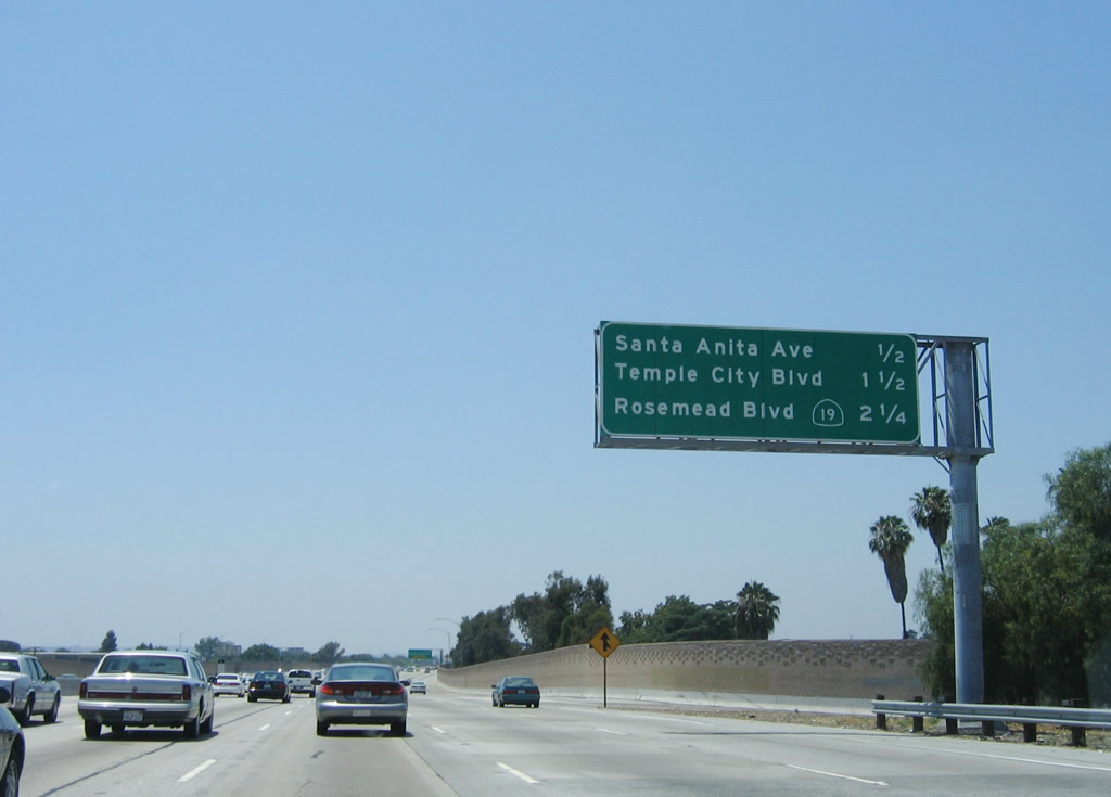 |
The next three exits along Interstate 10 (San Bernardino Freeway) west are Exit 28, Santa Anita Avenue (to south to the city of South El Monte and north to El Monte Airport); Exit 27, Temple City Boulevard north to the city of Temple City; and Exit 26B, California 19 (California 164)/Rosemead Boulevard north to Rosemead and south to the Whittier Narrows. Photo taken 06/17/06. |
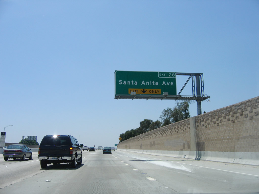 |
The right lane of Interstate 10 west becomes exit only for Exit 28, Santa Anita Avenue. Use Santa Anita Avenue south to the city of South El Monte and north to El Monte Airport, the city of Arcadia, and Santa Anita Park (race track). Photo taken 06/17/06. |
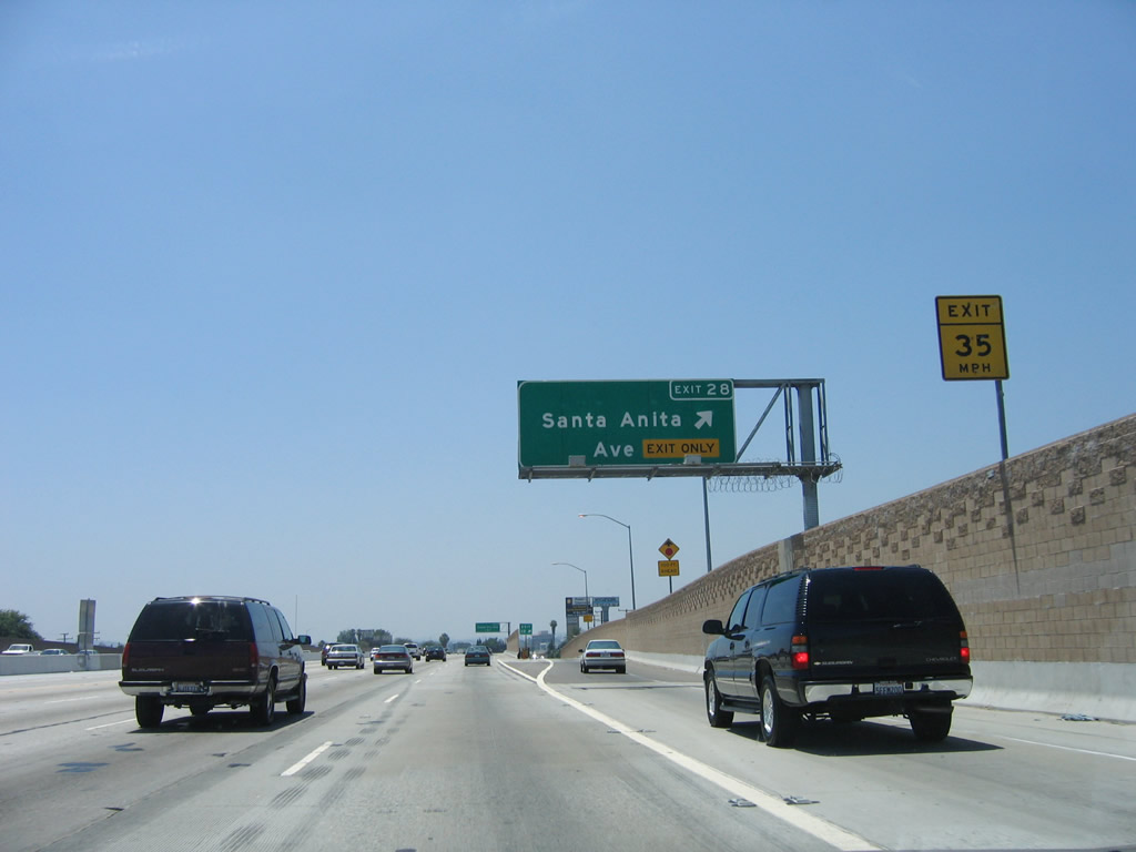 |
Westbound Interstate 10 (San Bernardino Freeway) reaches Exit 28, Santa Anita Avenue. While Interstate 10 stays north of South El Monte, California 60 passes directly through that city. Santa Anita Avenue connects with Tyler Avenue, then passes through downtown South El Monte before connecting with California 60 at Exit 10B. The city of South El Monte had a population of 21,144 as of the 2000 Census, was incorporated on July 30, 1958, and consists of 2.89 square miles. Photo taken 06/17/06. |
 |
The next exit along Interstate 10 (San Bernardino Freeway) west is Exit 27, Temple City Boulevard. As the name implies, Temple City Boulevard travels north to the city of Temple City(population 33,377 as of 2000 Census). Temple City incorporated on May 20, 1960, and consists of 4.01 square miles. Photo taken 06/17/06. |
 |
A roadside sign posts the destinations of both Temple City and Rosemead. Interstate 10 will leave the city of El Monte and enter the city of Rosemead after passing by the Baldwin Avenue interchange (no access to Baldwin Avenue from westbound Interstate 10). The city of Rosemead had a population of 53,505 as of the 2000 Census and was incorporated on August 4, 1959. The next five exits (27, 26B, 26A, 25B, and 25A) all serve the city of Rosemead. Photo taken 06/17/06. |
 |
Westbound Interstate 10 (San Bernardino Freeway) reaches Exit 27, Temple City Boulevard. The next exit along westbound is Exit 28B, California 19 (Rosemead Boulevard). Around this point, the Busway begins in the middle of Interstate 10. This high occupancy vehicle (HOV) lane requires three or more vehicle occupants or buses for use. Photo taken 06/17/06. |
 |
A sign indicates that using the Busway can result in an average of 20 minutes of travel savings each day. It would be nice if the sign offered a phone number or other instructions on how to use the Busway, since very few such signs are posted along the westbound mainline. The Busway and the Metrolink commuter rail corridor remain in the median between here and Interstate 710; they will shift onto a separate alignment after that interchange for the final distance to downtown Los Angeles. Photo taken 06/17/06. |
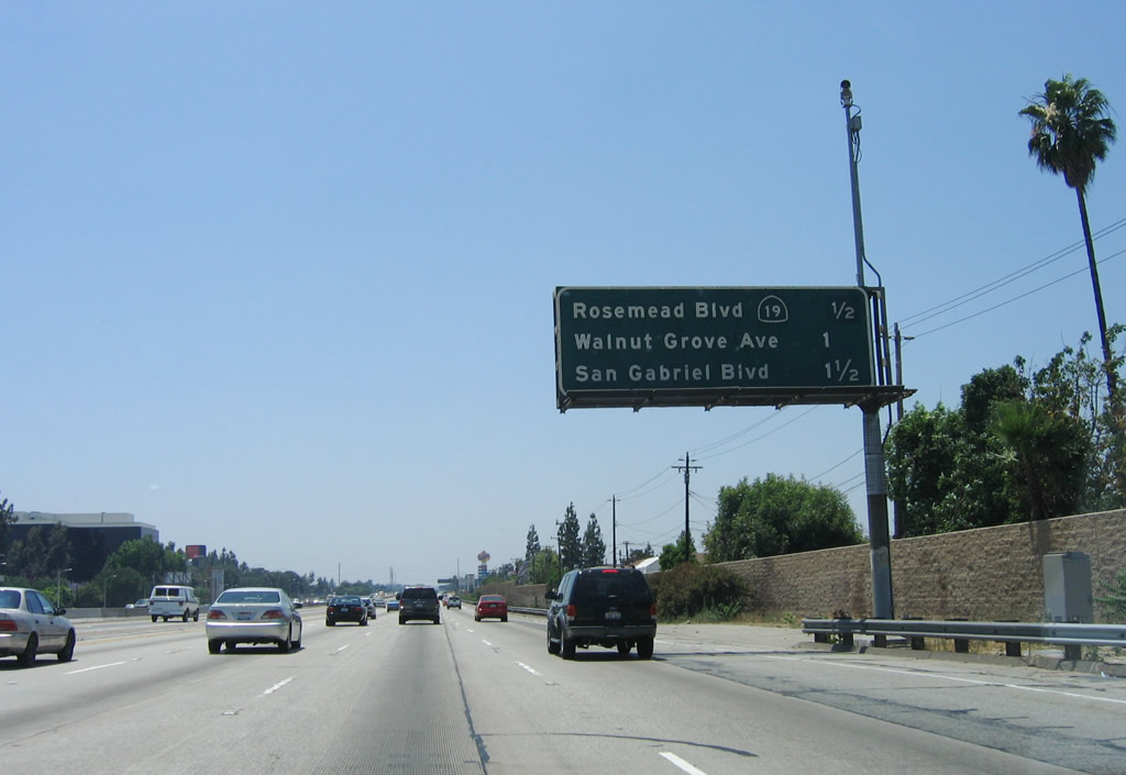 |
This mileage sign provides the distance to the next three exits along Interstate 10 (San Bernardino Freeway) (former Ramona Parkway): Exit 26B, California 19 (California 164)/Rosemead Boulevard; Exit 26A, Walnut Grove Avenue; and Exit 25B, San Gabriel Boulevard. Photo taken 06/17/06. |
 |
Westbound Interstate 10 (San Bernardino Freeway) reaches Exit 26B, California 19 (California 164)/Rosemead Boulevard. California 19 is a state route that extends from the Los Alamitos Traffic Circle (intersection with California 1 (Pacific Coast Highway)) in Long Beach north to Interstate 210 (Foothill Freeway) in eastern Pasadena. While the route is still signed along its route on Lakewood Boulevard and Rosemead Boulevard, portions have been decommissioned to local control, with cities along the route taking over maintenance. The section of California 19 between Whittier Boulevard (former U.S. 101 and California 72) and Interstate 210 is legislatively defined as California 164, but the route is signed as California 19 to provide route numbering consistency. The intent of California 164 is to provide a direct link from Interstate 605 to Rosemead Boulevard in Pico Rivera south of Whittier Narrows. However, that link is unconstructed, so California 19 remains the signed route. It is not clear if California 164's missing link would ever be constructed. Photo taken 06/17/06. |

Page Updated February 1, 2009.
|
About Contact Glossary |
In The News Testimonials Interstate Guide |
Social Media:
 |
|
© 2000-23 AARoads.com | All Rights Reserved | Privacy Policy / Terms of Use
|
||