| Interstate 15/Mojave Freeway south |
|
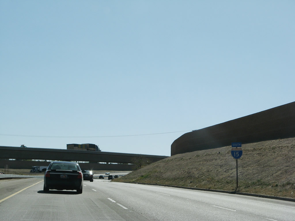
This Interstate 15 south reassurance shield is posted after the on-ramp from Exit 183 (Business 15). The flyover ramp in the distance carries traffic from Interstate 40 west to Interstate 15 south. Photo taken 03/31/08. |
|
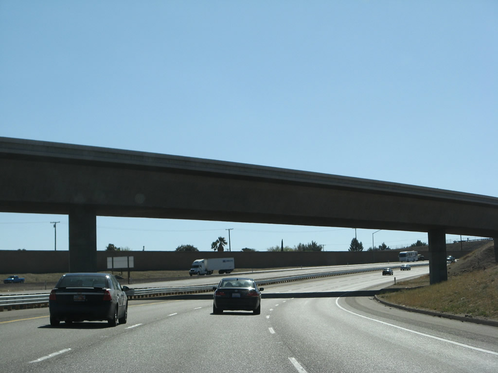
The three lanes of Interstate 15 south turn a bit to the west as the freeway passes under the Interstate 40 west transition ramp. Photo taken 03/31/08. |
|
Transcontinental Interstate 40 comes to an end as its westbound lanes merge onto southbound Interstate 15/Mojave Freeway. The left three lanes continue south on Interstate 15, while the right lanes connect to California 247 south (Exit 183) and eventually California 58 west (Exit 179). California 58 is a freeway/expressway combination (with a few two-lane sections) that extends west from Barstow to Bakersfield via Boron, Mojave, and Tehachapi. Photo taken 03/31/08. |
|
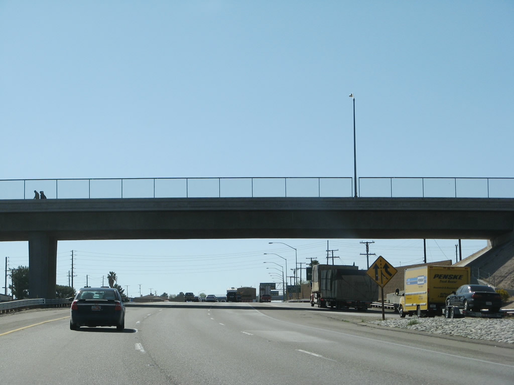
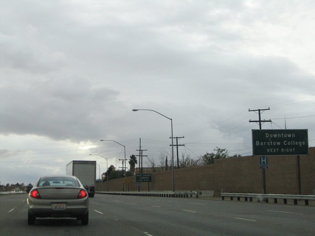
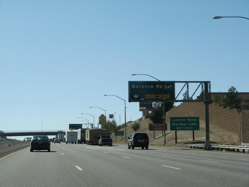
Interstate 15 continues west from the merge with Interstate 40 toward downtown Barstow. Crossing paths with the freeway ahead is California 247 (Barstow Road). Use Barstow Road north for the central business district and Barstow College. Photo taken 10/19/04. |
|
A two-lane off-ramp departs Interstate 15 ahead for California 247 (Barstow Road). California 247 travels south 33 miles from Barstow to Lucerne Valley. There the highway meets California 18. California 18 continues the journey southward 23 miles to Big Bear Lake in the San Bernardino Mountains. Photo taken 03/31/08. |
|
Interstate 15 (Barstow Freeway) enters the Exit 183 partial-cloverleaf interchange with California 247 (Barstow Road). California 247 ends at the freeway but Barstow Road continues north 0.8 miles to Main Street (old U.S. 66). Photo taken 03/31/08. |
|
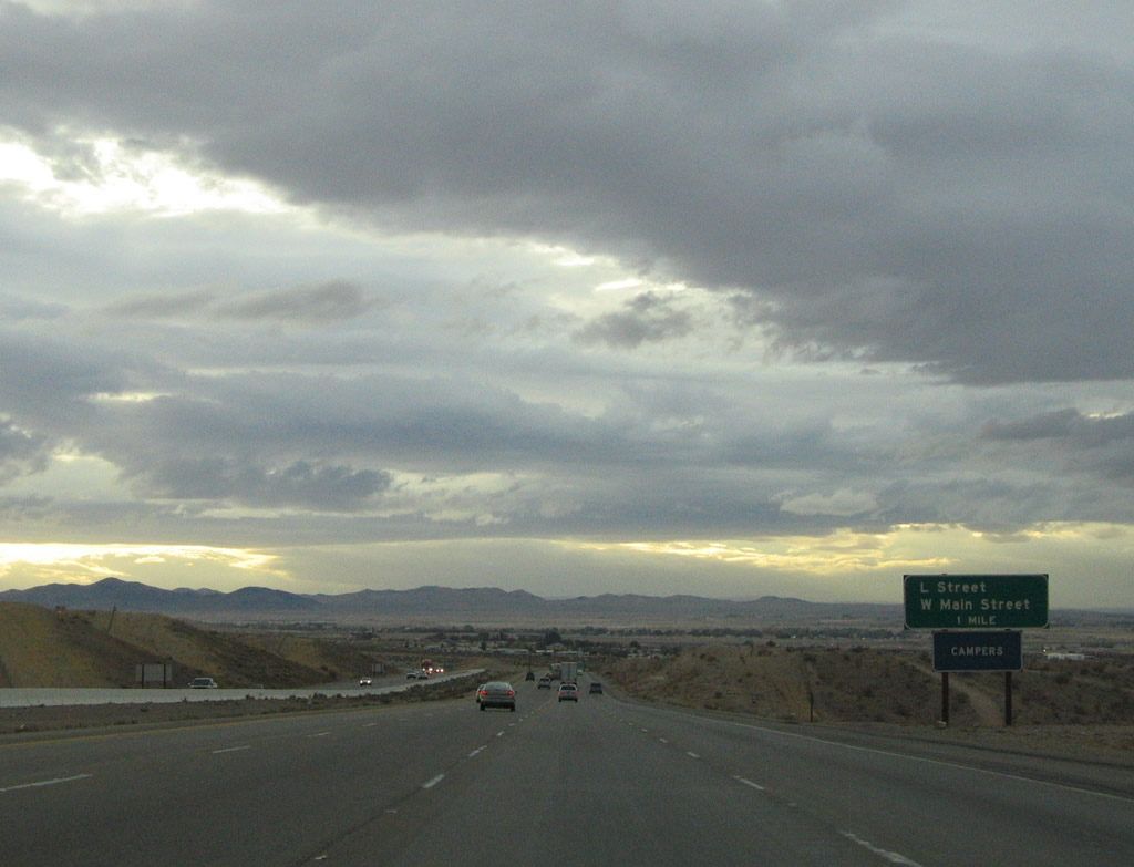
Interstate 15 carries eight overall lanes through the city of Barstow. Pictured here is the one mile approach to L Street (Exit 181) on southbound. L Street provides a direct connection to Main Street (old U.S. 66). Iron Mountain lies along the horizon. Photo taken 10/19/04. |
|
Southbound near the Exit 181 diamond interchange with L Street. The interchange here originally was planned to include high speed ramps to Main Street nearby. Note the carriageway separation in the photo. Main Street carries Business Loop I-15 through downtown Barstow to L Street and Interstate 15. Photo taken 10/19/04. |
|
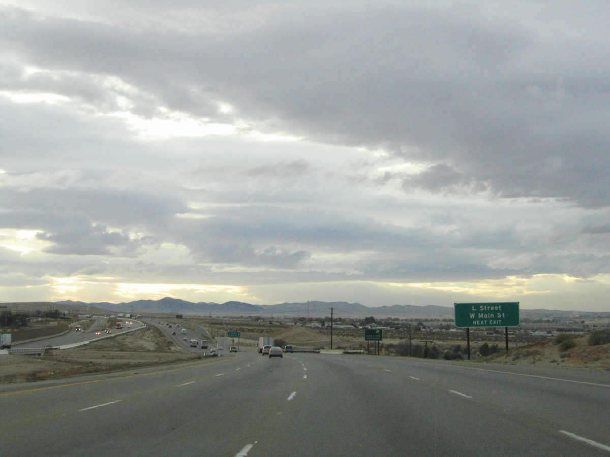
Southbound Interstate 15/Mojave Freeway reaches Exit 181, Business Loop I-15/L Street west to Historic U.S. 66-91 (South Barstow/Main Street). Use this exit to follow U.S. 66-91 south to towns bypassed by the freeway, including Lenwood, Hodge, Helendale, and Oro Grande. Photo taken 07/14/08. |
|
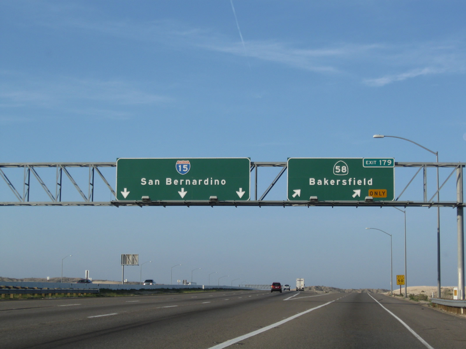
The next exit along Interstate 15 south is Exit 179, California 58 west to Bakersfield (one mile). California 58 provides the best connection from the high desert to the Central Valley and San Francisco Bay Area by avoiding Los Angeles. Photo taken 03/31/08. |
|
This Interstate 15 south reassurance shield is posted after the on-ramp from Business Loop I-15/L Street (Avenue L). Photo taken 03/15/09. |
|
Interstate 15 turns southwest from Barstow to Victorville and Hesperia beyond the split with California 58. California 58 ventures west 67 miles to Mojave and 120 miles to Bakersfield. The state route travels a freeway alignment west for about six miles, between Interstate 15 and the Barstow Bakersfield Highway (Old Highway 58). After that, California 58 varies between expressway, two-lane highway, and freeway all the way to Bakersfield. Ultimate plans call for this corridor to become a full freeway due to heavy traffic volumes. Photo taken 03/15/09. |
|
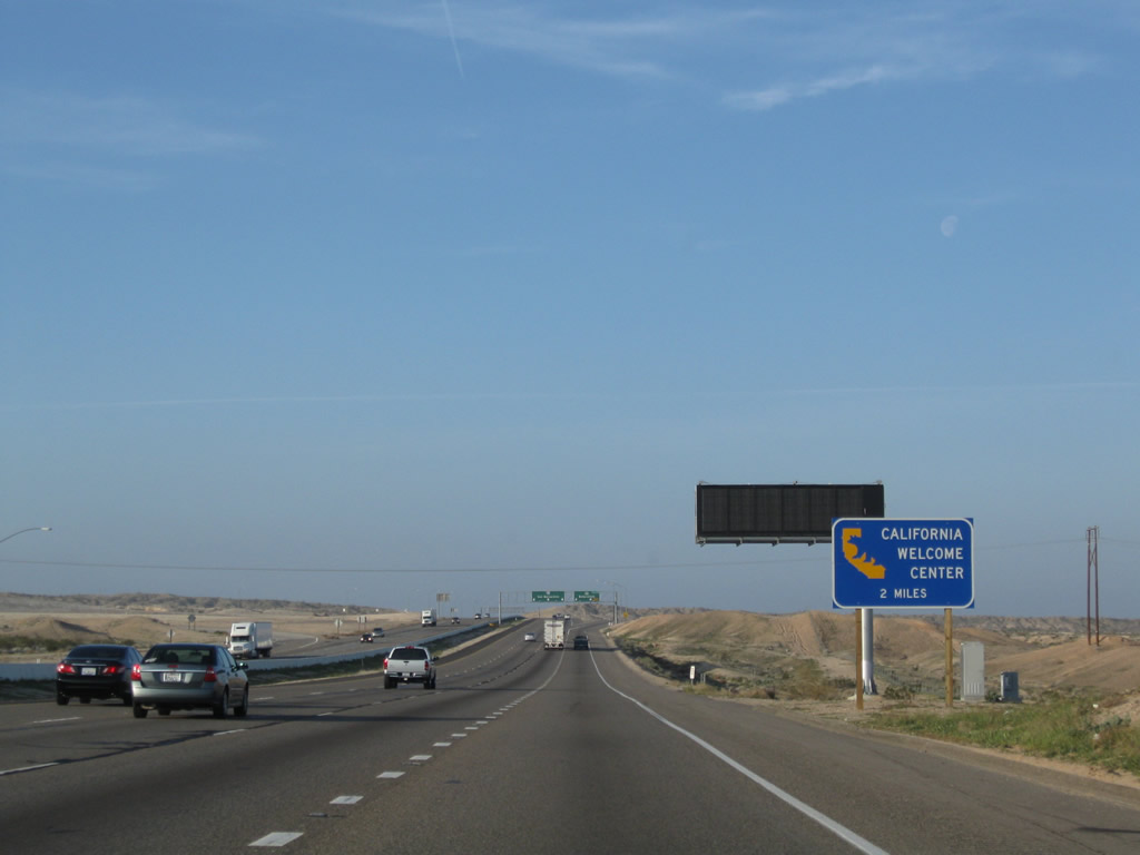
To the State of California Welcome Center, continue south on Interstate 15 to the Lenwood Road interchange (Exit 178). Photo taken 03/15/09. |
|
Southbound Interstate 15/Mojave Freeway reaches Exit 179, California 58 west to Bakersfield. California 58 begins its westerly journey as a hybrid freeway-expressway from Barstow west to Bakersfield. If this route were brought to Interstate standards, it could potentially become an extension of Interstate 40. However, much work would need to be done to make California 58 an Interstate-grade facility. This new interchange was completed by 2000. Photo taken 03/15/09. |
|
This view looks west on the California 58 freeway as seen from southbound lanes of Interstate 15. Photo taken 03/31/08. |
|
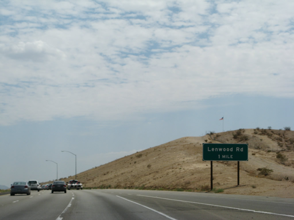
Continuing southward along Interstate 15, one mile north of the Exit 178 diamond interchange with Lenwood Road. Lenwood Road arcs northwest from the freeway through Lenwood to California 58 at Hinkley Valley. Photo taken 07/14/08. |
|
This mileage sign along southbound Interstate 15 provides the distance to Victorville, San Bernardino, and Los Angeles. Even though Interstate 15 comes to its end in San Diego, that city is not mentioned on this mileage sign. Interstate 15 does not even enter the city limits of Los Angeles, but many travelers will connect via Interstate 210, Interstate 10, or California 60. Photo taken 03/31/08. |
|
Use Exit 178 (Lenwood Road) to the State of California Welcome Center. The center is located in the outlet mall; follow the signs to the facility. Maps, brochures, and other tourist information is available at the welcome center. Photo taken 03/31/08. |
|
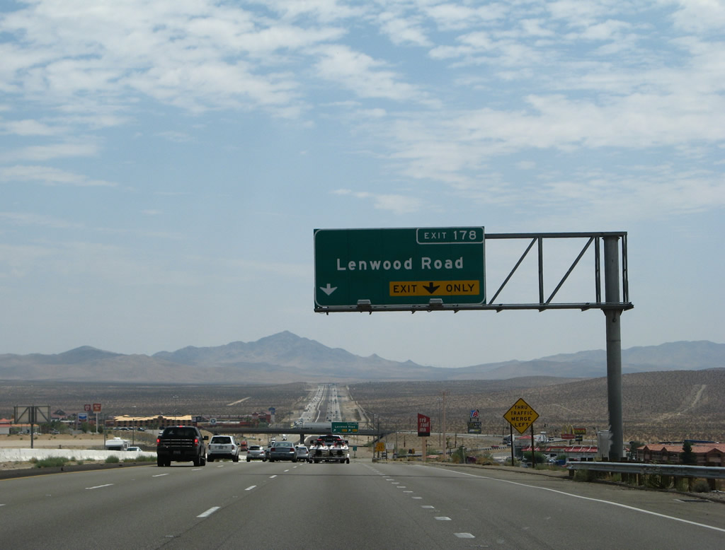
The right two lanes will connect to Exit 178, Lenwood Road. The Barstow outlet mall is located at this exit, along with several motorist facilities. Stoddard Mountain comes into view along the southern horizon. Photo taken 10/19/04. |
|
Motorists bound for Lenwood Road depart Interstate 15 via a two-lane off-ramp at Exit 178. Lenwood Road transitions into Outlet Center Drive east of Interstate 15. Outlet Center Drive loops southward from Townsend Road to Interstate 15 at Sidewinder Road. Photo taken 07/14/08. |
|
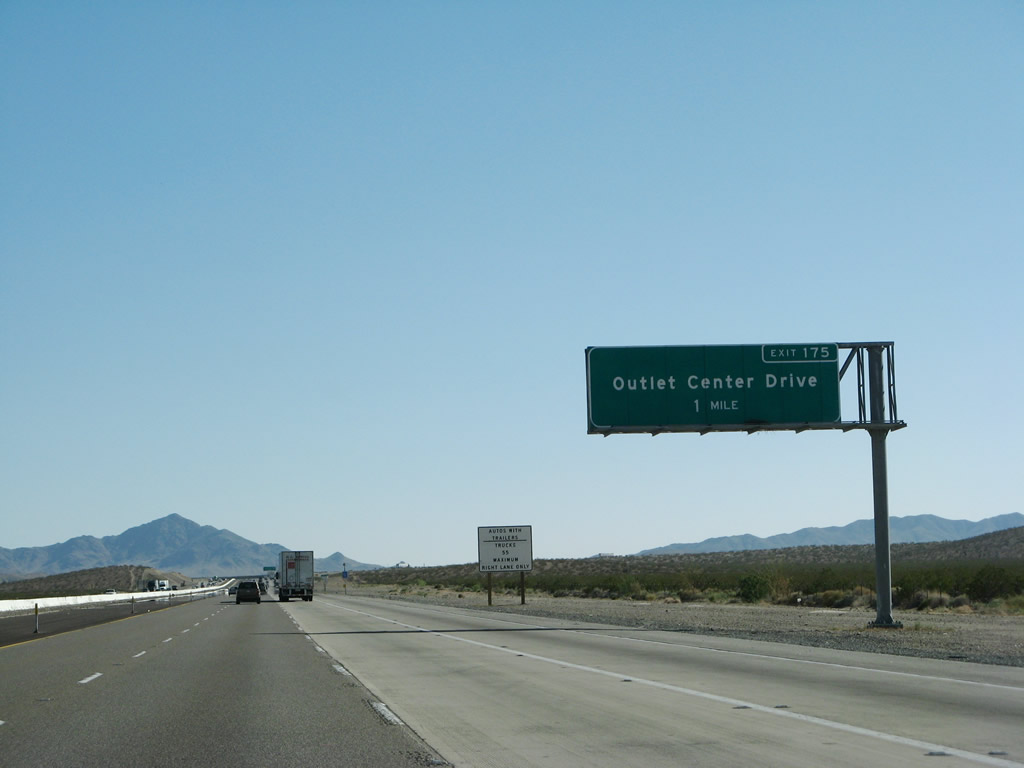
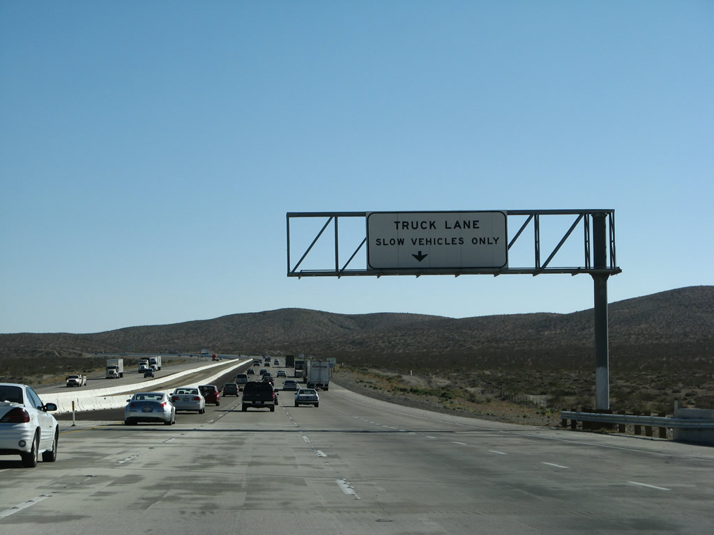
A truck lane joins Interstate 15 southbound ahead of the Exit 175 diamond interchange with Sidewinder Road and Outlet Center Drive. Photo taken 03/31/08. |
|
Slower vehicles should use the truck lane (right lane). Photo taken 03/31/08. |
|
Interstate 15 southbound at the Exit 175 off-ramp to Sidewinder Road west and Outlet Center Drive north. Sidewinder Road peters out west of the freeway in the open desert. Outlet Center Drive curves northward to Townsend Road and Lenwood Road. Outlet Center Drive was originally named Osborne Road. Photo taken 03/31/08. |
|
A new right lane becomes exit only for Exit 175, Outlet Center Drive. Photo taken 03/31/08. |
|
Southbound Interstate 15/Mojave Freeway reaches Exit 175, Sidewinder Road west and Outlet Center Drive north. Photo taken 03/31/08. |
|
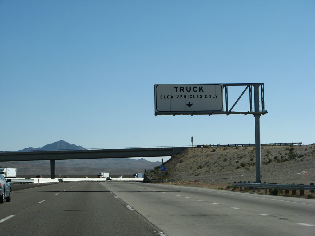
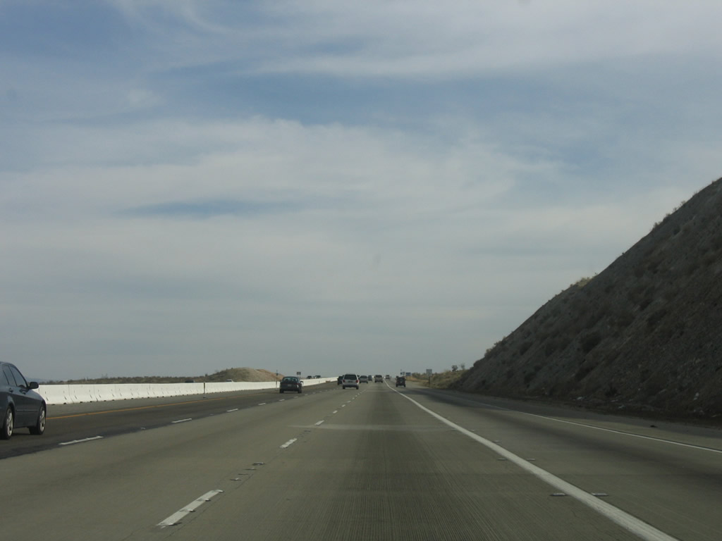
Passing through the Outlet Center Drive interchange, the truck climbing lane briefly resumes, but the extra lane ends after the on-ramp from Outlet Center Drive. A white overhead indicates the designation and the lane allows trucks to travel a speeds lower than 40 mph. RV's and other slow moving vehicles may also use the travel lane. Photo taken 03/31/08. |
|
Four lanes reduce to three lanes after the on-ramp from Exit 175. Photo taken 03/31/08. |
|
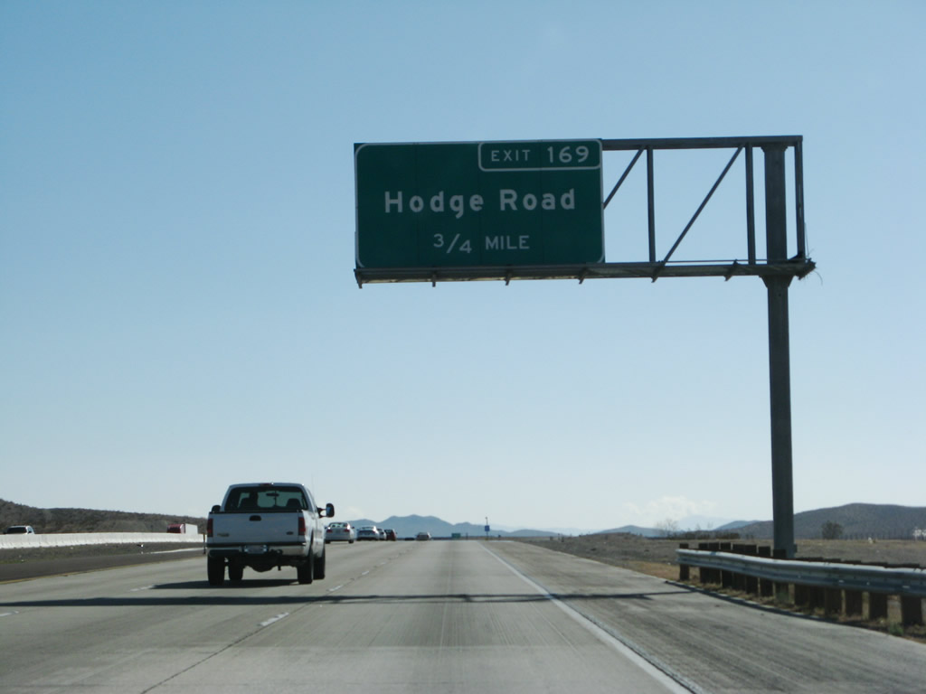
Crossing paths with Interstate 15 next is Hodge and Stoddard Mountain Roads at Exit 169. Hodge Road flows northwest 4.5 miles to National Trails Highway (old U.S. 66) in the Brisbane Valley. Photo taken 03/31/08. |
|
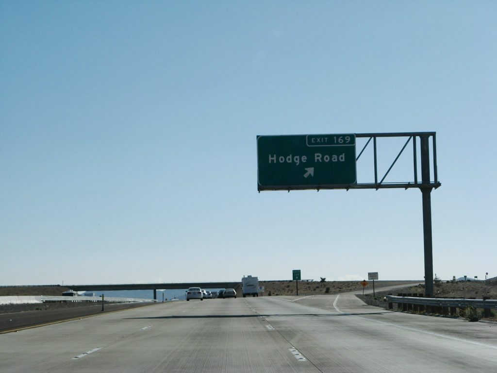
Exit 169 leaves Interstate 15 southbound for Hodge Road north and Stoddard Mountain Road south. Stoddard Mountain Road leads south to the Altuda Mine near Stoddard Mountain. Photo taken 03/31/08. |
|
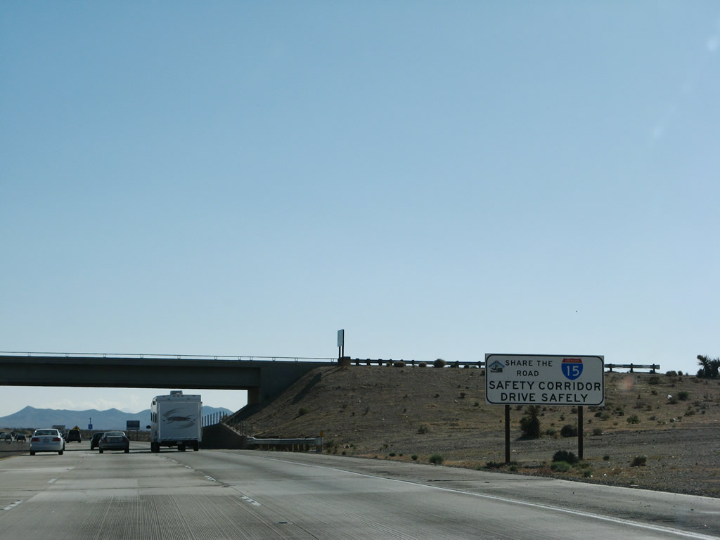
Another Interstate 15 safety corridor sign is posted within the Hodge Road interchange. Photo taken 03/31/08. |
|
|
Looking west across the Brisbane Valley from Interstate 15 southbound between Hodge Road (Exit 169) and Wild Wash Road (Exit 165). Photos taken 10/19/04. |
|
0.75-mile overhead for Wild Wash Road (Exit 165) posted along Interstate 15 southbound. Wild Wash Road leads northwest from the freeway into the Brisbane Valley. Photo taken 10/19/04. |
|
Southbound at the Exit 165 diamond interchange with Wild Wash Road. Sorrel Trail stems south from Interstate 15 and Wild Wash Road to Slash Ranch Road near Turtle Mountain. Photo taken 03/31/08. |
|
Another truck climbing lane begins after Exit 165. This lane will help the freeway pass near Stoddard Mountain. Photo taken 03/31/08. |
|
|
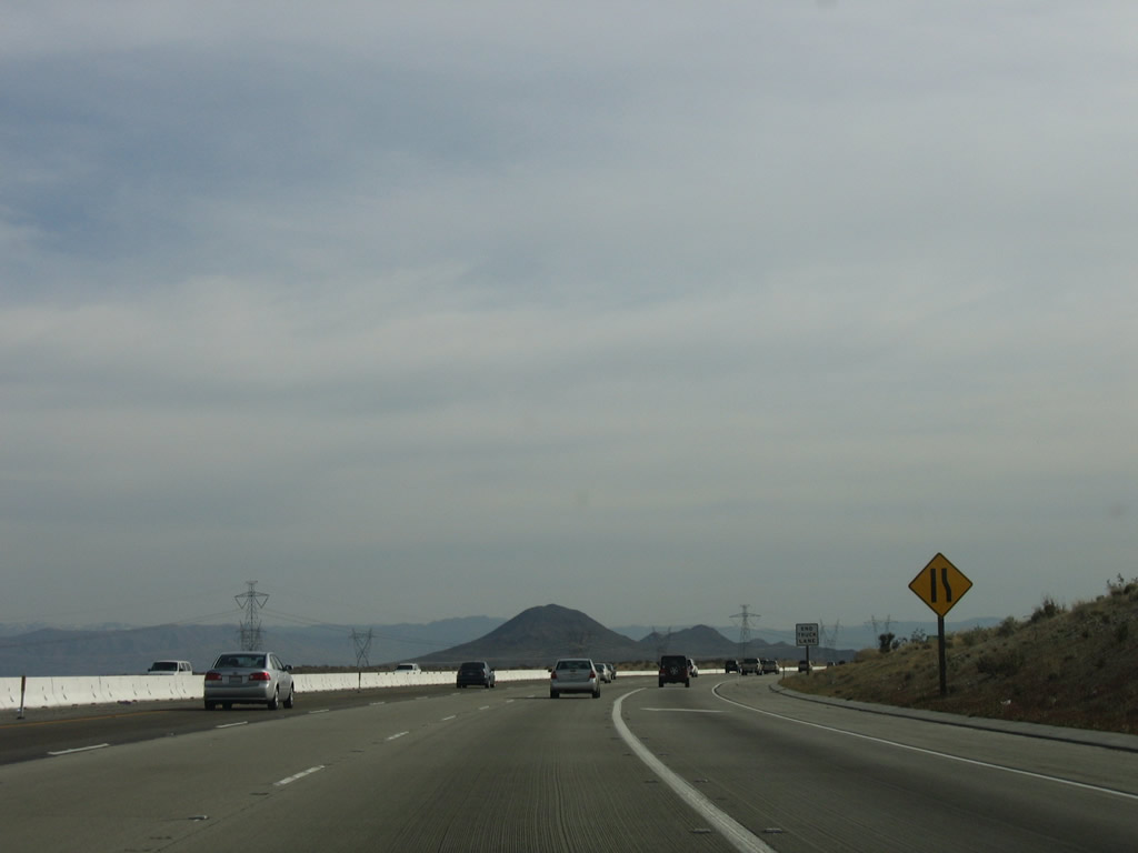
Interstate 15 uses four southbound lanes to climb the summit adjacent to Stoddard Mountain. At the top of the climb, the right truck lane ends. Photos taken 04/01/06. |
|
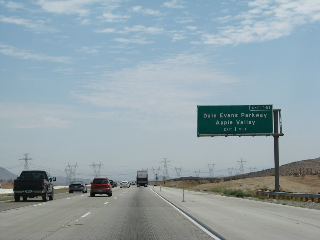
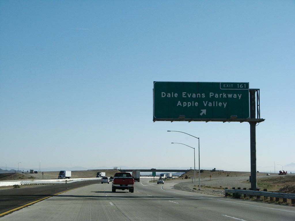
Interstate 15 approaches Apple Valley and the Exit 161 diamond interchange with Dale Evans Parkway. Dale Evans Parkway travels 6.5 miles south from nearby Boulder Road to Waalew Road in Apple Valley. Photo taken 07/14/08. |
|
|
|
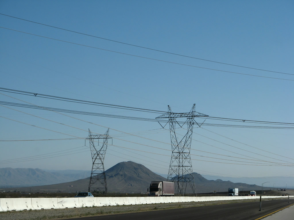
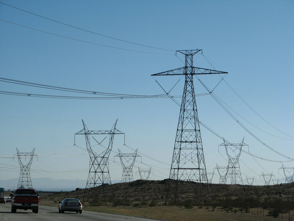
The same power transmission corridor that passed over Interstate 15 near Yermo again crosses Interstate 15 near Exit 161. The corridor (Los Angeles Department of Water and Power) joins the Los Angeles Basin with power generated in southern Nevada and points north and east. This group of 287, 500, and -500kV power lines had previously crossed Interstate 15 on the Nevada side of Primm (north of Exit 1) and again at Yermo. This is the third and final crossing. The first line is Path 27, the -500kV Intermountain High Voltage Direct Current (HVDC) transmission line (hence two bundles of wires rather than three bundles, which is typical of alternating current power lines). The middle two lines are the two 500kV Los Angeles Department of Water and Power's McCullough - Victorville transmission line (part of Path 46/West of Colorado River, Arizona-California West-of-the-River Path [WOR]). The fourth and final line is the 287kV Hoover - Victorville line. Photos taken 03/31/08 and 10/19/04. |
|
|
|
|
|
Exit 161 departs Interstate 15 southbound for Dale Evans Parkway. Dale Evans Parkway intersects Stoddard Wells Road 1.75 miles south at Bell Mountain. A reflectorized overhead including the exit number awaits installation in the second photograph. Photos taken 10/19/04 and 03/31/08. |
|
The Union Pacific Railroad crosses Interstate 15 on this overpass. It was widened earlier this decade with the expansion of Interstate 15 to six lanes. Photo taken 03/31/08. |
|
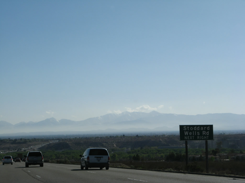
The next exit along Interstate 15 south is Exit 157, Stoddard Wells Road. Stoddard Wells Road continues southwest of the community of Bell Mountain four miles to Interstate 15 at Exit 157. Stoddard Wells Road intertwines with the freeway southward from there to Victorville. Photo taken 03/31/08. |
|
Another power transmission line passes over Interstate 15 prior to Exit 157. Photo taken 03/31/08. |
|
Southbound Interstate 15/Mojave Freeway reaches Exit 157, Stoddard Wells Road to Bell Mountain. Photo taken 03/31/08. |
|
This mileage sign provides the distance to Victorville (four miles), San Bernardino (44 miles), and Riverside (54 miles). the latter two cities are connected to Interstate 15 by using Interstate 215 south near Devore in the Inland Empire. At this point, Interstate 15 descends into the sprawling Victor Valley. Photo taken 04/01/06. |
|
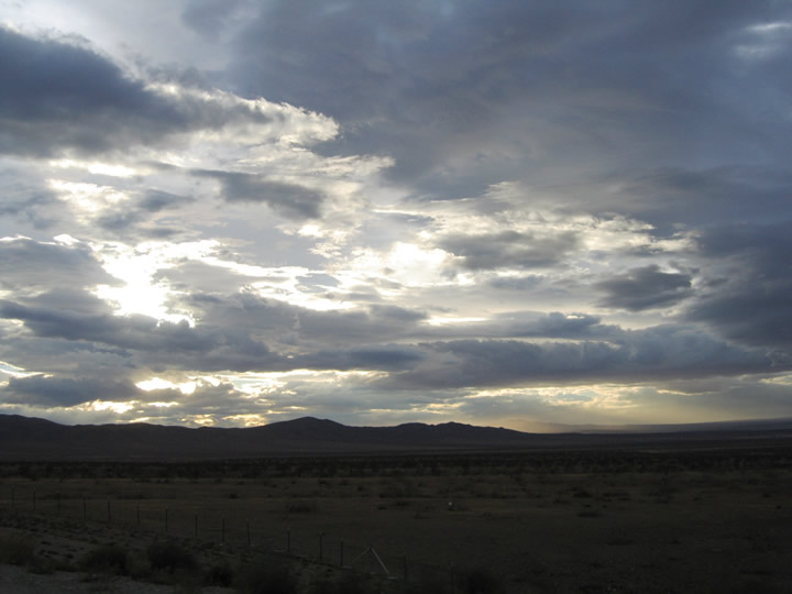
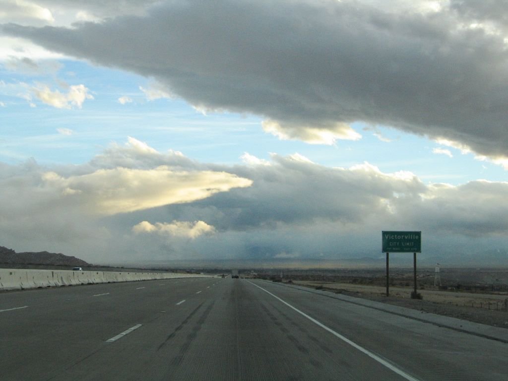
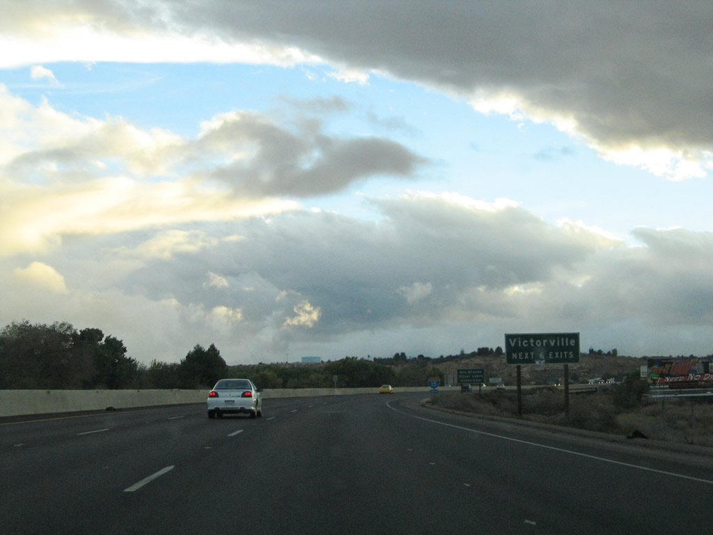
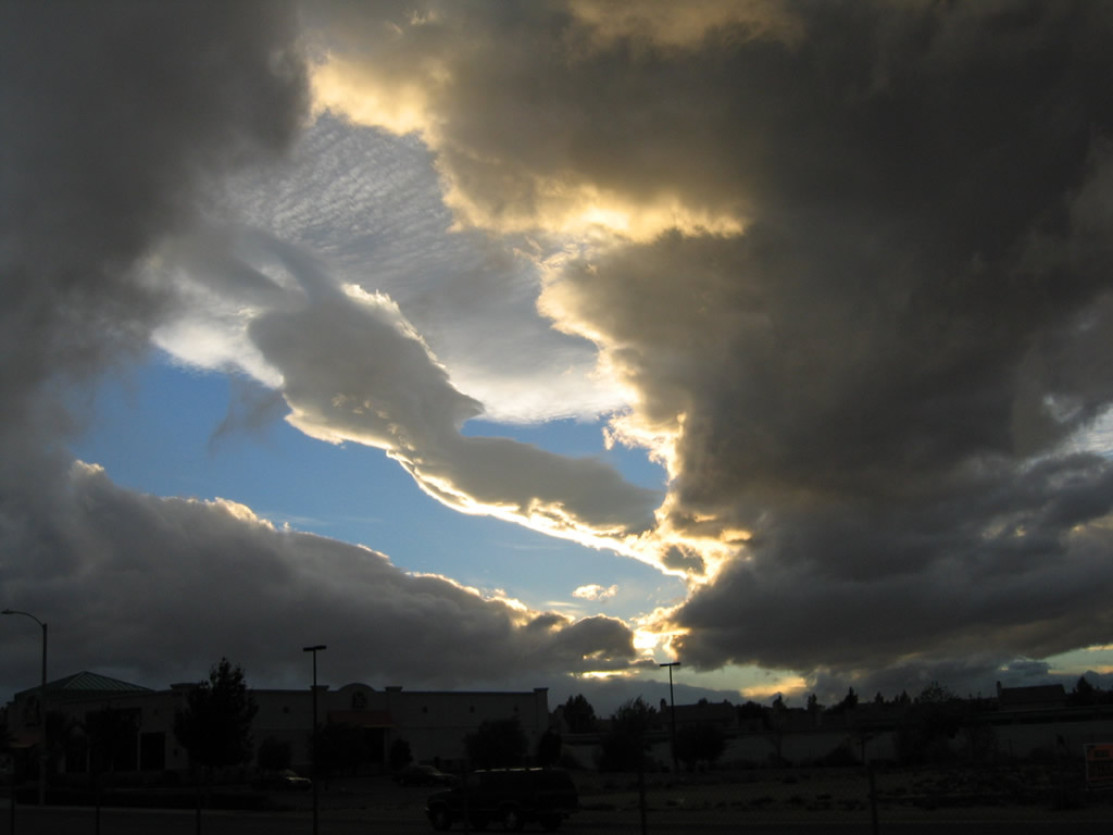
Storm clouds gather along the southern horizon and set the tone for a late fall day along Interstate 15. At this point, Interstate 15 enters the city limits of Victorville. The six-lane freeway maintains a barrier median throughout the vicinity of the cities of Apple Valley and Victorville. Photo taken 10/19/04. |
|
The same storm clouds created a beautiful evening sky over the desert. Photo taken 10/19/04. |
|
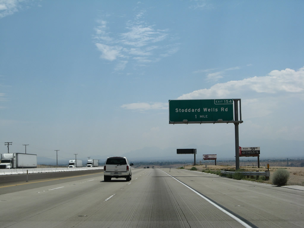
The next exit along Interstate 15/Mojave Freeway (also known as the Barstow Freeway) is a second interchange with Stoddard Wells Road (Exit 154). Interstate 15 progresses three miles southward between the Stoddard Wells Road interchanges of Exit 157 and exit 154. Stoddard Wells Road meets the freeway at a partial-cloverleaf interchange near the Mojave River. Photo taken 03/31/08. |
|
Interstate 15 sinks toward the Mojave River crossing and Exit 154. A small guide sign directs motorists to the Exit 154 off-ramp to Stoddard Wells Road. Stoddard Wells Road heads 1.75 miles south to its end at California 18 (Happy Trails Highway). California 18 continues east from there into Apple Valley. Photo taken 03/31/08. |
|
Southbound Interstate 15/Mojave Freeway reaches Exit 154, Stoddard Wells Road. Photo taken 07/14/08. |
|
Traveling southbound at the Stoddard Wells Road over crossing, the next interchange along Interstate 15 south is Exits 153B-A, a split cloverleaf interchange with E Street and California 18/D Street. California 18 follows D Street east into downtown Victorville to the Mojave River crossing into Apple Valley. Old U.S. 66-91 ties into the interchange from the north. Photo taken 07/14/08. |
|
The next six exits all serve the city of Victorville. Known as the "Key City of the High Desert," Victorville is named after Jacob Nash Victor, a railroad pioneer who helped bring the railroad over the Cajon Pass in 1885. Located in the high desert (2,730 feet), the city only receives 3.9 inches of precipitation per year but has ample sun and plenty of warmth during the summer. Photo taken 10/19/04. |
|
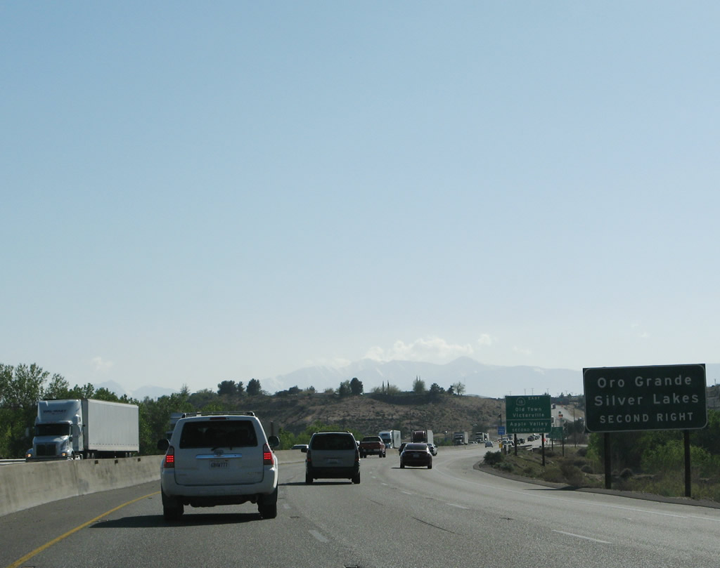
Motorists bound for Oro Grande and Silver Lakes (Helendale) should use Exit 153B onto old U.S. 66 (National Trails Highway) northbound along the Mojave River. The National Trails Highway travels north from Victorville to Mojave Heights, Oro Grande, and the Brisbane Valley between Interstate 15 and California 58 at Lenwood. Photo taken 03/31/08. |
|
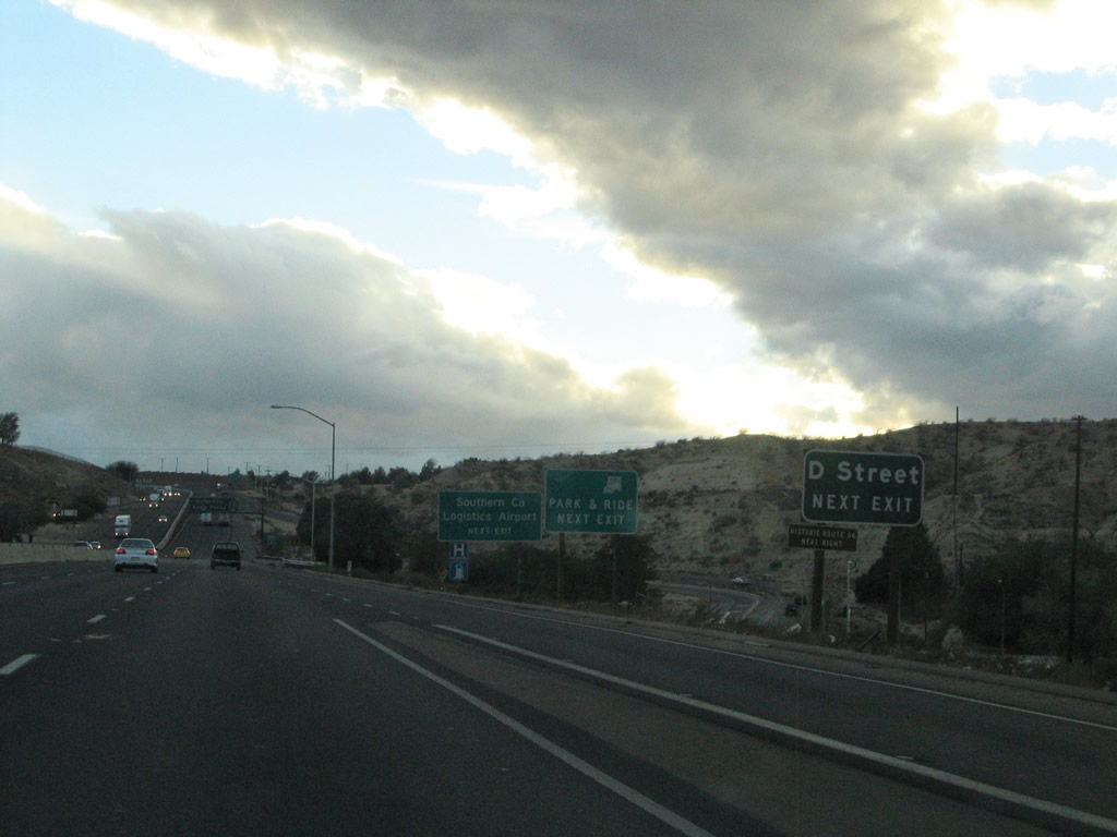
The second exit connects to D Street, which is U.S. 66 east/U.S. 91 north and Business Loop I-15/U.S. 91 south, U.S. 66 west, and California 18 east. The next exit is Exit 153B, E Street. Photo taken 03/31/08. |
|
|
Exit 153B departs Interstate 15 southbound for E Street north. E Street remains segregated from the former U.S. 66 (D Street / National Trails Highway) due to the adjacent Union Pacific Railroad. E Street ends in an industrial area north of Interstate 15 and connects with 6th Street near downtown Victorville. Photos taken 03/31/08 and 10/19/04. |
|
Exit 153A serves D Street, the former routing of U.S. 66. The off-ramp serves both D Street north and south. Old U.S. 66 heads north 1.8 miles to the intersection with Adelanto Road. Adelanto Road travels west from there to the former George A.F.B. / Southern California Logistics Airport and Adelanto (U.S. 395). Photo taken 10/19/04. |
|
|
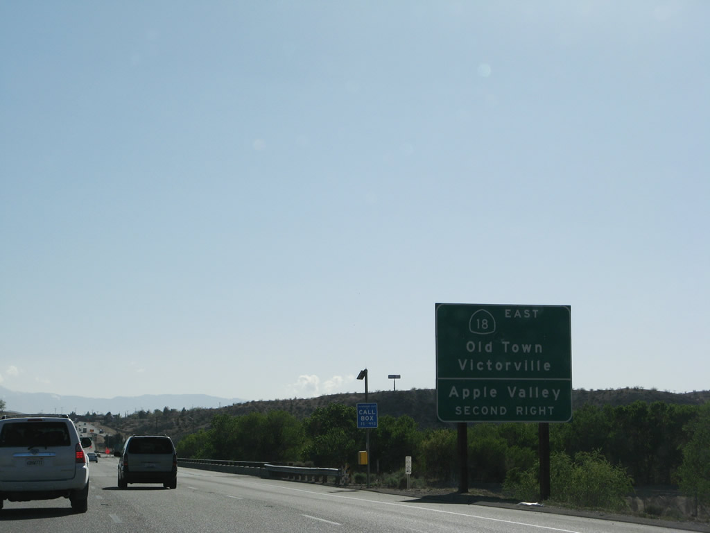
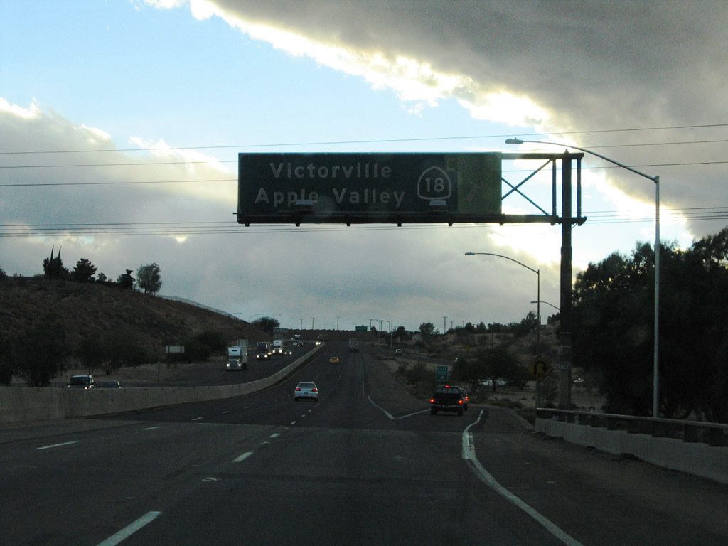
Southbound Interstate 15/Mojave Freeway reaches Exit 153A, Business 15 and California 18/D Street. The loop ramp onto D Street southbound. D Street carries California 18 and Business Loop I-15 south into downtown Victorville. There Business Loop I-15 turns onto 7th Street while California 18 continues east toward the Mojave River crossing into the town of Apple Valley. California 18 westbound merges with Interstate 15 southbound. Photos taken 07/14/08 and 10/19/04. |
| Interstate 15/Mojave Freeway south and California 18 west |
|
To California 18 west, continue south on Interstate 15/Mojave Freeway to Exit 150. Photo taken 07/14/08. |
|
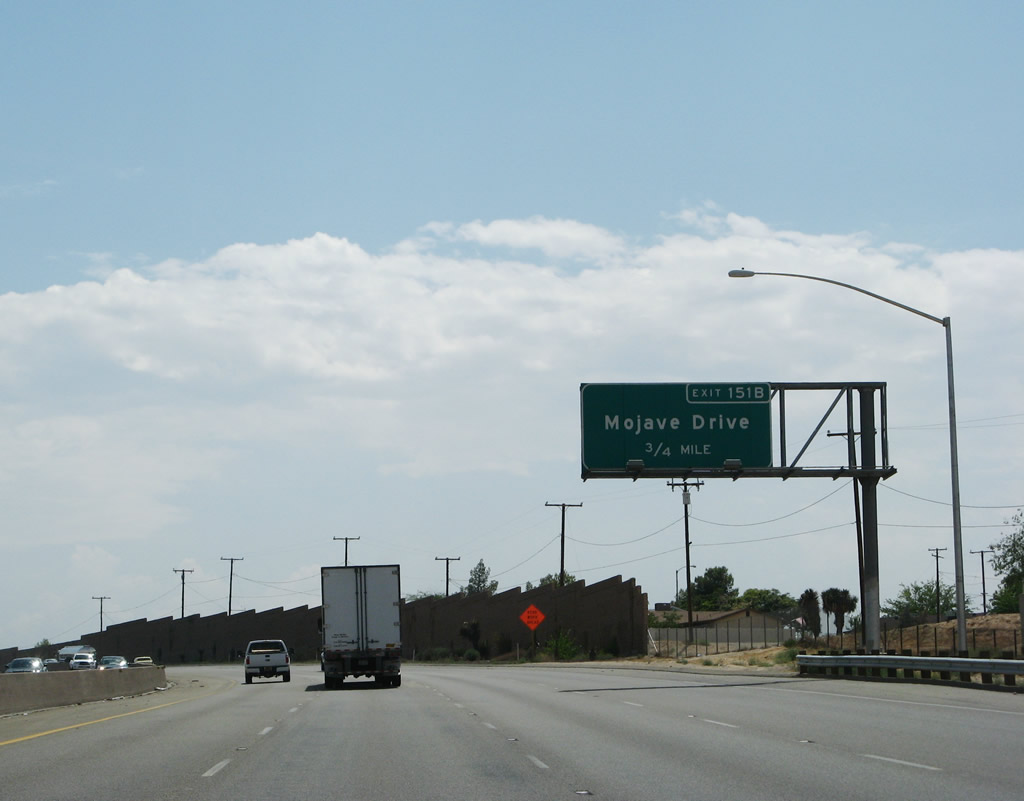
Intersecting the freeway next in Victorville is Mojave Drive, an east-west road traveling 5.7 miles between U.S. 395 and Business Loop I-15 (7th Street). Exit 151B constitutes a diamond interchange. Photo taken 07/14/08. |
|
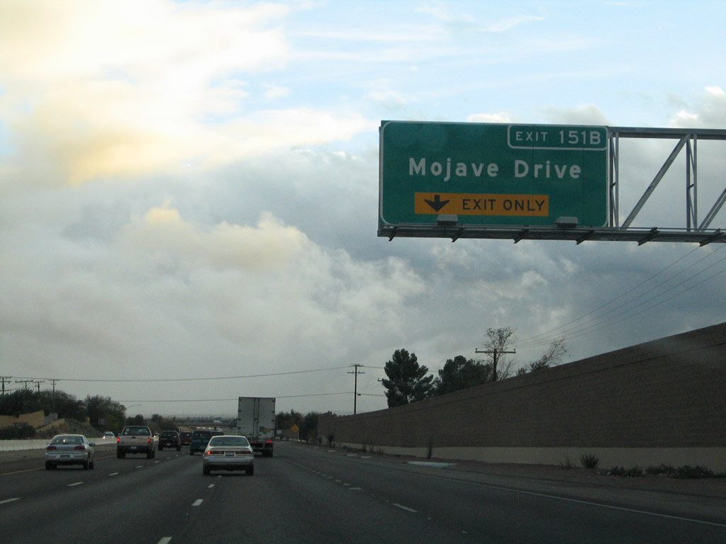
The right lane becomes exit only for Mojave Drive (Exit 151B). Photo taken 10/19/04. |
|
Interstate 15 south & California 18 westbound meets the two-lane ramp departure to Mojave Drive (Exit 151B). Mojave Drive provides a second access point from the freeway into downtown Victorville. Photo taken 10/19/04. |
|
|
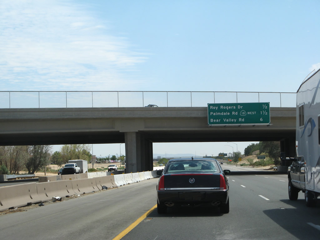
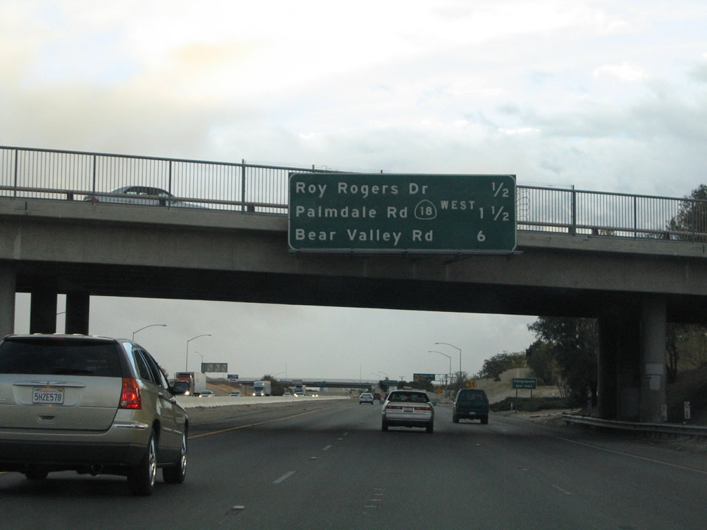
An upcoming exits overhead was previously posted at the Mojave Drive overpass on Interstate 15 south & California 18 west. The sign was replaced with a temporary sign by March 2008 due to bridge widening. Victorville represents a fast growing suburban community and the stretch of Interstate 15 through the city feels urban. The six-lane freeway next meets Roy Rogers Drive (Exit 151A) in one half mile. Photos taken 07/14/08 and 10/19/04. |
|
Exit 151A departs Interstate 15 south & California 18 west for Roy Rogers Drive on one quarter mile. Roy Rogers Drive continues La Paz Drive west from Business Loop I-15 (7th Street) to the intersection of Amargosa Road and Hook Boulevard. Photo taken 03/31/08. |
|
Drivers bound for Roy Rogers Drive depart Interstate 15 south & California 18 west via Exit 151A. Roy Rogers Drive meets Civic Drive just west of the freeway. La Paz Drive turns southward at 7th Street to Pebble Beach Drive and the Victorville Municipal Golf Course. Photo taken 03/31/08. |
|
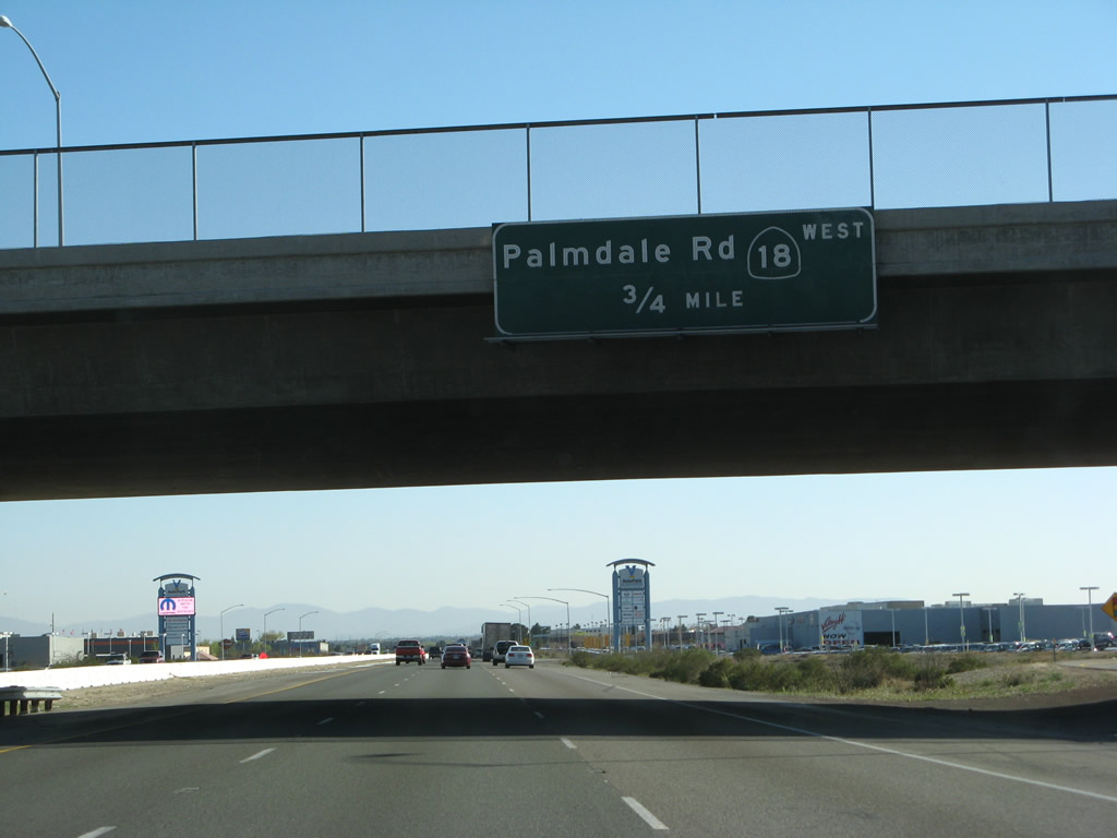
The next exit along Interstate 15 south is Exit 150, California 18 (Palmdale Road) west and Business 15 and U.S. 66-91/7th Street north. California 18 follows Palmdale Road west from Exit 150 across the Victor Valley. The state route ventures west to Mountain View Acres and Adobe Corners on the 4.3-mile drive to the junction with U.S. 395 and the city of Adelanto. Photo taken 10/19/04. |
|
Traffic merging onto Interstate 15 southbound from Roy Rogers Drive forms the exit-only lane for California 18 (Palmdale Road) west. Palmdale Road continues east as 7th Street (Business Loop I-15 and Old U.S. 66-91) away from Interstate 15. Green Tree Boulevard stems east from Business Loop I-15 through the Victorville Municipal Golf Course to Hesperia Road. Photo taken 04/01/06. |
|
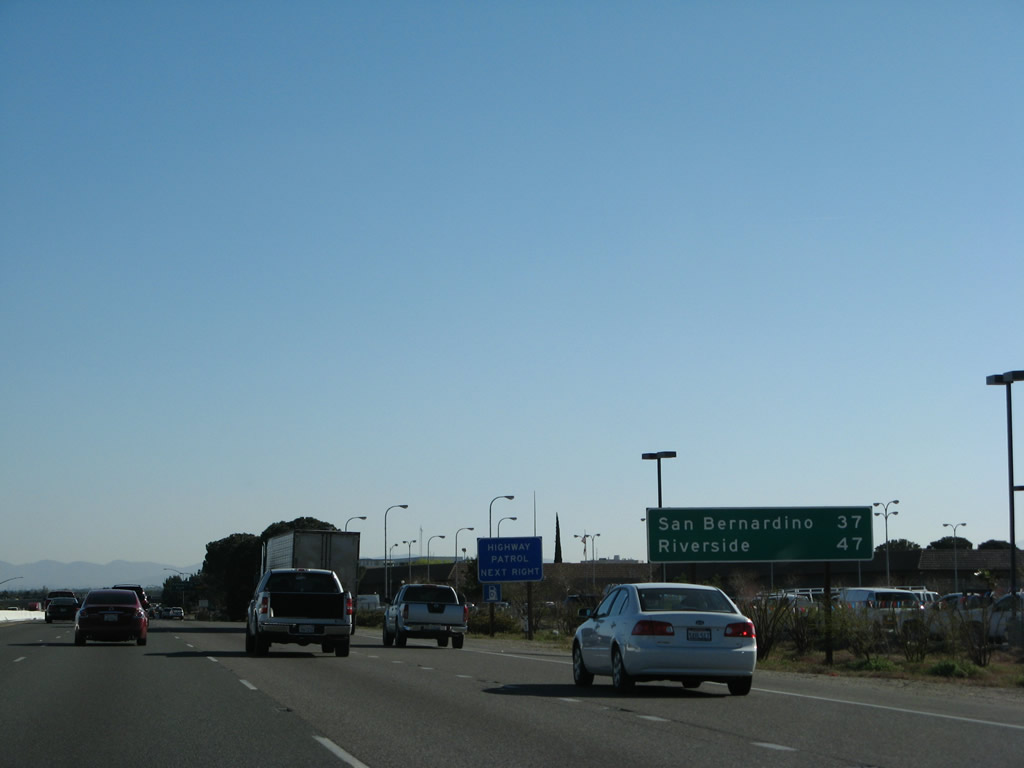
A mileage sign provides the distance to San Bernardino (37 miles) and Riverside (47 miles). Photo taken 03/31/08. |
|
A California 18 trailblazer is posted shortly thereafter, prior to the exit-only off-ramp to California 18 (Palmdale Road) west. Photo taken 04/01/06. |
|
A six-ramp partial-cloverleaf interchange facilitates the movements between Interstate 15, California 18 (Palmdale Road), and Business Loop I-15 (7th Street). California 18 continues 23.5 miles west to its end at California 138. California 138 travels west from there 17 miles to Palmdale. 7th Street (former California 18) carries Business Loop I-15 2.5 miles back to D Street (California 18). Photo taken 03/31/08. |
| Interstate 15/Mojave Freeway south |
|
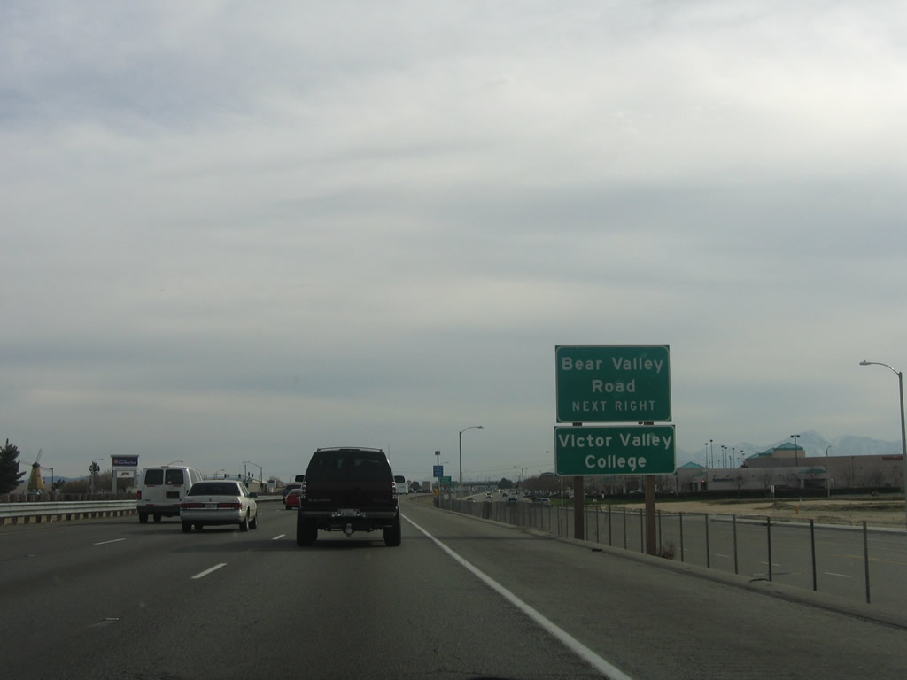
The next exit along Interstate 15 south is Exit 147, Bear Valley Road. Interstate 15 gains two frontage roads: Amargosa Road (west side) and Mariposa Road (east side) as between Victorville and Hesperia. La Mesa Road intersects Amargosa Road at this traffic signal, which is one mile north of the Interstate 15 partial-cloverleaf interchange with Bear Valley Road (Exit 147). Photo taken 04/01/06. |
|
Exit 147 leaves Interstate 15 southbound for Bear Valley Road. Bear Valley Road travels west from Interstate 15 and The Mall of Victor Valley three miles to U.S. 395 at Duncan Road. East of the freeway, Bear Valley Road progresses 3.7 miles to Thorn and 16.3 miles to California 18 at Apple Valley. Photo taken 04/01/06. |
|
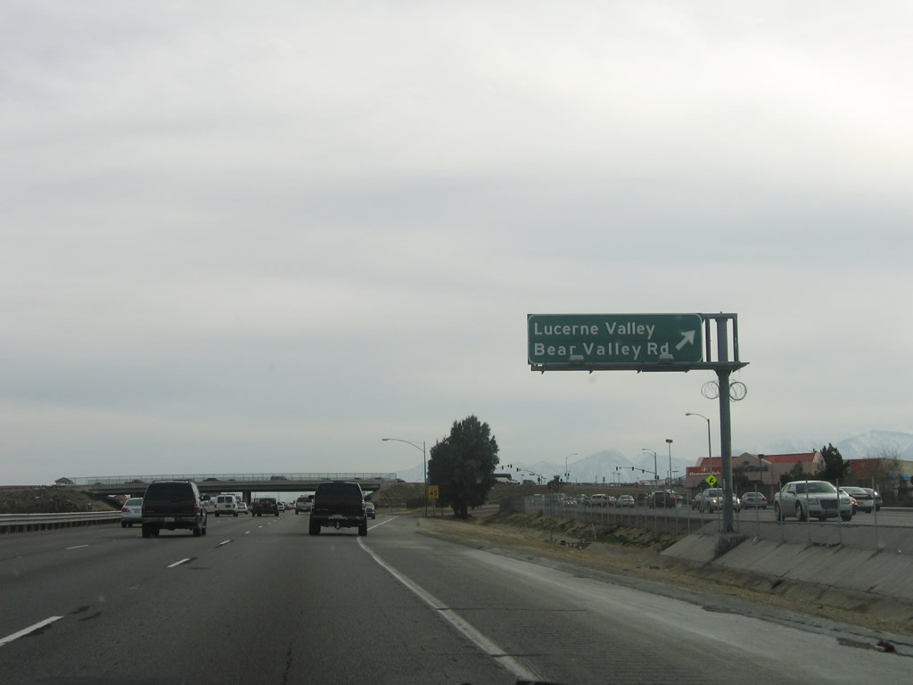
Bear Valley Road travels east through Apple Valley to connect with California 18 east en route to the community of Lucerne Valley. Photo taken 04/01/06. |
|
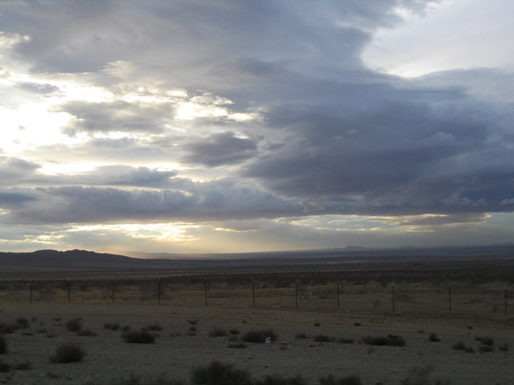
Skies such as this were common during the rainy winter of 2004-2005. Photo taken 10/19/04. |
|
Southbound Interstate 15/Mojave Freeway reaches Exit 147, Bear Valley Road to Apple Valley and Lucerne Valley. The Mall of Victor Valley is also located at this interchange (northwest quadrant). Photo taken 04/01/06. |
|
|
|
Another series of power lines cross Interstate 15 between Exit 147 and Exit 143. This is Path 61, which links the Southern California Edison-owned Lugo Substation southeast of here with the Los Angeles Department of Water and Power substation located in Victorville (basically connecting two segments of Path 46). Based on the tower designs, the 500kV line is likely owned by Southern California Edison. Photos taken 10/19/04, 04/01/06, and 03/31/08. |
|
|
|
|
|
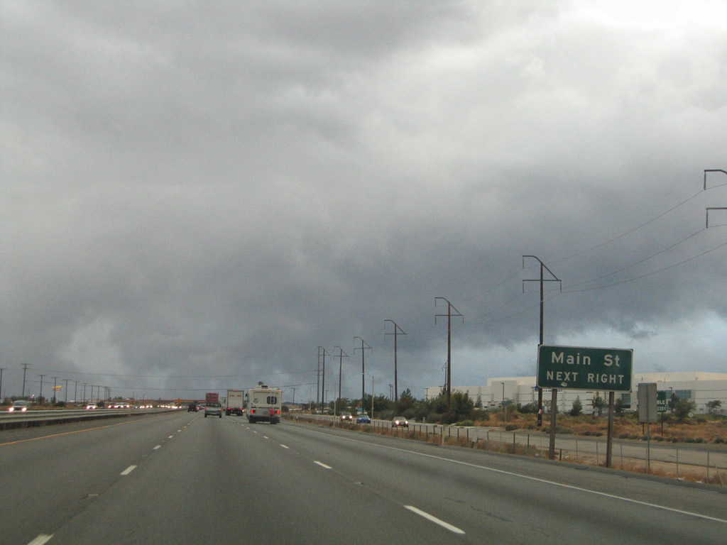
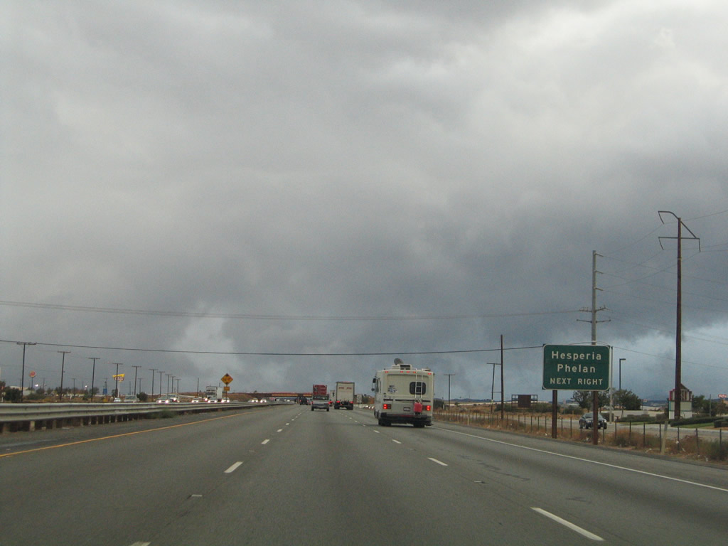
Interstate 15 continues south toward the Hesperia and Phelan interchange (Exit 143). Intersecting the freeway ahead is Main Street, an east-west surface highway between U.S. 395 and downtown Hesperia. Photos taken 03/31/08 and 10/19/04. |
|
Interstate 15 enters the city of Hesperia is posted within the U.S. 395 interchange. The city of Hesperia was incorporated in June 1988. As of the 2000 Census, 62,582 people lived in Hesperia; the city sits at an elevation of 3,186 feet in the Mojave Desert. We gradually gain elevation as we approach Cajon Summit (el. 4,190 feet) between the San Gabriel Mountains and the San Bernardino Mountains. Photo taken 10/19/04. |
|
|
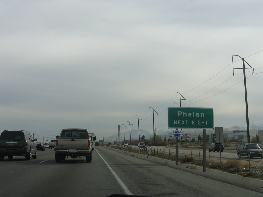
One half mile north of the Exit 143 partial-cloverleaf interchange with Main Street at Hesperia. Main Street ends at U.S. 395 just south of Phelan Road. Phelan Road stems west from the U.S. highway ten miles to Phelan. The sign was changed from "Main Street" to "Phelan" between 2004 and 2006. Photos taken 04/01/06 and 10/19/04. |
|
|
Nearing the Exit 143 off-ramp to Main Street on Interstate 15 south. Main Street intersects Cottonwood Avenue 2.4 miles to the east and Hesperia Road in 4.7 miles at downtown Hesperia. The sign was changed from "Phelan/Hesperia" to "Main Street/Hesperia" between 2004 and 2006. Photos taken 04/01/06 and 10/19/04. |
|
Exit 143 departs Interstate 15 southbound for Main Street to Hesperia and Phelan. Main Street ends eight miles to the east at the split of Arrowhead Lake and Rocksprings Roads. U.S. 395 lies just one mile to the west at this point. Photo taken 10/19/04. |
|
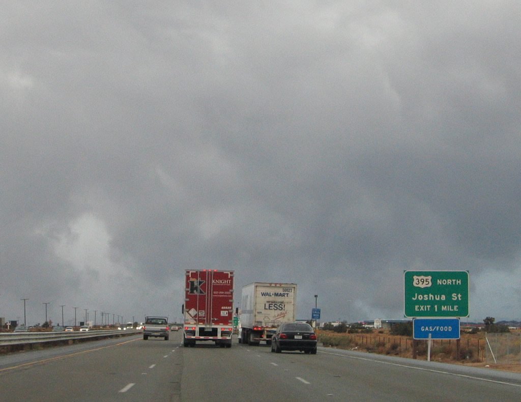
The next interchange along Interstate 15 south is Exit 141, Joshua Street to U.S. 395. Photo taken 03/31/08. |
|
U.S. 395 travels north toward the Eastern Sierra and Bishop from this interchange. Motorists can exit here to take the final quarter mile of U.S. 395 south if desired, since U.S. 395 actually merges with Interstate 15 via a wye interchange. Access to U.S. 395 northbound is provided by Joshua Street, an east-west connector between U.S. 395, Interstate 15, and Mariposa Road. Photo taken 10/19/04. |
|
One half mile north of the Exit 141 half-diamond interchange with Joshua Street. Joshua Street intersects U.S. 395 nearby. From there U.S. 395 northbound travels 222 miles north to Bishop and 389 miles to Carson City. Photo taken 10/19/04. |
|
Southbound Interstate 15/Mojave Freeway reaches Exit 141, Joshua Street to U.S. 395 north. U.S. 395 southbound traffic merges onto the freeway within the next mile. The U.S. 395 designation ends just south of here, as the U.S. route was truncated between Hesperia and San Diego by 1970 due to the construction of Interstate 15 and Interstate 215. The orphaned section in San Diego was redesignated as California 163. Photo taken 04/01/06. |
|
This overpass carries traffic from Interstate 15 north to U.S. 395 north. Photo taken 04/01/06. |
Page Updated August 5, 2009.