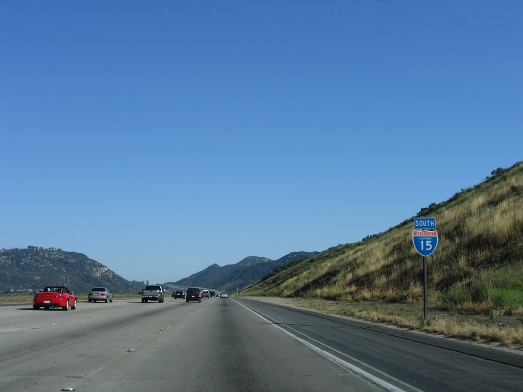
| Interstate 15 (Escondido Freeway) (Avocado Highway) south |
|
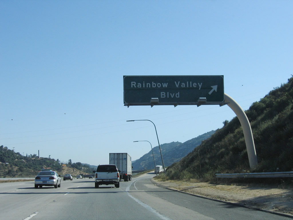
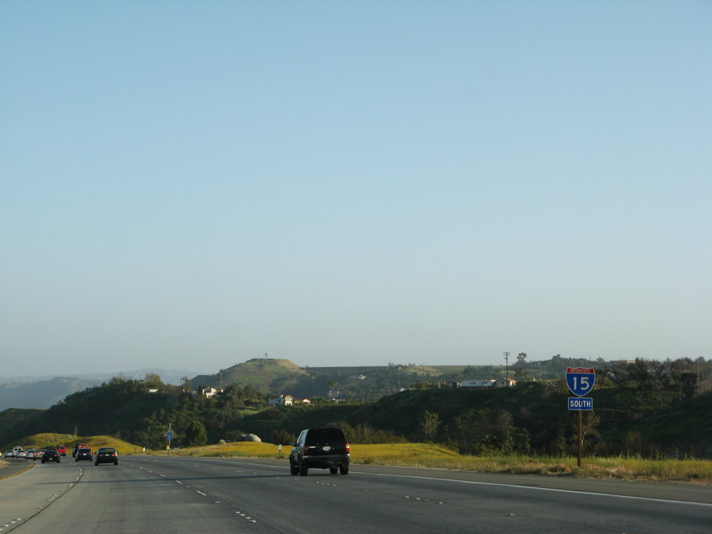
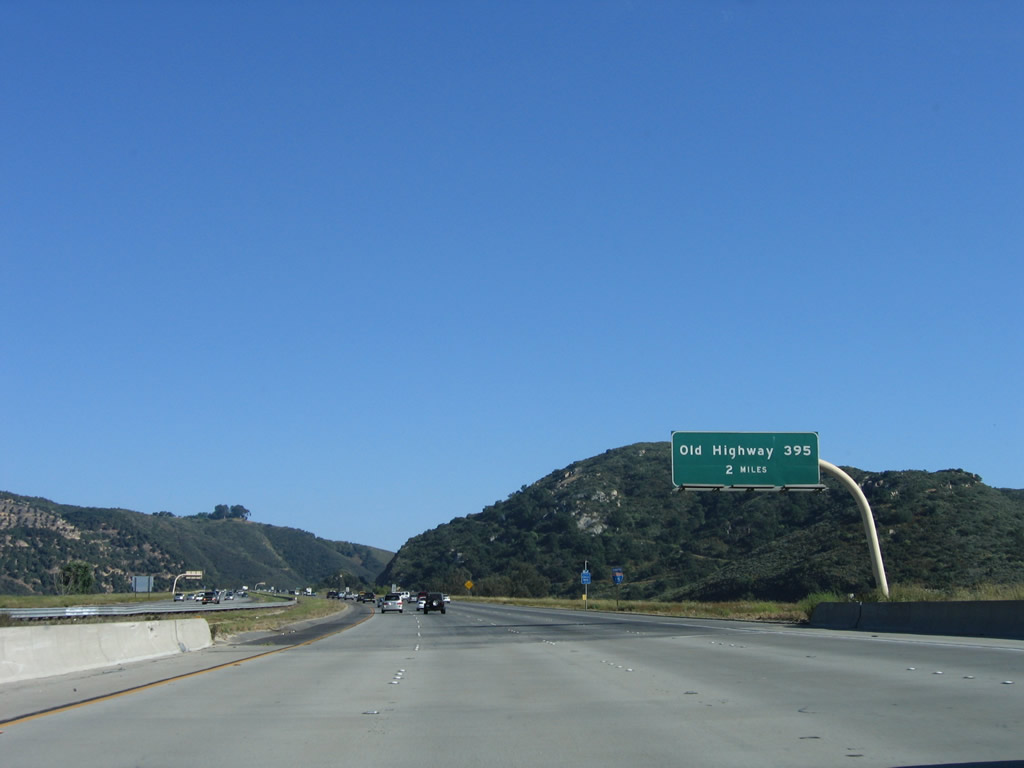
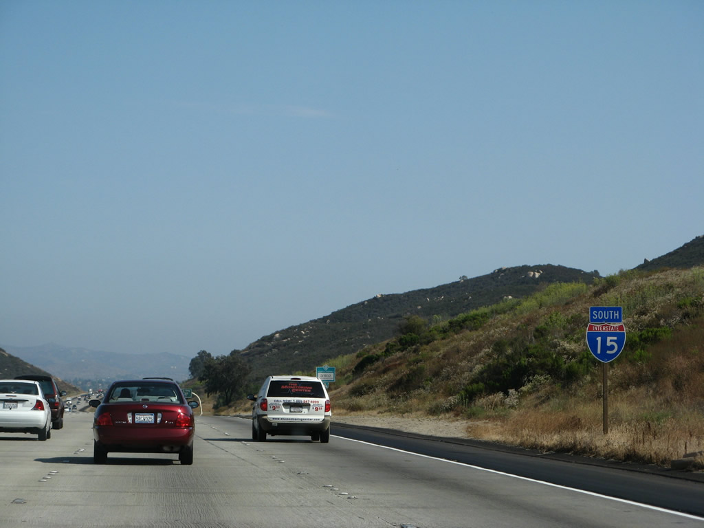
Southbound Interstate 15 reaches Exit 54, Rainbow Valley Boulevard east to Old Rainbow Canyon Road (old U.S. 395) north. Rainbow Canyon Road follows Old U.S. 395 north to meet Riverside County S-16 in Temecula, thus providing an alternate route into Riverside County. Exit 54 is the second interchange to serve the unincorporated community of Rainbow, and it is the first San Diego County exit along southbound Interstate 15. Photo taken 06/03/06. |
|
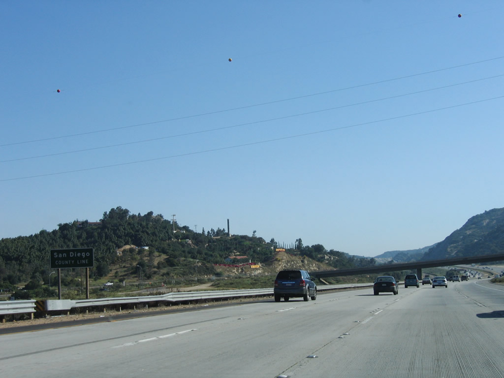
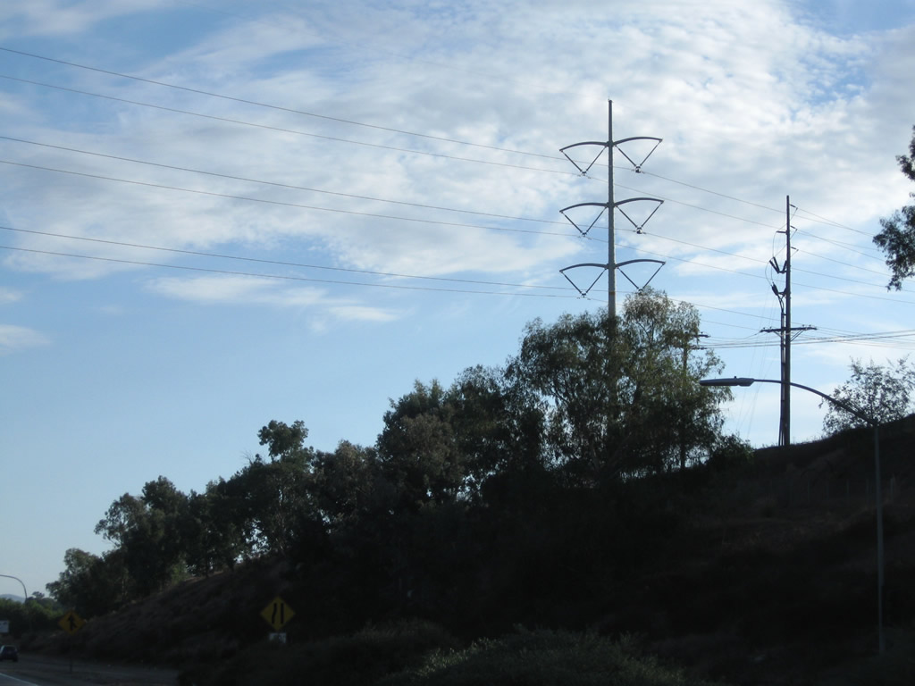
The San Diego County line is posted immediately after the Exit 54 gore point. Interstate 15 leaves Riverside County. At this point, a single circuit 230kV San Diego Gas and Electric Company power line crosses over the freeway and Rainbow Canyon. Photo taken 06/03/06. |
|
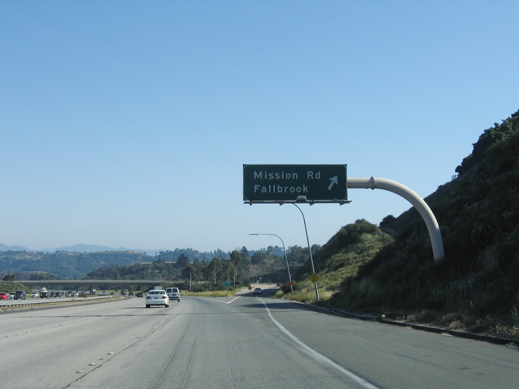
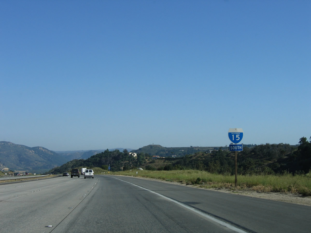
The next exit along Interstate 15 (Escondido Freeway) (Avocado Highway) south is Exit 51, San Diego County S-13 (Mission Road) west to Fallbrook, San Diego County S-15 (Reche Road) west to Fallbrook, and Junction Old Highway 395 north to Rainbow and south to Pala Mesa Village. Photo taken 06/03/06. |
|
San Diego County S-13 (Mission Road) leads due west into the community of Fallbrook then south to meet California 76 in Bonsall. San Diego County S-15 also leads to Fallbrook, but it takes Reche Road, which passes through Live Oak Park. County Route S-15 ends at its junction with County Route S-13 in Fallbrook. Photo taken 06/03/06. |
|
A roadside sign provides the exit number for Exit 51, Mission Road to Fallbrook. As usual, the county route designation is ignored. Photo taken 06/03/06. |
|
Southbound Interstate 15 (Escondido Freeway) reaches Exit 51, San Diego County S-13 (Mission Road) west to Fallbrook, San Diego County S-15 (Reche Road) west to Fallbrook, and Junction Old Highway 395 north to Rainbow and south to Pala Mesa Village. Photo taken 06/03/06. |
|
Upon exiting on Historic U.S. 395 (Exit 51) and turning right, this sign is posted to offer connections to San Diego County S-13 (Mission Road) west to Fallbrook or San Diego County S-15 (Reche Road) west to Fallbrook. A left turn here also connects to Historic U.S. 395 south. Photo taken 07/26/09. |
|
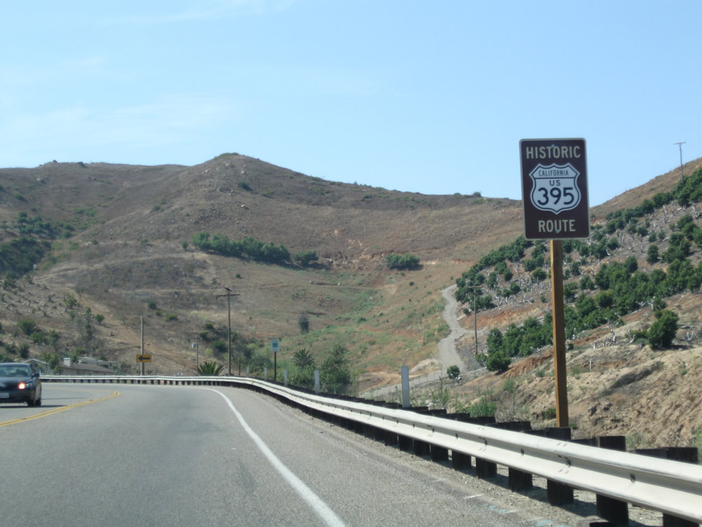
Historic U.S. 395 signage was introduced and posted along segments of the original alignment of U.S. 395 in northern San Diego County (locally referred to as "North County"). Signs like this were first posted in 2008. This particular sign is posted after the traffic signal along westbound San Diego County S-13 (the traffic signal was shown in the previous photobox after the green guide sign for the two county routes leading west to Fallbrook). Photo taken 07/26/09. |
|
|
|
This reassurance shield assembly is posted after the on-ramp from Exit 51. Interstate 15 was previously marked with a nice California shield; it was replaced after the Wildfires of 2007 with a neutered angular shield ... ugly! Photos taken 07/17/11, 03/31/08, and 06/03/06. |
|
|
|
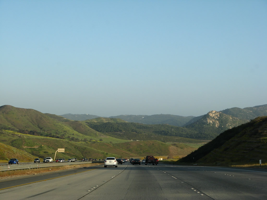
Looking south as Interstate 15 descends toward the San Luis Rey River valley, this area was ravaged by wildfires in October 2007. Some of the yellow flowers in bloom in March 2008 were the result of soaking winter rains. Photos taken 07/17/11, 03/31/08, and 06/03/06. |
|
|
The San Luis Rey River valley spreads out in front of southbound drivers. In the distance, the Lilac Road arch bridge crosses over the freeway. Photos taken 06/03/06 and 03/31/08. |
|
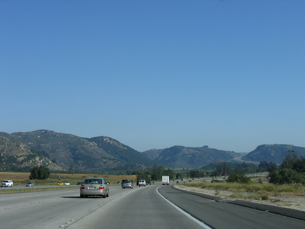
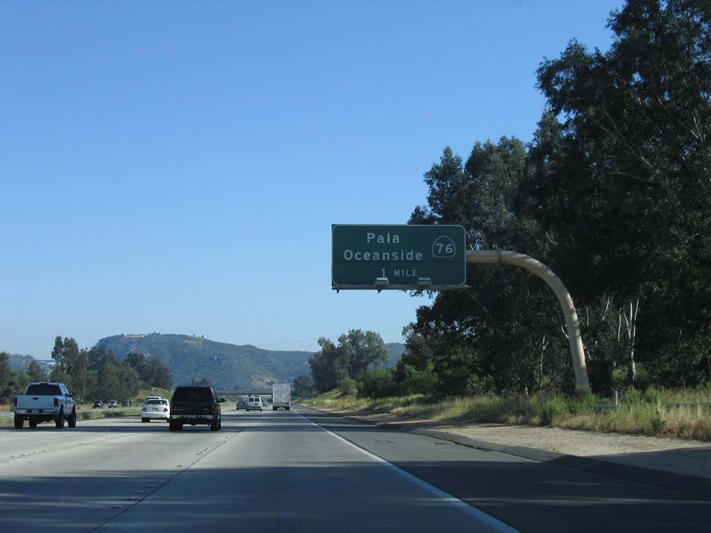
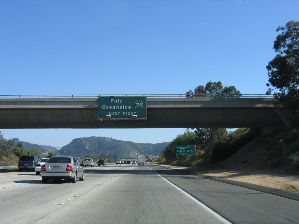
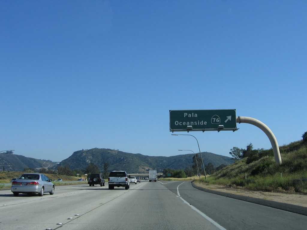
The next exit along southbound is Exit 46, California 76, which connects to Old U.S. 395 to the west of the freeway. Photo taken 06/03/06. |
|
California 76 leads east to Pala, Rincon Springs, Palomar Mountain, and Lake Henshaw before reaching its end at California 79 north of Santa Ysabel. The connection to Palomar Mountain is via California 76 east to San Diego County S-6 north. A state park, observatory, and related recreational opportunities are available at Palomar Mountain. Photo taken 06/03/06. |
|
California 76 west follows a congested two-lane alignment through Bonsall before heading southwest to Oceanside. While the westernmost segment of California 76 is an expressway, the section between the eastern limits of Oceanside and Interstate 15 are very congested, and plans call for the construction of a freeway or tollway that could handle more capacity. Of course, such a proposal has drawn intense controversy. Photo taken 06/03/06. |
|
Southbound Interstate 15 reaches Exit 46, California 76 west to Oceanside and east to Palomar Mountain. Photo taken 06/03/06. |
|
California 76 crosses over Interstate 15 on this bridge. As California 76 is widened, it is likely that this bridge and interchange will be modified to accommodate the increased traffic flow. Photo taken 06/03/06. |
|
|
Shortly thereafter, Interstate 15 crosses the San Luis Rey River. The original U.S. 395 crossing of the river is still intact (open for bicycles and pedestrians); the multi-arch bridge is located near Bonsall downriver from here via California 76 west. Photos taken 07/17/11 and06/03/06. |
|
The next exit along Interstate 15 is Exit 43, Junction Old Highway 395. Although called "Old Highway 395," this is not the original alignment of U.S. 395. Instead, the original U.S. 395 alignment traveled through Fallbrook, Bonsall, and Vista before entering Escondido. The frontage road on the west side of Interstate 15 is a later (1950s) version of U.S. 395, but it is not the original routing. Photo taken 06/03/06. |
|
A neutered, angular Interstate 15 shield was placed after the California 76 interchange in 2008. Photo taken 07/14/08. |
|
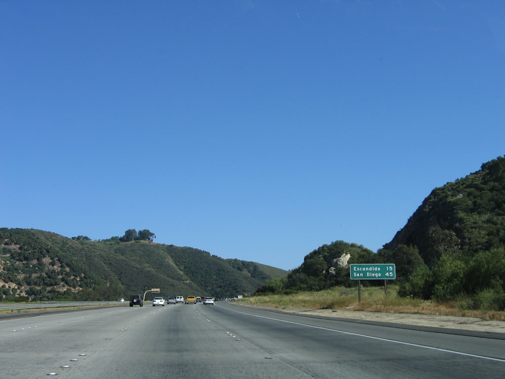
This mileage sign provides the distance to Escondido (15 miles) and San Diego (45 miles). The freeway ascends rapidly from the San Luis Rey River valley and now approaches one of the most scenic bridges in San Diego County: the Lilac Road arch bridge. Photo taken 06/03/06. |
|
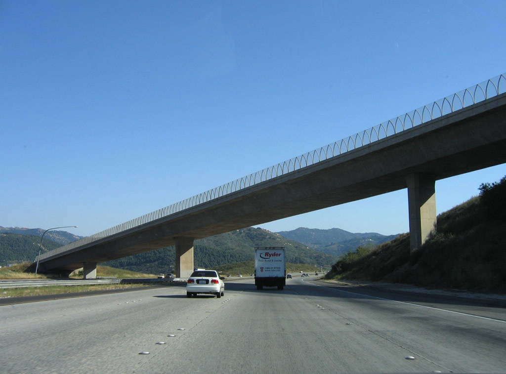
The Lilac Road overcrossing comes into view after the one-mile advance sign for Exit 43, Old Highway 395. The top of the bridge itself may be reached via Old Highway 395 (Exit 46 or 43). Photo taken 06/03/06. |
|
Built in 1978, the Lilac Road Bridge is one of two reinforced concrete arch bridges on San Diego County's Interstate Highway System. The other carries Eastgate Mall over Interstate 805 between the Miramar Road/La Jolla Village Drive and Mira Mesa Road interchanges near Sorrento Valley in the city of San Diego. Photo taken 06/03/06. |
|
This exit-number sign is for Exit 43, Old Highway 395. Photo taken 06/03/06. |
|
Southbound Interstate 15 reaches Exit 43, Old Highway 395. Old Highway 395 is the frontage road that parallels Interstate 15 between the northern end of Centre City Parkway (Business Loop I-15) in Escondido north to Rainbow and the San Diego-Riverside County Line. Photo taken 06/03/06. |
|
This bridge carries Old Highway 395 over Interstate 15. The old road will remain on the east side of the freeway south to Castle Creek and the Welk resort. Photo taken 06/03/06. |
|
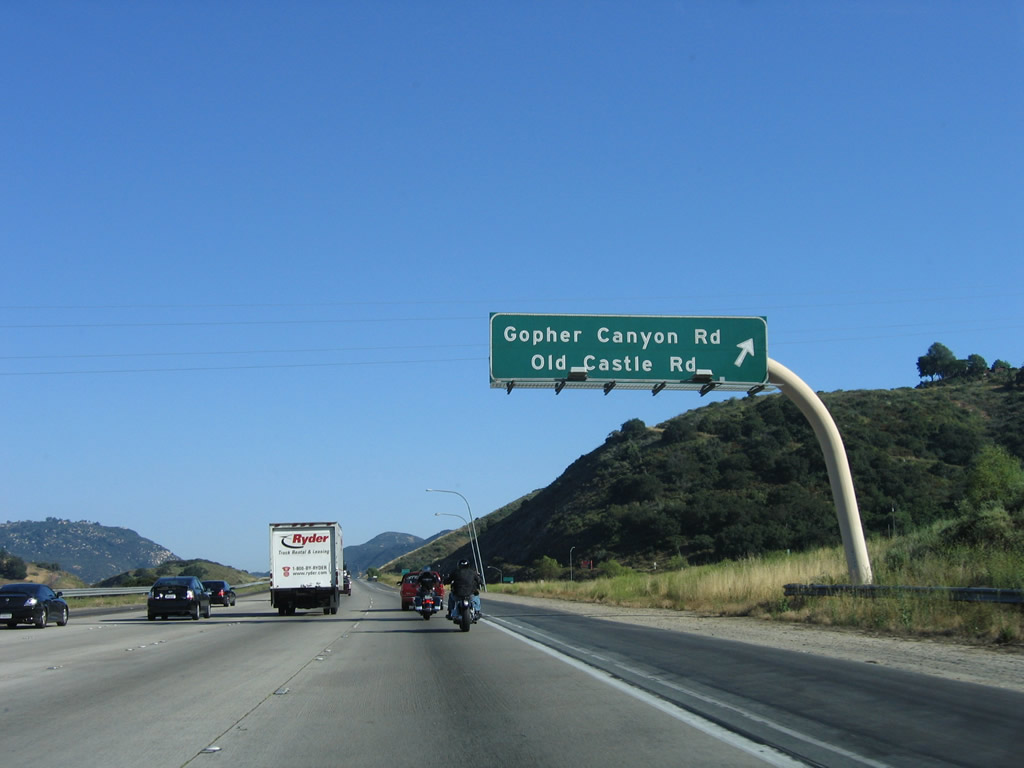
The next exit along Interstate 15 south is Exit 41, Gopher Canyon Road and Old Castle Road (one mile). Photo taken 06/03/06. |
|
Gopher Canyon Road leads west to meet California 76 and San Diego County S-13 southwest of Bonsall and north of Vista. Old Castle Road heads west to join Lilac Road en route to San Diego County S-6/Center Valley Road in Valley Center. Photo taken 06/03/06. |
|
As is the case along this stretch of Interstate 15, a single roadside exit number sign is posted in advance of the exit. This sign along with a numbered gore point sign are enough to grant minimum requirements for exit numbering. Photo taken 06/03/06. |
|
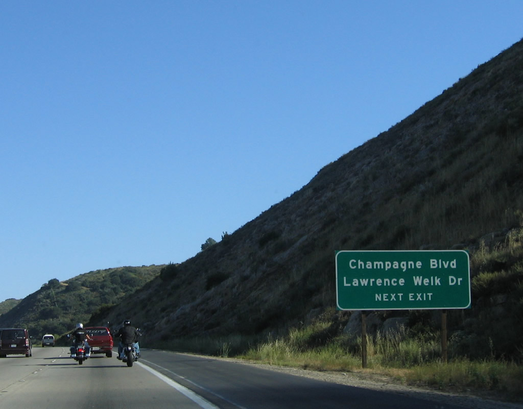
Exit 41 also serves Hidden Meadows, which includes the Lawrence Welk Resort, Champagne Meadows, and other nearby areas. Champagne Boulevard is also part of the 1950s-era old U.S. 395 alignment. While the 1930s alignment of U.S. 395 took a westerly detour through Vista and San Marcos, the 1950s alignment more closely emulated the path now used by Interstate 15 through rural northern San Diego County. Photo taken 06/03/06. |
|
Southbound Interstate 15 (Escondido Freeway) (Avocado Highway) reaches Exit 41, Gopher Canyon Road west and Old Castle Road east. Photo taken 06/03/06. |
|
This Interstate 15 south reassurance shield is posted after the on-ramp from Exit 41. Photo taken 06/03/06. |
|
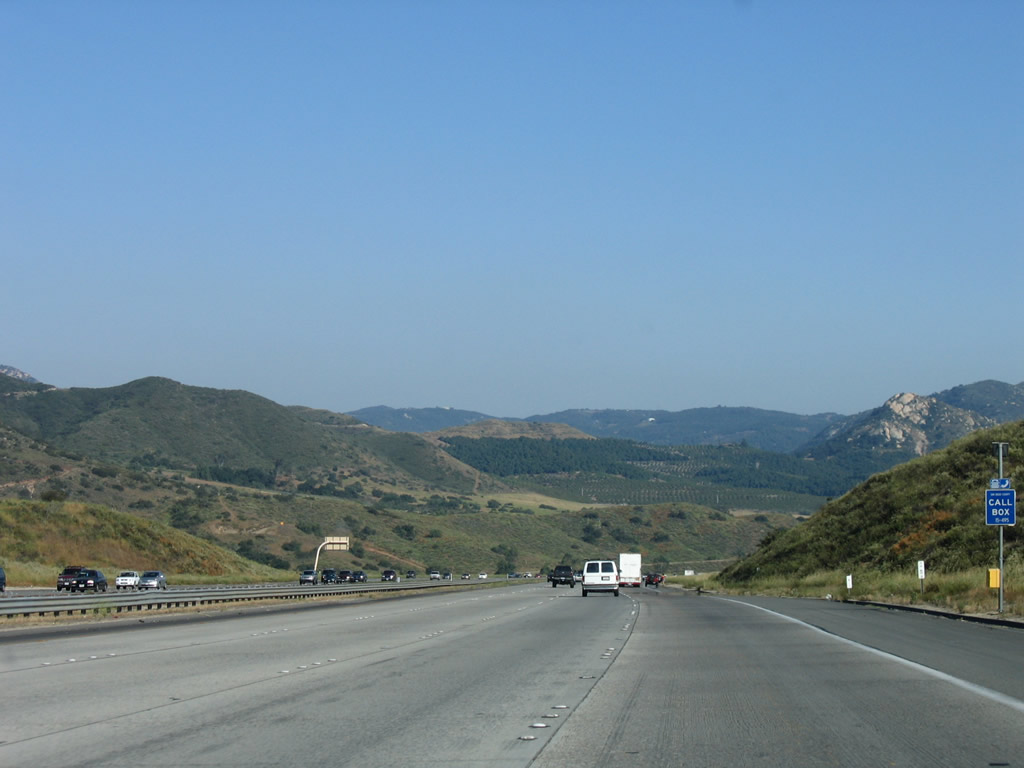
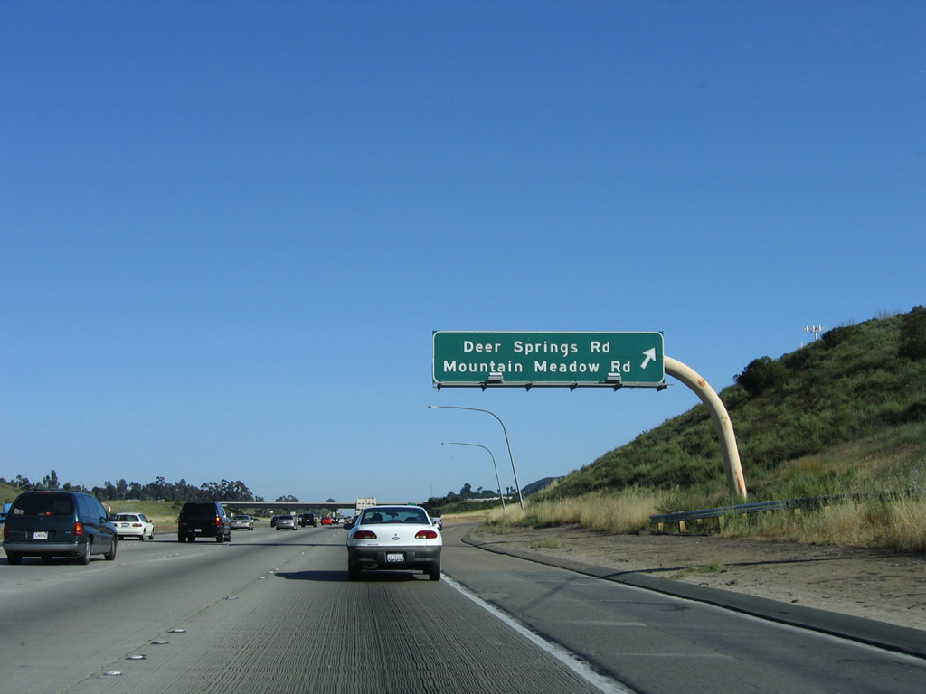
The next exit along Interstate 15 south is Exit 37, Deer Springs Road and Mountain Meadow Road, one mile. Photo taken 06/03/06. |
|
This exit serves four separate roadways. Champagne Boulevard is old U.S. 395, which parallels Interstate 15 on the east side of the freeway. Deer Springs Road and Mountain Meadow Road lead east-west across the valley. Lawrence Welk Drive connects to the resort center and museum. Photo taken 06/03/06. |
|
Exit 37 serves the unincorporated community of Hidden Meadows and connects to San Diego County S-12/Deer Springs Road southwest to the city of San Marcos and Twin Oaks Valley Road. Photo taken 06/03/06. |
|
San Diego County S-12 travels southwest from this interchange along Deer Springs Road to Twin Oaks Valley Road toward San Marcos. Near California 78, the county route turns west onto San Marcos Boulevard, then enters the city of Carlsbad. Once in Carlsbad, San Diego County S-12 changes into Palomar Airport Road, passes by the north county airport, and meets Interstate 5 at Exit 47 south of the Agua Hedionda Lagoon. Photo taken 06/03/06. |
|
Southbound Interstate 15 (Escondido Freeway) (Avocado Highway) reaches Exit 37, San Diego County S-12/Deer Springs Road west and Mountain Meadow Road east to Old Highway 395/Champagne Boulevard. Photo taken 06/03/06. |
|
|
This reassurance shield for Interstate 15 south is posted after the on-ramp from Exit 37; the angular state-named shield was replaced with a neutered angular shield in 2008. Sadly, many new reassurance shields in San Diego County feature this disturbing new look. Photos taken 07/14/08 and 06/03/06. |
|
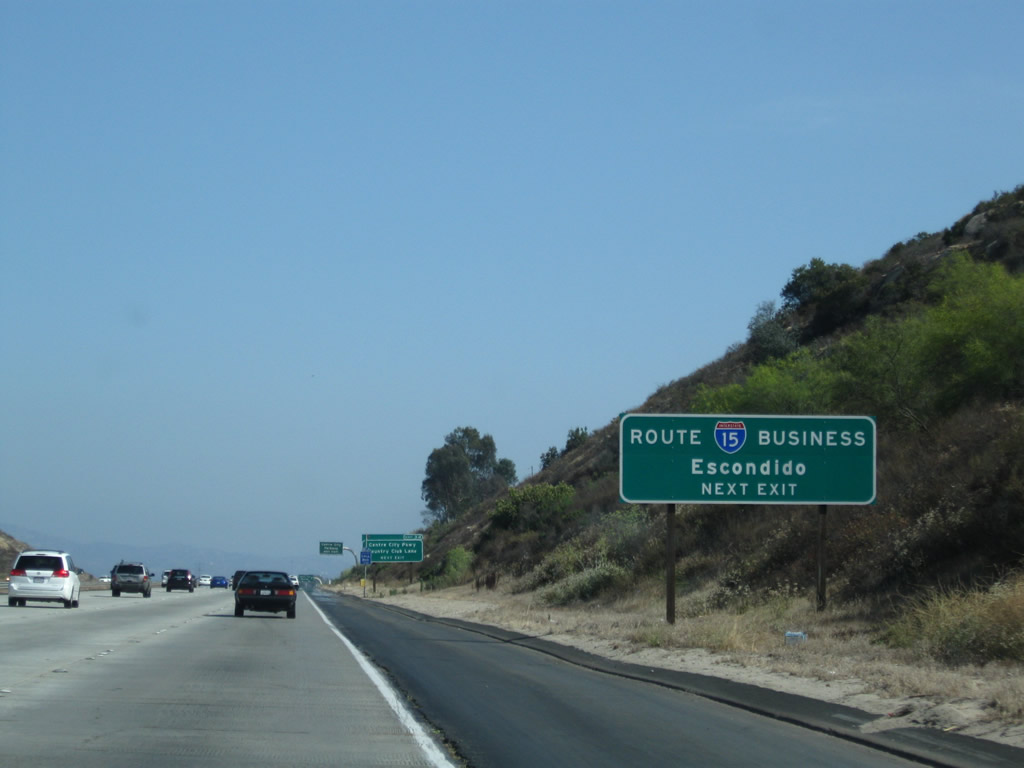
The next exit along southbound Interstate 15 (Escondido Freeway) (Avocado Highway) is Exit 34, Business Loop 15/Centre City Parkway south to Escondido. Photo taken 06/03/06. |
|
|
The Business Loop 15 that follows Centre City Parkway south through Escondido is the final signed business route on Interstate 15 south. The business route follows an expressway alignment through the city, rejoining Interstate 15 at Exit 28. Both ends of the business route connect to Interstate 15 via wye interchanges. Photos taken 07/26/09 and 06/03/06. |
|
An exit number sign for Exit 34, Business Loop 15/Centre City Parkway is posted shortly thereafter. Interstate 15 will now leave rural north San Diego County and enter the city of Escondido. Photo taken 06/03/06. |
|
Southbound Interstate 15 (Escondido Freeway) (Avocado Highway) approaches Exit 34, Business Loop 15/Centre City Parkway south to Escondido. Photo taken 06/03/06. |
|
A city limits sign for the city of Escondido is posted prior to the off-ramp to Exit 34. Known as the "Heart of San Diego North," Escondido means "hidden" in Spanish. Founded in 1888, Escondido was home to 133,559 people as of the 2000 Census. The city sits at an elevation of 646 feet and features a historic downtown district along Grand Avenue. Photo taken 06/03/06. |
|
Southbound Interstate 15 (Escondido Freeway) (Avocado Highway) reaches Exit 34, Business Loop 15/Centre City Parkway south to Escondido. Photo taken 06/03/06. |
|
The next exit along Interstate 15 (Escondido Freeway) (Avocado Highway) south is Exit 33, El Norte Parkway. Photo taken 06/03/06. |
|
Southbound Interstate 15 (Escondido Freeway) (Avocado Highway) reaches Exit 33, El Norte Parkway. After this interchange, the Avocado Highway designation comes to an end. Photo taken 06/03/06. |
| Interstate 15 (Escondido Freeway) south |
|
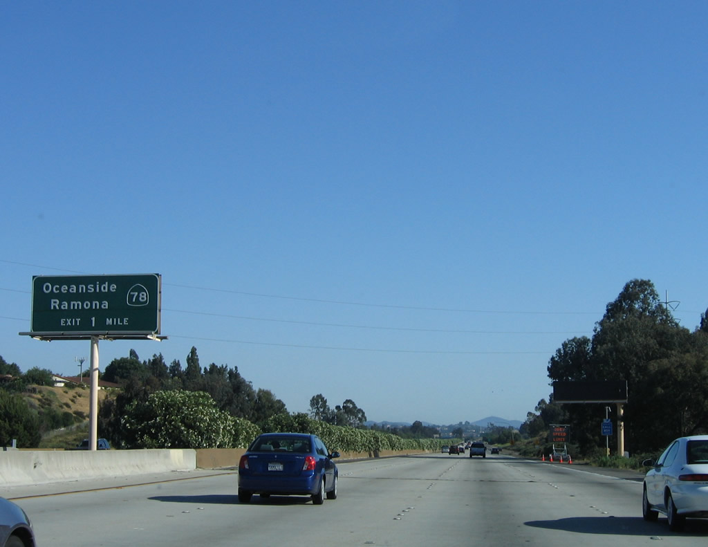
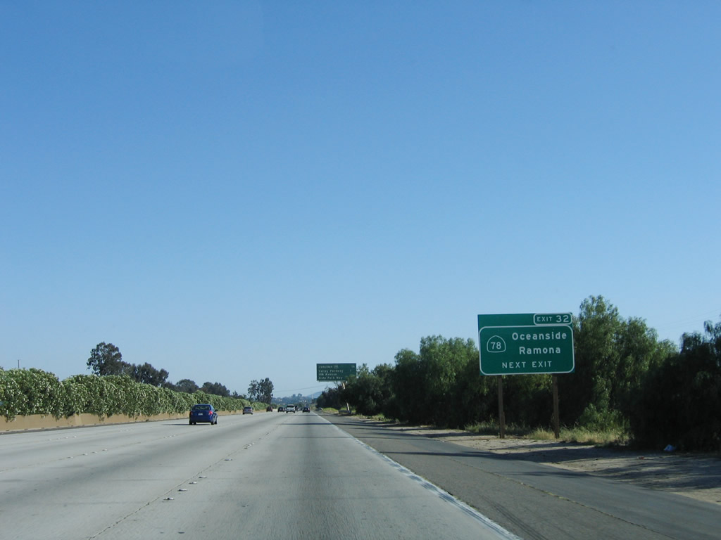
The next exit along Interstate 15 (Escondido Freeway) south is Exit 32, California 78 (Ronald Packard Freeway) west to San Marcos, Vista, and Oceanside and east to Escondido. Photo taken 06/03/06. |
|
A 230kV San Diego Gas & Electric power line passes overhead. Photo taken 10/02/11. |
|
California 78 is major east-west state route across Southern California. Originating in Oceanside, California 78 is a freeway from Oceanside east to Escondido via the cities of San Marcos and Vista along the way. East of this interchange, California 78 quickly becomes a surface street, skirting downtown Escondido via Broadway and Washington Avenue. East of Escondido, California 78 gains a rural character, passing the Wild Animal Park and the San Pasqual Valley before entering unincorporated Ramona. Passing through foothills, California 78 is the primary route from Ramona to Julian, then descends to the Anza-Borrego Desert State Park. From there, California 78 has a straight shot across the Imperial Valley, edging near the Salton Sea, then crossing the Imperial Sand Dunes. California 78 ends at Interstate 10 in Blythe only a short distance from the Colorado River and the state of Arizona. Photo taken 06/03/06. |
|
An exit number sign is posted for Exit 32, California 78 (Ronald Packard Freeway). Photo taken 06/03/06. |
|
This mileage sign provides the distance to the next three exits: Exit 32, California 78; Exit 31, San Diego County S-6/Valley Parkway; and Exit 30, Ninth Avenue and Auto Park Way. Photo taken 06/03/06. |
|
Southbound Interstate 15 reaches Exit 32, California 78 (Ronald Packard Freeway). There are plans to extend California 78 as a freeway east of here, but such an extension would be costly both in terms of land acquisition and the movement of people along the right of way. As such, an eastbound California 78 freeway extension is unlikely to occur anytime soon. Upon departing Interstate 15 south, the ramp splits, with a left ramp to California 78 east and a right ramp to California 78 west. Photo taken 06/03/06. |
|
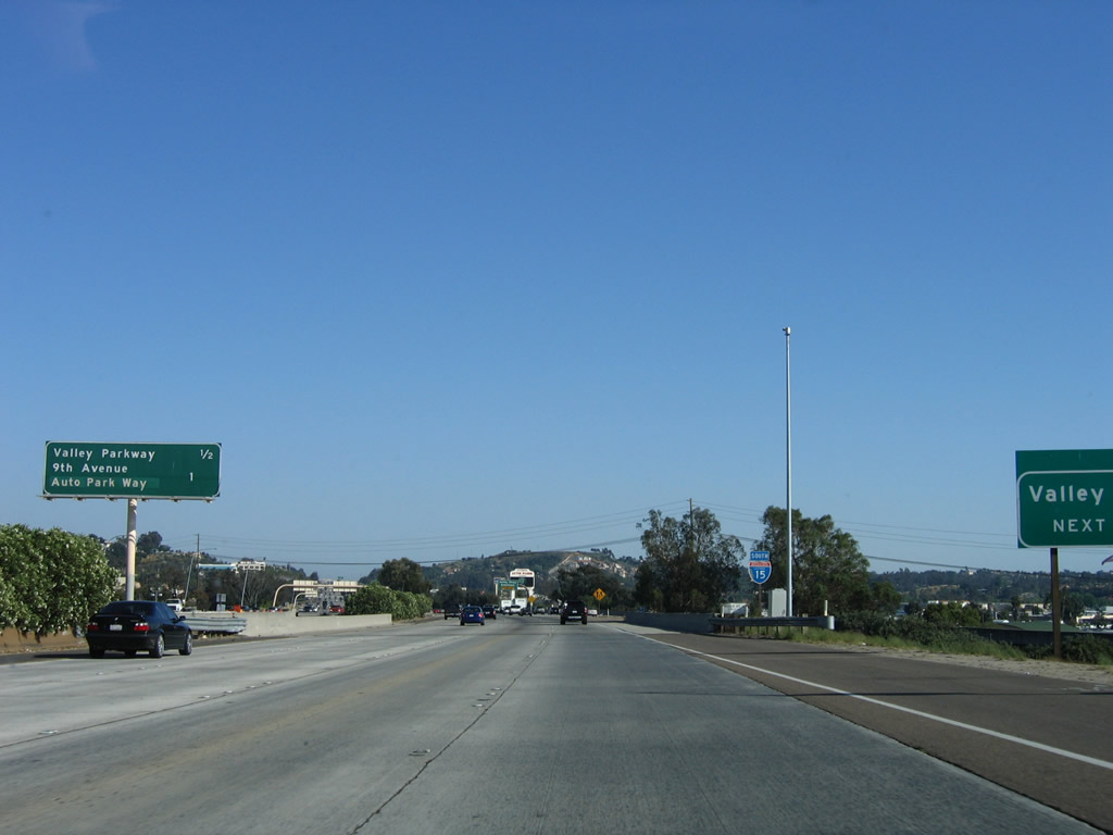
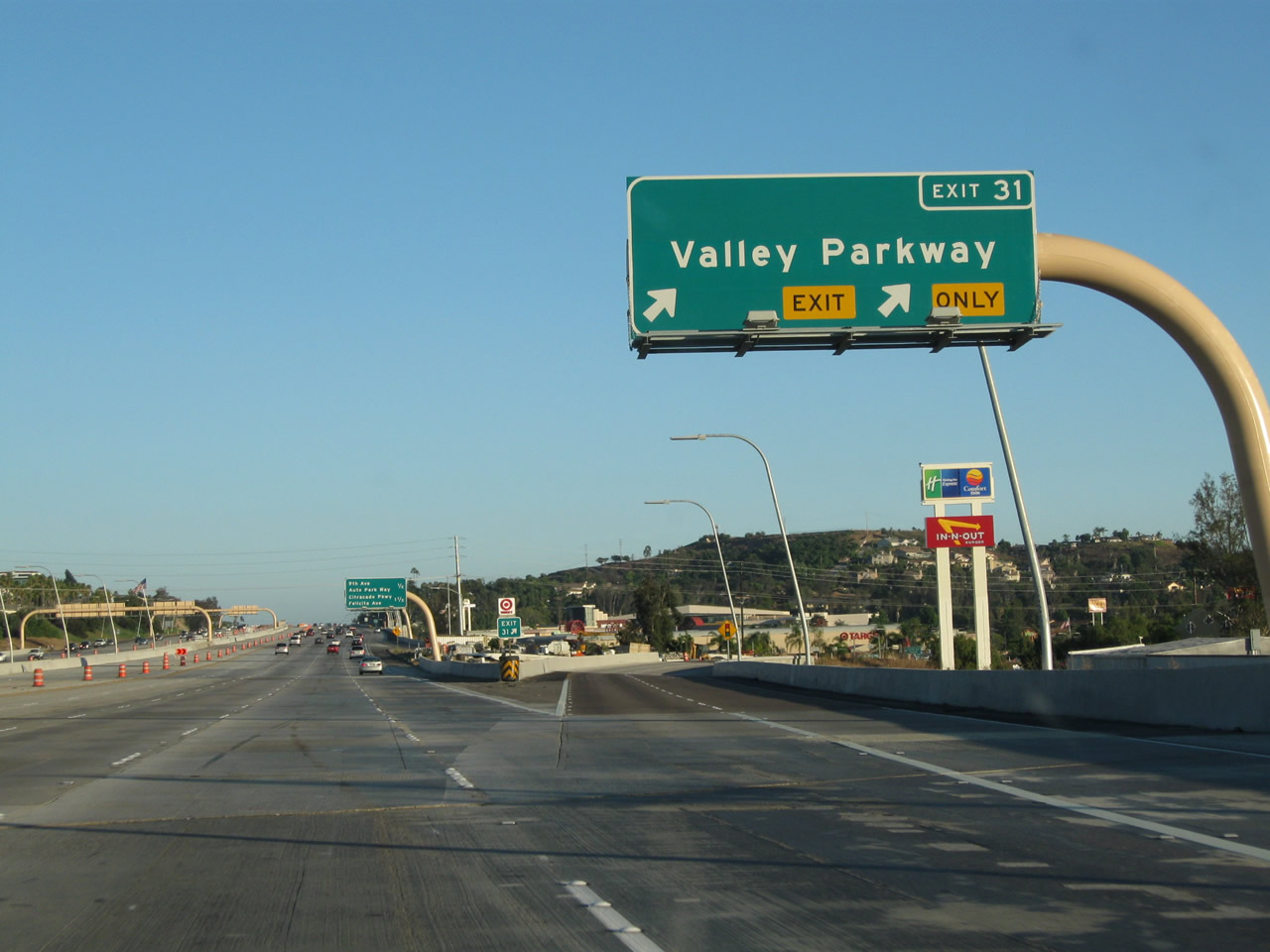
The next exit along Interstate 15 (Escondido Freeway) south is Exit 31, San Diego County S-6/Valley Parkway. Omitted is any mention of the county route designation. To the west, San Diego County S-6 travels southwest along Valley Parkway to Del Dios Highway, which in turn leads south toward Olivenhain and Rancho Santa Fe. San Diego County S-6 again turns west onto Via de la Valle en route to the coastal cities of Del Mar and Solana Beach. Photo taken 06/03/06. |
|
Use San Diego County S-6/Valley Parkway west to the California Center for the Arts Escondido, which is located near downtown Escondido in the Civic Center complex. Also to the east, San Diego County S-6 passes through downtown Escondido, then turns northeast toward Valley Center and ultimately Palomar Mountain, ending at the observatory parking lot. Photo taken 07/17/11. |
|
|
An exit number roadside sign is posted on southbound for Exit 31, San Diego County S-6/Valley Parkway. This sign was replaced between 2008 and 2011. An exit number sign for Exit 31 is posted on the side of the freeway; the hospital is Palomar Medical Center, located just east of downtown near where the one-way couplet merges back together. Photos taken 07/17/11 and 07/14/08. |
|
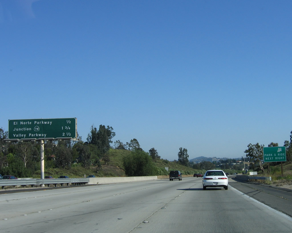
This mileage sign used to provide the distance to the next three exits: Exit 31, San Diego County S-6/Valley Parkway; Exit 30, Ninth Avenue and Auto Park Way; and Exit 29, Felicita Road. The interchange sequence sign was moved a bit further south with the Express Lanes construction. To follow Historic U.S. 395 north on its journey through Vista, San Marcos, Bonsall, and Fallbrook, exit Valley Parkway west to Auto Park Way north. Auto Park Way changes into Vineyard Avenue, which connects to Citracado Parkway and Mission Road (San Diego County S-14, which is 1930s-era old U.S. 395). For old U.S. 395 south, follow Valley Parkway east to downtown Escondido, then follow Escondido Boulevard south toward Lake Hodges. Photo taken 06/03/06. |
|
|
The right two lanes become exit only for Exit 31, San Diego County S-6/Valley Parkway; the left lanes continue south on Interstate 15. Use San Diego County S-6/Valley Parkway east to downtown Escondido. Shortly after the Interstate 15 interchange, San Diego County S-6 splits into a one-way couplet. Eastbound traffic follows Second Avenue, while westbound traffic uses Valley Parkway. The Escondido civic center, California Center for the Arts, Heritage Walk Museum, and Grape Day Park are all located on the north side of Valley Parkway between Broadway and Escondido Boulevard. To this complex, follow Valley Parkway east to the transition to Second Avenue, then turn north on either Escondido Boulevard or Broadway. Parking is available along Woodward Avenue at the north end of the civic center complex. Photos taken 07/17/11 and 06/03/06. |
|
The advance sign for the California Center for the Arts Escondido used to be located here rather than further north as shown above. Photo taken 06/03/06. |
|
|
|
Southbound Interstate 15 (Escondido Freeway) reaches Exit 31, San Diego County S-6/Valley Parkway east to downtown Escondido, and southwest to Del Mar and Solana Beach. This sign changed three times between 2006 and 2011. Photos taken 07/17/11, 07/14/08, and 06/03/06. |
|
|
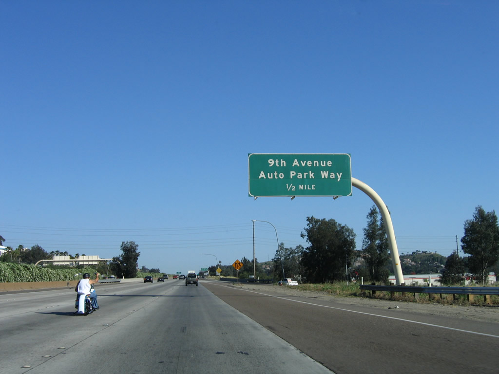
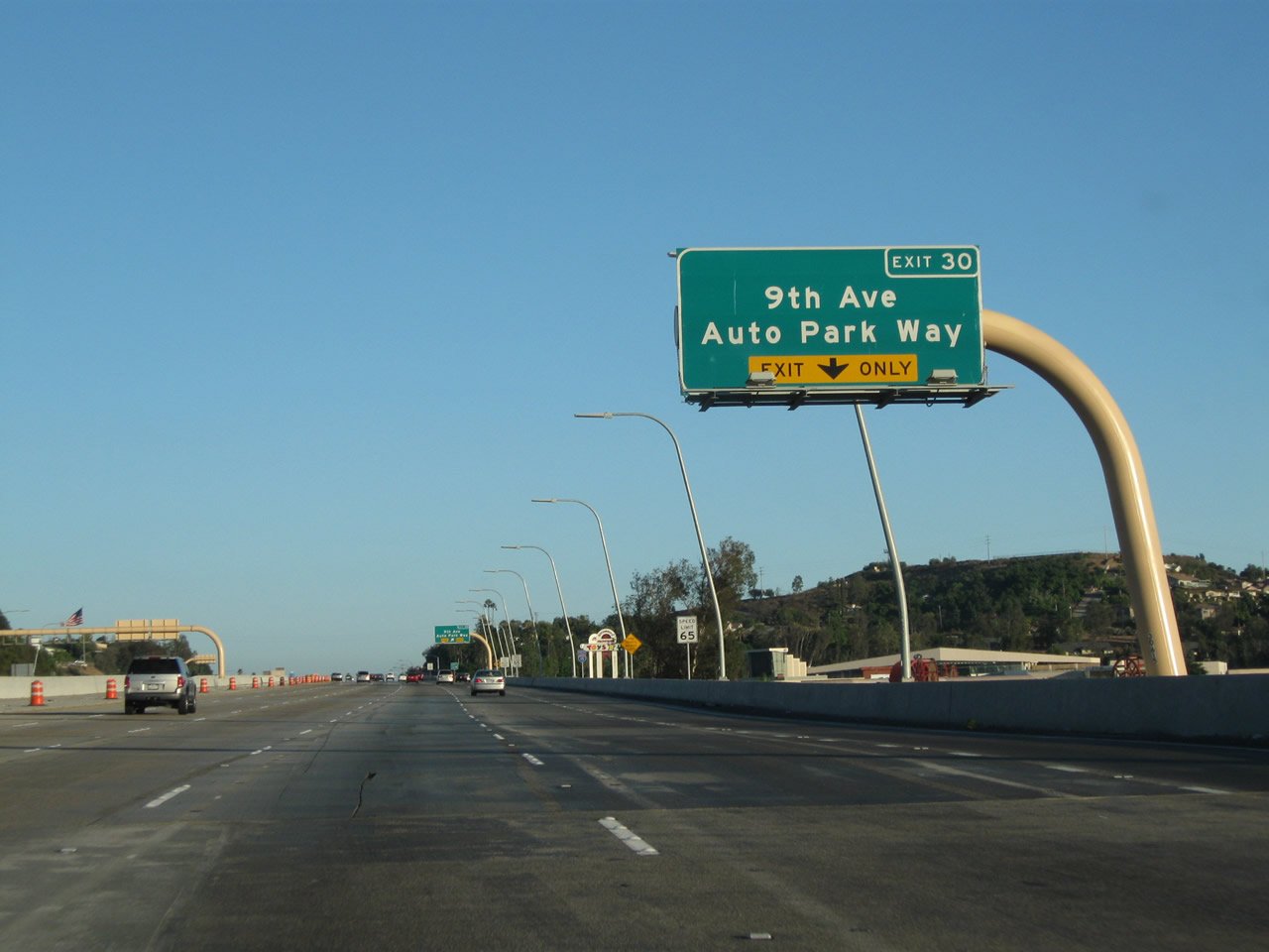
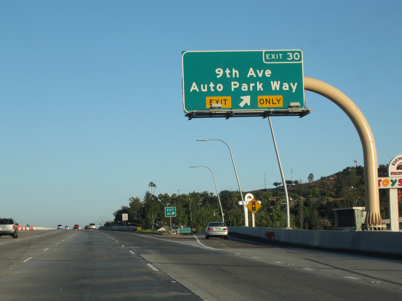
The next exit along southbound Interstate 15 is Exit 30, Ninth Avenue and Auto Park Way, one-half mile. Photos taken 07/17/11 and 06/03/06. |
|
The right lane of Interstate 15 south becomes exit only for Exit 30, Ninth Avenue and Auto Park Way. Photo taken 07/17/11. |
|
|
Another neutered, angular Interstate 15 south reassurance shield was briefly posted here (after the on-ramp from Valley Parkway) from 2008 to 2011; it was replaced with a much nicer, state-named route marker! Photos taken 07/17/11 and 07/14/08. |
|
|
Southbound Interstate 15 (Escondido Freeway) meets Exit 30, Ninth Avenue and Auto Park Way. Photos taken 07/17/11 and 06/03/06. |
|
The next exit along southbound Interstate 15 is Exit 29, Felicita Road, one mile. Photo taken 06/03/06. |
|
|
The right lane becomes exit only for Exit 29. Prior to 2010, this mileage sign provided the distance to the next three exits: Exit 29, Felicita Road; Exit 27, Via Rancho Parkway; and Exit 26, San Diego County S-5/Pomerado Road south and West Bernardo Road south. Photos taken 07/17/11 and 07/14/08. |
|
A neutered, angular Interstate 15 south reassurance shield was posted shortly thereafter but was removed in favor of the state-named shield shown in the prior photobox. Photo taken 07/14/08. |
|
An exit number roadside sign for Exit 29, Felicita Road was posted on southbound in 2006; it was gone by 2011. Photo taken 06/03/06. |
|
|
Southbound Interstate 15 (Escondido Freeway) meets Exit 29, Felicita Road. Photos taken 07/17/11 and 06/03/06. |
|
|
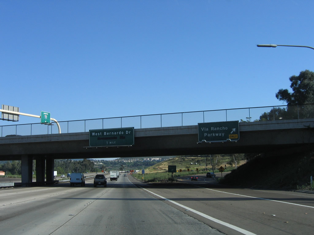
This mileage sign provides the distance to the next two exits: Exit 27, Via Rancho Parkway; and Exit 26, San Diego County S-5/Pomerado Road south and West Bernardo Road south. Note that there is no access to northbound Business Loop I-15 (Centre City Parkway) (old U.S. 395), which merges back onto Interstate 15 southbound near here. (NOTE: the exit to Pomerado Road was closed at the time this photo was taken, but it has since reopened.) Photos taken 07/17/11 and 06/03/06. |
|
Via Rancho Parkway extends east to the North County Fair Mall, then connects to Bear Valley Parkway north and San Pasqual Road east. To the west, Via Rancho Parkway skirts southwestern Escondido before connecting with Del Dios Highway (San Diego County S-6). This sign was removed when the Express Lanes were under construction. Photo taken 06/03/06. |
|
|
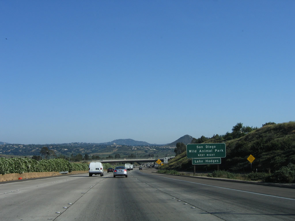
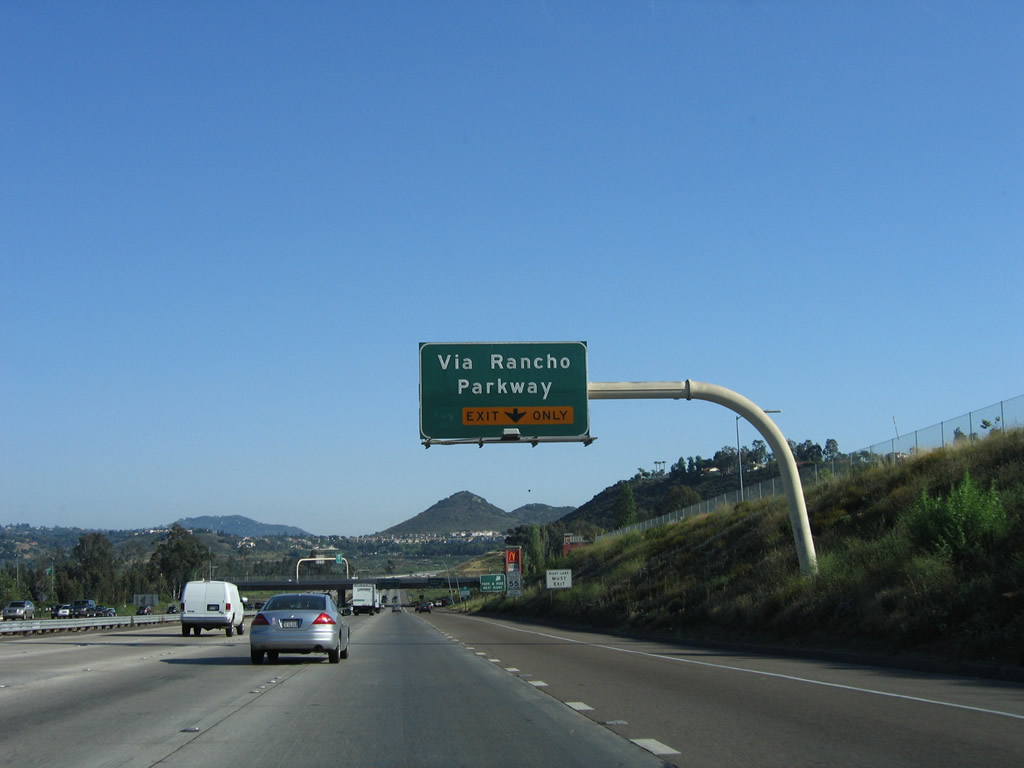
Use Via Rancho Parkway east to the north shore of Lake Hodges and to the San Diego Wild Animal Park via San Pasqual Valley Road and California 78 east. Traffic from Business 15 (Centre City Parkway) merges back onto the freeway at this point (northbound, this is Exit 28). Construction of the managed lanes project has resulted in changes to this section of freeway, including a new future off-ramp. Photos taken 07/17/11and 06/03/06. |
|
|
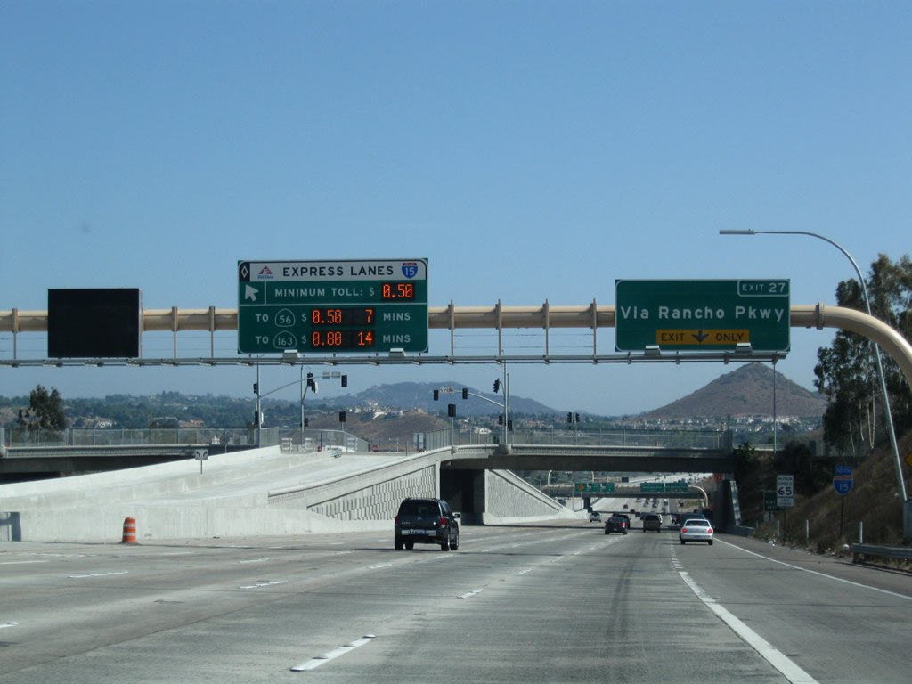
The right lane becomes exit only for Exit 27, Via Rancho Parkway after traffic from the business route merge onto southbound Interstate 15. Exit 27 is the final Escondido exit. Major changes occurred here in 2009 with the opening of the managed lanes. Note the variable message sign providing toll rates for single occupancy vehicles. Carpools (high occupancy vehicles) may use the managed lanes in the center for free; access to the lanes is a bit more restricted than the main lanes due to the smaller number of exits. Photos taken 07/26/09 and 06/03/06. |
|
|
|
Southbound Interstate 15 reaches Exit 27, Via Rancho Parkway; the next exit along southbound is Exit 26, San Diego County S-5/Pomerado Road south and West Bernardo Road south within the city of San Diego. This area has changed significantly due to the ongoing managed lanes project. Check back here later for photos as the new freeway emerges. Photos taken 07/26/09, 07/14/08, and 06/03/06. |
Page Updated November 4, 2011.