| Interstate 15 (Escondido Freeway) south |
|
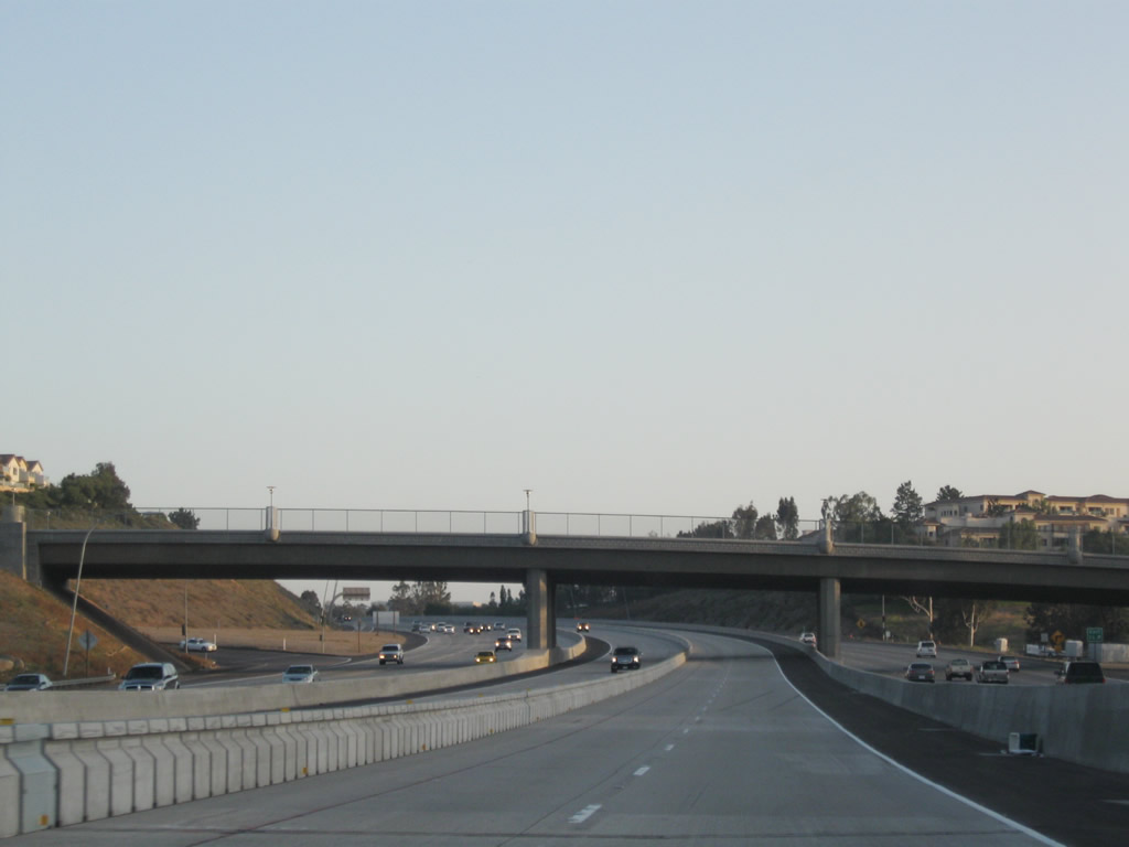
After much promise, Interstate 15 (Escondido Freeway) enters the city of San Diego as the freeway crosses Lake Hodges, a reservoir created by damming the San Dieguito River and by importing water via the San Diego Aqueduct program. Photo taken 06/03/06. |
|
San Diego County S-5 begins its short southbound journey at this interchange. It takes Pomerado Road south to Rancho Bernardo Road east, which changes into Espola Road upon entering the city of Poway. Once in Poway, San Diego County S-5 heads southeast to meet San Diego County S-4 (Poway Road) east of downtown Poway. The signage for this route is far better in Poway than in San Diego. Photo taken 08/08/04. |
|
|
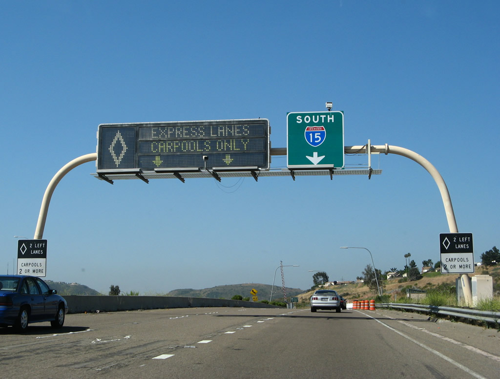
The next exit along Interstate 15 south is Exit 26, San Diego County S-5/Pomerado Road south and West Bernardo Drive south. An older interchange sequence sign used to provide the distance to the next two exits: Exit 26, San Diego County S-5/Pomerado Road south and West Bernardo Road south and Exit 24, Rancho Bernardo Road. Pomerado Road between Exit 26 and Exit 14 follows the original alignment of U.S. 395 prior to being straightened out along the current Interstate 15 corridor. Some remnants of old U.S. 395 still remain in southern Poway (along Old Pomerado Road). Note the changes in the freeway here due to the Express Lanes. Photos taken 10/02/11 and 08/08/04. |
|
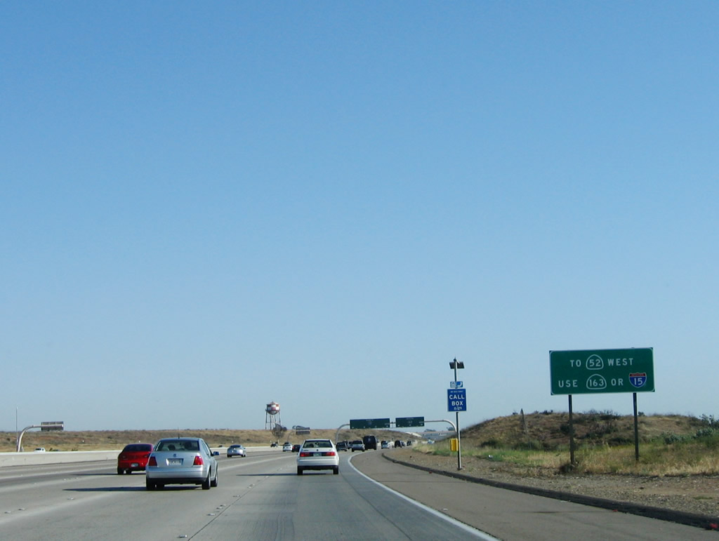
Southbound Interstate 15 reaches Exit 26, San Diego County S-5/Pomerado Road south and West Bernardo Road south. This exit serves the community of Rancho Bernardo, the northernmost area of San Diego. It is bisected by Interstate 15, with West Bernardo Drive serving the western half of the community and Pomerado Road serving the east side of the community. This interchange has been reconstructed, and the signage has changed since 2004. Photo taken 08/08/04. |
|
|
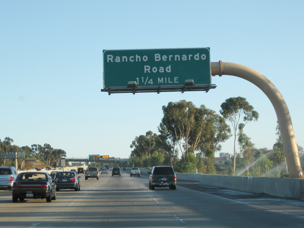
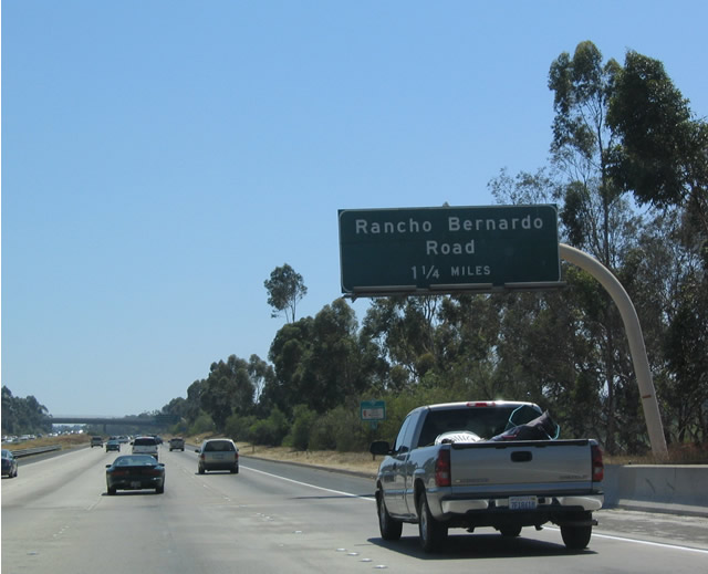
The next exit along southbound is Exit 24, Rancho Bernardo Road (1.25 miles). A replacement sign was installed by 2010. Photos taken 07/17/11 and 08/08/04. |
|
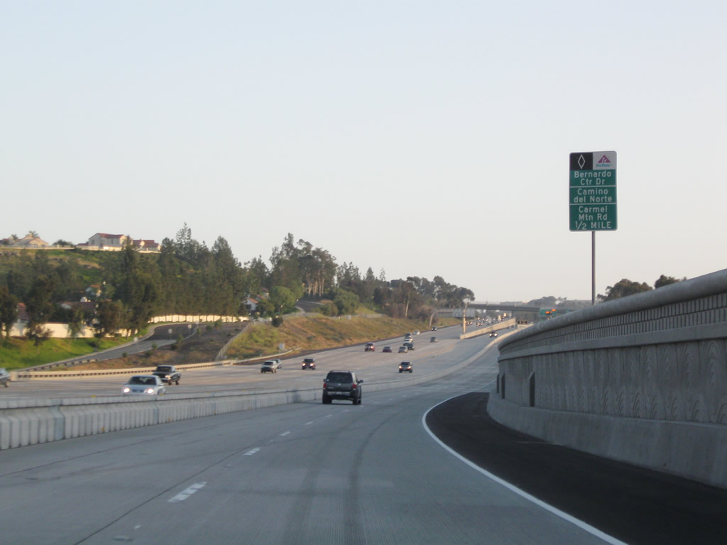
After Exit 24, Rancho Bernardo Road, the next two exits are Exit 23, Bernardo Center Drive and Exit 22, Camino del Norte. This sign was moved from here to the overpass. Photo taken 08/08/04. |
|
|
A second mileage sign used to provide the distance to the interchange with Interstate 8 in Mission Valley (18 miles at Exit 6) as well as the distance to downtown via California 163. Photos taken 07/17/11 and 08/08/04. |
|
The most direct route to the city of Poway is to use Rancho Bernardo Road east past the city limits, where the road becomes Espola Road. Photo taken 08/08/04. |
|
|
Southbound Interstate 15 (Escondido Freeway) reaches Exit 24, Rancho Bernardo Road, and the next exit is Exit 23, Bernardo Center Drive. Photos taken 07/17/11 and 08/08/04. |
|
|
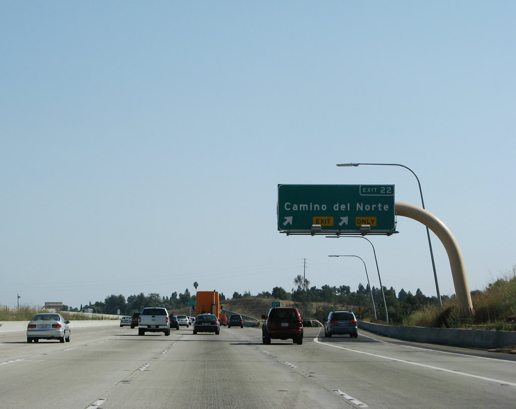
After Exit 23, Bernardo Center Drive, the next exits are Exit 22, Camino del Norte and Exit 21, Carmel Mountain Road. Photos taken 07/14/08 and 08/08/04. |
|
Passing under the managed lanes connecting ramp and overpass, the next mainline off-ramp is Exit 23, Bernardo Center Drive west to 4-S Ranch and Carmel Valley. Photo taken 07/14/08. |
|
|
Southbound Interstate 15 next meets Exit 23, Bernardo Center Drive, which is the third of four exits that serve Rancho Bernardo. Photos taken 07/14/08 and 08/08/04. |
|
|
The next three exits along southbound are Exit 22, Camino del Norte; Exit 21, Carmel Mountain Road; and Exit 19, California 56 (Ted Williams Freeway) west to Carmel Valley and Ted Williams Parkway east to Poway. Photos taken 07/14/08 and 08/08/04. |
|
|
Use Camino del Norte west to reach the community of 4S Ranch in the unincorporated county and the community of Black Mountain Ranch North (Del Sur) in the city of San Diego. Photos taken 07/14/08 and 08/08/04. |
|
|
The next exit along southbound is Exit 21, Carmel Mountain Road, which is the first exit that serves Carmel Mountain Ranch and Rancho Penasquitos. The newer sign was modified to a mileage sign and was moved about a quarter mile north of the older sign. Photos taken 06/03/06 and 08/08/04. |
|
|
Carmel Mountain Road is fairly long road with a gap in the middle. Currently, it extends from Carmel Mountain Ranch southwest to Torrey Highlands, then ends in a field of open space. To the west, Carmel Mountain Road resumes in Del Mar Mesa, and it passes through Carmel Country Highlands and Torrey Hills before it will meet Interstate 5 in an interchange to be constructed in 2007. It is unclear if the gap between Torrey Highlands and Del Mar Mesa will ever be filled to make one continuous roadway. Photos taken 06/03/06 and 08/08/04. |
|
Prior to the opening of the new Express Lanes, the former reversible express lanes for high occupancy vehicles originally began just after Exit 19, Ted Williams Parkway/California 56. At the time this photo was taken, the express lanes were closed for southbound motorists. Photo taken 08/08/04. |
|
Southbound Interstate 15 (Escondido Freeway) reaches Exit 21, Carmel Mountain Road. This exit serves the community of Rancho Peñasquitos to the west and Carmel Mountain Ranch to the west. Photo taken 06/03/06. |
|
|
The next two exits along southbound are Exit 19, California 56 (Ted Williams Freeway) and Exit 18, San Diego County S-4 (Poway Road) east and Rancho Peñasquitos Boulevard west. Photos taken 06/03/06 and 08/08/04. |
|
|
Southbound Interstate 15 next approaches Exit 19, California 56 (Ted Williams Freeway) west to Carmel Valley and Ted Williams Parkway east to Sabre Springs and the city of Poway. Photos taken 07/14/08 and 08/08/04. |
|
A roadside sign for Exit 19, California 56 is posted shortly thereafter. Photo taken 07/14/08. |
|
|
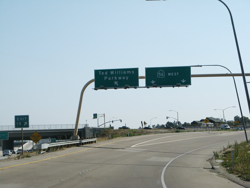
Southbound Interstate 15 (Escondido Freeway) reaches Exit 19, California 56 (Ted Williams Freeway) west and Ted Williams Parkway east. This interchange was reconfigured due to the managed lanes project between 2004 and 2008. However, this project did not result in a freeway-to-freeway interchange. In 2004, temporary signage was in place at Exit 19 until the current overpass was completed. Traffic signals still remain. Since California 56 opened as a freeway, this interchange can be the scene of backups and delays due to the signals. Photos taken 07/14/08 and 08/08/04. |
|
Now on the transition ramp, the connection between Interstate 15 south and California 56 west does not require stopping at the traffic signal and essentially functions as a freeway to freeway connection. However, the connection to Ted Williams Parkway east to Sabre Springs and the city of Poway is served by a traffic signal. Photo taken 07/14/08. |
|
At this point, the main lanes of Interstate 15 used to offer a transition onto the high occupancy vehicle/reversible lanes. However, upon conversion to managed lanes in 2011, this ramp was closed and access moved to the center of the freeway. Only two lanes wide, the old express lanes used to be open for southbound traffic only during the morning commuting hours on most days. They were closed at the time the picture was taken. Photo taken 08/08/04. |
|
Historic picture: Now on the defunct transition ramp to the high occupancy vehicle/reversible lanes, a direct connection used to be provided from Interstate 15 south (left lane) and California 56 east (right lane). This ramp is now in use solely for California 56 traffic only. A variable toll rate message sign is posted on the transition ramp; the rate changes with the traffic congestion on the main lanes. On this day, the toll lanes were open for southbound traffic. For those unwilling to pay the toll or without the required two or more people per vehicle, the right lane will transition directly back onto Interstate 15 south. Photo taken 05/30/08. |
|
The transition ramp splits here, with the left two lanes connecting to the southbound high occupancy vehicle/reversible lanes, and the right lane reconnecting to Interstate 15 south. As noted earlier, this ramp is part of the direct connection between California 56 east and Interstate 15 south. Photo taken 05/30/08. |
|
A small gore point sign presents the split between the "carpool" (high occupancy vehicle or toll) lanes and the return to mainline Interstate 15 south. During commuting hours, the ramp back to the mainline is regulated by a ramp meter. The configuration of this split has changed with the addition of managed lanes in 2011. Photo taken 05/30/08. |
|
Back on the mainline, the next two exits along southbound are Exit 18, San Diego County S-4 (Poway Road) east to Poway and Rancho Peñasquitos Boulevard west to the community of Rancho Peñasquitos and Exit 17, Scripps Poway Parkway east to Scripps-Miramar Ranch North and Mercy Road west to Mira Mesa. While Interstate 15 does not enter the city of Poway, both Exits 18 and 17 provide direct access into Poway. Due to reconstruction and the managed lanes project, this sign was removed a few years after this picture was taken. Photo taken 08/08/04. |
|
|
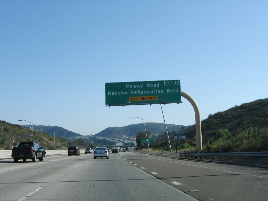
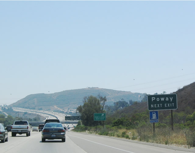
The next exit along Interstate 15 south is Exit 18, San Diego County S-4 (Poway Road)/Rancho Peñasquitos Boulevard. The county route basically follows Poway Road between Interstate 15 and California 67 in the east near the foot of Iron Mountain. Photos taken 06/03/06 and 08/08/04. |
|
|
Use San Diego County S-4 (Poway Road) east to the city of Poway; Exit 18 is the second of three exits to serve the city of Poway, which sits east of the freeway. The roadside sign was replaced by an overhead sign since the right lane exits only. Due to the expansion of the managed lanes, this sign was temporarily removed in 2008. Photos taken 06/03/06 and 08/08/04. |
|
A roadside auxiliary sign for Exit 18 (San Diego County S-4 (Poway Road) and Rancho Peñasquitos Boulevard) used to be placed shortly thereafter; it is gone due to expansion of the managed lanes. Photo taken 06/03/06. |
|
|
Southbound Interstate 15 (Escondido Freeway) meets Exit 18, San Diego County S-4 (Poway Road) east and Rancho Peñasquitos Boulevard west. The sign here was changed as a result of the managed lanes project, wasd under construction from 2009 to 2012. The managed lanes (two high-occupancy/toll lanes in each direction) between California 56 and California 163 initially opened to traffic on June 27, 2011 (with direct access ramps and configuration changes done by 2012). Photos taken 06/04/11 and 06/03/06. |
|
|
With the managed lanes widening coming to Interstate 15, this bridge will be replaced with an entirely new bridge. This mileage sign on Interstate 15 south provides the distance to the next three exits: Exit 17, Scripps Poway Parkway and Mercy Road west; Exit 16, Mira Mesa Boulevard; and Exit 15, Carroll Canyon Road. The mileage sign was only around for a couple years (2006-2008), then replaced by 2010. Prior to 2006, the original sign only showed the distance to Exit 17. Scripps Poway Parkway travels east to Miramar Ranch North and Poway and Mercy Road travels west to Mira Mesa, Los Peñasquitos Canyon Preserve, and Rancho Peñasquitos. This sign would likely come back after the overpass is completed to allow for the new managed lanes to pass underneath. Photos taken 06/04/11, 05/30/08, 06/03/06, and 08/08/04. |
|
|
|
|
|
The right two lanes of Interstate 15 (Escondido Freeway) south connect to Exit 17, Scripps Poway Parkway east and Mercy Road west. The 2011 picture shows a sign was replaced as part of the managed lanes project. Photos taken 06/04/11, 06/03/06, and 08/08/04. |
|
|
|
Southbound Interstate 15 (Escondido Freeway) reaches Exit 17, Scripps Poway Parkway east and Mercy Road west. Photos taken 06/04/11, 06/03/06, and 08/08/04. |
|
|
After Exit 17 is this mileage sign with the distance to Interstate 8 and downtown San Diego. Note the changes to the roadway as a result of the ongoing widening project to convert the carpool/HOT lanes into managed lanes. Photos taken 05/30/08 and 06/03/06. |
|
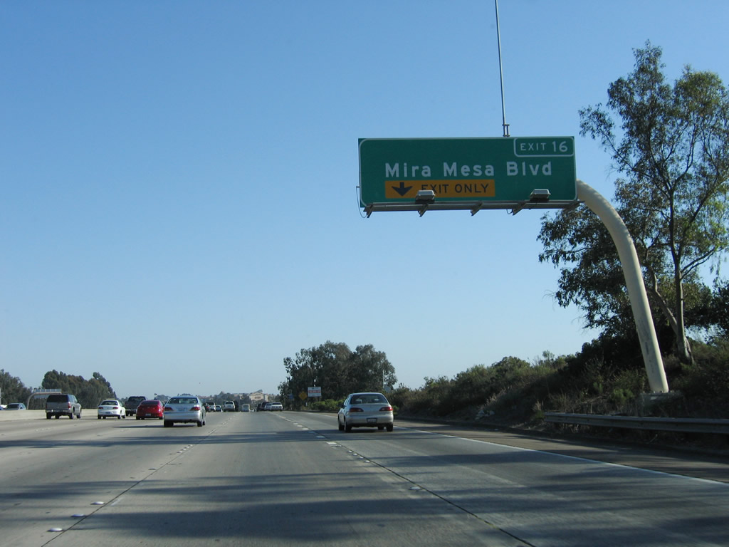
The next exit along southbound is Exit 16, Mira Mesa Boulevard. This sign was removed during the managed lanes project, only to be replaced with the sign shown in the next photobox. Photo taken 06/03/06. |
|
|
The next two exits along southbound are Exit 16, Mira Mesa Boulevard and Exit 15, Carroll Canyon Road. Access to the managed lanes is provided at this point. Photos taken 06/04/11 and 06/03/06. |
|
Use Exit 16 to Miramar Reservoir (via Mira Mesa Boulevard east) and Miramar College (via Mira Mesa Boulevard west to Black Mountain Road south). Photo taken 06/03/06. |
|
|
Mira Mesa Boulevard is a major east-west corridor that spans the Mira Mesa community between Scripps Ranch in the east and Sorrento Valley in the west, where it meets Interstate 805. For much of its length, it is six to eight lanes wide. This sign was also replaced due to the Managed Lanes project. Photos taken 06/04/11 and 06/03/06. |
|
|
Southbound Interstate 15 (Escondido Freeway) reaches Exit 16, Mira Mesa Boulevard; the next exit is Exit 15, Carroll Canyon Road. (Note the incorrect exit number was posted in the 2011 picture.) The 2011 picture also shows the distance to Exit 12, California 163 (Cabrillo Freeway) (four miles). Photos taken 06/04/11 and 06/03/06. |
|
|
The next exit along southbound Interstate 15 (Escondido Freeway) is Exit 15, Carroll Canyon Road. Photos taken 06/04/11 and 06/03/06. |
|
|
Southbound Interstate 15 (Escondido Freeway) reaches Exit 15, Carroll Canyon Road. The sign was changed as a result of the managed lanes project. Photos taken 06/06/11 and 06/03/06. |
|
|
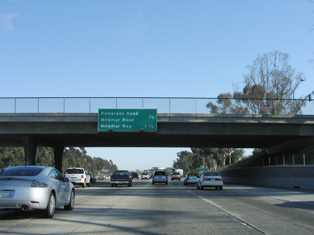
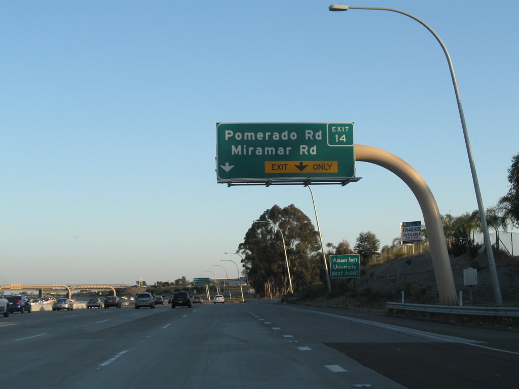
The next two exits along southbound are Exit 14, Pomerado Road and Miramar Road and Exit 13, Miramar Way. This sign was missing by 2011. Photos taken 06/06/11 and 06/03/06. |
|
|
The right lane becomes exit only for Exit 14, Pomerado Road and Miramar Road. Pomerado Road heads northeast through Scripps Ranch to Rancho Encantada, Poway, and ultimately Rancho Bernardo. Miramar Road heads west along the northern edge of the Miramar Marine Corps Air Station, then changes into La Jolla Village Drive upon crossing Interstate 805. Photos taken 06/04/11 and 06/03/06. |
|
|
Southbound Interstate 15 reaches Exit 14, Pomerado Road and Miramar Road. Use this exit to reach an extant section of old U.S. 395 expressway along Kearny Villa Road as it travels through the Marine Corps Air Station. Photos taken 06/04/11 and 06/03/06. |
| Interstate 15 (Escondido Freeway) (Semper Fi Highway) south |
|
Passing under the Pomerado Road and Miramar Road overpass, Interstate 15 briefly gains the designation Semper Fi Highway (until the California 163 split). Photo taken 05/30/08. |
|
|
The next exit along southbound connects Interstate 15 to the Miramar Marine Corps Air Station via Exit 13, Miramar Way. Photos taken 06/06/11 and 06/03/06. |
|
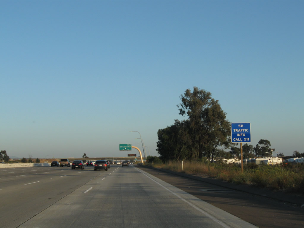
This sign, added in 2011, advises motorists that San Diego 511/traffic information can be had by calling 511. Photo taken 06/06/11. |
|
|
Southbound Interstate 15 reaches Exit 13, Miramar Way. The next exit is the split between Interstate 15 and California 163. Through traffic on Interstate 15 should merge left. Photos taken 06/06/11 and 06/03/06. |
|
The exit number is signed at the gore point. Miramar Way travels west to the U.S. Marine base with an interchange at Kearny Villa Road along the way. Photo taken 05/30/08. |
|
|
In 2011, this variable message sign advised of the week-long closure that resulted in the extension of managed lanes (two in each direction) between California 56 and California 163. In 2006, the Rock and Roll Marathon was underway, so the variable message sign indicated the resultant closure of California 163 through Balboa Park near downtown San Diego. Photos taken 06/06/11 and 06/03/06. |
|
|
To connect to California 52 west to La Jolla and Pacific Beach, either Interstate 15 or California 163 may be used to make the connection. For California 52 east, only south Interstate 15 may be used. The overhead sign in the median was removed during the managed lanes project, so the roadside sign is the main advisory of the connections to California 52. Photos taken 06/06/11 and 06/03/06. |
|
Prior to the conversion of the one-way express lanes to the two-way managed lanes, a "To California 163 south" sign was posted in the center express lanes. This sign is now gone. At this point, traffic from Miramar Way merges back onto Interstate 15 south. Photo taken 06/03/06. |
|
Another roadside sign advises of the connection to California 52 east via Interstate 15 (not California 163). Photo taken 06/06/11. |
|
|
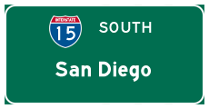
After the Miramar Way interchange, the next exit along southbound Interstate 15 is the split with California 163 (Cabrillo Freeway) south. While California 163 follows former U.S. 395 southwest to downtown San Diego and related attractions, Interstate 15 continues due south along the old alignment of California 103 through Murphy Canyon and along the old 40th Street corridor through City Heights and Mid-City before meeting Interstate 5 in Barrio Logan near the 32nd Street Naval Station. This is a major decision point on southbound Interstate 15. Photos taken 06/01/11 and 06/03/06. |
|
While the freeway widens to seven lanes along in preparation for the Interstate 15 and California 163 split, it is remarkable that the area around Interstate 15 is remarkably free of development. This is because Interstate 15 passes through Miramar Marine Corps Air Station (MCAS). Fighter jets and other aircraft routinely pass over the freeway to make landings and takeoffs at the air station. Every ten years or so, someone wants another vote of the people to convert this area into a new international airport for San Diego. However, such referenda are routinely voted down because of the impact to the military and because of the impact to nearby neighborhoods. Photo taken 06/03/06. |
|
|
Construction of an airport on the property currently occupied by Miramar Marine Corps Air Station would require relocation of Interstate 15 and a possible direction connection from California 163 into the proposed terminal under plans considered by the voters in 2006. This plan was ultimately denied by the voters, so the airport will remain at Lindbergh Field downtown. Photos taken 06/01/11 and 06/03/06. |
|
|
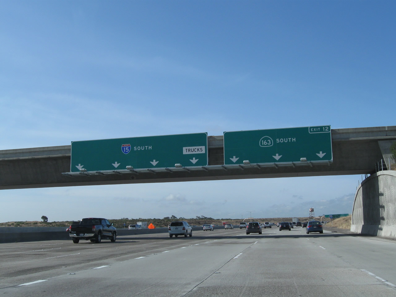
Southbound Interstate 15 (Escondido Freeway) splits with California 163 (Cabrillo Freeway) here. The four left lanes continue south on Interstate 15, while the three right lanes exit onto California 163 south. Photos taken 06/01/11 and 06/23/08. |
|
|
A massive gore point split sign separates southbound Interstate 15 (Escondido Freeway) from California 163 (Cabrillo Freeway) here. Photos taken 06/01/11. |
|
The high occupancy vehicle lanes come to an end at the California 163 split. These signs changed in 2011 (see previous photobox) as a result of the project to expand the reversible lanes to managed lanes (which is complete by 2012). Photo taken 06/23/08. |
|
|
Southbound Interstate 15 (Escondido Freeway) passes under a flyover ramp from California 163 before continuing south on its own toward Tierrasanta, City Heights, and Barrio Logan. To the right, California 163 (Cabrillo Freeway) peels southwest toward downtown San Diego. Photos taken 06/23/08 and 06/01/11. |
| Interstate 15 (Escondido Freeway) MANAGED LANES south |
|
|
|
Returning now to vicinity of the Centre City Parkway / Via Rancho Parkway interchanges, this series of photos shows the southbound managed lanes along Interstate 15. Photos taken 05/16/09. |
|
|
|
The southbound managed lanes cross over Lake Hodges and enter the city of San Diego, community of Rancho Bernardo. Photos taken 05/16/09. |
|
|
|
This exchange allows traffic from the managed lanes to access the Rancho Bernardo exits (Rancho Bernardo Road, Bernardo Center Drive, and Camino del Norte). Continue straight ahead to the Rancho Bernardo transit center. Photos taken 05/16/09. |
|
|
|
Southbound Interstate 15's managed lanes connect with the Rancho Bernardo transit center at this off-ramp. Photos taken 05/16/09. |
|
To California 56, shift into the main lanes. The managed lanes continue south to connect to the Interstate 15 main lanes for points south of California 56 and the Sabre Springs/Rancho Peñasquitos Transit Center. Photo taken 05/16/09. |
|
|
|
At the time this photo was taken, the managed lanes were closed, since traffic on the two-lane express section was traveling north. This sign is posted next to the Carmel Mountain Road overpass. This exit (which was the final managed lanes exit until June 2011, when the managed lanes were opened south to California 163) is the Sabre Springs-Rancho Peñasquitos Transit Center, but that will change once the managed lanes are extended south. Photos taken 05/16/09. |
Page Updated July 10, 2011.