| Interstate 80 east |
|
After passing by the University of California at Davis exit, Interstate 80 enters Yolo County. The Richards Boulevard exit, shown as "Davis" on this overhead, is Exit 72 on eastbound. Providing access into downtown Davis, Richards Boulevard is the most direct route into the city. This is also an interchange to connect to Historic U.S. 40 and U.S. 99W from Interstate 80. Use Richards Boulevard northwest into downtown. To follow U.S. 40 and U.S. 99W east, take Richards Boulevard southeast to connect to Cowell Boulevard and Chiles Road. Olive Drive on the north side of the freeway in Davis is also an extant segment of old U.S. 40. Photo taken 09/10/05. |
|
Richards Boulevard serves the city of Davis, which had a population of 60,308 as of 2000 Census and is home to the University of California at Davis. The city sits in the Central Valley west of Sacramento at the intersection of Interstate 80 and California 113. Davis was incorporated on March 28, 1917. All motorist services are available at Exit 72. Photo taken 07/07/07. |
|
Richards Boulevard heads northwest into downtown Davis, where it changes into First Street east-west or E Street north. The Davis Civic Center and City Park are located near the intersection of Fifth Street and B Street. Richards Boulevard eastbound transitions into Cowell Drive east of Research Park Drive nearby. Photo taken 07/18/09. |
|
The next exit along Interstate 80 east is Exit 75, Yolo County E-6/Mace Boulevard. Photo taken 07/07/07. |
|
Interstate 80 eastbound turns east parallel to the Union Pacific Railroad, 2nd Street, Cowell Boulevard, and Chiles Road between the Pole Line Road overpass and Exit 75 with Mace Boulevard. Chiles Road comprises the eastbound side frontage road from Drummand Avenue & Cowell Boulevard eastward to the Yolo Bypass. Photo taken 09/10/05. |
|
Mace Boulevard (Yolo County E-6 west) interchanges with Interstate 80 (Exit 75) near the community of El Macero. Yolo County E-6 follows Mace Boulevard north to Covell Boulevard along the eastern and northern edge of Davis. Photo taken 09/10/05. |
|
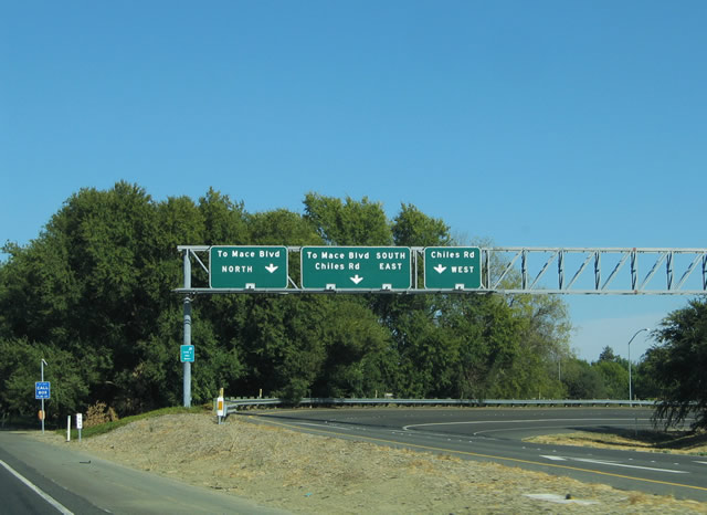
Exit 75 carries motorists from Interstate 80 eastbound onto adjacent Chiles Road. Chiles Road intersects Mace Boulevard nearby. Mace Boulevard leads south to Tremont Road and areas near the west edge of the Yolo Bypass flood control system. Chiles Road is Old U.S. 40, and it rejoins Interstate 80 at Exit 78. Photo taken 09/10/05. |
|
This reassurance shield for Interstate 80 east is posted after the on-ramp from Exit 75 (Yolo County E-6/Mace Boulevard). Photo taken 07/07/07. |
|
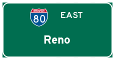
This mileage sign along eastbound Interstate 80 provides the distance to Sacramento (11 miles); Auburn (44 miles); and Reno, Nevada (144 miles). By the time Interstate 80 reaches Reno, it will be in a high altitude desert. Photo taken 09/10/05. |
|
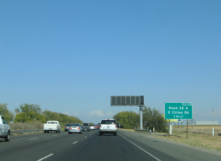
Interstate 80 leaves Davis with its frontage road contingency of Road 32A and Chiles Road (Road 32B). Chiles Road heads east to the Webster turnaround where it becomes Road 32A along Interstate 80 west. Photo taken 09/10/05. |
|
|
The third set of 500kV power lines, which constitute the other half of Path 15, crosses over Interstate 80 near Exit 78. These lines, like the other half of Path 15, were installed by Pacific Gas and Electric. Photos taken 11/23/07 and 07/28/12. |
|
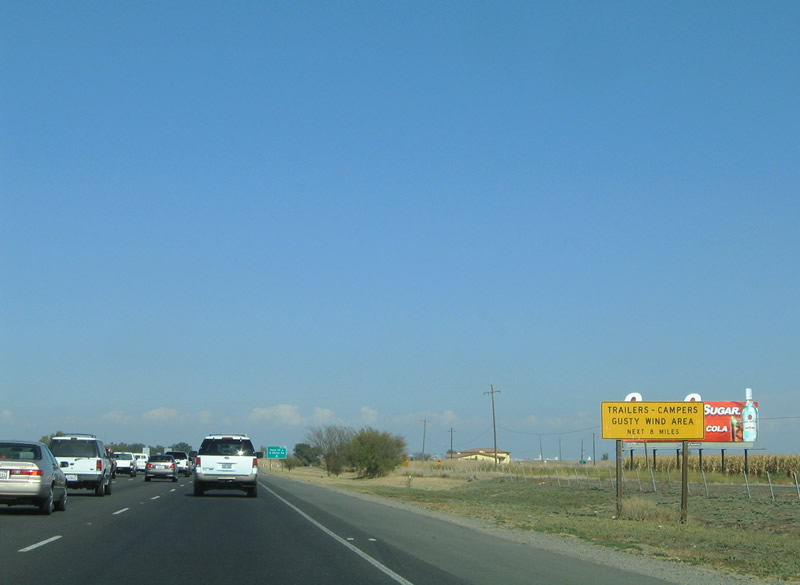
The wide open flood plains between Davis and West Sacramento yields windy conditions at times. Therefore high profile motorists, such as trucks carrying trailers and RV campers should use caution along Interstate 80 between Exits 78 and Sacramento. Photo taken 09/10/05. |
|
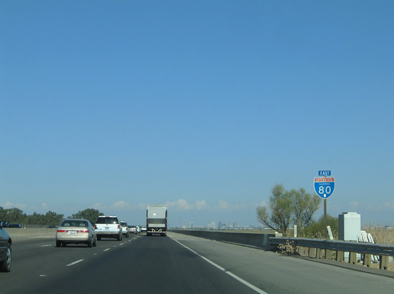
Eastbound Interstate 80 reaches Exit 78, East Chiles Road. This exit connects to the old U.S. 40 frontage road heading west from here. Ahead, Interstate 80 crosses the Yolo Bypass, a flood control channel designed to divert floodwaters around the Sacramento urban area. Photo taken 09/10/05. |
|
The Yolo Bypass Causeway is officially designated as the CHP Officers Blecher and Freeman Memorial Causeway per this sign. Photo taken 05/14/11. |
|
In the distance, the skyscrapers of downtown Sacramento, the capital of California, rises above the agricultural fields and flood plains of the Sacramento Delta region. Interstate 80 crosses the diversion channel known as the Yolo Bypass. Photo taken 09/10/05. |
|
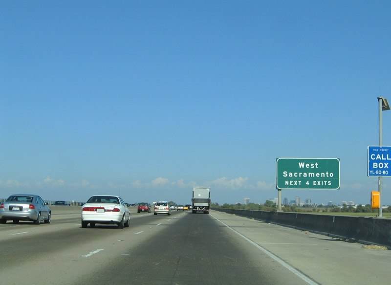
The next exit along eastbound is Exit 81, West Capitol Avenue and Enterprise Boulevard, two miles. West Capitol Avenue is Old U.S. 40-99W; it was briefly signed as Business Loop I-80 before the business route was moved onto its current alignment (Capital City Freeway). This is the first exit for the city of West Sacramento, which is located on the west shore of the Sacramento River within Yolo County. As of 2000, 31,615 call West Sacramento home, but population forecasts expect that figure to double by 2020. Photo taken 07/18/09. |
|
Through traffic for Interstate 80 to North Lake Tahoe (Tahoe City and Incline Village) and Reno should use Interstate 80 to bypass downtown Sacramento. Business Loop I-80 takes the left lanes into downtown, so through traffic should merge right to prepare to exit. Photo taken 07/18/09. |
|
The Exit 81 partial-cloverleaf interchange with West Capitol Avenue and Enterprise Boulevard serves the West Sacramento industrial area south of Interstate 80. Industrial Boulevard straddles the Sacramento River Deep Water Ship Channel east from Enterprise Boulevard to the Port of Sacramento, Stone Boulevard, and Lake Washington Boulevard. Photo taken 09/10/05. |
|
The next four exits along eastbound Interstate 80 *and* Business Loop I-80 serve the city of West Sacramento: Exit 81, West Capitol Avenue; Exit 82, Business Loop I-80; Exit 1, Harbor Boulevard; and Exit 3, California 84 (Jefferson Boulevard). The spires of downtown Sacramento are again visible over the Yolo Bypass flood plain. Photo taken 09/10/05. |
|
Eastbound Interstate 80 reaches Exit 81, West Sacramento and West Capitol Avenue. This is former U.S. 40-99W, and it was briefly known as Business Spur I-80. West Capitol Avenue parallels Interstate 80 and Business Loop I-80 east from Exit 81 to the Sacramento River and gateway to downtown Sacramento, the Capital Mall. Former California 275 provides a direct connection to the Capitol Mall via Business Loop I-80 Exit 3. Photo taken 07/07/07. |
|
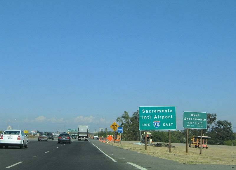
Interstate 80 enters the West Sacramento city limits at the Exit 82 ramps to Enterprise Boulevard. Traffic interests to Sacramento International Airport should remain on Interstate 80 east to its junction with Interstate 5 & California 99 (Exit 86). The airport resides northwest of Sacramento at Interstate 5 Exit 528. Eastbound Interstate 80 approaching Exit 82, Business Loop I-80/Interstate 305/U.S. 50 westbound (Capital City Freeway). Photo taken 09/10/05. |
|
Nearing the Exit 82 split with the eastbound beginning of U.S. 50, Business Loop I-80, and unsigned Interstate 305 east on I-80 east. I-305 overlays the western 8.44 miles of the Capital City Freeway from here to the split with U.S. 50 and California 99. The designation represents the remaining Interstate mileage of the pre-1982 routing of I-80 through Downtown Sacramento. Photo taken 05/14/11. |
|
Replaced button copy guide signs for the eastbound partition of I-80 and U.S. 50. Interstate 80 was relocated from the Capital City Freeway in 1982 to replace then-I-880. The City of Sacramento cancelled a plan to build a new freeway for I-80 from the American River, near SR 160, northward to where I-80 and 880 merged. Federal officials deemed the northeast section of present-day Business Loop I-80 beyond U.S. 50 & SR 99 south (Exit 6) as non-standard and removed it from the Interstate system. Interstate 80 was aligned to maintain continuity, with the old route redesignated as a business loop. Photo taken 07/18/09. |
|
|
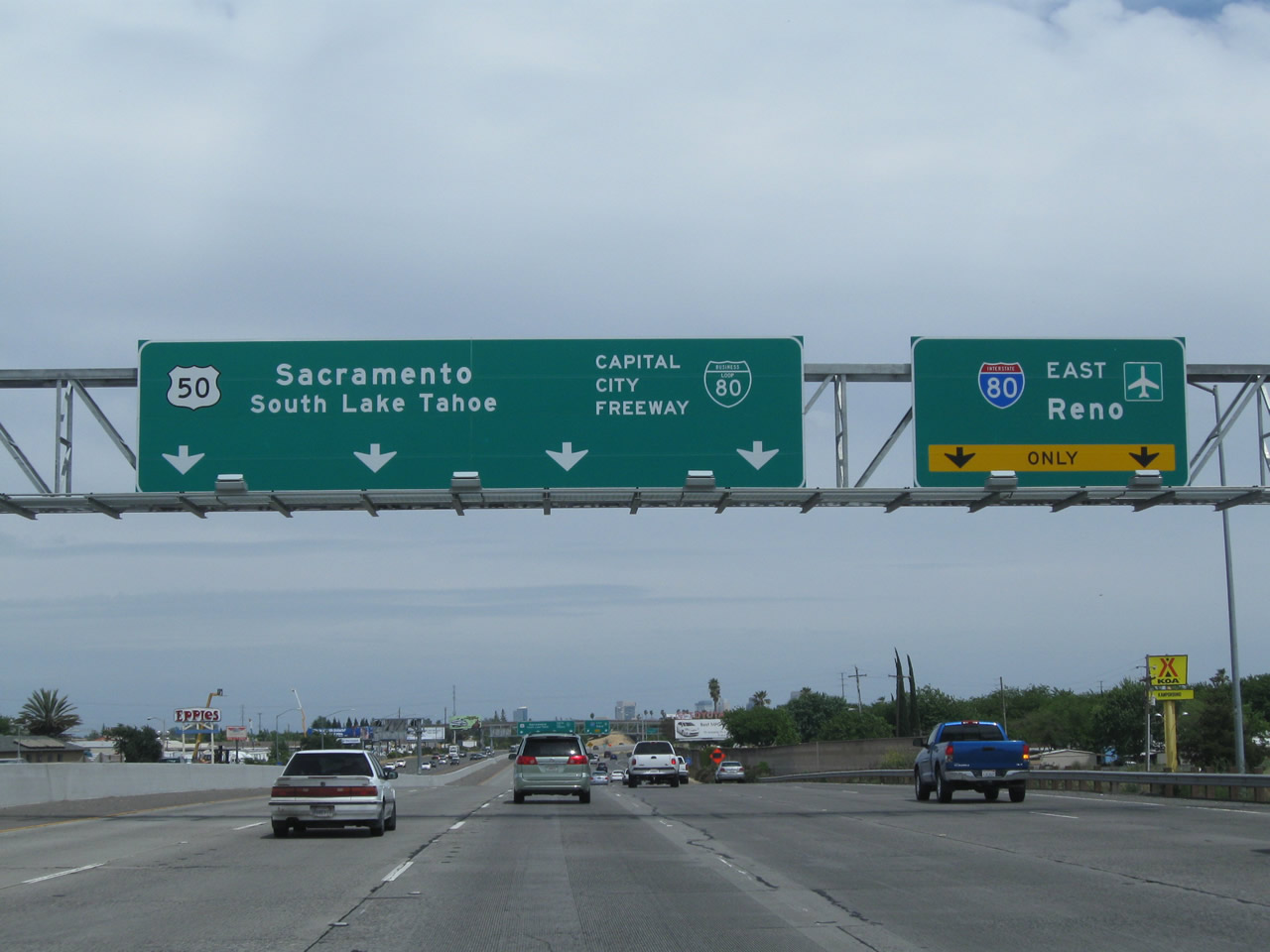
The Interstate 80 eastbound mainline defaults onto Business Loop I-80, U.S. 50, and unsigned Interstate 305 (Capital City Freeway) into downtown West Sacramento and Sacramento. The trio meet Interstate 5 & California 99 in four miles. Interstate 5 and California 99 follow separate paths south to Stockton. U.S. 50 meanwhile leaves the Capital City Freeway via Exit 6A en route to Placerville and Lake Tahoe. Business Loop I-80 continues from there northeast back to Interstate 80 at east Sacramento. The porcelain enamel overhead sign for Interstate 80 in the 2007 picture originally had an Interstate 880 shield on it; an Interstate 880 shield was removed and the Interstate 80 added in its place. These signs were replaced with reflective signs by 2011, but no exit numbers were added to indicate that this is Exit 82. Photos taken 05/14/11 and 07/07/07. |
|
|
|
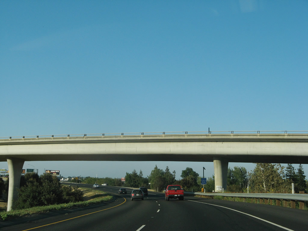
Interstate 80 reduces to two eastbound lanes as it joins a flyover ramp to leave the western Capital City Freeway interchange in West Sacramento. Prior to approximately 1980, this was the beginning of the original Interstate 880, which used to bypass Sacramento. When Interstate 80 through the Marconi Curve was deemed unacceptable for Interstate standards, Interstate 80 was rerouted onto former Interstate 880, and old Interstate 80 became Business Loop I-80. U.S. 50 was similarly extended from its former end east of downtown Sacramento to here, at the West Sacramento interchange. Photos taken 07/07/07. |
|
The next exit along Interstate 80 east is Exit 83, Reed Avenue (To California 84 (Jefferson Boulevard) south). Photo taken 07/07/07. |
|
The skyline of Sacramento comes into view from Interstate 80 looking southeast. This is about as close as Interstate 80 will get to downtown. More compelling views are available on Business 80 and U.S. 50. Photo taken 07/18/09. |
|
For those planning to join the California Highway Patrol after a rigorous application process, new recruits would take Exit 83, Reed Avenue to the California Highway Patrol Academy. Photo taken 07/07/07. |
|
Eastbound Interstate 80 reaches Exit 83, Reed Avenue to California 84 south and to the California Highway Patrol Academy. This is the final Yolo County interchange along Interstate 80 east. Photo taken 07/07/07. |
|
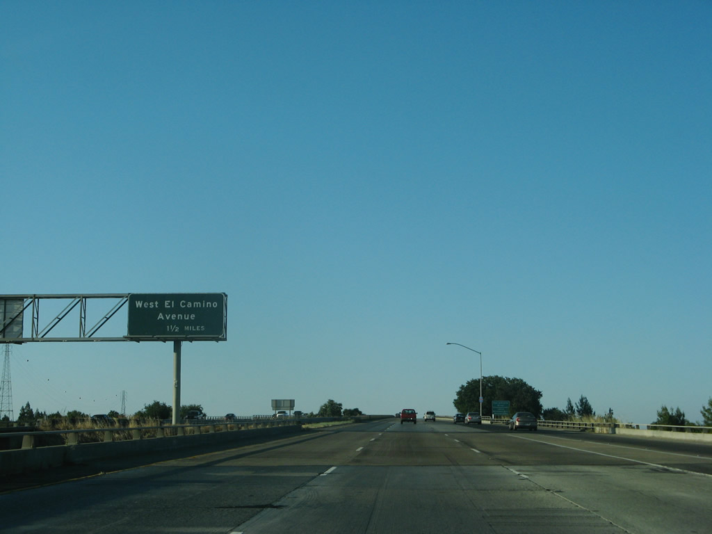
Interstate 80 gains elevation for the Sacramento River crossing. The next exit along Interstate 80 east is Exit 85, West El Camino Avenue (1.50 miles). Photo taken 07/07/07. |
|
Shortly thereafter, Interstate 80 crosses the Sacramento River on this 1971 bridge. Photo taken 07/07/07. |
|
|
At the middle of the Sacramento River, Interstate 80 leaves Yolo County/city of West Sacramento and enters Sacramento County/city of Sacramento. Photos taken 07/18/09 and 07/07/07. |
Page Updated September 4, 2012.