| Interstate 80/Alan S. Hart Freeway east |
|
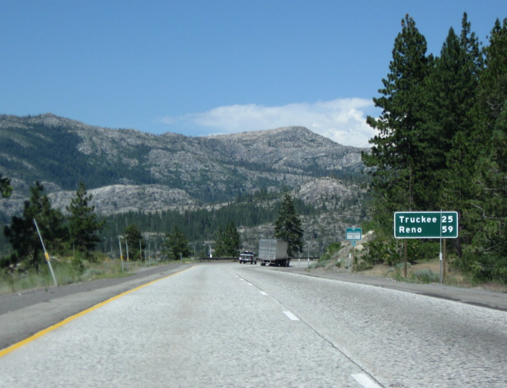
This Interstate 80 reassurance shield is posted after the California 20 on-ramp. For the next several miles, Interstate 80 is in Nevada County, but it will shift back into Placer after Exit 164. Photo taken 07/18/09. |
|
This mileage sign provides the distance to Truckee (25 miles) and Reno (59 miles). Photo taken 07/18/09. |
|
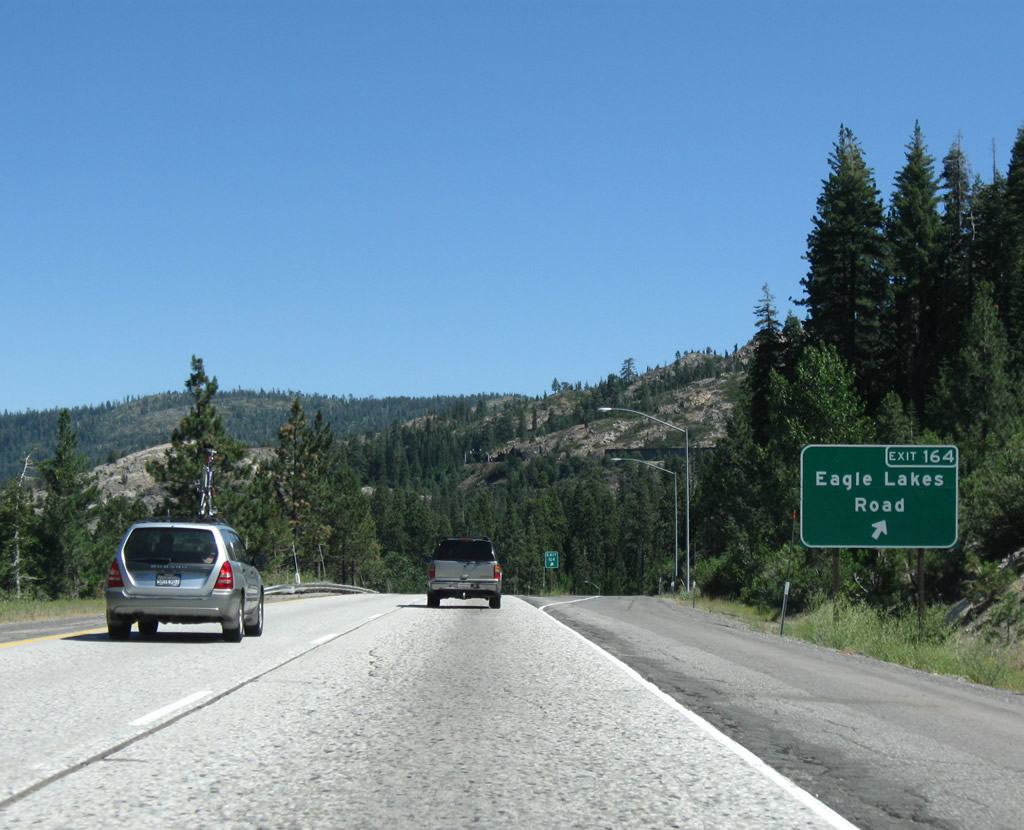
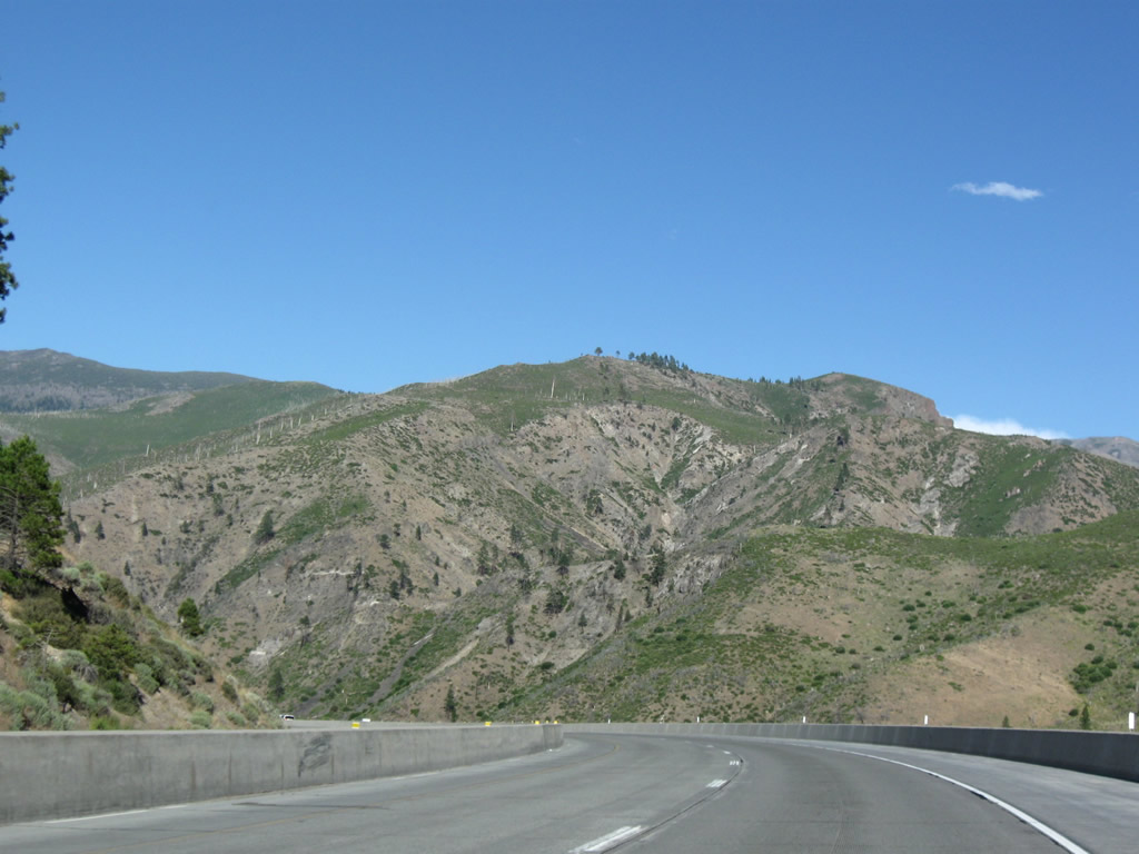
The next exit along Interstate 80 east is Exit 164, Eagle Lakes Road (one mile). Photo taken 07/18/09. |
|
Eastbound Interstate 80/Alan S. Hart Freeway reaches Exit 164, Eagle Lakes Road. Photo taken 07/18/09. |
|
This Interstate 80 reassurance shield is posted after the Eagle Lakes Road on-ramp. Look, a normal looking, state-named shield! Photo taken 07/18/09. |
|
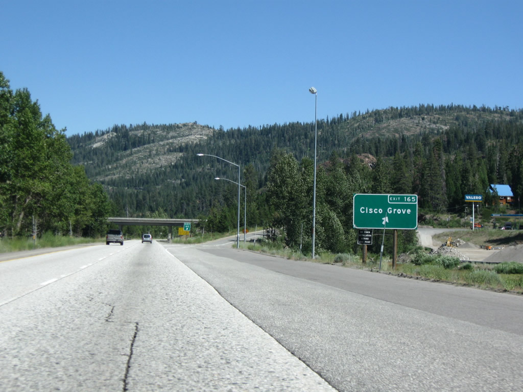
The next exit along Interstate 80 east is Exit 165, Cisco Road to Cisco Grove (one mile). Now we're back in Placer. Photo taken 07/18/09. |
|
This concrete pavement dates back to the freeway's original construction in the early 1960s. Significant segments have been repaved recently, and more segments are scheduled for pavement replacement. Photo taken 07/18/09. |
|
Eastbound Interstate 80/Alan S. Hart Freeway reaches Exit 165, Cisco Road to Cisco Grove. Photo taken 07/18/09. |
|
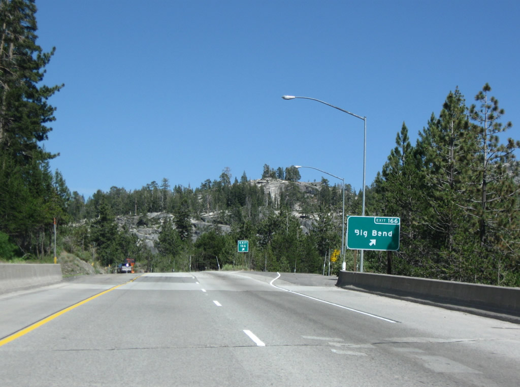
The next exit along Interstate 80 east is Exit 166, U.S. 40/Hampshire Rocks Road to Big Bend (0.75 mile). Photo taken 07/18/09. |
|
Eastbound Interstate 80/Alan S. Hart Freeway reaches Exit 166, U.S. 40/Hampshire Rocks Road. Photo taken 07/18/09. |
|
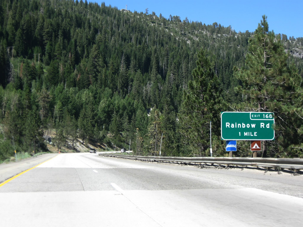
The next exit along Interstate 80 east is Exit 168, U.S. 40 and Rainbow Road (one mile). Photo taken 07/18/09. |
|
Eastbound Interstate 80/Alan S. Hart Freeway reaches Exit 168, Historic U.S. 40 (Donner Pass Road), Rainbow Road, and Hampshire Rocks Road. U.S. 40 travels east from this interchange parallel to Interstate 80 on the north side of the freeway until Exit 174. Then eastbound Historic U.S. 40 (Donner Pass Road) shifts to the south side of the freeway, ascending to Donner Pass, and returning to Interstate 80 in the town of Truckee at Exit 184. Photo taken 07/18/09. |
|
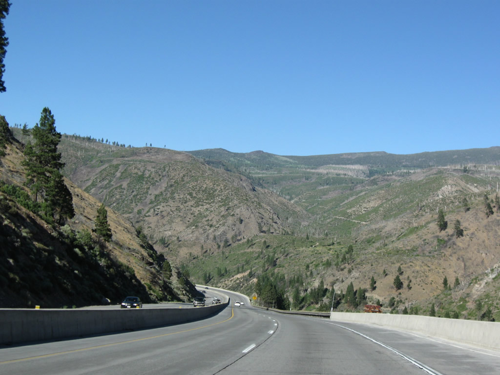
The next exit along Interstate 80 east is Exit 171, To Historic U.S. 40 (Donner Pass Road) at Kingvale. Pavement replacement was underway at this location at the time this photo was taken. Photo taken 07/18/09. |
|
Eastbound Interstate 80/Alan S. Hart Freeway reaches Exit 171, To Historic U.S. 40 (Donner Pass Road) at Kingvale. Around this point, Interstate 80 again leaves Placer and reenters Nevada County. Photo taken 07/18/09. |
|
An Interstate 80 east shield is posted after the on-ramp from Exit 171, Kingvale. Photo taken 07/18/09. |
|
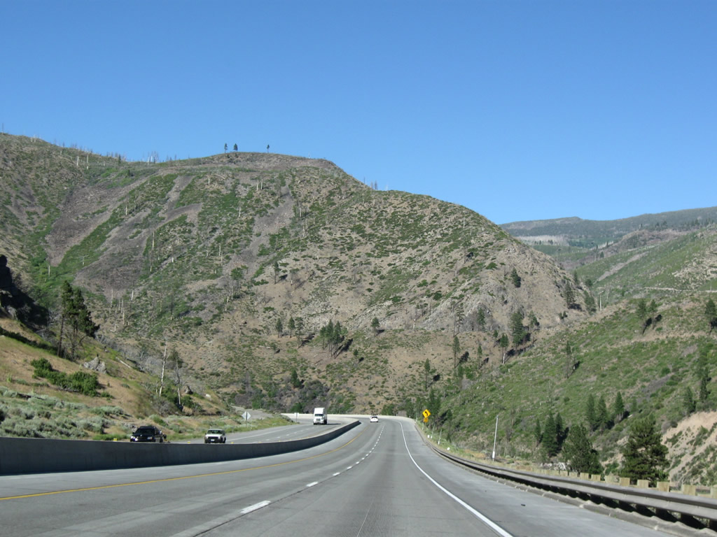
The next exit along Interstate 80 east is Exit 174, Historic U.S. 40 (Donner Pass Road) west to Kingvale and east to Soda Springs, Donner Summit, and Donner Lake. Photo taken 07/18/09. |
|
Use Exit 174 to Sugar Bowl (ski area), Soda Springs ski area, Donner Ski Ranch, and the unincorporated communities of Norden and Soda Springs. Photo taken 07/18/09. |
|
The next two exits along Interstate 80 east serve Donner Pass-area ski areas. Photo taken 07/18/09. |
|
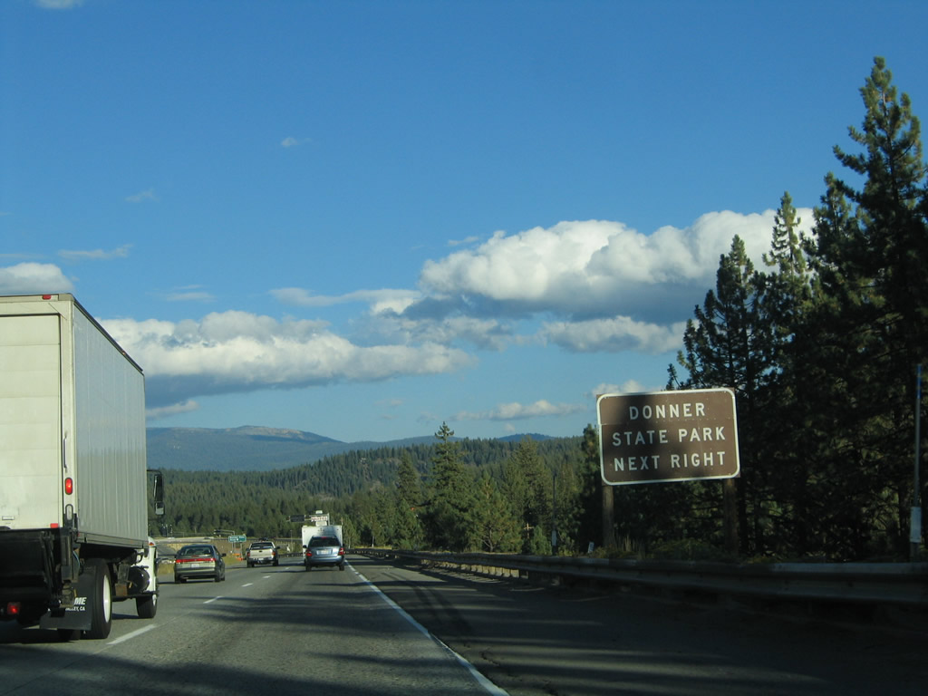
Eastbound Interstate 80/Alan S. Hart Freeway reaches Exit 174, Historic U.S. 40 (Donner Pass Road) to Soda Springs and Norden. To see the historic U.S. 40 bridge on Donner Pass, take this exit and follow U.S. 40 east. This route can be used for a through route to the town of Truckee if desired. Photo taken 07/18/09. |
|
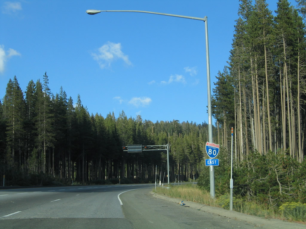
This Interstate 80 east reassurance shield is posted shortly after the on ramp from Donner Pass Road (Exit 174). Photos taken 09/09/05. |
|
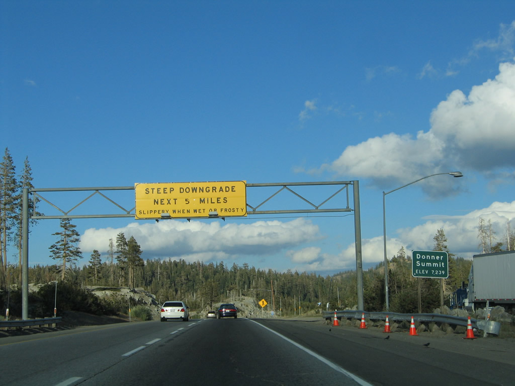
A rest area is located at the top of Donner Summit (two miles). The freeway ascends to its highest point in California at Donner Summit (el. 7,239 feet). U.S. 40, meanwhile, takes Donner Pass Road over Donner Pass (el. 7,088 feet). The Donner Summit Rest Area lies at the summit itself. Note the poor shape of the concrete freeway. The combination of ice/snow, heavy truck traffic, and age have really taken its toll on Interstate 80 through here. The right-hand lanes are so rutted from the trucks that many motorists remain in the less damaged left-hand lane. Photos taken 09/09/05. |
|
For the final push to the top of Donner Summit, Interstate 80 carries three eastbound lanes. Photo taken 09/09/05. |
|
The next exit along Interstate 80 east is Exit 176, Boreal Ridge Road to Boreal Ski Resort. Boreal Ridge Road intersects Interstate 80 at Exit 176 prior to cresting at Donner Summit. The local road stems north from Bunny Hill Road to the Castle Peak area and south to Boreal Ski Resort. Castle Peak, with its distinctive rocky summit, rises to 9,103 feet nearby. Photo taken 09/09/05. |
|
An older button copy guide sign posted ahead of the Exit 176 diamond interchange with Boreal Ridge Road. Bunny Hill Road links Boreal Ridge Road with Donner Pass Road (Historic U.S. 40) at Soda Springs. Photo taken 09/09/05. |
|
Also at Exit 176 is the Pacific Crest Trail, which allows hikers to travel from the U.S.-Mexico border north to the U.S.-Canada border along the spine of the Sierra Nevada and Cascade Mountains. Photo taken 09/09/05. |
|
Exit 176 leaves Interstate 80 eastbound for Boreal Ridge Road. Use Boreal Ridge Road to access the Pacific Crest National Scenic Trail and the Boreal Ski Area. Photo taken 09/09/05. |
|
|
The next exit along Interstate 80 east is Exit 177, Donner Summit Rest Area. The right lane becomes exit only after the on-ramp from Exit 176, Boreal Ridge Road. Photos taken 09/09/05. |
|
|
Cresting at Donner Summit, Interstate 80 crosses the top of the Sierra Nevada. From here, the freeway descends rapidly from the summit toward Donner Lake. Trucks must travel the grade slowly as Interstate 80 drops from 7,239 to 5,935 feet between the pass and lake. Snowfall is an issue through here during the late fall, winter, and early spring months. The pass itself derives its name from the Donner family tragedy of November 1, 1846, when five feet of snow fell and stranded the party of 87 people. Thirty-nine of the pioneers lost their lives at the hand of the cold and 30 to 40-foot snow drifts; survivors turned to the dead for a means of sustenance. For more, see Wikipedia's Donner Party entry. Photos taken 09/09/05 and 07/18/09. |
|
|
|
Continuing downhill, this series of photos follows Interstate 80 east as it rapidly descends from Donner Summit to Truckee. Donner Lake appears to the south of the freeway; Old U.S. 40 follows the shores of the lake, as the old road also descended from Donner Pass south of here. A vista point midway between the rest area and Exit 180 provides terrific views of Donner Lake. The next exit along eastbound is with Exit 180, Donner Lake Road south to Historic U.S. 40 (Donner Pass Road). Photos taken 09/09/05. |
|
|
|
|
|
|
|
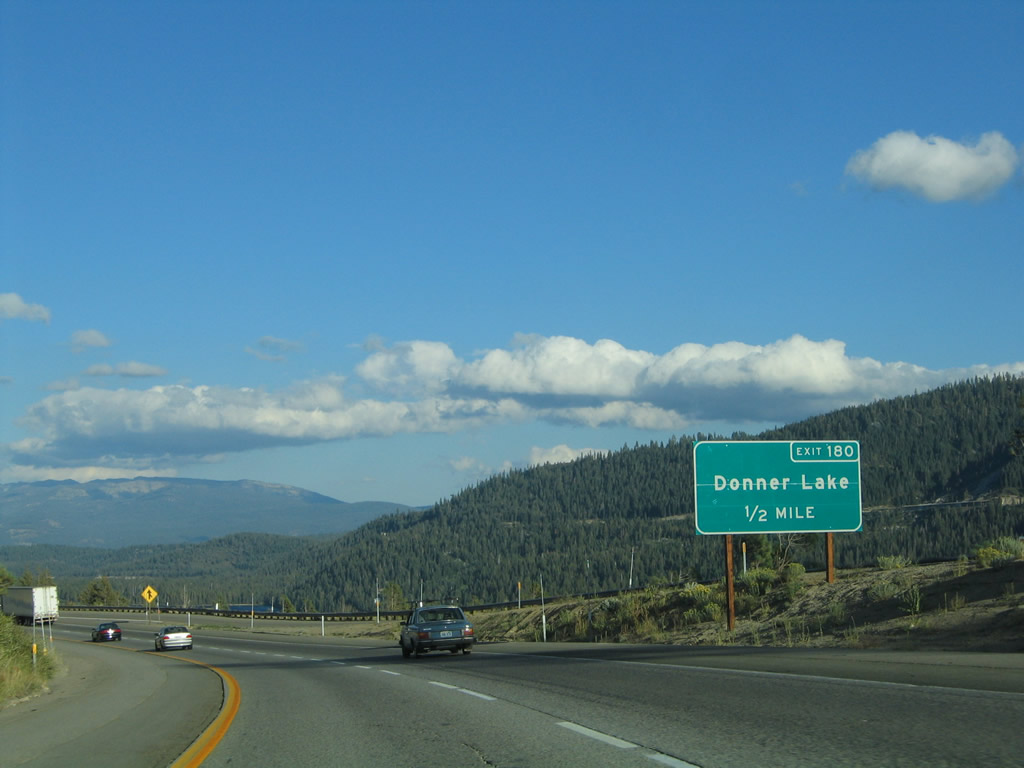
Donner Lake comes into view from the Interstate 80 mainline at the aforementioned vista point. Donner Lake Road intersects the freeway at the Exit 180 diamond interchange ahead. The road joins the freeway with Historic U.S. 40 (Donner Pass Road) 1.1 miles to the south. Photo taken 09/09/05. |
|
Continuing the steep grade toward Donner Lake (Exit 180) on Interstate 80 east. Donner Lake lies between the freeway and the Placer line. Historic U.S. 40 (Donner Pass Road) follows the northern shore of the lake. Photo taken 07/18/09. |
|
Eastbound Interstate 80/Hart Freeway meets Exit 180 at this partial-cloverleaf interchange with Donner Lake Road. Billie Mack Road meanders northward from Interstate 80 into the nearby mountains. Photo taken 07/18/09. |
|
Interstate 80 must make a turn at the ramp to Exit 180 in order to avoid another tall mountain. The steep descent from Donner Summit continues for another four miles, until Exit 184. Photo taken 09/09/05. |
|
Within the Donner Lake Road interchange (Exit 180), Interstate 80 enters the town of Truckee in Nevada County. The town had a population of 13,864 as of the 2000 Census, consists of 33.8 square miles, has an elevation of 5,817 feet, and was incorporated on March 23, 1993. Photo taken 09/09/05. |
|
This Interstate 80 reassurance shield is posted along eastbound after the on-ramp from Donner Lake Road. A set of Sierra Pacific power lines cross over Interstate 80 at this point. Photo taken 09/09/05. |
|
|
Exit 180 is the first of four interchanges to serve the town of Truckee, the first of which is Exit 184, Historic U.S. 40 (Donner Pass Road). Interstate 80 continues to lose elevation between Exit 180 (Donner Lake Road) and Exit 184 (Donner Pass Road). This sign was replaced in 2009 with an exit number sign. Photos taken 07/18/09 and 09/09/05. |
|
|
Advance signs inform motorists of the Donner Pass Road (Historic U.S. 40) attractions of Donner Lake State Park, the Pioneer Monument, and the Donner Summit Sno-Park. Photos taken 07/18/09 and 09/09/05. |
|
|
A partial-cloverleaf interchange facilitates the movements between Interstate 80 and Historic U.S. 40 (Donner Pass Road). Donner Pass Road travels west to Donner Lake State Park and east into Truckee from here. Within the five-year interval between photos, note that the Shell gas station changed logos on its overhead sign. Photos taken 07/18/09 and 09/09/05. |
|
Now on the off-ramp to Exit 184, a Historic U.S. 40 marker lies at the end of the Exit 184 off-ramp to Donner Pass Road. Travelers taking the scenic road west from Donner Lake have a steep climb toward Donner Pass itself. A concrete arch bridge dating from 1925 still carries motorists over a ravine at McGlashen Point. Photo taken 09/09/05. |
|
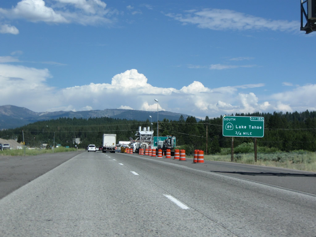
The next exit along Interstate 80/Alan S. Hart Freeway east is Exit 185, California 89 south to Tahoe City (and all northshore resorts), Emerald Bay, and South Lake Tahoe. Photo taken 07/18/09. |
|
To Kings Beach and Incline Village on the north shore of Lake Tahoe, use Exit 188B, California 267 south (three miles). Photo taken 07/18/09. |
|
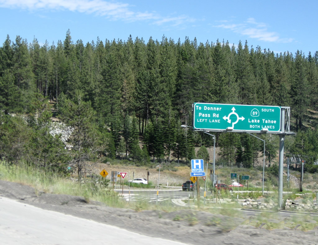
Eastbound Interstate 80 reaches Exit 185, California 89 south to Tahoe City. This view looks down at the exit ramp, which leads into a roundabout as part of the interchange (rather than a traffic signal). Traffic for California 89 north joins Interstate 80 east for the next couple of miles as we bypass downtown Truckee. Photo taken 07/18/09. |
| Interstate 80/Alan S. Hart Freeway east and California 89 north |
|
The next exit along Interstate 80 east and California 89 north is Exit 186, Historic U.S. 40 (Donner Pass Road) (Former Business Loop I-80) to Truckee (0.25 mile). A tourist information center and official California Welcome Center is located in the converted train depot in downtown Truckee just east of this interchange. All services are available in Truckee. Photo taken 07/18/09. |
|
Eastbound Interstate 80 and northbound California 89 reaches Exit 186, Historic U.S. 40 (Donner Pass Road) (Former Business Loop I-80) to downtown Truckee. Photo taken 07/18/09. |
|
The next two exits along Interstate 80 east and California 89 north are Exit 188A, Donner Pass Road to Historic U.S. 40 and Exit 188B, California 89 north to Sierraville and California 267 south to Kings Beach and Incline Village. Photo taken 07/18/09. |
|
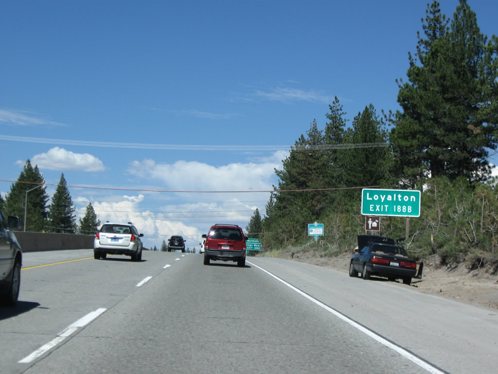
Use California 89 north to Sierraville, where California 89 meets California 49. To Loyalton and Vinton, follow California 89 north to California 49 north. Photo taken 07/18/09. |
|
Use California 267 south to Northstar-at-Tahoe ski resort and Kings Beach on the north shore of Lake Tahoe. Photo taken 07/18/09. |
|
A new right lane connects Interstate 80 east with California 89 north and California 267 south. Photo taken 07/18/09. |
|
Eastbound Interstate 80 reaches Exit 188A, Donner Pass Road to eastern Truckee and U.S. 40. The next exit is Exit 188B, California 89 north and California 267 south. Photo taken 07/18/09. |
|
Immediately thereafter, Interstate 80 east meets Exit 188B, California 89 north and California 267 south. Photo taken 07/18/09. |
|
Once on the off-ramp, a left turn connects to California 89 north to Sierraville, while a right turn leads to California 267 south to Lake Tahoe. A traffic signal governs the flow of traffic at this intersection, unlike the traffic circles/roundabouts seen at Exit 185. Photo taken 07/18/09. |
|
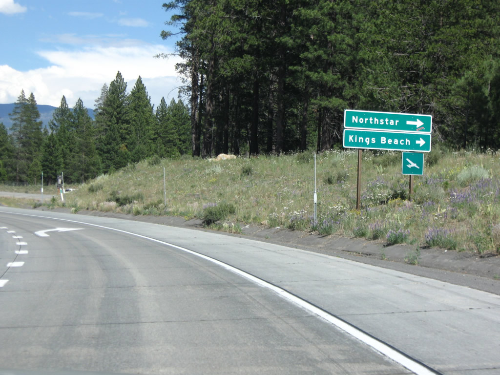
Turn right on California 267 south to Kings Beach, northern Lake Tahoe resorts, Incline Village, and all points along California 28 and Nevada 28. Photo taken 07/18/09. |
| Interstate 80/Alan S. Hart Freeway east |
|
Back on the mainline, a weather warning sign is posted after the on-ramp from Exit 188B. Interstate 80 again drives solo now that California 89 has departed, and it will remain that way until meeting up with U.S. 95 in Nevada's Forty-Mile Desert northeast of Reno. Photo taken 07/18/09. |
|
This reassurance shield for Interstate 80 east is posted shortly thereafter. Photo taken 07/18/09. |
|
This mileage sign provides the distance to two Nevada destinations: Verdi (21 miles) and Reno (31 miles). Photo taken 07/18/09. |
|
The next exit along Interstate 80 east is Exit 190, Overland Trail (0.50 mile). Photo taken 07/18/09. |
|
Eastbound Interstate 80/Alan S. Hart Freeway reaches Exit 190, Overland Trail. Photo taken 07/18/09. |
|
A bent, neutered Interstate 80 east reassurance shield is posted after the on-ramp from Exit 190, Overland Trail. All motorists traveling westbound must stop for the agricultural inspection station. Photo taken 07/18/09. |
|
|
|
Passing through the Truckee Meadows near the inspection station, Interstate 80 continues east on a path carved by the Truckee River. This river, which is the only one to drain from Lake Tahoe, travels east alongside Interstate 80 and the Union Pacific Railroad toward Verdi and Reno. East of Reno, the river turns northeast to empty into Pyramid Lake, making the Truckee River one of the many Great Basin rivers that do not drain into an ocean. Photos taken 07/18/09. |
|
|
|
|
|
|
|
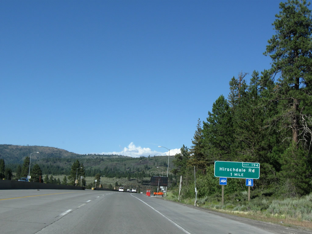
The next exit along Interstate 80 east is Exit 194, Hirschdale Road (one mile). Photo taken 07/18/09. |
|
Use Exit 194 (Hirschdale Road) north to Boca Stampede Recreation Area and south to Hirschdale. Photo taken 07/18/09. |
|
Eastbound Interstate 80 reaches Exit 194, Hirschdale Road. Photo taken 07/18/09. |
|
Another Interstate 80 east reassurance shield is posted after the on-ramp from Hirschdale Road. Once again this is a neutered, angular shield found on the mainline. Photo taken 07/18/09. |
|
|
|
Between Exits 194 and 199, Interstate 80 passes through the Truckee Canyon in eastern Nevada County. It is a feat of modern highway construction to see how a four- to six-lane freeway fit into such a narrow space. Fires destroyed much of the trees on the mountainsides visible in the distance. Photos taken 07/18/09. |
|
|
|
|
|
|
|
|
|
|
The next exit along Interstate 80 east is Exit 199, Floriston Way (one mile). Between here and the Farad interchange, Interstate 80 travels almost due north. Photo taken 07/18/09. |
|
Eastbound Interstate 80 reaches Exit 199, Floriston Way (right lane exit only) to the unincorporated community of Floriston. Photo taken 07/18/09. |
|
A final bent, neutered Interstate 80 east reassurance shield is posted after the on-ramp from Exit 199, Floriston Way. Only one interchange remains in the state of California; then it's onward into Nevada! Photo taken 07/18/09. |
|
This view looks north toward the Truckee River as we cross over the river. Photo taken 07/18/09. |
|
The final exit along Interstate 80 east within the state of California is Exit 201, Farad (one mile). Photo taken 07/18/09. |
|
Eastbound Interstate 80/Alan S. Hart Freeway reaches Exit 201, Farad. Photo taken 07/18/09. |
|
After the Farad interchange, eastbound Interstate 80 turns northeast to approach the state line. The Truckee River carves the path out of the Sierra Nevada toward the metropolis of Reno, Nevada. Photo taken 07/18/09. |
|
This segment of Interstate 80 again has two lanes in each direction, with only a barrier median separating traffic. Around this point, Interstate 80 leaves Nevada County and enters Sierra County for the first time. Interstate 80 only cuts the southeastern corner of this county, as it soon will cross into the state of Nevada. Photo taken 07/18/09. |
|
The southeast bank of the Truckee River serves as the path for the Union Pacific Railroad. Photo taken 07/18/09. |
|
Interstate 80 leaves the Golden State of California and enters the Silver State of Nevada. Known as the Silver State, Nevada entered the United States of America in 1864 as the 36th state. Much of the state is covered by the Great Basin in the north and the Mojave Desert in the south. Only the tallest peaks receive ample precipitation; the rest of the state sees sporadic rain on its arid lands. Winter snows and summer thunderstorms are common. Rated seventh in total area, Nevada has seen explosive population growth especially around Las Vegas in the south (the total population of the state was 1,998,257 as of the 2000 Census). Interstate 80 is one of two major Inter state routes to serve the state; the other is Interstate 15. Photo taken 07/18/09. |
Page Updated November 10, 2009.