

California 210 West - Interstate 10 to Interstate 15
| California 210 west | |
|---|---|
 |
Two lanes transition from westbound Interstate 10 onto westbound California 210 in the city of Redlands. Initially, the four-lane freeway travels due north toward Highland, then turns west. Photo taken 09/28/08. |
 |
The first three exits along westbound California 210 are Exit 84, San Bernardino Avenue; Exit 83, Fifth Street; and Exit 82, Base Line Road. A new pull-through sign is posted for California 210; this sign was changed in March 2008 when the California 30 signs were removed from this stretch of freeway. Photo taken 09/28/08. |
 |
Use Exit 84 to Tennessee Street, which travels south on an alignment parallel to California 210 to Colton Avenue (former U.S. 70-99). Photo taken 09/28/08. |
 |
Westbound California 210 (Foothill Freeway) reaches Exit 84, San Bernardino Avenue and Tennesse Street. Photo taken 09/28/08. |
 |
After the San Bernardino Avenue interchange, two lanes transition of westbound California 210 continue north. Initially, the four-lane freeway travels due north toward Highland, then turns west. Photo taken 09/28/08. |
 |
Almost immediately afterward, California 210 crosses the Santa Ana River. This section of freeway opened in 1993. Photo taken 09/28/08. |
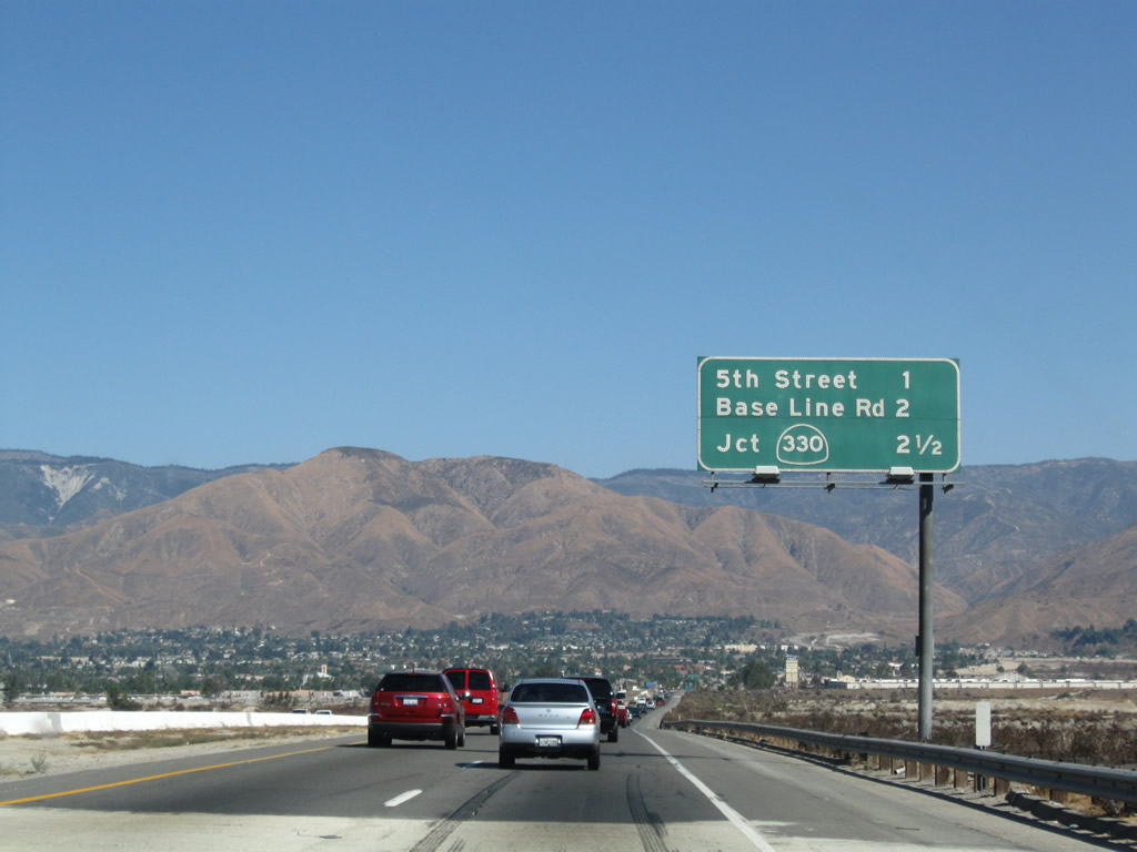 |
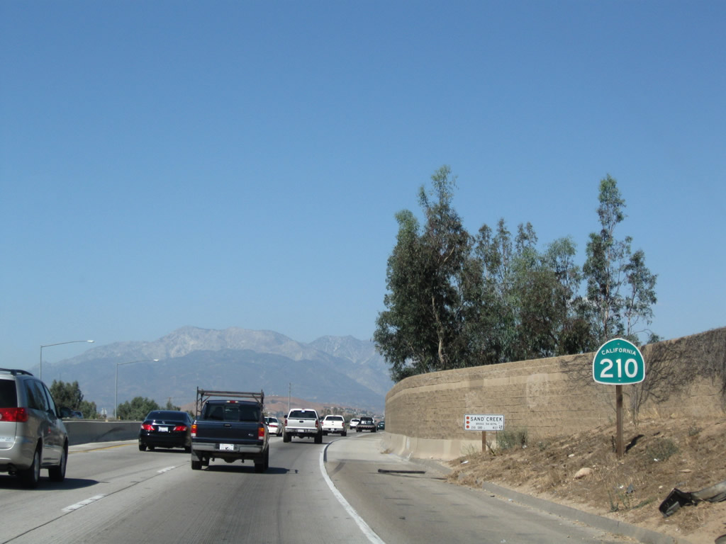
This mileage sign provides the distance to the next three exits along westbound California 210 are Exit 83, Fifth Street; Exit 82, Base Line Road; and Exit 81, California 330/City Creek Road north to Running Springs and Lake Arrowhead. Photo taken 09/28/08. |
 |
 |
The next three exits all serve the city of Highland. Located at an elevation of 1,350 feet, Highland had a population of 44,605 as the 2000 Census and was incorporated on November 24, 1987. Photo taken 09/28/08. |
 |
Westbound California 210 reaches Exit 83, Fifth Street in Highland. Photo taken 09/28/08. | |
 |
A California 210 west reassurance shield is posted after the on-ramp from Fifth Street. This mileage sign provides the distance to the next three exits along westbound California 210: Exit 82, Base Line Road; Exit 81, California 330/City Creek Road north to Running Springs and Lake Arrowhead; and Exit 79, California 30 Business (Highland Avenue). Photo taken 09/28/08. | |
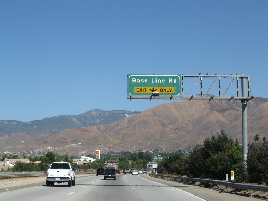 |
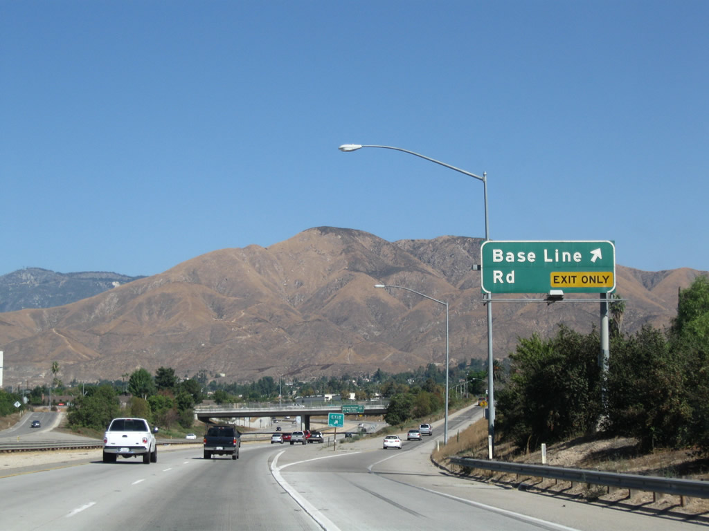
The next exit along California 210 west is Exit 82, Base Line Road. Photo taken 09/28/08. | |
 |
Westbound California 210 reaches Exit 82, Base Line Road. Photo taken 09/28/08. | |
 |
The next exit along California 210 west is Exit 81, California 330/City Creek Road north to Running Springs, Big Bear Lake, and Lake Arrowhead. Photo taken 09/28/08. | |
 |
The right two lanes link California 210 west to Exit 81, California 330/City Creek Road. California 330 begins as a freeway, then turns into a four-lane highway for its journey into the mountains. Prior to the extension of California 30 south to Redlands, the current route of California 330 was previously a part of California 30. Photo taken 09/28/08. | |
 |
Westbound California 210 reaches Exit 81, California 330/City Creek Road north. This is one of the fastest routes into the San Bernardino Mountains and recreational areas near Lake Arrowhead and Big Bear Lake. California 330 ends at its junction with California 18. Photo taken 09/28/08. | |
 |
Passing through the California 330 interchange, westbound California 210 turns west, leaves the city of Highland, and enters the city of San Bernardino. Named on May 20, 1810 (for Roman Catholic St. Bernardino de Sienna), the city of San Bernardino was incorporated in 1854. Home of the first McDonald's restaurant (opened by the McDonald brothers in 1948 on U.S. 66 Business at 1398 North E Street), San Bernardino is the seat of San Bernardino County. The city consists of 59.2 square miles, has about 16 inches of rainfall annually, sits at an elevation of 1,046 feet, and had a population of 185,401 people as of the 2000 Census. Downtown San Bernardino is located south of California 210 via California 259 and Interstate 215 south. Photo taken 09/28/08. | |
 |
An advance sign for Exit 76, California 18/Waterman Avenue is posted even though there are two other exits between here and there: Exit 79, California 30 Business (Highland Avenue) and Exit 78, Del Rosa Avenue. Photo taken 09/28/08. | |
 |
A California 210 west shield is posted shortly after the interchange with California 330. For the first time, the state route now traveling in the same direction as the cardinal direction. Photo taken 09/28/08. | |
 |
The next exit along California 210 west is Exit 79, California 30 Business (Highland Avenue). A remnant from the old California 30 designation, Highland Avenue is signed as a business route of California 30 from Exit 79 west to the interchange with California 259 north of downtown San Bernardino. Many old, faded reassurance and trailblazers for California 30 Business and California 18 Business are still posted along Highland Avenue. Photo taken 09/28/08. | |
 |
Use Exit 79 to the San Bernardino Soccer Complex via Highland Avenue west to Arden Avenue south. Use Highland Avenue east to the Patton State Hospital. Photo taken 09/28/08. | |
 |
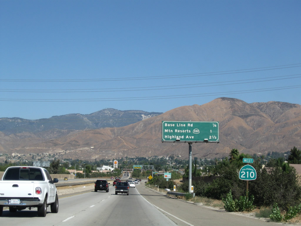
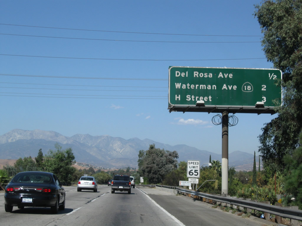
This mileage sign provides the distance to the next three exits: Exit 79, California 30 Business (Highland Avenue); Exit 78, Del Rosa Avenue; and Exit 76, California 18/Waterman Avenue. California 30 Business leads west along Highland Avenue into San Bernardino, running parallel to the freeway. California 30 Business and California 30 rejoin west of San Bernardino. The portion of California 30 Business between California 259 and Waterman Avenue is also designated as California 18 Business, but it is likely that the California 18 Business designation is a throwback from when California 259 was signed as California 18, and California 18 continued south and west to Long Beach. Photo taken 09/28/08. | |
 |
The first California 210 reassurance shield to be posted on the section of former California 30 between Interstate 10 and Interstate 215 was this shield, found just prior to the off-ramp for Exit 79. Photo taken 09/28/08. | |
 |
Westbound California 210 (Foothill Freeway) reaches Exit 79, California 30 Business (Highland Avenue). Photo taken 09/28/08. | |
 |
Another California 210 west reassurance shield is posted after the on-ramp from Highland Avenue. Photo taken 09/28/08. | |
 |
This mileage sign along California 210 west provides the distance to the three of the next four exits: Exit 78, Del Rosa Avenue; Exit 76, California 18/Waterman Avenue; (Exit 75B, California 259 south to Interstate 215 south;) and Exit 75A, H Street. This porcelain enamel sign dates back to an earlier style of freeway signage; this section of freeway opened in 1971, over 20 years prior to the opening of the segment from Interstate 10 to California 330. Photo taken 09/28/08. | |
 |
Westbound California 210 reaches Exit 78, Del Rosa Avenue. Photo taken 09/28/08. | |
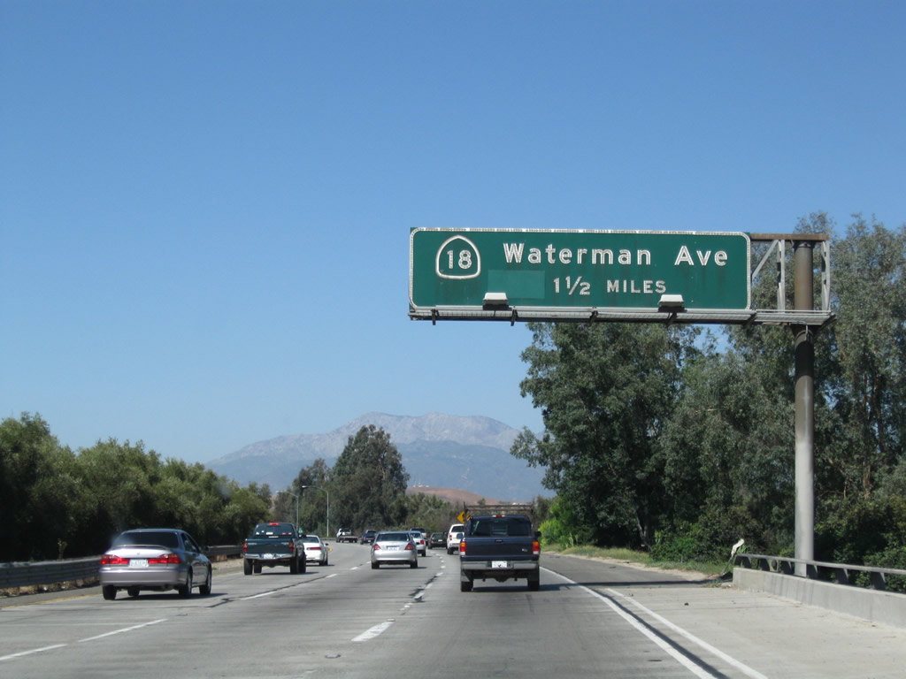 |
The next exit along California 210 west is Exit 76, California 18/Waterman Avenue. Photo taken 09/28/08. | |
 |
This mileage sign along California 210 west provides the distance to the next three exits: Exit 76, California 18/Waterman Avenue; Exit 75B, California 259 south to Interstate 215 (San Bernardino Freeway) south; and Exit 75A, H Street. Photo taken 09/28/08. | |
 |
California 18 travels north from San Bernardino toward Crestline and Lake Arrowhead, turning east to Big Bear Lake. At Big Bear Lake, California 18 turns north and then northwest into Victorville, then west to merge with California 138 in eastern Los Angeles County. Prior to 1964, California 18 used to continue southwest from San Bernardino along California 259, Interstate 215, and California 91 toward Long Beach; this section of signed state route was eliminated when most U.S. routes were eliminated in the state of California. Photo taken 09/28/08. | |
 |
Westbound California 210 reaches Exit 76, California 18/Waterman Avenue. Photo taken 09/28/08. | |
 |
Departing onto Exit 76, the ramp will connect to the northern frontage road, 30th Street. At the top of the ramp, turn left on 30th Street to California 18/Waterman Avenue. Photo taken 07/15/07. | |
 |
Turn left on 30th Street to California 18/Waterman Avenue. Photo taken 07/15/07. | |
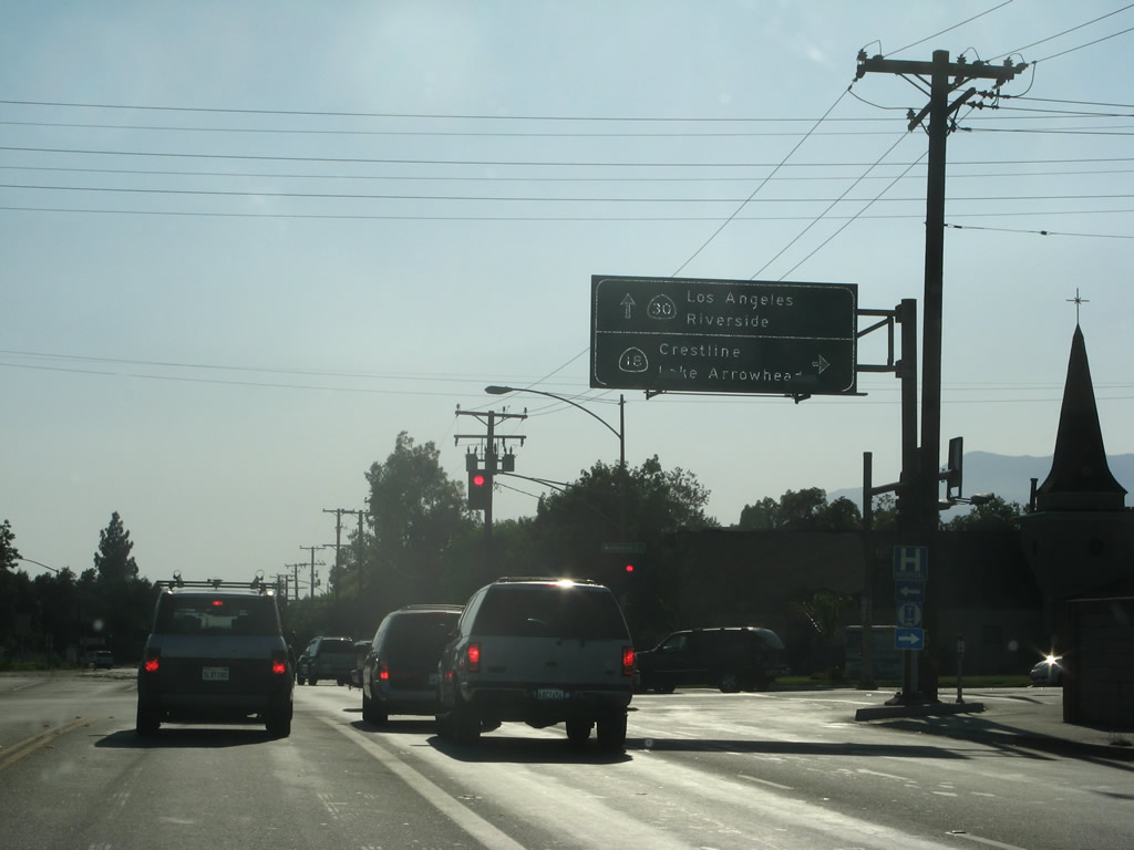 |
Westbound 30th Street meets California 18/Waterman Avenue at this traffic signal. Turn right to follow California 18 north to Lake Arrowhead and other mountain resorts. Photo taken 07/15/07. | |
 |
The next exit along westbound California 210 (Foothill Freeway) is Exit 75B, California 259 south to Interstate 215 to Riverside. The exit for northbound Interstate 215 does not occur until the point where California 210 crosses over Interstate 215. Photo taken 09/28/08. | |
 |
A mileage sign provides the distance to the next three exits along westbound California 210 (Foothill Freeway): Exit 75B, California 259 south to Interstate 215 to Riverside; Exit 75A, H Street; and Exit 74, Interstate 215 north to Barstow and Las Vegas. Photo taken 09/28/08. | |
 |
The left three lanes continue west on California 210, while the right lane becomes exit only for California 259 south (Exit 75B). Photo taken 09/28/08. | |
 |
Continue west on California 210 to connect to Exit 75A, H Street. Photo taken 09/28/08. | |
 |
Westbound California 210 (Foothill Freeway) reaches Exit 75B, California 259 south to Interstate 215 to Riverside. The original sign was retrofitted to include a California 210 shield rather than California 30 shield on the pull-through. Photo taken 09/28/08. | |
 |
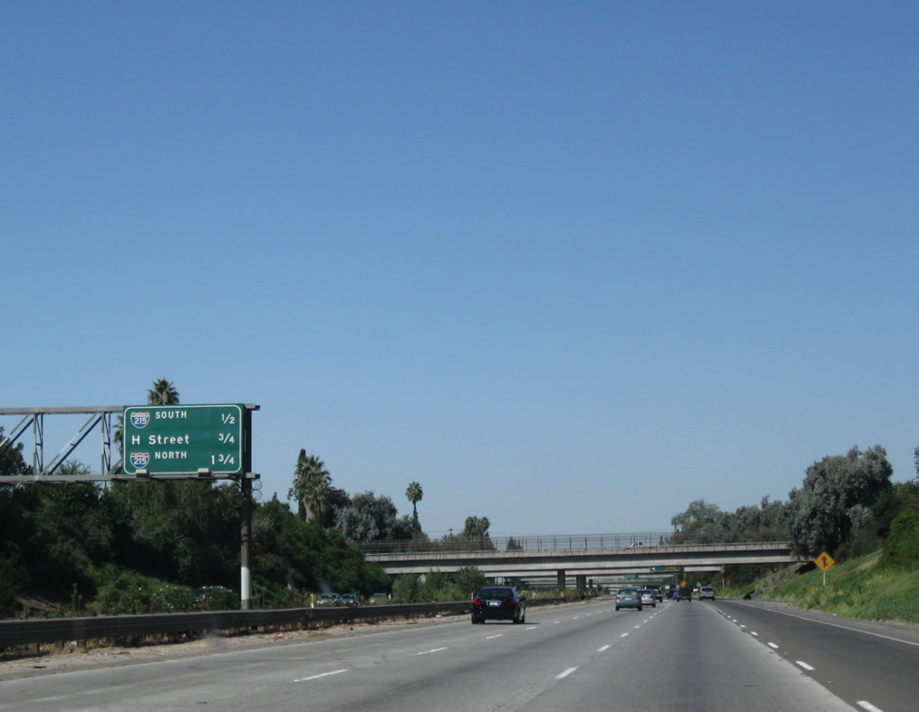
Immediately thereafter, westbound California 210 (Foothill Freeway) reaches Exit 75A, H Street. Use H Street south to downtown San Bernardino (the city street closely parallels Interstate 215). Photo taken 09/28/08. | |
 |
The left three lanes continue west on California 210 (Foothill Freeway); the right lane prepares to exit onto Interstate 215 north to Barstow and Las Vegas (via Exit 74). These new signs were placed in March 2008 when the new California 210 designation was added. Photo taken 09/28/08. | |
 |
Westbound California 210 reaches Exit 74, Interstate 215 north to Barstow and Las Vegas. Interstate 215 is the major north-south freeway through San Bernardino, having served as U.S. 66-91-395 until 1964, when U.S. 66 and U.S. 91 were legislatively eliminated in the state of California. U.S. 395 remained in service until 1969 (legislative decommissioning), and signs for U.S. 395 south of Hesperia were posted into the 1970s. Photo taken 09/28/08. | |
 |
Upon crossing over Interstate 215, westbound California 210 enters its newest segment, which opened in July 2007. The next interchange is Exit 73, State Street and University Parkway (one mile). Photo taken 09/28/08. | |
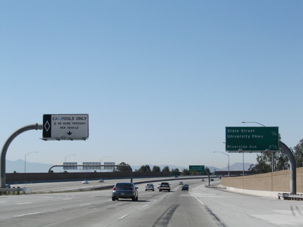 |
A carpool (high occupancy vehicle) lane begins on the left of the westbound lanes of California 210. The next three exits along California 210 west are: Exit 73, State Street and University Parkway; Exit 72, Pepper Street (future exit unconstructed as of September 2008); and Exit 71, Riverside Avenue. Photo taken 09/28/08. | |
 |
The right lane of California 210 west becomes exit only for Exit 73, State Street and University Parkway. Exit 73 serves the unincorporated community of Muscoy, and University Parkway travels north to California State University at San Bernardino. Photo taken 09/28/08. | |
 |
For Highland Avenue (old California 30), use Exit 73. Highland Avenue generally parallels the new California 210 freeway. Photo taken 09/28/08. | |
 |
Westbound California 210 reaches Exit 73, State Street and University Parkway to Muscoy. Photo taken 09/28/08. | |
 |
As traffic from University Parkway and State Street merges onto California 210 (Foothill Freeway) west, a Union Pacific Railroad bridge comes into view in the distance. Photo taken 09/28/08 . | |
 |
California 210 leaves the city of San Bernardino and enters the city of Rialto, the "Bridge to Progress." As of the 2000 Census, Rialto had a population of 91,873 people and incorporated on November 17, 1911. Photo taken 09/28/08. | |
 |
The next exit along California 210 west is Exit 71, Riverside Avenue (0.75 mile). Photo taken 09/28/08. | |
 |
The next three exits along California 210 all serve the city of Rialto, which celebrated the opening of California 210 with its own "Play on the Freeway" day on June 24, 2007. Photo taken 09/28/08. | |
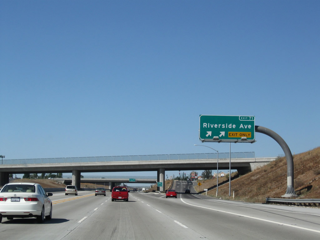 |
Westbound California 210 reaches Exit 71, Riverside Avenue, a two-lane off-ramp. Photo taken 09/28/08. | |
 |
The next exit along California 210 west is Exit 70, Ayala Drive (one mile). Photo taken 09/28/08. | |
 |
The right lane of California 210 west becomes exit only for Exit 70, Ayala Drive. Photo taken 09/28/08. | |
 |
This mileage sign provides the distance to the next three exits along California 210 west: Exit 70, Ayala Drive; Exit 68, Alder Avenue; and Exit 67, Sierra Avenue. Photo taken 09/28/08. | |
 |
Westbound California 210 reaches Exit 70, Ayala Drive in Rialto. Photo taken 09/28/08. | |
 |
The next exit along California 210 west is Exit 68, Alder Avenue (one mile). Photo taken 09/28/08. | |
 |
This mileage sign provides the distance to the next three exits along California 210 west: Exit 68, Alder Avenue; Exit 67, Sierra Avenue; and Exit 66, Citrus Avenue. Photo taken 09/28/08. | |
 |
Westbound California 210 (Foothill Freeway) reaches Exit 68, Alder Avenue. Photo taken 09/28/08. | |
 |
The next exit along California 210 west is Exit 67, Sierra Avenue (one mile). Photo taken 09/28/08. | |
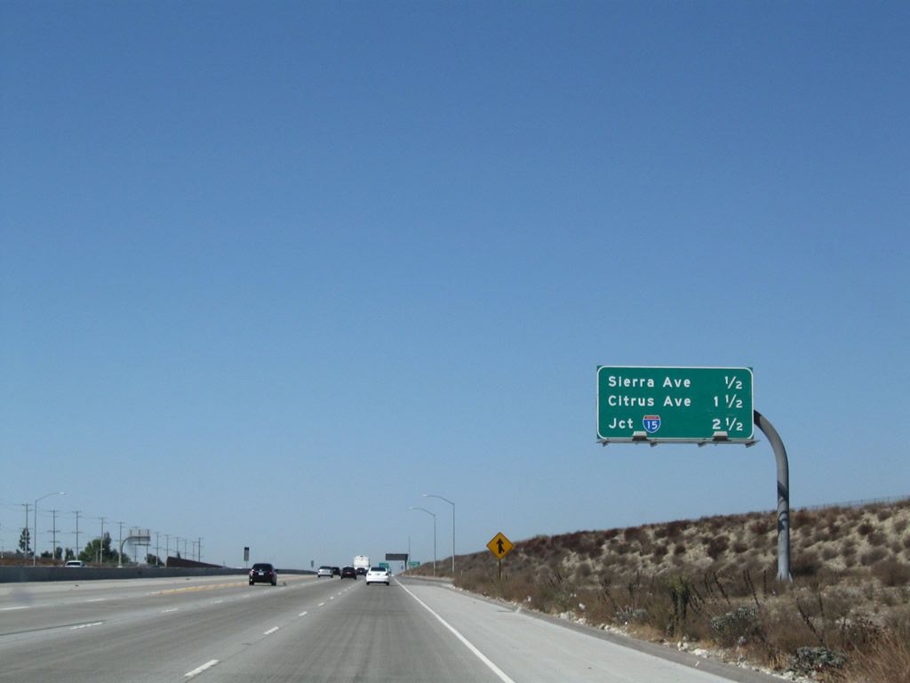 |
This mileage sign provides the distance to the next three exits along California 210 west: Exit 67, Sierra Avenue; Exit 65, Citrus Avenue; and Exit 64B, Interstate 15 (Ontario Freeway) north to Barstow and Las Vegas and south to Corona and San Diego. Photo taken 09/28/08. | |
 |
The next three exits along California 210 west serve the city of Fontana. Founded in 1913 and incorporated on June 25, 1952, Fontana sits along Historic U.S. 66 (Foothill Boulevard). The city's population was 128,929 as of the 2000 Census, but that number is estimated to be 188,498 as of a 2008 Census estimate. The boundaries of Fontana have changed with several annexations in 2006 and 2007, thus helping increase its overall population. Development has also increased through most of the first decade of the 2000s. Photo taken 09/28/08. | |
 |
Westbound California 210 (Foothill Freeway) reaches Exit 67, Sierra Avenue. Prior to 2007, Sierra Avenue was the eastern end of California 210 until the missing link between Sierra Avenue and Interstate 215 opened in stages. Photo taken 09/28/08. | |
 |
The next exit along California 210 west is Exit 65, Citrus Avenue. Photo taken 09/28/08. | |
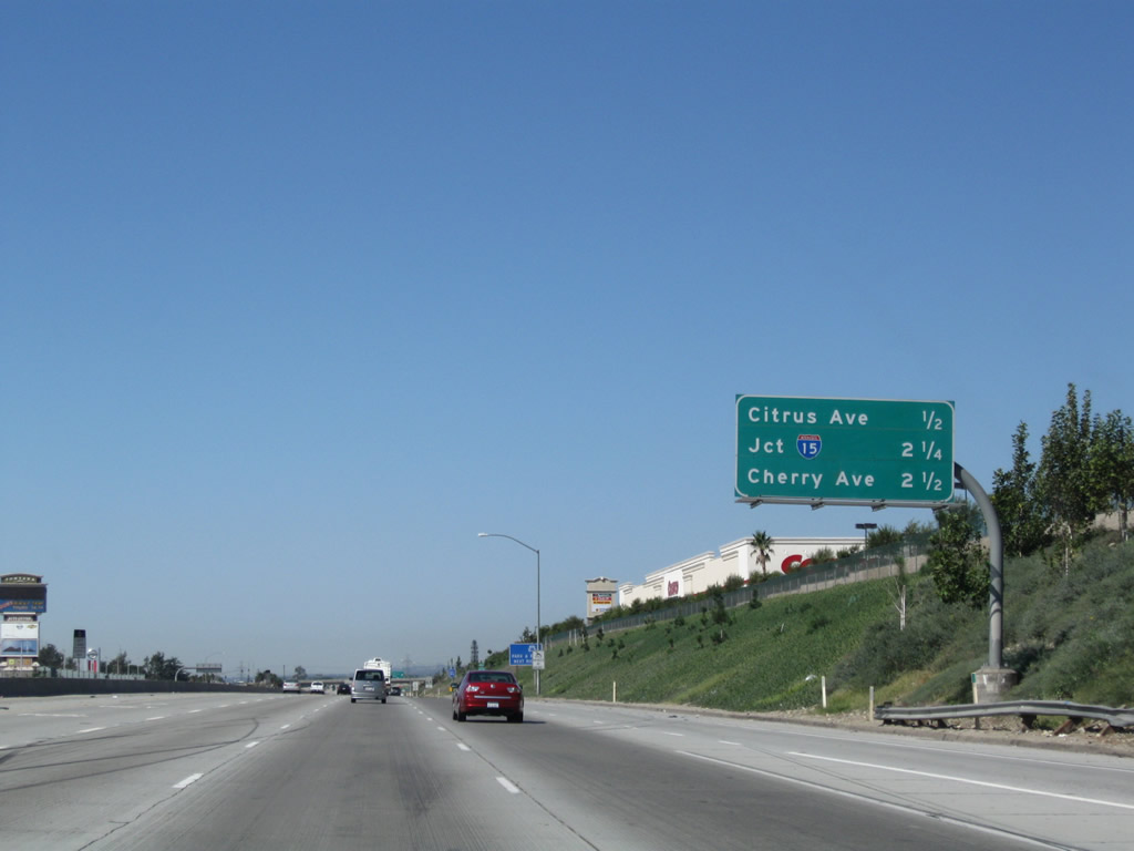 |
This mileage sign provides the distance to the next three exits along California 210 west: Exit 65, Citrus Avenue; Exit 64B, Interstate 15 (Ontario Freeway) north to Barstow and Las Vegas and south to Corona and San Diego; and Exit 64A, Cherry Avenue. Omitted is the direct access ramp from the HOV lanes to Exit 64C, Beech Avenue. Photo taken 09/28/08. | |
 |
A California 210 west reassurance shield is posted after the on-ramp from Sierra Avenue. Photo taken 09/28/08. | |
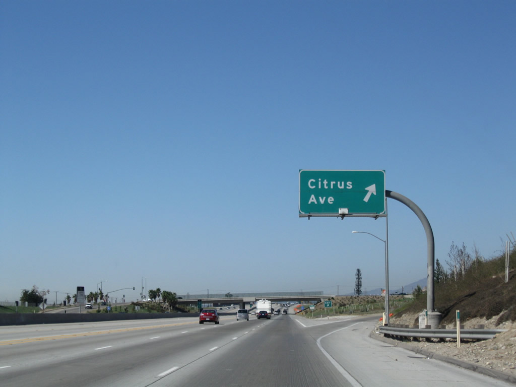 |
Westbound California 210 (Foothill Freeway) reaches Exit 65, Citrus Avenue. Photo taken 09/28/08. | |
 |
Passing under the Citrus Avenue overpass in Fontana, a blank, white sign is mounted on the bridge, perhaps intended for the direct access ramp to Beech Street from the carpool lanes. The lane markings along this section of California 210 are not the standard and ubiquitous Botts Dots common on most Southern California freeways. The lane markers are painted only. Photo taken 09/28/08. | |
 |
A direct access ramp to Beech Street from the carpool lanes is the next off-ramp available to carpools and high occupancy vehicles only (Exit 64C). Photo taken 09/28/08. | |
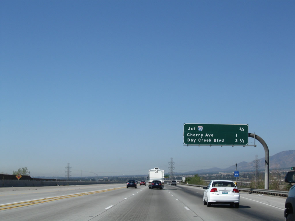 |
This mileage sign provides the distance to the next three exits along California 210 west: Exit 64B, Interstate 15 (Ontario Freeway) north to Barstow and Las Vegas and south to Corona and San Diego; Exit 64A, Cherry Avenue; and Exit 61, Day Creek Boulevard. Photo taken 09/28/08. | |
 |
The right two lanes of California 210 west become exit only for Exit 64B, Interstate 15 (Ontario Freeway). Use Interstate 15 north to Barstow, Las Vegas, St. George, Provo, Salt Lake City, Ogden, Pocatello, Butte, and Great Falls en route to Canada. To the south, Interstate 15 travels through the Inland Empire to Corona, then travels on the old alignment of California 71 and U.S. 395 to Lake Elsinore, Wildomar, Temecula, Escondido, and San Diego. Interstate 15 is a very busy freeway route that carries a great deal of truck traffic from the north and east (via Interstate 40 and Interstate 70). Photo taken 09/28/08. | |
 |
A massive Southern California Edison dual-circuit power line carries two 500kV circuits as part of the West of Colorado River power transmission system considered part of Path 46. These lines originate at the Lugo substation southeast of Hesperia, where they interconnect with lines coming from Vincent (junction of California 14 and Angeles Forest Highway) and Northern California. These lines also carry incoming power from power plants located in places as disparate as Lake Mead/Hoover Dam; Laughlin, Nevada; Delta, Utah; and near Shiprock, New Mexico, in the Four Corners region. Photo taken 09/28/08. | |
 |
Westbound California 210 (Foothill Freeway) reaches Exit 64B, Interstate 15 north to Barstow and south to San Diego. Photo taken 09/28/08. | |
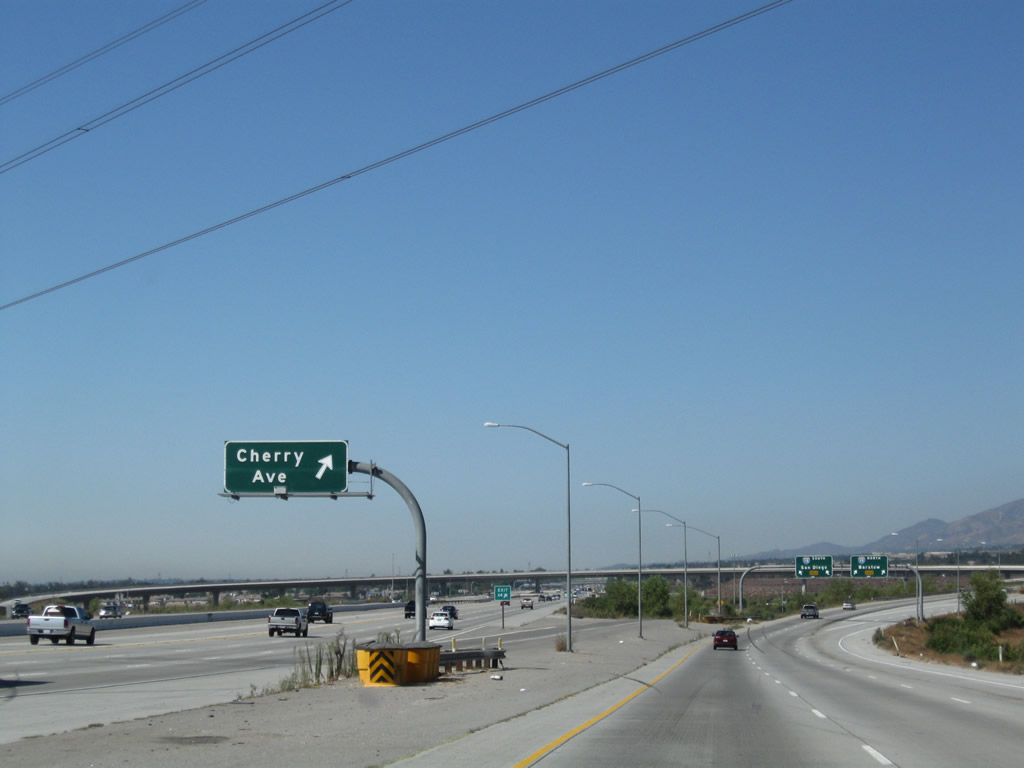 |
The off-ramp for Exit 64A to Cherry Avenue is embedded within the footprint of the Interstate 15-California 210 interchange. Photo taken 09/28/08. | |
 |
On the transition ramp from California 210 west to Interstate 15, the ramp splits with the left two lanes connecting to Interstate 15 south to San Diego and the right two lanes connecting to Interstate 15 north. Photo taken 09/28/08. | |
 |
The transition ramp to Interstate 15 south is two lanes and is wide and sweeping, allowing for a high speed connection from California 210 west. Photo taken 09/28/08. | |
 |
Westbound Interstate 210 (Foothill Freeway) next reaches Exit 64A, Cherry Avenue (within the Interstate 15 interchange). Photo taken 01/28/06. | |
 |
Interstate 210 (Foothill Freeway) crosses over Interstate 15. Photo taken 01/28/06. | |

Page Updated January 10, 2010.
|
About Contact Glossary |
In The News Testimonials Interstate Guide |
Social Media:
 |
|
© 2000-23 AARoads.com | All Rights Reserved | Privacy Policy / Terms of Use
|
||