| Interstate 215 south |
|
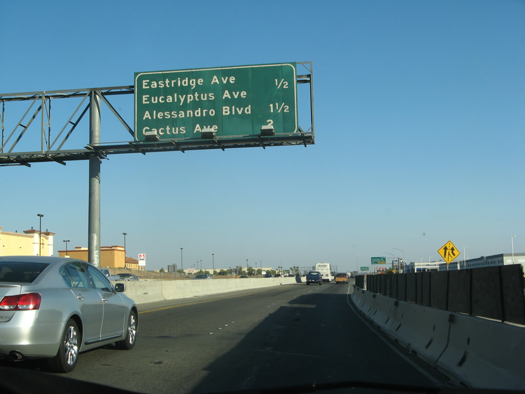
After the split from California 60 in Riverside, this mileage sign provides the distance to the next four exits along Interstate 215 (Escondido Freeway) south: Exit 28, Eastridge Avenue and Eucalyptus Avenue; Exit 27C, Alessandro Boulevard; Exit 27B, Cactus Avenue west to Arnold Heights; and Exit 27A, Cactus Avenue east to March Avenue. Photo taken 07/15/07. |
|
The right two lanes of Interstate 215 (Escondido Freeway) south connect to Exit 28, Eastridge Avenue and Eucalyptus Avenue. Photo taken 07/15/07. |
|
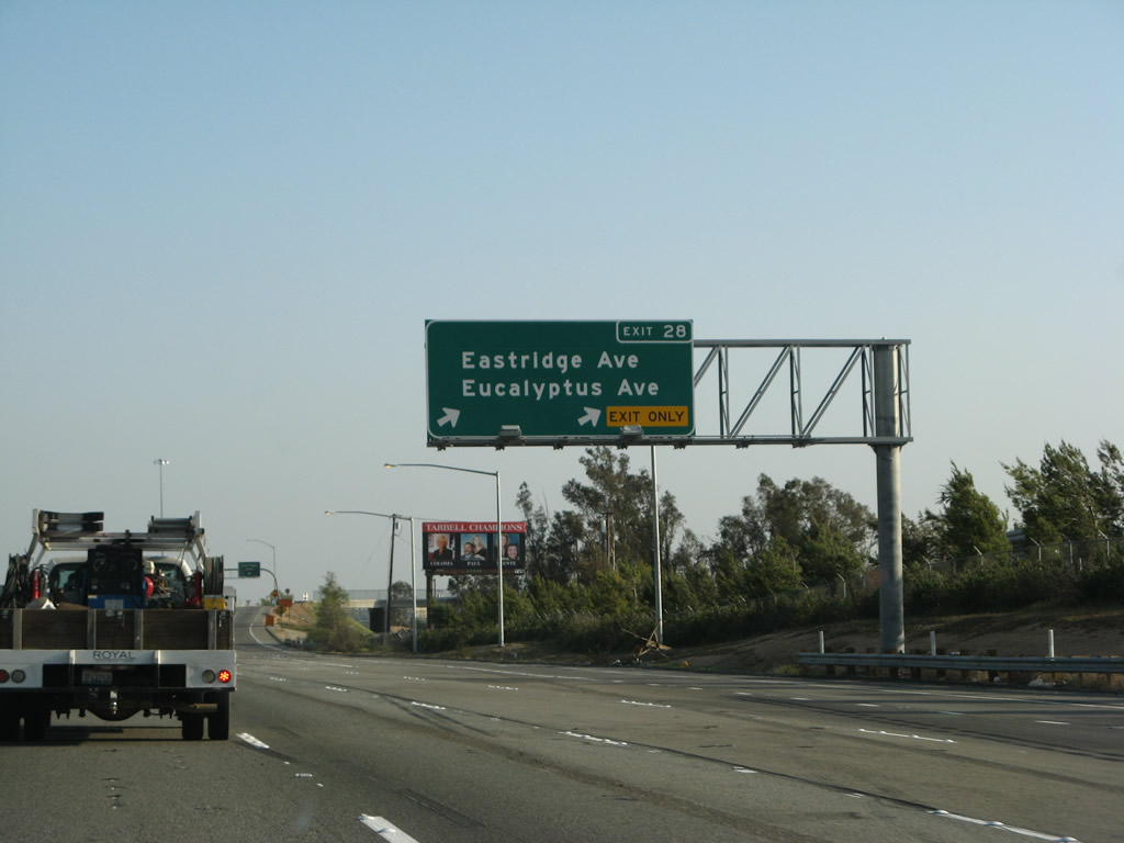
Southbound Interstate 215 (Escondido Freeway) reaches Exit 28, Eastridge Avenue and Eucalyptus Avenue in Riverside. This is a single-point urban interchange, which is an uncommon design in Southern California. Eastridge Avenue travels west to Riverside, while Eucalyptus Avenue travels east into the Edgemont neighborhood of the city of Moreno Valley. Photo taken 07/15/07. |
|
Interstate 215 (Escondido Freeway) passes under the Eastridge Avenue and Eucalyptus Avenue overpass. A mileage sign provides the distance to Interstate 15 (southern terminus, 25 miles), Escondido (55 miles), and San Diego (90 miles). Photo taken 05/13/05. |
|
The next three exits are: Exit 27C, Alessandro Boulevard; Exit 27B, Cactus Avenue west to Arnold Heights; and Exit 27A, Cactus Avenue east to March Avenue. Photo taken 05/13/05. |
|
Southbound Interstate 215 (Escondido Freeway) reaches Exit 27C, Alessandro Boulevard. At this point, Interstate 215 leaves the city of Riverside and enters unincorporated Riverside County. Photo taken 02/26/06. |
|
The next three exits are: Exit 27B, Cactus Avenue west to Arnold Heights; Exit 27A, Cactus Avenue east to March Avenue and March Air Force Reserve Base; and Exit 25, Van Buren Boulevard. Photo taken 03/31/08. |
|
|
|
The signage for Exits 27B-A has changed between 2006 and 2007, but there are still no exit numbers specified for this interchange. The next interchange is partial cloverleaf. The first ramp connects to Exit 27B, Cactus Avenue west to Arnold Heights, and the second ramp connects to Exit 27A, Cactus Avenue east to March Avenue and March Air Force Reserve Base. Photos taken 02/26/11, 07/15/07, and 02/26/06. |
|
Use Cactus Avenue east to the March Air Reserve Base and the city of Moreno Valley. While Interstate 215 does not enter Moreno Valley, several of the exits (Eucalyptus Avenue, Alessandro Boulevard, and Cactus Avenue) travel east into that city. Photo taken 03/31/08. |
|
|
Southbound Interstate 215 (Escondido Freeway) reaches Exit 27B, Cactus Avenue west to Meridian Parkway and Arnold Heights. Photos taken 02/26/11 and 07/15/07. |
|
|
Immediately thereafter, Interstate 215 south connects to Exit 27A, Cactus Avenue east to Moreno Valley and March Air Reserve Base. Photos taken 02/26/11 and 07/15/07. |
|
|
At the gore point for Exit 27A is a mileage sign for the next three exits: Exit 25, Van Buren Boulevard; Exit 23, Harley Knox Boulevard (Oleander Avenue); and Exit 22, Ramona Expressway and Cajalco Expressway. Photos taken 02/26/11 and 07/15/07. |
|
|
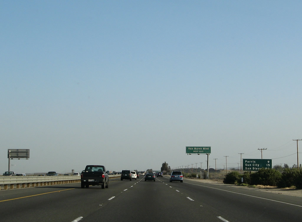
A second mileage sign provides the distance to Perris (nine miles), Menifee (formerly listed Sun City, 13 miles), and San Diego (89 miles). Photos taken 02/26/11 and 03/31/08. |
|
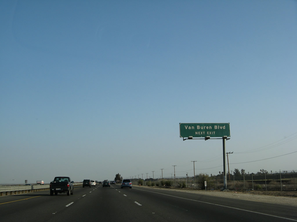
The next exit along Interstate 215 (Escondido Freeway) south is Exit 25, Van Buren Boulevard. Photo taken 03/31/08. |
|
Use Exit 25 to the March Field Museum on the east side of Interstate 215. This exit also connects to an extant section of former U.S. 395 expressway on the west side of the Interstate 215 freeway. Photo taken 03/31/08. |
|
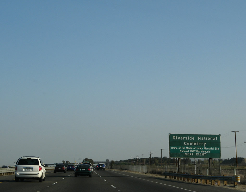
Also at this interchange is the Riverside National Cemetery, which occupies land on the west side of the freeway south of Van Buren Boulevard. The cemetery will come into view on Interstate 215 south as the freeway passes through the Van Buren Boulevard interchange. Photo taken 03/31/08. |
|
Southbound Interstate 215 (Escondido Freeway) reaches Exit 25, Van Buren Boulevard. Use Van Buren Boulevard west to the Orangecrest and Woodcrest communities of the city of Riverside (as well as the national cemetery). Van Buren Boulevard is a long street, as it turns northwest to meet California 91 (Riverside Freeway) at Exit 58. Photo taken 03/31/08. |
|
The next two exits along Interstate 215 south are: Exit 23, Harley Knox Boulevard (Oleander Avenue) and Exit 22, Ramona Expressway and Cajalco Expressway. Photo taken 03/31/08. |
|
|
The next exit along Interstate 215 south is Exit 23, Harley Knox Boulevard (Oleander Avenue). Photos taken 02/26/11 and 03/31/08. |
|
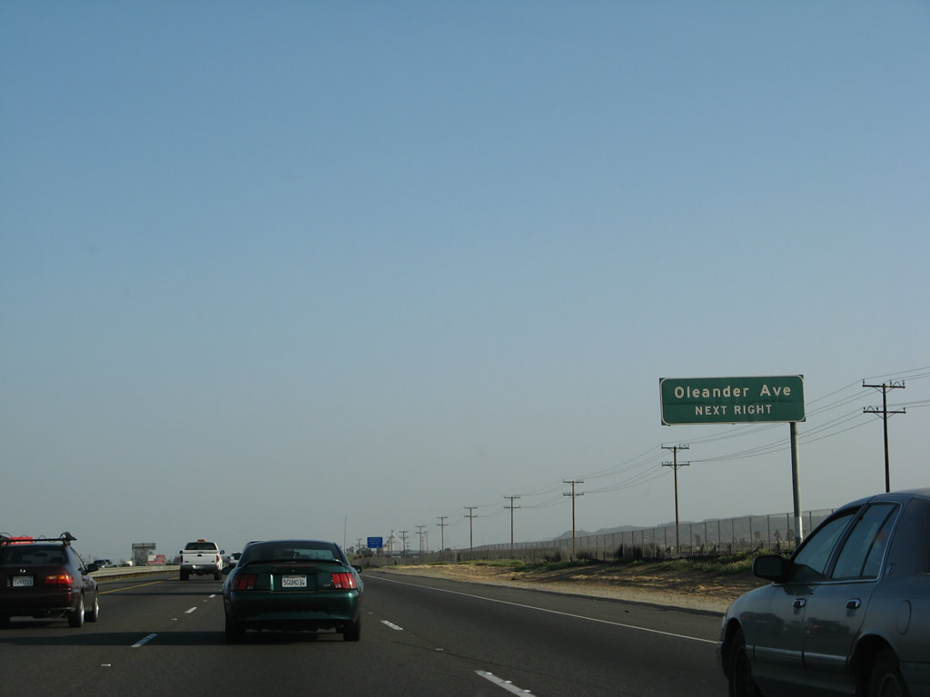
Oleander Avenue was renamed as Harley Knox Boulevard on January 7, 2009, in honor of Harley Knox, a longtime area farmer and developer.1 Harley Knox Boulevard travels southeast into the northern reaches of the city of Perris and west to Harvill Avenue. Photo taken 07/15/07. |
|
Southbound Interstate 215 reaches Exit 23, Harley Knox Boulevard (Oleander Avenue). Photo taken 07/15/07. |
|
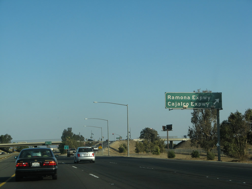
The next exit along southbound is Exit 22, Ramona Expressway and Cajalco Expressway. The Ramona Expressway travels east from this interchange across northern Perris, connecting with the main entrance to the Lake Perris State Recreation Area before entering unincorporated Riverside County. Ramona Expressway merges into California 79 in the city of San Jacinto. Photo taken 07/15/07. |
|
|
The Cajalco Expressway, meanwhile, travels west to connect with Cajalco Road. From there, Cajalco Road travels west toward Lake Mathews Estelle Mountain Reserve, then connects with Interstate 15 Exit 91 in the city of Corona. Photos taken 02/26/11 and 07/15/07. |
|
|
As noted earlier, two major recreation areas are located in either direction: Lake Mathews and Estelle Mountain lie to the west via Cajalco Road, and Lake Perris lies to the east via Ramona Expressway. Lakeview and the city of San Jacinto lie east of here via Ramona Expressway. Photos taken 07/14/08 and 02/26/06. |
|
Southbound Interstate 215 reaches Exit 22, Ramona Expressway and Cajalco Expressway. Photo taken 07/15/07. |
|
This mileage sign provides the distance to the next three exits: Exit 19, Nuevo Road; Exit 18, D Street (Old U.S. 395) south to downtown Perris; and Exit 17, California 74 (Fourth Street) west and Redlands Avenue north. Photo taken 03/31/08. |
|
This Interstate 215 reassurance shield is posted after the on-ramp from the Ramona Expressway and Cajalco Expressway. Photo taken 07/15/07. |
|
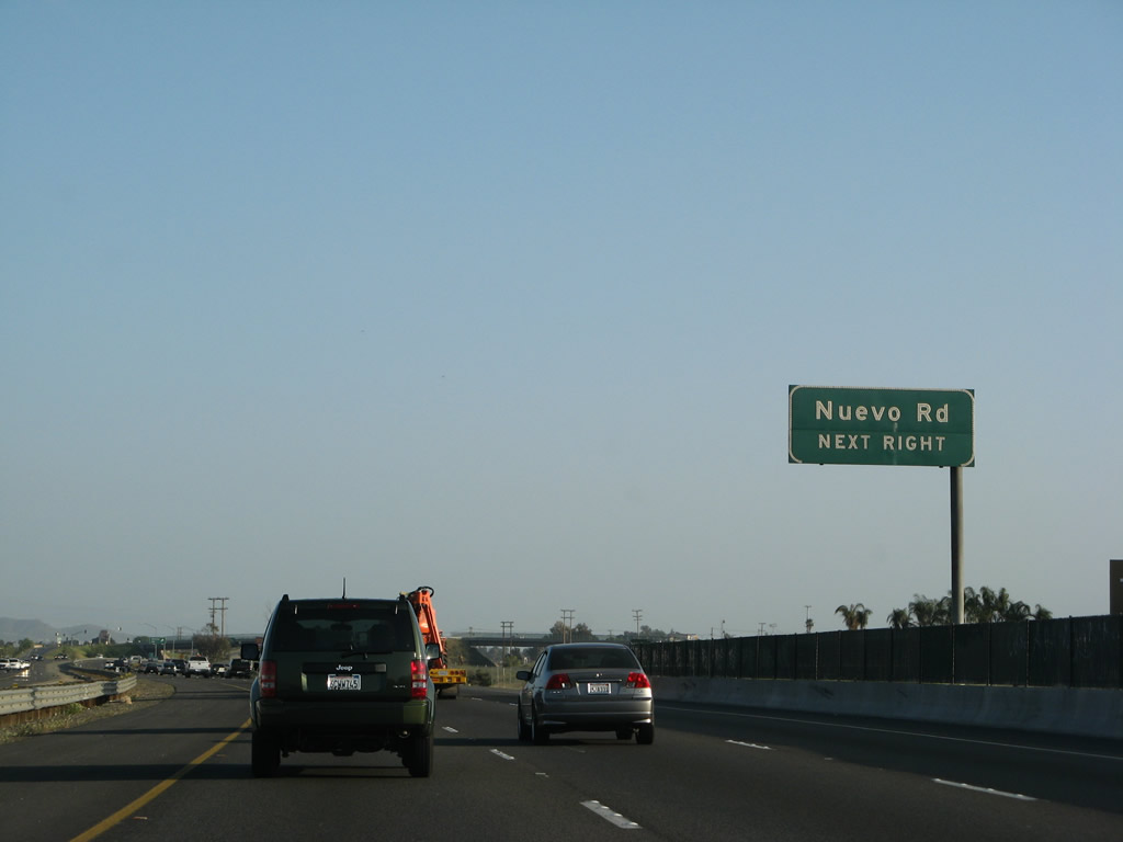
The next exit along southbound is Exit 19, Nuevo Road (one mile). Photo taken 07/15/07. |
|
|
Nuevo Road also connects to the city of Perris, which is mostly located east of Interstate 215. At Exit 19, Interstate 215 will enter the city limits of Perris. Photos taken 02/26/11 and 03/31/08. |
|
|
Use Nuevo Road west to Harvill Avenue. Photos taken 02/26/11 and 05/13/05. |
|
Southbound Interstate 215 (Escondido Freeway) reaches Exit 19, Nuevo Road. Photo taken 07/15/07. |
|
The next exit along southbound Interstate 215 is Exit 18, D Street. This exit follows Old U.S. 395 south into downtown Perris. Photo taken 02/26/06. |
|
At this point, Interstate 215 enters the city of Perris. Home to 46,600 people as of the 2000 Census, Perris sits at an elevation of 1,453 feet and consists of 31.5 square miles. Photo taken 07/15/07. |
|
The right lane becomes exit only for Exit 18, D Street south to Perris. The is an extant section of U.S. 395, which predates the bypass that takes Interstate 215 east of downtown Perris. Photo taken 02/26/06. |
|
Southbound Interstate 215 (Escondido Freeway) reaches Exit 18, D Street south to Perris. Photo taken 02/26/06. |
|
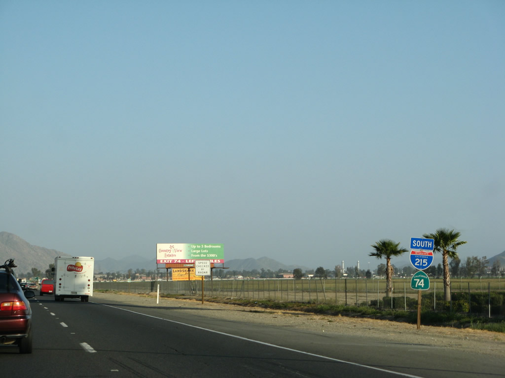
After the D Street off-ramp, this sign advises of the next interchange: Exit 17, California 74 (Fourth Street) west to downtown Perris and Lake Elsinore. California 74 east will merge onto Interstate 215 between Exits 17 and 15. Photo taken 02/26/06. |
|
|
Passing under the Perris Boulevard overpass, another advance sign for California 74 is posted. To the west, California 74 travels toward Lake Elsinore, then ascends the Santa Ana Mountains. The two-lane highway sees sharp twists and turns along the Ortega Highway, then descends to Ladera Ranch and the city of San Juan Capistrano in Orange County. California 74 ends at Interstate 5 (San Diego Freeway). Photos taken 02/26/11 and 03/31/08. |
|
Southbound Interstate 215 (Escondido Freeway) reaches Exit 17, California 74 (Fourth Street) west to downtown Perris. From here, Interstate 215 south and California 74 east will merge for a couple miles on a shared alignment. Photo taken 03/31/08. |
|
A supplemental sign after the gore point indicates the connection to California 74 east two miles ahead. Photo taken 03/31/08. |
| Interstate 215 south & California 74 east |
|
Interstate 215 and California 74 are fully signed on their shared alignment. Photo taken 03/31/08. |
|
This mileage sign along Interstate 215 south and California 74 east provides the distance to Sun City (five miles), Hemet (15 miles via California 74 east), and San Diego (81 miles). Photo taken 02/26/06. |
|
|
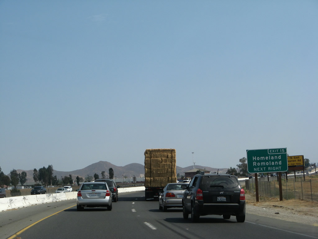
The next exit along southbound Interstate 215 (Escondido Freeway) is Exit 15, California 74/Mathews Road east to Romoland (now part of the city of Menifee) and Hemet. Photos taken 02/26/11 and 02/26/06. |
|
Another mileage sign provides the distance to the next three exits along Interstate 215 south: Exit 15, California 74/Mathews Road east and Case Road west; Exit 14, Ethanac Road; and Exit 12, McCall Boulevard. Photo taken 03/31/08. |
|
A new exit number sign is posted on Interstate 215 south for Exit 15, California 74/Mathews Road east to Romoland (now part of the city of Menifee) and Homeland. Photo taken 07/14/08. |
|
The next five exits along Interstate 215 (Escondido Freeway) south all serve the city of Menifee: Exit 15, California 74 east to Hemet; Exit 14, Ethanac Road; Exit 12, McCall Boulevard; Exit 10, Newport Road; and Exit 7, Scott Road. Photo taken 07/14/08. |
|
Southbound Interstate 215 (Escondido Freeway) and eastbound California 74 split here at Exit 15. Use California 74 east to Romoland and Hemet; continue south on Interstate 215 to Sun City and Murrieta. Photo taken 07/15/07. |
| Interstate 215 (Escondido Freeway) south |
|
After the California 74 split, the next interchange is Exit 14, Ethanac Road. This is the last interchange to serve the city of Perris. Photo taken 02/26/06. |
|
This mileage sign provides the distance to Menifee/Sun City (two miles), Temecula (18 miles), and San Diego (78 miles). Photo taken 03/31/08. |
|
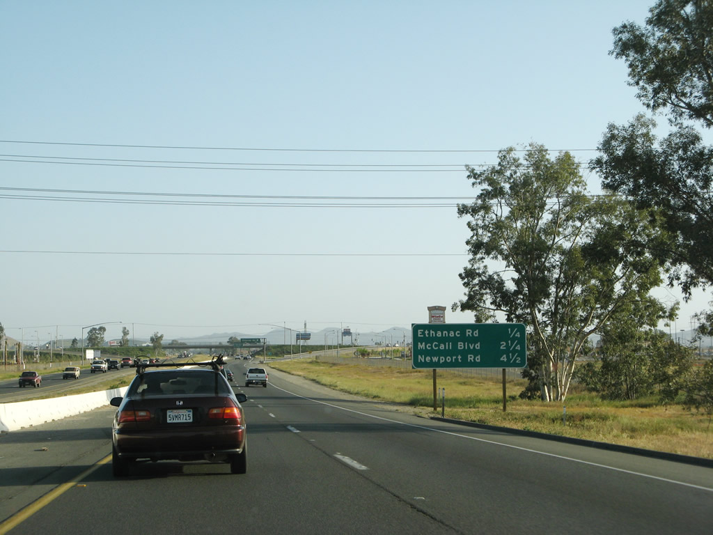
An interchange sequence sign provides the distance to the next three exits along Interstate 215 (Escondido Freeway) south: Exit 14, Ethanac Road; Exit 12, McCall Boulevard; and Exit 10, Newport Road. Photo taken 03/31/08. |
|
Southbound Interstate 215 (Escondido Freeway) reaches Exit 14, Ethanac Road. Photo taken 02/26/06. |
|
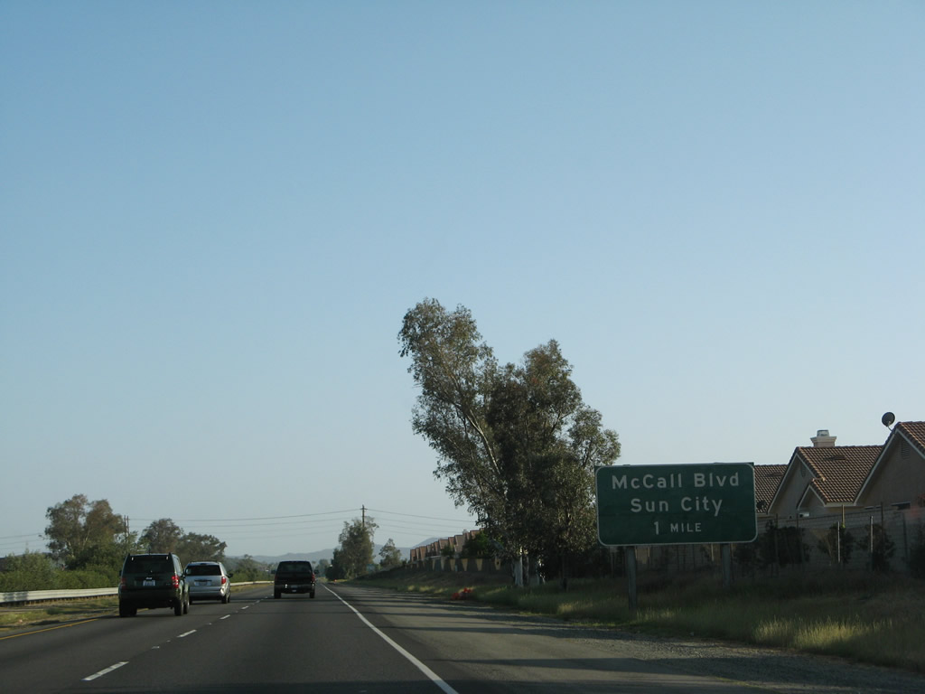
The next exit along southbound is Exit 12, McCall Boulevard to Sun City (two miles). Photo taken 03/31/08. |
|
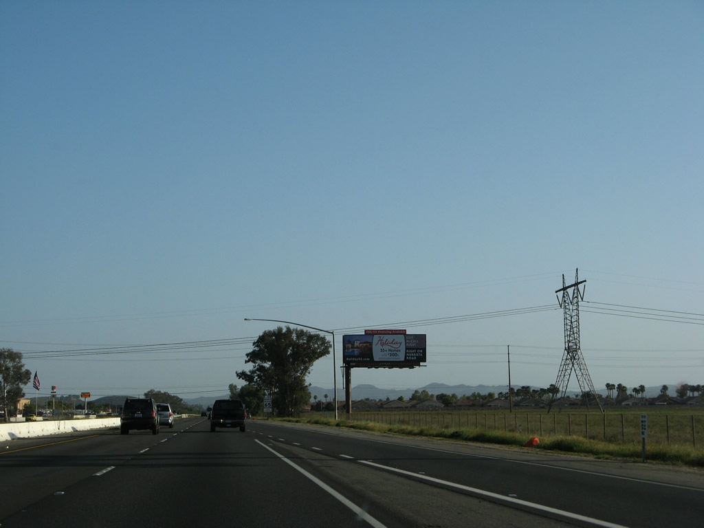
A 500kV Southern California Edison power line crosses Interstate 215; this line connects to the Palo Verde Nuclear Generating Station in Arizona and extends west through the Colorado Desert to a substation in Orange County. Photo taken 03/31/08. |
|
The 500kV line travels west toward Orange County. Southern California Edison chose a unique style of tower, which has four points that touch the ground. Photo taken 02/26/11. |
|
Sun City is an unincorporated community of Riverside County that is part of the newly incorporated city of Menifee. Sun City was incorporated as part of the city of Menifee on October 1, 2008. (Other communities within the city of Menifee include Sun City, Quail Valley, most of Paloma Valley and Paloma Hills, the community of Menifee, and part of Romoland). Prior to that, Sun City was a master planned community for senior citizens (over age 55). The community of Sun City had 17,773 people as of the 2000 Census. Photo taken 03/31/08. |
|
This mileage sign provides the distance to the next three exits along Interstate 215 (Escondido Freeway) south: Exit 12, McCall Boulevard; Exit 10, Newport Road; and Exit 7, Scott Road. Photo taken 03/31/08. |
|
Southbound Interstate 215 reaches Exit 12, McCall Boulevard to Sun City. Photo taken 03/31/08. |
|
The next exit along Interstate 215 south is Exit 10, Newport Road. Photo taken 03/31/08. |
|
This mileage sign provides the distance to the next three exits along Interstate 215 (Escondido Freeway) south: Exit 10, Newport Road; Exit 7, Scott Road; and Exit 4, Clinton Keith Road. Photo taken 03/31/08. |
|
Use Exit 10 to Menifee, Quail Valley, and Canyon Lake. The city of Canyon Lake is one of five gated cities in California. This master-planned development was built by the Corona Land Company in 1968 surrounding a reservoir created in 1927 (Canyon Lake Reservoir is owned and operated by the Elsinore Valley Municipal Water District). The city of Canyon Lake was incorporated on December 1, 1990, and it has a population of 9,952 people as of the 2000 Census. No state highway enters the city of Canyon Lake, and Railroad Canyon Road skirts the southern edge of the city. Most of the city is behind a gate. In addition, this exit also serves the unincorporated community of Quail Valley (population 1,639 as of 2000 Census), which is located northeast of Canyon Lake. Photo taken 03/31/08. |
|
Use Exit 10 to Mount San Jacinto College (Menifee Valley Campus). The college is located on the east side of Interstate 215; follow Newport Road east to Antelope Road. Turn south on Antelope Road to the campus. The unincorporated community on the east side of Interstate 215 is Menifee. Like Sun City, it is growing rapidly, so look for more housing and office development along this corridor. Photo taken 03/31/08. |
|
Southbound Interstate 215 (Escondido Freeway) reaches Exit 10, Newport Road east to Menifee and west to Quail Valley and the city of Canyon Lake. Photo taken 03/31/08. |
|
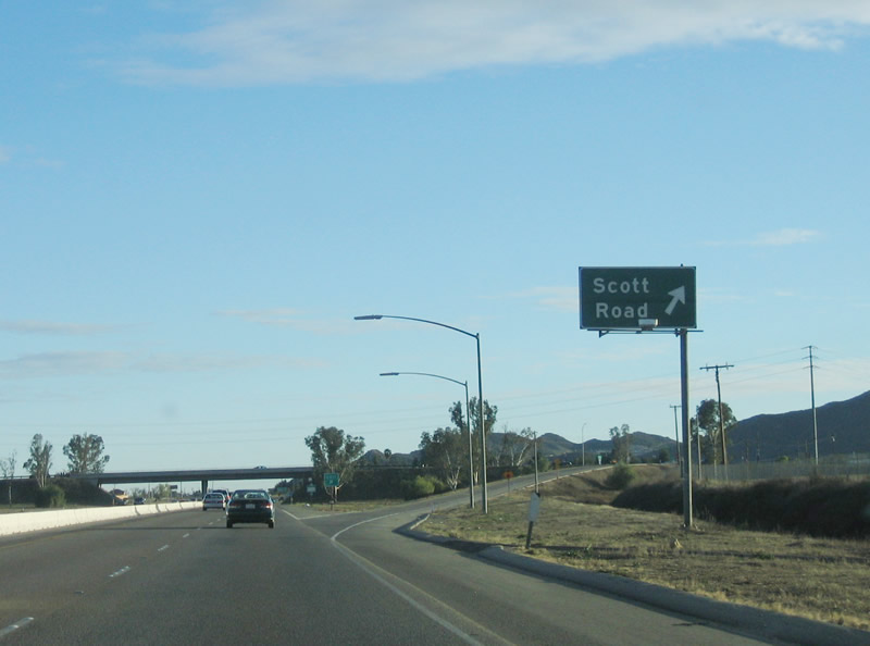
The next exit along southbound Interstate 215 (Escondido Freeway) is Exit 7, Scott Road. Photo taken 02/26/06. |
|
This interchange sequence sign provides the distance to the next three exits along Interstate 215 south: Exit 7, Scott Road; Exit 4, Clinton Keith Road; and Exit 2, Los Alamos Road. Photo taken 02/26/06. |
|
Southbound Interstate 215 reaches Exit 7, Scott Road. Photo taken 02/26/06. |
|
This mileage sign provides the distance to Murrieta (four miles), Temecula (11 miles), and San Diego (67 miles). Photo taken 02/26/06. |
|
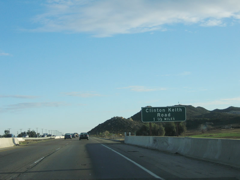
The next exit along southbound is Exit 4, Clinton Keith Road (1.50 miles). Photo taken 02/26/06. |
|
Interstate 215 enters the city of Murrieta, a "great place to grow." Murrieta is the southern terminus of Interstate 215 and is another rapidly growing community in the Temecula Valley. Like Temecula, Murrieta incorporated relatively recently (July 1, 1991). Murrieta is named for Esequial Murrieta, who purchased 52,000 acres and transferred the property to his brother, Juan Murrieta, in 1873. The region was mostly agricultural at that time, but development increased with the coming of Interstate 15 in the 1970s and 1980s (just as in neighboring Temecula). The city's population was 44,282 as of the 2000 Census, and California Department of Finance estimates place the 2007 population of Murrieta at 97,257. Photo taken 02/26/06. |
|
This interchange sequence sign provides the distance to the next three exits along Interstate 215 south: Exit 4, Clinton Keith Road; Exit 2, Los Alamos Road; and Exit 1, Murrieta Hot Springs Road. Photo taken 02/26/06. |
|
The final three exits of Interstate 215 all serve the city of Murrieta. Photo taken 02/26/06. |
|
Southbound Interstate 215 (Escondido Freeway) south reaches Exit 4, Clinton Keith Road. Photo taken 02/26/06. |
|
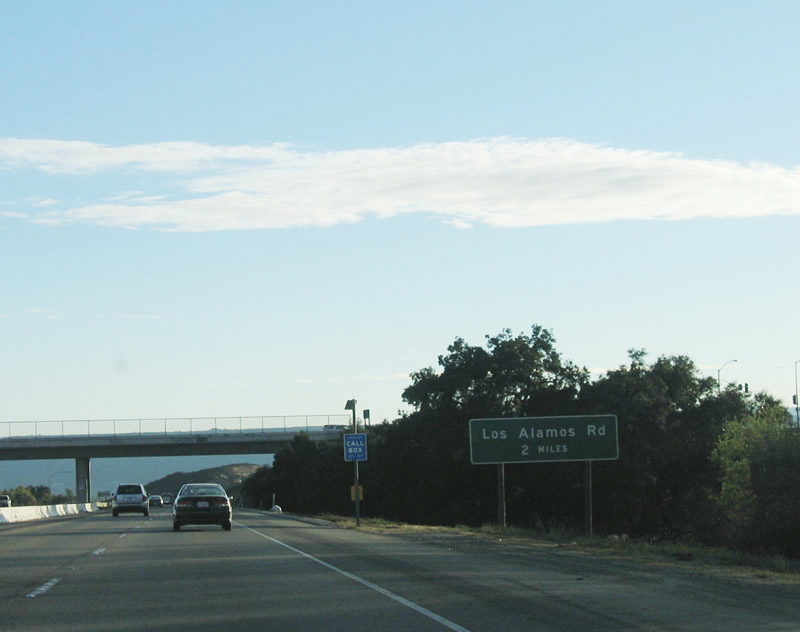
The next exit along Interstate 215 south is Exit 2, Los Alamos Road (two miles). Photo taken 02/26/06. |
|
This view shows Interstate 215 as it passes into the Temecula Valley. Photo taken 03/31/08. |
|
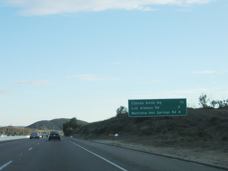
This interchange sequence sign provides the distance to the final two exits along Interstate 215 south: Exit 2, Los Alamos Road and Exit 1, Murrieta Hot Springs Road as well as the next exit after the Interstate 15 merge: Exit 61, California 79 (Winchester Road) north. Photo taken 03/31/08. |
|
|
Southbound Interstate 215 (Escondido Freeway) reaches Exit 2, Los Alamos Road. A new exit number sign was posted between 2006 and 2008. Photos taken 03/31/08 and 02/26/06. |
|
The final exit on Interstate 215 south is Exit 1, Murrieta Hot Springs Road. Photo taken 03/31/08. |
|
There is no direct connection from Interstate 215 south to Interstate 15 north, but that connection can be afforded by way of Murrieta Hot Springs Road west. Photo taken 02/26/06. |
|
This interchange sequence sign provides the distance to the final exit along Interstate 215 south: Exit 1, Murrieta Hot Springs Road as well as the next two exits after the Interstate 15 merge: Exit 61, California 79 (Winchester Road) north and Exit 59, Rancho California Road. Photo taken 02/26/06. |
|
Southbound Interstate 215 reaches Exit 1, Murrieta Hot Springs Road. Photo taken 02/26/06. |
|
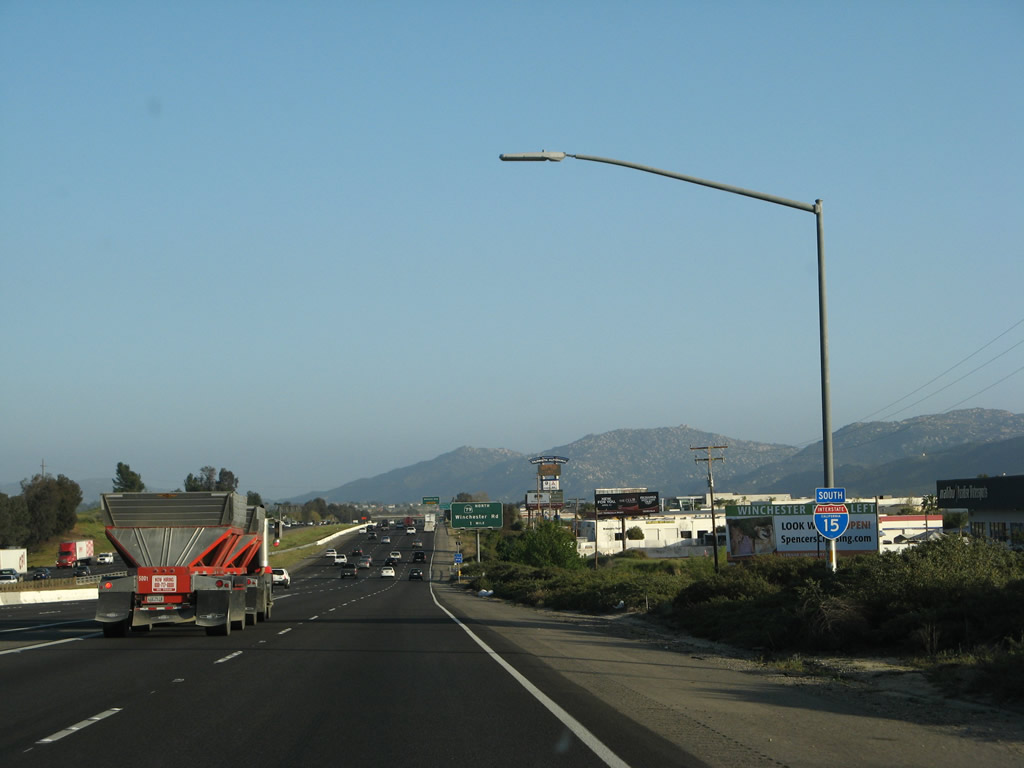
A directional Y interchange serves as the merge between Interstate 215 south and Interstate 15 south. This view shows the merge after the on-ramp from Murrieta Hot Springs Road (Exit 1). Photo taken 03/31/08. |
|
A final Interstate 215 reassurance shield is posted after the on-ramp from Murrieta Hot Springs Road. This shield probably could say "end Interstate 215," but instead it says SOUTH Interstate 215. Photo taken 02/26/06. |
|
This bridge carries Interstate 215 south traffic over Interstate 15. After crossing, Interstate 215 will merge into Interstate 15 south from the right. Photo taken 03/31/08. |
|
A large warning sign cautions drivers to watch for congestion and slowed vehicles. Photo taken 03/31/08. |
|
An Interstate 15 south reassurance shield marks the point where Interstate 215 directly transitions onto Interstate 15 south. There is no end shield for Interstate 215. Photo taken 03/31/08. |