| Interstate 405 (San Diego Freeway) north |
|
An Interstate 405 north reassurance shield is posted after the on-ramp from California 91 (Artesia Boulevard). Photo taken 03/25/07. |
|
The next three exits along Interstate 405 (San Diego Freeway) north are Exit 42A, California 107 (Hawthorne Boulevard); Exit 42B, Inglewood Avenue; and Exit 43, Rosecrans Avenue. Photo taken 03/15/08. |
|
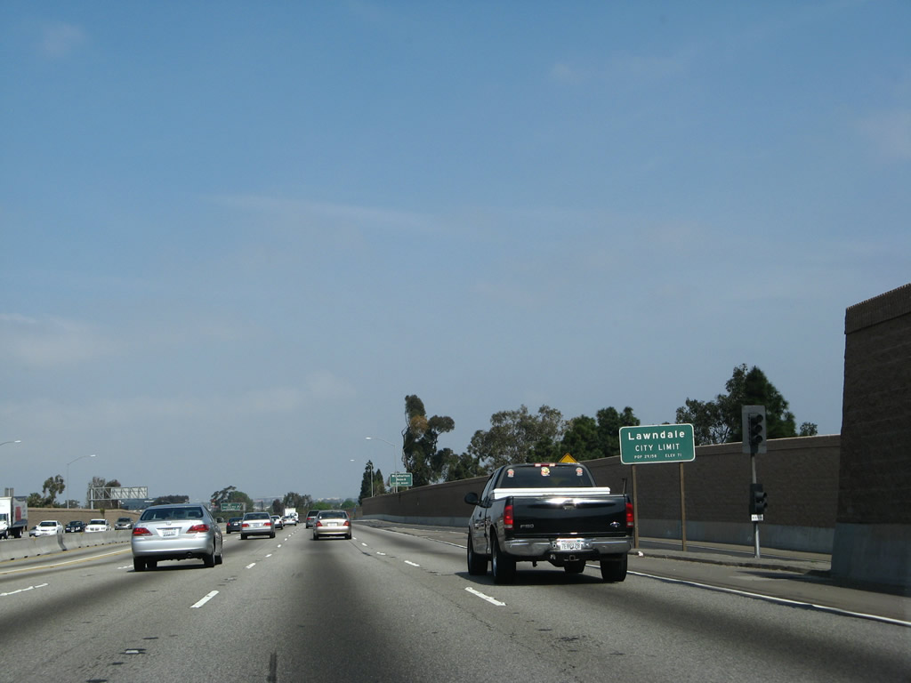
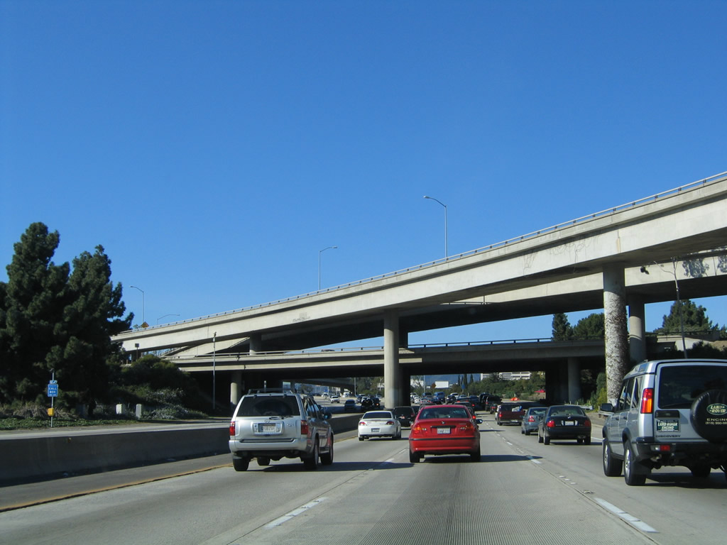
Interstate 405 leaves Hawthorne and enters the city of Lawndale ("The Heart of the South Bay," incorporated December 28, 1959, population 31,711 as of the 2000 Census). Photo taken 03/25/07. |
|
Use Hawthorne Boulevard north to Manhattan Beach Boulevard west to Manhattan Beach. Photo taken 11/14/04. |
|
Northbound Interstate 405 (San Diego Freeway) reaches Exit 42A, California 107 (Hawthorne Boulevard). This is a very old sign that features a somewhat angular California 107 route marker. Signs like this are very rare and will become extinct as California's sign replacement program continues. Photo taken 03/25/07. |
|
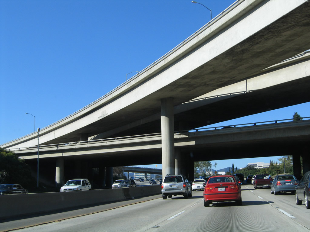
The next exit along Interstate 405 north (Exit 42B, Inglewood Avenue) connects the freeway to the Redondo Beach Performing Arts Center. Photo taken 03/25/07. |
|
Northbound Interstate 405 approaches Exit 42B, Inglewood Avenue. This major north-south arterial leads south into Redondo Beach and north into Hawthorne. At this interchange, Interstate 405 will leave Lawndale and cut through the northeastern corner of Redondo Beach (incorporated April 29, 1892, population 63,261 as of the 2000 Census). Photo taken 03/15/08. |
|
This mileage sign along Interstate 405 (San Diego Freeway) north provides the distance to the next three exits: Exit 42B, Inglewood Avenue; Exit 43, Rosecrans Avenue; and Exit 44, El Segundo Boulevard. Photo taken 03/15/08. |
|
An Interstate 405 north reassurance shield is posted next to a carpool lane entrance/exit. Photo taken 11/14/04. |
|
Northbound Interstate 405 (San Diego Freeway) reaches Exit 42B, Inglewood Avenue. Photo taken 03/25/07. |
|
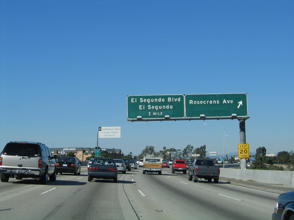
The next exit along Interstate 405 (San Diego Freeway) north is Exit 43, Rosecrans Avenue to the city of Hawthorne (population 84,112 as of 2000 Census). Rosecrans Avenue begins at El Porto Beach within the city of Manhattan Beach, and it leads due east through Hawthorne, Gardena, Los Angeles, Compton, Paramount, Bellflower, Norwalk, La Mirada and Fullerton. Many city streets in the Los Angeles basin are laid out in a grid pattern. Photo taken 03/25/07. |
|
Another Interstate 405 north reassurance shield is posted after the on-ramp from Inglewood Avenue. Photo taken 03/25/07. |
|
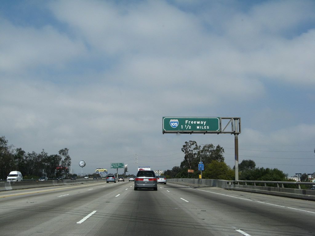
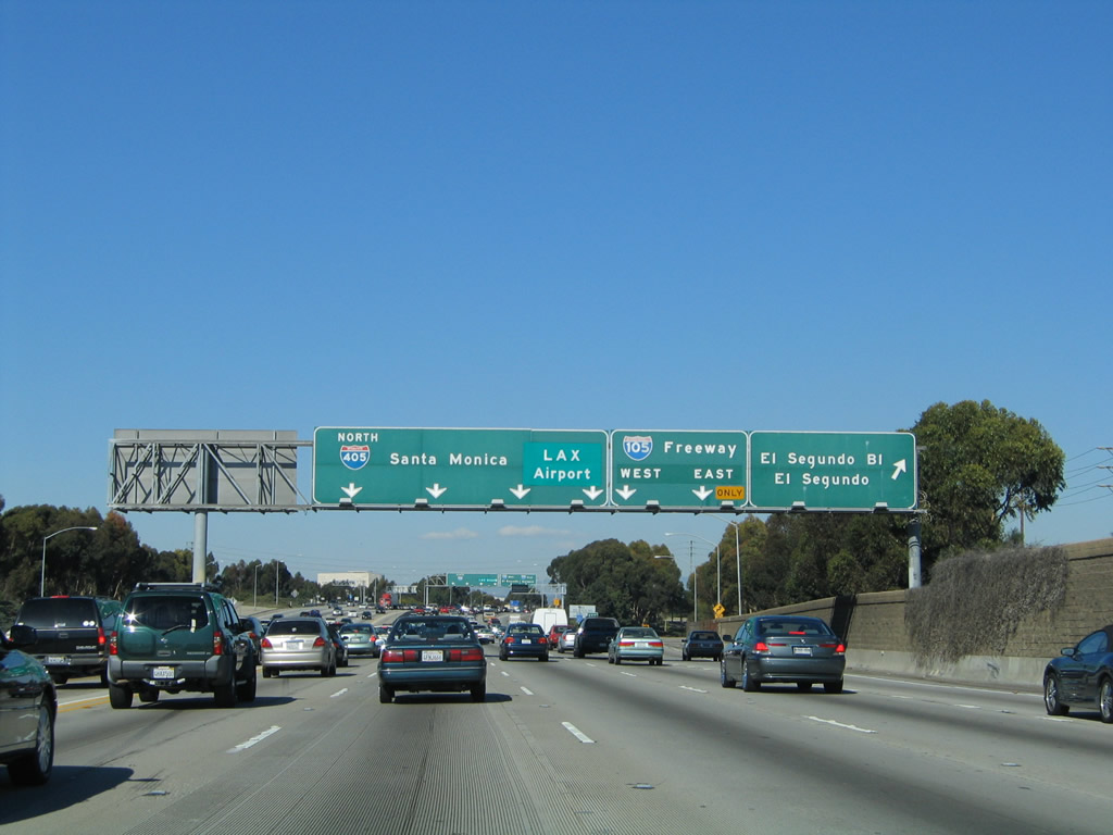
After Exit 43, Rosecrans Avenue and Exit 44, El Segundo Boulevard, the third exit from Interstate 405 north is Exit 45A, Interstate 105/Glenn Anderson (Century) Freeway. Photo taken 03/25/07. |
|
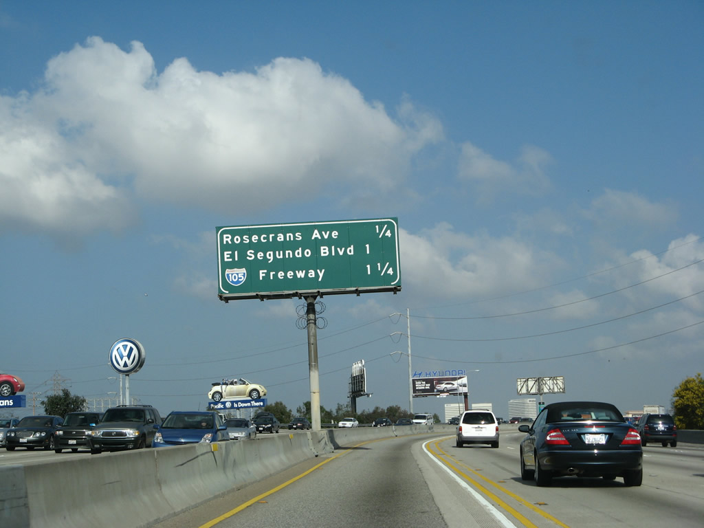
This mileage sign along Interstate 405 north provides the distance to the next three exits: Exit 43, Rosecrans Avenue; Exit 44, El Segundo Boulevard; and Exit 45A, Interstate 105/Glenn Anderson (Century) Freeway. Photo taken 03/15/08. |
|
Northbound Interstate 405 (San Diego Freeway) reaches Exit 43, Rosecrans Avenue. Photo taken 11/14/04. |
|
Traffic for Los Angeles International Airport (LAX) may tune in to AM 530 for updates related to traffic and parking at the airport. Photo taken 03/25/07. |
|
After Rosecrans Avenue (Exit 43), signage is targeted for Interstate 105 (Exit 45A), even though there is another exit (Exit 44 - El Segundo Boulevard) in between these two exits. Note that Exit 44 is omitted from this advance sign. Photo taken 11/14/04. |
|
Northbound Interstate 405 (San Diego Freeway) reaches Exit 44, El Segundo Boulevard. The next exit is Exit 45A, Interstate 105/Glenn Anderson (Century) Freeway. Photo taken 11/14/04. |
|
The Sepulveda Tunnel carries California 1 under a portion of Los Angeles International Airport (LAX). The highway is restricted for tank vehicles (flammable/combustible materials are prohibited). Use Interstate 105 west to California 1/Sepulveda Tunnel north. Photo taken 03/25/07. |
|
Northbound Interstate 405 (San Diego Freeway) reaches Exit 45A, Interstate 105/Glenn Anderson (Century) Freeway. Interstate 105 is the last new Interstate highway built in the Los Angeles area (opened in 1993), pending completion of the proposed but often-delayed Interstate 710 extension north to Pasadena. Note that the control city for the Interstate 405 pull-through sign was changed from Santa Monica to LAX Airport. Photo taken 03/25/07. |
|
The Interstate 105/Century (Glenn Anderson) Freeway interchange is located just southeast of Los Angeles International Airport (popularly known as "LAX," which is the three-letter abbreviation for the airport, much as Baltimore-Washington International is abbreviated and popularly known as "BWI"). The segment of Interstate 405 between Interstate 105 and Interstate 10 is almost always very busy, and traffic jams are frequent through this stretch. This sign along northbound points to part of the reason why: LAX. Photo taken 03/25/07. |
|
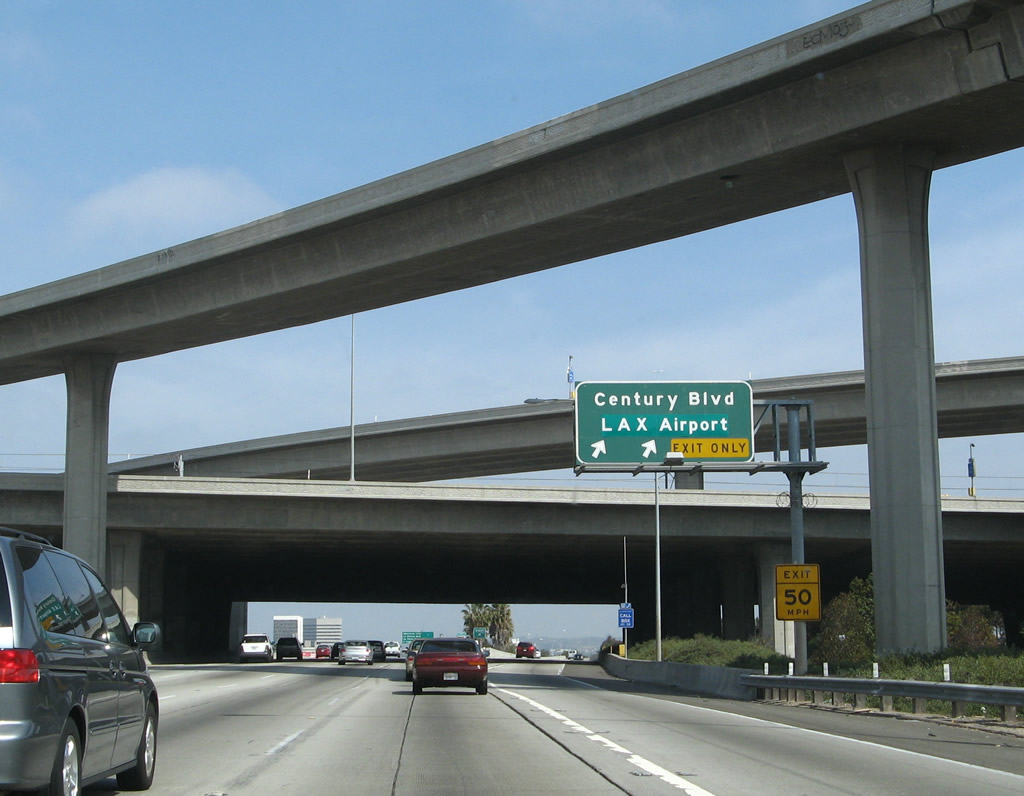
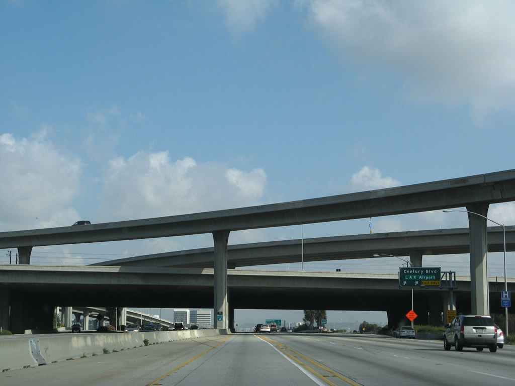
This mileage sign provides the distance to the next three exits along Interstate 405 (San Diego Freeway) north: Exit 45B, Imperial Highway/Los Angeles International Airport; Exit 46, Century Boulevard; and Exit 47, Manchester Boulevard (former California 42). There is no direct freeway connection to the airport. Note that the distant interchange complex is for Interstate 105. Photo taken 03/15/08. |
|
Northbound Interstate 405 (San Diego Freeway) approaches Exit 45B, Imperial Highway to Los Angeles International Airport (0.25 mile). Photo taken 03/25/07. |
|
Northbound Interstate 405 (San Diego Freeway) reaches Exit 45B, Imperial Highway to Los Angeles International Airport. The next off-ramp connects the freeway to Exit 46, Century Boulevard. Interstate 405 next passes through the stack interchange with Interstate 105. Photo taken 03/25/07. |
|
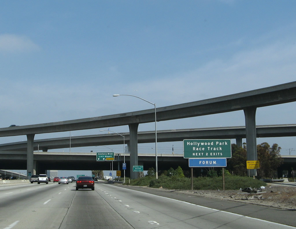
The next two exits connect Interstate 405 to Hollywood Park Race Track. The track is located east of Interstate 405 in the city of Inglewood, bounded by Century Boulevard on the south, Prairie Avenue on the west, and Pincay Drive on the north. Photo taken 03/25/07. |
|
|
|
Northbound Interstate 405 (San Diego Freeway) reaches Exit 46, Century Boulevard to Los Angeles International Airport (LAX). This off-ramp connects to a collector distributor lane that parallels Interstate 405's main lanes between Interstate 105 and Century Boulevard. Interstate 405 passes under the Interstate 105 interchange complex at the off-ramp for Exit 46, Century Boulevard. Photos taken 03/25/07, 11/14/04, and 03/15/08. |
|
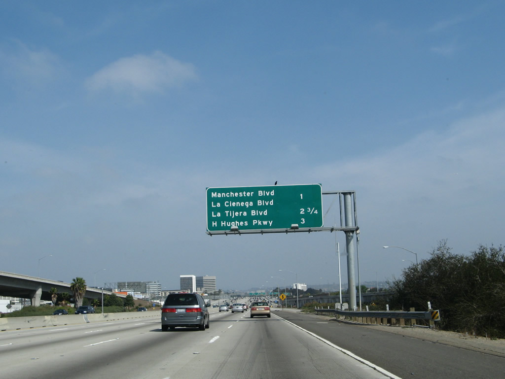
This mileage sign provides the distance to the next three exits along Interstate 405 (San Diego Freeway) north: Exit 47, Manchester Boulevard; Exit 48, La Tijera Boulevard; and Exit 49A, Howard Hughes Parkway. To Former California 7/Sepulveda Boulevard, follow Manchester Boulevard west toward LAX, then turn north on Sepulveda. California 7 predates Interstate 405 along this corridor, and it was eliminated in 1964 when California consolidated many of its routes. A more direct route to Old California 7 would be to stay on Interstate 405 north until the Slauson Avenue off-ramp (Exit 49B). Photo taken 03/25/07. |
|
A United Airlines jet passes over the freeway as it makes its final approach into LAX. Photo taken 03/25/07. |
|
|
A wide sign bridge carries signs to allocate lanes for the c-d lanes connection to Exit 46, Century Boulevard and the main lanes connection to Exit 47, California 42/Manchester Boulevard. Note that this is a dual freeway, with local traffic/exits separated from through traffic here. Photos taken 03/15/08 and 02/02/08. |
|
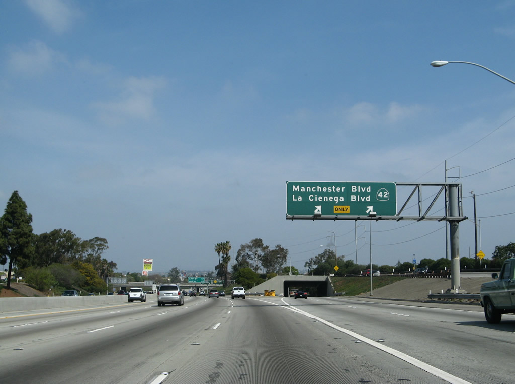
Northbound Interstate 405 reaches Exit 47, California 42/Manchester Boulevard. A former state route that was decommissioned and removed from signage in stages through the 1990s and 2000s after completion of Interstate 105, California 42 used to start at California 1 in Los Angeles near Loyola Marymount University, then follow Manchester Avenue and Firestone Boulevard east through Los Angeles, South Gate, and Downey before ending at Interstate 5 (Santa Ana Freeway) in Norwalk. Even though the route has been legislatively decommissioned, only a handful of signs still remain, including this freeway exit sign along Interstate 405. Photo taken 03/25/07. |
|
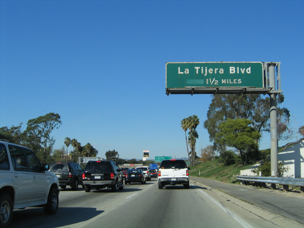
The next exit along northbound Interstate 405 (San Diego Freeway) is Exit 48, La Tijera Boulevard (1.25 miles). This old porcelain-enamel, button-copy sign (located right after the off-ramp to Exit 47, Manchester Boulevard) was gone by 2007 and was not replaced. Photo taken 11/14/04. |
|
|
This mileage sign provides the distance to the next three exits along Interstate 405 (San Diego Freeway) north: Exit 48, La Tijera Boulevard; Exit 49A, Howard Hughes Parkway; and Exit 49B, Slauson Avenue. Interstate 405 skirts the western edge of the city of Inglewood (incorporated February 14, 1908; population 112,580 as of 2000 Census). Photos taken 03/25/07 and 03/15/08. |
|
|
Over on the collector distributor lanes, the off-ramp connects to Exit 47, Manchester Boulevard and La Cienega Boulevard or back to Interstate 405 (San Diego Freeway) north. Photos taken 03/25/07 and 11/14/04. |
|
|
For traffic exiting onto Exit 47, the left two lanes link to La Cienega Boulevard north (part of which is an expressway) and Manchester Boulevard east/west. Photos taken 03/25/07. |
|
Back on the mainline, the next exit is Exit 48, La Tijera Boulevard, followed by Exit 49A, Howard Hughes Parkway. Photo taken 03/25/07. |
|
The right lane of Interstate 405 north becomes exit only for Exit 48, La Tijera Boulevard. Photo taken 03/25/07. |
|
This centerline view looks from the carpool (HOV) lanes north toward the off-ramp for Exit 48. Photo taken 03/15/08. |
|
|
Northbound Interstate 405 (San Diego Freeway) reaches Exit 48, La Tijera Boulevard. The original porcelain enamel sign was replaced soon after we took a picture here in 2004; it was replaced with exit numbers by 2007. Photos taken 02/02/08 and 11/14/04. |
|
|
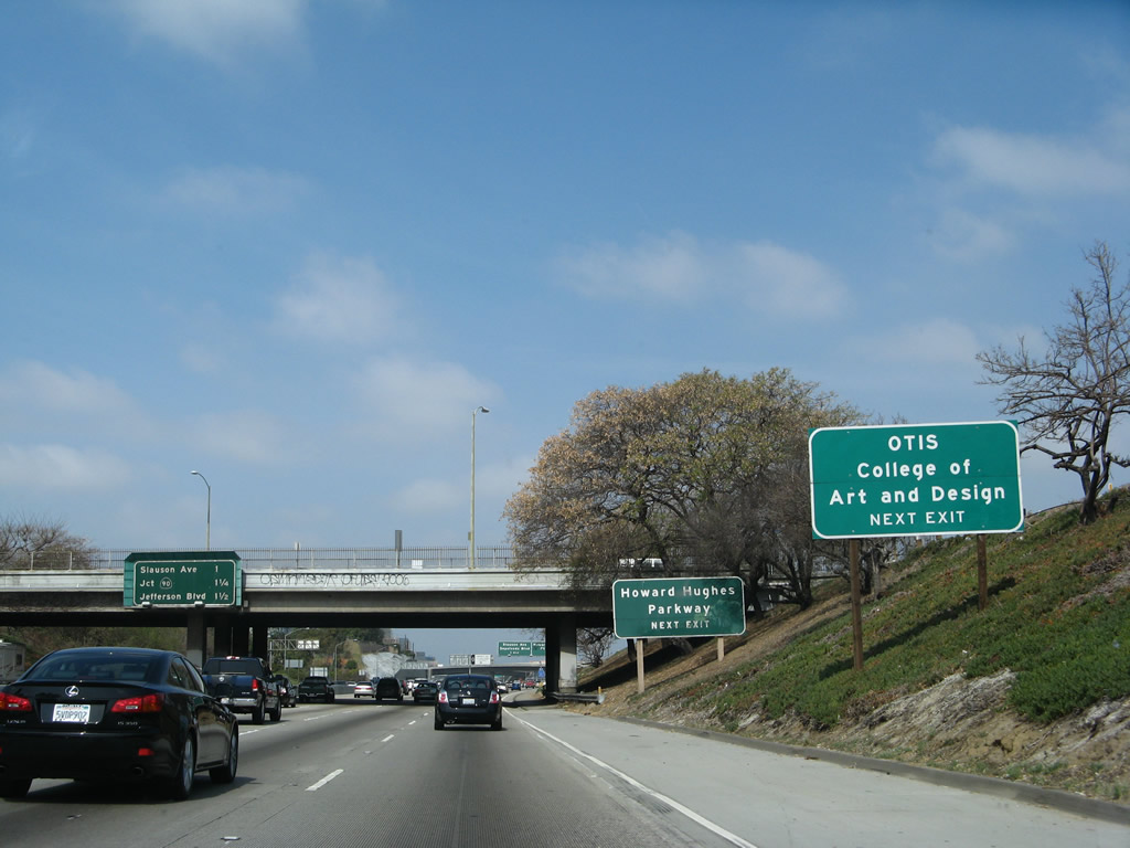
The next exit from northbound Interstate 405 (San Diego Freeway) (Exit 49A, Howard Hughes Parkway) connects the freeway with Pepperdine University and OTIS College of Art and Design. Photos taken 03/25/07. |
|
|
This mileage sign provides the distance to the next three exits along Interstate 405 (San Diego Freeway) north: Exit 49A, Howard Hughes Parkway; Exit 49B, Slauson Avenue; and Exit 50A, California 90 (Marina Freeway). Howard Hughes Parkway is a short east-west connector that leads from Interstate 405 to Sepulveda Boulevard (former California 7). Photos taken 03/15/08 and 02/02/08. |
|
Northbound Interstate 405 (San Diego Freeway) reaches Exit 49A, Howard Hughes Parkway. Photo taken 03/25/07. |
|
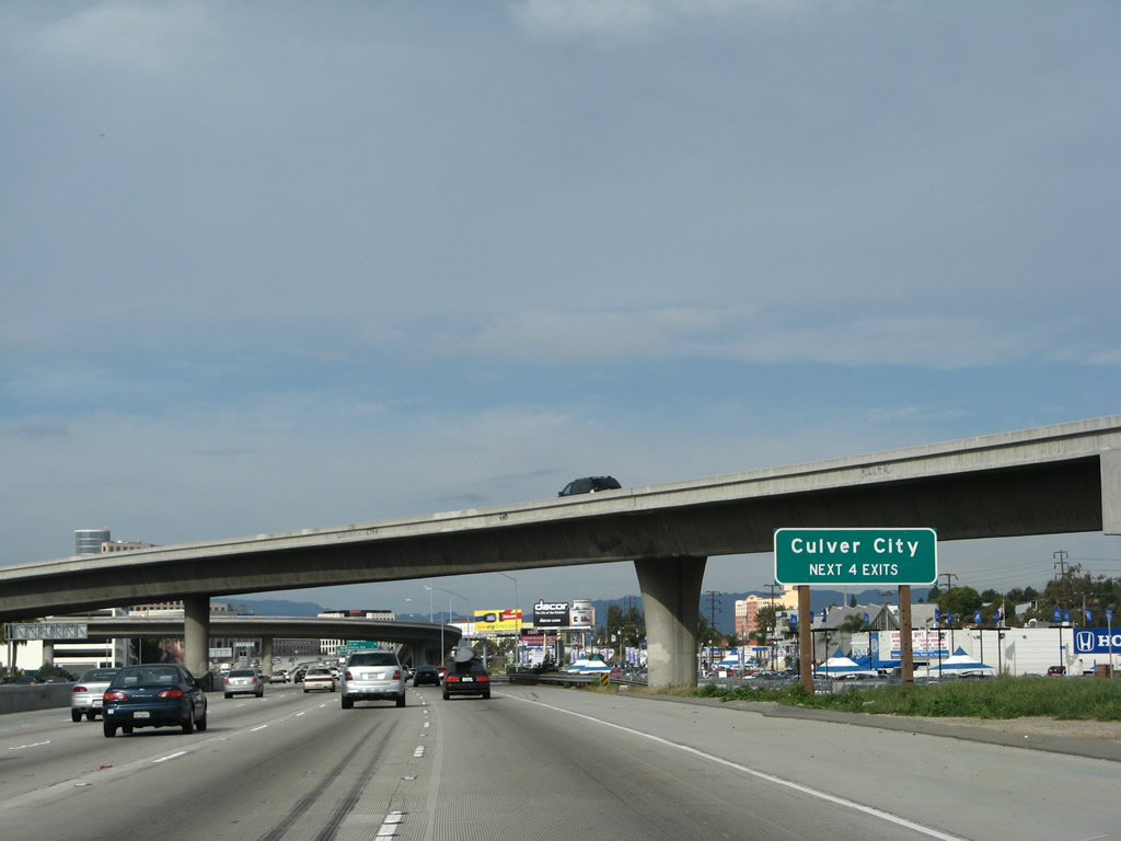
The next four exits along Interstate 405 (San Diego Freeway) north serve Culver City: Exit 49B, Slauson Avenue; Exit 50A, California 90 (Marina Freeway); Exit 50B, Jefferson Boulevard; and Exit 51, Culver Boulevard. Photo taken 02/02/08. |
|
This mileage sign along Interstate 405 (San Diego Freeway) north provides the distance to the next three exits: Exit 49B, Slauson Avenue; Exit 50A, California 90 (Marina Freeway); and Exit 50B, Jefferson Boulevard. Photo taken 02/02/08. |
|
The next exit along Interstate 405 (San Diego Freeway) north is Exit 49B, Slauson Avenue. This porcelain enamel, button copy sign was removed between 2005-2007 and was not replaced. Photo taken 11/14/04. |
|
The right two lanes of Interstate 405 (San Diego Freeway) north connect to Exit 49B, Slauson Avenue and Exit 50A, California 90 (Marina Freeway). Photo taken 02/02/08. |
|
Northbound Interstate 405 (San Diego Freeway) reaches Exit 49B, Slauson Avenue and Sepulveda Boulevard. Slauson Avenue is an east-west city street that leads into Los Angeles en route to Pico Rivera. Sepulveda Boulevard (former California 7, the predecessor to this segment of Interstate 405) is a major north-south city street that was the original route of California 7 back when it followed the route of what is now Interstate 405. Photo taken 02/02/08. |
|
Interstate 405 enters the city of Culver City, which is known as "The Heart of Screen Land." Culver City had a population of 38,816 as of the 2000 Census and sits at an elevation of 95 feet. Culver City was incorporated on September 7, 1917. Photo taken 02/02/08. |
|
Quickly thereafter, northbound Interstate 405 (San Diego Freeway) reaches Exit 50A, California 90 (Marina Freeway) west to Marina del Rey. California 90 was originally proposed to be a freeway parallel to Interstate 10 and Interstate 105 through South Central Los Angeles. While this freeway is still on the proposed state route legislation, it is unlikely to be constructed due to community opposition. Another segment of signed California 90 exists in Orange County between California 39 and California 91 via Imperial Highway. The proposed freeway would have connected the Imperial Highway segment with the Marina Freeway segment. Photo taken 02/02/08. |
|
|
|
|
These pictures follow the double-lane transition ramp from northbound Interstate 405 (San Diego Freeway) to California 90 (Marina Freeway) west to Marina del Rey. Photos taken 03/25/07. |
|
|
And immediately thereafter is the off-ramp to Exit 50B, Jefferson Boulevard. The original porcelain enamel sign was replaced with a reflective sign with exit number between 2004 and 2007. Photos taken 02/02/08 and 11/14/04. |
|
|
|
The next exit along Interstate 405 (San Diego Freeway) north is Exit 51, Culver Boulevard. This pair of signs has been altered a bit between each picture. Photos taken 07/10/10, 02/02/08, and 11/14/04. |
|
The right lane of Interstate 405 (San Diego Freeway) north becomes exit only for Exit 51, Culver Boulevard. Interstate 405 was widened between California 90 and Interstate 10 to allow for a new carpool lane and auxiliary lanes in 2008-2009. Photo taken 07/10/10. |
|
|
An Interstate 405 north reassurance shield is posted above a sound wall after the interchange with California 90. Photos taken 07/10/10 and 03/18/06. |
|
|
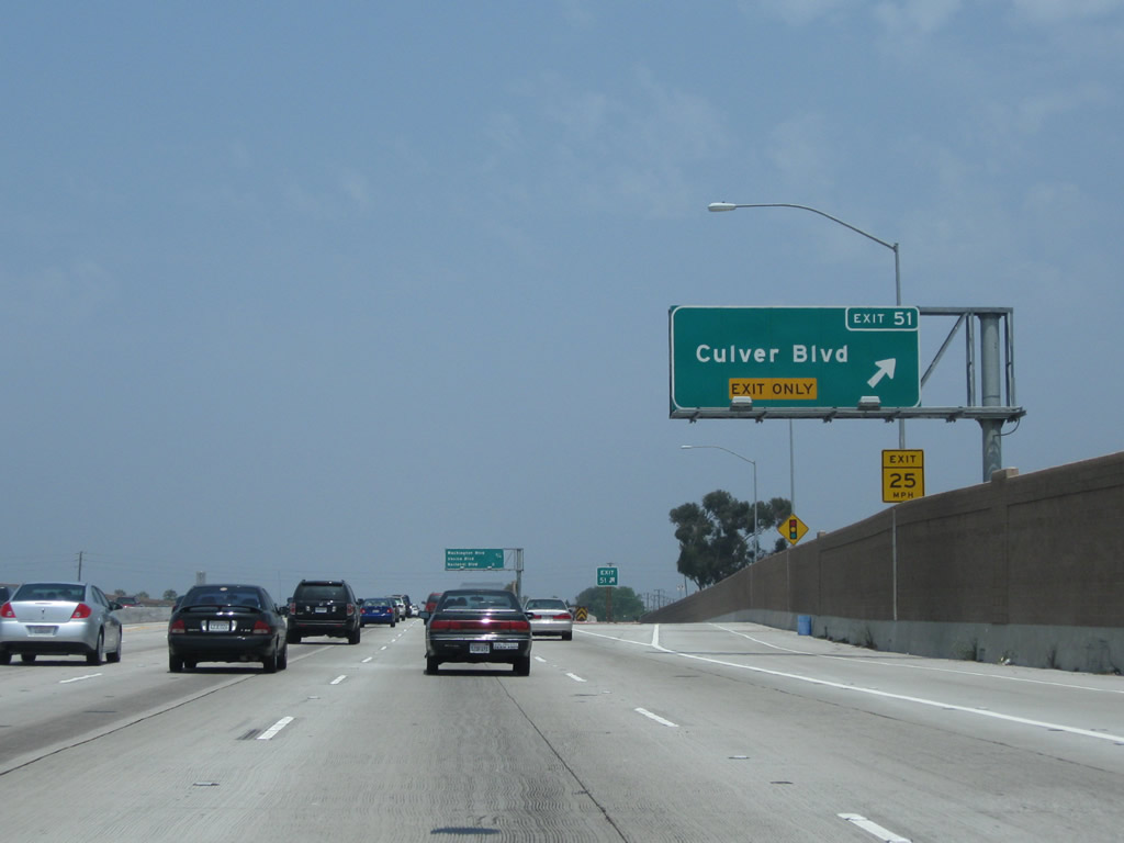
Northbound Interstate 405 (San Diego Freeway) reaches Exit 51, Culver Boulevard. With the freeway expansion between 2006-2009, the signs were changed. Photos taken 07/10/10 and 11/14/04. |
|
|
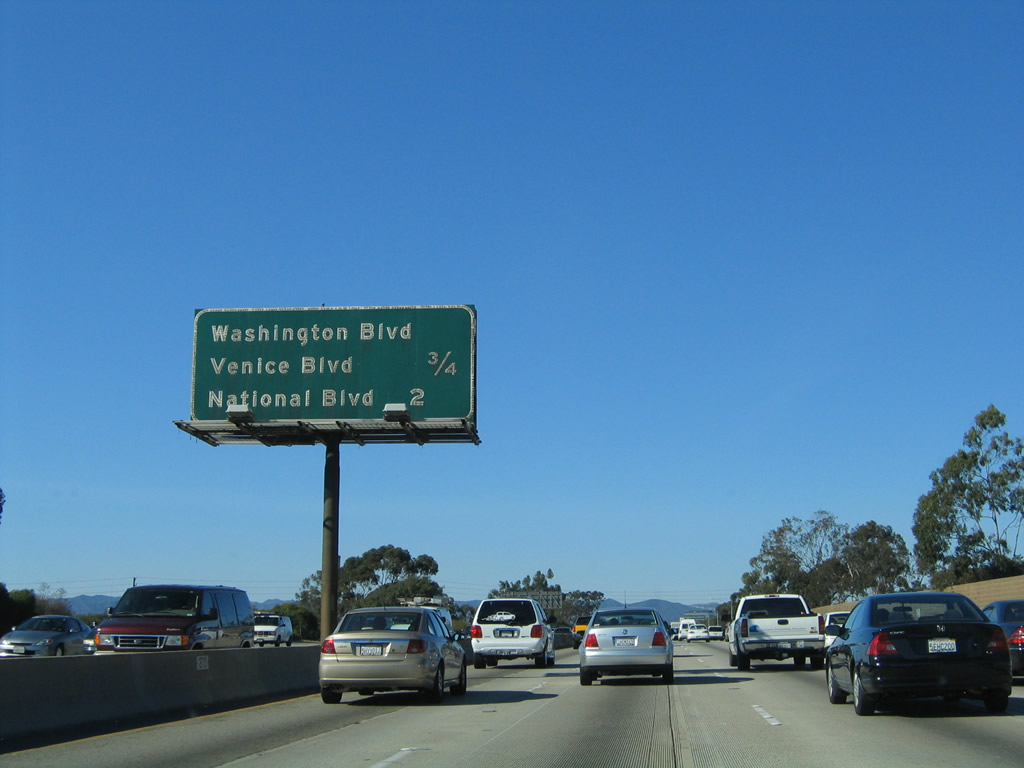
This mileage sign along Interstate 405 (San Diego Freeway) north provides the distance to the next two exits: Exit 52, Washington Boulevard and California 187 (Venice Boulevard) and Exit 53A, National Boulevard. With the freeway expansion, the original mileage sign was removed and replaced with a reflective sign relocated to the right side of the freeway rather than the median. Photos taken 07/10/10 and 11/14/04. |
|
|
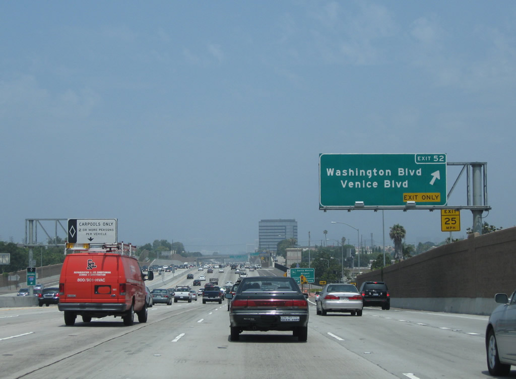
The right lane becomes exit only for Exit 52, Washington Boulevard and California 187 (Venice Boulevard). Photos taken 07/10/10 and 11/14/04. |
|
|
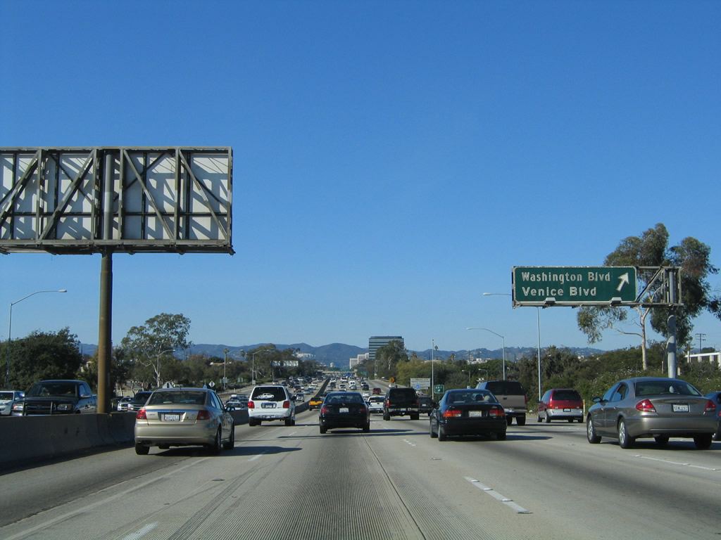
Northbound Interstate 405 (San Diego Freeway) reaches Exit 52, Washington Boulevard and California 187 (Venice Boulevard). A short state route, California 187 follows Venice Boulevard between California 1 (Lincoln Boulevard) and Interstate 10 (Santa Monica Freeway) near La Cienega Boulevard. California 187 is unsigned. Photos taken 07/10/10 and 11/14/04. |
|
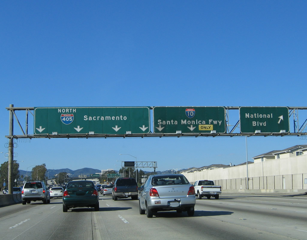
The next two exits along Interstate 405 (San Diego Freeway) north are Exit 53A, National Avenue and Exit 53B, Interstate 10 (Santa Monica Freeway). The freeway leading up to the Interstate 10 interchange was completely redone as part of he carpool lane and auxiliary lane expansion project completed in 2009. Use National Avenue west to Santa Monica Airport and the Museum of Flying. Photo taken 07/10/10. |
|
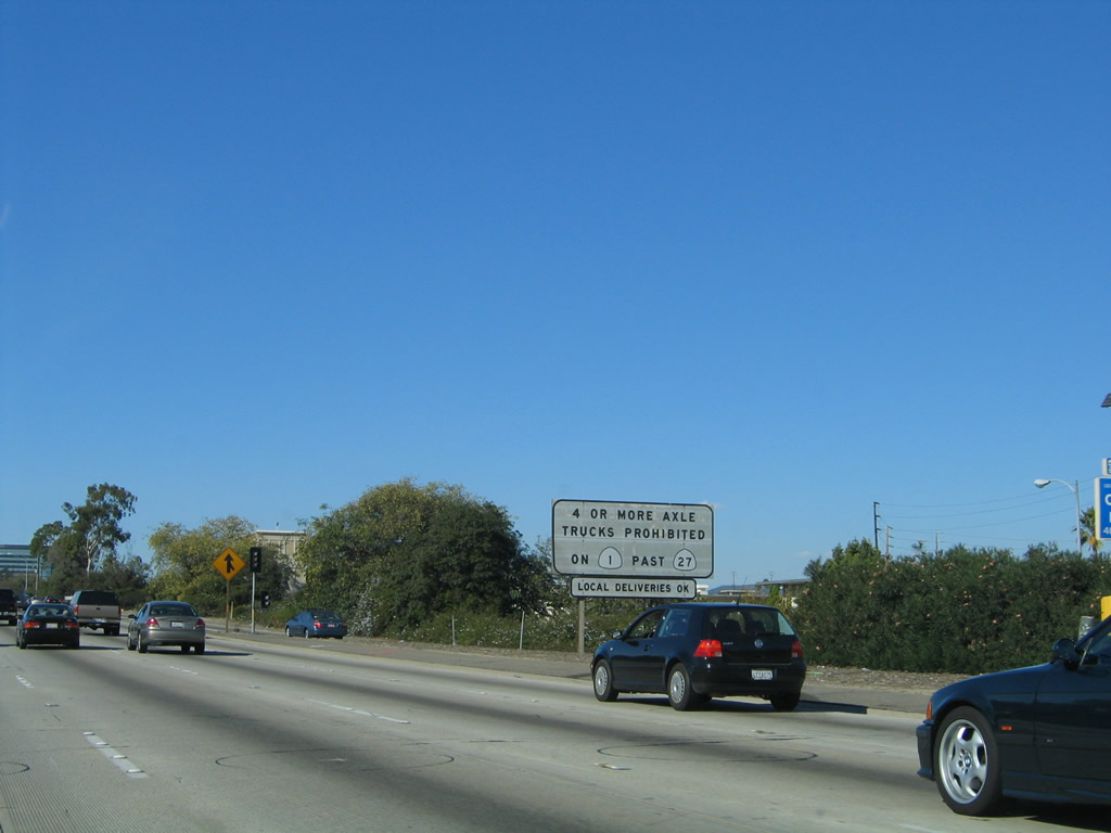
Since Interstate 10 (Santa Monica Freeway) west connects directly to California 1 (Pacific Coast Highway) north, this sign reminds truckers that California 1 may not be used for through traffic northwest of California 27, except for local deliveries into the city of Malibu. The state shields in this old sign should be green, not white; it was replaced (see previous photo). Photo taken 11/14/04. |
|
|
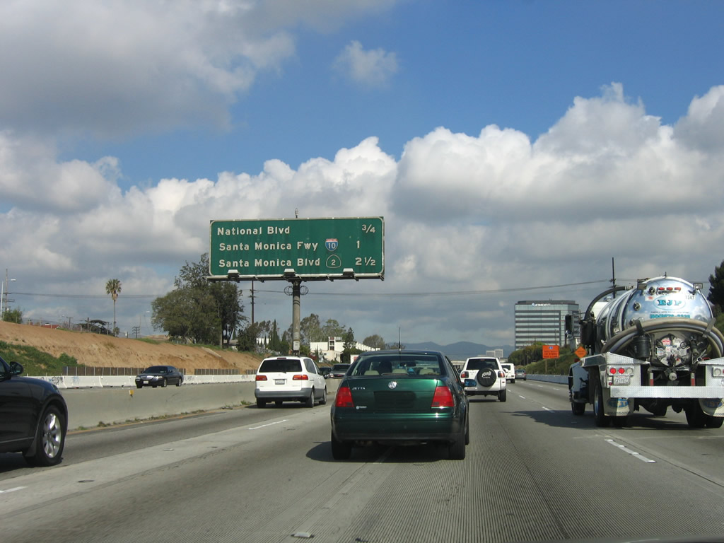
This mileage sign along northbound Interstate 405 (San Diego Freeway) provides the distance to Exit 53A, National Avenue; Exit 53B, Interstate 10 (Santa Monica Freeway); and Exit 55A, California 2 (Santa Monica Boulevard) (Historic U.S. 66). Note the roadway changes between 2006 and 2008 as well as the new guide sign placement. Photos taken 07/10/10 and 03/18/06. |
|
Use Interstate 10 west to Bergamot Station and Santa Monica Museum of Art. Interstate 10's western terminus is in Santa Monica. As for changes to the freeway due to reconstruction, notice how the foliage and trees on the east side of the freeway are now gone, replaced by additional lanes. Photo taken 11/14/04. |
|
|
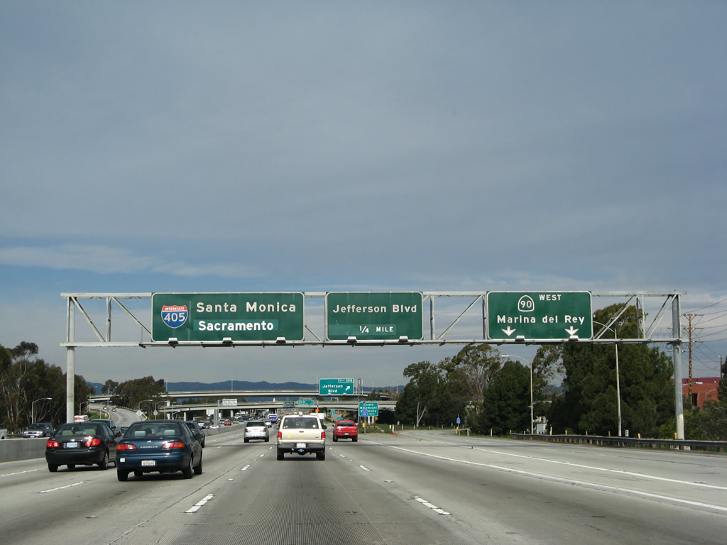
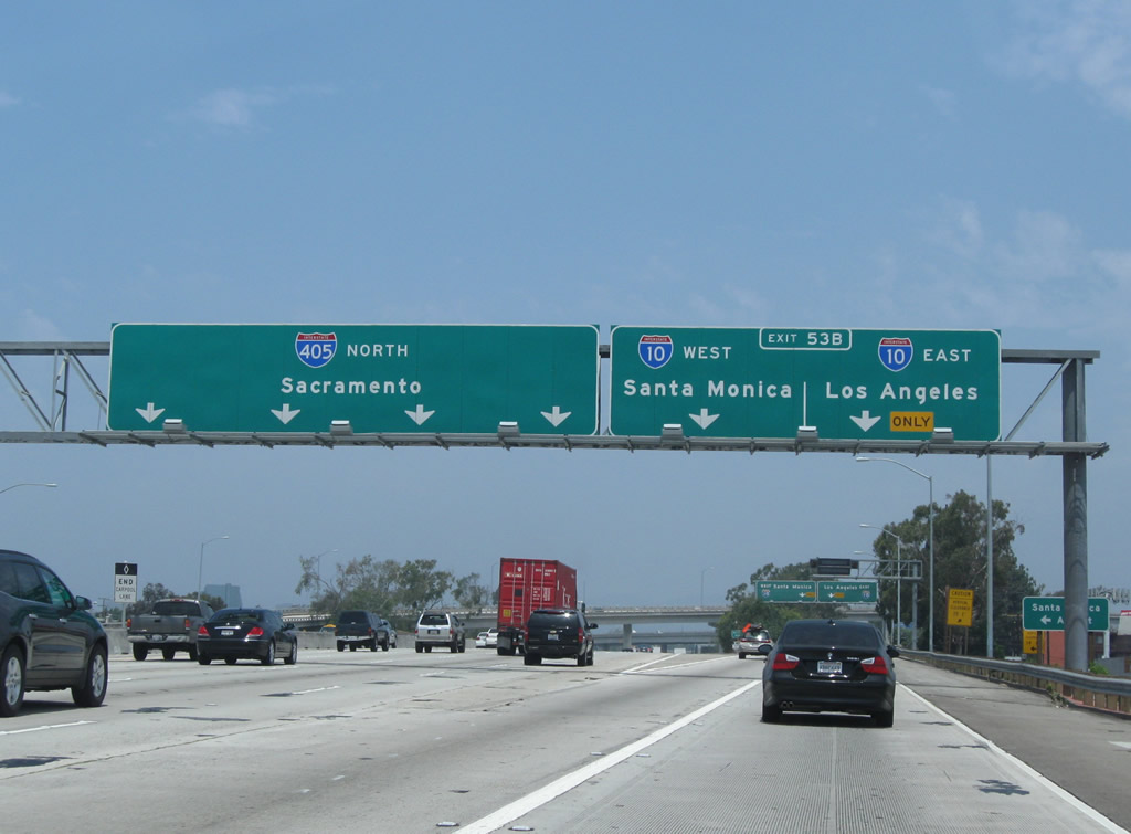
An overhead lane allocation sign advises that the left four lanes continue north on Interstate 405 (San Diego Freeway) while the right two lanes connect to Interstate 10 (Santa Monica Freeway) west to Santa Monica and east to Los Angeles, San Bernardino, Indio, Phoenix, and Jacksonville. The sign bridge was relocated closer to the overpass as part of reconstruction. Photos taken 07/10/10 and 11/14/04. |
|
|
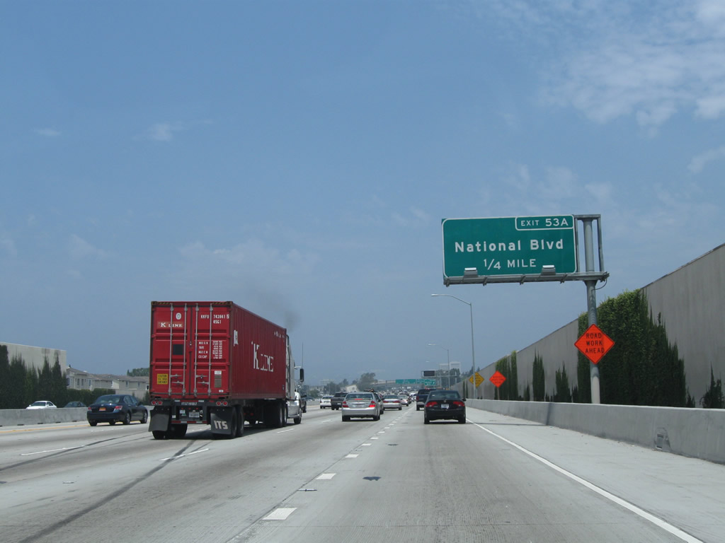
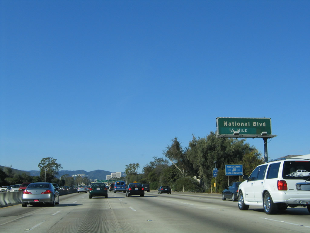
The next exit along Interstate 405 (San Diego Freeway) north is Exit 53A, National Avenue. Photos taken 07/10/10 and 11/14/04. |
|
|
Northbound Interstate 405 (San Diego Freeway) reaches Exit 53A, National Boulevard. The 2004 photo shows a much elaborate overhead sign bridge that includes lane allocations for Exit 53B, Interstate 10 (Santa Monica Freeway) and a pull-through sign for Interstate 405 north. With the late 2000s reconstruction, the signs were changed so that only the action sign for exiting here remains. Photos taken 07/10/10 and 11/14/04. |
|
|
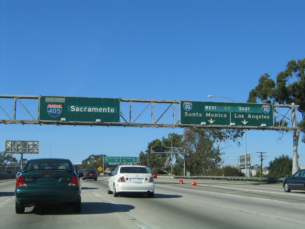
Exit 53B follows with two lanes leading Interstate 10 west to its end at Santa Monica and east to Downtown Los Angeles and San Bernardino. I-10 along the Santa Monica Freeway is one of the busiest stretches of freeway in Southern California. Photos taken 07/10/10 and 11/14/04. |
|
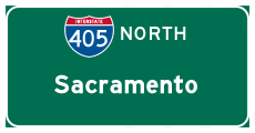
This pull-through sign for Interstate 405 (close-up from previous guide sign assembly) originally had a control city of Bakersfield. It was altered when Interstate 5's control city was changed to Sacramento. When the Interstate 405 expansion work was complete, the entire sign was replaced. Photo taken 11/14/04. |
|
I-10 west leads motorists to Santa Monica Municipal Airport (SMO). The general aviation facility is slated to close on December 31, 2028, with the 227-acre site returned to the city of Santa Monica for redevelopment.1 Photo taken 07/10/10. |
|
|
Once on the transition ramp from northbound Interstate 405 (San Diego Freeway), the left lane connects to Interstate 10 (Santa Monica Freeway) west to Santa Monica, while the right lane connects to Interstate 10 east to downtown Los Angeles and points east. Photos taken 07/10/10 and 11/14/04. |
|
|
|
Interstate 405 passes through the Interstate 10 stack interchange. This segment of roadway has been expanded since this picture series was taken. Photos taken 11/14/04. |
|
|
This mileage sign along northbound Interstate 405 (San Diego Freeway) provides the distance to Exit 55A, California 2 (Santa Monica Boulevard) (Historic U.S. 66); Exit 55B, Wilshire Boulevard; and Exit 56, Montana Avenue. Photos taken 02/02/08 and 11/14/04. |
|
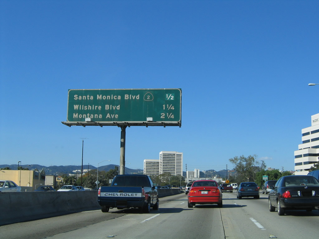
The next exit along Interstate 405 (San Diego Freeway) north is Exit 55A, California 2 (Santa Monica Boulevard), one-half mile. Santa Monica Boulevard used to be part of U.S. 66; it was decommissioned in phases between 1964 and 1974. U.S. 66 was legally decommissioned in 1964, but U.S. 66 route markers did not fully disappear until the early to mid-1970s. Segments such as this one remained under state maintenance, although recently some sections of California 2 (including a portion in Santa Monica and West Los Angeles) were decommissioned and returned to local control. Photo taken 11/14/04. |
|
California 2 travels west to Santa Monica along former U.S. 66 to Santa Monica, while eastbound U.S. 66 and California 2 lead to Beverly Hills, West Hollywood, and Hollywood. Photo taken 11/14/04. |
|
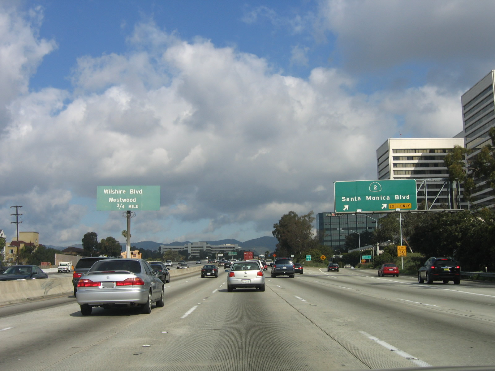
Northbound Interstate 405 (San Diego Freeway) meets Exit 55A, California 2 (Santa Monica Boulevard) (Historic U.S. 66). The next exit is Exit 55B, Wilshire Boulevard. Note the non-standard signage used for Exit 55B; it has since been removed with the reconstruction of the southbound lanes of Interstate 405 prior to the Interstate 10 interchange. Photo taken 03/18/06. |
Page Updated September 8, 2010.