| A Street |
|
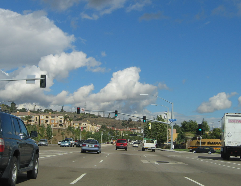
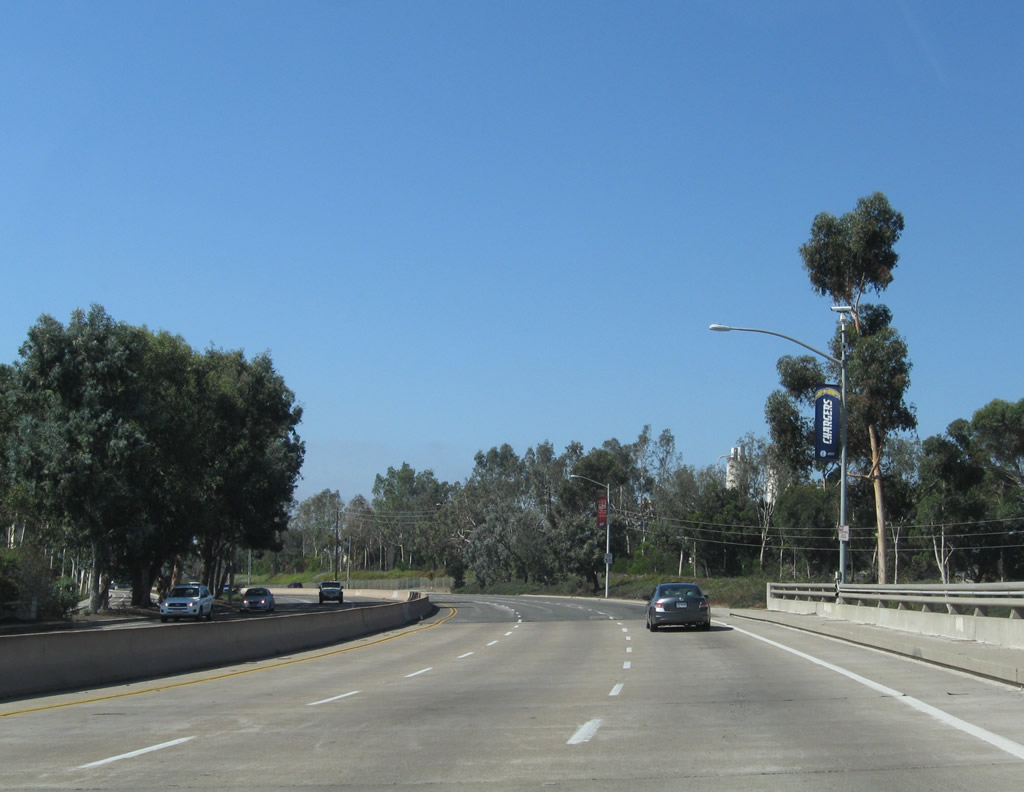
Nearing the southern end of California 163, the left two lanes of eastbound A Street transition directly onto northbound California 163 (Cabrillo Freeway) upon reaching the intersection with 11th Avenue. A Street is a major eastbound route through the Financial District of San Diego, skimming the southern edge of Little Italy. Together with Ash Street, A Street offers the best east-west route across downtown San Diego north of Broadway. Photo taken 10/06/05. |
| Ash Street |
|
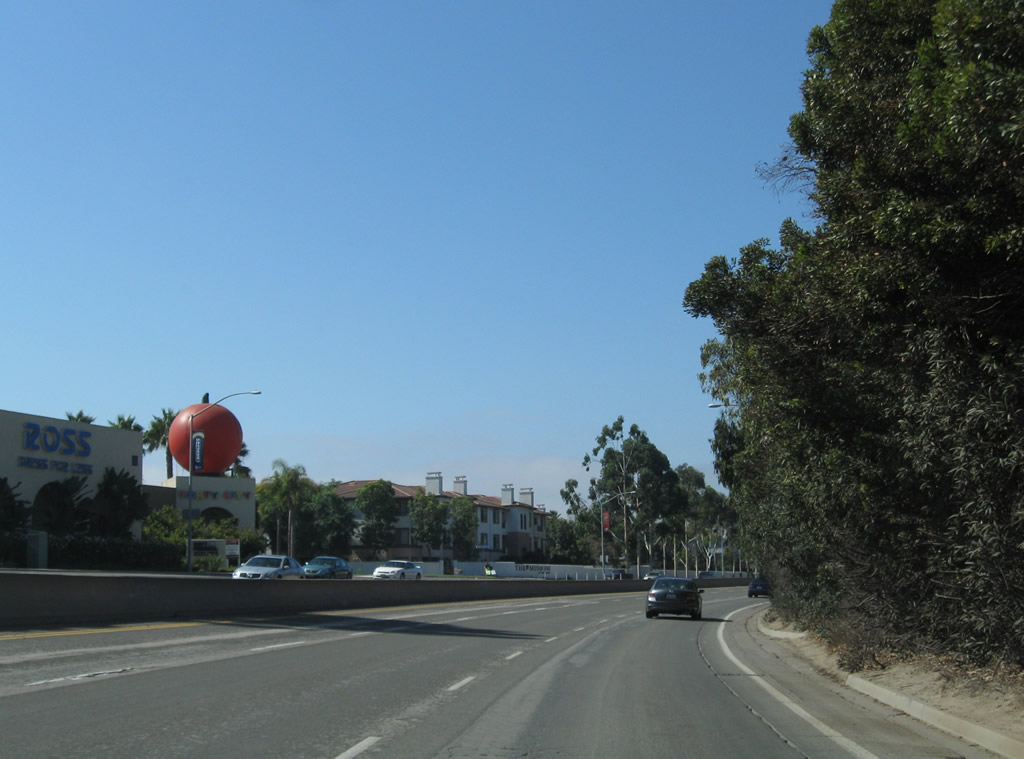
Westbound Ash Street reaches 6th Avenue, which travels south toward the Gaslamp Quarter and the Ballpark District. Continue west on Ash Street toward the Civic Center, Little Italy, and the North Embarcadero (bayfront). Photo taken 10/06/05. |
|
|
Although not visible in the first photograph, San Diego Bay and the Star of India (tall ship) are visible from this vantage point along westbound Ash Street as the road descends from Cortez Hill at the intersection with 7th Avenue. Photos taken 10/06/05. |
|
The El Cortez condominium complex on Cortez Hill comes into view at the intersection of westbound Ash Street at 9th Avenue about a block west of southbound California 163 (10th Avenue). Photo taken 10/06/05. |
| B Street |
|
This view looks east along B Street from Civic Center Plaza/Charles C. Dail Concourse toward the Financial District buildings. Photo taken 03/24/08. |
| Bear Valley Road |
|
Northbound Bear Valley Road approaches San Pasqual Road in Escondido. Turn right for the San Diego Zoo Safari Park (formerly Wild Animal Park) and San Pasqual Battlefield State Historic Park. Photo taken 03/24/08. |
| Black Canyon Bridge (near Lake Sutherland) |
|---|
|
|
|
These pictures show the Black Canyon Road Bridge located northwest of Sutherland Reservoir north of California 78. It is a very old arch bridge that is the prototype of several similar bridges along U.S. 80 in the Laguna/Cuyamaca area. Photos taken 10/12/03. |
| Broadway |
|
This view looks east along Broadway after the First Avenue intersection. Photo taken 03/24/08. |
|
Eastbound Broadway passes by Horton Plaza Park between Third Avenue and Fourth Avenue. Photo taken 03/24/08. |
|
The Horton Plaza Park fountain was active on this day (south side of Broadway between Third Avenue and Fourth Avenue) next to Horton Plaza. This area is slated for redevelopment in the coming years. Photo taken 03/24/08. |
| C Street |
|
This view looks west along C Street near the City Administration Building (at Third Avenue). Trolley lines run down the middle of the street, often precluding vehicular traffic from using C Street. Photo taken 03/24/08. |
|
Westbound C Street passes Columbia Street and approaches India Street. Photo taken 03/24/08. |
| Camino de la Plaza east |
|
Eastbound Camino de la Plaza approaches the on-ramp to Interstate 5 south to Tijuana, Baja California, Mexico. This left only connects to Mexico as noted by the sign. Photo taken 06/21/09. |
|
Shortly thereafter, Camino de la Plaza east meets the loop ramp onto southbound Interstate 5 to Mexico. Turn right here for Camiones Way south. Photo taken 06/21/09. |
|
To Interstate 5 and Interstate 805 north, follow Camino de la Plaza east to San Ysidro Boulevard south to the on-ramp for both freeways. Photo taken 06/21/09. |
|
Eastbound Camino de la Plaza crosses over Interstate 5 and Interstate 805 on this bridge. A taxi line-up area is staged on this bridge in the right lane. Photo taken 06/21/09. |
|
Shortly thereafter, Camino de la Plaza east approaches the intersection with San Ysidro Boulevard (Old U.S. 101) and East Beyer Boulevard (Old U.S. 101 Bypass). Photo taken 06/21/09. |
|
Eastbound Camino de la Plaza meets San Ysidro Boulevard north/south (left or right) and East Beyer Boulevard north (straight ahead). Photo taken 06/21/09. |
| Camino del Sur |
|
Northbound Camino del Sur passes under the California 56 (Ted Williams Freeway) overpass. Photo taken 12/19/08. |
|
Turn left from Camino del Sur north to California 56 (Ted Williams Freeway) west to Carmel Valley and Del Mar. Continue straight ahead into the community of Torrey Highlands and eventually Black Mountain Ranch. The large retaining wall on the northeast corner of this interchange supports a vernal pool preserve left untouched by housing development that occurred in the late 1990s and early 2000s. Photo taken 12/19/08. |
|
A landscaped median lines Camino del Sur, which currently has two lanes in each direction. As development occurs in this area, provisions were made to expand Camino del Sur to six lanes (three in each direction). Continue straight ahead through Torrey Highlands to Black Mountain Ranch. Photo taken 12/19/08. |
|
|
North of Carmel Valley Road, Camino del Sur is a relatively new road in the Black Mountain community in northern San Diego; it serves the new communities of Santaluz and Del Sur. This bridge carries Camino del Sur over McGonigle Canyon. Photos taken 04/16/08. |
|
Northbound Camino del Sur passes by the Santaluz neighborhood entry monument sign. Photos taken 04/16/08. |
| Carmel Country Road north |
|
Northbound Carmel Country Road approaches the on-ramp to California 56 east to Rancho Peñasquitos and Poway. Photo taken 01/19/12. |
|
The second right turn connects northbound Carmel Country Road to the on-ramp to California 56 west to Del Mar and La Jolla. Continue ahead on Carmel Country Road to the community of Carmel Valley. Photo taken 01/19/12. |
|
A California 56 west freeway entrance shield assembly is posted next to the traffic signal prior to the on-ramp. Photo taken 01/19/12. |
| Carmel Valley Road east |
|
The connection from Interstate 5 south to California 56 (Ted Williams Freeway) east is afforded via Carmel Valley Road, a busy arterial that carries a great deal of local and regional traffic. The bridges to the south carry California 56 above Carmel Valley Road and El Camino Real, which is the next major intersection. Photo taken 12/16/08. |
|
Old El Camino Real is a remnant of El Camino Real that was abandoned when the roadway was moved as part of the project to construction California 56 and to build the office and hotel developments in southwestern Carmel Valley. Photo taken 12/16/08. |
|
The eastbound lanes of Carmel Valley Road pass under the California 56 freeway, while the westbound lanes stay on the north side of the freeway. Photo taken 12/16/08. |
|
After passing under the freeway, eastbound Carmel Valley Road approaches its intersection with El Camino Real. After the intersection, eastbound Carmel Valley Road will merge onto California 56 (Ted Williams Freeway) east. Photo taken 12/16/08. |
|
Eastbound Carmel Valley Road meets El Camino Real at this traffic signal. Turn left to Carmel Valley and right to Torrey Hills. Continue straight ahead to merge onto California 56 (Ted Williams Freeway) east to Pacific Highlands Ranch, Torrey Highlands, Rancho Peñasquitos, Carmel Mountain Ranch, and the city of Poway. Photo taken 12/16/08. |
| Carmel Valley Road west |
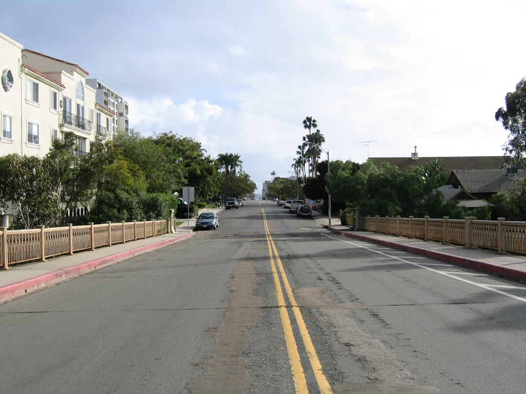
|
West of Interstate 5, Carmel Valley Road travels west as a two-lane highway along the northern edge of Los Peñasquitos Lagoon through the Del Mar Terrace neighborhood. The lagoon is located within the Torrey Pines State Reserve. Just before reaching the ocean and Old U.S. Highway 101, Carmel Valley Road will leave the city of San Diego and enters the city of Del Mar. Photo taken 09/01/12. |
|
Westbound Carmel Valley Road meets Portofino Drive at this signalized intersection. Photo taken 09/01/12. |
|
The waters of Los Peñasquitos Lagoon come into view as we look southwest across the lagoon toward the spit of land that separates the lagoon from the ocean. Old Historic U.S. 101 (North Torrey Pines Road) travels on top of the spit of land; as a result, cars can be seen in the distance in this view. Photo taken 09/01/12. |
|
The next intersection along Carmel Valley Road west is with Via Grimaldi, which travels north into Del Mar Terrace and its unique residential neighborhood. Photo taken 09/01/12. |
|
A huge Torrey pine tree, which gives the neighboring preserve its name, towers over Carmel Valley Road at the Via Grimaldi intersection. Photo taken 09/01/12. |
|
Westbound Carmel Valley Road meets Via Grimaldi at this intersection. Photo taken 09/01/12. |
|
One block west, we meet Via Felino at this intersection with Carmel Valley Road. Photo taken 09/01/12. |
|
|
Due to low elevation and proximity of the waters of the lagoon, this segment of Carmel Valley Road is subject to occasional flooding. Photos taken 09/01/12. |
|
|
These views show the morning beauty and tranquility of the lagoon as seen from the south side of Carmel Valley Road looking west and south. Photos taken 09/01/12. |
|
|
The main railroad link from Orange County south into San Diego County travels over Los Peñasquitos Lagoon. Here, the railroad uses a wooden trestle to carry it across the waters of Peñasquitos Creek. Photos taken 09/01/12. |
|
Carmel Valley Road turns northwest to avoid the lagoon and proceed toward the city of Del Mar. Here, westbound Carmel Valley Road meets Del Mar Scenic Parkway and McGonigle Road. Use McGonigle Road south into one of the Torrey Pines State Reserve parking lots for beach access (fee required to park). Photo taken 09/01/12. |
|
The North Torrey Pines Road/Camino Del Mar bridge over the railroad tracks was being restored at the time this picture was taken. Even with scaffolding and supports added to the bridge, it still retains its old-school charm. See the U.S. 101 page for closer views of this significant, historic bridge. Photo taken 09/01/12. |
| Carmel Valley Road scenes |
|
A spur road linking Carmel Valley Road to one of the Torrey Pines State Reserve's parking lots, McGonigle Road travels south from Carmel Valley Road to pass under the railroad tracks. A Coaster emblem was pasted onto the bridge, probably to cover up an older emblem or designation previously found on this bridge. Photo taken 09/01/12. |
| Citracado Parkway (Escondido) |
|
|
Near the Stone Brewery in western Escondido, Citracado Parkway travels north toward the Palomar Energy Center (550-megawatt natural gas power plant), which is operated by San Diego Gas and Electric (SDG&E). Tall power lines parallel Citracado Parkway en route to the energy center. Photos taken 05/16/09. |
|
|
| Clairemont Mesa Boulevard west |
|---|
|
|
|
Westbound Clairemont Mesa Boulevard approaches Interstate 15 in Tierrasanta near Murphy Canyon and Shepherd Canyon. Photos taken 03/29/10. |
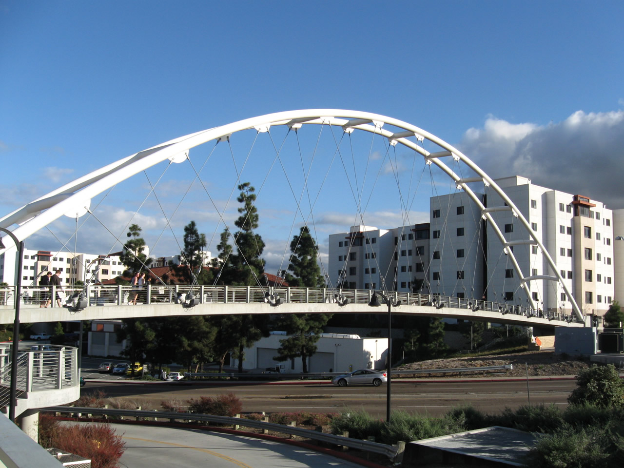
| College Avenue north |
|
A tied arch pedestrian bridge crosses over College Avenue; it connects San Diego State University's Aztec Center with east dormitories and parking lots/structures. Photo taken 03/19/11. |
|
This view looks north on College Avenue from the tied arch pedestrian bridge between San Diego State University's Aztec Center and east dormitories. Photo taken 03/19/11. |
|
Leaving the San Diego State University campus, northbound College Avenue approaches Canyon Crest Drive west and Alvarado Road east . After that is the connection to Interstate 8 east to El Cajon and El Centro and west to downtown and the beach areas. Photo taken 03/19/11. |
|
Northbound College Avenue meets an off-ramp that connects to Interstate 8 east to El Cajon and El Centro. The second right connects to Interstate 8 west to downtown and the beach areas. Photo taken 03/19/11. |
|
After passing over Interstate 8, northbound College Avenue meets the off-ramp to Interstate 8 west to downtown and the beach areas. Ahead, College Avenue enters the Del Cerro community. Photo taken 03/19/11. |
| College Avenue south |
|
After the interchange with Interstate 8, southbound College Avenue approaches a signalized intersection with Alvarado Road east and Canyon Crest Drive west. To the southwest of this intersection is the towering Chemical Science Laboratory/Geology Mathematics Computer Sciences building at San Diego State University. These older, porcelain enamel signs (not button copy) likely date back to the mid-1960s. Photo taken 03/19/11. |
|
Southbound College Avenue meets Alvarado Road east and Canyon Crest Drive west. The next several left turns connect with San Diego State University's eastern parking garages, some of which are open to the public and others of which are open solely to permit holders (typically faculty, staff, and/or students). Photo taken 03/19/11. |
|
This view looks south on College Avenue as seen from a pedestrian bridge between a parking structure and the Education and Business Administration building. Photo taken 03/19/11. |
| College Avenue scenes |
|
This view looks northeast from the Chemical Sciences Laboratory/Geology Mathematics Computer Sciences building toward the Interstate 8 and College Avenue interchange. Photo taken 03/19/11. |
| Del Mar Mesa Road east |
|
|
|
Del Mar Mesa Road serves a variety of country-style, residential developments on Del Mar Mesa, which is located east of Carmel Mountain, north of Grand Del Mar Golf Course, and southeast of Carmel Valley. An equestrian trail follows alongside the road. Photos taken 11/01/11. |
| E Street east |
|
In downtown San Diego, eastbound E Street transitions directly onto Interstate 5 south after intersecting 16th Avenue. Photo taken 01/29/09. |
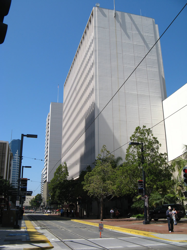
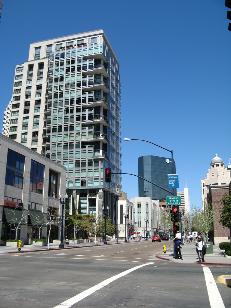
| Eighth Avenue north |
|
This view looks north on 8th Avenue after the intersection with Market Street. Some of the skyscrapers of the Financial District are visible from this vantage point in the East Village. Photo taken 06/05/11. |
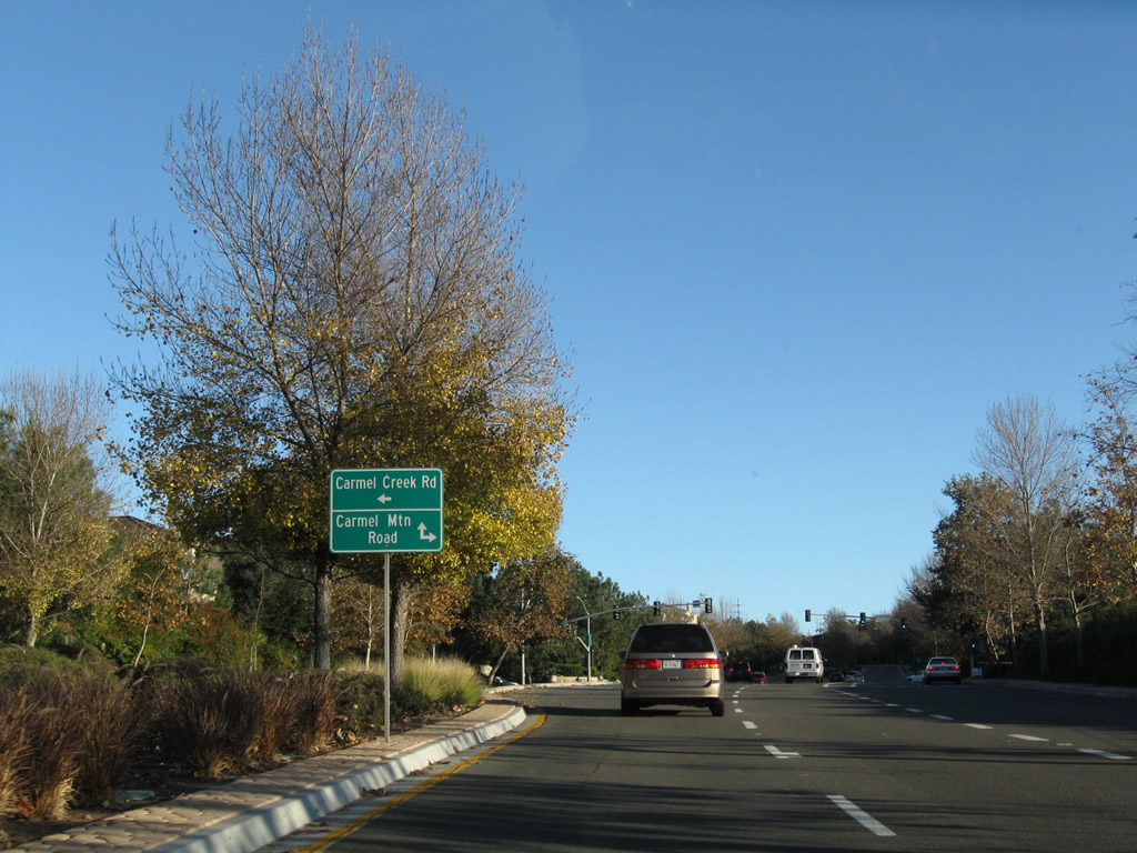
| El Camino Real south |
|
Southbound El Camino Real approaches Carmel Mountain Road in the Torrey Hills community south of Carmel Valley. Turn left to Carmel Creek Road, which is a local access road only. Plans originally called for Carmel Creek Road to continue northeast toward California 56, but those plans were called off when the Carmel Mountain Open Space Preserve was created. Turn right on Carmel Mountain Road to Interstate 5 and continue straight on Carmel Mountain Road to Del Mar Mesa. This intersection marks the southern end of San Diego's El Camino Real. Photo taken 12/16/08. |
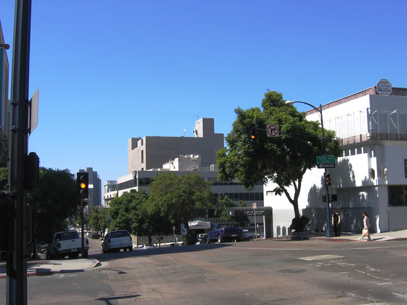
| Eleventh Avenue north |
|
This view looks north on 11th Avenue after the intersection with Market Street. After traveling about eight blocks, 11th Avenue will transition directly into the northbound lanes of California 163 (after A Street and Russ Boulevard). Photo taken 06/05/11. |
| F Street |
|
This view looks west on F Street after the intersection with Park Boulevard. F Street ultimately connects to the Horton Plaza parking garage (after crossing 4th Avenue in the Gaslamp Quarter). Photo taken 06/05/11. |
| Fairmount Avenue (Former U.S. 395) north |
| Fairmount Avenue (Former U.S. 395) south |
| Fifth Avenue north |
|
The Historic Heart of San Diego is the Gaslamp Quarter. This gateway arch is located on northbound Fifth Avenue after the San Diego Trolley tracks and the Martin Luther King, Jr. Promenade near Petco Park. Photo taken 03/24/08. |
|
Northbound Fifth Avenue meets Island Avenue in the Gaslamp Quarter. Photo taken 03/24/08. |
| Fifth Avenue south |
|
Southbound Fifth Avenue approaches the San Diego Trolley line and Harbor Drive. Shadowing Harbor Drive (old U.S. 101) is the San Diego Convention Center. Photo taken 03/24/08. |
| First Avenue |
|
A black and white sidewalk lines the east side of First Avenue between the Martin Luther King Jr. Promenade and Island Avenue. Photo taken 03/24/08. |
|
Northbound First Avenue meets Market Street (former U.S. 80-395) in downtown San Diego. Photo taken 03/24/08. |
|
At the southwestern corner of Horton Plaza, northbound First Avenue meets G Street. Use G Street east to California 94 (Martin Luther King Jr. Freeway) east to Lemon Grove, Rancho San Diego, Jamul, Tecate, and Campo. Photo taken 03/24/08. |
|
A sign advises of the best pedestrian routes to San Diego Bay, which is mostly blocked by hotels, Seaport Village, and the Convention Center. Broadway, Kettner Boulevard, First Avenue, and Fifth Avenue all offer connections to the bay. Photo taken 03/24/08. |
|
Northbound First Avenue meets E Street adjacent to Horton Plaza. Photo taken 03/24/08. |
|
This view looks north along First Avenue toward Broadway. Photo taken 03/24/08. |
|
Northbound First Avenue meets Broadway one block north of E Street. Photo taken 03/24/08. |
|
A wayfinder sign for Interstate 5 and California 94 are posted on northbound First Avenue between Broadway and C Street. Photo taken 03/24/08. |
|
Northbound First Avenue meets C Street. On the northeast corner of this intersection is the City Administration Building. Stay in the right lane ahead to connect to the civic center parking garage (Evan V. Jones Parkade). Photo taken 03/24/08. |
|
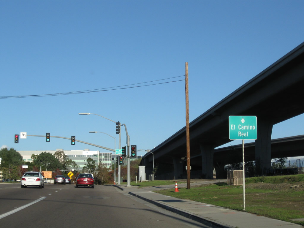
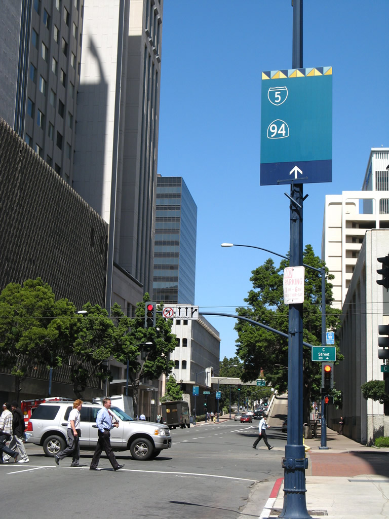
Northbound First Avenue approaches A Street. Turn right here for A Street east to California 163 (Cabrillo Freeway) north to Escondido. Photo taken 03/24/08. |
|
Northbound First Avenue meets A Street at this traffic signal in downtown San Diego, adjacent to the Evan V. Jones Parkade near the San Diego Civic Center. Continue north on First Avenue to the Interstate 5 interchange, which offers a connection to California 94 (Martin Luther King Jr. Freeway) east. Turn right for A Street east to California 163 north. Photo taken 03/24/08. |
|
|
|
|
This group of photos profile the Maple Canyon Bridge, which carries First Street across Maple Canyon just north of downtown San Diego. Built in 1911 using improvement act funds, this steel arch bridge rises 104 feet above the floor of the open space canyon. The bridge was being repaired in late 2008-early 2009, resulting in temporary closure of the historic bridge. Photos taken 02/19/05. |
|
|
|
|
| Foothill Boulevard west |
|
Foothill Boulevard is a short connecting street in Pacific Beach that links Ingraham Street north with Turquoise Street west. Here, westbound Foothill Boulevard approaches Fanuel Street south and Cardeno Street north. At this intersection Foothill Boulevard changes into Turquoise Street west. As a result, every street (from each direction) entering this intersection ends and changes names. Turn left to downtown Pacific Beach, right to Mount Soledad, or continue straight to Bird Rock. Photo taken 01/14/11. |
| Friars Road east |
|
Friars Road is the main east-west route through San Diego's Mission Valley district. Generally four to eight lanes wide, Friars Road is the primary route to Fashion Valley and Qualcomm Stadium. Here, eastbound Friars Road passes under a series of bridges after passing under Interstate 5: Pacific Highway (Old U.S. 101), the railroad (Amtrak and Coaster), the San Diego trolley, and Morena Boulevard. After an at-grade crossing with the San Diego Trolley, Friars Road sees a traffic signal with Napa Street. Photo taken 04/20/09. |
|
Eastbound Friars Road passes under the railroad at this viaduct. Photo taken 04/20/09. |
|
Next up is the first pass under the San Diego trolley. Friars Road stays close to the north bank of the San Diego River here. Photo taken 04/20/09. |
|
Power lines cross Friars Road and the San Diego River on a route parallel to Morena Boulevard. Photo taken 04/20/09. |
|
Eastbound Friars Road passes under the Morena Boulevard bridge; this is the last overpass in sequence over this segment of Friars Road. Photo taken 04/20/09. |
|
The next intersection along Friars Road is with Napa Street. Turn left (north) on Napa Street to Linda Vista Road en route to the University of San Diego. Photo taken 04/20/09. |
|
Eastbound Friars Road meets Napa Street at this traffic signal. Photo taken 04/20/09. |
|
Friars Road enters the community of Mission Valley. Photo taken 04/20/09. |
|
Towering power lines again dominate the view on eastbound Friars Road. A dedicated bike lane with a curb separating it from the main lanes of traffic provides a route for bicyclists to pedal through Mission Valley en route to the bay and beaches to the west. Photo taken 04/20/09. |
|
Friars Road passes by the Riverwalk Golf Course. Photo taken 04/20/09. |
|
Eastbound Friars Road approaches Fashion Valley, a major shopping destination. Photo taken 04/20/09. |
|
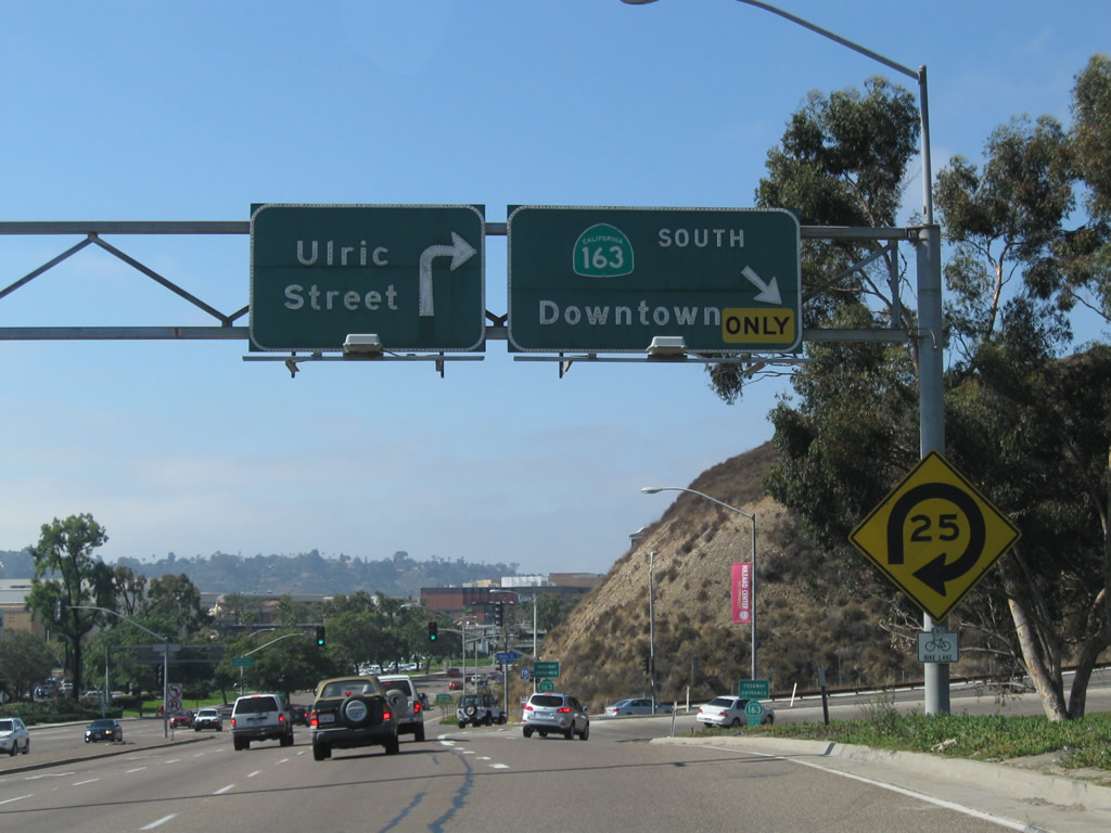
After passing by Fashion Valley shopping center, eastbound Friars Road approaches California 163 (Cabrillo Freeway). Use California 163 south to downtown San Diego (next right) or north to Escondido and points north via Interstate 15 (next left). Photo taken 04/20/09. |
|
The interchange between Friars Road and California 163 is frequently busy and is slated for revision and reconstruction as funding becomes identified for the project. Photo taken 04/20/09. |
|
Friars Road crosses over California 163 on this bridge. Photo taken 04/20/09. |
|
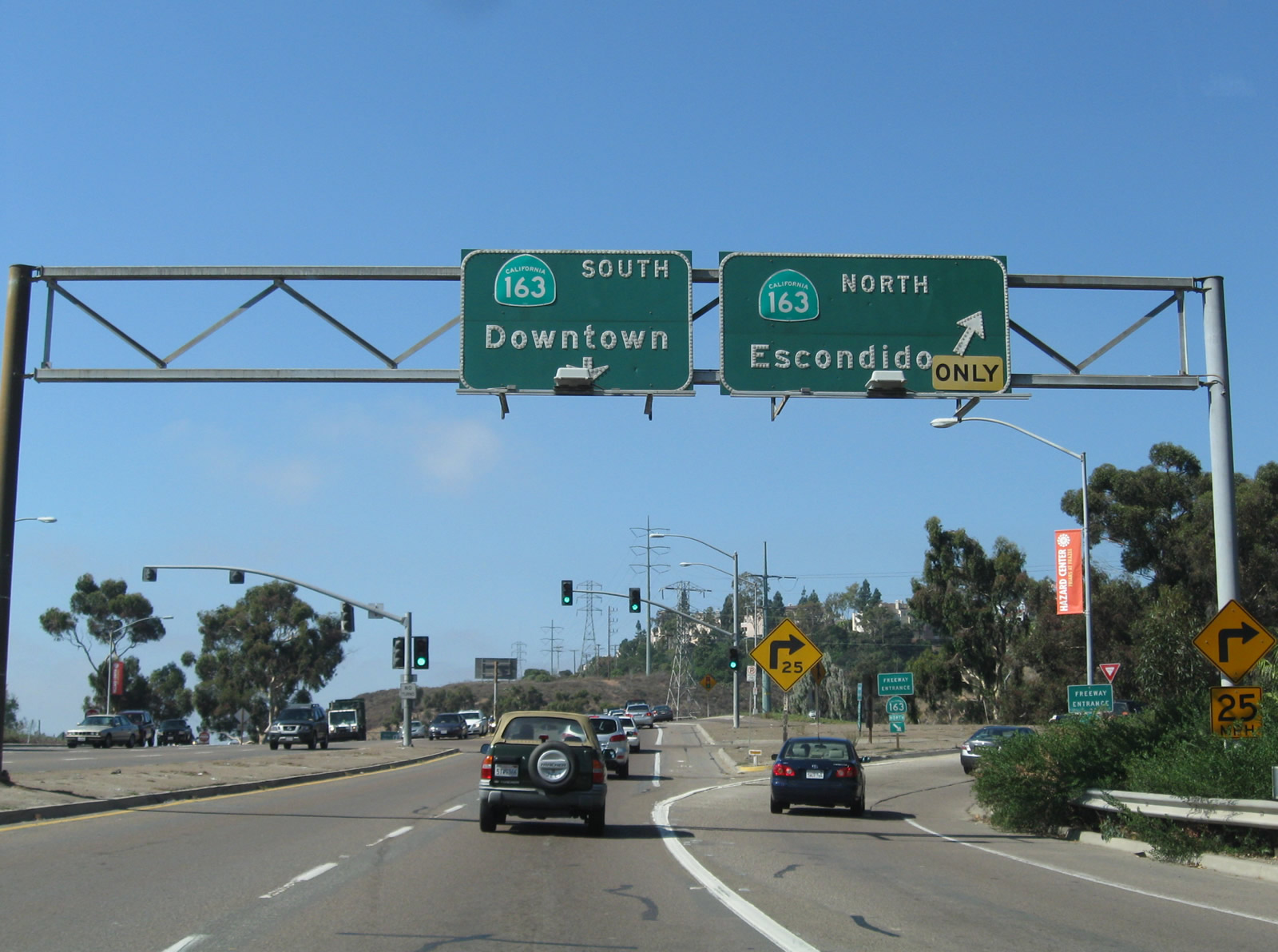
|
Eastbound Friars Road connects to California 163 north via a left turn here. Hazard Center is located on the southeastern corner of the interchange between Friars Road and California 163. Photos taken 04/20/09 and 10/28/04. |
|
After the California 163 interchange, the next signalized intersection along Friars Road is with Frazee Road. Photo taken 04/20/09. |
|
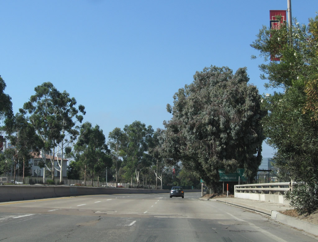
An off-ramp connects eastbound Friars Road with Mission Center Road and Auto Circle. Upon exiting, turn right to follow Mission Center Road south to the Mission Valley Center shopping centers. For the next mile or so, Friars Road has a limited access arrangement with interchanges at Mission Center Road and Qualcomm Way as well as a few side road connections. Photo taken 10/28/04. |
|
After the interchange with Qualcomm Way, eastbound Friars Road will approach Rio Bonito Way and then pass under the Interstate 805 bridge. Photo taken 10/28/04. |
|
Eastbound Friars Road meets Rio Bonito Way (side road with no traffic signal) and passes under the massive Interstate 805 bridge that spans Mission Valley. Photo taken 10/28/04. |
|
After the River Run Drive intersection, eastbound Friars Road approaches Fenton Parkway. The Fenton Marketplace development (with Ikea, Lowe's, and Costco as well as the Mission Valley Library) is located on the south side of Friars Road. Photo taken 10/28/04. |
|
Eastbound Friars Road approaches Northside Drive in Mission Valley. Photo taken 10/28/04. |
|
|
|
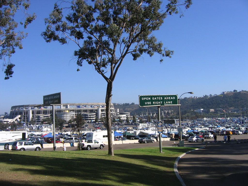
Friars Road is the primary route to Qualcomm Stadium, which is home to the National Football League's San Diego Chargers. Built in 1967 and expanded in 1997, the stadium is surrounded on all sides by a sea of parking stalls and a connection to the regional trolley system. Photos taken 10/28/04 and 10/10/05. |
|
|
|
The exit from Qualcomm Stadium back to Friars Road is a diamond interchange. This view looks north toward Mission Village; turn right for Friars Road east to Interstate 8 and Interstate 15. Photos taken 10/10/05. |
|
After the Mission Village Drive interchange, eastbound Friars Road approaches the junction with Interstate 15. A direct access ramp connects Friars Road with Interstate 8 west and east, primarily for stadium traffic. Turn left ahead for the connection to Interstate 8; stay right for the link to Interstate 15 south. The ramp to Interstate 15 north is a left turn on the east side of the interchange. Photo taken 10/28/04. |
|
The ramp from Friars Road east to Interstate 15 south actually connects with California 15 south, since the state route designation begins just south of Interstate 8. There is no access from this ramp to Interstate 8 east or west. Photo taken 10/28/04. |
| Friars Road west |
|
Now traveling west, Friars Road passes by Qualcomm Stadium (formerly San Diego Stadium and Jack Murphy Stadium), home of the NFL San Diego Chargers and San Diego State University football team. Photo taken 10/11/10. |
|
At the west end of the Qualcomm Stadium parking lot is an entrance that opens during stadium events. Photo taken 10/11/10. |
|
Westbound Friars Road travels past Fenton Marketplace on the south side of the roadway and a residential complex on the north side. Prior to its development, much of Mission Valley was farmland, with several quarries located throughout. Photo taken 10/11/10. |
|
After the intersections with Fenton Parkway and River Run Drive, Friars Road will pass below the Interstate 805 Jack Schrade Bridge. This landmark bridge passes high above Mission Valley. Photo taken 10/11/10. |
|
Assuming a brief expressway configuration, Friars Road sees diamond interchanges with Qualcomm Way (formerly Stadium Way) and Mission Center Road. Stay right to exit onto Qualcomm Way south to Interstate 8 and Texas Street to North Park. Photo taken 10/11/10. |
|
Westbound Friars Road meets the off-ramp to Qualcomm Way south to Interstate 8 and Texas Street. If development plans proceed for the rock quarry on the north side of Friars Road, this exit will also serve the Civita development. Photo taken 10/11/10. |
|
Friars Road crosses over Qualcomm Way on this six-lane bridge. Photo taken 10/11/10. |
|
|
|
Adjacent to the Rio Vista development on the south and future Civita development to the north, Friars Road briefly feels like a freeway for the mile or so between Qualcomm Way and Mission Center Road. Photos taken 10/11/10. |
|
|
|
Westbound Friars Road next approaches and meets the off-ramp to Mission Center Road. Traffic to California 163 (Cabrillo Freeway) should continue west on Friars Road. Photos taken 10/11/10. |
|
|
|
Friars Road curves over Mission Center Road and approaches a traffic signal with Frazee Road. Photos taken 10/11/10. |
|
After the Frazee Road intersection, westbound Friars Road approaches California 163 (Cabrillo Freeway). The first right turn connects to California 163 north to Escondido; the second right connects to California 163 south to Balboa Park and downtown San Diego. Photo taken 10/11/10. |
|
A pair of California 163 freeway entrance shields flank the on-ramp to California 163 north from Friars Road. Photo taken 10/11/10. |
|
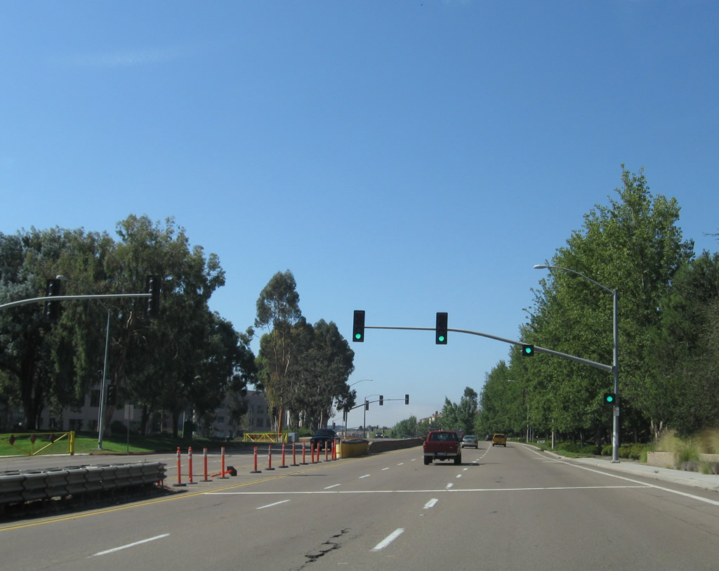
Westbound Friars Road meets California 163 (Cabrillo Freeway) south to Balboa Park and downtown San Diego. The second right connects to Ulric Road north to Linda Vista. Photo taken 10/11/10. |
| G Street east |
|
Eastbound G Street passes First Avenue and approaches Second Avenue near the southwestern corner of Horton Plaza. Photo taken 03/24/08. |
| Genesee Avenue north |
|
Northbound Genesee Avenue (San Diego County S-21) approaches Science Park Drive and North Torrey Pines Road. Photo taken 10/29/05. |
| Genesee Avenue south |
|
Southbound Genesee Avenue (San Diego County S-21) approaches Science Park Drive after the North Torrey Pines Road intersection. Photo taken 10/29/05. |
|
Descending from Torrey Pines Mesa, Genesee Avenue (San Diego County S-21) approaches the ramp to southbound Interstate 5. The second traffic signal at this interchange provides a connection to northbound Interstate 5. Photo taken 10/29/05. |
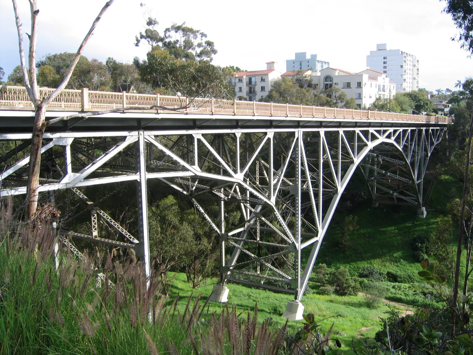
| Georgia Street Bridge |
|
Built in 1914, the Georgia Street bridge over University Avenue was built in 1914. This 69-foot long bridge is an open-spandrel arch bridge and is a type not commonly seen in new construction. This view looks north on Georgia Street; only the bridge rail confirms that Georgia Street is about to cross a bridge. Photo taken 05/15/08. |
|
Looking east from Georgia Street, this view follows University Avenue east into the community of North Park. Photo taken 05/15/08. |
|
The Georgia Street bridge crosses over University Avenue; this view looks east along University Avenue. Photo taken 05/15/08. |
|
The understory of the arch bridge has held up fairly well but is in need of maintenance and improvement. Photo taken 05/15/08. |
|
A shadow from the late-day sun showed the arch of the Georgia Street bridge was cast onto eastbound University Avenue. Photo taken 05/15/08. |
|
While there is no date stamp, the Georgia Street bridge is identified as a separation structure and is given a county bridge inventory number. Photo taken 05/15/08. |
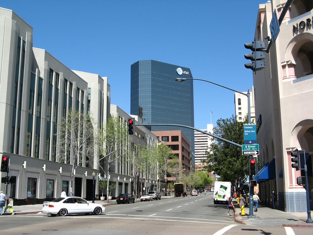
| Grand Avenue west |
|
|
This sign on Grand Avenue west is for Figueroa Boulevard north. It is a very old sign; in fact close inspection reveals that it was painted green, and at one time it was a white Auto Club of Southern California sign. Photos taken 05/15/08. |
|
Westbound Grand Avenue meets Figueroa Boulevard at this traffic signal. Photo taken 05/15/08. |
|
|
After the split from Mission Bay Drive (Business Loop I-5), westbound Grand Avenue passes by the Pacific Beach welcome sign. The sign is located in the median after the the Figueroa Boulevard turnoff. Photos taken 05/15/08. |
Page Updated February 24, 2013.