| Historic U.S. 66 - Figueroa Street (Former Alternate U.S. 66) east |
|
Northbound (eastbound) Alternate U.S. 66/Figueroa Street meets Avenue 26 in the Arroyo Seco neighborhood of the city of Los Angeles. A U.S. 66 historical route marker is posted on the mast arm for the Avenue 26 intersection. Turn right here for a bit of road history ... Avenue 26 from here southeast to the Interstate 5 ramps near Lacy Street was originally part of U.S. 99 and also was briefly part of California 163 as it crossed over California 110/Arroyo Seco Parkway. Some older relics (including a original bridge railing, a "Route 163/11 Separation" bridge sign, and a 1939 bridge date stamp) are posted where Avenue 26 passes over California 110. Photo taken 01/14/07. |
|
The historic U.S. 66 route marker has a design unique to the city of Los Angeles. Figueroa Street, which was part of mainline U.S. 66 from 1934 through 1941, became Alternate U.S. 66 when mainline U.S. 66 was shifted to the Arroyo Seco Parkway. Photo taken 01/14/07. |
| Historic U.S. 66 east |
|
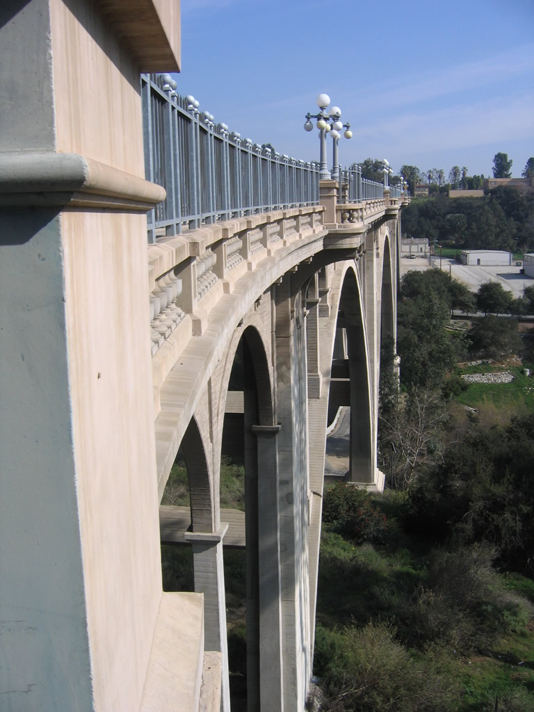
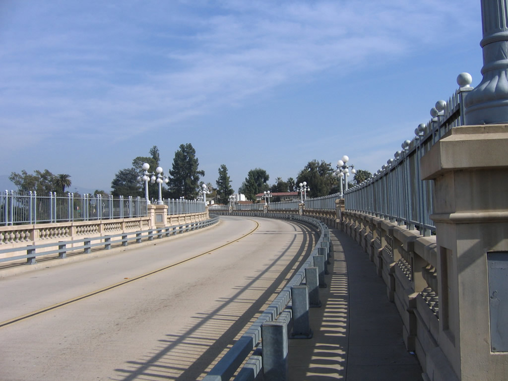
After the intersection with San Rafael Avenue, eastbound Historic U.S. 66 (Colorado Boulevard) approaches the Colorado Street Pioneer Bridge. This 1913 bridge carries the historic route over the Arroyo Seco and is one of the most impressive bridges along the notable U.S. 66 corridor across the western United States. Photo taken 01/28/06. |
|
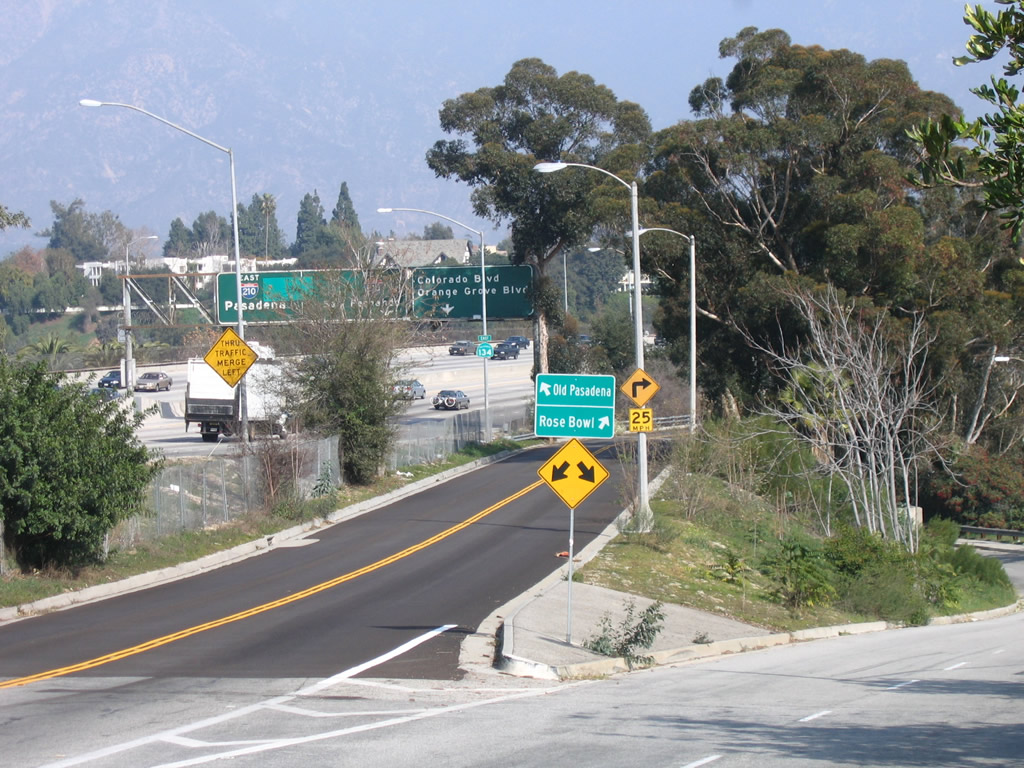
Eastbound Historic U.S. 66 (Colorado Boulevard) splits, with the right two lanes linking to Linda Vista Avenue (former California 159) north to the Rose Bowl and the left lane transitioning onto the Colorado Street Pioneer Bridge. U.S. 66 turns left onto the bridge to cross the Arroyo Seco and enter downtown Pasadena. Photo taken 01/28/06. |
|
A small guide sign for U.S. 66 east to downtown Pasadena and Linda Vista Avenue north to the Rose Bowl is posted at the gore point. Photo taken 01/28/06. |
|
|
|
|
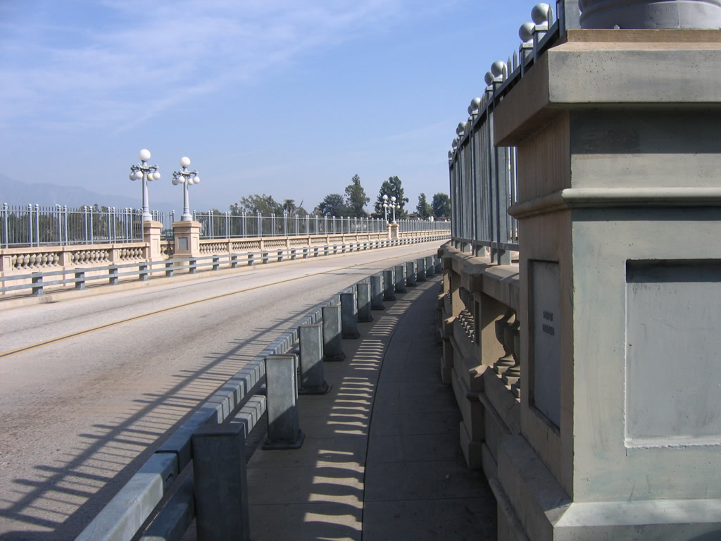
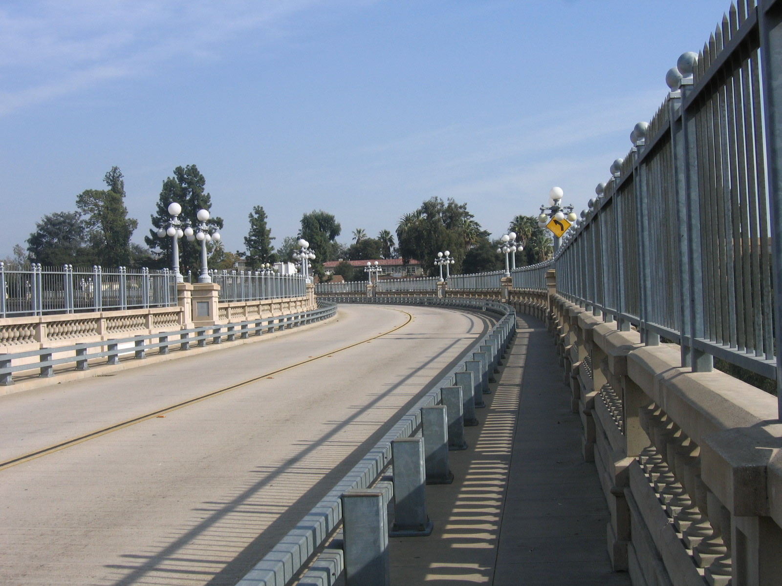
This series of photos follows Historic U.S. 66 (Colorado Boulevard) as the historic route crosses the Arroyo Seco on the Colorado Street Pioneer Bridge. Photos taken 01/28/06. |
|
|
|
|
|
At the end of the Colorado Street Pioneer Bridge, a median barrier separates eastbound and westbound U.S. 66. A traffic signal ahead is with Orange Grove Boulevard (after traffic merges with an off-ramp from California 134). Photo taken 01/28/06. |
|
Prior to Orange Grove Boulevard, traffic merges with an off-ramp from California 134. Photo taken 01/28/06. |
|
This U.S. 66 east shield was found in the city of Duarte along the city-maintained segment of the historic U.S. 66 route. This is located west of the officially designated California 66. Photo taken 01/06/02. |
| Historic U.S. 66 east & U.S. 91-395 north |
|
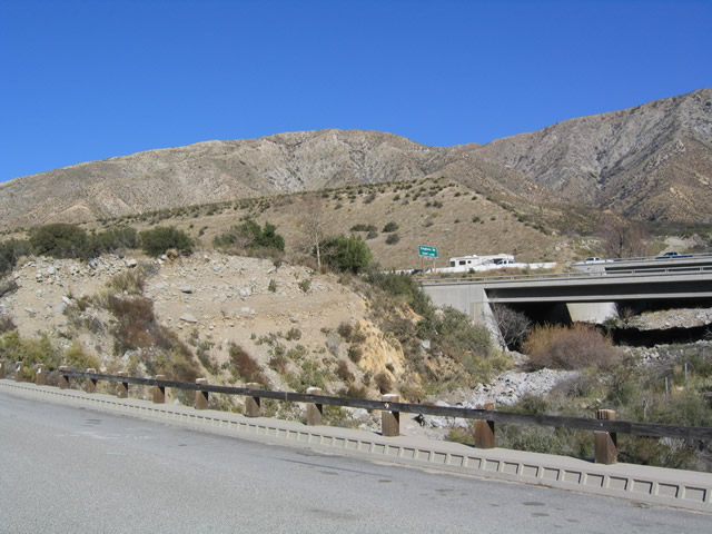
An extant section of U.S. 66 (and its former companions, U.S. 91-395) is located on the ascent to Cajon Pass between Interstate 15, Exits 124 and 129. Following Cajon Boulevard, this old stretch of U.S. 66 features a former divided highway that was converted back into a two-lane road. Some of the old eastbound/northbound lanes are still intact, but they are only used by bicyclists and hikers. In this picture, the former eastbound lanes are torn up. Photo taken 01/20/04. |
|
|
|
Views of eastbound U.S. 66/northbound U.S. 91-395 as it passes through the lower reaches of the Cajon Pass. The old eastbound lanes of the expressway have been decommissioned in favor of a two-lane road. Photos taken 01/20/04. |
|
|
|
The old expressway features a 1939 concrete bridge for the former northbound lanes of U.S. 66-91-395. This bridge is closed to motor vehicles. This series of photos shows some views of this old bridge. Photos taken 01/20/04. |
|
|
|
Historic U.S. 66 shields are occasionally found painted on the pavement, as shown on these three pictures taken at the 1939 bridge. Photo taken 01/20/04. |
|
View of the 1939 concrete bridge as seen from northbound U.S. 66-91-395. Photo taken 01/20/04. |
|
Northbound U.S. 66-91-395 approach their junction with Interstate 15 at the Kenwood Road interchange. This neutered shield (no state name) was likely placed by San Bernardino County rather than Caltrans. Much of the remaining highway from here to the top of the Cajon Summit has been destroyed and is no longer in use. Through traffic to other extant segments of U.S. 66 must rejoin Interstate 15 and follow it north toward Victorville. Photo taken 01/20/04. |
| For pictures of the shared segment of Historic U.S. 66-91, California 18, and Business Loop I-15 through downtown Victorville, visit Business Loop I-15 in Victorville. |
| Historic U.S. 66 (San Bernardino County 66) - & Historic U.S. 91 north |
|
North of Victorville, U.S. 66 and U.S. 91 follow the railroad and enjoy a long segment separate from the Interstate 15 freeway. On November 4, 2011, signs were placed along this segment of National Trails Highway designating this historic road as San Bernardino County 66. The county highway (Historic U.S. 66-91) parallels the Mojave River closely between Victorville and Barstow, while Interstate 15 favors an alignment that is more direct but further away from the river and small communities along it, including Oro Grande, Helendale, Hodge, and Lenwood. Photo taken 01/20/04. |
|
View of the National Trails Highway/U.S. 66-91 north of Victorville. The highway passes by two cement facilities and several communities before reaching the less populated portions of the high desert. Photo taken 01/20/04. |
|
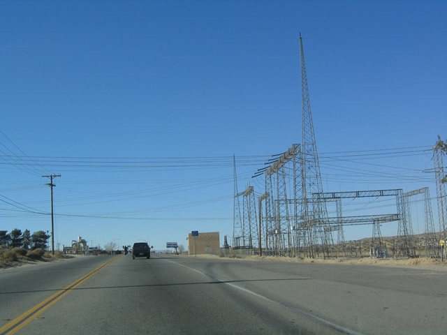
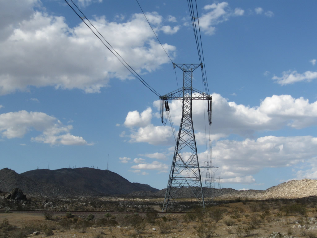
Nearing the top of a hill along northbound U.S. 66-91/National Trails Highway is this towering Los Angeles Department of Water and Power substation, which helps transmit power across the power grid in Southern California. Photo taken 01/20/04. |
|
The Oro Grande (Rockfield) Bridge allows U.S. 66-91 to cross the Mojave River northwest of Victorville and southeast of Oro Grande. Known as the Oro Grande Bridge or Rockfield Bridge, it was constructed in 1930, and it is still in use today. It extends for about 575 feet to cross the river. Another through truss bridge to cross the Mojave River is located along old U.S. 91 in Barstow. Photo taken 01/20/04. |
|
This view of the Oro Grande (Rockfield) Bridge can be found at midspan along eastbound U.S. 66 and northbound U.S. 91 (now signed as San Bernardino County 66). Photo taken 01/20/04. |
|
The Path 27 power transmission line, also known as the Intermountain High-Voltage Direct Current (HVDC) line, crosses over the National Trails Highway. Path 27 links a power plant near Delta, Utah, and a static inverter station in Adelanto, where Path 27 connects with the Southern California power grid. Photo taken 06/27/09. |
|
Proceeding northwest briefly, U.S. 66-91 will turn due north on the approach into the unincorporated community of Oro Grande, which is situated alongside the Mojave River northwest of Victorville. Photo taken 06/27/09. |
|
Northbound U.S. 66-91 and San Bernardino County 66 approach the turnoff to First Street, which connects to the Oro Grande post office. A Burlington Northern Santa Fe train was blocking access to First Street at the time we visited. Photo taken 06/27/09. |
|
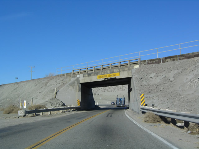
U.S. 66-91 and San Bernardino County 66 approach a subway that allows the highway to pass under the railroad tracks. This warning sign advises high profile vehicles not to enter if they are taller than the height shown on the sign. Photo taken 01/20/04. |
|
This narrow subway pushes U.S. 66-91 under the railroad tracks. With a clearance of only 13 feet, 11 inches, taller vehicles have been known to get stuck here or even damage the subway. Photo taken 01/20/04. |
|
Leaving the vicinity of Oro Grande, northbound U.S. 66-91 enters the uincorporated community of Helendale, which sits midway between Victorville and Barstow. Photo taken 06/27/09. |
|
Soon thereafter, northbound U.S. 66-91 and eastbound San Bernardino County 66 meet Vista Road, which travels west to cross the Mojave River and serve the communities of Helendale and Silver Lakes. Helendale includes areas the east side of the river, while Silver Lakes sits on the west side of the river and includes a golf course/country club. Photo taken 06/27/09. |
|
|
|
|
|
| U.S. 66-91 and San Bernardino County 66 pass through some sparsely settled areas in the Mojave Desert. This series of pictures follows the historic route along National Trails Highway between Helendale and Hodge. Indian Trail, a significant intersection along National Trails Highway, travels northwest across the Mojave River to connect to some ranches and industrial areas. In the last picture in this series, note the "Route 66" stencil placed on the pavement in lieu of a sign that could be removed and stolen. Photos taken 01/20/04 and 06/27/09. |
|
|
|
|
|
|
|
|
|
|
|
Eastbound U.S. 66-91 and San Bernardino County 66 enter the community limits of Hodge. Most of the development in Hodge is by the Mojave River, where green farmland contrasts sharply with the surrounding dry landscape. Photo taken 06/27/09. |
|
Perhaps in homage to the historic U.S. 66 route, we pass by the "Two Sixes Company" ranch. Photo taken 06/27/09. |
|
Northbound U.S. 66-91 approaches the left turn to Hinckley Road. Use Hinckley Road west to cross the Mojave River; once on the west bank, Hinckley Road turns north to connect ultimately with California 58 west of Barstow. Photo taken 06/27/09. |
|
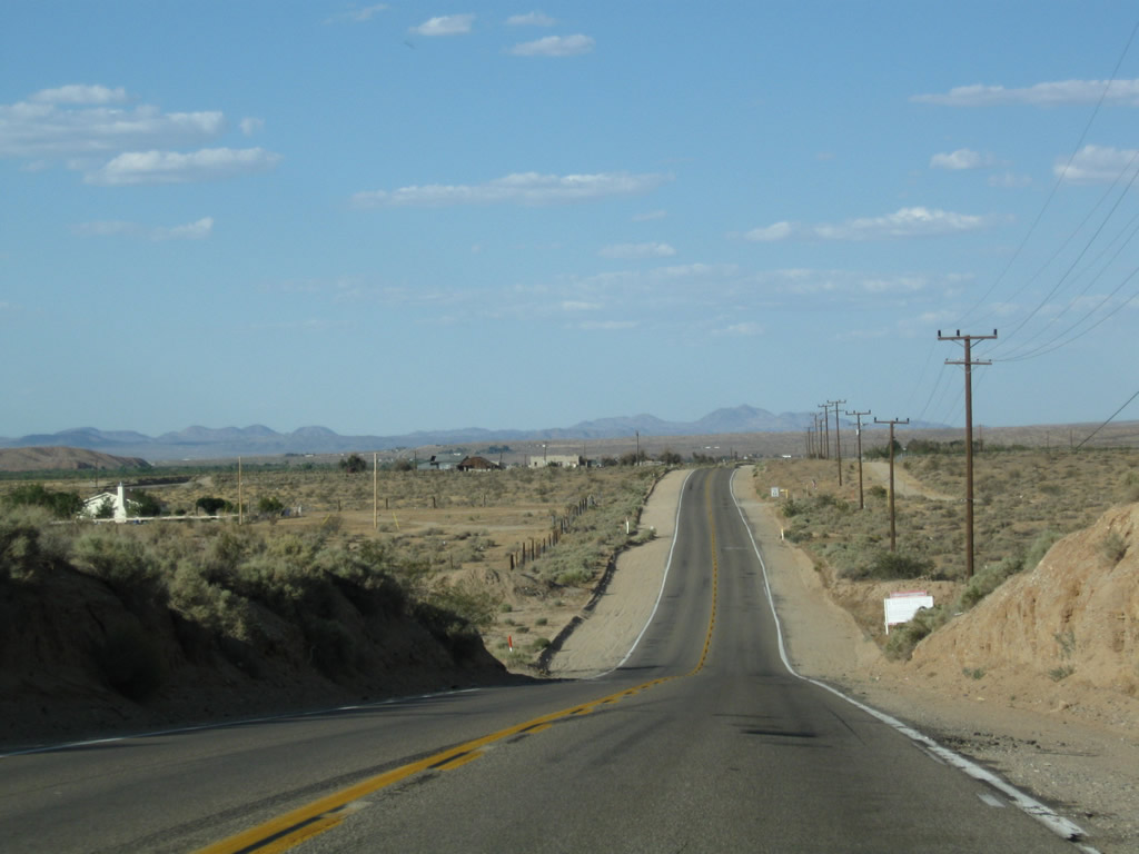
This view of northeastbound U.S. 66-91 is taken between Hodge and Barstow. Photo taken 06/27/09. |
|
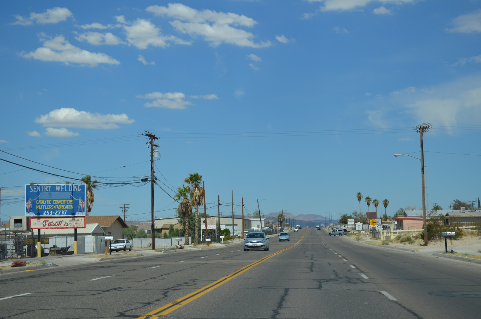
Historic U.S. 66 (National Trails Highway) and U.S. 91 enter the city limits of Barstow some distance south of the California 58 interchange. The city of Barstow is huge, with 33.59 square miles of desert, but large sections of the city are undeveloped. This includes the initial section of Barstow seen on U.S. 66-91 northbound. Barstow had a population of 22,639 as of the 2010 Census, and it was incorporated on September 30, 1947. Sitting at the intersection of Interstates 15 and 40 and California 58, in 1964 Barstow was at the confluence of U.S. 66, 91, and 466. today's Interstate 40 replaced U.S. 66 east of Barstow, and Interstate 15 replaced U.S. 91-466 northeast of Barstow. West of Barstow, California 58 replaced U.S. 466, and southwest of Barstow, California 58 replaced U.S. 466. Both the Union Pacific (UP) Railroad and the Burlington Northern Santa Fe (BNSF) Railroad enter Barstow, and BNSF has a large railyard in the city. Photo taken 06/27/09. |
|
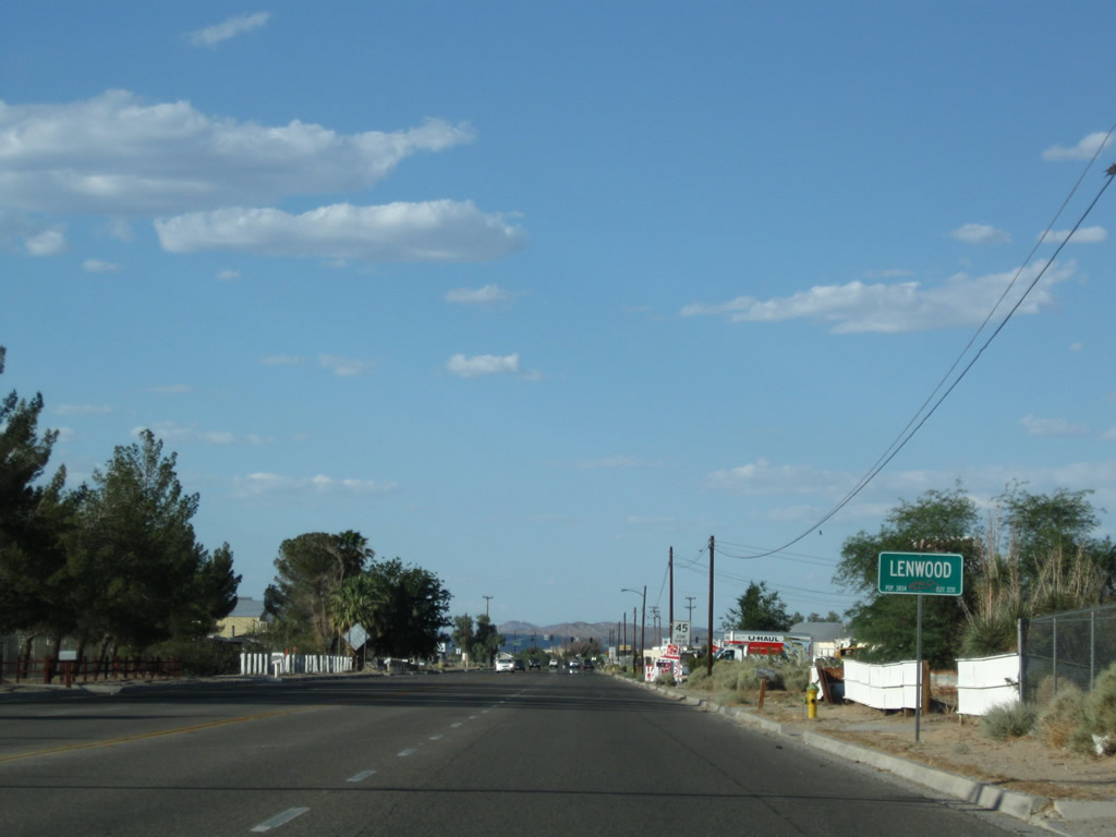
U.S. 66-91/National Trails Highway briefly leaves the city of Barstow and enters the unincorporated community of Lenwood. Photo taken 06/27/09. |
|
Eastbound U.S. 66-91 and San Bernardino County 66 approach Lenwood Road. Use Lenwood Road east to Interstate 15 (Exit 178), which is the location of the Barstow outlets and dozens of restaurants, and west to California 58 en route to Mojave and Bakersfield. A California Welcome Center is located within the outlet mall and is generally open during mall hours of operation. Photo taken 06/27/09. |
|
The Lenwood Road intersection is the first signalized intersection found on National Historic Highway since leaving Victorville. Photo taken 06/27/09. |
|
This view looks northeast along the National Trails Highway prior to the intersection with Birch Street as U.S. 66-91 (San Bernardino County 66) passes through the unincorporated community of Lenwood. Photo taken 07/20/14. |
|
A second Barstow city limits sign is posted northeast of Lenwood Road as we reenter the city. Photo taken 06/27/09. |
|
Northbound U.S. 66-91 approaches Citrine Road, which travels under the railroad tracks north to Jasper Road. Photo taken 06/27/09. |
|
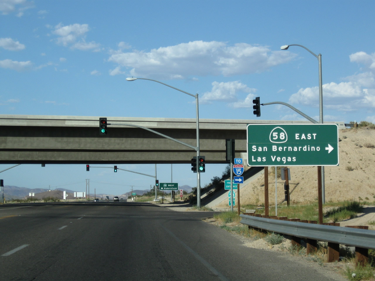
Continuing northeast, U.S. 66-91 approaches California 58, a freeway that leads east to Bakersfield and west to Interstate 15, with connections to Interstate 40 east to Needles, Kingman, and Flagstaff. Photo taken 06/27/09. |
|
California 58 bypasses old U.S. 466, which used to approach Barstow from the west. With the recent construction of the Barstow Bypass, traffic may avoid north Barstow and old U.S. 466. This picture shows north/eastbound U.S. 91-66 at the freeway interchange for eastbound California 58, which leads to Interstate 15 and Interstate 40. Photo taken 06/27/09. |
|
An Interstate 15 trailblazer is posted shortly thereafter. Photo taken 06/27/09. |
|
Freeway entrance signage for eastbound California 58 is posted here along northeastbound U.S. 66-91. Photo taken 01/20/04. |
|
Eastbound U.S. 66-91 meets California 58 west, which travels to Mojave, Tehachapi, and Bakersfield. Photo taken 07/20/14. |
|
Northbound U.S. 91 and eastbound U.S. 66 and San Bernardino County 66 again enter the city of Barstow. A reassurance shield for the ccunty route is mounted on top of the city limits sign. Photo taken 07/20/14. |
|
Route 66 rolls ahead into Barstow. Photo taken 07/20/14. |
|
One way to avoid sign theft is to stencil Historic U.S. Route 66 signs onto the pavement. Few historic 66 route markers are posted in San Bernardino outside of Barstow. Photo taken 07/20/14. |
|
Soon thereafter, eastbound U.S. 66 and northbound U.S. 91 meets Business Loop I-15 at the L Street intersection in Barstow. The business loop shield is omitted from this guide sign, but the business loop joins U.S. 66-91 northeast into downtown Barstow (straight ahead). Turn right for Business Loop I-15/L Street south to Interstate 15 Exit 181. Photo taken 07/20/14. |
| For pictures of the shared segment of Historic U.S. 66-91, Business Loop I-15, and San Bernardino County 66 through downtown Barstow, visit the Business Loop I-15 in Barstow page. |
| Historic U.S. 66 (San Bernardino County 66) - National Trails Highway east |
|
We begin our eastbound journey of the long extant segment of U.S. 66 between Ludlow and Goffs under the moonlight in Ludlow. The stop sign ahead is for Crucero Road, which connects to Interstate 40. Photo taken 04/01/07. |
|
Eastbound U.S. 66 meets Crucero Road in Ludlow; turn left here to Interstate 40. Photo taken 04/01/07. |
|
|
|
Eastbound Historic U.S. 66 (National Trails Highway) approaches Roy's Motel and Cafe in Amboy. The gas station is now back in business after years of being closed; the business suffered once Interstate 40 opened to the north. U.S. 66 motorists enjoy stopping here as part of the Mother Road tour in California. Photos taken 04/01/07. |
|
Leaving Amboy, the Bristol Mountains gleam in the late-day sunlight. Photo taken 04/01/07. |
|
A U.S. 66 shield is painted onto the asphalt along the eastbound lane on the way out of Amboy. Note the speed limit for this whole stretch of U.S. 66 is 55 miles per hour. Photo taken 04/01/07. |
|
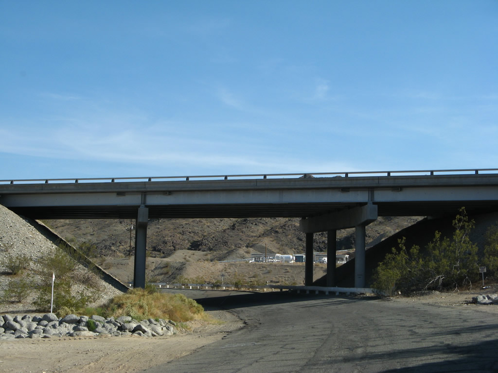
Many of the bridges along this section of U.S. 66 carry the two-lane highway over washes that may carry floodwater after significant precipitation falls in the desert. Distant thunderstorms in the summer can bring water to washes such as this one near Amboy. Photo taken 04/01/07. |
|
This is a side view of the same bridge as shown in the previous photobox ... most of these U.S. 66 bridges are designed in the same manner. Photo taken 04/01/07. |
|
|
A trailblazer for Interstate 40 is posted on eastbound U.S. 66 prior to the Goffs Road intersection. Photos taken 03/14/09. |
|
Eastbound Historic U.S. 66 (National Trails Highway) meets Goffs Road. The pre-1931 alignment turns left at this point, while the post-1931 continues straight ahead toward Mountain Springs Summit. Photo taken 04/01/07. |
|
After Goffs Road, a U.S. 66 shield is painted into the pavement. Photo taken 03/14/09. |
|
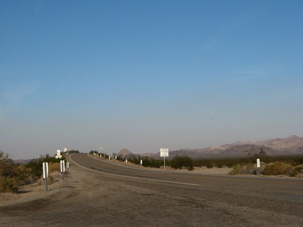
This mileage sign along westbound Historic U.S. 66 (National Trails Highway) is located about five miles east of Essex. It provides the distance to Needles (36 miles), Kingman (99 miles), and Flagstaff (260 miles). Photo taken 03/14/09. |
| Historic U.S. 66 - National Trails Highway east |
|
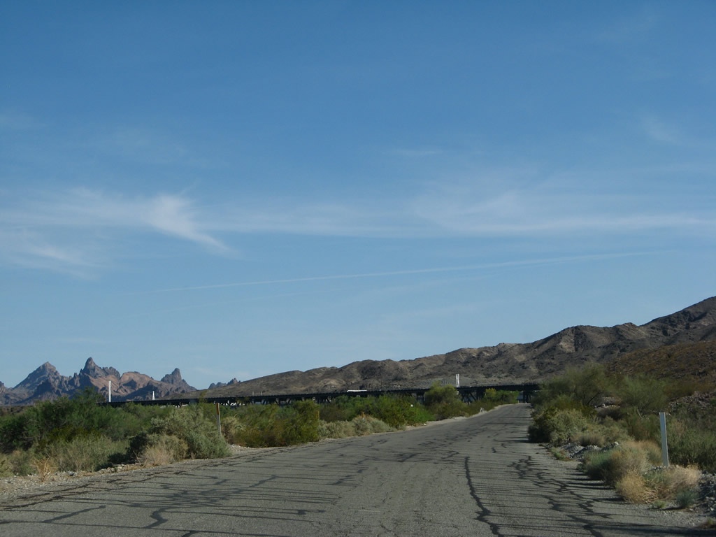
A short section of U.S. 66 extends from Park Moabi Recreation Area east to the former Colorado River bridge. Photo taken 04/01/07. |
|
The road from Park Moabi east to the Topock crossing is not a very good one; watch for pavement undulations. Photo taken 04/01/07. |
|
The Colorado River comes into view as U.S. 66 turns southeast back toward the freeway. Photo taken 04/01/07. |
|
The Needles, which gives the city of Needles its name, come into view; they are located in Arizona within Havasu National Wildlife Refuge. Ahead, the railroad and freeway bridges over the Colorado River come into view. Photo taken 04/01/07. |
|
Eastbound U.S. 66 passes under the Santa Fe Railroad and will next pass under Interstate 40. Photo taken 04/01/07. |
|
The old road banks on a superelevated turn to the east as it passes under Interstate 40. Photo taken 04/01/07. |
|
Old style, white guardrail lines U.S. 66 as the turn continues toward the Colorado River. Photo taken 04/01/07. |
|
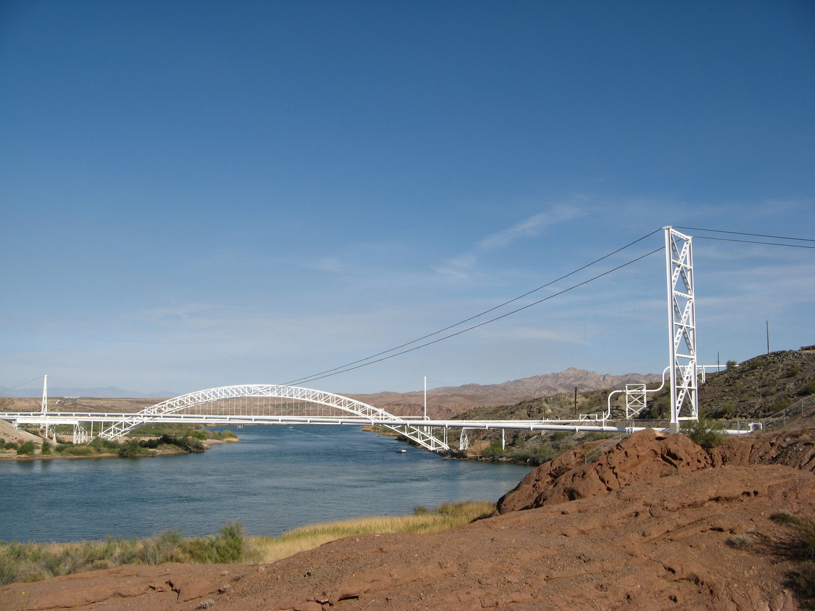
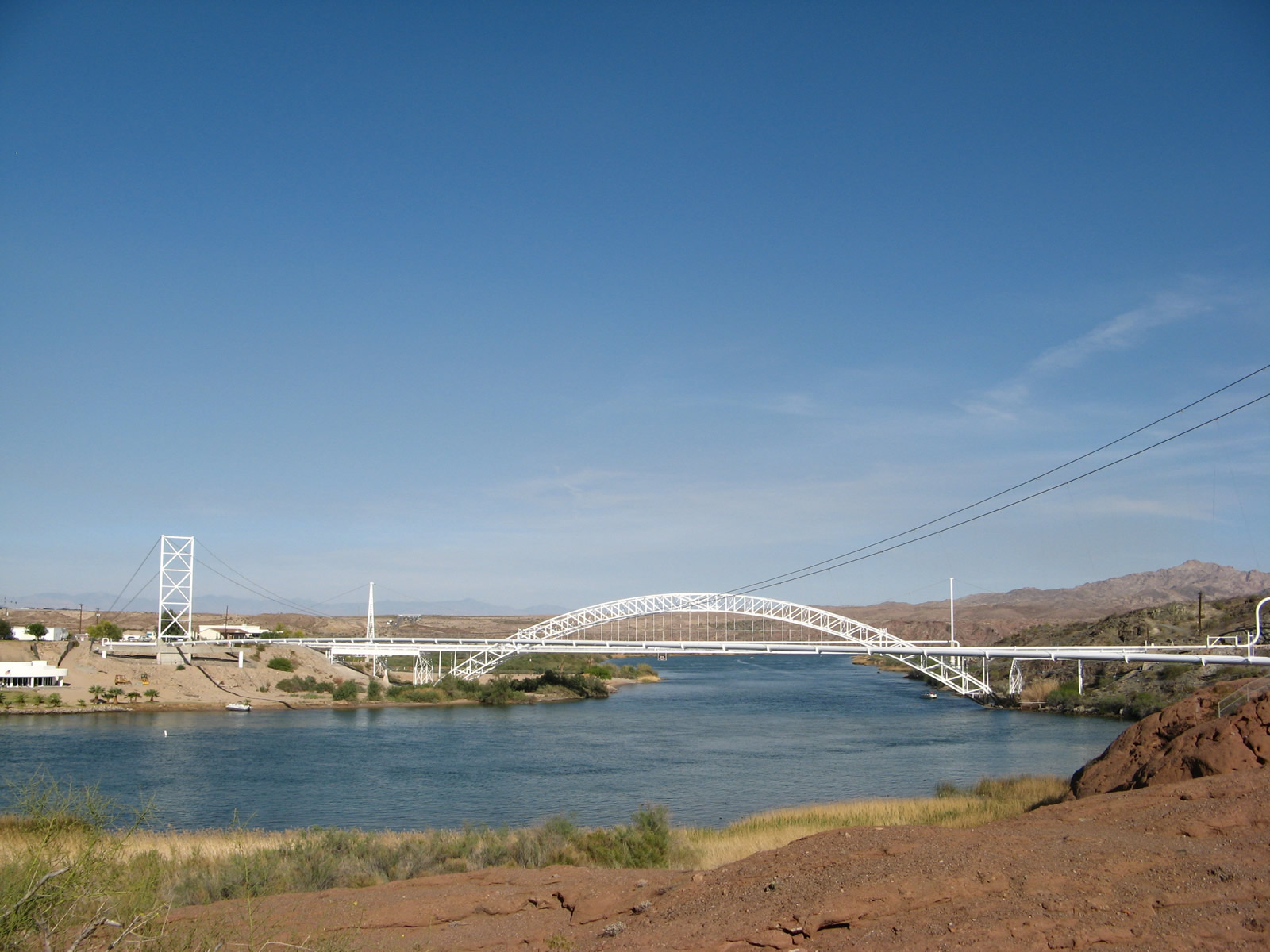
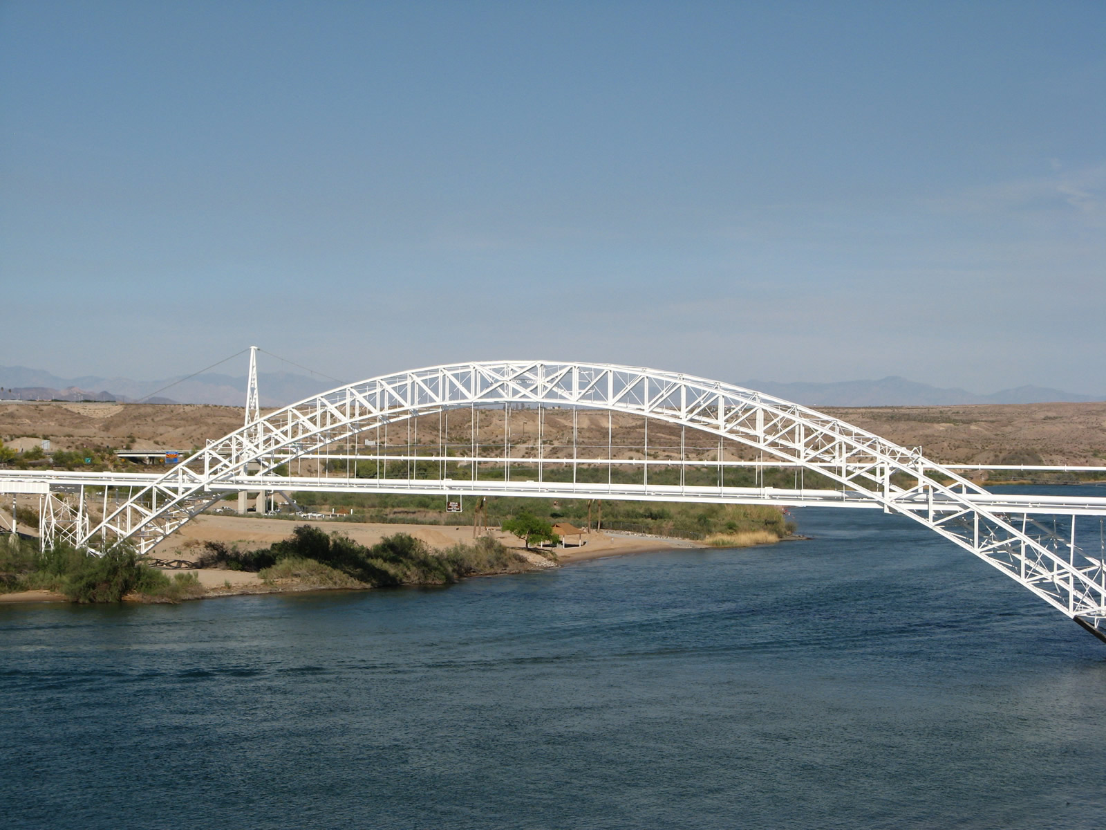
The superstructure for two bridges that carry natural gas pipelines over the Colorado River comes into view as U.S. 66 turns sharply south toward Topock Crossing. Photo taken 04/01/07. |
|
Pavement ends as the old road meets the western ends of the two natural gas bridges. The Old Trails Arch Bridge, which opened to traffic in 1916, used to carry U.S. 66 across the Colorado River. In 1947, the bridge was bypassed and retrofitted to carry a natural gas pipeline over the river. As a result, today it is impossible to cross the Old Trails Arch Bridge with a vehicle. In fact, the bridge is guarded due to the sensitive nature of the pipeline. Photo taken 04/01/07. |
|
|
|
This view looks south along the Colorado River at the two natural gas pipeline bridges. The white through arch bridge, which is the Old Trails Arch Bridge, was built in 1916. In 1947, U.S. 66 was realigned to a through truss bridge (the Red Rocks Bridge), which was dismantled in 1978 (which is 11 years after the opening of the Interstate 40 bridge in 1966-1967). The only way motorists can travel from California to Arizona along the Route 66 corridor today is via Interstate 40. Photos taken 04/01/07. |
|
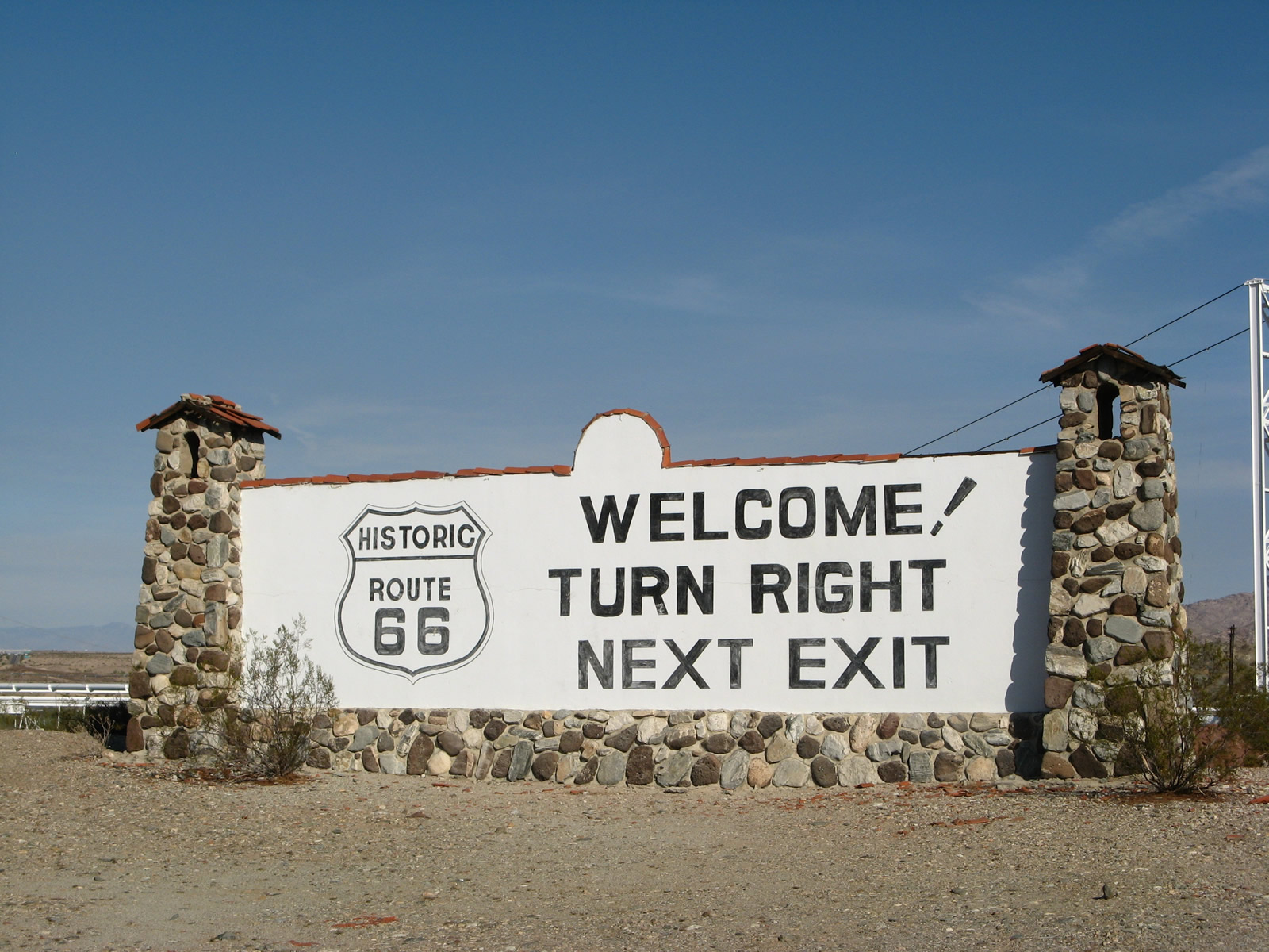
This historic U.S. 66 billboard is located near Park Moabi on the California side of the Colorado River. The billboard faces Interstate 40 traffic at the Colorado River just west of Topock. Photo taken 04/01/07. |
|
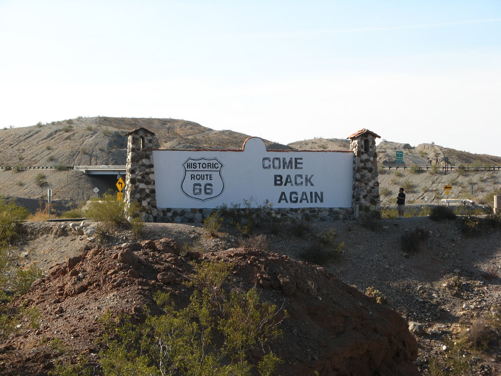
On the reverse side of the same sign is the statement "Come Back Soon" with another U.S. 66 historic shield. Photo taken 04/01/07. |
Page Updated July 24, 2014.