| U.S. 101 north |
|
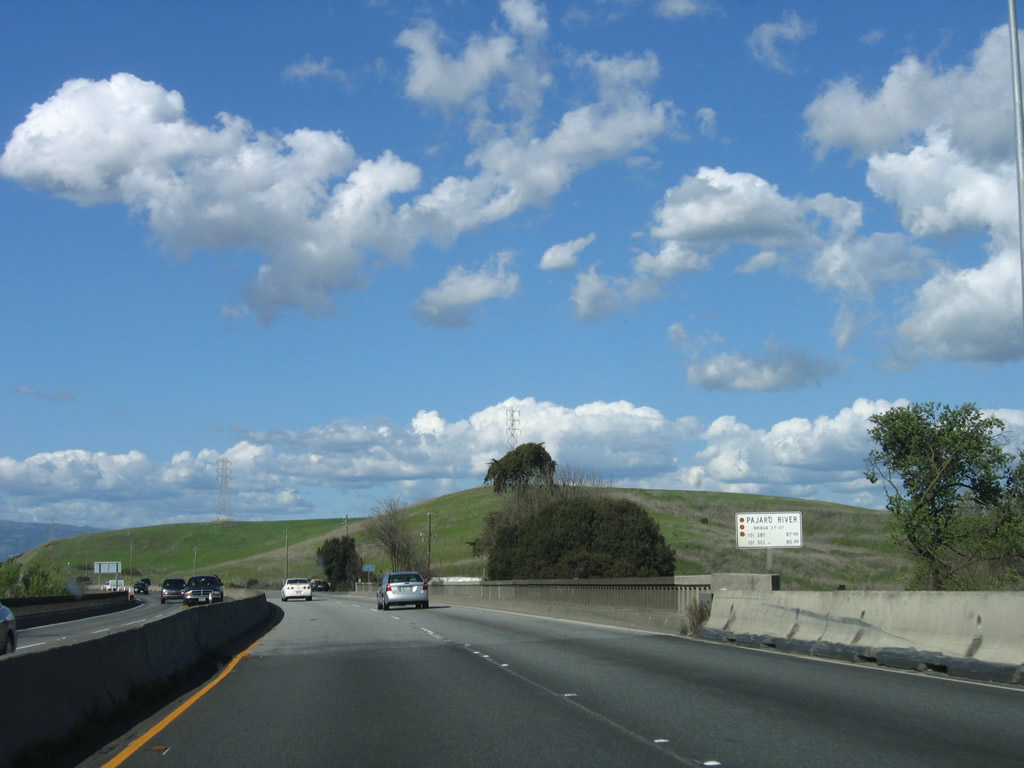
Traveling north on U.S. 101 north, the freeway crosses the Pajaro River, which marks the boundary between San Benito County and Santa Clara County. This bridge was built in 1941. Upon entering Santa Clara County, U.S. 101 also enters the San Francisco Bay Area. Photo taken 03/18/06. |
|
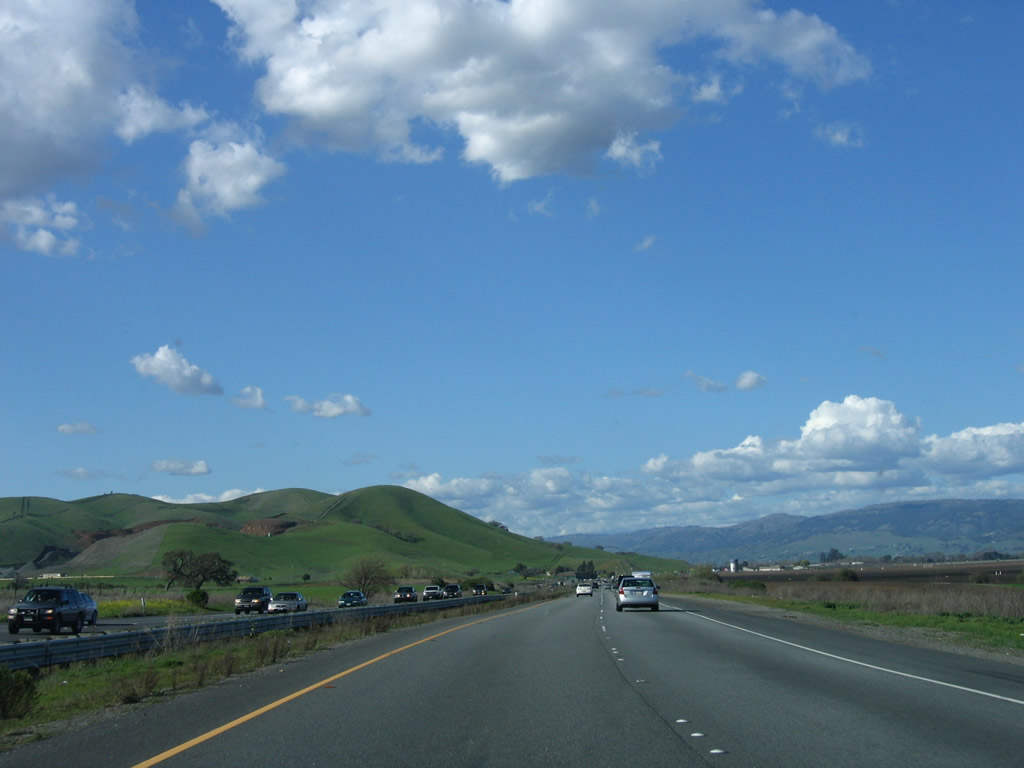
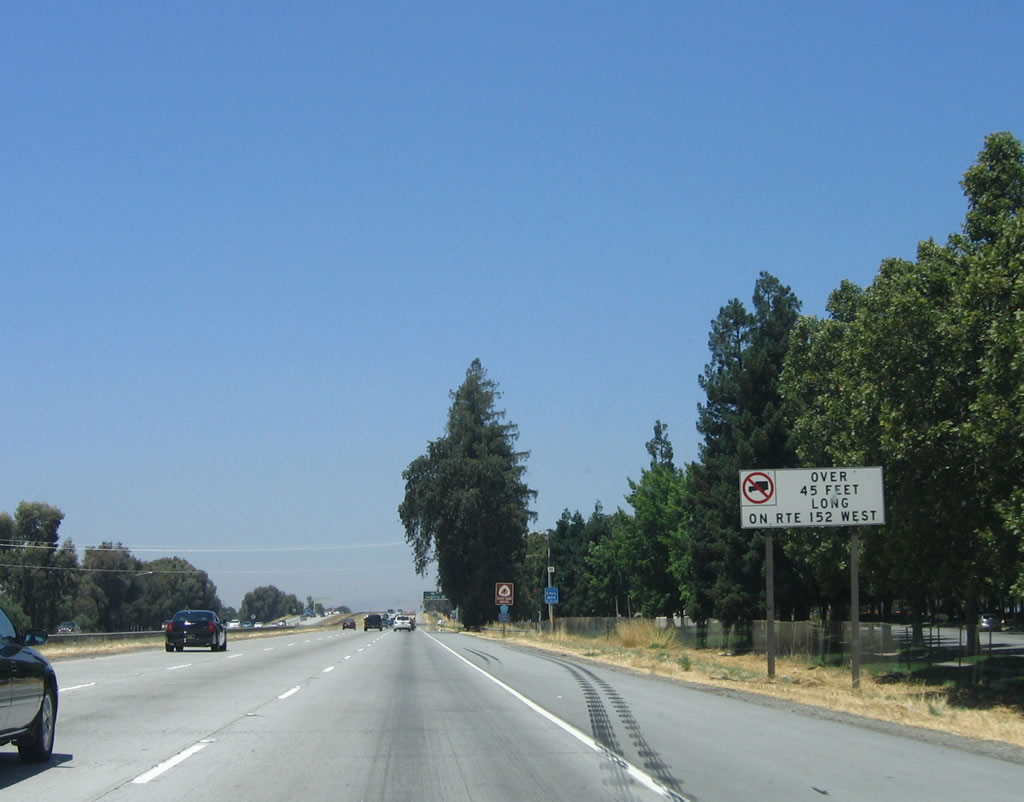
Between the Pajaro River and the southern reaches of Gilroy, U.S. 101 is considered an expressway, but it mostly feels like a freeway. While there is only one at-grade intersection (to Old Monterey Highway for southbound traffic north of the Sargent Overhead) along this section of U.S. 101, this section of highway is placed in along a narrow right of way with a limited left shoulder. Photo taken 03/18/06. |
|
|
The two carriageways of U.S. 101, split prior to the Sargent Overhead structure. Photos taken 03/18/06. |
|
|
The median widens out at this point, compared to the narrow jersey barrier median seen previously. A railroad will pass under the expressway, shifting from the west side to the east side of U.S. 101. Photos taken 03/18/06. |
|
|
The Sargent Overhead was built in 1950 (northbound) and 1970 (southbound) to cross over the railroad tracks. Original bridge railing is seen on the northbound bridge. Photos taken 03/18/06. |
|
Green hills to the west of U.S. 101 are the result of winter rains and spring sunshine. These hills are part of the southern end of the Santa Cruz Mountains that generally parallel the San Andreas fault to the northwest. U.S. 101 continues north into the Santa Clara Valley. An agricultural region, the southern Santa Clara Valley, and especially the area around Gilroy, is known for garlic. Photo taken 03/18/06. |
|
The first exit along U.S. 101 north in Santa Clara County is Exit 353, California 25 south to Hollister. Photo taken 03/18/06. |
|
A U.S. 101 north reassurance shield and a San Juan Bautista de Anza auto tour sign are posted prior to Exit 353, California 25/Bloomfield Avenue. The exit onto California 25 requires a sharp right turn as shown by the yellow diamond warning sign. Photo taken 03/18/06. |
|
Northbound U.S. 101 (El Camino Real) reaches Exit 353, California 25/Bloomfield Avenue south to Hollister. The state route continues south from Hollister generally along the path of the San Andreas Fault until ending at California 198 in the mountains west of Coalinga. Photo taken 03/18/06. |
|
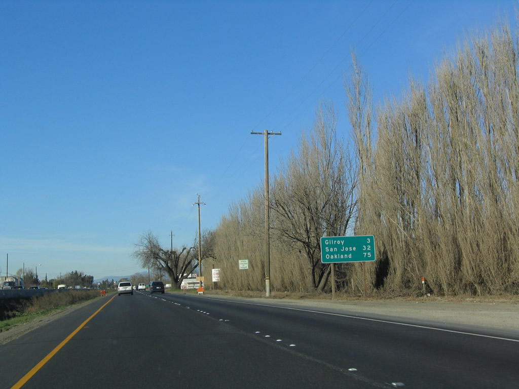
Northbound U.S. 101 approaches Gilroy (two miles), but this section is still considered an expressway due to intersections along the southbound side of U.S. 101 and a few driveways to farms and ranches on the northbound side. The Santa Clara County seat of San Jose is still 32 miles distant, and the control city of San Francisco is omitted in favor of Oakland (via Interstate 880 (Nimitz Freeway) north, 75 miles). Photo taken 12/23/04. |
|
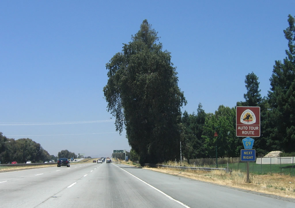
Motorist services are available at each of the next three exits in the city of Gilroy. Photo taken 12/23/04. |
|
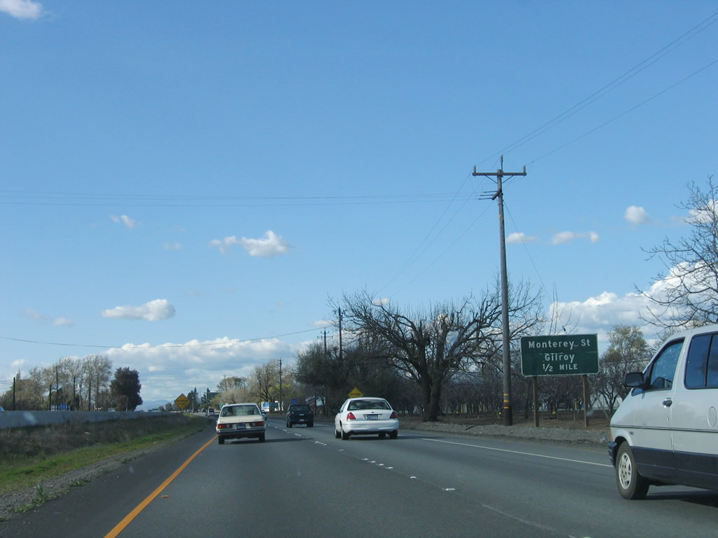
The next exit along U.S. 101 north is Exit 355, U.S. 101 Business (Monterey Street) (El Camino Real) north to Gilroy. After this point, U.S. 101 shifts from an expressway configuration to freeway standards, and it will remain this way for the remaining distance to San Francisco. Photo taken 03/18/06. |
| U.S. 101 (South Valley Freeway) north |
|
Northbound U.S. 101 enters the city of Gilroy, which is the first city within Santa Clara County along the U.S. 101 corridor. Gilroy had a population of 41,464 as of the 2000 Census and is known as the "Garlic Capital of the World." The city was incorporated on March 12, 1870, and it consists of 15.9 square miles. Photo taken 03/18/06. |
|
U.S. 101 Business follows Monterey Street through Gilroy, then changes into the Monterey Highway as it passes through San Martin and the city of Morgan Hill. The business route may end at the Cochrane Road interchange with U.S. 101 (Exit 367) or continue north to the California 82 interchange with U.S. 101 (Exit 378). Either way, signage for the business route is spotty and is perhaps best on the section where U.S. 101 Business overlaps California 152 near downtown Gilroy. Either way, this is one of the longest instances of U.S. 101 Business in California. Photo taken 12/23/04. |
|
Northbound U.S. 101 reaches Exit 355, U.S. 101 Business (Monterey Street) north into Gilroy. Photo taken 12/23/04. |
|
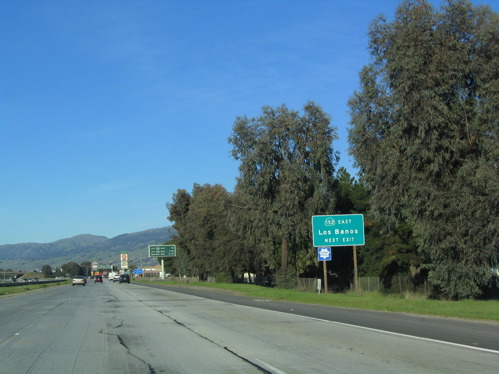
The next exit along U.S. 101 (South Valley Freeway) north is Exit 356, California 152 east (0.75 mile). Photo taken 03/18/06. |
|
California 152 is a major east-west corridor that originates along the coast at California 1/Cabrillo Freeway in the city of Watsonville. The state route meets U.S. 101 in Gilroy, then crosses the Diablo Range at Pacheco Pass and then descends to meet Interstate 5 west of Los Banos. California 152 crosses the Central Valley, ending at California 99 (Golden State Freeway) near Chowchilla in Madera County. Most of the route is up to four-lane, expressway standards, excluding the section west of here and between Interstate 5 and California 156 east of here. California 152 is a major east-west expressway corridor that connects to both Interstate 5 and California 99, thus providing high-speed connections from San Jose, Silicon Valley, and the South Bay with Fresno and Bakersfield. Photo taken 12/23/04. |
|
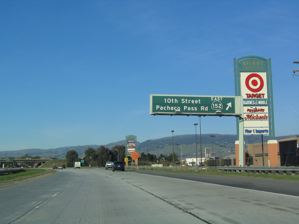
The next three exits along U.S. 101 (South Valley Freeway) are Exit 356, California 152/Tenth Street east to Los Banos and Tenth Street west to Gilroy; Exit 357, California 152 (Leavesley Road) west and Santa Clara County G-9 (Leavesley Road) east; and Exit 360, Masten Avenue. Photo taken 12/23/04. |
|
Use Tenth Street west to downtown Gilroy, where it meets U.S. 101 Business (Monterey Street). California 152 west merges onto U.S. 101 (South Valley Freeway) north. Photo taken 12/23/04. |
|
Northbound U.S. 101 (South Valley Freeway) (El Camino Real) reaches Exit 356, California 152 East to Pacheco Pass and the Central Valley. This exit also connects to Tenth Street west to downtown Gilroy. Photo taken 12/23/04. |
|
The next three exits along U.S. 101 (South Valley Freeway) north are Exit 357, California 152 (Leavesley Road) west and Santa Clara County G-9 (Leavesley Road) east; Exit 360, Masten Avenue; and Exit 362, San Martin Avenue. Photo taken 12/23/04. |
| U.S. 101 (South Valley Freeway) north and California 152 west |
|
U.S. 101 north and California 152 are signed together for their brief shared alignment. Photo taken 07/05/06. |
|
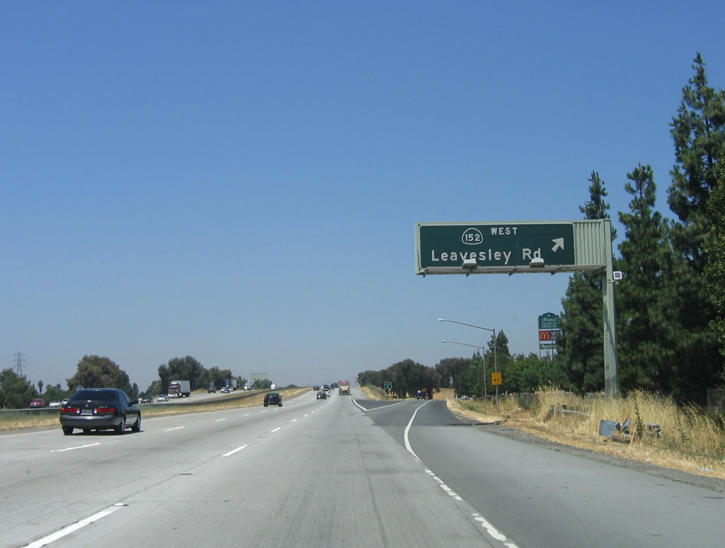
The next exit along U.S. 101 (South Valley Freeway) north is Exit 357, California 152 (Leavesley Road) west to downtown Gilroy and Watsonville (via Hecker Pass). Photo taken 07/05/06. |
|
|
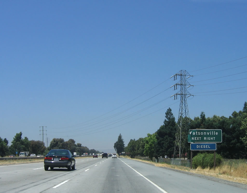
California 152 travels west via Hecker Pass Road to Watsonville on the Pacific coast. The route is somewhat winding and twisting, so trucks are restricted. Photos taken 07/05/06. |
|
Exit 357 connects to California 152 (Leavesley Road) west to downtown Gilroy. In addition, a right turn connects to Santa Clara County G-9 (Leavesley Road) east to Ferguson Road. Santa Clara County G-9 serves as an alternate route for California 152 around Gilroy; it too has truck restrictions. Photo taken 07/05/06. |
|
Northbound U.S. 101 (South Valley Freeway) (El Camino Real) reaches Exit 357, California 152 (Leavesley Road) west to downtown Gilroy and Santa Clara County G-9 east to Ferguson Road (alternate to California 152 east). Photo taken 07/05/06. |
|
Upon exiting from U.S. 101 (South Valley Freeway), the left lane connects to California 152 west to Watsonville. A right turn connects to Santa Clara County G-9 east. Photo taken 07/05/06. |
| U.S. 101 (South Valley Freeway) north |
|
The next exit along U.S. 101 (South Valley Freeway) north is Exit 360, Masten Avenue. Photo taken 12/23/04. |
|
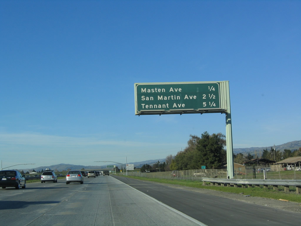
This mileage sign provides the distance to the next three exits along U.S. 101 (South Valley Freeway) north: Exit 360, Masten Avenue; Exit 362, San Martin Avenue; and Exit 365, Tennant Avenue. Photo taken 12/23/04. |
|
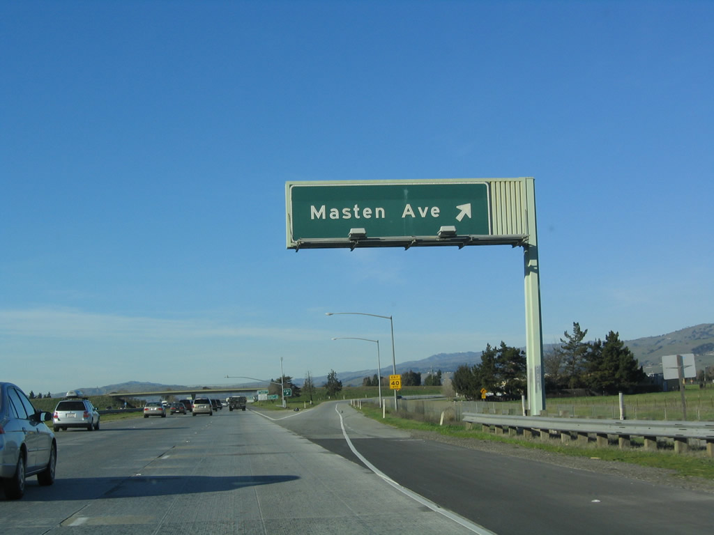
Northbound U.S. 101 (South Valley Freeway) reaches Exit 360, Masten Avenue. By this point, U.S. 101 has left the city of Gilroy and is now passing through unincorporated Santa Clara County. Photo taken 12/23/04. |
|
|
A weigh station is one mile ahead, after the Masten Avenue interchange. In 2004, this was apparently a test site; it seemed to be fully open for business in 2006 (based on the changes in signage). Photos taken 12/23/04 and 03/18/06. |
|
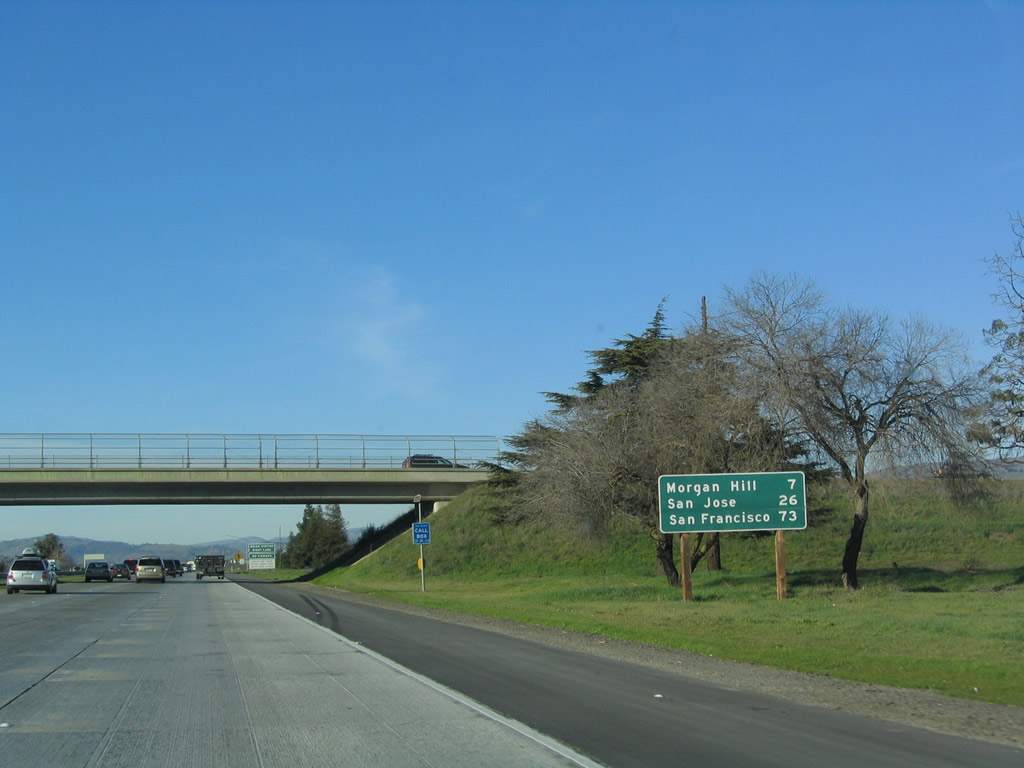
This mileage sign provides the distance to Morgan Hill (seven miles), San Jose (26 miles), and San Francisco (73 miles). Photo taken 12/23/04. |
|
All trucks must enter the weigh station when the facility is open. Photo taken 03/18/06. |
|
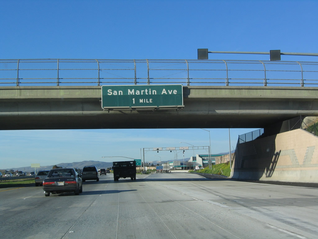
The next exit along U.S. 101 (South Valley Freeway) north is Exit 362, San Martin Avenue to the unincorporated community of San Martin. The off-ramp for the weigh station is located after the overpass. Photo taken 12/23/04. |
|
Northbound U.S. 101 reaches Exit 361, Weigh Station. Note the rainbow of colors reflected in the overhead white signs on the off-ramp to the weigh station. Photo taken 12/23/04. |
|
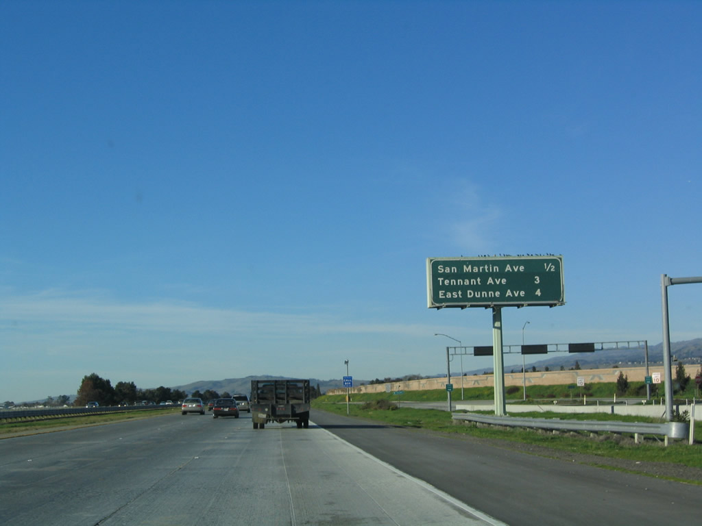
This mileage sign provides the distance to the next three exits along U.S. 101 (South Valley Freeway) north: Exit 362, San Martin Avenue; Exit 365, Tennant Avenue; and Exit 366, East Dunne Avenue. Photo taken 12/23/04. |
|
San Martin is located west of U.S. 101 along U.S. 101 Business (Monterey Highway). The unincorporated community had a population of 4,230 people as of the 2000 Census, and discussions continue about whether the area should incorporate as a city or town. Agriculture is the main commercial activity, although some commute from San Martin to work in San Jose and Silicon Valley. The freeway widens out north of Gilroy to accommodate commuter traffic from southern Santa Clara Valley into the urbanized areas. Photo taken 03/18/06. |
|
Northbound U.S. 101 (South Valley Freeway) reaches Exit 362, San Martin Avenue. Photo taken 12/23/04. |
|
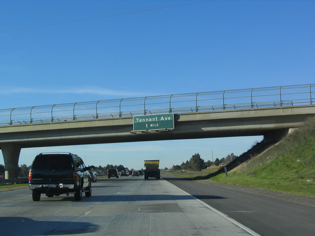
The next exit along U.S. 101 north is Exit 365, Tennant Avenue. Photo taken 12/23/04. |
|
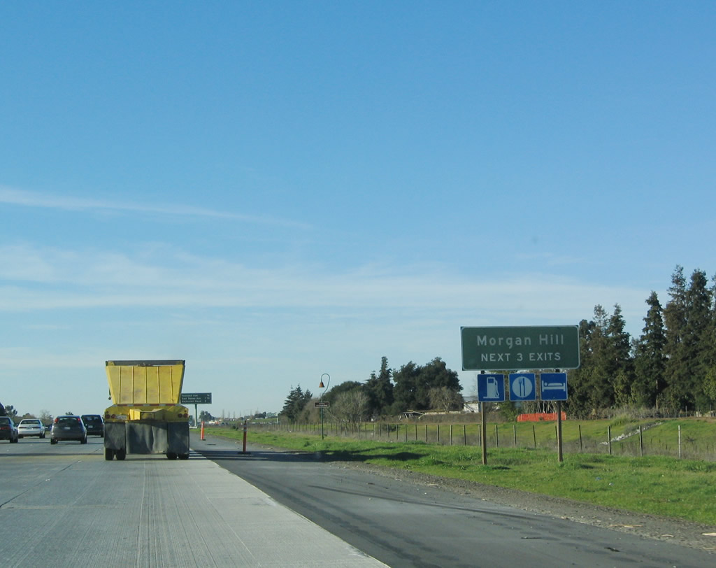
Each of the next three exits along U.S. 101 north serve the city of Morgan Hill. U.S. 101 departs the city of San Jose and enters Morgan Hill, which was incorporated on November 10, 1906, and is home to 33,556 people as of the 2000 Census. Photo taken 12/23/04. |
|
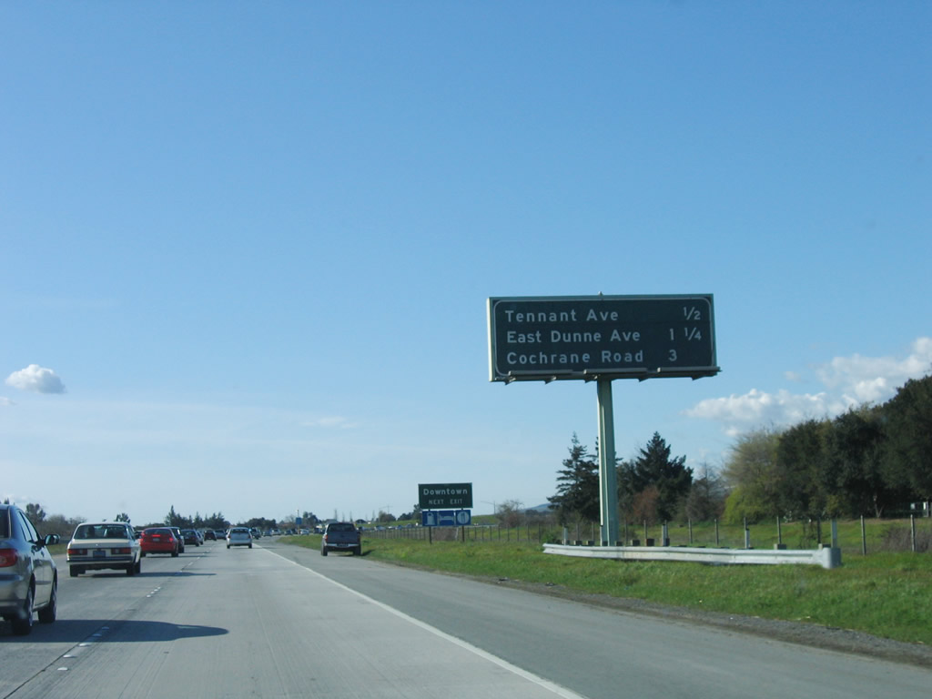
This mileage sign provides the distance to the next three exits along U.S. 101 (South Valley Freeway) north: Exit 365, Tennant Avenue; Exit 366, East Dunne Avenue; and Exit 367, Cochrane Avenue to U.S. 101 Business (Monterey Highway). Photo taken 03/18/06. |
|
Northbound U.S. 101 (South Valley Freeway) reaches Exit 356, Tennant Avenue to downtown Morgan Hill. The next two exits are Exit 366, East Dunne Avenue and Exit 367, Cochrane Avenue to U.S. 101 Business (Monterey Highway). Photo taken 12/23/04. |
|
The next exit along U.S. 101 (South Valley Freeway) north is Exit 366, East Dunne Avenue to Morgan Hill. Photo taken 12/23/04. |
|
Use East Dunne Avenue east to Henry Coe State Park, which is the largest state park in Northern California (over 87,000 acres preserved). Coe State Park is a large open space park situated in the foothills and canyons generally found east of U.S. 101 and along Coyote Creek west of the Diablo Range. Hiking, sightseeing, camping, fishing, and other outdoor activities are all available at this park. Photo taken 03/18/06. |
|
This mileage sign provides the distance to the next three exits along U.S. 101 (South Valley Freeway) north: Exit 366, East Dunne Avenue; Exit 367, Cochrane Avenue to U.S. 101 Business (Monterey Highway); and Exit 371, Coyote Creek Golf Club. Photo taken 12/23/04. |
|
Exit 366 (East Dunne Avenue) also connects to downtown Morgan Hill. Photo taken 03/18/06. |
|
Northbound U.S. 101 (South Valley Freeway) reaches Exit 366, East Dunne Avenue. Photo taken 03/18/06. |
|
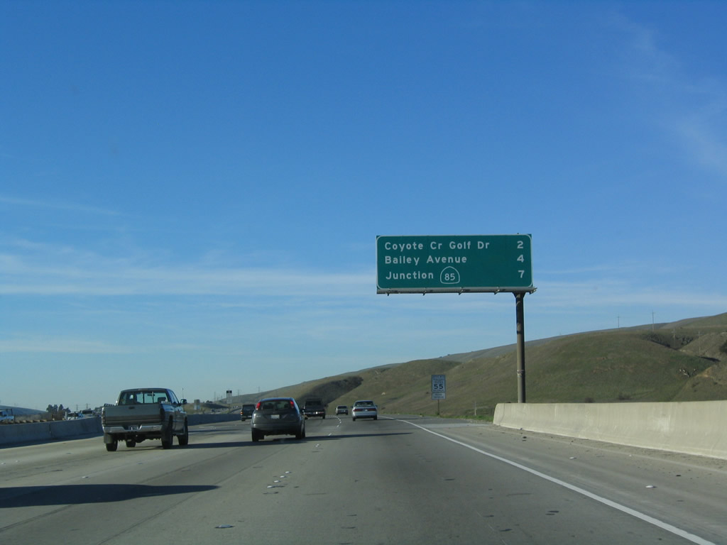
This mileage sign provides the distance to the next two exits along U.S. 101 (South Valley Freeway) north: Exit 367, Cochrane Avenue to U.S. 101 Business (Monterey Highway) Exit 371, Coyote Creek Golf Drive as well as the distance to Exit 377A, California 85 (West Valley Freeway). Omitted from this sign is the Bailey Avenue interchange (Exit 373). Photo taken 03/18/06. |
|
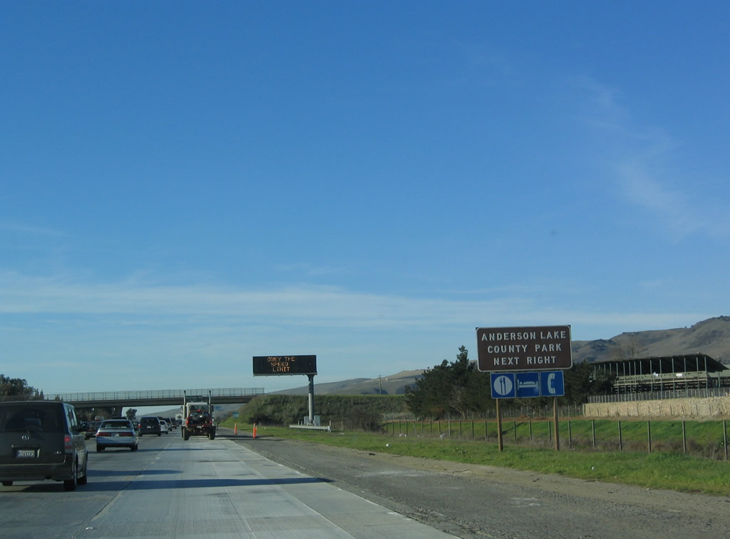
Use Cochrane Avenue east to Anderson County Park, which is located on the west shore of Lake Anderson. The lake is the largest reservoir in Santa Clara County (1,250 surface acres, seven miles long), and a multitude of recreational opportunities abound here, including fishing, hiking, and picnicking. The reservoir is formed along the Coyote Creek, which flows into the Santa Clara Valley from the southeast and travels north before emptying into the lower San Francisco Bay (along with the Guadalupe River. Photo taken 12/23/04. |
|
Cochrane Avenue is the final exit to serve the city of Morgan Hill from U.S. 101 north. It is also the connection between U.S. 101 Business (Monterey Highway) and U.S. 101. It is not clear if Cochrane Avenue is part of the business route or merely a connector between the freeway and business alignments. Photo taken 12/23/04. |
|
An exit number auxiliary sign is posted along U.S. 101 north prior to Exit 367, Cochrane Avenue. Photo taken 12/23/04. |
|
Northbound U.S. 101 (South Valley Freeway) reaches Exit 367, Cochrane Avenue west to Morgan Hill and U.S. 101 Business and east to Lake Anderson. Continue straight ahead to San Jose, Oakland, and San Francisco. Photo taken 12/23/04. |
|
U.S. 101 enters the city of San Jose, which is home to 894,943 people as of the 2000 Census. Founded on November 29, 1777, and incorporated on March 27, 1850, San Jose is the third largest city in California (behind Los Angeles and San Diego). San Jose consists of 178.2 square miles and sits at an elevation of 85 feet. Rainfall in San Jose is much less than San Francisco due to its location at the south end of the San Francisco Bay and enclosure within mountains; it is also less susceptible to foggy conditions that dominate the northern tip of the Peninsula. The average annual precipitation is 14.4 inches. This initial section of San Jose is largely undeveloped, and some of area is preserved in parks, including the Coyote Creek Parkway that parallels the freeway into the city. San Jose is the point for travelers to decide whether to take the Peninsula route north into the city of San Francisco or to bypass the city by way of Oakland or Interstate 680. Through traffic for U.S. 101 north to Eureka may use Interstate 880 to avoid the city of San Francisco, then reconnect to U.S. 101 via Interstate 580 in San Rafael (Marin County). Photo taken 12/23/04. |
|
This mileage sign provides the distance to the next three exits along U.S. 101 (South Valley Freeway) north: Exit 371, Coyote Creek Golf Club; Exit 373, Bailey Avenue; and Exit 377A, California 85 (West Valley Freeway). Photo taken 03/18/06. |
|
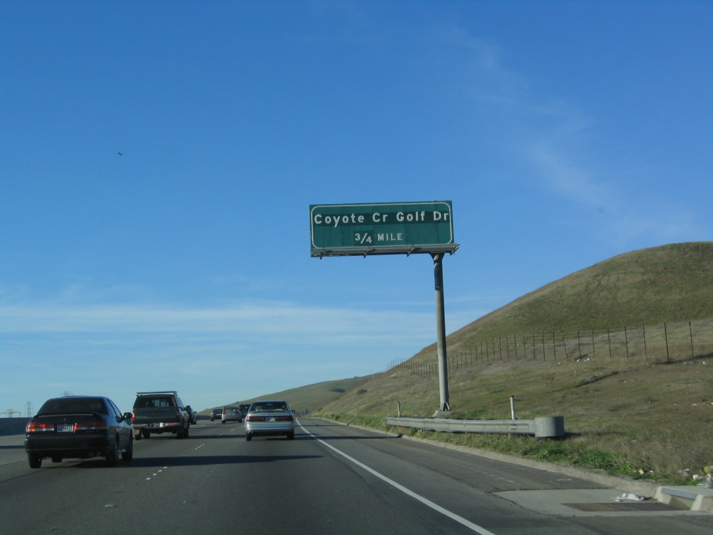
Northbound U.S. 101 (South Valley Freeway) approaches Exit 371, Coyote Creek Golf Drive. This is the first exit of many to serve the city of San Jose. A golf course comes into view on the west side of the freeway as U.S. 101 continues northwest toward San Jose and San Francisco. Photo taken 03/18/06. |
|
A second mileage sign provides the distance to the next three exits along U.S. 101 (South Valley Freeway) north: Exit 371, Coyote Creek Golf Club; Exit 373, Bailey Avenue; and Exit 377A, California 85 (West Valley Freeway). This is placed primarily due to the distance between exits along this section of U.S. 101. Originally, this section of U.S. 101 had two lanes in each direction. In the early 2000s, two additional lanes were added in each direction. One of these new lanes functions as a high occupancy vehicle lane during commuting hours, and the other lane is a general purpose lane. Commuting traffic along U.S. 101 increased dramatically with the dot com and housing boom of the late 1990s and early-mid 2000s. Traffic in and out of Silicon Valley remains a major concern for San Jose residents and visitors alike. Photo taken 03/18/06. |
|
Northbound U.S. 101 (South Valley Freeway) reaches Exit 371, Coyote Creek Golf Drive. A pair of power lines (230kV and 138kV) crosses over U.S. 101 at this point; they will lead to the Metcalf substation. This substation is located a few miles north of here alongside the freeway. Photo taken 03/18/06. |
|
The next exit along U.S. 101 (South Valley Freeway) is Exit 373, Bailey Avenue. This interchange was built in the early 2000s to accommodate traffic generated from a new development along Coyote Creek. The homes are visible along the west side of U.S. 101. Photo taken 03/18/06. |
|
Northbound U.S. 101 (South Valley Freeway) reaches Exit 373, Bailey Avenue. This is the second interchange to serve the city of San Jose, even though the area does not look much like an urbanized area. Photo taken 03/18/06. |
|
|
|
U.S. 101 approaches the Metcalf Substation. At Metcalf, several 230kV, 138kV, and 69kV power lines connect with the Path 15 500kV system, which interconnects power transmission across the state of California. The 500kV power line from Moss Landing Power Generating Station has paralleled U.S. 101 since leaving the Salinas Valley, and it will cross over U.S. 101 shortly to return to the Central Valley segment of Path 15 500kV power line at the Tesla substation south of Tracy. Photos taken 12/23/04 and 03/18/06. |
|
|
|
|
|
The Path 15 500kV power line passes over U.S. 101. A notice of completion for the reconfigured U.S. 101 and California 85 interchange ("We Deliver") is posted in 2004, but the sign was gone by 2006. Photos taken 12/23/04 and 03/18/06. |
|
The next exit along U.S. 101 (South Valley Freeway) is Exit 377A, California 85 (West Valley Freeway). This is a major interchange and has two transition ramps, one for general traffic (exit right) and a left exit for high occupancy vehicles. This configuration debuted in 2004; construction was overseen by the Santa Clara Valley Transportation Authority (VTA), which oversees all transportation projects in the San Jose area. Photo taken 03/18/06. |
|
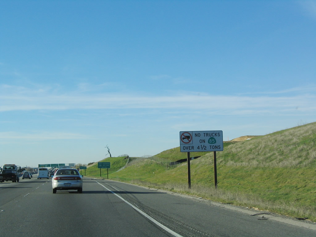
No trucks are permitted along California 85; this was a condition that allowed the freeway to be constructed. Photo taken 12/23/04. |
|
California 85 is a freeway for its entire length. Originating in southern San Jose, the freeway travels west to Los Gatos, Campbell, and Saratoga, then turns north to serve Cupertino, Sunnyvale, and Mountain View. At the north end, California 85 merges back onto U.S. 101 north. In effect, U.S. 101 and California 85 offer alternate routes between U.S. 101 Exits 377 and 398. For traffic en route to downtown San Jose, use either U.S. 101 north to Interstate 280 north (west) or California 85 north (west) to California 87 north. Photo taken 12/23/04. |
|
The second exit after the ramp to California 85 (Exit 377A) is the ramp to Bernal Road and Silicon Valley Boulevard (Exit 377B). Photo taken 12/23/04. |
|
The right two lanes of U.S. 101 north connect to California 85 (West Valley Freeway) AND the left lane connects to California 85 north via a high occupancy lane (HOV) carpool connector. Both of these ramps are considered part of Exit 377A. The next exit after the California 85 connection is Exit 377B, Bernal Road and Silicon Valley Boulevard. Through traffic to San Francisco is encouraged to remain on U.S. 101 north. Photo taken 03/18/06. |
|
Northbound U.S. 101 reaches Exit 377A, California 85 (West Valley Freeway) (right exit for general traffic and left exit for high occupancy vehicles such as carpools). No trucks may use California 85; trucks should remain on U.S. 101 north. The next exit is Exit 377B, Silicon Valley Boulevard and Bernal Road. At this point, U.S. 101 shifts from the South Valley Freeway to the Bayshore Freeway. Photo taken 03/18/06. |
| U.S. 101 (Bayshore Freeway) north |
|
The next three exits along U.S. 101 (Bayshore Freeway) north are Exit 377B, Silicon Valley Boulevard and Bernal Road; Exit 378, California 82 (Monterey Highway) north, Santa Clara County G-10 (Blossom Hill Road) west; U.S. 101 Business (Monterey Highway) south; and Silver Creek Valley Road east; and Exit 380, Hellyer Avenue. Photo taken 03/18/06. |
|
Northbound U.S. 101 (Bayshore Freeway) reaches Exit 377B, Silicon Valley Boulevard and Bernal Road. Use Bernal Road southwest to Santa Teresa County Park, which is an open space park located in the Santa Teresa Hills. Photo taken 03/18/06. |
|
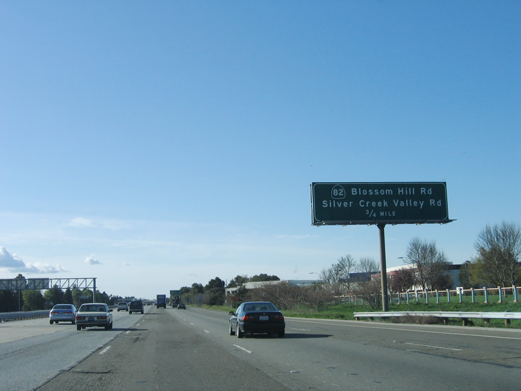
The next exit along U.S. 101 (Bayshore Freeway) north is Exit 378, California 82 (Monterey Highway) north, Santa Clara County G-10 (Blossom Hill Road) west; U.S. 101 Business (Monterey Highway) south; and Silver Creek Valley Road east. The connection to Monterey Highway north and south is made via Blossom Hill Road west; U.S. 101 does not intersect with Monterey Highway directly. California 82 departs the freeway at this interchange, follows Blossom Hill Road west briefly, then turns north onto Monterey Highway north. From this point north to San Francisco, California 82 follows the original alignment of U.S. 101 before the "Bypass U.S. 101" alignment was created along the Bayshore Highway (eventually Bayshore Freeway) corridor in the 1930s. California 82 is generally considered to be El Camino Real from here north to San Francisco; U.S. 101 is now the Bayshore Freeway. Photo taken 03/18/06. |
|
The next three exits along U.S. 101 (Bayshore Freeway) north are Exit 378, California 82 (Monterey Highway) north, Santa Clara County G-10 (Blossom Hill Road) west; U.S. 101 Business (Monterey Highway) south; and Silver Creek Valley Road east; Exit 380, Hellyer Avenue; and Exit 381, Yerba Buena Road. Photo taken 12/23/04. |
|
Northbound U.S. 101 (Bayshore Freeway) reaches Exit 378, California 82 (Monterey Highway) north, Santa Clara County G-10 (Blossom Hill Road) west; U.S. 101 Business (Monterey Highway) south; and Silver Creek Valley Road east. Santa Clara County G-10 travels west from this interchange through southern San Jose along Blossom Hill Road, then enters Los Gatos before ending at the Saratoga Avenue interchange with California 9 and California 17 in western Los Gatos. Photo taken 12/23/04. |
|
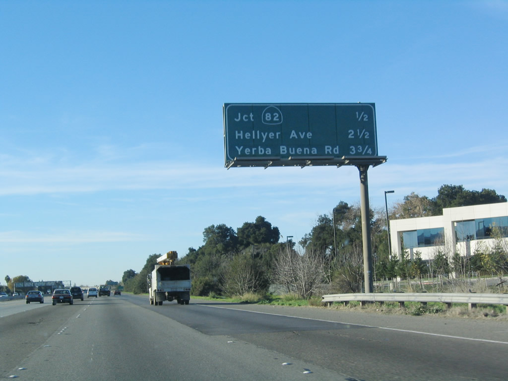
The next three exits along U.S. 101 (Bayshore Freeway) north (shown on this interchange sequence sign) are Exit 380, Hellyer Avenue; Exit 381, Yerba Buena Road; and Exit 382, Santa Clara County G-21 (Capitol Expressway). All of these exits serve the city of San Jose. Photo taken 12/23/04. |
|
A second mileage sign provides the distance to Redwood City (seat of San Mateo County, 33 miles via U.S. 101), Oakland (50 miles via Interstate 880), and San Francisco (57 miles via U.S. 101). Photo taken 12/23/04. |
|
|
The next exit along northbound is Exit 380, Hellyer Avenue. The sign for this interchange suffered somewhat between 2004 and 2006; a small "NEXT EXIT" add-on sign was posted below the remaining top half of the sign. Photos taken 12/23/04 and 03/18/06. |
|
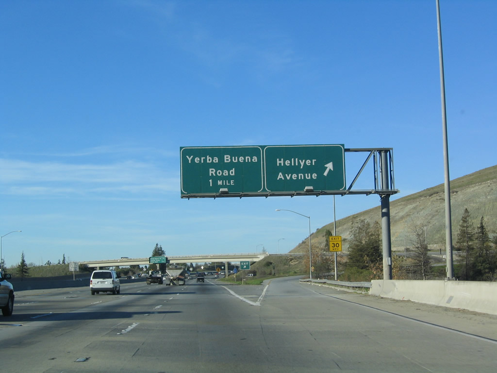
After crossing over Coyote Creek and its adjacent parkway, northbound U.S. 101 (Bayshore Freeway) reaches Exit 380, Hellyer Avenue. The next exit is Exit 381, Yerba Buena Road. Photo taken 12/23/04. |
|
The next three exits along U.S. 101 (Bayshore Freeway) north (shown on this interchange sequence sign) are Exit 381, Yerba Buena Road; Exit 382, Santa Clara County G-21 (Capitol Expressway); and Exit 383, Tully Road. All of these exits serve the city of San Jose. Photo taken 03/18/06. |
|
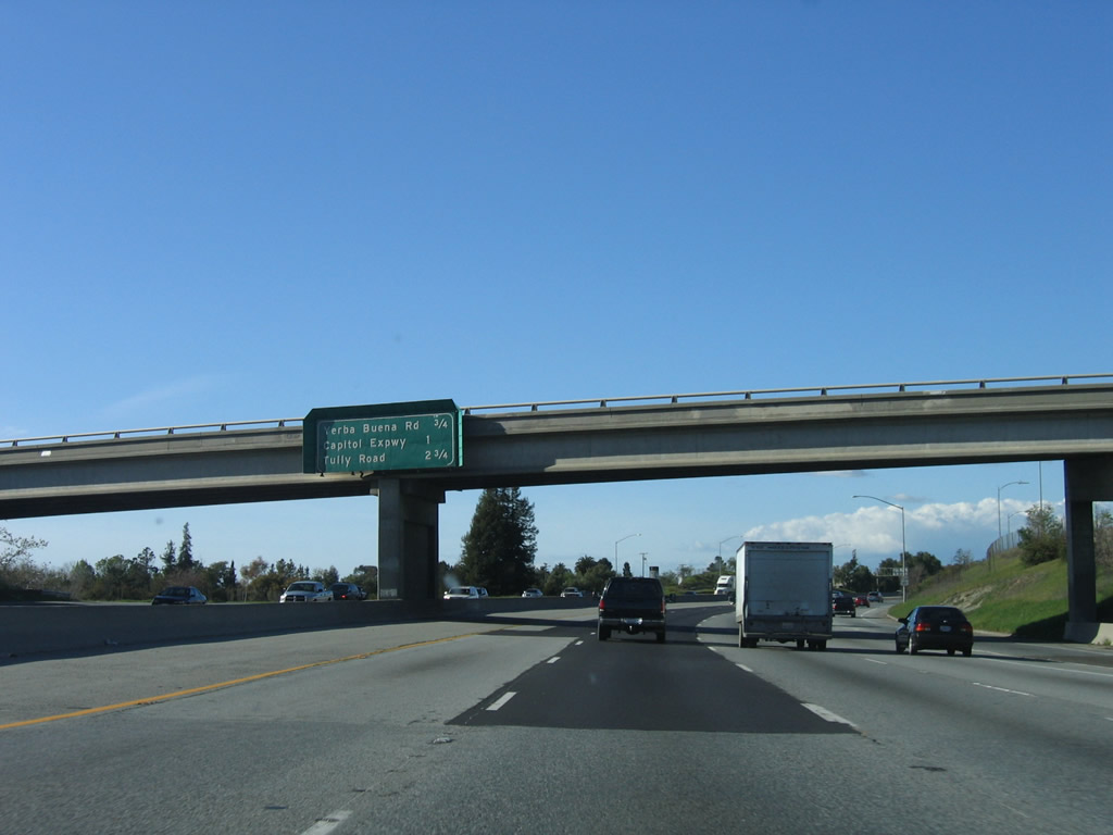
After Exit 381, Yerba Buena Road, the next exit along northbound U.S. 101 is Exit 382, Santa Clara County G-21 (Capitol Expressway). Use Capitol Expressway east to the Evergreen district of San Jose and Lake Cunningham Park (which is adjacent to a Raging Waters theme park). This county road is mostly unsigned, although some maps show it as G-21. Photo taken 12/23/04. |
|
Northbound U.S. 101 (Bayshore Freeway) reaches Exit 381, Yerba Buena Road. The next exit is Exit 382, Santa Clara County G-21 (Capitol Expressway). Photo taken 12/23/04. |
|
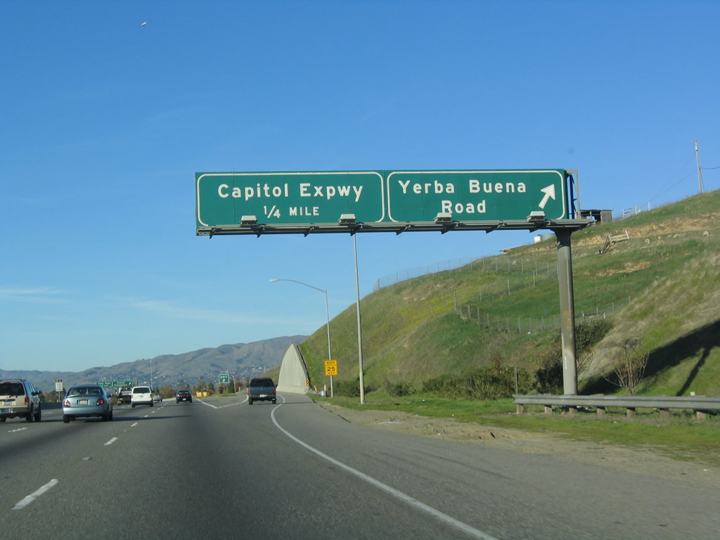
Immediately thereafter, northbound U.S. 101 (Bayshore Freeway) reaches Exit 382, Santa Clara County G-21 (Capitol Expressway). Use the Capitol Expressway north as an alternate route to Interstate 680 (Sinclair Freeway) north. To the west, the Capitol Expressway connects with California 87 at Exit 1 and transitions onto Hillsdale Avenue, which travels west to Cambrian Park and eventually Santa Clara County G-4 (San Tomas Expressway) and California 17 Exit 23. Photo taken 12/23/04. |
|
The interchange with Santa Clara County G-21 (Capitol Expressway) is a modified cloverleaf, and this signage is present on the collector distributor lane for Exit 382. Photo taken 12/23/04. |
Page Updated March 5, 2008.