U.S. 101 has a variety of identities as it passes through the city and county of San Francisco. Entering the city as a freeway, it quickly becomes a city street, since no freeways cross the city from south to north. U.S. 101 follows the remnants of the Central Freeway (portions were irreparably damaged as a result of the 1989 Loma Prieta Earthquake), Van Ness Avenue, and Lombard Street.
Avoiding most of the tourist attractions such as the Embarcadero, Pier 39, Ghiradelli Square, downtown San Francisco, Ocean Beach, and Golden Gate Park, the highway does pass through some very neat sections of the city. Look for Tommy's Joynt on the west side of Van Ness Avenue - it is a famous restaurant and hang out for a multitude of famous San Franciscans. In addition, U.S. 101 enters the scenic Presidio, now part of Golden Gate National Park. But the most picturesque section of U.S. 101 is still ahead, straddling San Francisco and Marin Counties: the Golden Gate Bridge. This bridge is a well-known fixture, visible on many movies that are filmed in San Francisco. Unlike many similar bridges, pedestrians may walk along the Golden Gate Bridge, which any visitor should walk at least once.
| U.S. 101 (James Lick Freeway) north |
|
The Bayshore Freeway changes into the James Lick Freeway as U.S. 101 enters the city and county of San Francisco. Home to 776,733 as of the 2000 Census, a 2006 estimate indicates that San Francisco has lost people (estimate of 744,041 people in 2006 per State & County QuickFacts for San Francisco City / County. This may be due to the impacts of the "dot com" bust that occurred earlier this decade. San Francisco is notable for its unique geography, with at least 50 hills within city limits. A combined city and county, San Francisco includes several islands (such as Alcatraz, Yerba Buena Island, and distant Farallon Islands to the west). The city has plenty of distinct and unique neighborhoods, and the city is one of the most densely populated cities in California. Comparably spread out San Jose to the south has more people than San Francisco but also a lot more land. Photo taken 03/19/06. |
|
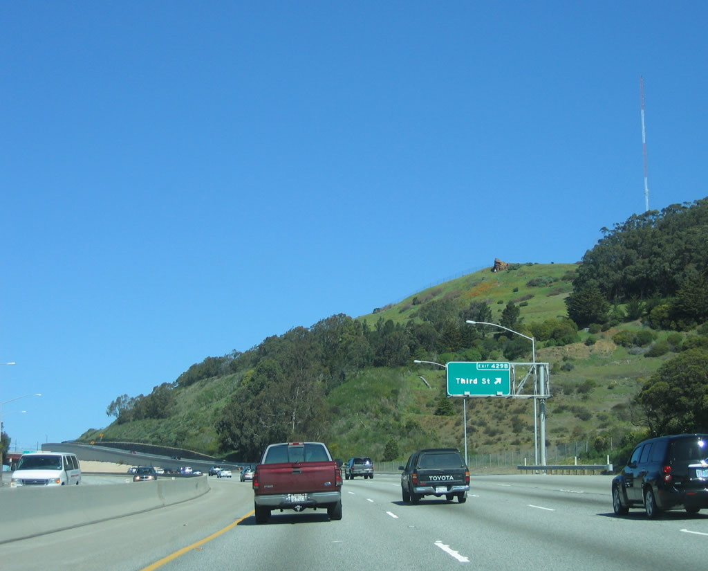
Northbound U.S. 101 (James Lick Freeway) reaches Exit 429B, Third Street. Third Street travels north into the Bayview district, then proceeds past Potrero Hill neighborhood to Mission Bay and South Beach. Due to its location on a peninsula surrounded by the Pacific Ocean, Golden Gate, and San Francisco Bay, fog is common especially in summer months when colder oceanic area collides with hot dry air from inland (Central Valley). The city also sits near the San Andreas Fault, which spans the state of California and is capable of producing a large-scale earthquake. San Francisco was founded in 1776 and incorporated on April 15, 1850. The city is home to a large minority population (including immigrants) and is likely the most densely populated city in California. Photo taken 03/19/06. |
|
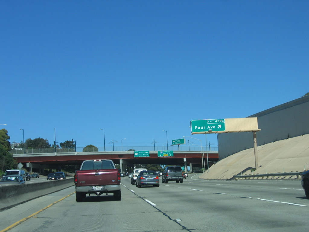
The next exit along northbound U.S. 101 (James Lick Freeway) is Exit 429C, Paul Avenue. Photo taken 03/19/06. |
|
Northbound U.S. 101 (James Lick Freeway) reaches Exit 429B, Third Street. Photo taken 03/19/06. |
|
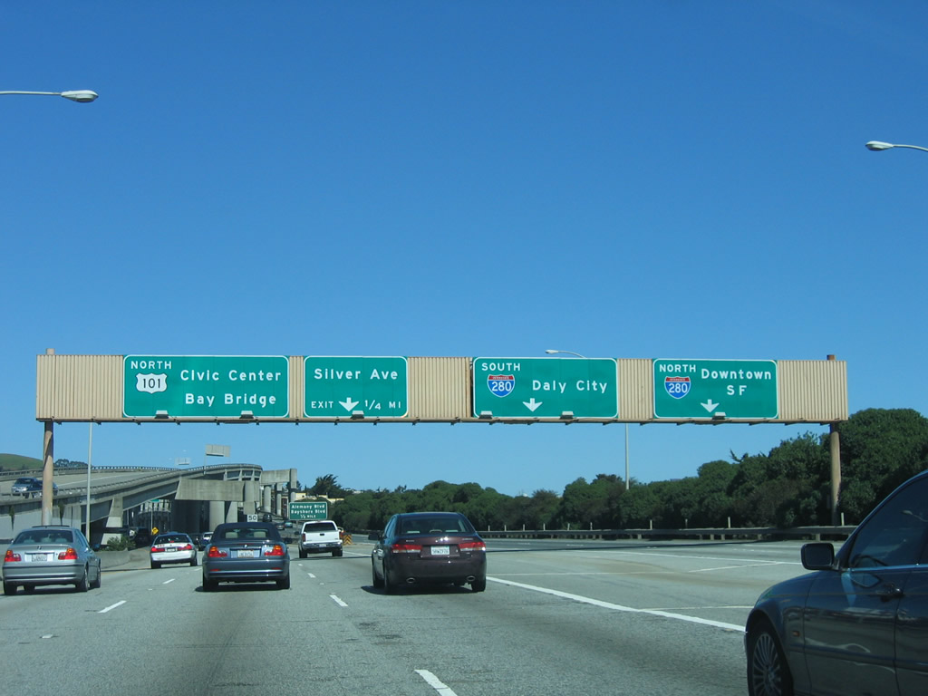
The next exit along northbound U.S. 101 (James Lick Freeway) is Exit 430A, Interstate 280 north to the Port of San Francisco and south to Daly City and Pacifica. Photo taken 03/19/06. |
|
This mileage sign on northbound U.S. 101 (James Lick Freeway) provides the distance to the next three exits: Exit 430A, Interstate 280 north to the Port of San Francisco and south to Daly City and Pacifica; Exit 430B, Silver Avenue; and Exit 432, Cesar Chavez Street (former Army Street). Photo taken 03/19/06. |
|
The right two lanes of U.S. 101 (James Lick Freeway) north become exit only for Exit 430A, Interstate 280 north to the Port of San Francisco and south to Daly City and Pacifica. The left three lanes continue north on U.S. 101 (James Lick Freeway). Note the use of a state-named Interstate 280 shield on this overhead; it has been in place for most of this decade (and thus one of the first reflective signs to be placed in San Francisco). Photo taken 03/19/06. |
|
Northbound U.S. 101 (James Lick Freeway) reaches Exit 430A, Interstate 280 north to the Port of San Francisco and south to Daly City and Pacifica. Use the right lane for the connection to northbound Interstate 280, which ends near AT&T Park (home of the San Francisco Giants). The next exit is Exit 430B, Silver Avenue, followed by Exit 431, Alemany Boulevard and Bayshore Boulevard. Photo taken 03/19/06. |
|
The next exit along northbound U.S. 101 (James Lick Freeway) is Exit 430B, Silver Avenue followed by Exit 431, Alemany Boulevard and Bayshore Boulevard. Photo taken 03/19/06. |
|
Northbound U.S. 101 (James Lick Freeway) reaches Exit 430B, Silver Avenue. Photo taken 03/19/06. |
|
The connection between U.S. 101 (James Lick Freeway) and Interstate 280 (Southern Freeway) is via a double-decked freeway connecting ramp. Photo taken 03/19/06. |
|
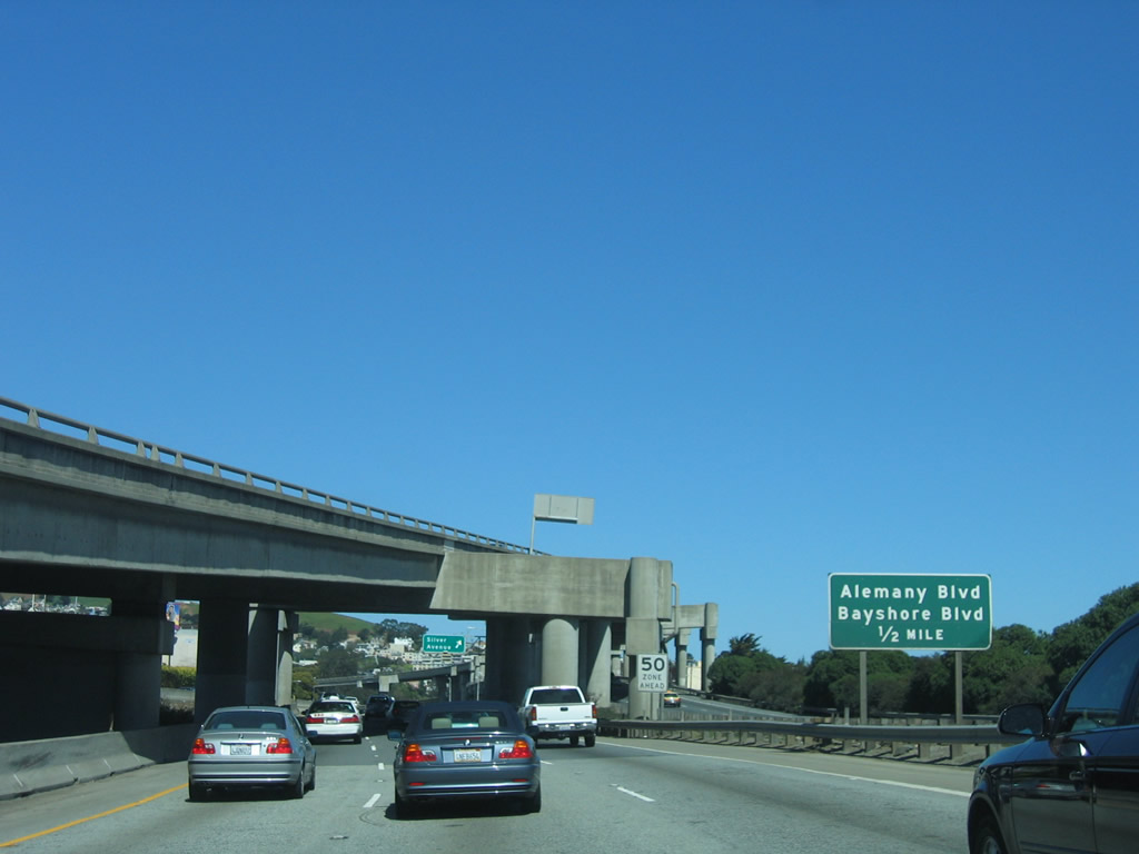
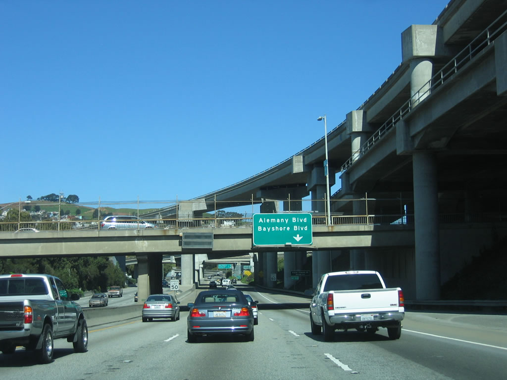
The next exit along U.S. 101 (James Lick Freeway) north is Exit 431, Alemany Boulevard and Bayshore Boulevard. Photo taken 03/19/06. |
|
After Exit 431, Alemany Boulevard and Bayshore Boulevard, the ensuing interchange is with Exit 432, Cesar Chavez Street. The ramps connecting U.S. 101 with Interstate 280 cast a shadow on the below-grade U.S. 101 freeway. Photo taken 03/19/06. |
|
Northbound U.S. 101 (James Lick Freeway) reaches Exit 431, Alemany Boulevard and Bayshore Boulevard. Photo taken 03/19/06. |
|
The first indication that U.S. 101 is approaching the western end of Interstate 80 is this mileage sign, which is 2.25 miles south of the split. There are two intervening exits: Exit 432, Cesar Chavez Street and Exit 433A, Vermont Street. Photo taken 03/19/06. |
|
A retrofit brace helps support the connecting ramp from Interstate 280 north to U.S. 101 north. Photo taken 03/19/06. |
|
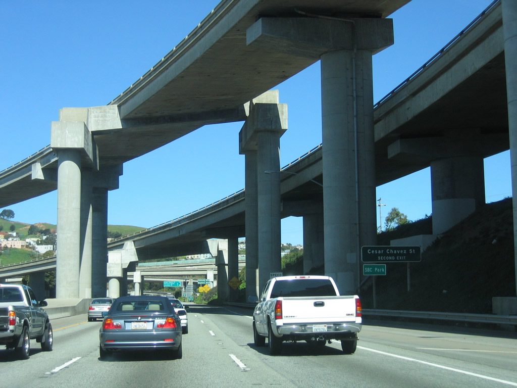
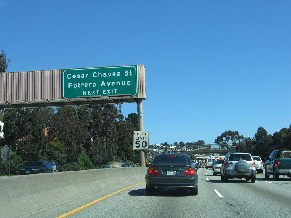
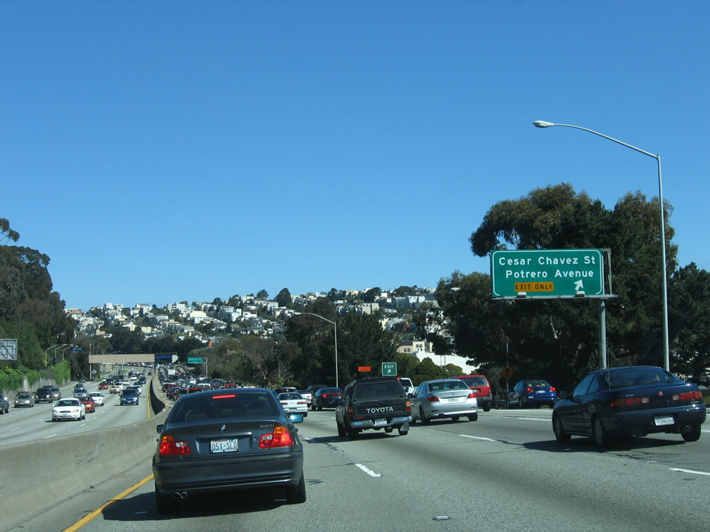
The right lane becomes exit only for Exit 432, Cesar Chavez Street and Potrero Avenue. This exit is a high-speed connection, and it serves the Potrero Hill community. Photo taken 03/19/06. |
|
Potrero Avenue travels north on a path parallel to U.S. 101 from this interchange north to the U.S. 101/Interstate 80 interchange. Use this exit to San Francisco General Hospital, which is located on the east side of Potrero Avenue. This exit also serves as the connection to Cesar Chavez Street, which used to be named Army Street until renamed in honor of the civil rights leader. Photo taken 03/19/06. |
|
An arched pedestrian bridge crosses U.S. 101 north prior to the Potrero Avenue exit. Photo taken 03/19/06. |
|
Northbound U.S. 101 (James Lick Freeway) reaches Exit 432, Potrero Avenue and Cesar Chavez Street. Photo taken 03/19/06. |
|
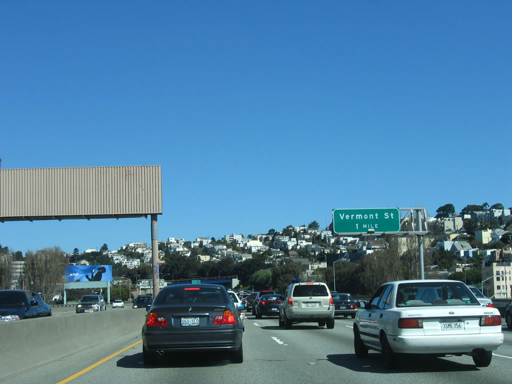
The next exit on U.S. 101 north is Exit 433A, Vermont Street (one mile). Photo taken 03/19/06. |
|
Vermont Avenue is another north-south city street that parallels U.S. 101 on the east side of the freeway. Serving the Potrero Hill neighborhood, Exit 433A also connects to Mariposa Street east. Photo taken 03/19/06. |
|
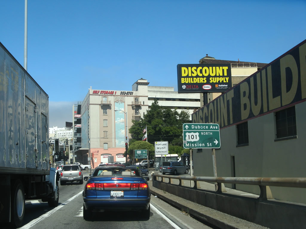
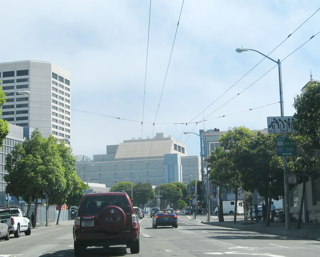
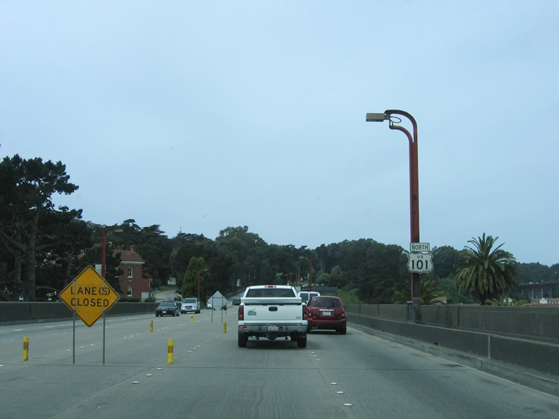
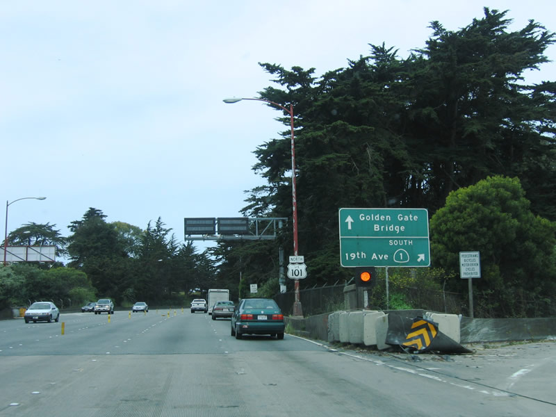
This yellow sign, which features language normally reserved for state routes that cross mountain passes or feature lots of curves, tells the story of U.S. 101 northbound: It departs from the freeway system at Seventh Street, and it follows Seventh Street to Van Ness Avenue, a major route through the city. Van Ness Avenue is six lanes wide, but nearly every major intersection is governed by a traffic signal and is very busy. Trucks are not advised on Van Ness Avenue. Through traffic to the Golden Gate Bridge should take U.S. 101/Van Ness Avenue (or California 1 (19th Avenue) if possible), but it may be full of traffic at any time. Photo taken 03/19/06. |
|
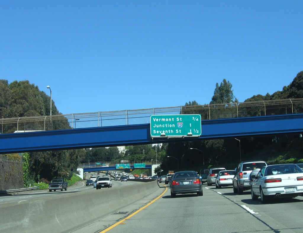
Northbound U.S. 101 reaches its final exit prior to the Interstate 80 split: Exit 433A, Vermont Avenue. After this off-ramp, we approach the Interstate 80 split. Even though the signs say that U.S. 101 follows the Seventh Street exit, it really continues silently onto the Central Freeway stub. In order to reduce traffic flowing onto the Central Freeway stub, the signs now point to Seventh Street as an alternative. Photo taken 03/19/06. |
| Transition from Interstate 80 west to U.S. 101 (Central Freeway) north |
|
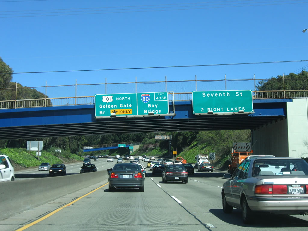
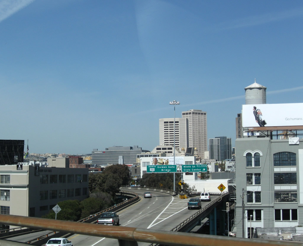
After the Interstate 80 interchange, northbound U.S. 101 shifts onto the Central Freeway and meets Exit 433C, Ninth Street and San Francisco Civic Center. The left two lanes will continue north briefly on the freeway, then depart onto Mission Street and Van Ness Avenue with the destination of Golden Gate Bridge. (This view is seen from the transition ramp from Interstate 80 west to U.S. 101 north.) Photo taken 04/06/09. |
|
Leaving the U.S. 101/Interstate 80 interchange, this ramp leads from Interstate 80 west to U.S. 101 north. This ramp will connect with mainline U.S. 101 (Central Freeway) ahead. U.S. 101 will continue north for its brief length, until U.S. 101 departs the brief freeway at Exit 434A. The Central Freeway was originally planned to carry Interstate 80 west to Golden Gate Park, where the Interstate would have ended at California 1 along the Fell Street/Oak Street corridor. That freeway was canceled along with most other unconstructed freeways planned within the city limits of San Francisco. With the cancellation, Interstate 80 was truncated to its current terminus, and only a short section of the Central Freeway built. However, maps indicate that Interstate 80 was signed briefly on the Central Freeway for a time in the mid-1960s. When the city/county of San Francisco eliminated most new freeway additions in January 1959 with the passage of a resolution eliminating many unconstructed freeway segments within San Francisco, Interstate 80 was truncated off the Central Freeway in 1965 by the federal government and by the state of California in 1968. Photo taken 07/06/07. |
|
This view is also on the transition ramp from Interstate 80 west to U.S. 101 north. The Central Freeway serves as U.S. 101, traveling west from the James Lick Freeway west to Mission Street, then turning north to follow Octavia Street to near Fulton Street and Turk Street. The section of the elevated Central Freeway between Mission Street and Turk Street was damaged by the 1989 Loma Prieta. Final judgment of this damaged section was rendered in the late 1990s and early 2000s when the elevated freeway structure was demolished, and Octavia Boulevard was converted into a major surface arterial parkway. With that, U.S. 101 departs the Central Freeway at Mission Street, then turns north on Van Ness Avenue. (Prior to the removal of the double-decked Central Freeway segment, U.S. 101 used to continue along the Central Freeway north to the Golden Gate Avenue-Turk Street one-way couplet, then follow that alignment east to Van Ness Avenue. Now U.S. 101 uses Mission Street to make the connection between the Central Freeway and Van Ness Avenue.) Photo taken 07/06/07. |
| U.S. 101 (Central Freeway) north |
|
At this point, through traffic on U.S. 101 north merges in with traffic from Interstate 80 from the right. A flashing yellow beacon signifies the merge point. This elevated freeway was opened to traffic on March 1, 1955, between U.S. 101 (Bayshore Freeway) and Mission Street. This original segment of freeway is the only one that remains open and in place as of 2009. The rest of the Central Freeway opened in April 1959, and that segment of elevated viaduct has been demolished. Photo taken 04/06/09. |
|
A single U.S. 101 north reassurance shield is posted on the Central Freeway viaduct. Ahead, the Central Freeway ends at Mission Street, where the freeway defaults onto Octavia Boulevard. Photo taken 07/06/07. |
| Central Freeway/Octavia Boulevard north (after U.S. 101 departs) |
|
Now let's take a look at the off-ramp from U.S. 101 north to Octavia Boulevard and Fell Street (Exit 434B). The advisory speed for the "off-ramp" is 30 miles per hour, but the number of vehicles on the off-ramp kept traffic moving much more slowly. Photo taken 04/06/09. |
|
The elevated viaduct bends a bit as the freeway soon comes to an end. The new Octavia Boulevard at-grade parkway was opened to traffic on September 9, 2005, with landscaped medians and limited turns to intersecting streets to alleviate traffic concerns. The Loma Prieta earthquake of 1989 had damaged the Central Freeway between Fell Street and Turk Street (this segment was demolished and removed in 1992 and now features parking lots), and the city decided to remove the remaining section between Mission Street and Fell Street in order to remove the freeway and create a nicer entrance to the city from this freeway exit, with the opening in 2005. Photo taken 04/06/09. |
|
This views looks down to Valencia Street just south of McCoppin Street. Photo taken 04/06/09. |
|
With the removal of the final several blocks of the Central Freeway, today the freeway descends to ground level at Market Street. This intersection has a photo-enforced traffic signal. The section of former freeway between Market Street and Fell Street is known as Octavia Boulevard, an at-grade parkway with landscaped median. State maintenance of the freeway ends at the upcoming Market Street intersection. Photo taken 04/06/09. |
|
The Central Freeway ends at the Market Street signalized intersection; Octavia Boulevard begins here. Photo taken 04/06/09. |
|
Prior to the dismantling of several blocks of Central Freeway, this area was covered with a double-decked freeway. This was demolished by the mid-2000s. Here Octavia Boulevard meets Haight Street. Photo taken 04/06/09. |
|
The next signalized intersection is with Page Street. Photo taken 04/06/09. |
|
In the original freeway plan for San Francisco, a freeway was planned to extend from the Central Freeway west to Golden Gate Park via a corridor defined along the Oak Street and Fell Street one-way couplet. Interstate 80 would have followed this Panhandle Freeway west, and U.S. 101 would have continued north on the Central Freeway to link to unconstructed Interstate 480/Embarcadero Freeway. While Octavia Boulevard currently ends at Fell Street, the Central Freeway used to continue from this intersection northeast to end at Turk Street, with the northbound (lower) side ending at a ramp to Golden Gate Avenue and Franklin Street, and the southbound (upper) level touching down to the northwest at Turk and Gough Streets. The excess right of way that used to include the freeway is now a series of parking lots that can be seen on satellite imagery of the city. Photo taken 04/06/09. |
|
Northbound Octavia Boulevard meets Fell Street at this signalized intersection. Use Fell Street west to Golden Gate Park. Look for the widened median between Oak Street and Fell Street between Baker Street and Stanyan Street; this was right of way preserved for the Interstate 80/Panhandle Freeway that is now a linear park. Upon reaching Golden Gate Park, the Panhandle Freeway would have split into the Sunset Freeway (along Lincoln Street on the south side of the park) and the Richmond Freeway (along Fulton Street on the north side of the park). Both freeways would travel west to the Great Highway, where both would have ended. Of course, none of these freeways were ever built (just envisioned in a 1948 freeway plan for San Francisco). As for Octavia Boulevard, while most traffic turns west onto Fell Street here, the next block (between Fell Street and Hayes Street) is a landscaped area. Photo taken 04/06/09. |
| U.S. 101/Mission Street north |
|
After leaving the Central Freeway, U.S. 101 north now follows Mission Street for only a few blocks. To continue on U.S. 101, merge to the center three lanes. Photo taken 07/06/07. |
|
The next traffic signal is with Van Ness Avenue. U.S. 101 will turn north onto Van Ness Avenue via a left turn. The right lane affords a connection to Van Ness Avenue south, which has a loop ramp back onto the Central Freeway south to U.S. 101 south and Interstate 80 west. Photo taken 07/06/07. |
|
U.S. 101 turns north onto Van Ness Avenue. U.S. 101 will follow Van Ness Avenue north to Lombard Street, a distance of over two miles. Photo taken 07/06/07. |
|
Northbound U.S. 101 transitions from Mission Street to Van Ness Avenue. Continue northeast on Mission Street to the old San Francisco Mint, Yerba Buena Gardens, San Francisco Centre, TransBay Transit Terminal, the Embarcadero, and the Ferry Building. Photo taken 07/06/07. |
| U.S. 101/Van Ness Avenue north |
|
A reassurance shield for U.S. 101 north is posted immediately after the intersection between Mission Street and Van Ness Avenue. Photo taken 07/06/07. |
|
The next intersection on northbound U.S. 101/Van Ness Avenue is with Market Street, a major arterial that parallels Mission Street and serves many of the same destinations as Mission Street to the northeast. To the southwest, Market Street leads to the Castro District and to Twin Peaks. Photo taken 07/06/07. |
|
One block north, U.S. 101/Van Ness Avenue meets Fell Street. Fell Street is noteworthy because the portion west of Octavia Boulevard to Golden Gate Park was planned as part of a freeway corridor for Interstate 80. Photo taken 07/06/07. |
|
Meeting Hayes Street at this traffic signal, U.S. 101/Van Ness Avenue continues north past the San Francisco Civic Center. The main complex is on the east side of Van Ness Avenue, including a small park bounded by Polk Street and Larkin Street. Photo taken 07/06/07. |
|
The civic center complex comes into view on the east side of U.S. 101/Van Ness Avenue at the Grove Street intersection. To the west of here, via Grove Street, is Alamo Square, a popular park that rests on a hillside that affords spectacular views of the surrounding city. Photo taken 07/06/07. |
|
After two blocks, Van Ness Avenue passes the civic center complex and approaches McAllister Street. The University of San Francisco is located west of here on McAllister Street. No left turn is permitted, so proceed to the next available left turn (Turk Street) for the connection. Photo taken 07/06/07. |
|
The next traffic signal is with Golden Gate Avenue, a one-way street heading east. Photo taken 07/06/07. |
|
A reassurance shield for U.S. 101 north is posted after the Golden Gate Avenue intersection. The overhead wires that follow Van Ness Avenue are used to power the bus system in lieu of gasoline. Photo taken 07/06/07. |
|
Northbound U.S. 101/Van Ness Avenue meet Turk Street at the next traffic signal. Left turns are permitted here, so turn here for destinations along Fulton Street and Golden Gate Avenue such as the University of San Francisco and Alamo Square. Photo taken 07/06/07. |
|
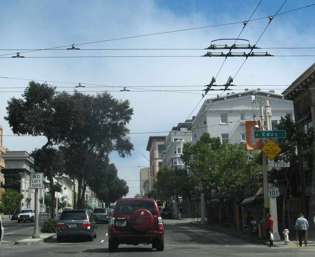
No left turn is permitted at Eddy Street, which is the next traffic signal on northbound U.S. 101/Van Ness Avenue. Photo taken 07/06/07. |
|
A left turn is permitted at Ellis Street, which is the next traffic signal. Photo taken 07/06/07. |
|
A reassurance shield for U.S. 101 north is posted shortly thereafter, just before the O'Farrell Street intersection. Photo taken 07/06/07. |
|
The next traffic signal on U.S. 101 north is with O'Farrell Street. It forms a one-way couplet with Geary Street to provide a major east-west route across the peninsula from downtown to Ocean Beach and back again. Only a right turn is permitted on this one-way street eastbound. Photo taken 07/06/07. |
|
Continuing north, the next traffic signal is with Geary Street. To the west, Geary Street changes into the Geary Boulevard expressway, offering a somewhat fast route west to the Cliff House and the Seacliff neighborhood. Geary Boulevard also serves Japan Center, Hamilton Square, Jordan Heights/Laurel Heights, Anza Vista, and Richmond. A semi-interchange is located at the junction of Geary Boulevard and Masonic Avenue near Anza Vista. Photo taken 07/06/07. |
|
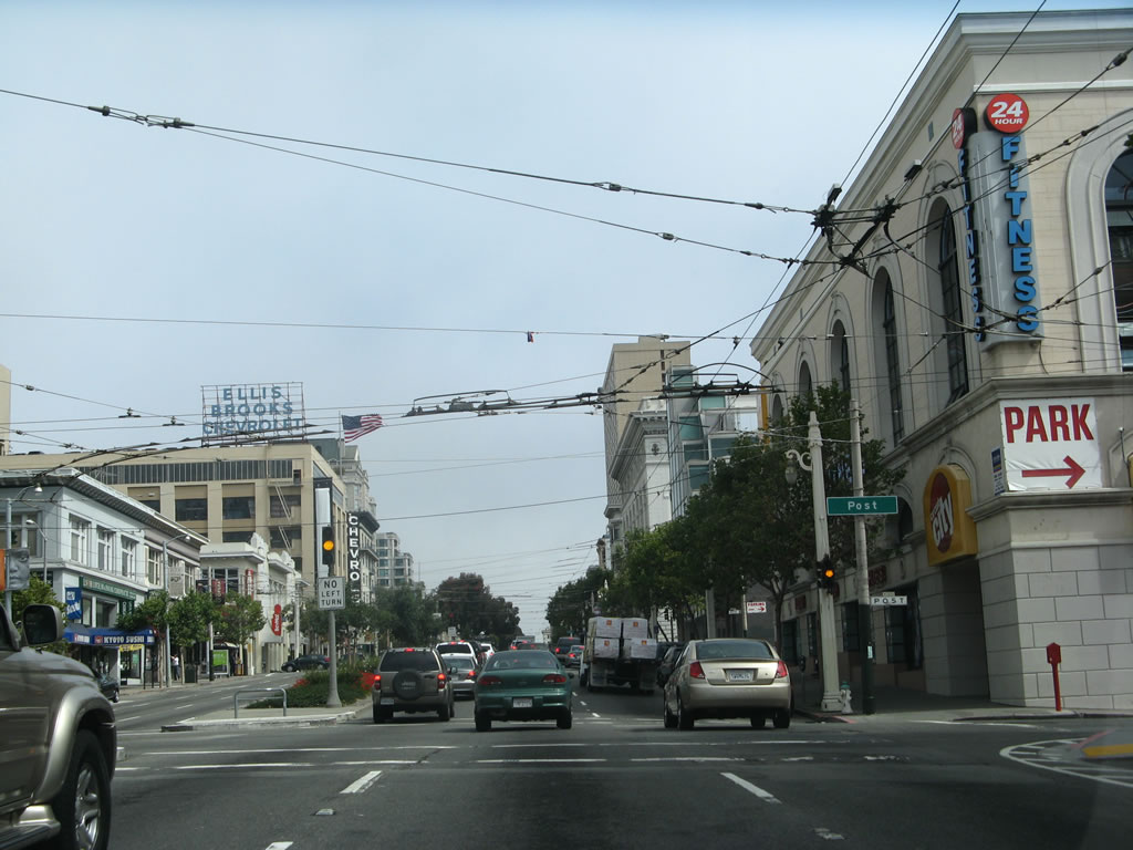
After Geary Street, the next traffic signal along northbound Van Ness Avenue is with Post Street, which is one-way traveling east. Photo taken 07/06/07. |
|
Next up is the intersection with Sutter Street. Businesses have to build up and not out in San Francisco due to the lack of space. As a result, some non-traditional businesses end up in high-rise buildings, including the car dealership on the west side of Van Ness Avenue. Photo taken 07/06/07. |
|
The next signalized intersection along U.S. 101/Van Ness Avenue north is with Bush Street, which travels east toward the Financial District and Nob Hill. Photo taken 07/06/07. |
|
Pine Street travels west Jordan Heights/Laurel Heights. Photo taken 07/06/07. |
|
The next signalized intersection along U.S. 101/Van Ness Avenue north is with California Street, which travels east toward the Financial District and Chinatown. Photo taken 07/06/07. |
|
Northbound U.S. 101/Van Ness Avenue meets Sacramento Street, which travels one-way westbound toward Lafayette Park. Photo taken 07/06/07. |
|
The next signalized intersection along U.S. 101/Van Ness Avenue north is with Clay Street, which travels east toward Chinatown. Photo taken 07/06/07. |
|
Continuing north, the next traffic signal is for Washington Street, which becomes one-way eastbound. Photo taken 07/06/07. |
|
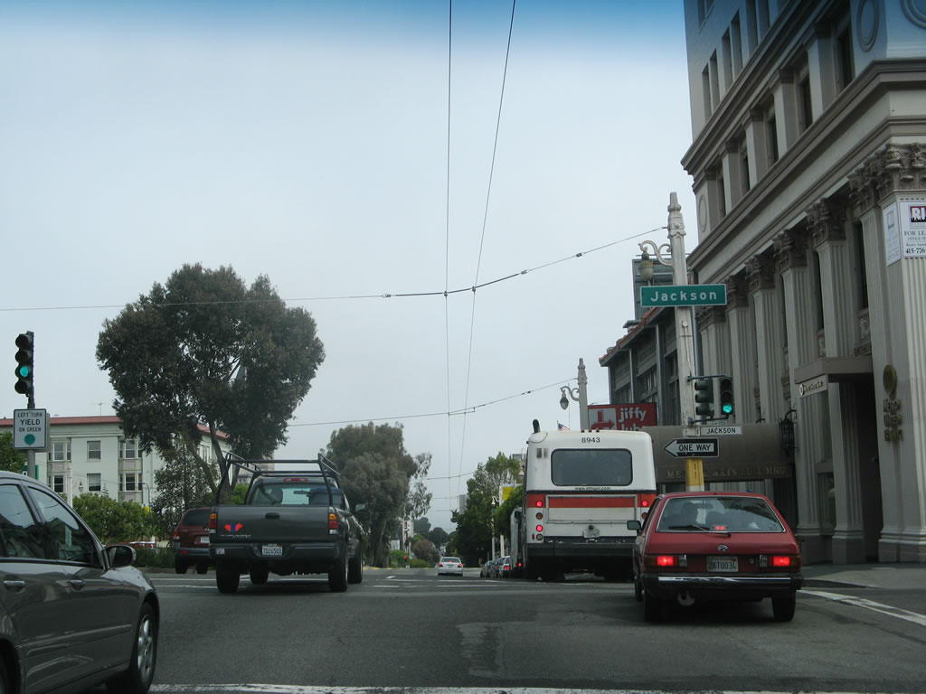
The next signalized intersection along U.S. 101/Van Ness Avenue north is with Jackson Street, which travels west toward Pacific Heights, Alta Plaza, and the Presidio of San Francisco. Photo taken 07/06/07. |
|
Northbound U.S. 101/Van Ness Avenue next meets Pacific Street, which travels east toward Chinatown and west toward the Presidio. Photo taken 07/06/07. |
|
One block north, the next traffic signal is with Broadway, a major east-west arterial that at one time was intended to be part of the path for unconstructed Interstate 480. Using the Broadway Tunnel, Interstate 480 would have connected the now-defunct Embarcadero Freeway with the Golden Gate Bridge approach at Doyle Drive. Under that plan, U.S. 101 would have been on the unconstructed Central Freeway. The Broadway Tunnel is still around, so turn right on Broadway to see the tunnel pass under Russian Hill and connect to North Beach and Chinatown. To the west, Broadway leads to Pacific Heights and the Presidio, where it ends. Photo taken 07/06/07. |
|
The next intersection on U.S. 101/Van Ness Avenue north is with Vallejo Street. No left turn is permitted at this intersection. Photo taken 07/06/07. |
|
A reassurance shield for U.S. 101 north is posted after Vallejo Street to advise of the pending separation of U.S. 101 from Van Ness Avenue at the Lombard Street intersection. All three northbound lanes of Van Ness Avenue provide a connection to the continuation of U.S. 101 north. Photo taken 07/06/07. |
|
At Green Street, trucks are advised to use the right lane of Van Ness Avenue to make the left turn onto Lombard Street for the continuation of U.S. 101. Photo taken 07/06/07. |
|
Northbound U.S. 101/Van Ness Avenue next meets Union Street. The Lombard Street intersection is three blocks ahead. Photo taken 07/06/07. |
|
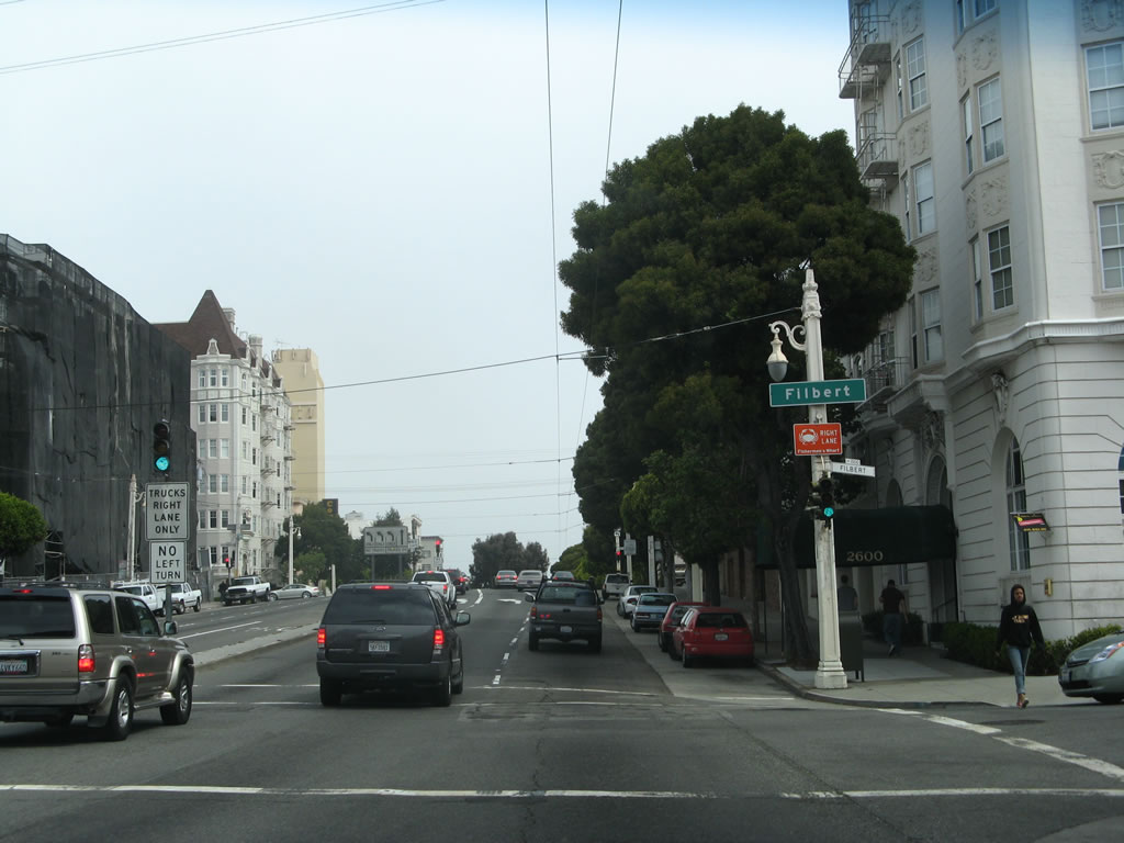
The next signalized intersection on northbound U.S. 101/Van Ness Avenue is with Filbert Street. Photo taken 07/06/07. |
|
A trailblazer for U.S. 101 is posted at the Greenwich Street intersection. The Lombard Street intersection is at the next block. Photo taken 07/06/07. |
|
All three lanes of Van Ness Avenue make the transition to Lombard Street west to facilitate the continuation of U.S. 101 en route to the Golden Gate Bridge. Continue straight ahead to follow Van Ness Avenue north to North Point Street east to connect to Fisherman's Wharf and Pier 39. Photo taken 07/06/07. |
| U.S. 101 north/Lombard Street west |
| U.S. 101/Richardson Avenue northwest |
| Marina Boulevard Approach west |
|
We continue our journey on westbound Marina Boulevard in San Francisco in the Marina District near Crissy Field. Upon reaching Baker Street, through traffic may turn slightly left onto a viaduct that connects to the Golden Gate Bridge or turn toward the right to follow Mason Street west to Fort Point. This "no toll" warning sign is the only advice that this ramp leads to the Golden Gate Bridge. Photo taken 05/26/06. |
|
Reversible lanes, a key feature of the six-lane Golden Gate Bridge, also appear on the approach viaduct. This on-ramp from Marina Boulevard is not considered part of U.S. 101 itself, but U.S. 101 will merge onto the viaduct shortly. Photo taken 05/26/06. |
|
The other direction's overhead signs show the southbound split between Marina Boulevard and U.S. 101/Lombard Street. Photo taken 05/26/06. |
| U.S. 101 north/Doyle Drive (Future Presidio Parkway) west |
|
Traffic from the Crissy Field area of Golden Gate National Park and U.S. 101/Richardson Avenue merge together. U.S. 101 begins to pick up appearances of the Golden Gate bridge as it crosses this viaduct that flies over the Presidio. There are only two more San Francisco exits before the freeway defaults onto the bridge. Photo taken 05/26/06. |
|
This mileage sign provides the distance to the final two exits along U.S. 101 north before crossing the Golden Gate Bridge into Marin County. Doyle Drive, which has been in service as the U.S. 101 approach to the Golden Gate Bridge since 1936, is scheduled for complete replacement. A project between 2009 and 2015 will replace Doyle Drive with the new Presidio Parkway. A temporary alignment of the Presidio Parkway will be in service in early 2012. We hope to return to this area to document the changes in the future. The 1936 viaduct itself will be removed due to its vulnerability in a major earthquake. Photo taken 05/26/06. |
|
A U.S. 101 reassurance shield is posted on the viaduct to the northbound Golden Gate Bridge. The junction with California 1 (Exit 439) is located in less than a half mile. Photo taken 05/26/06. |
|
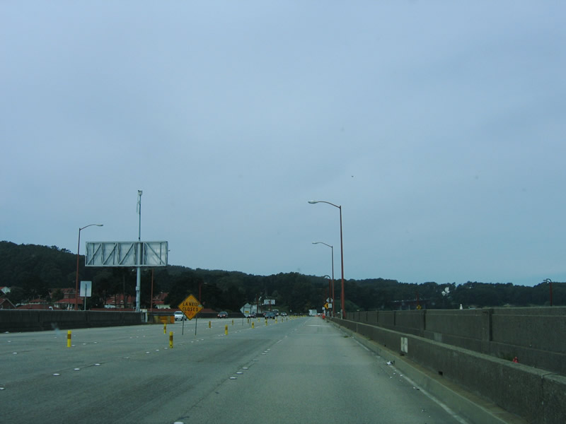
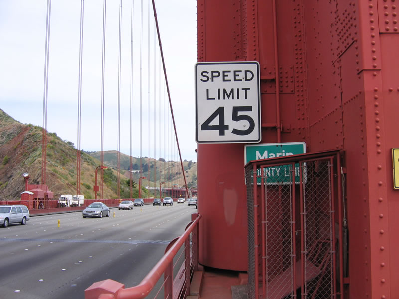
A scenic corridor, the U.S. 101/Doyle Drive viaduct to the Golden Gate Bridge is surrounded by trees and offers six lanes of travel. There are no shoulders, which is a common design feature on the bridge itself as well as its approaches. Photo taken 05/26/06. |
|
A standalone trailblazer for California 1 south is posted prior to Exit 439. The signage for this exit from the Golden Gate Bridge approach viaduct is not standard for a freeway interchange. California 1 north will merge onto U.S. 101 north so they can jointly cross the bridge. Photo taken 05/26/06. |
|
Southbound U.S. 101 approaches Exit 439, California 1, 19th Avenue and Park Presidio southbound. On this sign, note that the U.S. 101 shield is omitted! One could say that this is the case because the Golden Gate Bridge is not maintained by Caltrans and is therefore not part of the state highway system. But of course, that is just speculation. Bottom line is that through traffic for northbound California 1 and U.S. 101 should continue straight ahead. Photo taken 05/26/06. |
|
The ramp from northbound U.S. 101 to southbound California 1 has limited sight distance; it will pass underneath the Doyle Drive viaduct and turn south toward Golden Gate Park. Through traffic for the Golden Gate Bridge northbound should continue straight ahead. Photo taken 05/26/06. |
|
The final exit along northbound U.S. 101 before leaving San Francisco is Exit 440, Lincoln Drive. This sharp ramp provides access to the Presidio in Golden Gate National Park and is located immediately prior to the final approach to the Golden Gate Bridge. After traffic from northbound California 1 merges onto U.S. 101 north, exiting traffic should quickly merge right to connect to Lincoln Drive. Photo taken 05/26/06. |
|
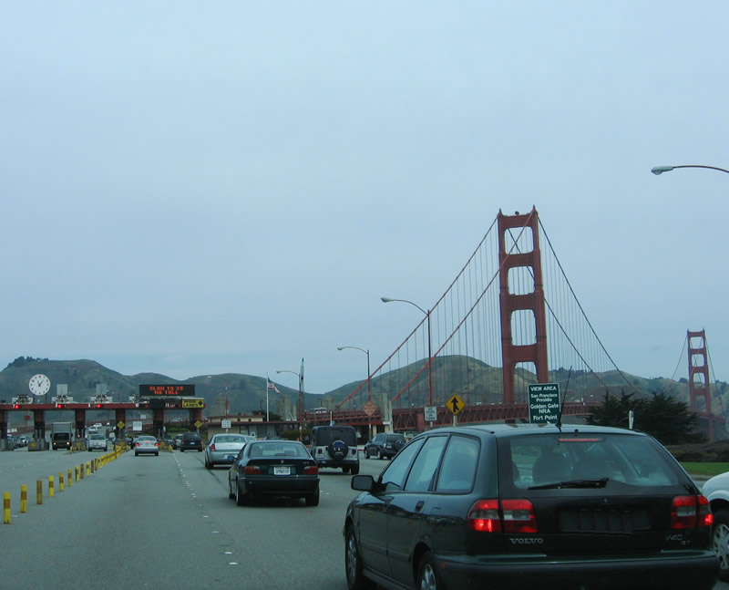
There is no toll for northbound traffic on the Golden Gate Bridge. Notice the incoming traffic from northbound California 1. Merge right for the next exit on northbound California 1 and U.S. 101, which is Exit 440, Lincoln Drive. Photo taken 05/26/06. |
| U.S. 101 & California 1 - Golden Gate Bridge north |
|
Exit 440, Lincoln Drive is signed as "View Area - Presidio - Golden Gate National Recreation Area." All four lanes will continue north onto the bridge, then contract or expand depending upon the number of lanes available for northbound U.S. 101 and California 1 traffic. Photo taken 05/26/06. |
|
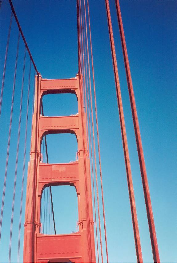
A final sign for Exit 440, Lincoln Drive is visible from behind some cars. Again signed for "View Area - San Francisco Presidio - Golden Gate National Recreation Area," it also mentions "Fort Point." The toll booth comes into view for southbound traffic, as do the Golden Gate Bridge towers with their well-known international orange color. Photo taken 05/26/06. |
|
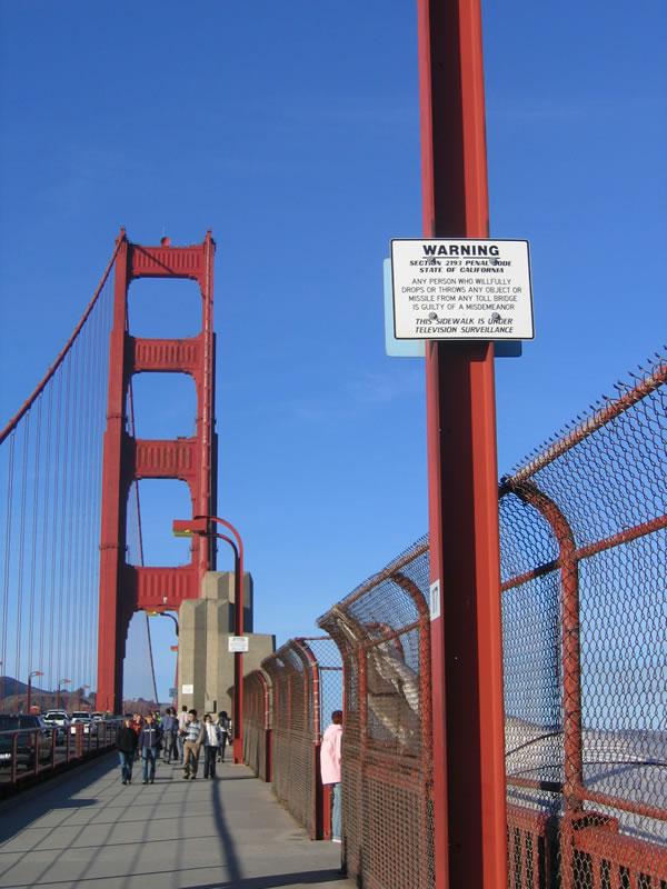
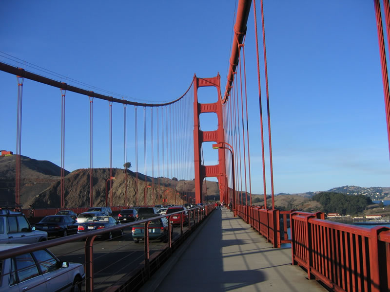
All traffic must slow to 25 miles per hour. Watch for pedestrians and slowing traffic in this area, since many first time crossers will want to slow down to take in the scenic beauty both natural and manmade. The left lanes may pass through the toll booths, even though no toll is collected. Watch the lane markers. Photo taken 05/26/06. |
|
This view of the Golden Gate Bridge is afforded from the trails surrounding the visitors center to the east of the U.S. 101 northbound approach. Photo taken 11/25/05. |
|
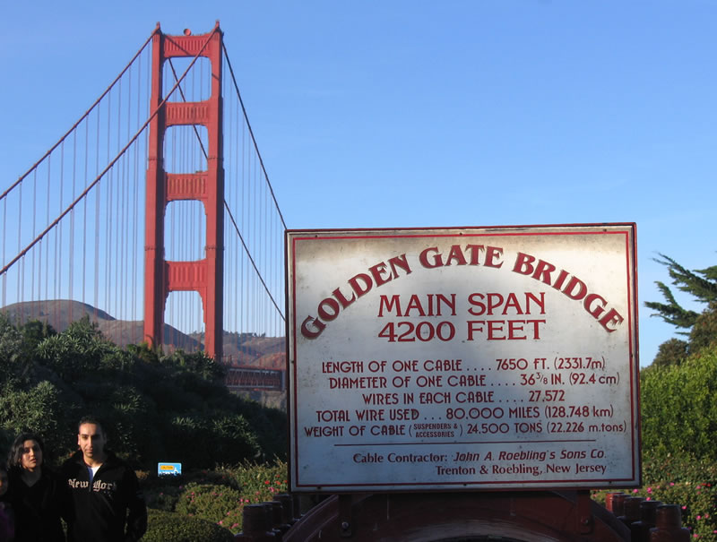
This sign, located adjacent to the visitors center in the pedestrian plaza, provides facts about the Golden Gate Bridge including size of the cables that support the bridge. Photo taken 11/25/05. |
|
Notably, Caltrans does not maintain the freeway approaches to the Golden Gate Bridge or the bridge itself. The Golden Gate Bridge Authority provides that service, and it is wholly funded by the bridge toll that is collected in the southbound direction only. Photo taken 11/25/05. |
|
At the north tower, U.S. 101 leaves San Francisco city / county and enters Marin County. Photo taken 05/26/06. |
| Golden Gate Bridge: View from Treasure Island |
|
View of the Golden Gate Bridge as seen from Treasure Island. Photo taken 03/19/06. |
| Golden Gate Bridge: October 2000 Photos |
|
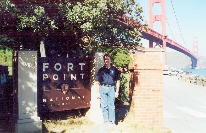
The Golden Gate Bridge is the primary link from the North Coast and Sonoma Valley regions via U.S. 101 and California 1. The Golden Gate Bridge construction started near in January 1933 and opened to traffic four years later, on May 28, 1937. At the time it was constructed, the span between the two towers (4,200 feet long) was the longest suspension span. This lasted until 1964, when the Verrazano Narrows Bridge (Interstate 278) was opened in New York City. Today, several other bridges surpass the Golden Gate Bridge in terms of suspension span distance. Administered by the Golden Gate Bridge and Highway District, the bridge is not maintained by Caltrans, even though it carries two state routes (U.S. 101 and California 1) across the Golden Gate. Unlike many days in San Francisco, it was warm, sunny, and calm. As such, it was a great day for walking and taking pictures. These pictures show the Golden Gate Bridge from a distance, looking northwest from the Marina District of San Francisco. Photos taken 10/16/00. |
|
|
|
|
This suite of pictures provides views of the six-lane Golden Gate Bridge looking north from San Francisco. Painted "international orange," the bridge fits in well with the green hills behind it and the blue bay below it. The paint helps to protect the bridge against the rigors of humid, salty air. The bridge is managed and maintained by the Golden Gate Bridge and Highway District. This organization consists of representatives from San Francisco, Marin, Sonoma, Del Norte and parts of Mendocino and Napa counties. The toll on the bridge increased to five dollars per round trip (there is no toll collected along northbound) in 2002, primarily to cover the increasing cost of labor and material as well as the ongoing retrofit of the bridge for earthquakes. In addition to toll collection, bridge maintenance, and capital improvements, the Golden Gate Bridge and Highway District manages the reversible lanes, so that during the morning commute there are four lanes southbound and two lanes northbound and during the afternoon commute there are two lanes southbound and four lanes northbound. At other times, the lanes are balanced to three lanes each way. Photos taken 10/16/00. |
|
|
|
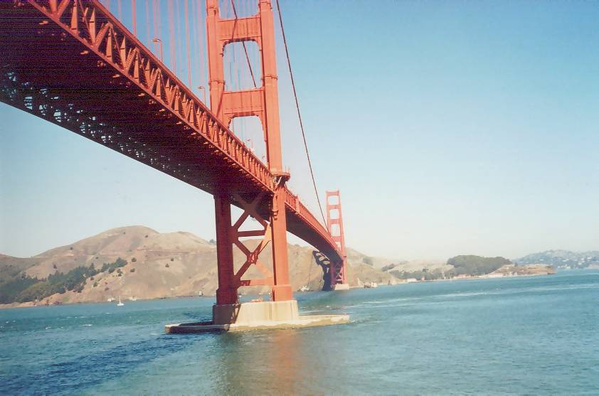
View of the superstructure under the Golden Gate Bridge as seen from Fort Point, looking north. Photo taken 10/16/00. |
|
Cable Cross Section display at the visitors center near the northern approach to the bridge. The large cables that suspend the bridge actually consist of several small cables, as shown by this display. Photo taken 10/16/00. |
|
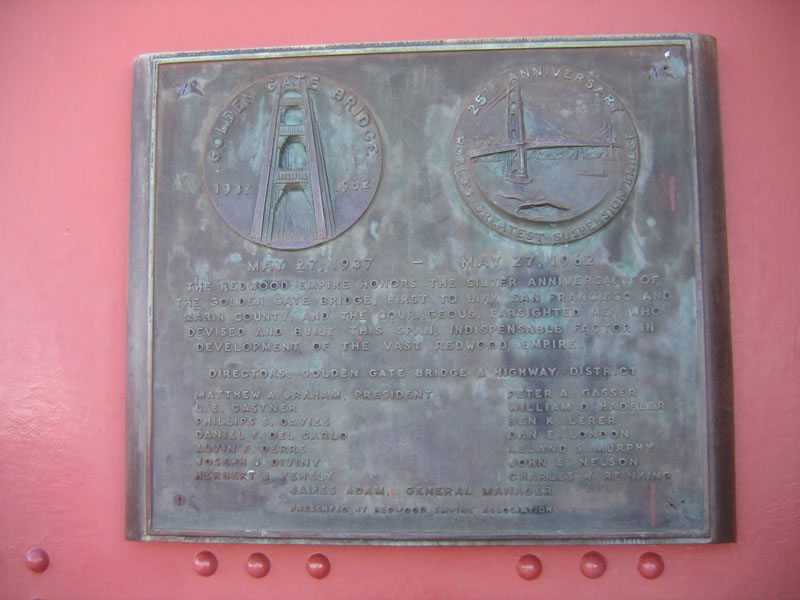
Golden Gate Bridge dedication plaque on the northern approach. Photo taken 10/16/00. |
|
Golden Gate Bridge Tollbooth, looking south. As noted earlier, the toll is currently five dollars and is only collected on southbound; it was four dollars at the time this photo was taken. Photo taken 10/16/00. |
|
This Crisis Counseling Call Box was placed on the Golden Gate Bridge to allow suicidal jumpers a last chance to discuss their problems with someone. It also doubles as a call box for those with automotive or other difficulties. Photo taken 10/16/00. |
|
This no stopping or turning sign was placed by the California State Automobile Association, as noted by the insignia at the bottom of the sign. Prior to the 1950s, affiliates of the American Automobile Association erected many guide and regulatory signs in California, and the state took over that function from the auto clubs during that decade. Clearly, this is a very old sign. Photo taken by Joel Windmiller, 02/01. |
|
View of the north tower as seen from the pedestrian walkway. Photo taken 10/16/00. |
Page Updated January 15, 2012.