| U.S. 101 south |
|
South in Mendocino County after California 271/Piercy, U.S. 101 (Redwood Highway) travels over Confusion Hill south of Exit 625. The route starts as a freeway but will eventually downgrade to a two-lane highway. U.S. 101 will follow the South Fork of the Eel River as it ascends Confusion Hill. Photo taken 05/29/06. |
|
Confusion Hill looms in the distance. Large cuts allow U.S. 101 to pass over the hill. While a bypass of Confusion Hill would be ideal, it is perpetually unfunded. As a result, U.S. 101 follows a winding and often dangerous route over the hill. Photo taken 05/29/06. |
|
The freeway ends in one-half mile. Photo taken 05/29/06. |
|
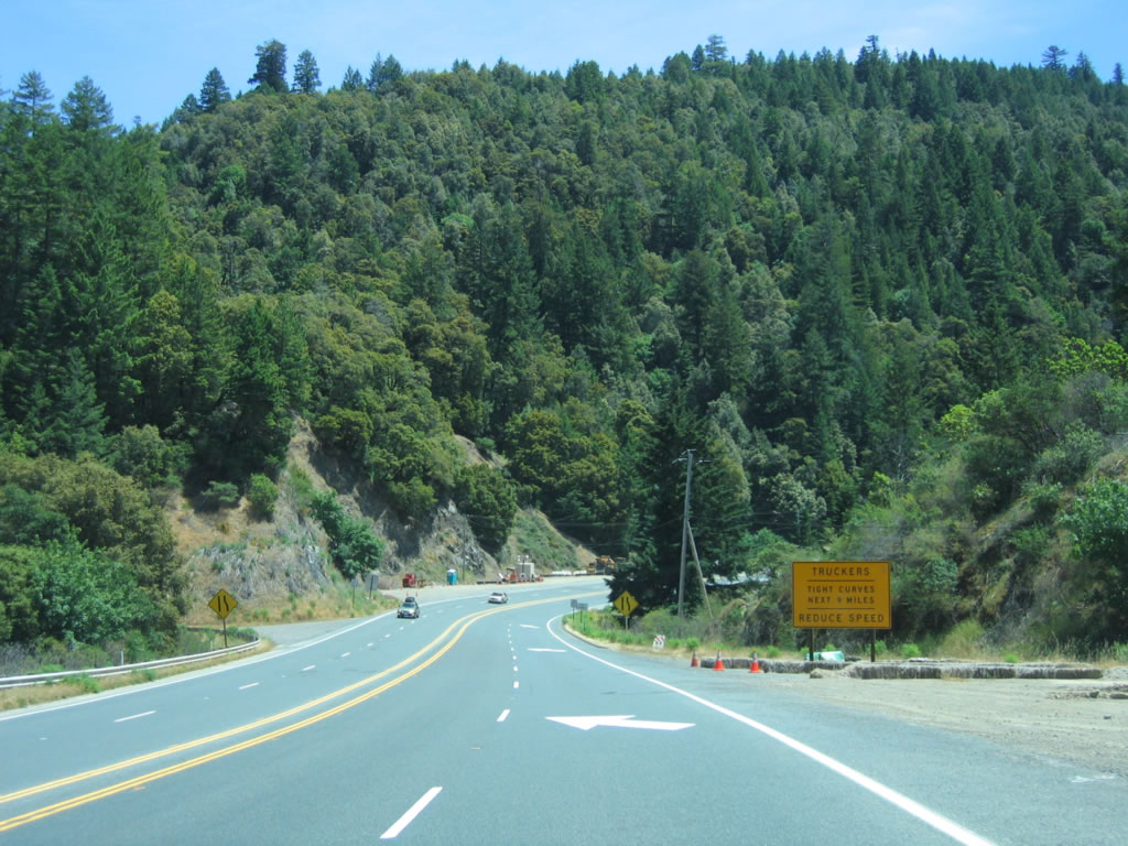
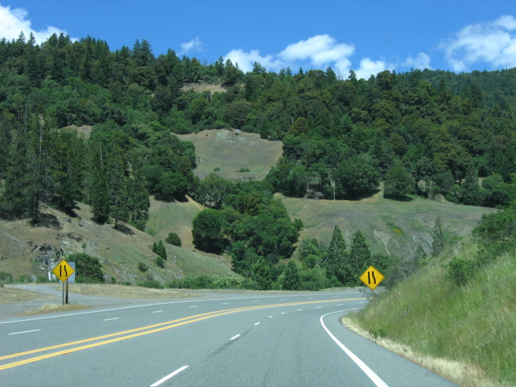
U.S. 101 is not a good truck corridor between Ukiah and Eureka primarily because of the Confusion Hill and Richardson Grove State Park areas. As noted by the sign, the next nine miles have sharp curves and are especially dangerous during inclement or icy weather. Photo taken 05/29/06. |
|
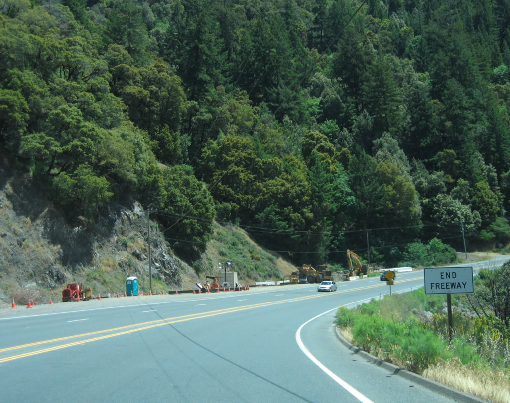
An end freeway sign is posted at the bottom of the downgrade. From here, U.S. 101 resumes a two-lane configuration as it travels over Confusion Hill. Photo taken 05/29/06. |
|
|
|
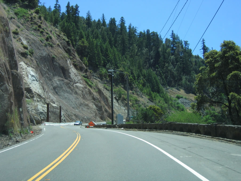
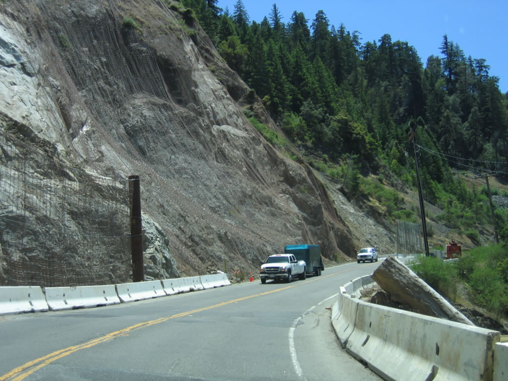
Immediately, U.S. 101 enters a narrow section of two-lane roadway at the base of the large rock cut seen in the previous photographs from a distance. Rock slides are always a concern here, as shown by the measures to keep the rocks off the road. U.S. 101 clings to the South Fork of the Eel River as it crosses near Confusion Hill, which rises nearly 1500 feet above the highway between Leggett and Piercy. Due to the proximity of the highway to the river and the hill, closures along this stretch of U.S. 101 can be common. For example, in the in the rainy season of 2002-2003 (during winter), Confusion Hill closed ten separate times.1 This area is considered geologically unstable, meaning that landslides induced by rain or earthquakes are likely if not probable. A section of recently repaired landslide on U.S. 101 can be seen among these photos; netting tries to capture falling rock. Fog can also cause visibility issues, especially on narrow segments with limited sight distance. Photos taken 05/29/06. |
|
|
|
Sections of U.S. 101 have failed in prior rockslides and landslides, including the area shown in these photos. After this exposed section, U.S. 101 passes under the trees and approaches Confusion Hill. If U.S. 101 eventually bypasses Confusion Hill, this route would presumably become part of California 271. Plans call for the portion of Confusion Hill most affected by landslides to be bypassed using two bridges that will cross a bend in the South Fork of the Eel River. Completion is expected to begin in June 2006 and end in June 2009. Confusion Hill in Mendocino County coupled with Richardson Grove State Park create the "Redwood Curtain," as drivers must pass through both areas to make the long-distance connection between Willits and Eureka. Photos taken 05/29/06. |
|
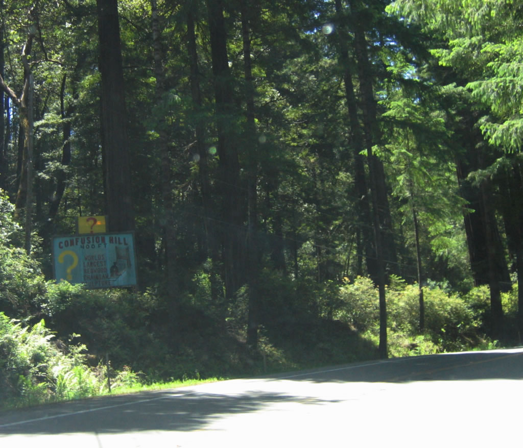
A sign promoting the Confusion Hill tourist attraction (and the largest redwood tree chainsaw sculpture) is posted on southbound U.S. 101. Photo taken 05/29/06. |
|
Confusion Hill tourist attraction is located on the east side of U.S. 101 (Redwood Highway). Visit here for the World Famous Gravity House, the Redwood Shoe house, the Worlds Largest Free Standing Redwood Chainsaw Carving, and the unique miniature Mountain Train Ride. A gift shop is also available. Photo taken 05/29/06. |
|
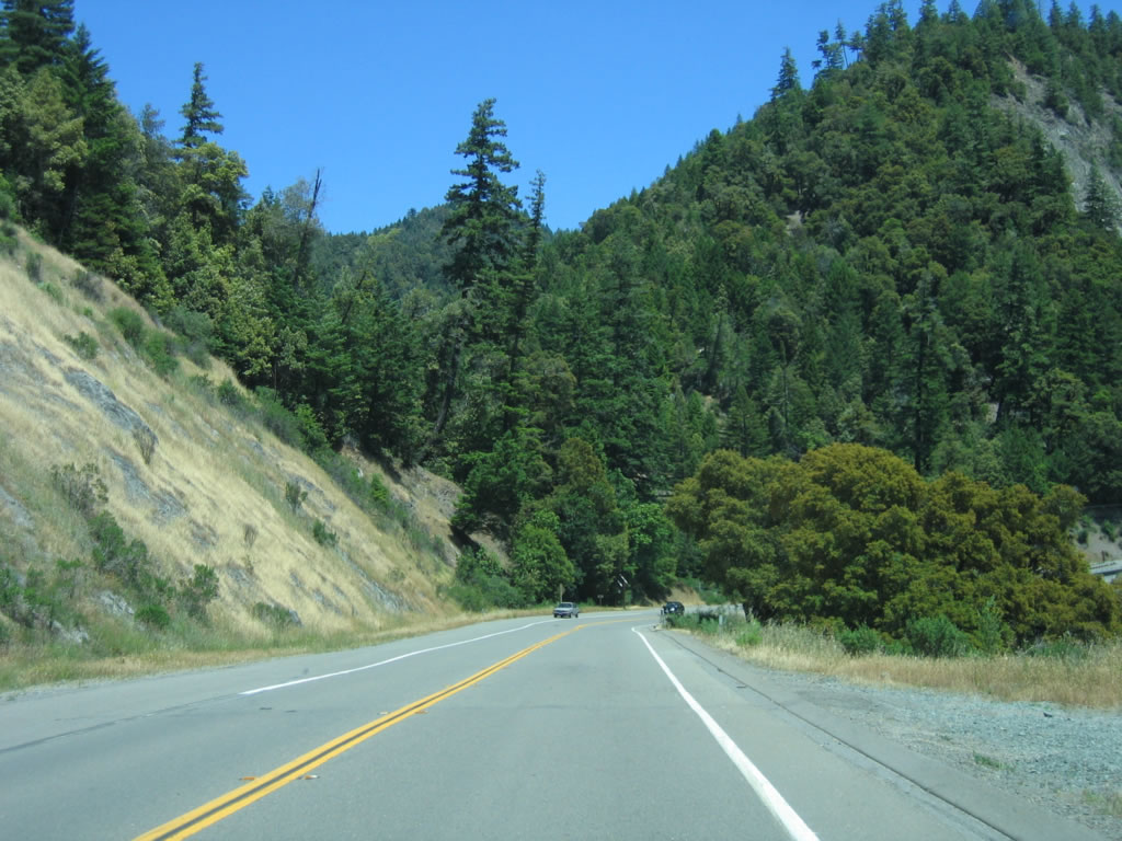
Continuing south, U.S. 101 passes by redwood trees and deciduous and evergreen forest. The highway remains two lanes as it continues toward Leggett. Photo taken 05/29/06. |
|
Some of the redwood trees are located alongside the highway, such as this one. Photo taken 05/29/06. |
|
This turnoff follows an old, abandoned alignment of U.S. 101 that follows a horseshoe bend close to the South Fork of the Eel River. An old sidehill viaduct, concrete paving, and other old highway artifacts are located along this section of old U.S. 101. Photo taken 05/29/06. |
|
This large road cut enables U.S. 101 to bypass the horseshoe shaped old alignment and provides for a more direct route. Photo taken 05/29/06. |
|
U.S. 101 south travels down from Confusion Hill toward Leggett. Photo taken 05/29/06. |
|
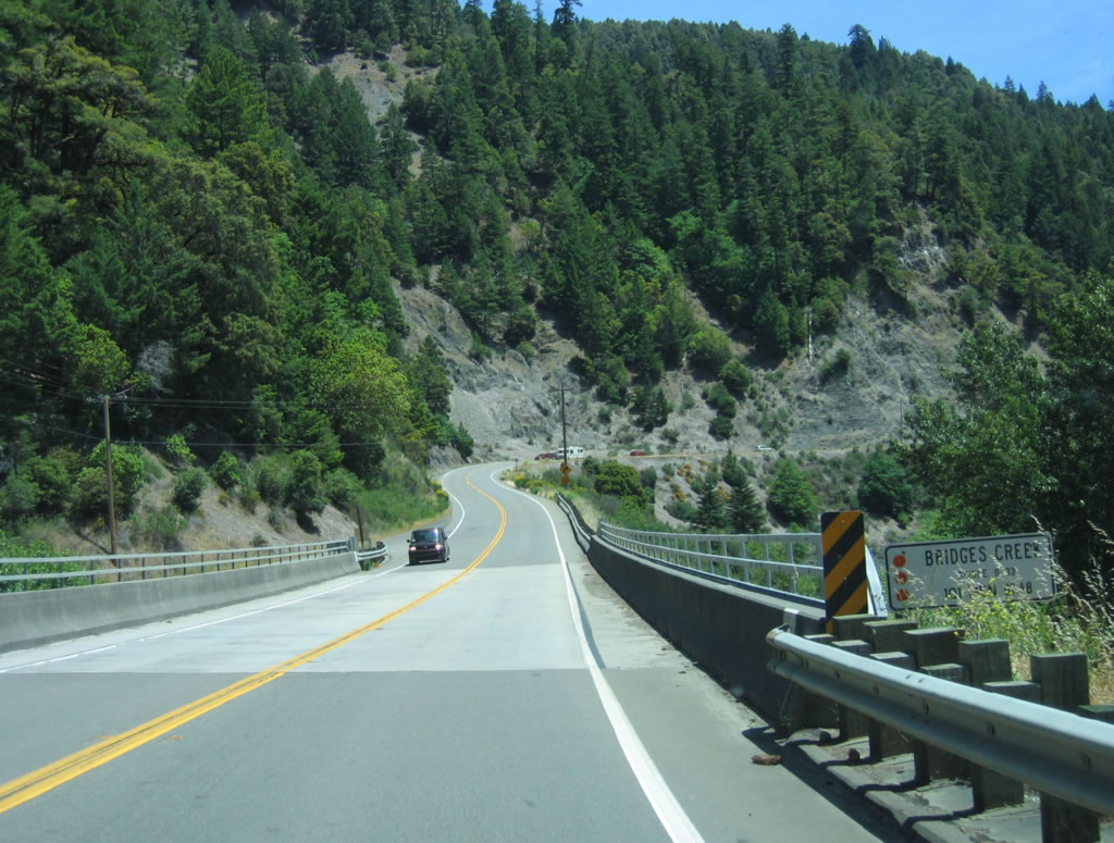
Bridges Creek bridge was constructed in 1980 and carries U.S. 101 over Bridges Creek. Photo taken 05/29/06. |
|
A U.S. 101 south shield assembly is posted after the Bridges Creek bridge. Photo taken 05/29/06. |
|
Several curves are located along U.S. 101 as it continues downhill toward Leggett, including this 30-mile-per-hour curve. Photo taken 05/29/06. |
|
A suicidal recreation vehicle attempts to make a three-point U-turn in the middle of U.S. 101 as the highway continues south. A passing lane is located two miles ahead. Photo taken 05/29/06. |
|
Another series of rock cuts are located along U.S. 101 as the highway continues to descend. Photo taken 05/29/06. |
|
Southbound U.S. 101 continues as a two-lane highway with more curving sections. Photo taken 05/29/06. |
|
The aforementioned passing lane begins on this three-lane section of U.S. 101. A tourist information station at Standish-Hickey State Recreation Area is located on the west side of U.S. 101. The state recreation area has facilities for day use picnicking, swimming, and hiking. Some camping is also allowed. Photo taken 05/29/06. |
|
Southbound U.S. 101 (Redwood Highway) approaches the turnoff for Standish-Hickey State Recreation Area. The passing lane ends prior to the entrance to the park. Photo taken 05/29/06. |
|
The Rock Creek Bridge was constructed in 2000 and features modern bridge design and railing. Photo taken 05/29/06. |
|
Continuing south, another section of divided highway lies two miles ahead. Photo taken 05/29/06. |
|
Another section of U.S. 101 rides between a rock cut and cliff. Photo taken 05/29/06. |
|
The Jitney Gulch Bridge was built in 1965. After this bridge, U.S. 101 leaves the Confusion Hill area and proceeds into Leggett, where it meets California 1 for the first time. Photo taken 05/29/06. |
|
The first signage for the California 1 junction (which would be Exit 618 if this intersection is upgraded to an interchange) is located here, at a construction staging area at the south end of the Confusion Hill area. Use California 1 south to downtown Leggett and to California 271 south to the Drive-Thru Tree. Photo taken 05/29/06. |
|
From here, California 1 travels southwest to the Pacific Coast, then turns south along the coast toward Fort Bragg, Mendocino, Bodega Bay, and Point Reyes National Seashore. California 1 will reunite with U.S. 101 near Sausalito north of San Francisco. Both U.S. 101 and California 1 are tremendously scenic, with U.S. 101 following the Russian River valley south along a mostly freeway/expressway alignment. California 1 follows the coast. Photo taken 05/29/06. |
|
Trucks are not recommended to use California 1 south due to the curves and hills along the route. The best route for through trucks is to continue south along U.S. 101. Photo taken 05/29/06. |
|
Southbound U.S. 101 (Redwood Highway) reaches Exit 618, California 1 to Leggett. Use this exit to the continuation of California 271 south (Old U.S. 101) and Drive Thru Tree Road. Note that although California 1 ends here now, that was not always the plan. Originally, California 1 was planned to continue north through the Lost Coast to Ferndale and Fernbridge. This route is now unconstructed California 211, and California 1 was rerouted to end in Leggett. Prior to the reroute, the section of current California 1 west of Leggett was designated as California 208. Photo taken 05/29/06. |
|
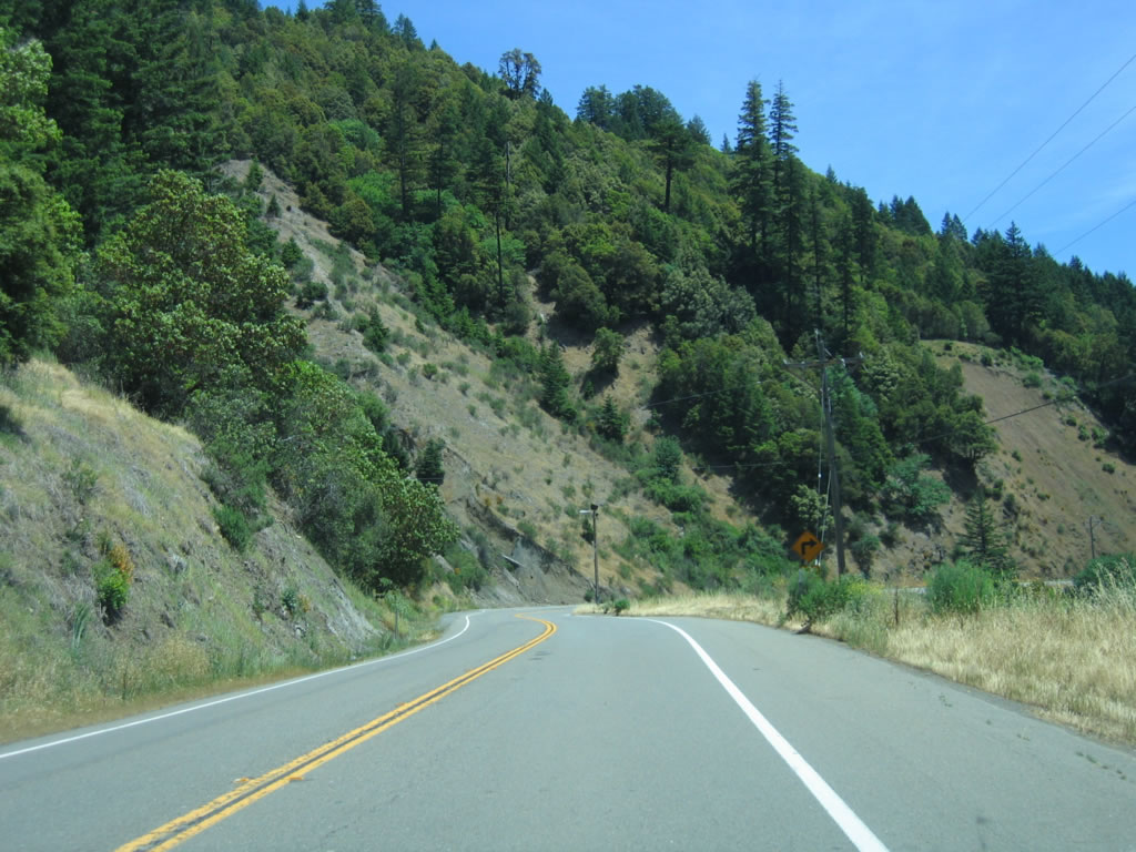
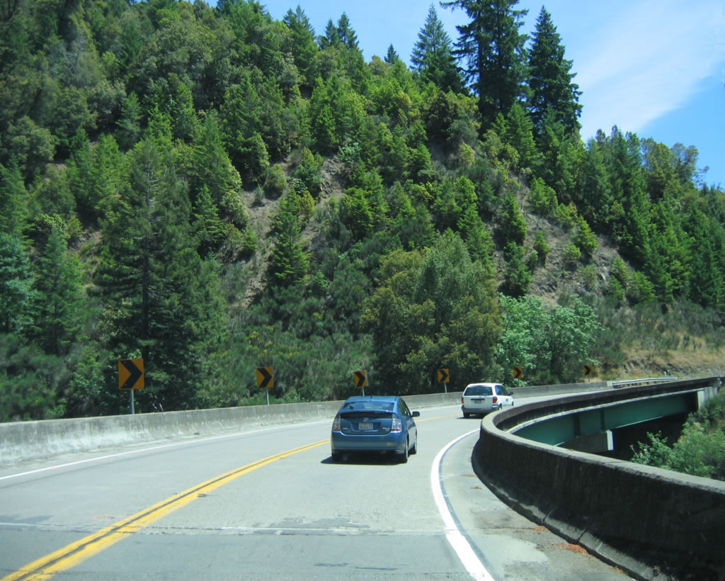
After Exit 618, the next exit is Exit 614, California 271/South Leggett followed by Exit 609, California 271 north/Cummings. After this interchange, U.S. 101 south begins its journey to Rattlesnake Summit (el. 1796 feet). Note the undivided configuration of the U.S. 101 freeway, with three uphill northbound lanes and two downhill southbound lanes. Photo taken 05/29/06. |
|
A U.S. 101 reassurance shield is posted shortly after the Exit 609 interchange. Photo taken 05/29/06. |
|
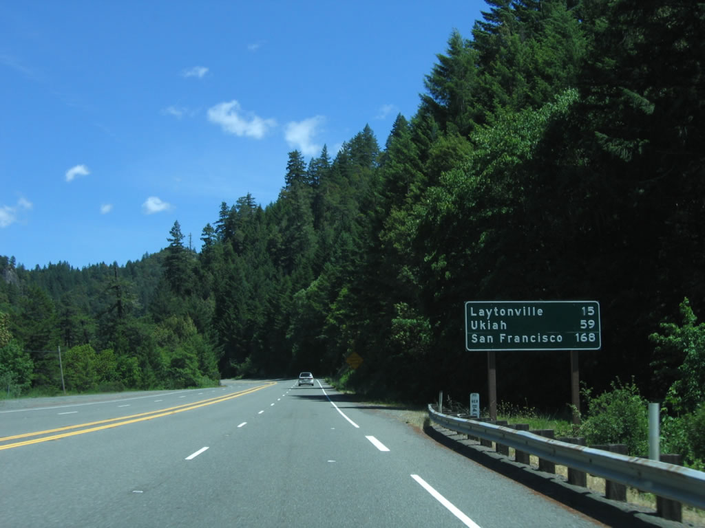
This mileage sign provides the distance to Laytonville (15 miles), Ukiah (59 miles), and San Francisco (168 miles) via U.S. 101 south. Photo taken 05/29/06. |
|
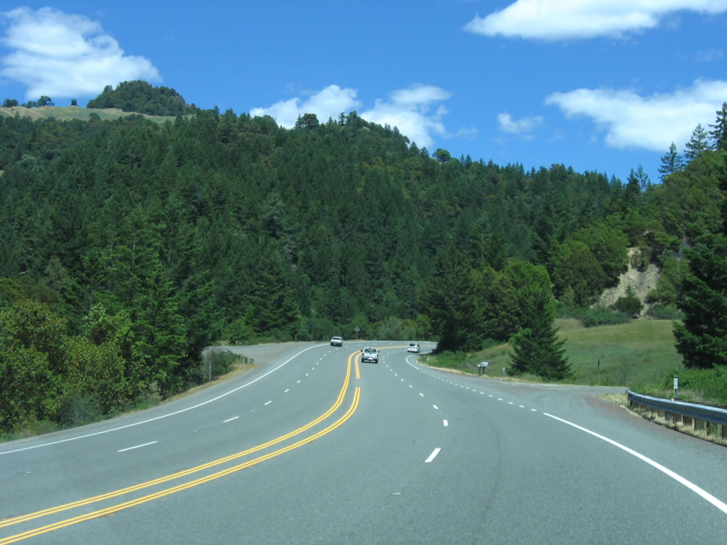
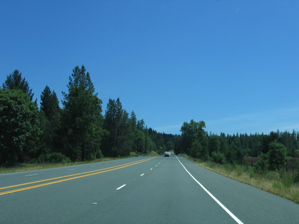
After the downgrade from Cummings is over, U.S. 101 has two lanes in each direction (undivided). The highway generally continues in a easterly direction. Photo taken 05/29/06. |
|
Southbound U.S. 101 reaches the Tan Oak Park cutoff; by this point, the freeway section has ended, and the expressway section has begun. Photo taken 05/29/06. |
|
Another U.S. 101 south reassurance shield is posted along the four-lane stretch of undivided expressway. Photo taken 05/29/06. |
|
The four-lane section of expressway continues for another few miles, but the highway will soon reduce to a total of two lanes. Photo taken 05/29/06. |
|
At the bottom of this grade, the expressway will downgrade to two lanes. Photo taken 05/29/06. |
|
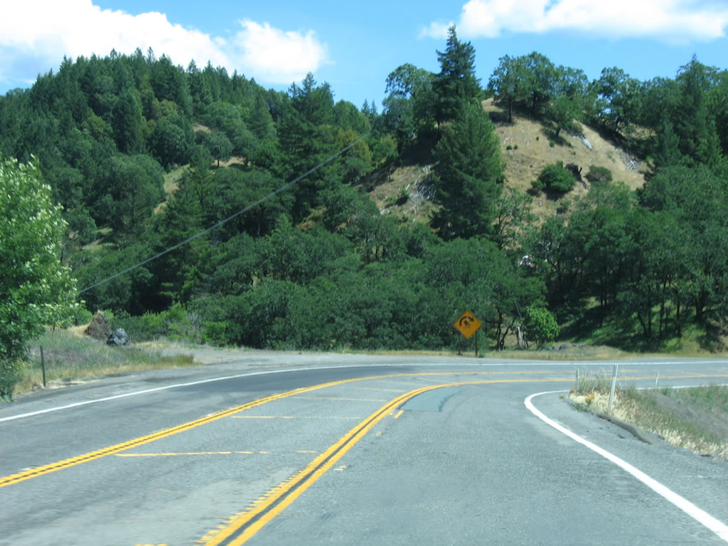
Southbound U.S. 101 (Redwood Highway) approaches Bell Springs Road. At this point, U.S. 101 turns south again. Photo taken 05/29/06. |
|
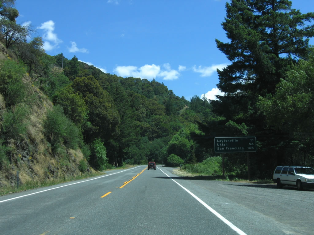
This mileage sign provides the distance to Laytonville (11 miles), Ukiah (56 miles), and San Francisco (165 miles). Photo taken 05/29/06. |
|
A passing lane begins as U.S. 101 ascends Rattlesnake Summit as it follows Rattlesnake Creek. After ascending the summit, U.S. 101 will wind its way into the town of Laytonville. Photo taken 05/29/06. |
|
|
Now on the descent from Rattlesnake Summit (el. 1,796 feet), U.S. 101 passes through a few curves. Photo taken 05/29/06. |
|
After crossing Rattlesnake Summit, U.S. 101 now follows Tenmile Creek and travels south toward Laytonville. Photo taken 05/29/06. |
|
A pair of U.S. 101 shields is posted shortly thereafter. Photo taken 05/29/06. |
|
Another set of passing lanes is located a bit further south. Photo taken 05/29/06. |
|
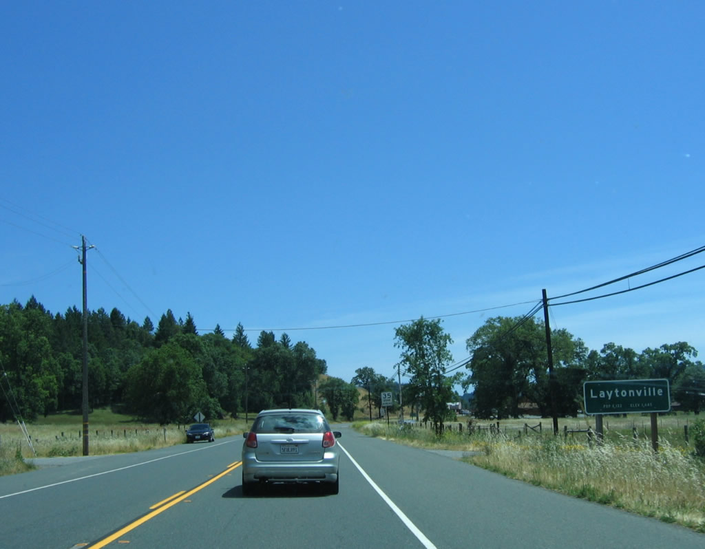
Southbound U.S. 101 enters the town of Laytonville. Home to 1,301 people as of the 2000 Census, Laytonville is an unincorporated community of Mendocino County. Photo taken 05/29/06. |
|
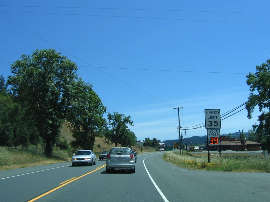
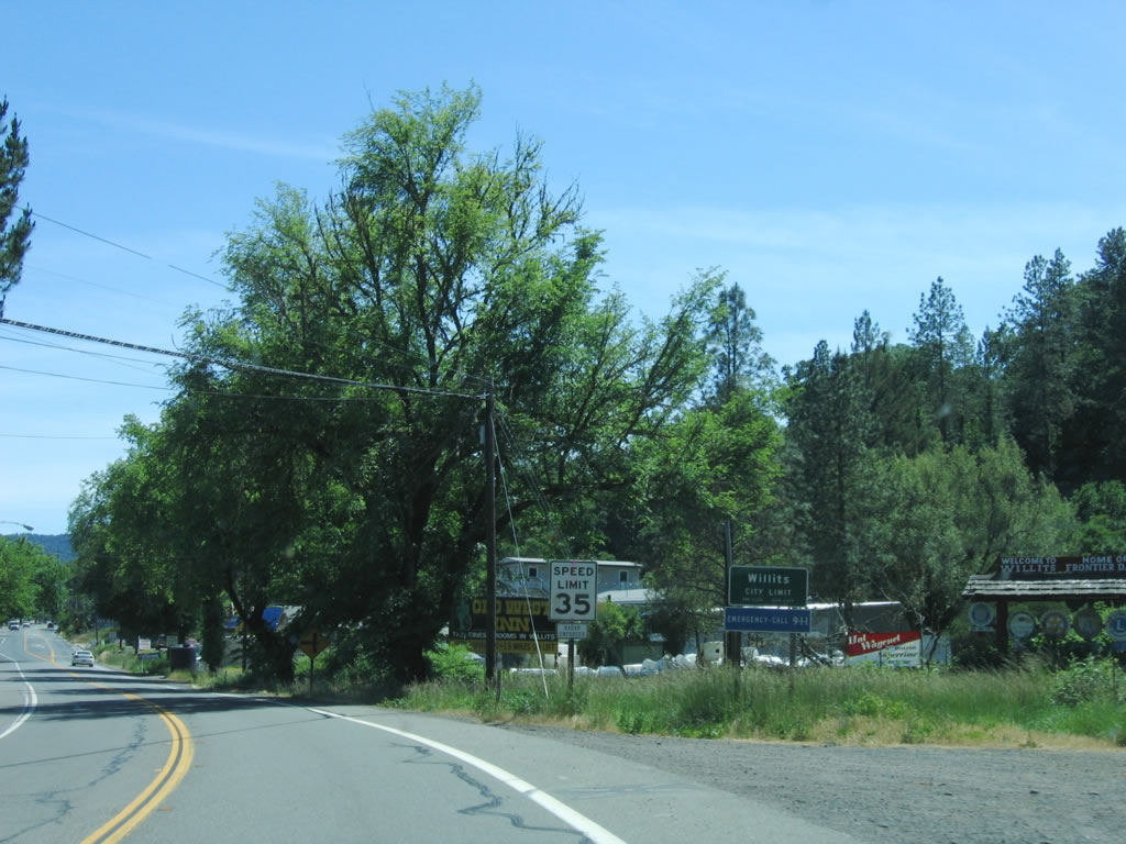
The speed limit along U.S. 101 reduces to 35 miles per hour upon entering Laytonville. Photo taken 05/29/06. |
|
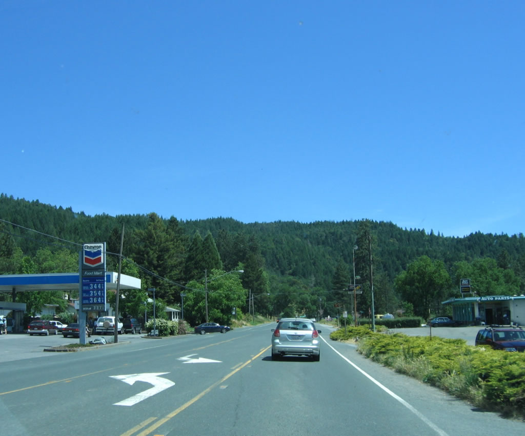
The major intersection in Laytonville is between U.S. 101 and Laytonville-Dos Rios Road east and Branscomb Road west. Laytonville-Dos Rios Road travels east to Dos Rios before intersecting California 162. Branscomb Road travels west to Branscomb. Photo taken 05/29/06. |
|
Through Laytonville, U.S. 101 carries two through lanes and a center turn lane. There are no immediate plans for U.S. 101 to bypass Laytonville or for the route to be upgraded to limited access standards. Photo taken 05/29/06. |
|
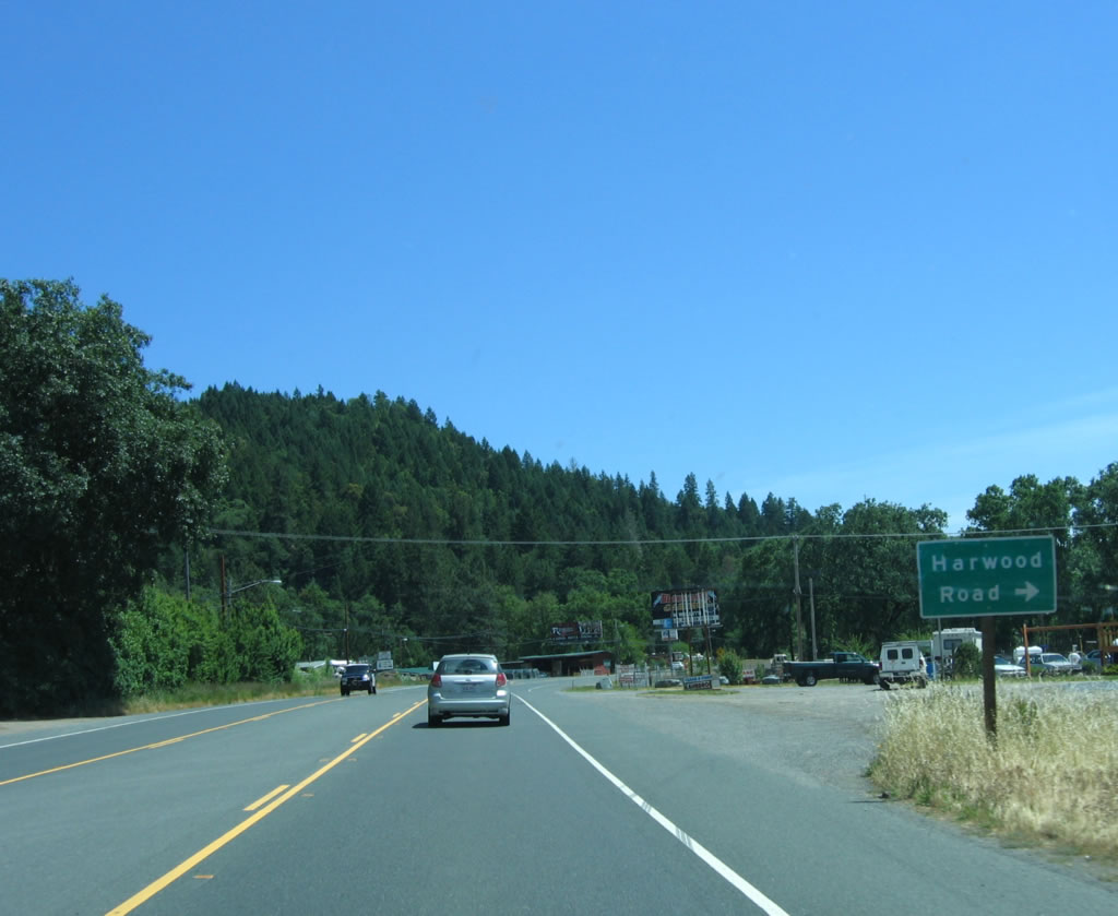
Toward southern Laytonville, U.S. 101 approaches Harwood Road. Photo taken 05/29/06. |
|
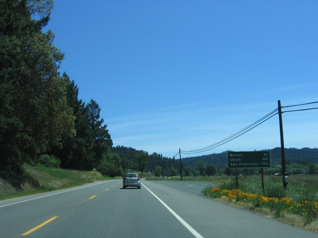
Leaving Laytonville, this mileage sign provides the distance to Willits (21 miles), Ukiah (44 miles), and San Francisco (153 miles). Photo taken 05/29/06. |
|
Southbound U.S. 101 (Redwood Highway) approaches Davidson Road and Steel Road. Neither of these are through roads; they provide residential and ranch access. Photo taken 05/29/06. |
|
|
|
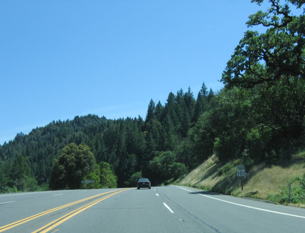
U.S. 101 widens out to four lanes south of Laytonville, then approaches Sherwood Road. Photos taken 05/29/06. |
|
A U.S. 101 reassurance shield is posted along southbound as the four-lane highway descends into Long Valley. Photo taken 05/29/06. |
|
As the highway continues its descent, southbound U.S. 101 (Redwood Highway) crosses Long Valley Creek. Photo taken 05/29/06. |
|
U.S. 101 maintains four lanes as it continues to descend in elevation. Photo taken 05/29/06. |
|
Southbound U.S. 101 approaches California 162. At this left turn, California 162 travels northeast to Round Valley and Covelo, then ends before entering the Mendocino National Forest. A national forest highway traverses Mendocino Pass, and California 162 resumes in the Central Valley at Elk Creek, intersecting Interstate 5 at Willows. Photo taken 05/29/06. |
|
A left turn is required to connect from U.S. 101 south to California 162 east. This is not a through road except in summer, and even in summer, the forest road over Mendocino Pass is unpopulated and rough. Photo taken 05/29/06. |
|
California 162 is also known as Covelo Road. Photo taken 05/29/06. |
|
A pair of U.S. 101 and California 162 trailblazers are posted prior to their junction in Longvale. There are no facilities here. Photo taken 05/29/06. |
|
A mileage sign provides the distance to Willits, Ukiah, and San Francisco. Ahead is a rest area, but it was closed at the time this photo was taken. Photo taken 05/29/06. |
|
|
|
The highway ascends out of Long Valley. Photos taken 05/29/06. |
|
Southbound U.S. 101 approaches Shimmins Ridge Road, which travels northeast to connect with California 162 near Farley. Photo taken 05/29/06. |
|
After a long distance, the four-lane section of U.S. 101 ends, and another two-lane section begins. Photo taken 05/29/06. |
|
U.S. 101 crosses Outlet Creek at postmile 50.66. This 1979 bridge is paralleled by a railroad bridge that has followed U.S. 101 since the California 162/Covelo Road intersection. Photo taken 05/29/06. |
|
This rural scene is found north of Willits after the abandoned railroad crossing. Photo taken 05/29/06. |
|
Willits is the first city city along U.S. 101 since leaving the vicinity of Ukiah. Incorporated as a city in 1888, Willits is known as the "Gateway to the Redwoods." To the west, Jackson State Demonstration Forest and Noyo can be found along California 20, with several stands of redwoods along the way. To the south, U.S. 101 continues its way south toward Ukiah and Lakeport (via California 20). Willits (named for founder Hiram Willits) is the first city of significance on U.S. 101 since leaving Eureka (aside from several picturesque smaller towns along U.S. 101). The Pacific Northwestern Railroad provides north-south train service to Eureka and San Francisco (as of 1901), and the California Western "Skunk Train" was put into service as of 1911. Photo taken 05/29/06. |
|
Southbound U.S. 101 meets Sherwood Road again at this traffic signal. Sherwood Road parallels U.S. 101 to the west. Photo taken 05/29/06. |
|
The next traffic signal along southbound U.S. 101 is with Commercial Street in downtown Willits. Photo taken 05/29/06. |
|
|
Through downtown Willits, U.S. 101 has three lanes (one lane in each direction plus middle turn lane). Photo taken 05/29/06. |
|
The next traffic signal in Willits is the junction with California 20/South Street west to Fort Bragg and Mendocino on the coast. Photo taken 05/29/06. |
|
Southbound U.S. 101 (Redwood Highway) meets California 20/South Street at this intersection. From here, California 20 east merges onto U.S. 101 south, and the two routes will remain merged until Calpella, just north of Ukiah. Photo taken 05/29/06. |
| U.S. 101 (Redwood Highway) south and California 20 east |
|
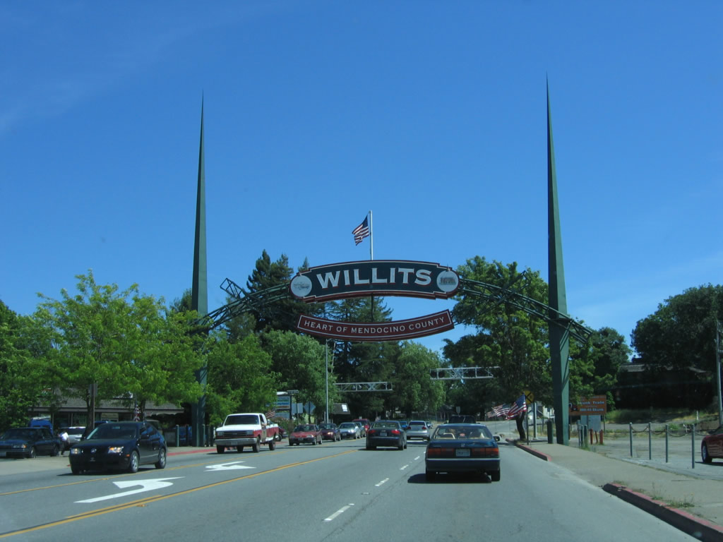
The Willits Arch is the only such arch to cross over U.S. 101 in California (at least until the U.S. highway is relocated onto the proposed Willits Bypass). The arch was placed in 1995 and was originally placed in Reno, Nevada. Photo taken 05/29/06. |
|
U.S. 101 south and California 20 east prepare to cross the Skunk Train railroad after the Willits Arch. This railroad crossing allows the Skunk Train to pass U.S. 101. This train connects Willits with the coast along a secluded railway corridor that is not always readily accessible from California 20. Some settlements and homes along the way take their access solely from the Skunk Train. In service since 1904 (with a 1911 extension to Willits), the Skunk Train uses some 30 crossings and two tunnels to get to the coast. The mid-point of the Skunk Train is located at Northspur. Photo taken 05/29/06. |
|
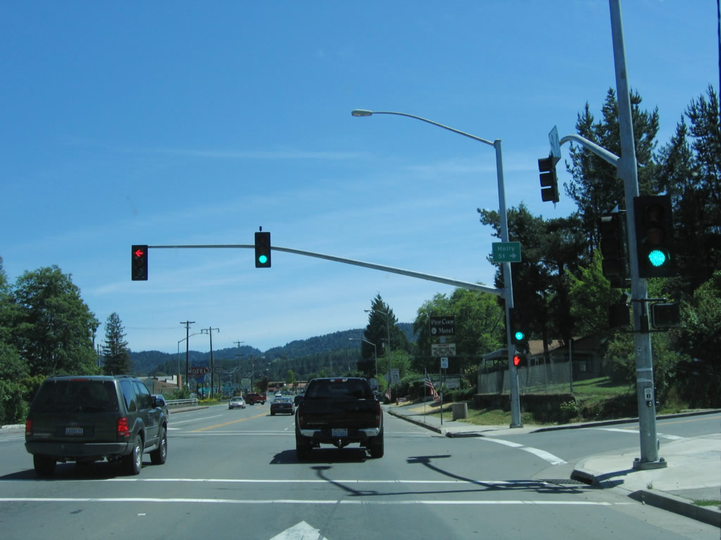
The next signalized intersection along southbound U.S. 101 and eastbound California 20 is with Holly Street. Photo taken 05/29/06. |
|
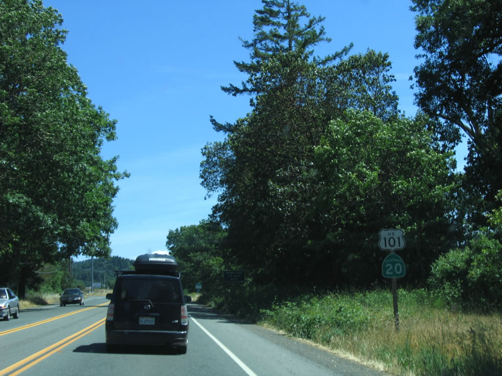
A set of reassurance shields for U.S. 101 south and California 20 is posted as the highway leaves Willits. Photo taken 05/29/06. |
|
After the Walker Road intersection (Exit 570), southbound U.S. 101 and eastbound California 20 widen into four lanes with a median barrier. From here, U.S. 101 begins its ascent over Ridgewood Summit. Photo taken 05/29/06. |
|
Four-lane U.S. 101 and California 20 cross this railroad bridge (South Willits Overhead) built in 1957. Photo taken 05/29/06. |
|
A weigh station is located at the top of Ridgewood Summit. Photo taken 05/29/06. |
|
Southbound U.S. 101 and eastbound California 20 meet the weigh station at Ridgewood Summit, elevation 1,953 feet. Photo taken 05/29/06. |
|
After the weigh station at Ridgewood Summit, southbound U.S. 101 leaves the Eel River watershed and enters the Russian River watershed. Photo taken 05/29/06. |
|
|
|
|
A median between the two directions of traffic is in place for the descent from Ridgewood Summit. Photo taken 05/29/06. |
|
Southbound U.S. 101 and eastbound California 20 (Redwood Highway) approach Reeves Canyon Road. Photo taken 05/29/06. |
|
At the base of the Ridgewood Summit grade, southbound U.S. 101 and eastbound California 20 (Redwood Highway) approach North State Street, which is the old alignment of U.S. 101 south into Ukiah. This route functions as a business route, but it is not signed as such. Photo taken 05/29/06. |
|
After the North State Street turnoff, southbound U.S. 101 and eastbound California 20 assume a freeway configuration. The next three exits on U.S. 101 are Exit 557, West Road to Redwood Valley; Exit 555B, California 20 east to Lakeport; and Exit 555A, Calpella. Photo taken 05/29/06. |
|
A begin freeway sign assembly confirms that U.S. 101 is now a freeway for the first time since leaving the vicinity of Leggett and Cummings in northern Mendocino County. Photo taken 05/29/06. |
|
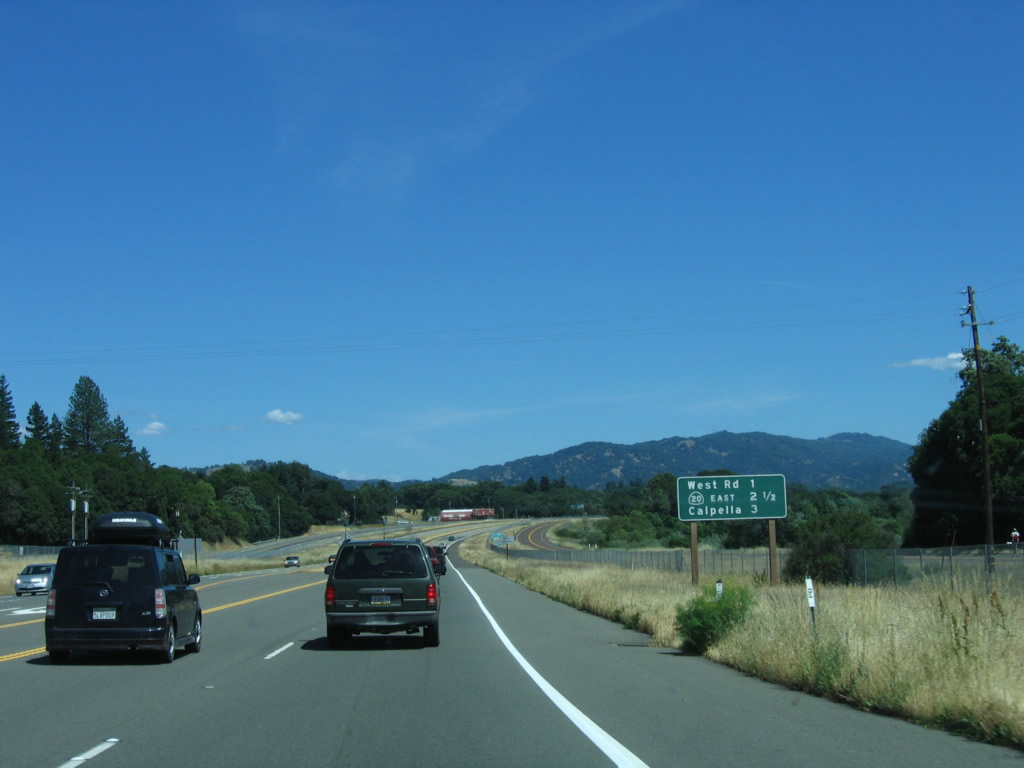
The next exit along southbound U.S. 101 and eastbound California 20 is Exit 557, West Road to Redwood Valley. Photo taken 05/29/06. |
|
Use Exit 557, West Road to the Coyote Valley Indian Reservation. Photo taken 05/29/06. |
|
Redwood Valley is an unincorporated area north of Ukiah. Photo taken 05/29/06. |
|
Southbound U.S. 101 and eastbound California 20 reach Exit 557, West Road to Redwood Valley and Coyote Valley Indian Reservation. Photo taken 05/29/06. |
|
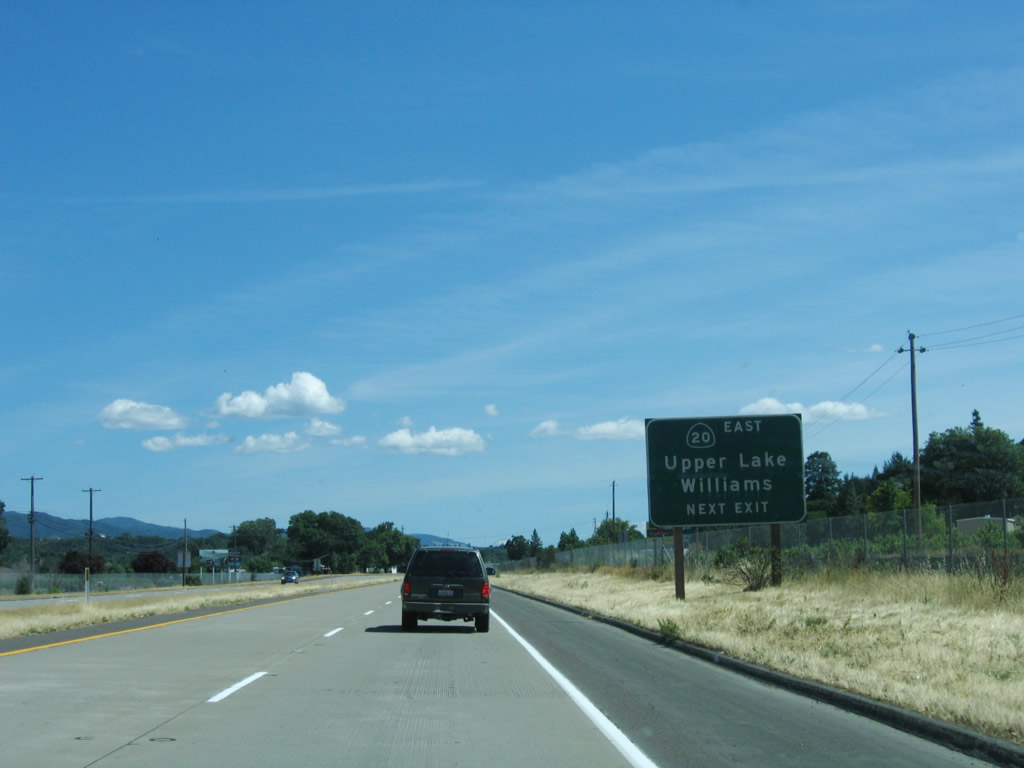
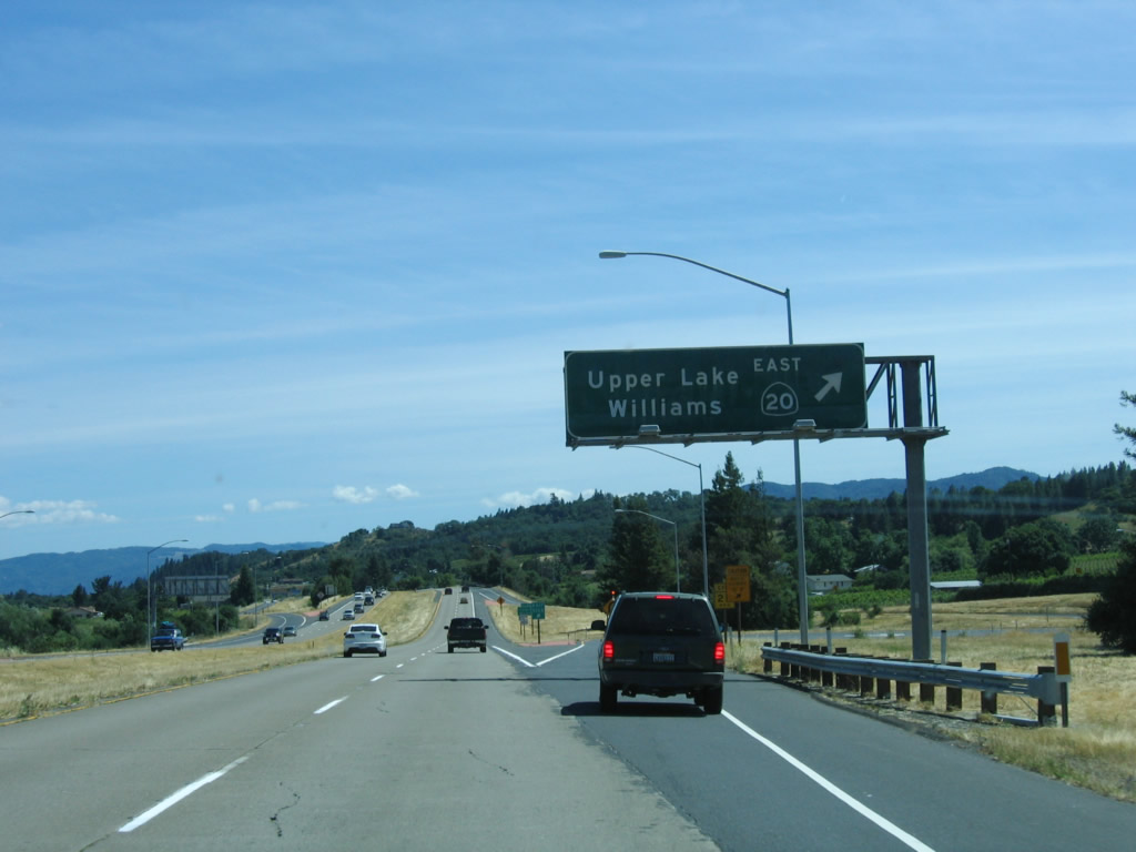
The next two exits along southbound U.S. 101 and eastbound California 20 are Exit 555B, California 20 east to Upper Lake, Lakeport, Clearlake, and Williams and Exit 555A, Calpella. Photo taken 05/29/06. |
|
California 20 travels east along the Mendocino River and the north shore of Clear Lake before connecting to the Central Valley. California 20 is perhaps the best east-west connection north of Interstate 80 across the coastal range and Pacific Ridge. Use California 20 east to California 29, which travels southeast to Lakeport, Kelseyville, Lower Lake, Middletown, and Napa Valley. Use California 20 east to California 53 south to the city of Clearlake and Lower Lake. Photo taken 05/29/06. |
|
Many resorts and campgrounds line Clear Lake, and California 20 provides the link to the various attractions along the north shore. California 29 provides the connection to the south shore resorts, including Konocti Harbor Resort and Spa (via California 29 south to California 281 west). Photo taken 05/29/06. |
|
Southbound U.S. 101 and eastbound California 20 split at Exit 555B. From here, U.S. 101 continues south toward Ukiah, the seat of Mendocino County, while California 20 travels east toward Clear Lake. This is a trumpet interchange. Photo taken 05/29/06. |
| U.S. 101 south |
|
The next exit along southbound U.S. 101 is Exit 555A, Central Avenue to Calpella. Calpella is notable as the location for the interchange between U.S. 101 and California 20. This township extends north from Ukiah toward Round Valley and Little Lake, and the town of Calpella as founded in 1858, making it one of the earliest settlements in Mendocino County. Calpella was considered as a site for Mendocino County, but Ukiah was chosen instead. Ukiah has since vastly outpaced Calpella in growth over the years. The town was named by settlers for the chief of the Native American tribe; "Calpella" refers to a "shell bearer" in the Native American language. Photo taken 05/29/06. |
|
Southbound U.S. 101 (Redwood Highway) reaches Exit 555A, Central Avenue to Calpella. Photo taken 05/29/06. |
|
A U.S. 101 reassurance shield is posted after the Calpella exit. Photo taken 05/29/06. |
|
This mileage sign provides the distance to Ukiah, Santa Rosa, and San Francisco. Photo taken 05/29/06. |
|
The next exit along U.S. 101 south is Exit 552, Lake Mendocino Drive. Photo taken 05/29/06. |
|
Southbound U.S. 101 (Redwood Highway) reaches Exit 552, Lake Mendocino Drive. Photo taken 05/29/06. |
|
The next four exits serve the city of Ukiah, which is the seat of Mendocino County and is located at 610 feet elevation and reaches an annual average of 36.96 inches of rain. Ukiah became county seat when Mendocino County split from Sonoma County in 1859; Ukiah incorporated in 1876. Home to 15,497 people as of the 2000 Census, Ukiah is another major wine-producing region and is home to the Mendocino Brewing Company (which was formerly the Hopland Brewing Company). Photo taken 05/29/06. |
|
The next exit along southbound U.S. 101 is Exit 551, U.S. 101 Business/North State Street south into downtown Ukiah. Photo taken 05/29/06. |
|
Use Exit 551 to the Pinoleville Indian Reservation. Photo taken 05/29/06. |
|
Most motorist services can be obtained at Exit 551, North State Street. State Street is not signed as a business route, but it functions as a business loop and connects through downtown Ukiah. Photo taken 05/29/06. |
|
Southbound U.S. 101 reaches Exit 551, U.S. 101 Business/North State Street south into downtown Ukiah. Photo taken 05/29/06. |
|
Upon exiting, turn right onto North State Street south toward downtown Ukiah or left onto North State Street toward Pinoleville Indian Reservation. Photo taken 05/29/06. |
|
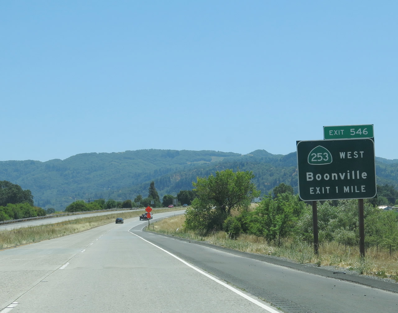
Skipping ahead to the southern edge of Ukiah, southbound U.S. 101 (Redwood Highway) approaches Exit 546, California 253 (Boonville-Ukiah Road) west to Boonville. This exit also links to U.S. 101 Business/South State Street north and the Ukiah Municipal Airport. Photo taken 07/05/13. |
|
An exit number sign is posted for Exit 546, California 253 (Boonville-Ukiah Road) west to Boonville along southbound U.S. 101 (Redwood Highway). California 253 begins at this interchange and extends west to Boonville and Anderson Valley. Photo taken 07/05/13. |
|
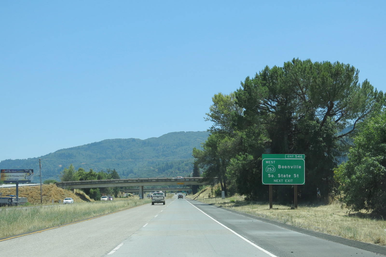
Southbound U.S. 101 (Redwood Highway) meets Exit 546, California 253 (Boonville-Ukiah Road) west to Boonville and U.S. 101 Business/South State Street north to the Ukiah Municipal Airport. Photo taken 07/05/13. |
|
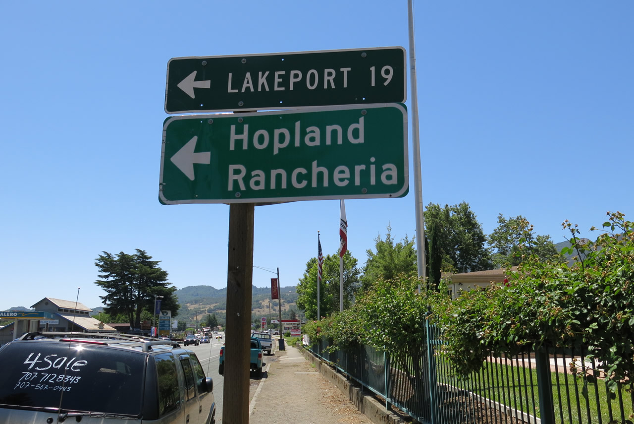
Skipping ahead to Hopland, southbound U.S. 101 (Redwood Highway) approaches California 175 in downtown Hopland. California 175 travels east over the steep Hopland Grade into Lake County, where it connects to California 29 near Lakeport. California 29 and California 175 merge together to bypass Kelseyville, then split again. California 29 takes a fast route to Middletown via Lower Lake, while California 175 takes a slower pace through Cobb Mountain before ending at Middletown. Photo taken 07/05/13. |
|
A mileage sign points the way to Lakeport (19 miles), and an auxiliary sign mentions that California 175 east also leads to Hopland Rancheria. Photo taken 07/05/13. |
Page Updated September 2, 2013.