
U.S. 101 South - San Luis Obispo County
U.S. 101 enters San Luis Obispo County, as it passes through Paso Robles, Atascadero, San Luis Obispo, Pismo Beach, and Arroyo Grande. In San Luis Obispo County, U.S. 101 continue south along El Camino Real through the Salinas Valley wine country, then turn southwest over Cuesta Grade Summit (el. 1,522 feet) and approaching the coastal plain via San Luis Obispo, where the freeway meets California 1 coming south from Big Sur. U.S. 101 and California 1 follow the coastline until Pismo Beach, where the two routes split. California 1 aims south toward Vandenburg Air Force Base, while U.S. 101 turns southwest through Grover Beach and Arroyo Grande toward Nipomo. The county line is located at the Santa Maria River just north of the city of Santa Maria in Santa Barbara County.
| U.S. 101 south | |
|---|---|
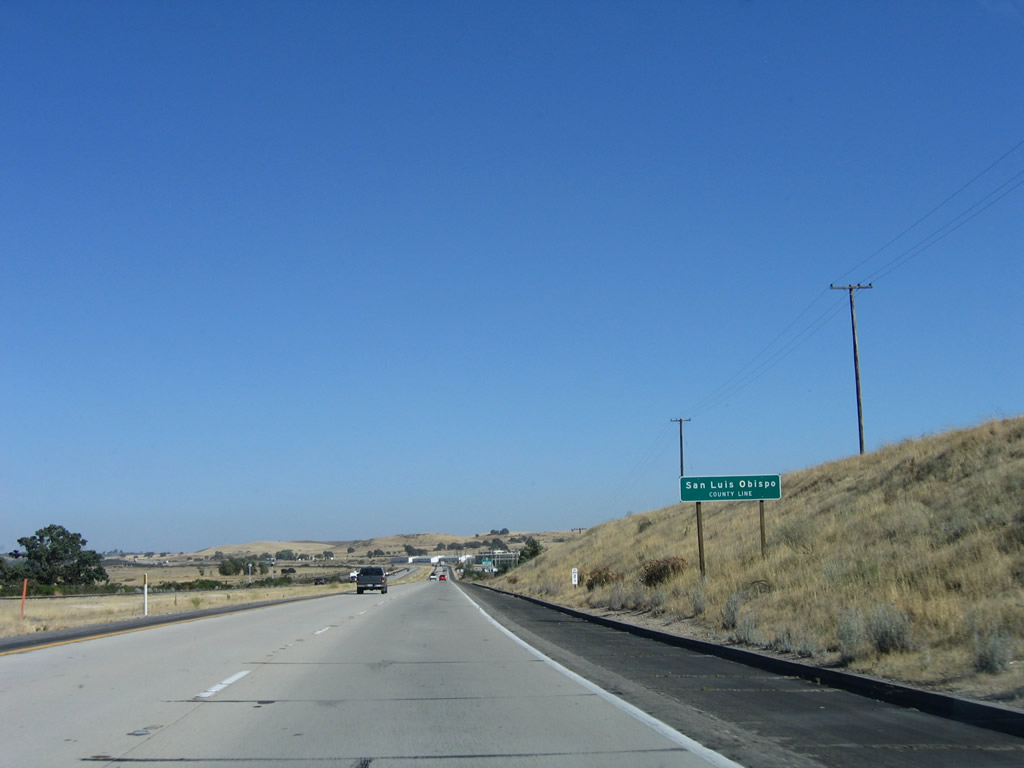 |
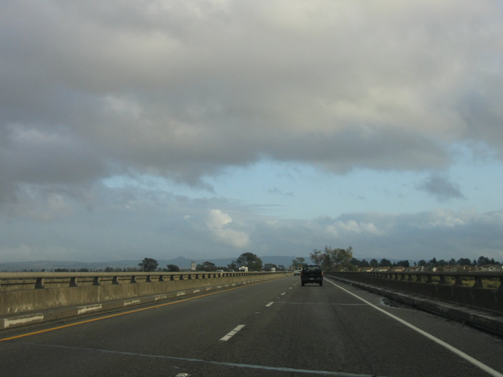
U.S. 101 (El Camino Real) leaves Monterey County and enters San Luis Obispo County. Photo taken 07/05/06. |
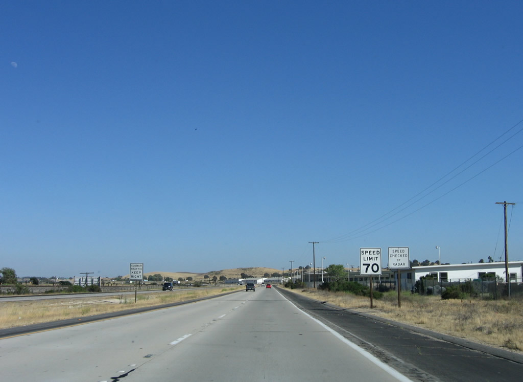 |
The speed limit along U.S. 101 south remains 70 miles per hour through Camp Roberts, but will revert back to 65 miles per hour prior to entering Paso Robles. Photo taken 07/05/06. |
 |
These buildings are part of Camp Roberts, which is part of the California National Guard. For more, visit California National Guard - Camp Roberts. Photo taken 07/05/06. |
 |
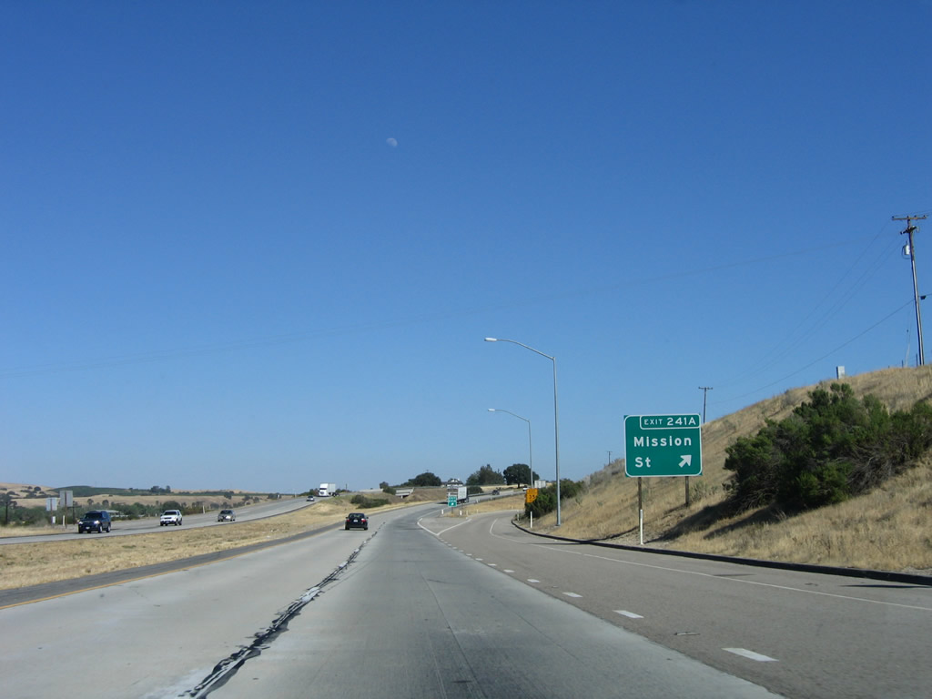
The next two exits are Exit 241B, San Miguel Avenue to Camp Roberts and Mission Street south and Exit 241A, Mission Street. Traffic to San Miguel is directed to use Exit 241A, Mission Street rather than Exit 241B. In the distance is the exit ramp to Exit 241B, which does not have any approach guide signs for it, only a gore point with exit number. Photo taken 07/05/06. |
 |
Southbound U.S. 101 reaches Exit 241B, San Miguel Avenue to Camp Roberts and Mission Street south. This gore point with exit number is the only signage for this interchange from southbound U.S. 101. Photo taken 11/29/04. |
 |
 |
The next exit after the southern Camp Roberts interchange (Exit 241B) is Exit 241A, Mission Street south to San Miguel. Mission Street could be a business route for U.S. 101, since it begins at Exit 241A and returns to the freeway at Exit 239A (northbound access only). Photos taken 07/05/06 and 11/27/05. |
 |
Southbound U.S. 101 (El Camino Real) reaches Exit 241A, Mission Street south to San Miguel. Photo taken 07/05/06. |
 |
U.S. 101 enters San Miguel, an unincorporated community of San Luis Obispo County. San Miguel was founded with the construction of Mission San Miguel Arc-ngel on July 25, 1797, and it has a population of 1,427 people (as of 2000 Census). Photo taken 07/05/06. |
 |
The next exit along U.S. 101 south is Exit 239, 10th Street east to downtown San Miguel and west to Perimeter Road in southwestern Camp Roberts. Photo taken 11/27/05. |
 |
Southbound U.S. 101 approaches Exit 239, 10th Street to San Miguel. Photo taken 11/29/04. |
 |
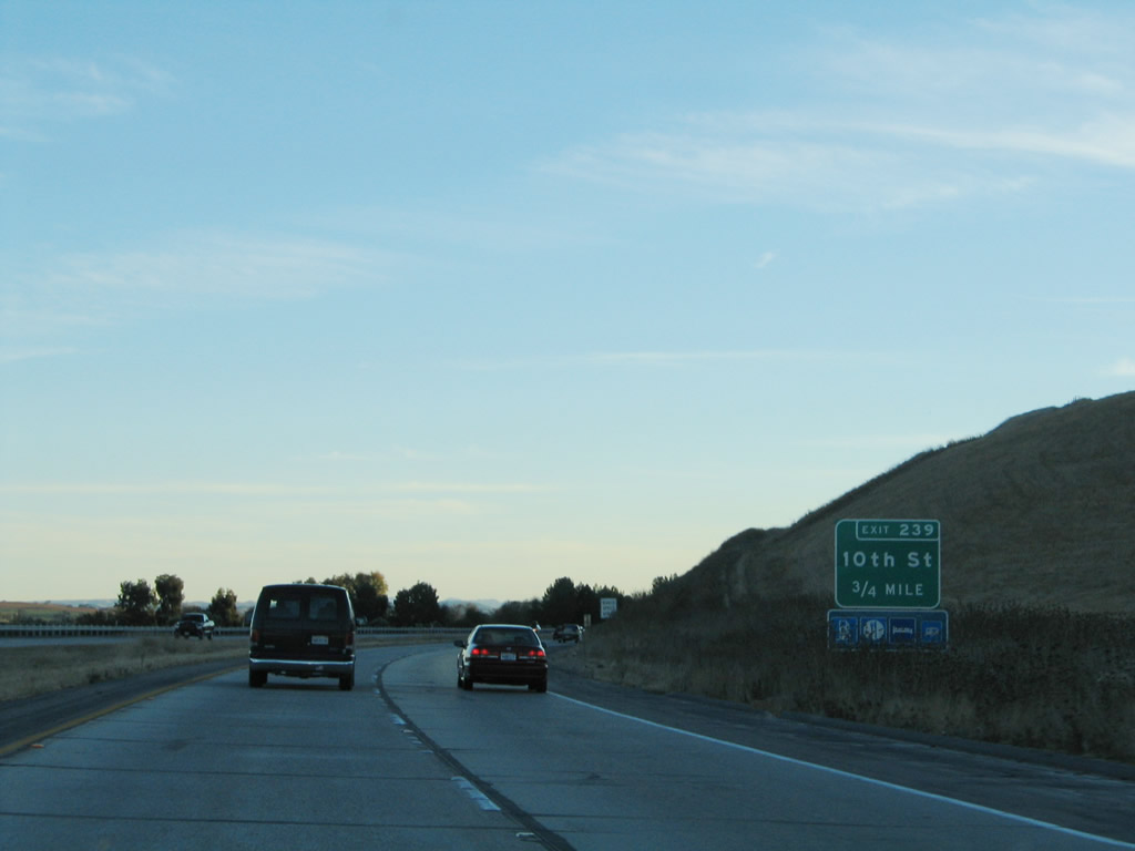
Southbound U.S. 101 reaches Exit 239, 10th Street to San Miguel. Note the unusual placement of this exit sign on the median rather than on the right side of the travel lanes. Photo taken 11/29/04. |
 |
After the 10th Street interchange and the merge with Mission Street south, the U.S. 101 freeway again ends. Photo taken 07/05/06. |
 |
This mileage sign provides the distance to Paso Robles (seven miles), San Luis Obispo (36 miles), and Los Angeles (240 miles). Photo taken 07/05/06. |
 |
For the next seven miles (until entering the city of Paso Robles), U.S. 101 will see at-grade intersections. This stretch of at-grade expressway is fairly long, but is not as long as the eight-mile section in Monterey County north of here. Photo taken 07/05/06. |
 |
The first intersection along U.S. 101 (El Camino Real) south is with San Marcos Road. Photo taken 07/05/06. |
 |
Southbound U.S. 101 (El Camino Real) crosses over San Marcos Creek on this bridge. Vineyards and farms again line both sides of U.S. 101. Photo taken 07/05/06. |
 |
The next intersection along U.S. 101 (El Camino Real) south is with Monterey Road. Photo taken 07/05/06. |
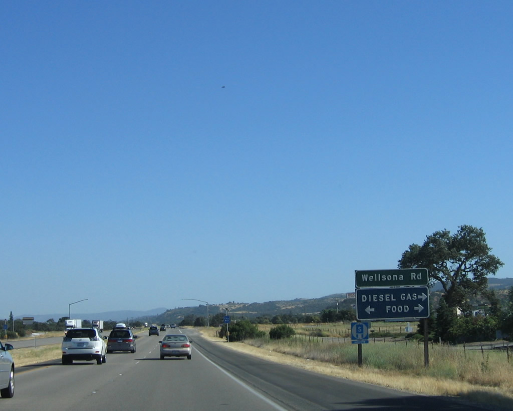 |
Southbound U.S. 101 (El Camino Real) next approaches Wellsona Road, which features motorist services (gas and food). Photo taken 07/05/06. |
 |
The next intersection along U.S. 101 (El Camino Real) south is with Exline Road, which connects with Stockdale Road (western frontage road) on the west and Monterey Road on the east side of the expressway. Photo taken 07/05/06. |
 |
At the next intersection along U.S. 101 (El Camino Real), turn right to connect with Stockdale Road and left to Monterey Road. Both roads parallel the expressway to provide local access. Photo taken 07/05/06. |
 |
After the Stockdale Road/Monterey Road intersection, U.S. 101 (El Camino Real) again becomes a freeway. The next four exits all serve the city of Paso Robles: Exit 232, U.S. 101 Business/Spring Street south; Exit 231B, California 46 east to Fresno and Bakersfield and San Luis Obispo County G-14/Nacimiento Lake Drive northwest; Exit 231A, 16th Street; and Exit 230, Pine Street. Photo taken 07/05/06. |
 |
A begin freeway sign is posted shortly thereafter. Photo taken 07/05/06. |
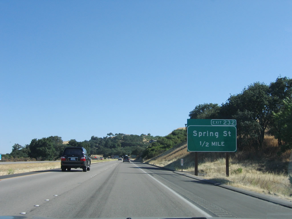 |
The next exit along U.S. 101 (El Camino Real) south is Exit 232, U.S. 101 Business/Spring Street south to Paso Robles. Photo taken 07/05/06. |
 |
U.S. 101 Business follows Spring Street south through Paso Robles between Exit 232 and Exit 229 (northbound access only). The business route remains west of U.S. 101, as the freeway bypasses the downtown area to the east. Photo taken 07/05/06. |
 |
Southbound U.S. 101 (El Camino Real) reaches Exit 232, U.S. 101 Business/Spring Street south to Paso Robles. After this interchange, U.S. 101 enters the city of Paso Robles. Photo taken 07/05/06. |
 |
The city of Paso Robles is the first incorporated city found along U.S. 101 south in San Luis Obispo County. Paso Robles means "Pass of the Oaks." Incorporated in 1889, Paso Robles originated from the Paso Robles Rancho (Mexican land grant) and is famous for its wine country and mineral bath waters. The city has a population of 24,297 as of the 2000 Census, sits at an elevation of 794 feet along the Salinas River. Paso Robles consists of 19.9 square miles in area. On December 22, 2003, a destructive 6.5 earthquake shook the city and caused two deaths from debris falling from a nearby clock tower (built in 1892). The central business district was damaged, but restorative work has continued through the rest of the decade, including erection of a new clock tower.1 Photo taken 07/05/06. |
 |
 |
U.S. 101 crosses the Salinas River on a nearly shoulderless bridge, then approaches Exit 231B, California 46 east to Bakersfield and Fresno and San Luis Obispo County G-14 north to Nacimiento Lake. Note the changes in signage between 2004 and 2006. Photo taken 07/05/06 and 11/29/04. |
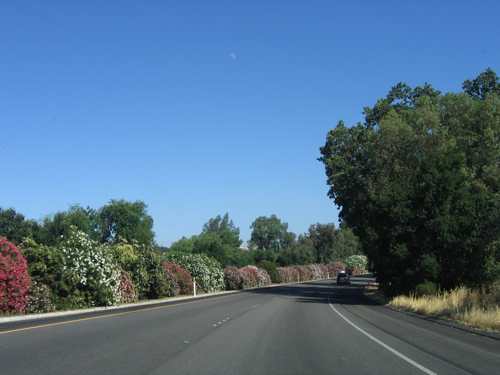 |
Stands of blooming oleander line U.S. 101 as the freeway proceeds south through Paso Robles. Although pretty in the summer, oleanders are poisonous and are toxic to humans if consumed. However, oleander bushes can be very pretty to view, especially on older sections of California freeways and expressways that still retain oleander in the center median or along the rights of way. Photo taken 07/05/06. |
 |
Amidst the colorful oleander bushes, U.S. 101 approaches Exit 231B. Upon exiting, turn left (east) to follow California 46 east to the Central Valley, with connections to Interstate 5 and California 99. Turn right (west) to follow San Luis Obispo County G-14/Nacimiento Lake Drive northwest to Nacimiento Lake and Lockwood. Photo taken 07/05/06. |
 |
California 46 is a major east-west highway connecting the Central Coast with the Central Valley. For traffic connecting to Interstate 5, use California 46 east to that freeway interchange near Lost Hills. The section of California 46 between California 41 and California 99 was formerly part of U.S. 466, but the U.S. highway did not serve Paso Robles. Instead, U.S. 466 more or less followed California 41 southwest to Atascadero and ultimately Morro Bay. Photo taken 07/05/06. |
 |
Southbound U.S. 101 (El Camino Real) reaches Exit 231B, California 46/24th Street east to Bakersfield and Fresno and San Luis Obispo County G-14/24th Street west to Nacimiento Lake. For traffic continuing west on California 46, follow U.S. 101 south; the two routes share an alignment around Paso Robles, then separate at Exit 228. Photo taken 07/05/06. |
 |
The next exit along U.S. 101 south and California 46 west is Exit 231A, 16th Street. Follow 16th Street west to downtown Paso Robles. Photo taken 07/05/06. |
| U.S. 101 (El Camino Real) south and California 46 west | |
|---|---|
 |
This is the first reassurance shield assembly to feature both U.S. 101 south and California 46 west together. Photo taken 11/29/04. |
 |
Another exit sign is posted in the median of U.S. 101, which appears to be a common design theme for this section of freeway. The next exit is Exit 231A, 16th Street to downtown Paso Robles. Photo taken 07/05/06. |
 |
Turning a bit to the southwest, U.S. 101 south and California 46 west reach Exit 231A, 16th Street to downtown Paso Robles. Photo taken 11/29/04. |
 |
The next exit along U.S. 101 south and California 46 west is Exit 230, Pine Street. Photo taken 07/05/06. |
 |
Southbound U.S. 101 and westbound California 46 reach Exit 230, Pine Street. This is the final Paso Robles exit. Photo taken 11/29/04. |
 |
U.S. 101 again crosses the Salinas River; after this crossing, the river will remain east of the freeway. There is no access from U.S. 101 south and California 46 west to U.S. 101 Business/Spring Street north at Exit 228, but the on-ramp from the business route can be seen ahead. Photo taken 07/05/06. |
 |
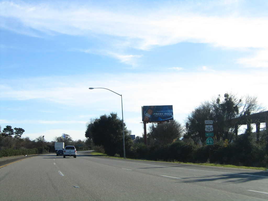
This mileage sign along U.S. 101 south and California 46 west provides the distance to Atascadero (10 miles), San Luis Obispo (27 miles), and Los Angeles (231 miles). Omitted is the distance to Cambria or Hearst Castle (San Simeon) via California 46 west. Photo taken 07/05/06. |
 |
Speaking of Cambria and Hearst Castle, California 46 will split from U.S. 101 at the next interchange (Exit 228). While U.S. 101 will continue south through the upper Salinas Valley toward Atascadero, California 46 will drive west toward the coast, connecting with California 1 south of Cambria and near Hearst Castle. Photo taken 11/29/04. |
 |
Hearst Castle is part of Hearst San Simeon State Historical Monument. Hearst Castle (La Cuesta Encantada, or The Enchanted Hill) is the massive estate once owned by deceased newspaper magnate William Randolph Hearst. Construction began in 1919 and continued through the rest of Hearst's life; after Hearst died, La Cuesta Encantada was deeded to the state of California by the Hearst Corporation in 1957. The state now operates the site as a state historic monument. Hearst's life inspired a movie, Citizen Kane (1941), which is considered to be among the best movies of all time. Guided tours leave the visitors center through the day to take tourists through various parts of the castle and grounds, which include gilded pools and beautiful landscaping. For a day trip, Hearst Castle is well worth the visit. Photo taken 07/05/06. |
 |
A safety guardrail is placed in the median strip for this section of U.S. 101. Exit 228 also serves Ramada Drive and Theatre Drive. Photo taken 07/05/06. |
 |
The routes divide at Exit 228, as California 46 splits west toward Cambria and Hearst Castle, while U.S. 101 continues south toward Atascadero. California 46 passes through more wine country before connecting with the coast south of Cambria. The unincorporated community of Cambria (population 6,232 as of 2000 Census) is the southern entrance to the drive along California's Big Sur. California 1 follows the craggy coast from Cambria and San Simeon north to Monterey and Carmel-by-the-Sea. This drive is consistently rated as among America's best drives, as the ocean offers a stunning contrast with the towering mountains of the Santa Lucia Range. Photo taken 07/05/06. |
| U.S. 101 south | |
 |
The next three exits all serve the unincorporated community of Templeton (population 4,687 as of 2000 Census), which was founded in 1886. Like Paso Robles and Atascadero, Templeton is in a Mediterranean climate and sees about 15 inches of precipitation annually, most of which falls during the fall-winter-spring months. Photo taken 07/05/06. |
 |
The next exit along U.S. 101 (El Camino Real) south is Exit 226, U.S. 101 Business (Main Street) south to Templeton. Photo taken 07/05/06. |
 |
Southbound U.S. 101 (El Camino Real) reaches Exit 226, U.S. 101 Business (Main Street) south to Templeton. Photo taken 07/05/06. |
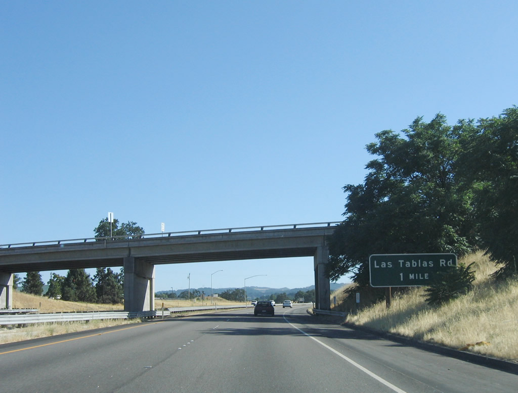 |
The next exit along U.S. 101 (El Camino Real) south is Exit 225, Las Tablas Road to Templeton. Photo taken 07/05/06. |
 |
Southbound U.S. 101 (El Camino Real) reaches Exit 225, Las Tablas Road east to Templeton and west to California 46 en route to Cambria. Photo taken 07/05/06. |
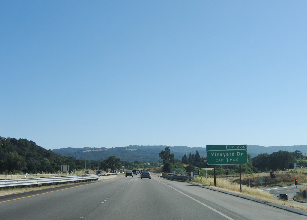 |
The next exit along U.S. 101 (El Camino Real) south is Exit 224, Vineyard Drive west and U.S. 101 Business/Templeton Road east to Templeton. Photo taken 07/05/06. |
 |
Southbound U.S. 101 (El Camino Real) reaches Exit 224, Vineyard Drive west and U.S. 101 Business/Templeton Road east to Templeton. Photo taken 07/05/06. |
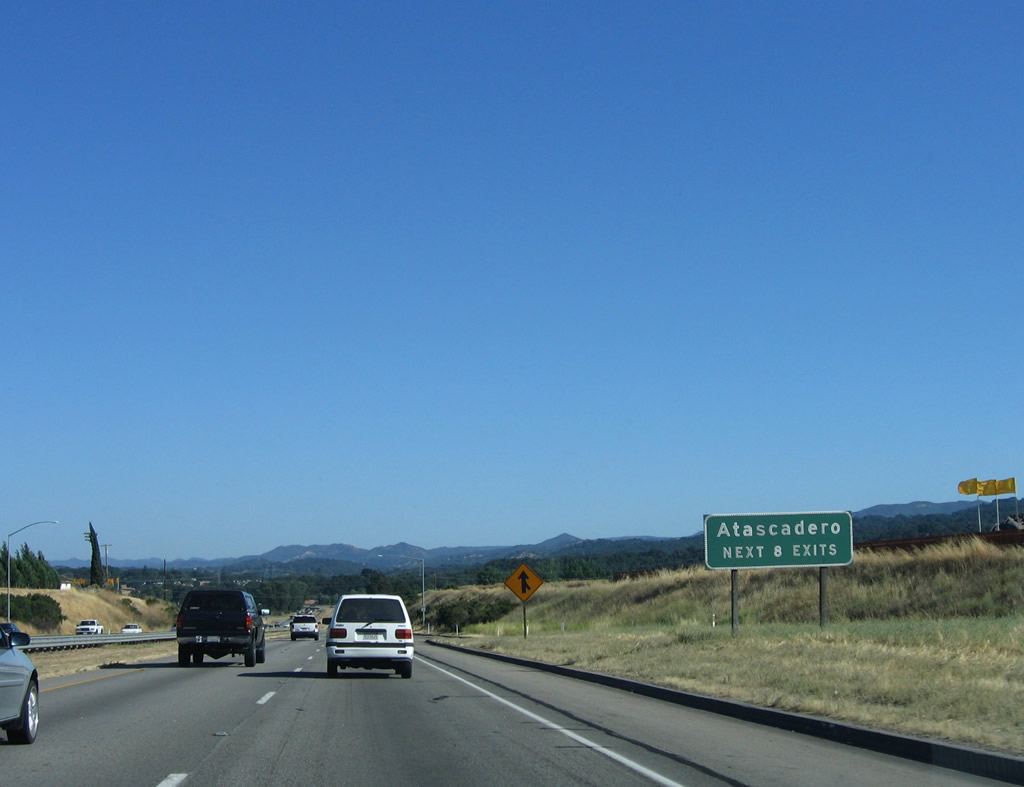 |
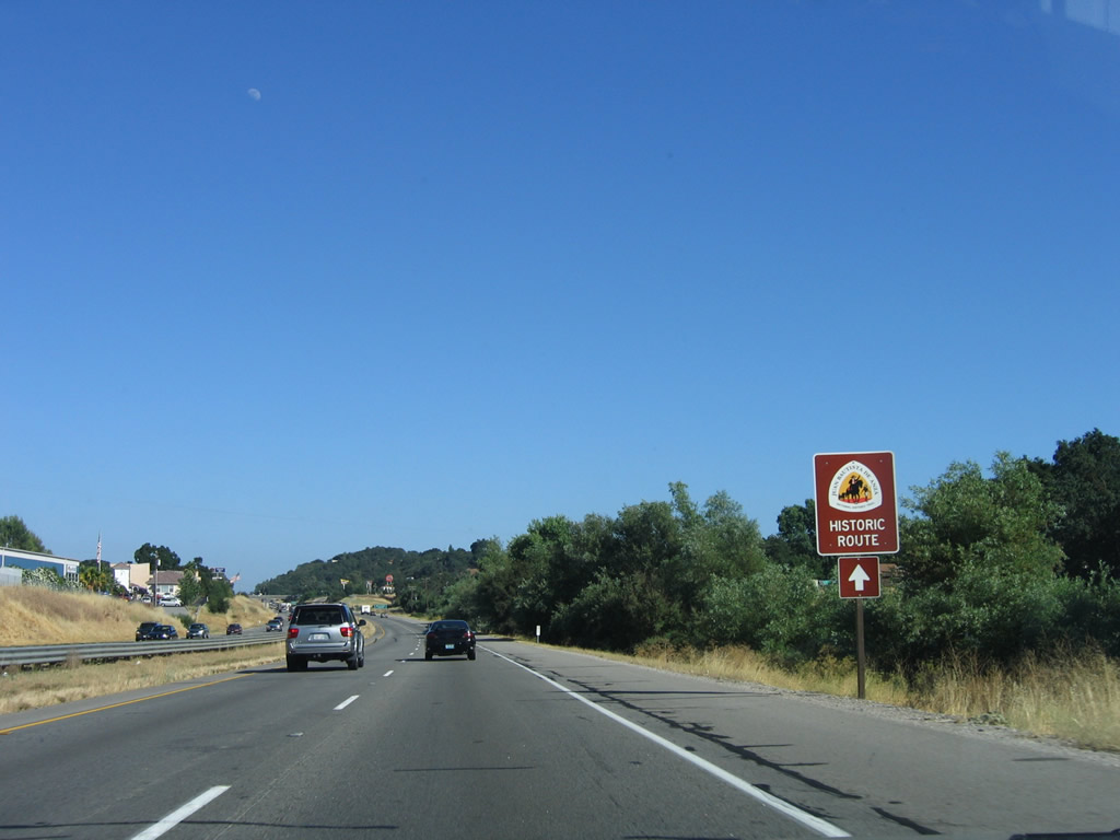
The next eight exits along U.S. 101 (El Camino Real) south serve the city of Atascadero: Exit 223, San Ramon Road (Santa Cruz Road) to El Camino Real south; Exit 222, Del Rio Road; Exit 220B, San Anselmo Road; Exit 220A, Traffic Way; Exit 219, California 41 west to Morro Bay and east to Atascadero; Exit 218B, Curbaril Avenue; Exit 218A, Santa Rosa Road; and Exit 216, Santa Barbara Road. Photo taken 07/05/06. |
 |
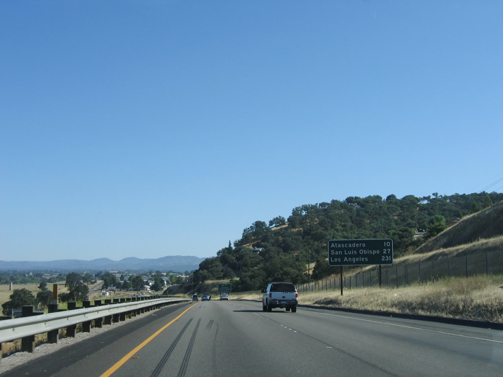
This mileage sign provides the distance to Atascadero (four miles); Santa Maria (52 miles); and Los Angeles (225 miles). Atascadero is roughly equidistant between San Francisco and Los Angeles. Photo taken 07/05/06. |
 |
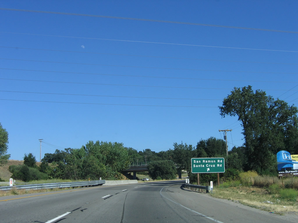
The next exit along U.S. 101 (El Camino Real) south is Exit 223, San Ramon Road to Santa Cruz Road and El Camino Real (U.S. 101 Business). San Ramon Road travels south from this interchange on the west side of the U.S. 101 freeway. Santa Cruz Road travels east from this interchange, changing into Traffic Way at the point where the road turns southeast. Traffic Way follows an alignment that parallels the railroad and Salinas River, then turns south into downtown Atascadero. Also emanating from this interchange is El Camino Real, which parallels U.S. 101 on the east side of the freeway. Photo taken 07/05/06. |
 |
U.S. 101 passes under a 500kV power line and a 230kV power line. The 500kV power line is one of three to connect the Diablo Canyon Nuclear Generating Station on the coast with the Path 15 electricity transmission system that travels north-south through California's Central Valley. This particular line travels northeast from the nuclear power plant to a substation located near the Interstate 5 and California 198 interchange in the Central Valley. Photo taken 07/05/06. |
 |
Southbound U.S. 101 (El Camino Real) reaches Exit 223, San Ramon Road, Santa Cruz Road, and El Camino Real. This interchange would be the northern terminus of U.S. 101 Business, which would travel south along El Camino Real (or Traffic Way) to downtown Atascadero. Photo taken 07/05/06. |
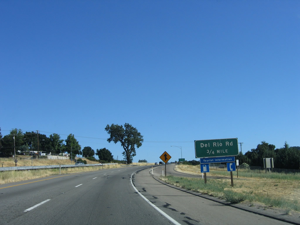 |
The next exit along U.S. 101 is Exit 222, Del Rio Road. Photo taken 07/05/06. |
 |
U.S. 101 (El Camino Real) enters the city of Atascadero, which has a population of 26,411 as of the 2000 Census, sits at an elevation of 879 feet, and consists of 26.7 square miles. Located approximately 225 miles from either San Francisco or Los Angeles, Atascadero was founded in 1913 and incorporated in 1979. Atascadero was founded as a utopian society colony by Edward Gardner Lewis. Damage to the city was sustained during the December 22, 2003, San Simeon earthquake (6.5 magnitude), which also damaged downtown Paso Robles to the north. Photo taken 07/05/06. |
 |
Southbound U.S. 101 reaches Exit 222, Del Rio Road. Photo taken 07/05/06. |
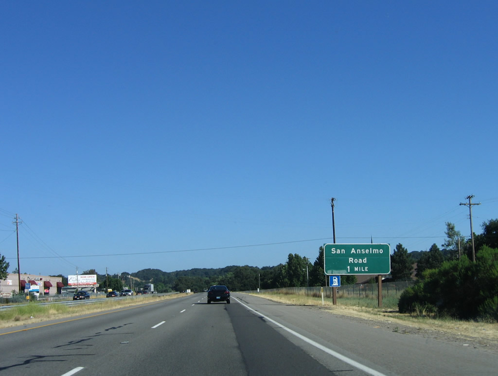 |
The next exit along U.S. 101 is Exit 220B, San Anselmo Road. Photo taken 07/05/06. |
 |
Motorist services are all available at the next five exits (all of which serve the city of Atascadero). Photo taken 07/05/06. |
 |
Continue south along U.S. 101 for the historic San Juan Bautista de Anza National Historic Trail. Photo taken 07/05/06. |
 |
Southbound U.S. 101 reaches Exit 220B, San Anselmo Road. Photo taken 07/05/06. |
 |
The next exit along U.S. 101 south is Exit 220A, Traffic Way. Photo taken 07/05/06. |
 |
Use Exit 220A, Traffic Way to the Atascadero Administration Building (Rotunda Building), which was constructed between 1914 and 1918. Located at 6500 Palma Avenue, it was the city hall and museum until it was damaged in the 2003 San Simeon earthquake. Photo taken 07/05/06. |
 |
Southbound U.S. 101 reaches Exit 220A, Traffic Way into downtown Atascadero. This exit also connects to El Camino Real, which still parallels the freeway on the east side. Photo taken 07/05/06. |
 |
The next exit along U.S. 101 south is Exit 219, California 41 east to downtown Atascadero and west to Morro Bay. This section of California 41 (from Morro Bay to Shandon via Atascadero) is basically the old alignment of defunct U.S. 466. The former U.S. highway used to originate in Morro Bay and extend east via California 41 and California 46 to U.S. 99 in the Central Valley north of Bakersfield. After a brief overlap with U.S. 99 south into Bakersfield, U.S. 466 continued east via California 58 to Barstow, where U.S. 466 almost met its parent U.S. 66 (but missed the Mother Road by a few blocks). U.S. 466 then turned northeast on former U.S. 91 (Interstate 15) to Las Vegas, then turned southeast via U.S. 93 to end at U.S. 66 in Kingman, Arizona. The routing of U.S. 466 between U.S. 101 in Atascadero and Shandon was nebulous in maps until the mid-1950s, which is why there is some confusion on the exact location of the original alignment for this route. For our purposes, California 41 more or less covers the general alignment of the old route. Photo taken 07/05/06. |
 |
Southbound U.S. 101 reaches Exit 219, California 41 east to downtown Atascadero and west to Morro Bay. California 41 is a major north-south corridor, but it is signed as east-west between Morro Bay and Shandon (the section that follows Old U.S. 466). From Cholame, California 41 is signed north-south and follows a major corridor toward Fresno. The highway changes into a freeway through Fresno (meeting California 99 near downtown Fresno), and it eventually leads into Yosemite Valley in Yosemite National Park. Photo taken 07/05/06. |
 |
The next exit along U.S. 101 south is Exit 218B, Curbaril Avenue. Photo taken 07/05/06. |
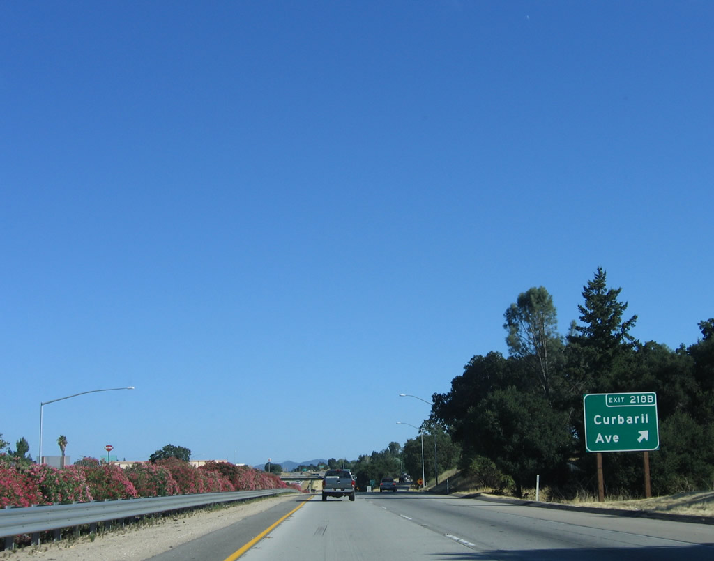 |
Southbound U.S. 101 reaches Exit 218B, Curbaril Avenue. Photo taken 07/05/06. |
 |
The next exit along U.S. 101 south is Exit 218A, Santa Rosa Road. Photo taken 07/05/06. |
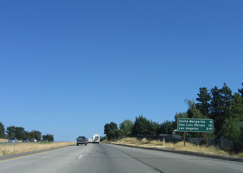 |
This mileage sign along U.S. 101 south provides the distance to Santa Margarita (eight miles), San Luis Obispo (16 miles), and Los Angeles (219 miles). Photo taken 07/05/06. |
 |
Use Exit 218A, Santa Rosa Road east to El Camino Real, Heilman Regional Park, and the Atascadero State Hospital (all male, maximum security prison for various psychiatric issues). Photo taken 07/05/06. |
 |
Southbound U.S. 101 reaches Exit 218A, Santa Rosa Road. Photo taken 07/05/06. |
 |
Original concrete bridge railing is still in place on the Santa Rosa Road overpass. Photo taken 07/05/06. |
 |
The next exit along U.S. 101 south is Exit 216, Santa Barbara Road. Use Santa Barbara Road east to El Camino Real, which is Old U.S. 101. The old alignment travels southeast to unincorporated Garden Farms and Santa Margarita. Photo taken 07/05/06. |
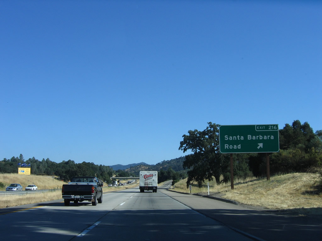 |
Southbound U.S. 101 reaches Exit 216, Santa Barbara Road. This is the final exit to serve the city of Atascadero and would be the southern terminus of U.S. 101 Business. Photo taken 07/05/06. |
 |
South of Atascadero, U.S. 101 passes through rolling hills and oak trees, leaving the Salinas River behind for the first time since near the city of Salinas in Monterey County. The next exit will be five miles south of the Santa Barbara Road interchange. Photo taken 07/05/06. |
 |
The next exit along U.S. 101 south is Exit 211, California 58 (California's Loneliest Road) east to Santa Margarita, California Valley, McKittrick, and Taft. This two-lane highway extends east across some of the most sparsely populated areas in the Central Coast and anywhere outside of the deserts in Central or Southern California. Traffic counts along this section of highway are low. Photo taken 07/05/06. |
 |
Use California 58 east to Santa Margarita Lake, which is a reservoir located along the Salinas River in the Santa Lucia Range. The Salinas River has its headwaters in this range east of here. Photo taken 07/05/06. |
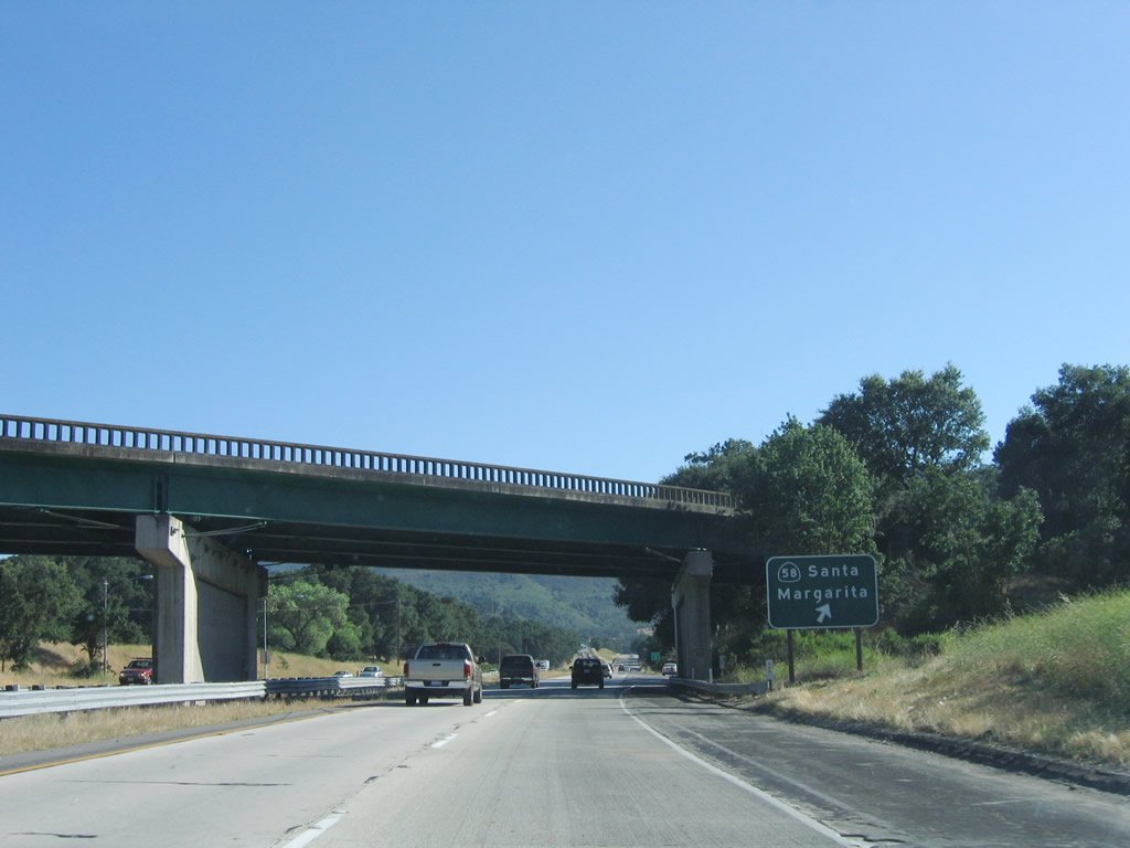 |
Southbound U.S. 101 reaches Exit 211, California 58 east. This interchange also serves as the point where old U.S. 101 (El Camino Real) again joins the freeway alignment. After this exit, U.S. 101 again downgrades from a freeway to an expressway alignment for the trip over Cuesta Grade Summit and the Santa Lucia Range. Photo taken 07/05/06. |
 |
U.S. 101 climbs toward Cuesta Grade Summit (el. 1,522 feet), which enables El Camino Real to cross Santa Lucia Range. A brake check area is located on top of the summit for vehicles prior to descending the pass into San Luis Obispo. This grade is one of the few remaining major hills along the U.S. 101 corridor, which manages to keep a much lower elevation than Interstate 5 does when crossing Tejon Pass in the Tehachapi Mountains. Photo taken 11/29/04. |
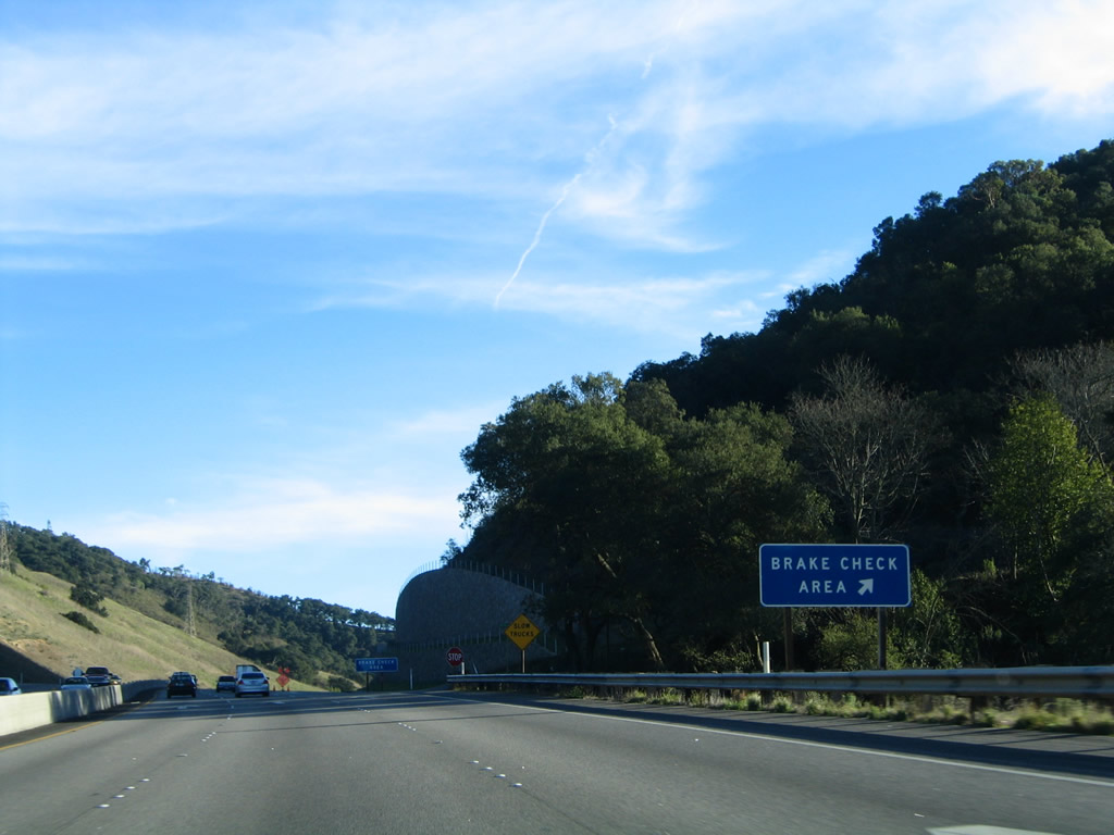 |
Reaching Cuesta Grade Summit (el. 1,522 feet), a truck climbing lane continues but is now for slow truck traffic descending the grade. The brake check area is located on the right. Photo taken 11/29/04. |
 |
A tall retaining wall keeps rocks and mud off the highway near the brake check area. The climbing lane comes to an end, and the highway begins to descend into San Luis Obispo. Photo taken 11/29/04. |
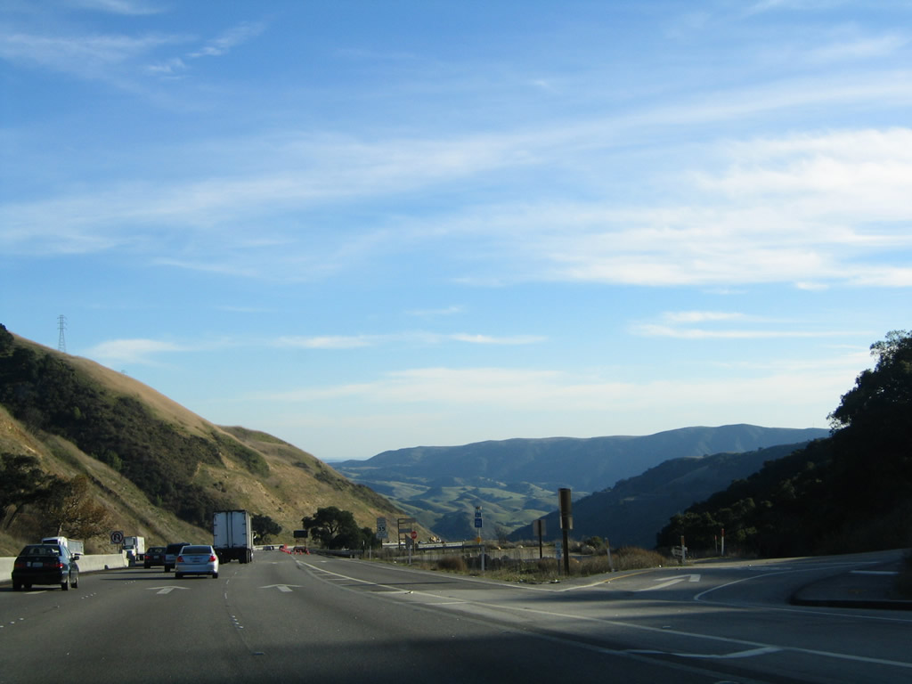 |
At the brake check area off-ramp, the valley containing the city of San Luis Obispo comes into view. The three lane configuration continues down the hill from the summit. Photo taken 11/29/04. |
 |
 |
The three-lane U.S. 101 southbound expressway continues downhill, offering beautiful views of the valley below. Photos taken 11/29/04. |
 |
On the downgrade, an at-grade intersection is located at Old Stagecoach Road. This intersection provides local and residential access. Photo taken 11/29/04. |
 |
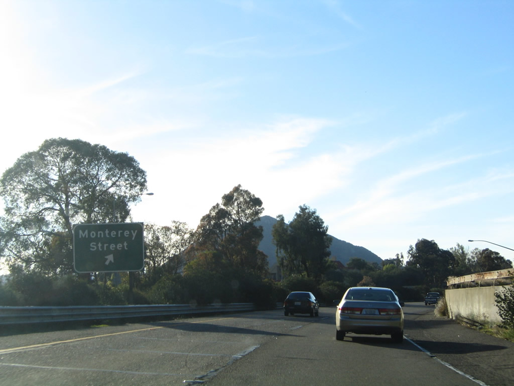
At the bottom of the hill from Cuesta Grade Summit, U.S. 101 again becomes a freeway and approaches the city of San Luis Obispo, a destination city on mileage signs since Monterey County. Commonly known as SLO, San Luis Obispo is the seat of San Luis Obispo County and is the among the larger cities on the Central Coast of California (population 44,174 as of the 2000 Census). Founded along with the Mission San Luis Obispo de Tolosa in 1772 by Father Junipero Serra, San Luis Obispo features a bustling downtown and features an incredible array of restaurants, shops, and museums in a walkable core. The city is also home to the California State Polytechnic University (Cal Poly), which has over 18,000 students and offers a variety of degree programs. The 6,000-acre campus is situated northwest of U.S. 101 and can be reached via Exit 204, Monterey Street. Photo taken 11/29/04. |
 |
The first of eight San Luis Obispo interchanges is Exit 204, Monterey Street. If there were a business loop through San Luis Obispo, it would follow old U.S. 101, which includes Monterey Street and the Higuera Street and Marsh Street one-way couplet. However, no business route is signed through San Luis Obispo, and it is unclear if one ever existed through the city. Use Monterey Street southwest into downtown, and follow Monterey Street southwest to Grand Avenue north to Cal Poly. Photo taken 11/29/04. |
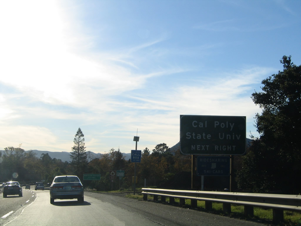 |
A sign for Cal Poly and the city limits of San Luis Obispo come prior to the Monterey Street exit. Photo taken 11/29/04. |
 |
Southbound U.S. 101 (El Camino Real) reaches Exit 204, Monterey Street southwest to downtown San Luis Obispo and Cal Poly. After traveling nearly due south or southeast since Paso Robles, U.S. 101 takes a turn west through San Luis Obispo and will turn south again near Exit 201, California 227/Madonna Road. Photo taken 11/29/04. |
 |
After the Monterey Street off-ramp, an interchange sequence sign provides the distance to the next three exits along U.S. 101 south: Exit 203C, California Boulevard; Exit 203B, California 1 north to Morro Bay and Cambria; and Exit 203A, Santa Rosa Street. Photo taken 11/29/04. |
 |
Southbound U.S. 101 approaches Exit 203C, California Boulevard. This exit also connects to Cal Poly via northbound and to downtown SLO via southbound. U.S. 101 continues west from this point. Photo taken 11/29/04. |
 |
Soon thereafter, southbound U.S. 101 reaches Exit 203C, California Boulevard. Photo taken 11/29/04. |
 |
The off-ramp for Exit 203B, California 1 north to Morro Bay comes quickly after the California Boulevard interchange. The two routes merge together for the first time since the southern approach to the Golden Gate Bridge in San Francisco, and they will spend the rest of their journey southwest to Los Angeles closely linked. While U.S. 101 generally follows the faster route, California 1 occasionally departs to serve coastal cities or take an alternative route through the rest of San Luis Obispo County and Santa Barbara County. The two routes will split permanently in Oxnard in Ventura County. But for now, they merge and will remain together until Pismo Beach. Photo taken 11/29/04. |
 |
This interchange sequence sign provides the distance to the next three exits along U.S. 101 south: Exit 203A, Santa Rosa Street; Exit 202B, Broad Street; and Exit 202A, Marsh Street. Photo taken 11/29/04. |
 |
Southbound U.S. 101 reaches Exit 203A, Santa Rosa Street. After this exit ramp, traffic from California 1 south will merge onto U.S. 101 south. Photo taken 11/29/04. |
| U.S. 101 & California 1 south | |
|---|---|
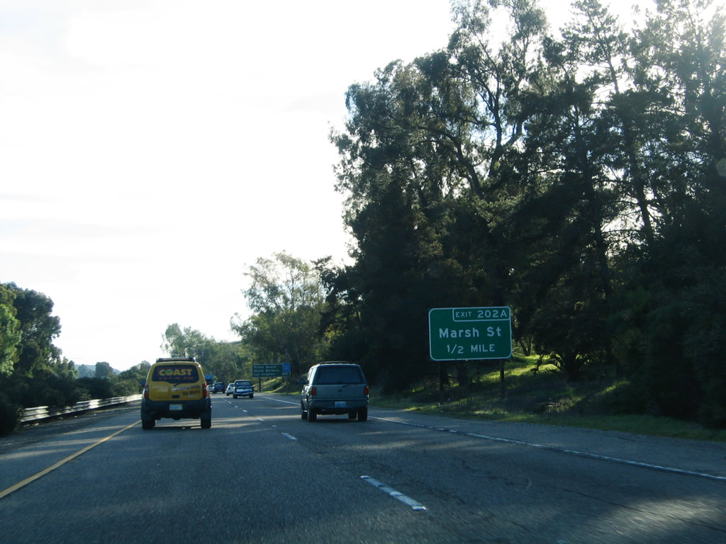 |
There is no photo of the off-ramp for Exit 202B, Broad Street. The next exit is Exit 202A, Marsh Street northeast to downtown San Luis Obispo and Higuera Street (Old U.S. 101) south to southern San Luis Obispo. Old U.S. 101/Higuera Street reunites with U.S. 101 and California 1 at Exit 198. Photo taken 11/29/04. |
 |
Southbound U.S. 101 (El Camino Real) and California 1 reach Exit 202A, Marsh Street and Higuera Street (Old U.S. 101). The next exit along southbound is Exit 201, California 227/Madonna Road east to eastern San Luis Obispo and south to McChesney Field airport and Arroyo Grande. Photo taken 11/29/04. |
 |
The next exit along U.S. 101 and California 1 south is Exit 201, California 227 south and Madonna Road. Use Madonna Road southwest to Los Osos Valley Road, Laguna Lake, and Irish Hills Natural Reserve. To the west, Madonna Road carries California 227 east to Higuera Street, then follows South Street east to Broad Street southeast. This maze of street connections allows California 227 to connect to Broad Street, which then leaves San Luis Obispo and travels through rolling wine country en route to Arroyo Grande. At that point, California 227 returns to U.S. 101. Photo taken 11/29/04. |
 |
Southbound U.S. 101 and California 1 reach Exit 201, California 227 south and Madonna Road. The Madonna Inn dominates the view on the west side of the freeway; its 109 rooms are decorated in themes. The Madonna Inn was built in 1958 by Alex Madonna, and includes a rock waterfall urinal. Photo taken 03/20/06. |
 |
Southbound U.S. 101 and California 1 reach Exit 200, Osos Valley Road northwest to Los Osos, Cuesta by the Sea, Baywood Park, Montana de Oro State Park (via Pecho Valley Road south from Cuesta by the Sea), and Morro Bay (via South Bay Boulevard north). The next exit (Exit 198, Higuera Street north) is not photographed. Photo taken 11/29/04. |
 |
The next exit along U.S. 101 and California 1 south is Exit 196, San Luis Bay Drive west to Avila Beach. U.S. 101 is finally coming close again to the Pacific Ocean, which has not been seen since leaving the Golden Gate Bridge in San Francisco. As for California 1, the brief inland stint through the city San Luis Obispo will soon come to an end. Photo taken 11/29/04. |
 |
The remaining two 500kV power lines that connect transmission Path 15 with Diablo Canyon Nuclear Power Generating Station pass over U.S. 101 and California 1 near Exit 196. These two power lines lead east from the nuclear power plant to the Midway substation near Buttonwillow (Interstate 5 and California 58). The Pacific Gas and Electric (PG&E) nuclear power plant is not visible from U.S. 101; it is located west of unincorporated Avila Beach on restricted roadways south of Montana de Oro State Park. Photo taken 11/29/04. |
 |
Southbound U.S. 101 and California 1 reach Exit 196, San Luis Bay Drive west to Avila Beach. Photo taken 11/29/04. |
 |
The next exit along U.S. 101 and California 1 south is Exit 195, Avila Beach Drive west to Avila Beach. Photo taken 11/29/04. |
 |
Southbound U.S. 101 and California 1 meet Exit 195, Avila Beach Drive west to Avila Beach and Shell Beach Road south into the community of Shell Beach (part of the city of Pismo Beach). Shell Beach Road is the old alignment of U.S. 101 and California 1. The freeway turns southeast at this point into the city of Pismo Beach (population 8,551 as of 2000 Census). Photo taken 11/29/04. |
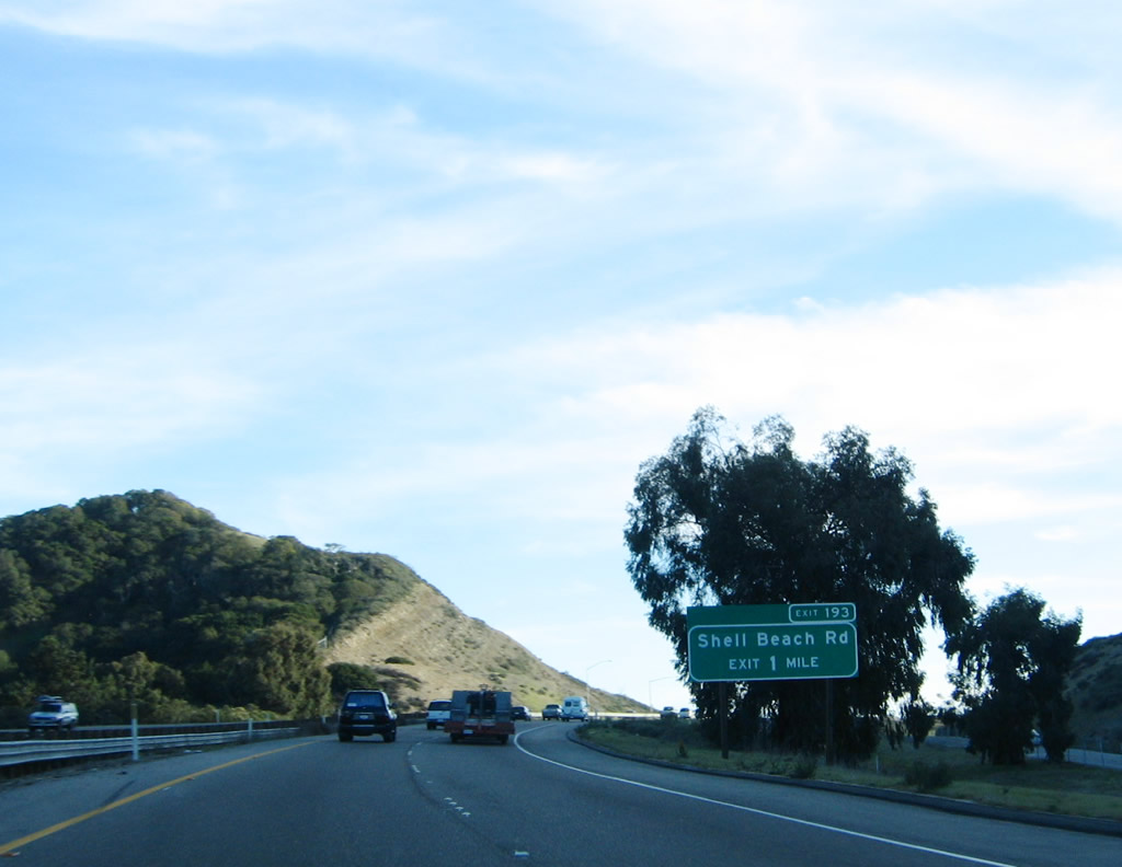 |
The next exit along U.S. 101 and California 1 south is Exit 193, Spyglass Drive, Shell Beach Road to the Shell Beach community of Pismo Beach, and Mattie Road. Photo taken 11/29/04. |
 |
Late-day sun shines over the Pacific Ocean in this view looking west from U.S. 101 and California 1 southbound lanes in the city of Pismo Beach. Photo taken 11/29/04. |
 |
San Luis Obispo Bay comes into view as southbound U.S. 101 and California 1 approach Exit 193, Shell Beach Road to Pismo Beach. This exit also serves Mattie Road and Spyglass Drive. Photo taken 11/29/04. |
 |
Southbound U.S. 101 and California 1 reach Exit 193, Spyglass Drive north to Mattie Road (northern frontage road) and south to Shell Beach Road (old U.S. 101) in Pismo Beach. Photo taken 11/29/04. |
 |
A California 1 and U.S. 101 reassurance shield assembly features the state shield on top of the U.S. shield after the Shell Beach Road interchange. Photo taken 11/29/04. |
 |
The next two exits along U.S. 101 and California 1 south are Exit 191B, U.S. 101 Business (Price Street) and Exit 191A, California 1 (Dolliver Street) south to downtown Pismo Beach, Grover Beach, and Oceano. Photo taken 11/29/04. |
 |
After the Price Street off-ramp (Exit 191B), the next exit along southbound California 1 and U.S. 101 will split the two routes that have been united since San Luis Obispo. California 1 will serve downtown Pismo Beach and Grover Beach before traveling south along the Cabrillo Highway into Oceano. Photo taken 11/29/04. |
 |
A rock formation comes into view on the northeast side of U.S. 101 prior to the California 1 exit. Photo taken 11/29/04. |
 |
The routes divide at Exit 191A: California 1 follows Dolliver Street south into Pismo Beach, Grover Beach, and Oceano before traveling south to Guadalupe, Orcutt, Vandenburg Air Force Base, and Lompoc. California 1 will merge back onto U.S. 101 south at Exit 132 near Gaviota Pass. U.S. 101, meanwhile, turns inland by heading southeast into Arroyo Grande and Nipomo, then connects with Santa Maria in Santa Barbara County. Photo taken 11/29/04. |
| U.S. 101 south | |
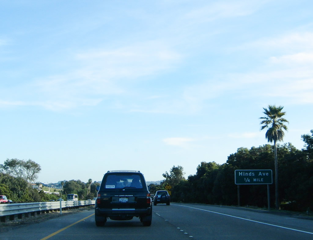 |
The next exit along U.S. 101 (El Camino Real) south is Exit 190B, Hinds Avenue. Photo taken 11/29/04. |
 |
Southbound U.S. 101 (El Camino Real) reaches Exit 190B, Hinds Avenue. Photo taken 11/29/04. |
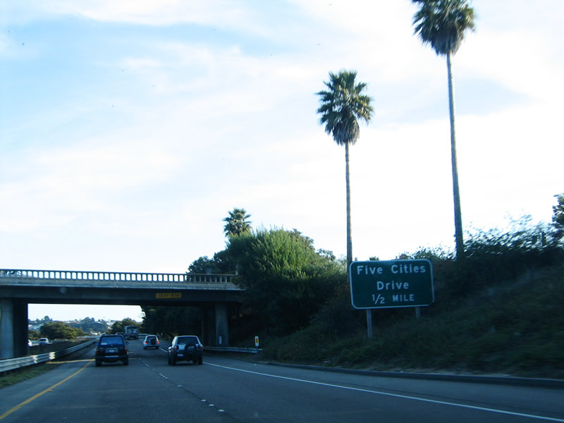 |
The next exit along U.S. 101 (El Camino Real) south is Exit 190A, Five Cities Drive. This road is named after Arroyo Grande, Grover Beach, Oceano, Pismo Beach, and Shell Beach. As noted earlier, Shell Beach was absorbed into the city of Pismo Beach, so only four of the five cities still exist independently. This interchange was the location of a shopping area referred to as "Five Cities Shopping Center." The old shopping center was became vacant, and was eventually reconstructed into a prime outlet mall. Thanks to Steven Yoneda for additional background information on the Five Cities. Photo taken 11/29/04. |
 |
This mileage sign provides the distance to the next three exits along U.S. 101 (El Camino Real) south: Exit 190A, Five Cities Drive; Exit 189, 4th Street; and Exit 188, Oak Park Road. Photo taken 11/29/04. |
 |
Southbound U.S. 101 (El Camino Real) reaches Exit 190, Five Cities Drive. All motorist services are available at this interchange. Photo taken 11/29/04. |
 |
The next exit along U.S. 101 (El Camino Real) south is Exit 189, Fourth Street north to Paso Robles and south to Grover Beach. While U.S. 101 does not enter the city of Grover Beach, the freeway skirts the northern edge of the city. Founded in 1887, Grover Beach was incorporated on December 21, 1959, and has a population of 13,067 as of the 2000 Census. Photo taken 11/29/04. |
 |
This interchange sequence sign provides the distance to the three exits after Exit 189 (Fourth Street) along U.S. 101 (El Camino Real) south: Exit 188, El Camino Real and Oak Park Road to Grover Beach; Exit 187B, Halcyon Road to Arroyo Grande; and Exit 187A, California 227 (Branch Street) east and U.S. 101 Business (Traffic Way) south to downtown Arroyo Grande. Photo taken 11/29/04. |
 |
Southbound U.S. 101 reaches Exit 189, Fourth Street south to Grover Beach and north to Pismo Beach. This is the final Pismo Beach exit and the first of two to serve the city of Grover Beach. Photo taken 11/29/04. |
 |
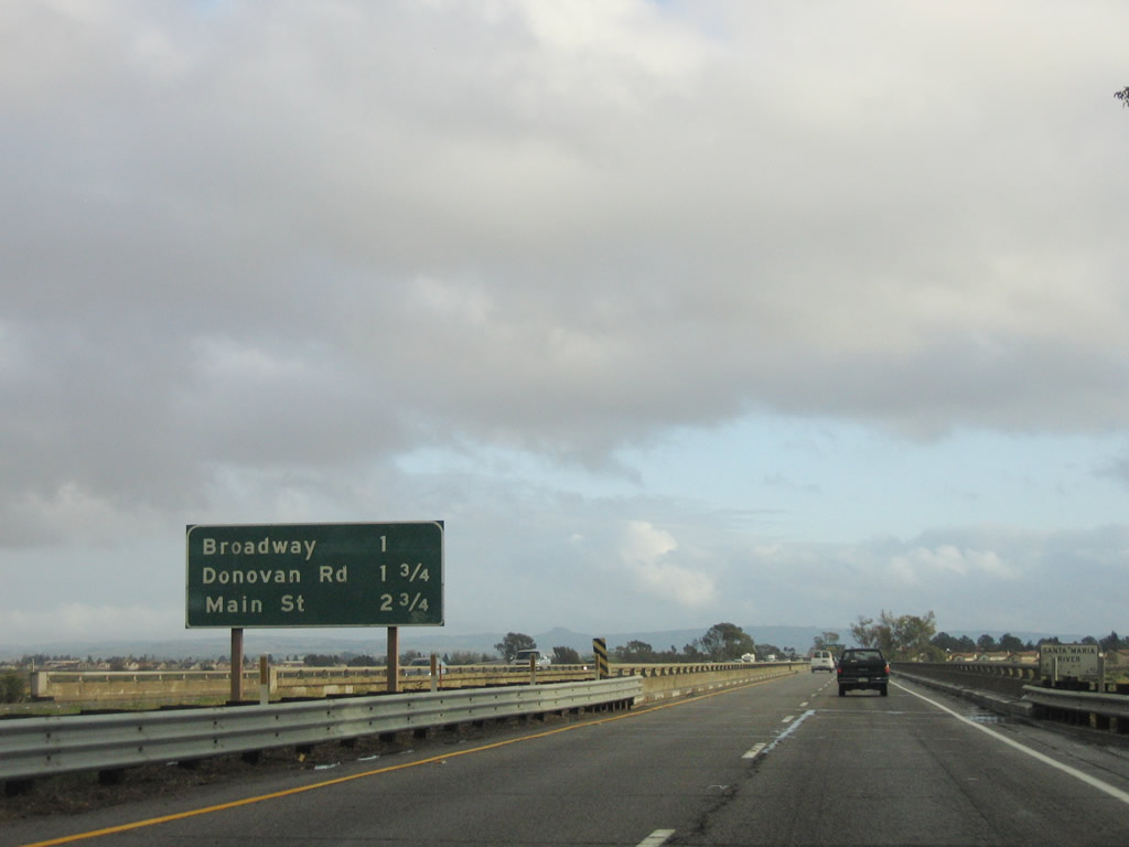
This mileage sign provides the distance to downtown Arroyo Grande (three miles), Santa Barbara (93 miles), and the control city of Los Angeles (191 miles). Photo taken 11/29/04. |
 |
The next exit along U.S. 101 (El Camino Real) south is Exit 188, Oak Park Road south to eastern Grover Beach. At this point, U.S. 101 is traveling southeast as it bisects the "Five Cities" area. This exit also connects to El Camino Real, which parallels the freeway on the south side between Exit 189 and 187A. Photo taken 11/29/04. |
 |
This interchange sequence sign provides the distance to the three exits after Exit 187B, Halcyon Road to Arroyo Grande; Exit 187A, California 227 (Branch Street) east, Grand Avenue west, and U.S. 101 Business (Traffic Way) south to downtown Arroyo Grande; and Exit 186, Fair Oaks Avenue (final Arroyo Grande exit). At this point, U.S. 101 leaves Pismo Beach/Grover Beach and enters the city of Arroyo Grande (population 15,851 as of 2000 Census). Photo taken 11/29/04. |
 |
After Exit 187B, Halcyon Road, the next interchange on southbound will be Exit 187A, California 227 (Branch Street) east, Grand Avenue west, and U.S. 101 Business (Traffic Way) south to downtown Arroyo Grande. This exit will serve as the southern terminus of California 227, which departed from U.S. 101 at the Madonna Road interchange in San Luis Obispo. Photo taken 11/29/04. |
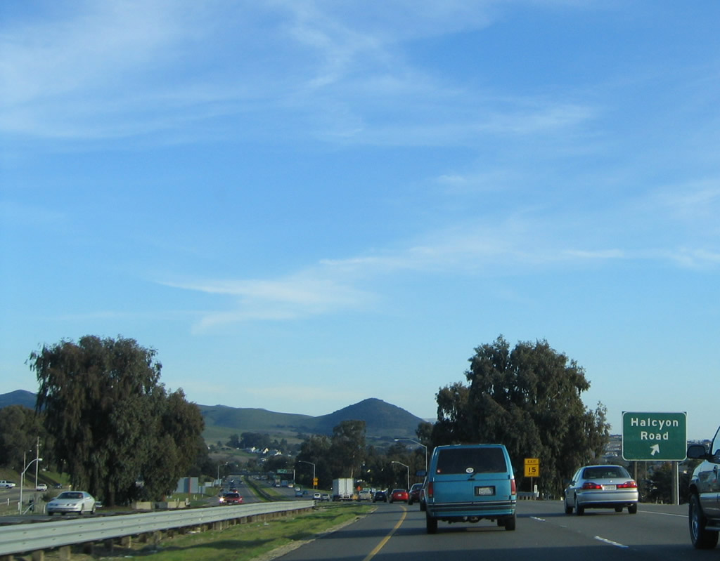 |
Southbound U.S. 101 reaches Exit 187B, Halcyon Road to Arroyo Grande. The next exit is Exit 187A, California 227 (Branch Street) east, Grand Avenue west, and U.S. 101 Business (Traffic Way) south to downtown Arroyo Grande. Photo taken 11/29/04. |
 |
Immediately thereafter, southbound U.S. 101 reaches Exit 187A. This exit connects to California 227 north and U.S. 101 Business, which together turn east briefly on Branch Street and then divide at the Traffic Way intersection. From there, U.S. 101 Business turns southeast via Traffic Way to return to U.S. 101 at Exit 186. California 227 continues east on Branch Street, then turns north via Corbett Canyon Road, Printz Road, and Carpenter Canyon Road to leave Arroyo Grande. This exit also serves Grand Avenue west through Arroyo Grande to Grover Beach. Photo taken 11/29/04. |
 |
The next exit along U.S. 101 (El Camino Real) south is Exit 186, Fair Oaks Avenue to U.S. 101 Business (Traffic Way). Photo taken 11/29/04. |
 |
Southbound U.S. 101 (El Camino Real) reaches Exit 186, Fair Oaks Avenue west to southern Arroyo Grande and east to U.S. 101 Business (Traffic Way). Photo taken 11/29/04. |
 |
A left entrance brings traffic back onto U.S. 101 south from U.S. 101 Business (Traffic Way) after the off-ramp to Exit 186. There is no direct connection to Traffic Way except via Fair Oaks Avenue. Photo taken 11/29/04. |
 |
Leaving Arroyo Grande, U.S. 101 again reverts to an expressway alignment. Three at-grade intersections ensue: one with El Campo Road south, another with Laetitia Vineyard Drive east to the Laetitia Vineyard and Winery, and Hemi Road east (local access). The freeway will resume at Exit 182, Los Berros Road and Thompson Avenue. Photo taken 11/29/04. |
 |
An end freeway sign is posted prior to the El Campo Road intersection. Photo taken 03/20/06. |
 |
The next exit after the at-grade expressway segment of U.S. 101 south is Exit 182, Los Berros Road northwest to Arroyo Grande and Thompson Avenue southeast to Nipomo. Photo taken 03/20/06. |
 |
Southbound U.S. 101 reaches Exit 182, Los Berros Road and Thompson Avenue. The freeway segment resumes; Thompson Avenue is the old alignment of U.S. 101 that leads into the community of Nipomo. Photo taken 03/20/06. |
 |
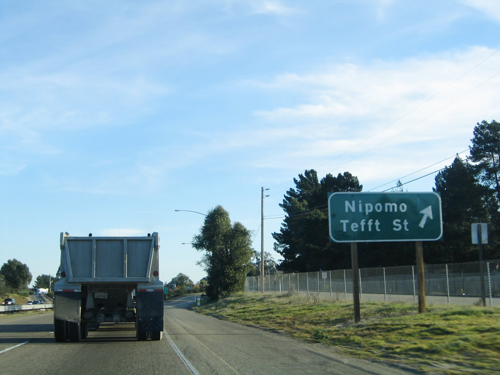
The next exit along U.S. 101 south is Exit 179, Tefft Street to Nipomo. An unincorporated community in southern San Luis Obispo County, Nipomo has a population of 12,626 per the 2000 Census. Photo taken 11/29/04. |
 |
All motorist services are available in Nipomo at Exit 179. Photo taken 11/29/04. |
 |
Southbound U.S. 101 reaches Exit 179, Tefft Street to Nipomo. Photo taken 11/29/04. |
 |
A Pacific Gas and Electric substation comes into view on the southwest side of U.S. 101. The U.S. route will remain in Pacific Gas and Electric territory until passing through Gaviota Pass in Santa Barbara County. At that point, U.S. 101 will enter Southern California Edison service territory. Photo taken 11/29/04. |
 |
Two Pacific Gas and Electric 138kV power lines cross over U.S. 101 south; these lines connect to the substation shown previously. Photo taken 11/29/04. |
 |
The next exit along U.S. 101 south is Exit 175, California 166 east to Maricopa and Wheeler Ridge, where California 166 meets Interstate 5 and California 99. The frontage road on the southwest side of U.S. 101 is Hutton Road, which comes south from Nipomo. Photo taken 11/29/04. |
 |
Both Hutton Road and Thompson Avenue (old U.S. 101) merge back into U.S. 101 at Exit 175. Photo taken 11/29/04. |
 |
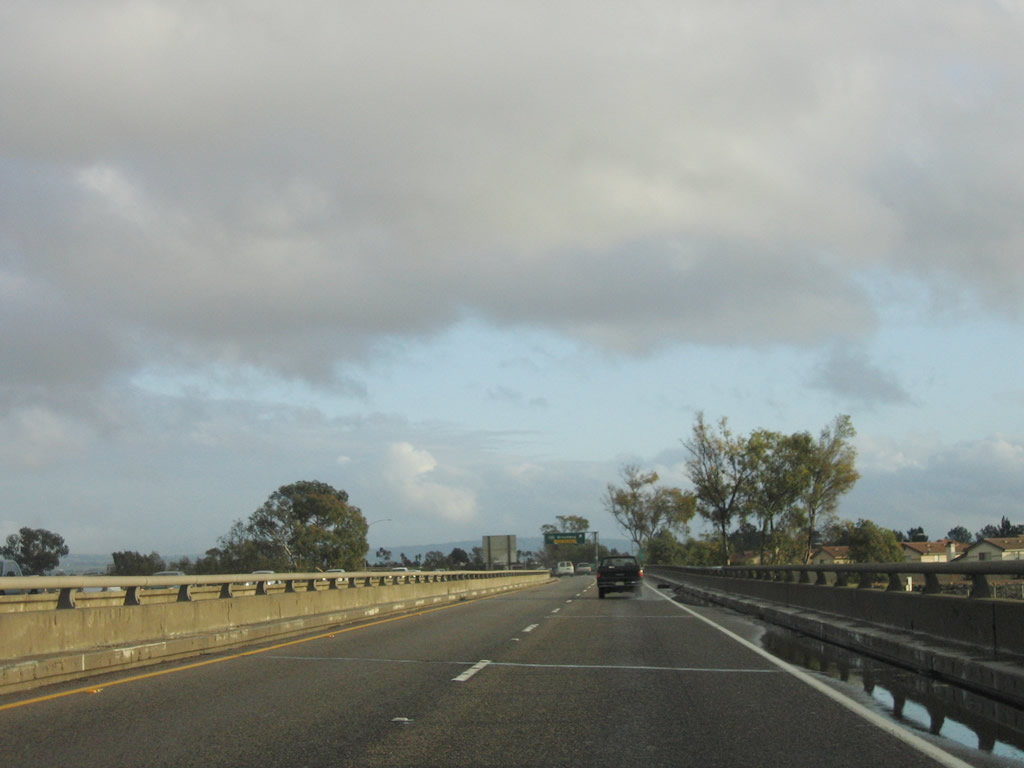
Southbound U.S. 101 reaches Exit 175, California 166 east to Maricopa and Wheeler Ridge. Follow California 166 east to its end at California 99, then turn north on California 99 (Golden State Freeway) to the city of Bakersfield in Kern County. Exit 175 is the final interchange in San Luis Obispo County; California 166 west soon merges onto U.S. 101 south into the city of Santa Maria. Photo taken 03/20/06. |
 |
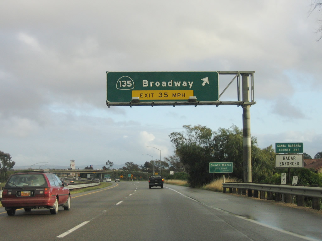
The next exit along U.S. 101 south and California 166 west is Exit 173, California 135 and U.S. 101 Business (Broadway) south to Santa Maria. Photo taken 03/20/06. |
 |
The next six exits along U.S. 101 south serve the city of Santa Maria: Exit 173, California 135 and U.S. 101 Business (Broadway); Exit 172, Donovan Road; Exit 171, California 166 (Main Street) west and Main Street east; Exit 170, Stowell Road; Exit 169, Betteravia Road; and Exit 164, Clark Avenue. To Vandenburg Air Force Base and Lompoc, use Exit 169 for Betteravia Road west to California 135 south to California 1 south. Photo taken 11/29/04. |
| U.S. 101 south & California 166 west | |
 |
Partially obscured by grass, this is the first reassurance shield for U.S. 101 south and California 166 west. Since U.S. 101 spends so much time traveling southeast through Central and Southern California, it's hard to believe it is briefly signed for westbound California 166! Photo taken 03/20/06. |
 |
The freeway narrows in advance of crossing the Santa Maria River. There is no left shoulder and only a limited right shoulder on U.S. 101 south as the freeway crosses the river. The next three exits along U.S. 101 south serve the city of Santa Maria: Exit 173, California 135 and U.S. 101 Business (Broadway); Exit 172, Donovan Road; Exit 171, California 166 (Main Street) west and Main Street east. Photo taken 03/20/06. |
 |
 |
 |
This suite of photos shows the Santa Maria River bridge. At the end of the bridge, U.S. 101 will leave San Luis Obispo County and enter Santa Barbara County. Photos taken 03/20/06. |
 |
A California 135 trailblazer is posted prior to Exit 173. California 135 travels south along with U.S. 101 Business on Broadway through downtown Santa Maria, then continues south toward Orcutt. The state route becomes a freeway briefly as it merges with California 1, then turns southeast toward the community of Los Alamos, where California 135 rejoins U.S. 101. California 1 splits to the southwest from California 135 and connects to Vandenburg Air Force Base and the city of Lompoc. Photo taken 03/20/06. |
 |
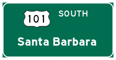
Southbound U.S. 101 (El Camino Real) and westbound California 166 reach Exit 173, California 135 and U.S. 101 Business (Broadway) south through downtown Santa Maria. U.S. 101 Business will follow California 135 through Santa Maria, then split southeast to return to U.S. 101 at Exit 167. Just prior to this exit, U.S. 101 leaves San Luis Obispo County and enters Santa Barbara County. Photo taken 03/20/06. |
Sources:
- "Post-quake Paso Robles pairs olives, beer, new hotels with wineries." San Francisco Chronicle, February 10, 2008.


Page Updated March 16, 2008.
|
About Contact Glossary |
In The News Testimonials Interstate Guide |
Social Media:
 |
|
© 2000-23 AARoads.com | All Rights Reserved | Privacy Policy / Terms of Use
|
||