|
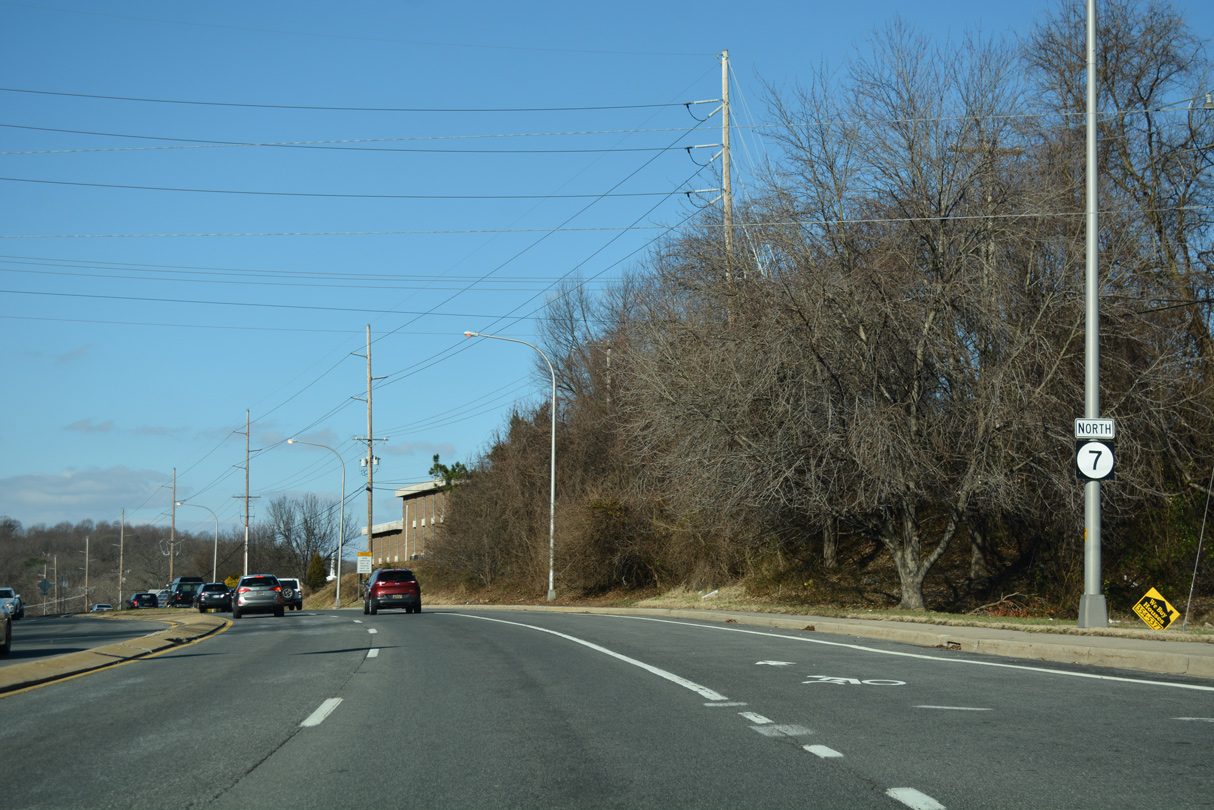
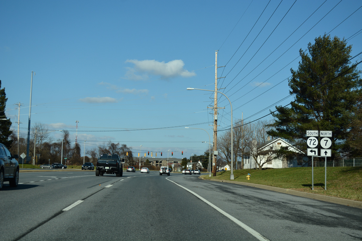
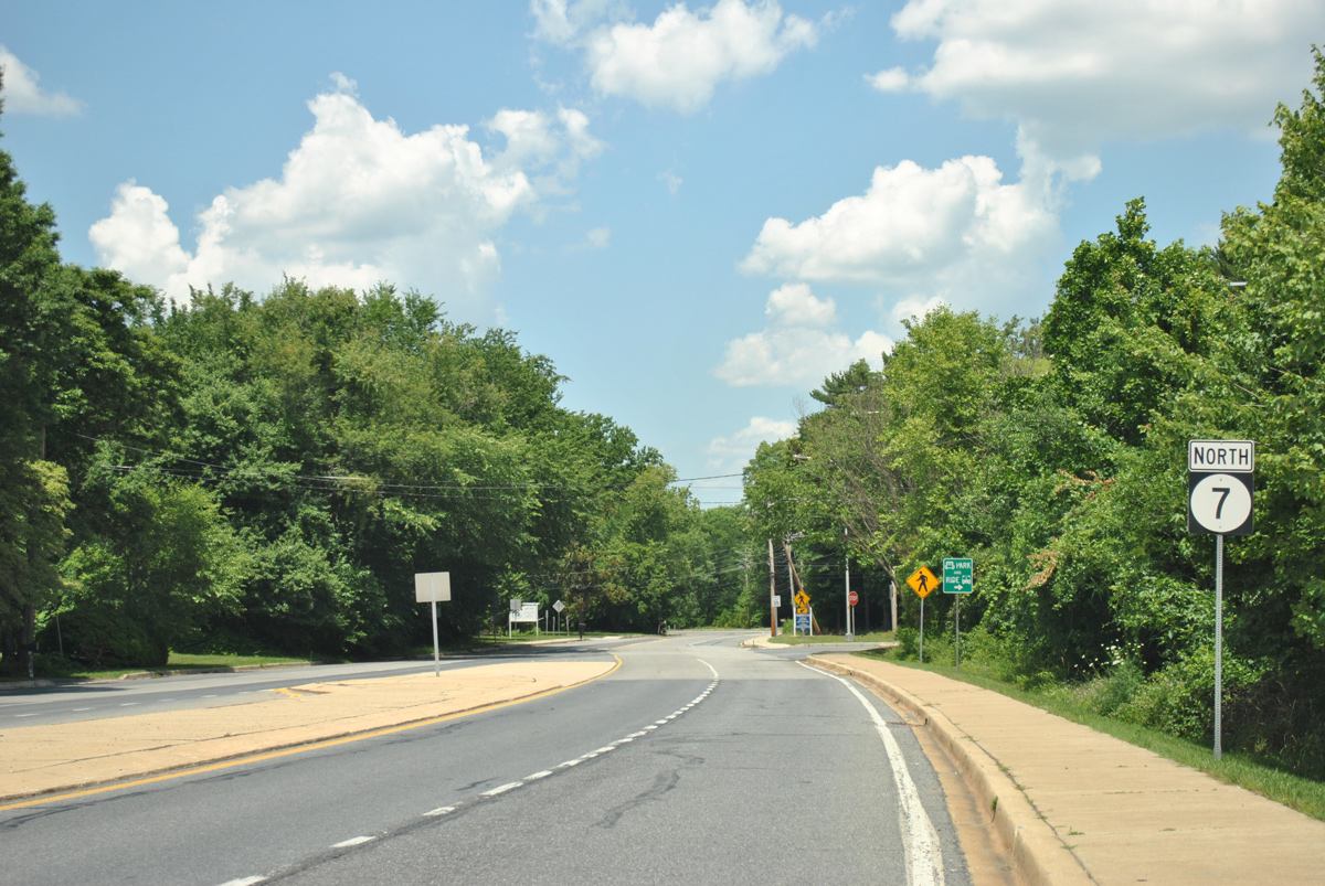
| SR 7 extends Dupont Highway north from U.S. 13 and SR 72 at Wrangle Hill. Pictured here is the first confirming marker. 12/23/22 |
|
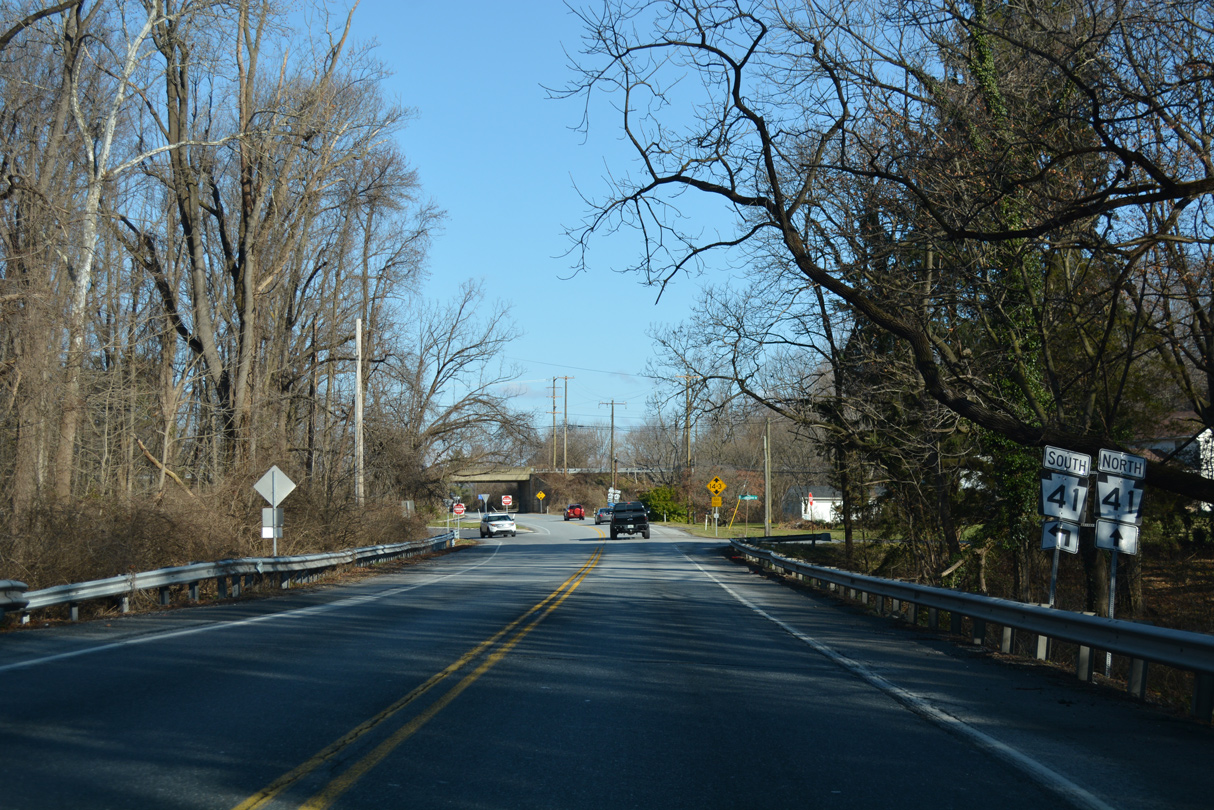
| Dupont Highway passes under U.S. 13/SR 1 just north of Corbitt and an at-grade crossing with the Norfolk Southern Railroad. SR 7 reduces to two lanes below the freeway and shifts to Bear Corbitt Road. 12/23/22 |
|
| Two portions of Old Dupont Highway remain to the east of SR 7. 12/23/22 |
|
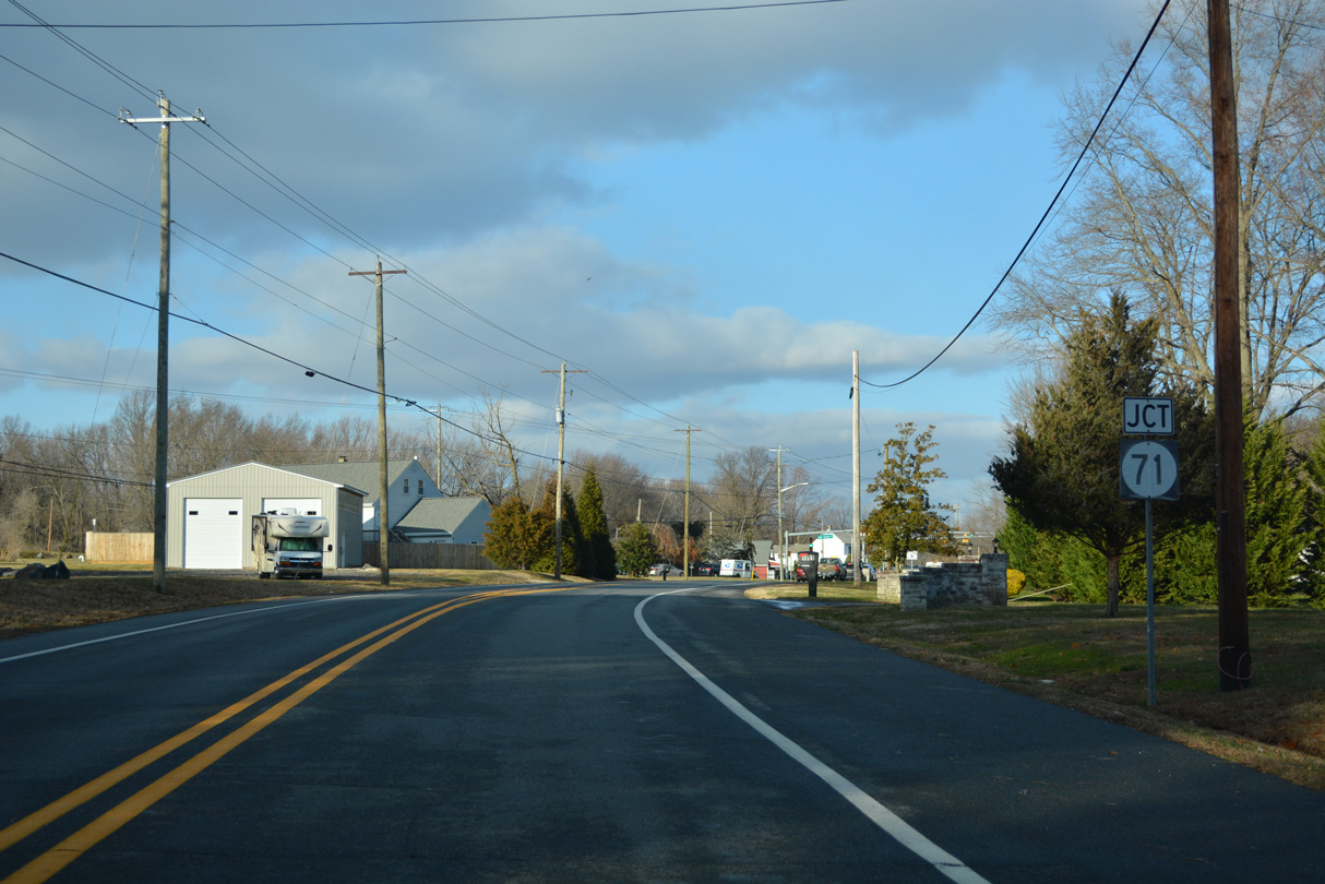
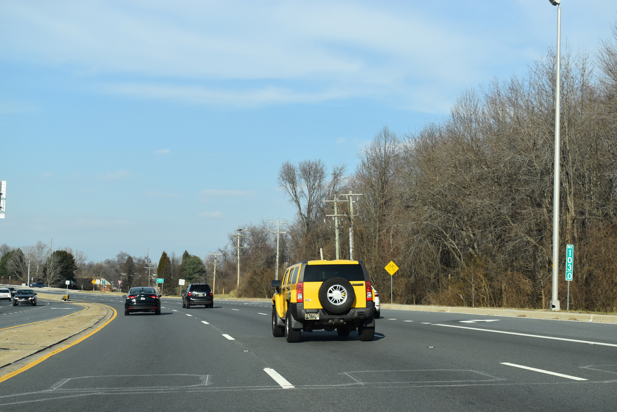
| SR 7 (Bear Corbitt Road) advances north to the community of Red Lion and the junction with SR 71 (Red Lion Road). 12/23/22 |
|
| SR 71 (Red Lion Road) leads northeast to U.S. 13 (Dupont Highway) at Tybouts Corner. 12/23/22 |
|
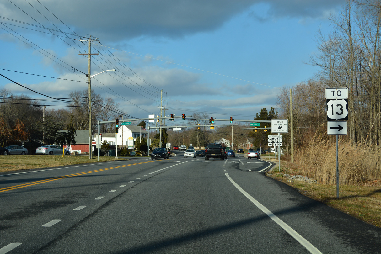
| SR 71 (Red Lion Road) crosses SR 7 (Bear Corbitt Road) at a sharp angle. SR 71 historically was a part of the split routing of U.S. 301. The state route doubled as U.S. 301 South from Tybouts Corner to the Summit Bridge and Mt. Pleasant. 12/23/22 |
|
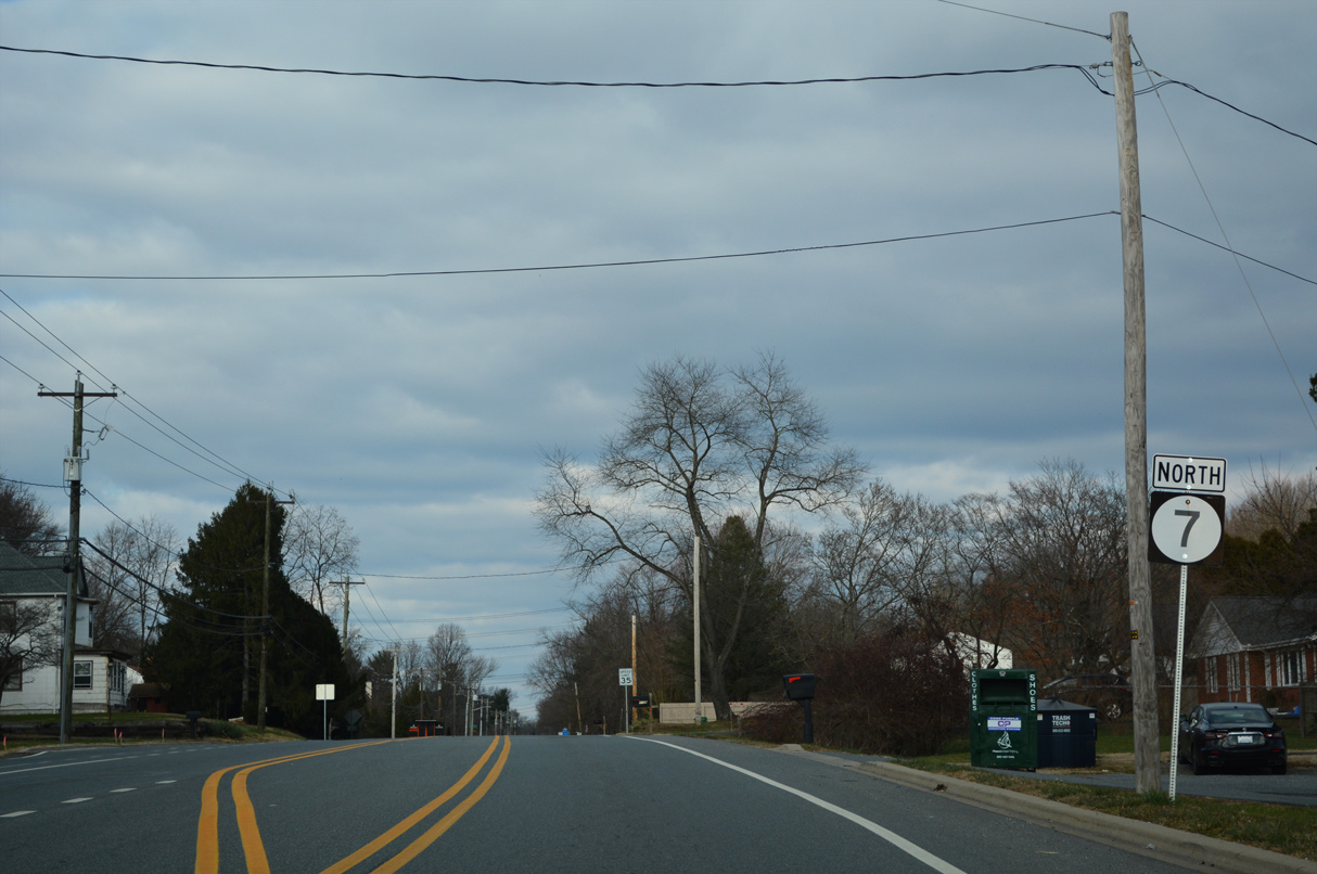
| North from SR 71 and Red Lion, SR 7 (Bear Corbitt Road) passes by a number of Bear area subdivisions starting with Country Woods and Garwood Estates. 12/18/22 |
|
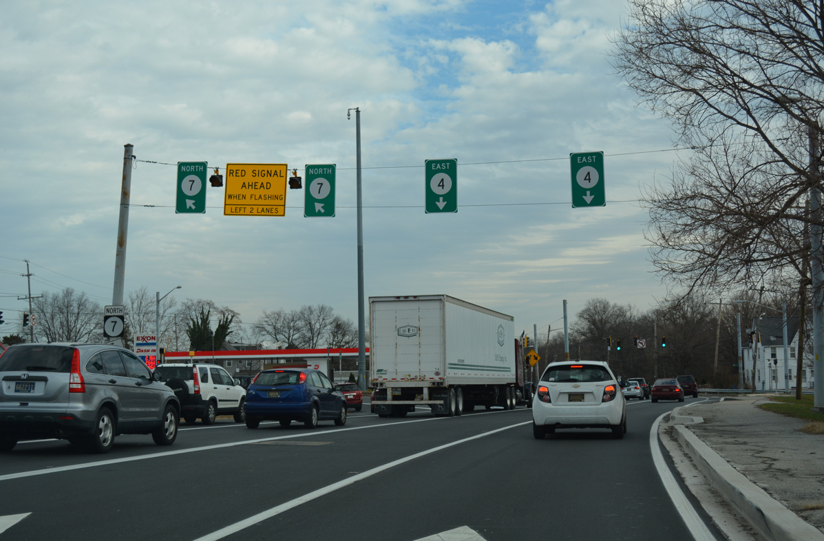
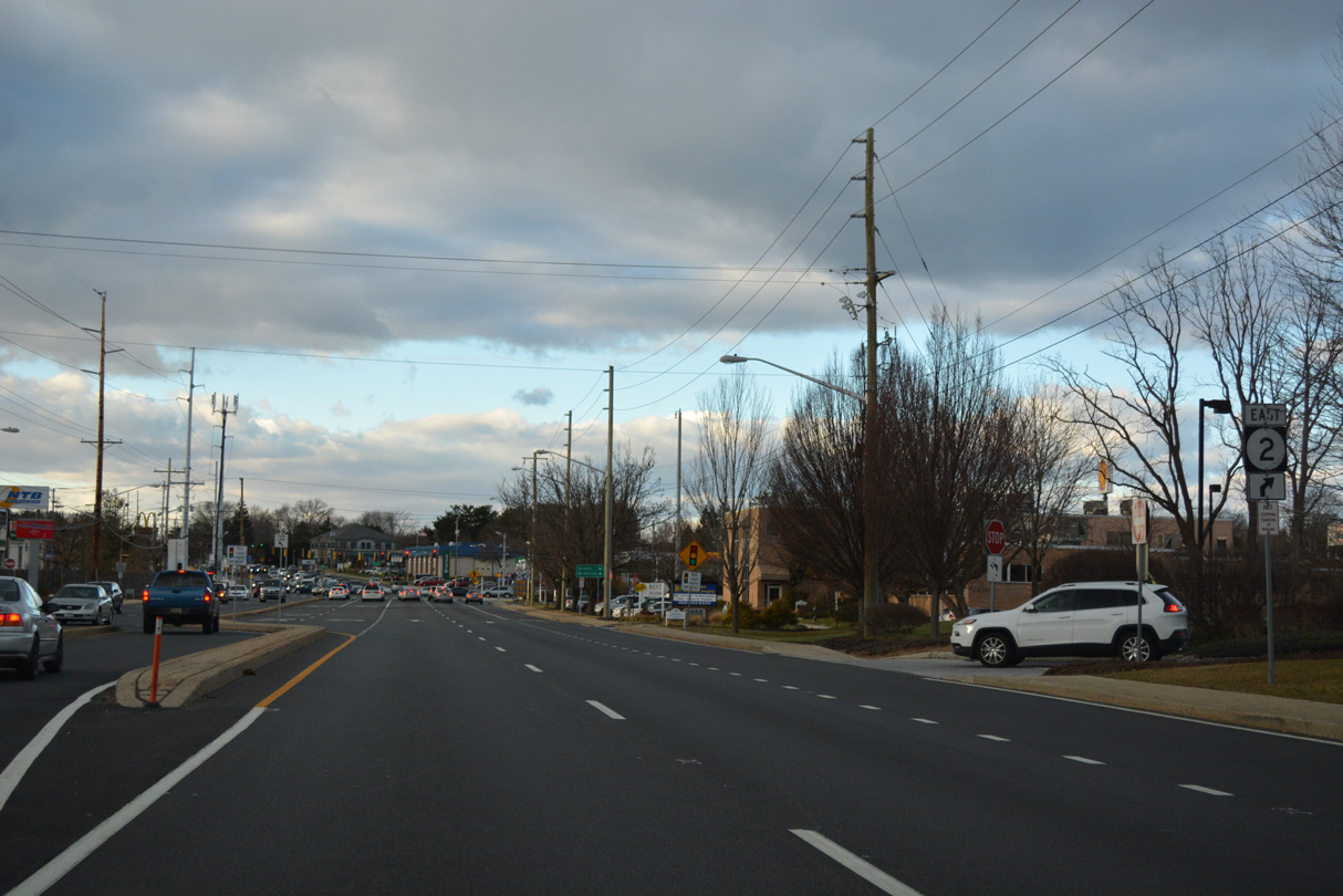
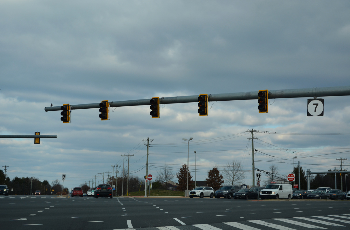
| Entering the commercialized intersection with U.S. 40 (Pulaski Highway) on SR 7 (Bear Corbitt Road) north in Bear. Eden Square, Glendale Plaza and Governors Square shopping centers occupy three of the four quadrants of the busy junction. New big box retail was built in the northeast quadrant by 2015. 12/18/22 |
|
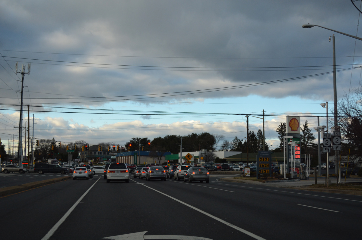
| U.S. 40 constitutes the main commercial arterial through Bear west to Glasgow and Elkton, Maryland. 12/18/22 |
|
| U.S. 40 (Pulaski Highway) connects Bear with SR 1 north to I-95 just east of SR 7. 12/18/22 |
|
| Songsmith Drive loops east and west from SR 7 (Bear Christiana Road) at the succeeding traffic light north of U.S. 40. The suburban road serves Governors Square Townhouses and shopping center nearby. 12/18/22 |
|
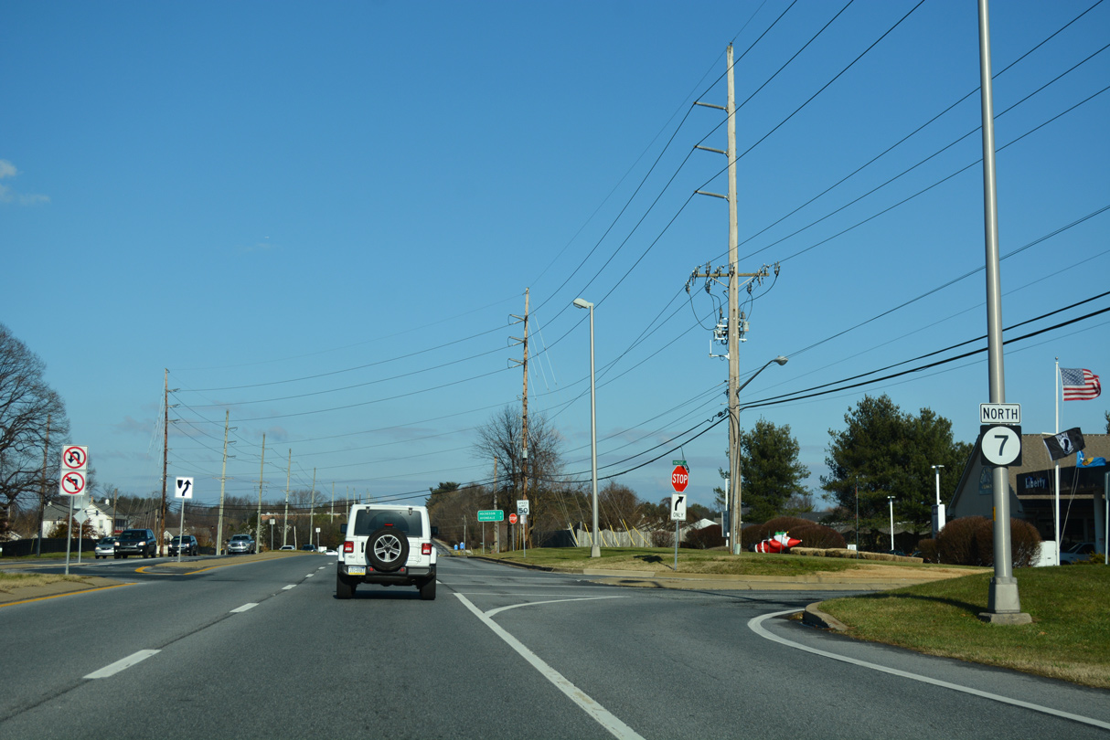
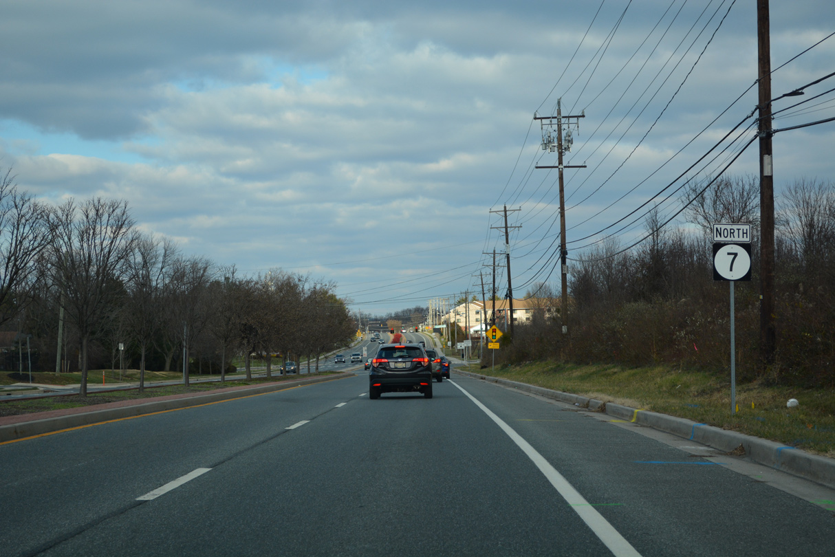
| Reassurance marker for SR 7 north posted after U.S. 40 and Songsmith Drive. 12/18/22 |
|
| Newtown Road (Road 68) stems west from SR 7 (Bear Christiana Road) to Smalleys Dam Road and Brookfield Park. Newtown Road was originally planned as a through route west to Salem Church Road. 12/18/22 |
|
| Four lane expansion of SR 7 north of Newtown Road (Road 68) was underway from April 2012 to 2014. Upon completion, all of SR 7 north from U.S. 40 to SR 273 (Christiana Bypass) carries four lanes. 12/18/22 |
|
| Rivers End Drive leads west from SR 7 to the Crofton, Woodbridge and Treelane Terrace neighborhoods. 12/18/22 |
|
| Back to back signals operate along SR 7 at Christiana Meadows and School Bell Road. 12/18/22 |
|
| School Bell Road (Road 344) is a major collector 1.31 miles east to U.S. 40 (Pulaski Highway). 12/18/22 |
|
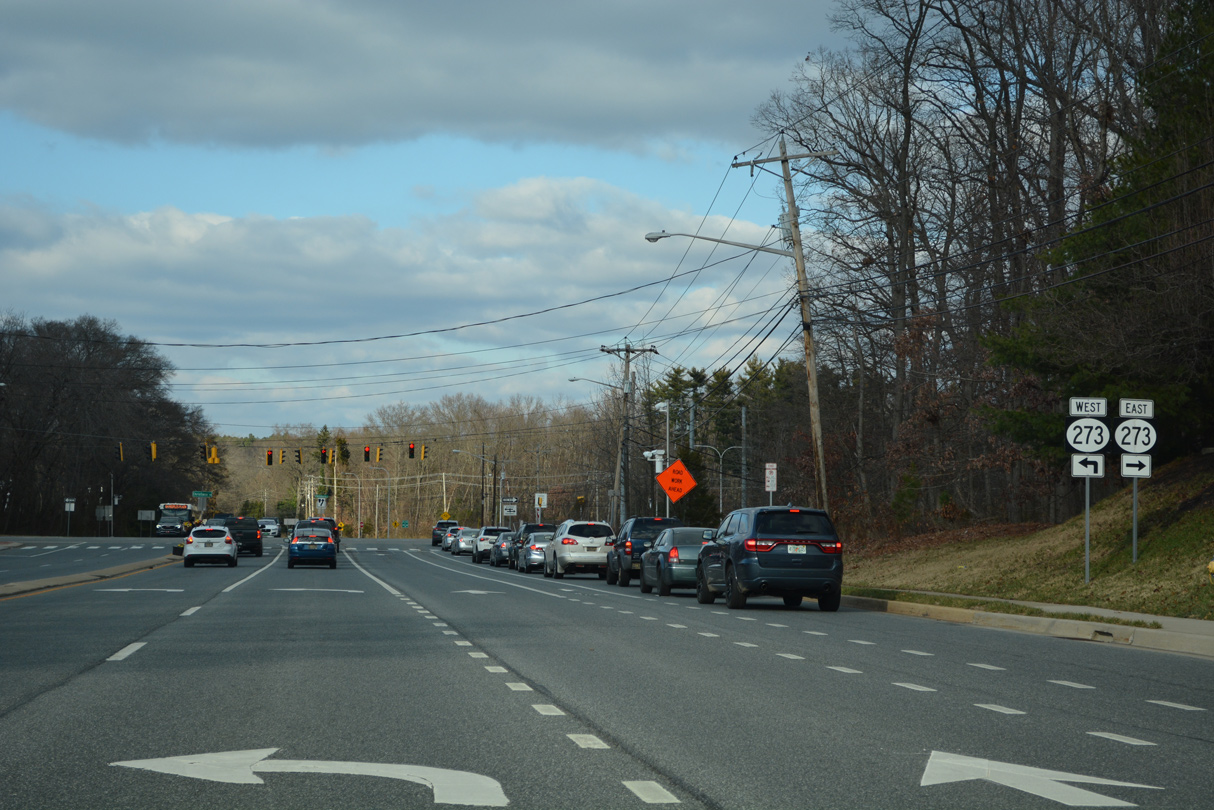
| Nearing Christiana, SR 7 meets SR 273, a controlled access arterial encircling the unincorporated community to the south and west. 12/18/22 |
|
| The Christiana Bypass for SR 273 was constructed in the mid 1980s to move traffic away from Main Street (SR 7). The arterial route joins Christiana with Ogletown, I-95 and Newark to the west and Hares Corner, U.S. 13 (Dupont Highway) and New Castle to the east. 12/18/22 |
|
| Following E Main Street north from SR 273, SR 7 approaches Christiana. The initial stretch passes just west of SR 1 and a park and ride lot. The carpool facility takes the place of a former section of SR 273. 06/23/12 |
|
| SR 7 (E Main Street) enters Christiana across the Christina River on a bridge built in 1937. 12/26/20 |
|
| SR 7 turns north onto Old Baltimore Pike from Main Street in Christiana. W Main Street (former SR 273) extends west as a local route to the Christiana Town Center retail area. Old Baltimore Pike (Rd 26) west emerges from Christiana as a three lane suburban boulevard to Iron Hill and Elkton, Maryland. 12/26/20 |
|
| SR 7 turns east onto Road A from Stanton Christiana Road 0.36 miles to SR 1 northbound. 08/18/21 |
|
| SR 7 meets SR 1 at a folded diamond interchange between Stanton Christiana Road (Road 26) and Center Boulevard to Christiana Mall. 08/18/21 |
|
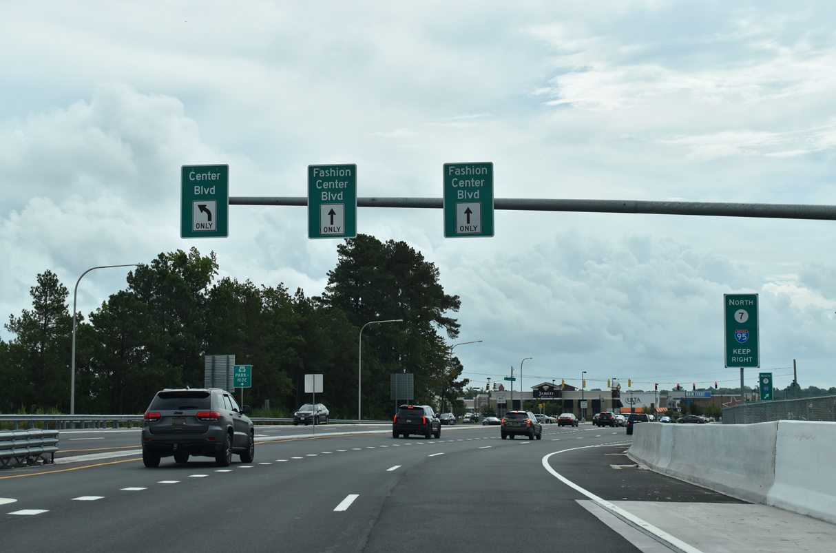
| SR 7 (Road A) heads east across SR 1 to intersect Center Boulevard north and Fashion Center Boulevard east to the Christiana Fashion Center retail complex. 08/18/21 |
|
| Providing additional capacity between Stanton Christiana Road and Center Boulevard, construction from Spring 2019 to Spring 20211 added a second bridge for SR 7 (Road A) over SR 1. The new span opened to traffic ahead of Thanksgiving 2020. 08/18/21 |
|
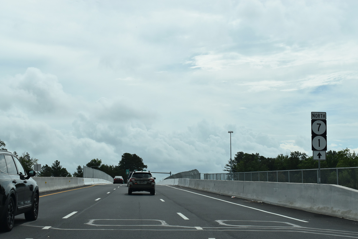
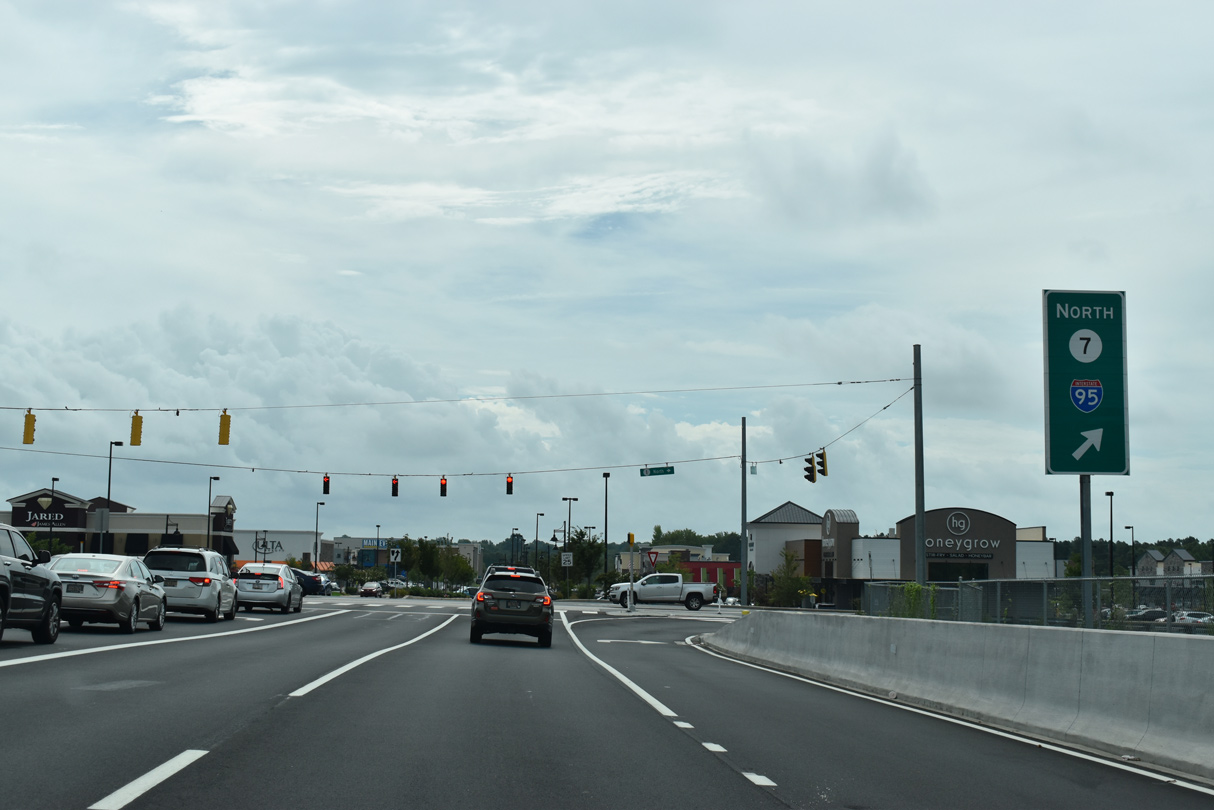
| SR 7 follows a loop ramp south from Center Boulevard onto SR 1 north leading into the exchange with Interstate 95. 08/18/21, 12/22/20 |
|
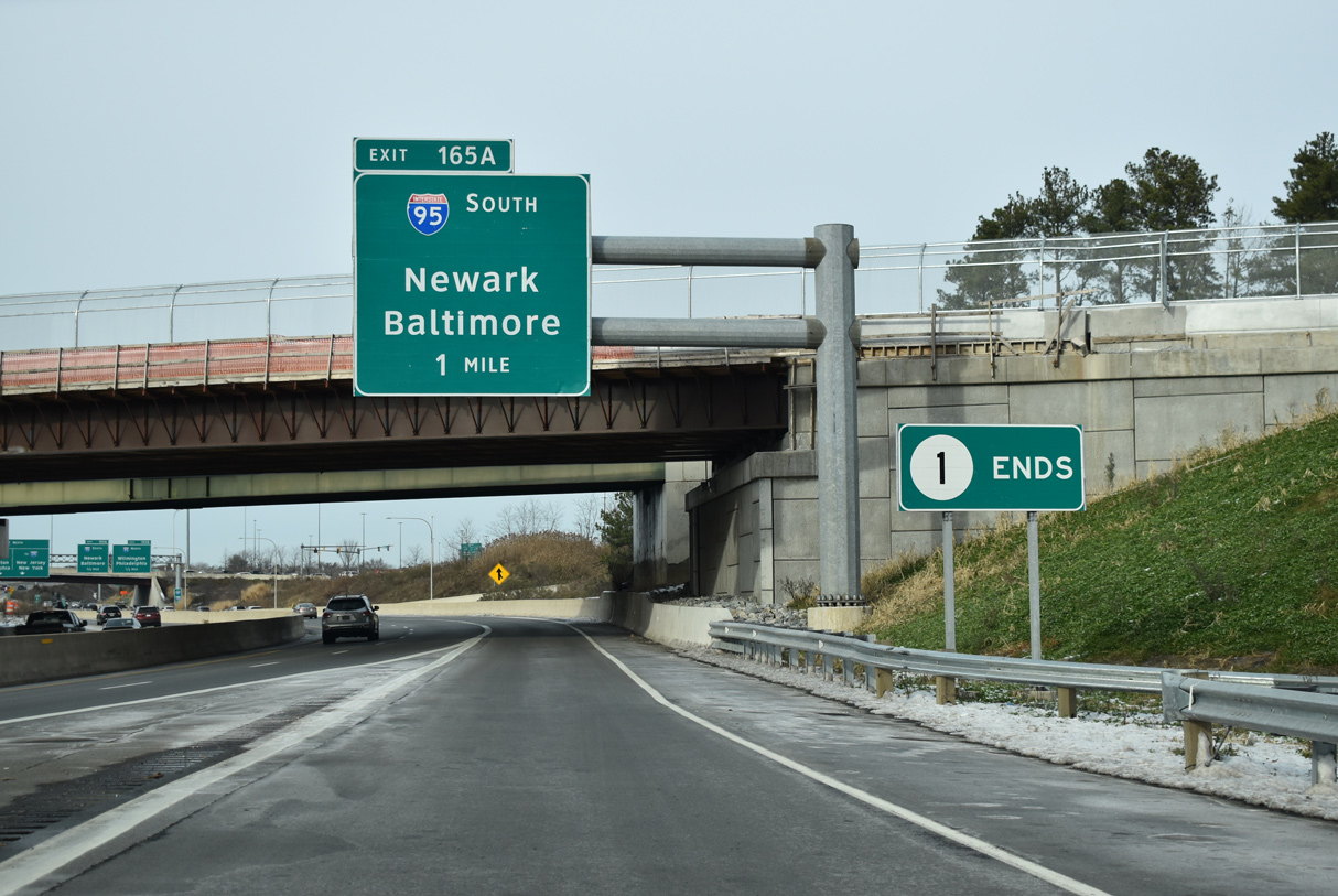
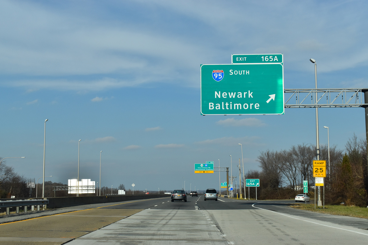
| SR 1/7 combine 0.72 miles north to the centerline of Interstate 95 at Exit 165. 12/19/20 |
|
| SR 1/7 proceed north alongside Christiana Mall to Exit 165B for I-95 north to Wilmington and Philadelphia. 12/22/20 |
|
| I-95 (Delaware Turnpike) runs 2.6 miles east from SR 1/7 to split with I-295 north to the Delaware Memorial Bridge and four miles to partition with I-495 around Wilmington. 12/19/20 |
|
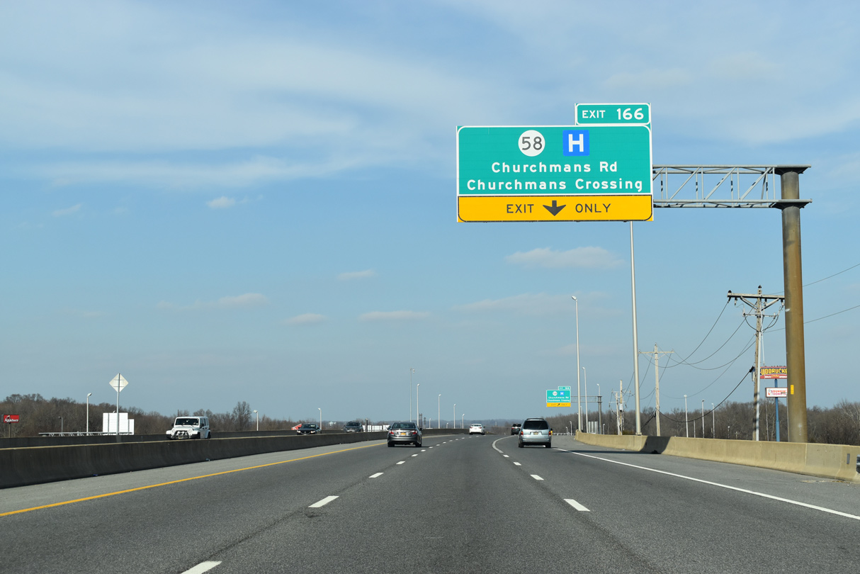
| SR 7 passes through the cloverstack interchange with Interstate 95 ahead of Exit 166 for SR 58 (Churchmans Road). 12/19/20 |
|
| Exit 165B loops onto a collector roadway leading from SR 1/7 to Interstate 95 south ahead of Newark. 12/30/18 |
|
| The entrance ramp from I-95 north adds an auxiliary lane to SR 7 north for SR 58 at Churchmans Crossing. 12/30/18 |
|
| SR 58 (Churchmans Road) heads 0.83 miles west from SR 7 to Christiana Hospital, SR 4 (Ogletown Station Road) and Delaware Park Boulevard. East from SR 7, SR 58 continues 3.03 miles to SR 273 at Hares Corner. 12/30/18 |
|
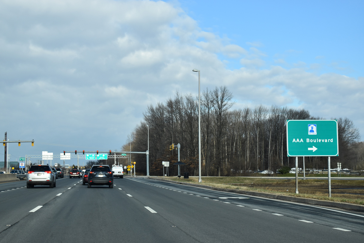
| AAA Boulevard / Del-Tech Connector Road and the west side service road (Twin C Road) ties into SR 7 just beyond the expressway end from SR 1. 12/22/20 |
|
| The west service road represents the old alignment of SR 7. The east road leads back to AAA Boulevard the Stanton Campus of Delaware Technical & Community College (DTCC). 12/22/20 |
|
| Advancing north, SR 7 (Stanton Christiana Road) meets SR 4 (Stanton Ogletown Road) east by the Morgan Christiana Center office park. SR 4 heads west to Christiana Hospital, Ogletown and Newark. 12/22/20 |
|
| SR 4/7 combine for 1.2 miles north to Stanton. SR 4 west travels 7.5 miles to SR 279 (Elkton Road) in south Newark. 12/30/18 |
|
| Mileposts along SR 7 continue the numbering of SR 1 into Churchmans Crossing. 12/30/18 |
|
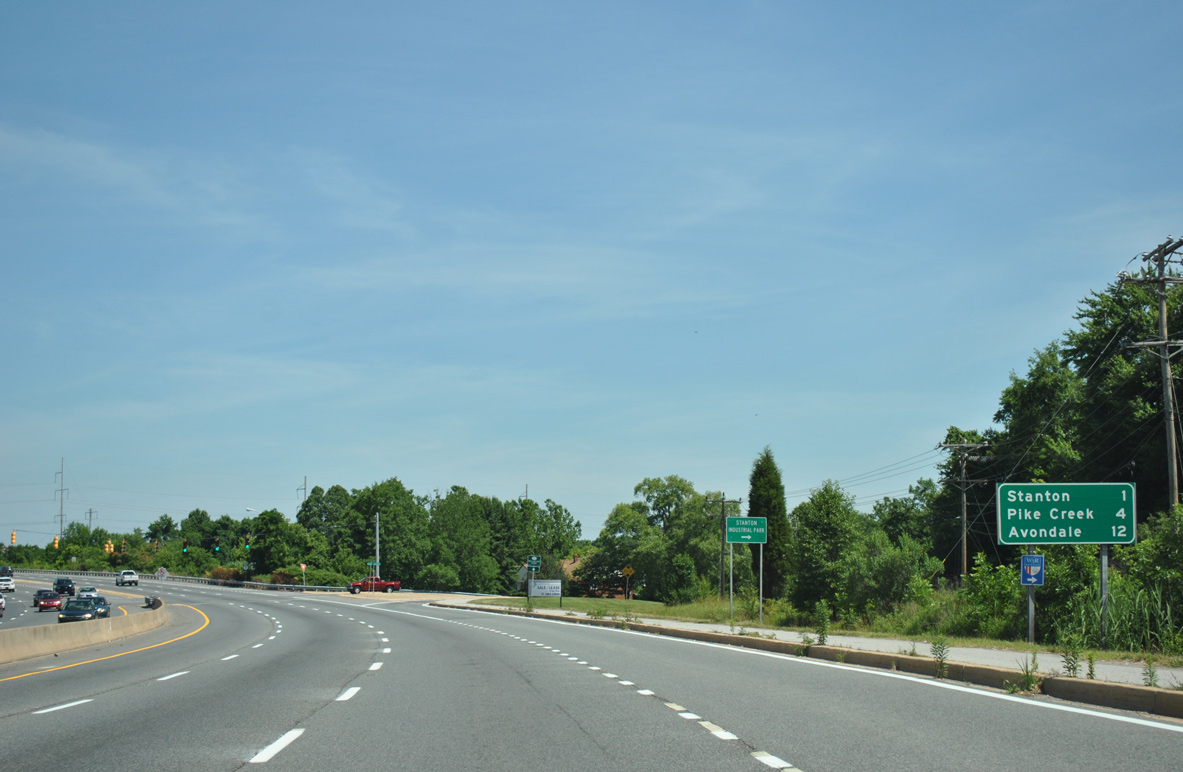
| Removed by 2017, this distance sign was posted after the merge of SR 4 east / SR 7 north for the Pike Creek Valley (four miles via SR 7) and Avondale, Pennsylvania (12 miles via SR 7 to PA 41 north). 06/16/12 |
|
| The former alignment of Route 4, Stanton Christiana Road (Rd 336D) branches northeast from SR 4/7, 0.53 miles to a dead end at White Clay Creek. 12/22/20 |
|
| SR 4/7 ascend across the AMTRAK Northeast Corridor beyond these reassurance markers. 12/22/20 |
|
| An additional set of reassurance markers for SR 4/7 stand beyond the AMTRAK Northeast Corridor. The controlled access arterial carries six lanes as it curves east by Delaware Park. 12/30/18 |
|
| Road 336F is a 0.12 mile long link from this signal along SR 4/7 and the north end of Stanton Christiana Road (Road 336D). 12/22/20 |
|
| Delaware Park Boulevard stems west from the succeeding traffic light north of White Clay Creek to Delaware Park Racetrack & Casino. 12/22/20 |
|
| SR 4/7 enter the unincorporated community of Stanton ahead of their separation at Limestone Road. 12/22/20 |
|
| Telegraph Road curves northwest from SR 4/7 to Old Capitol Trail, which heads west to the north entrance of Delaware Park and SR 2 (Kirkwood Highway). 12/30/18 |
|
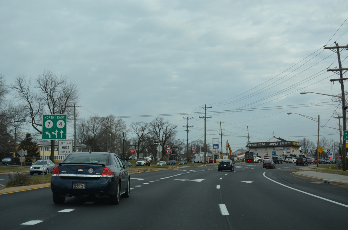
| SR 4 partitions into the couplet of Mitch Road east and Main Street west beyond Telegraph Road. SR 7 turns north at the subsequent intersection to follow Limestone Road north from Stanton. 12/22/16 |
|
| SR 4 (Mitch Road) continues east from SR 7 (Limestone Road) and Stanton to Newport, Richardson Park and Wilmington. 12/22/16 |
|
| Curving north, motorists intersect the westbound lanes of SR 4 (Main Street) and the southbound ramp from Limestone Road to Mitch Road east. 04/03/04 |
|
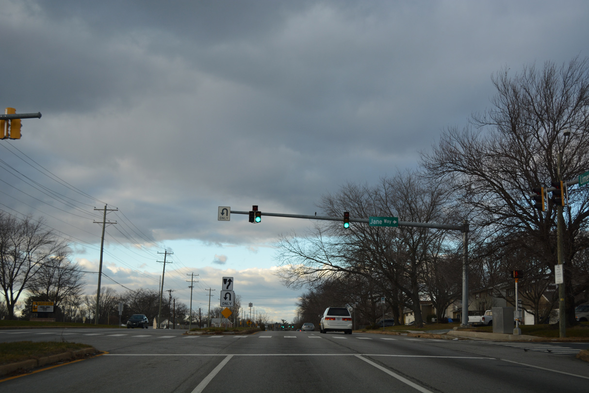
| A traffic signal operates just north of SR 4 (Main Street) at the entrance to Stanton Middle School and Jane Way east to the Windermere subdivision on SR 7 (Limestone Road). 12/30/16 |
|
| Back to back traffic lights on SR 7 (Limestone Road) precede the CSX Railroad underpass at Tarry Lane east and Laura Drive west. 12/30/16 |
|
| A U-turn connects northbound SR 7 with apartments and a mobile home park along the west side of Limestone Road ahead of the intersection with Hendry Avenue east to Klair Estates. 12/30/16 |
|
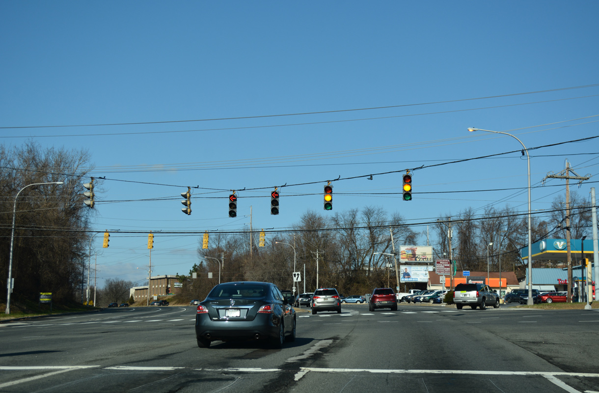
| Commercialized frontage lines both sides of Limestone Road to the busy intersection with SR 2 (Kirkwood Highway). 12/30/16 |
|
| SR 2 expands to six lanes from St. James Church Road nearby, east to Prices Corner and SR 141 (Newport Freeway). 12/30/16 |
|
| Numerous shopping centers and car dealerships appear along Kirkwood Highway east from Limestone Road through the town of Elsmere. The route ends in northwest Wilmington at SR 52 (Pennsylvania Avenue). 12/30/16 |
|
| Dual turns lanes take motorists onto SR 2 (Kirkwood Highway) westbound. A well traveled commuter route, SR 2 ends in Newark at East Main Street (SR 273). 12/30/16 |
|
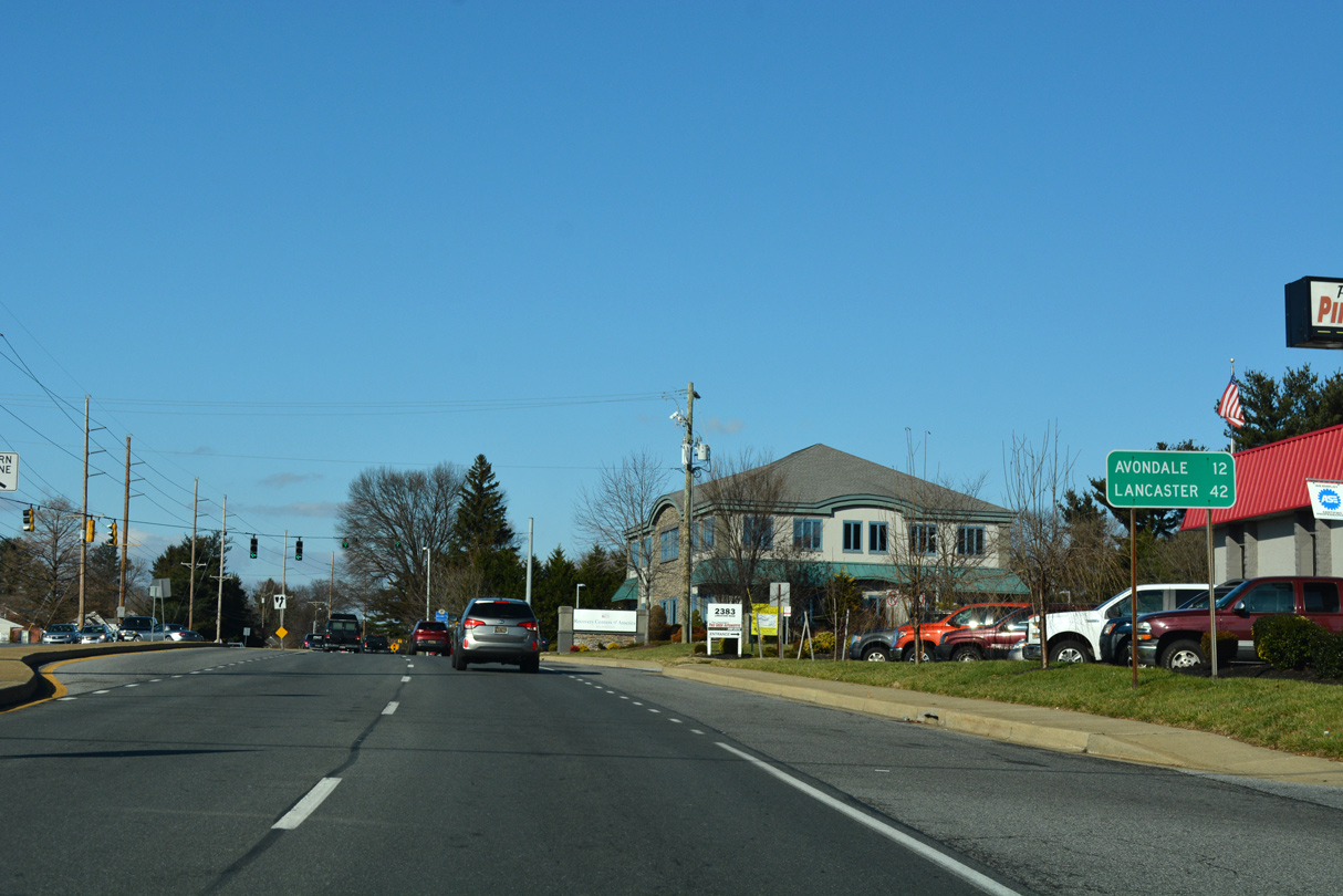
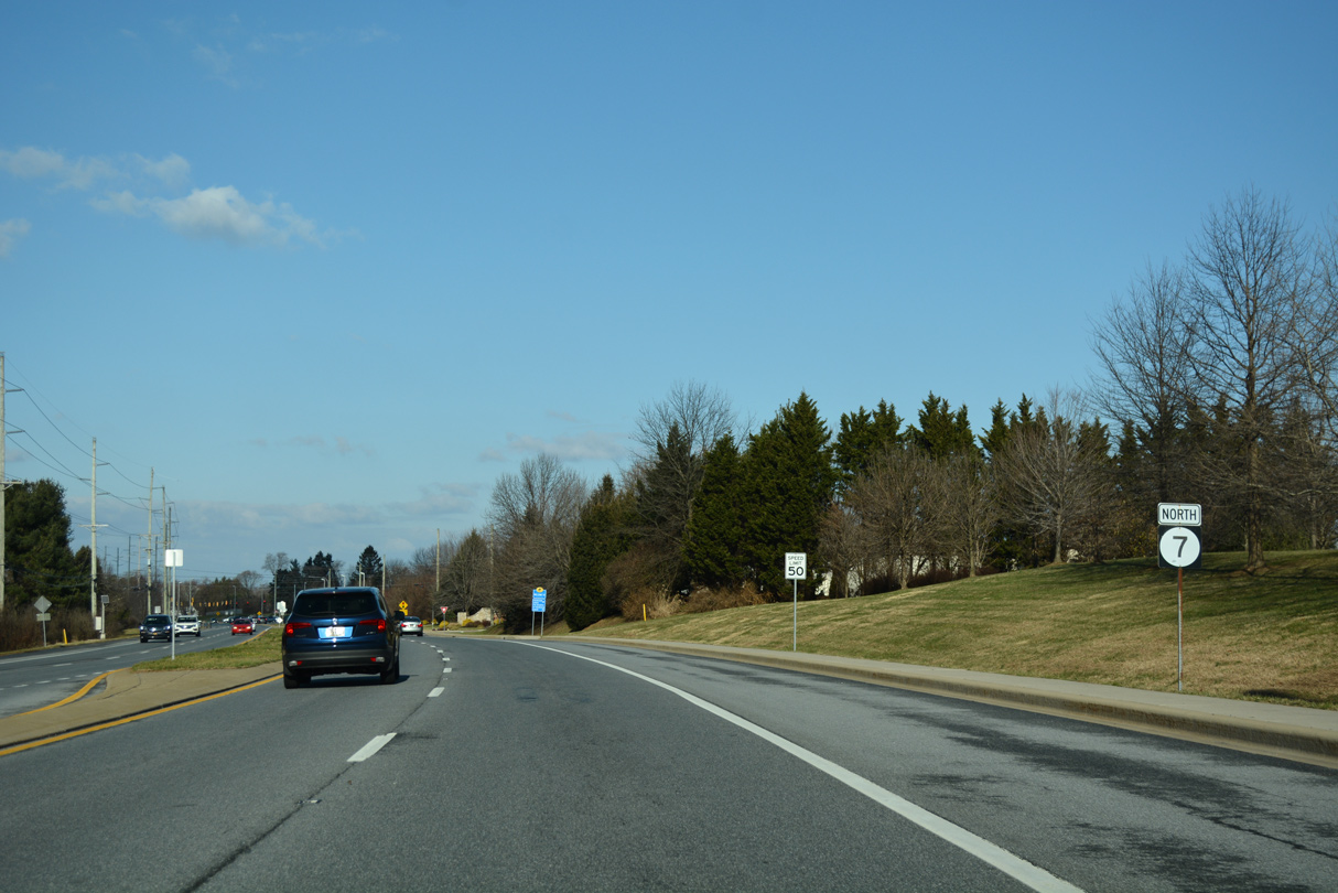
| North from SR 2, SR 7 (Limestone Road) provides part of a route to Avondale and Lancaster, Pennsylvania via PA 41 and U.S. 30. 12/24/18 |
|
| A protected turn connects SR 7 (Limestone Road) northbound with Midway Shopping Center on the north side of SR 2 (Kirkwood Highway). 12/24/18 |
|
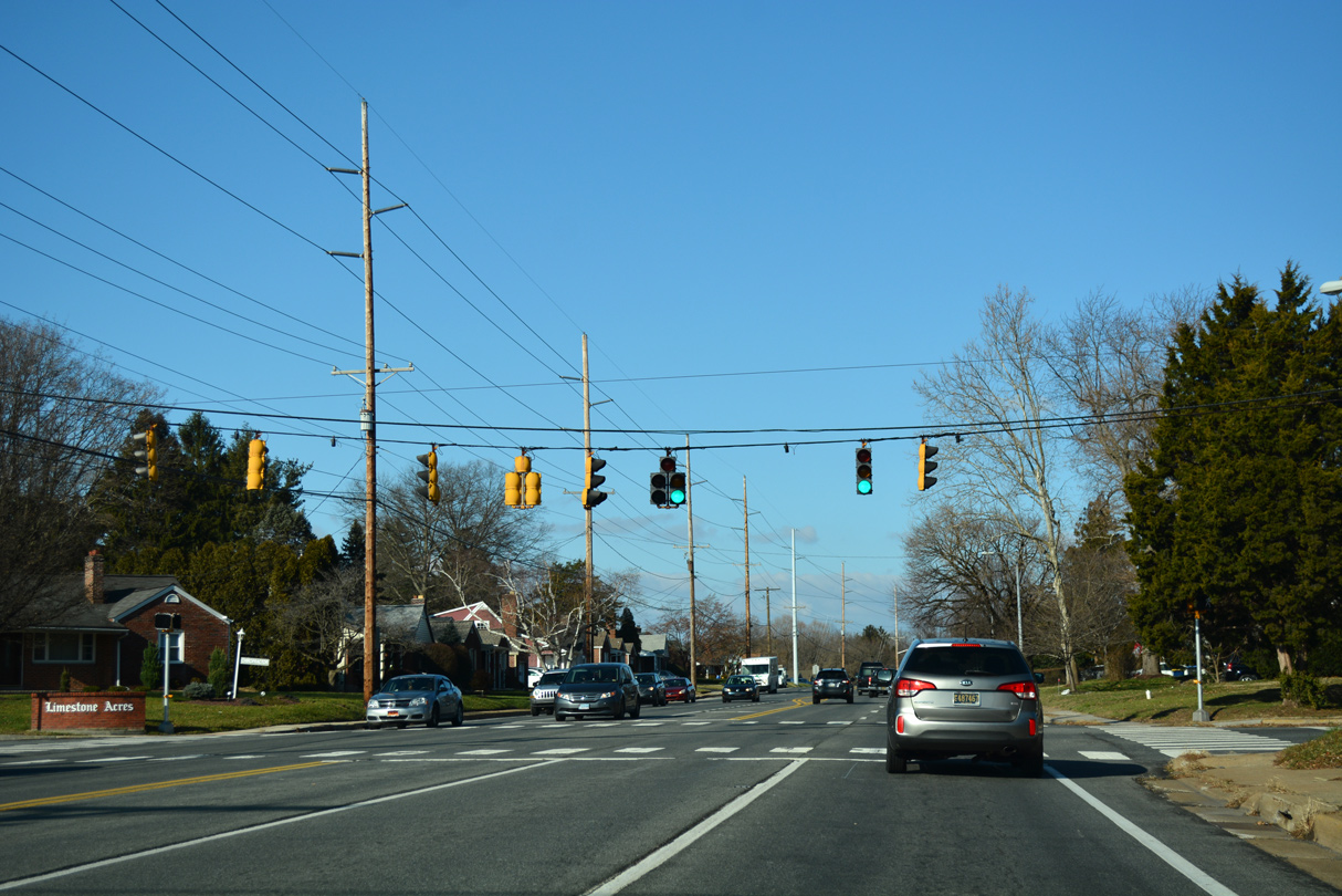
| Pickwick Drive intersects SR 7 between the Limestone Acres and Limestone Gardens subdivisions midway between Kirkwood Highway and Milltown Road. 12/24/18 |
|
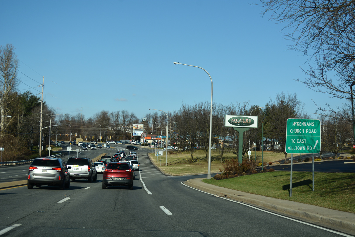
| McKennans Church Road branches northeast from SR 7 (Limestone Road), initially connecting with Milltown Road east, while leading to Delcaster Park and SR 41 (Newport Gap Pike) near Hockessin. 12/24/18 |
|
| Milltown Road angles southwest to SR 2 (Kirkwood Highway) near Delaware Park Boulevard. Heading east, Milltown Road merges with SR 41 (Newport Gap Pike) south at the Cedars community ahead of Prices Corner. 12/24/18 |
|
| The first reassurance marker for SR 7 posted north of SR 2 appears after Milltown Road. A section of Old Limestone Road loops to the west. 12/24/18 |
|
| Arundel Drive ties into SR 7 (Limestone Road) at the succeeding traffic light northbound from the Arundel neighborhood and apartments. 12/24/18 |
|
| Following an S-curve northwest by New Castle County Carousel Park, SR 7 intersects Greenwood Drive at the entrance to Faith Baptist Church. Greenwood Drive is the lone street into the Wood Creek development. 12/24/18 |
|
| Linden Hill Road, stems southwest from SR 7 (Limestone Road) at the entrance to Goldey Beacom College. The minor arterial follows a winding course 2.23 miles to Polly Drummond Hill Road across Pike Creek. 12/24/18 |
|
| SR 7 runs between Goldey Beacom College and Pike Creek Shopping Center on the ensuing stretch northbound. 12/24/18 |
|
| Stoney Batter Road west and Skyline Drive east come together at the succeeding traffic light on SR 7 northbound. Stoney Batter Road is a 1.19 mile long minor collector linking Limestone Road with Mill Creek Road. 12/24/18 |
|
| Ochletree Lane intersects SR 7 (Limestone Road) between the Limestone Hills community. 12/24/18 |
|
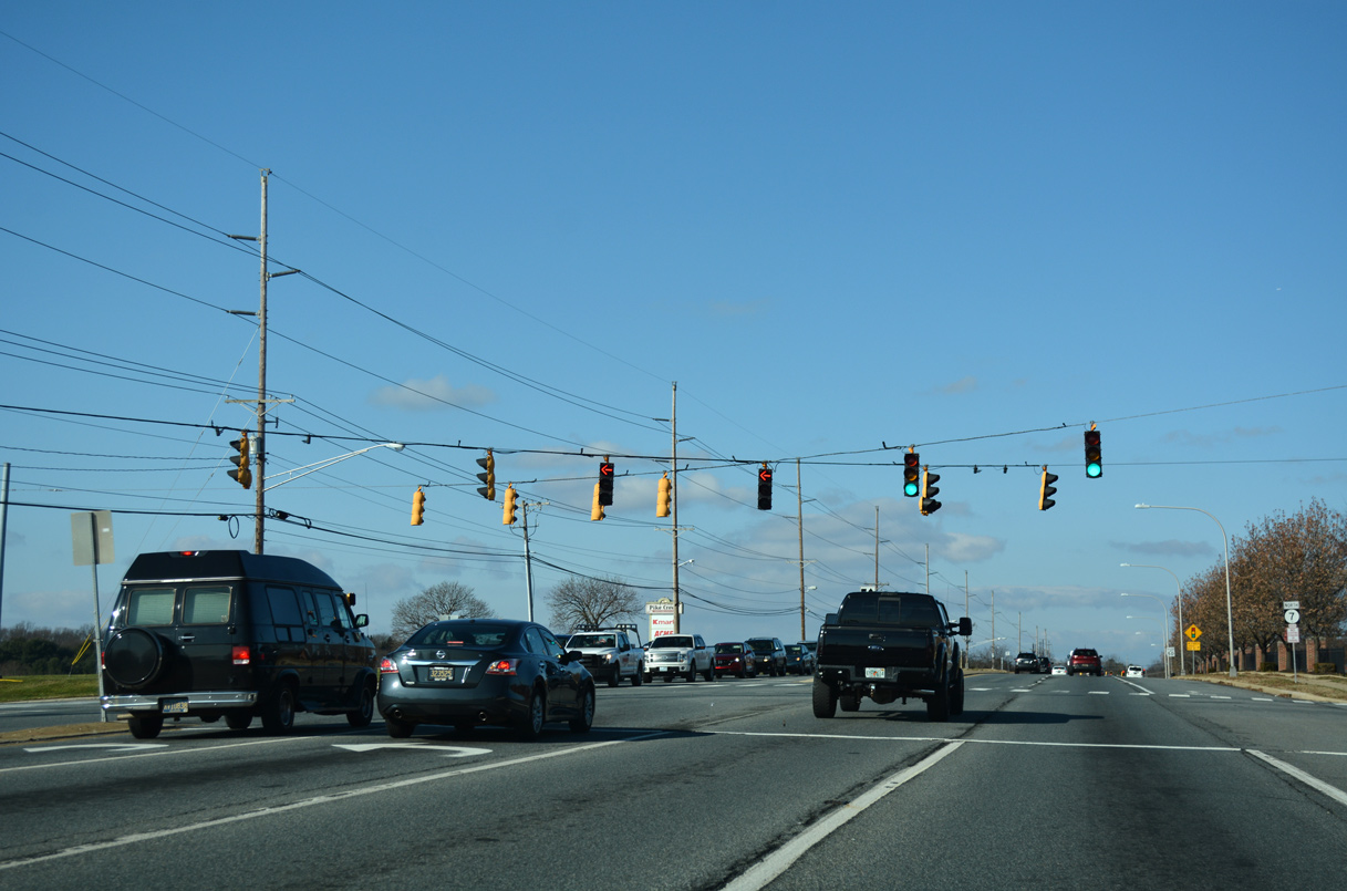
| Advancing north, SR 7 (Limestone Road) meets the north end of SR 72 (Paper Mill Road). 12/24/18 |
|
| State Route 72 arcs southwest to White Clay Creek State Park, Newark and Glasgow along a 17.52 mile route to Delaware City. 12/24/18 |
|
| The ensuing 1.1 mile section of SR 7 (Limestone Road) north from SR 72 to Brackenville and Little Baltimore Roads was expanded to four lanes between 2000 and 2003. 12/24/18 |
|
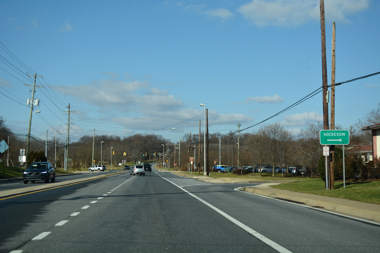
| Hockessin lies three miles to the northeast via Brackenville or Valley Roads to SR 41. 12/24/18 |
|
| Village Drive west from the Mendenhall Village development and Haleys Trail east from Jarrell Farms and North Star, meet SR 7 at a signalized intersection. 12/24/18 |
|
| Reassurance marker posted along Limestone Road northbound after Mendenhall Mill Road east. 12/24/18 |
|
| SR 7 (Limestone Road) north at Brackenville Road east to Hockessin and Little Baltimore Road west to Landenburg, Pennsylvania. 12/24/18 |
|
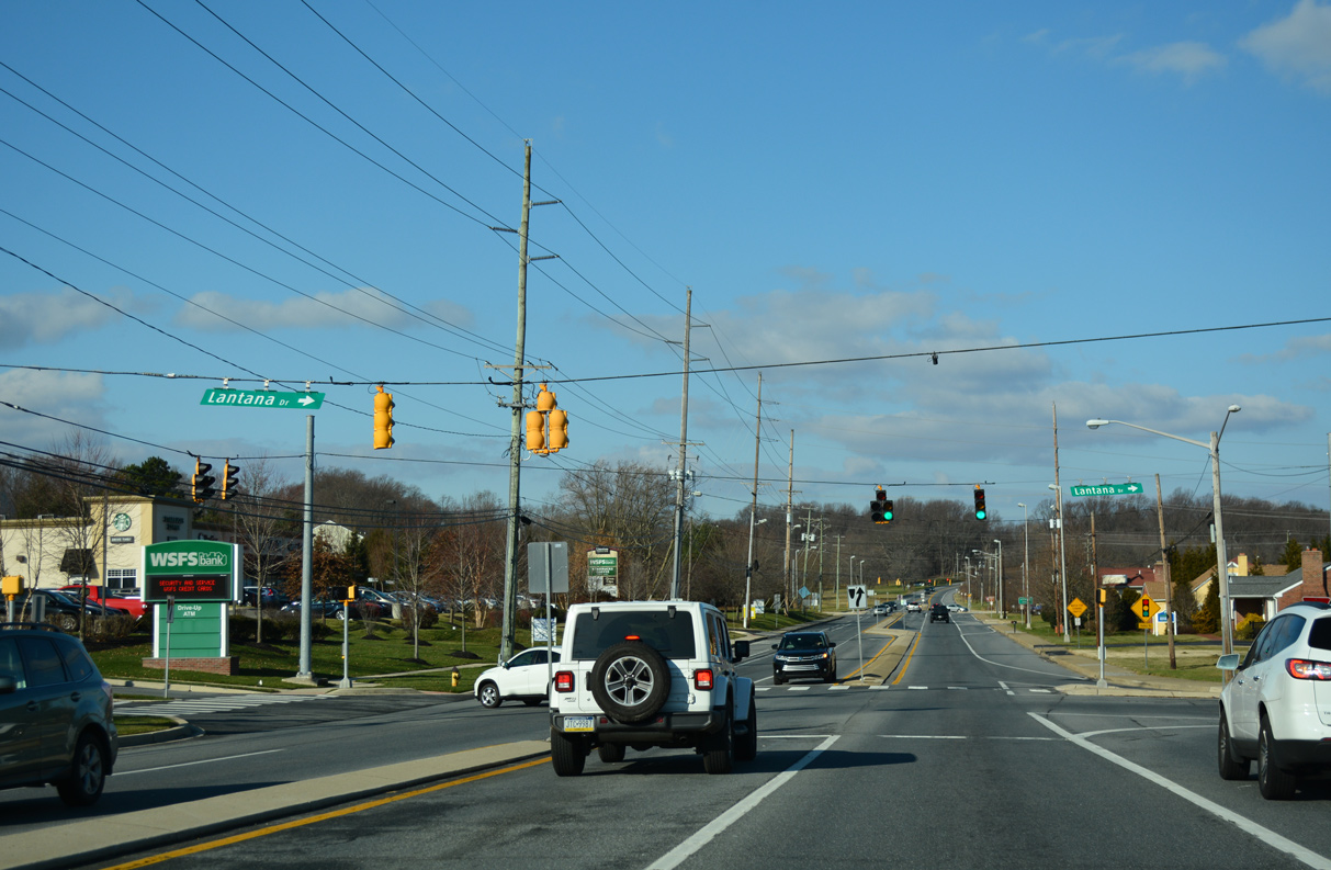
| Lantana Drive loops into Lantana Square Shopping Center between SR 7 (Limestone Road) and Valley Road. 12/24/18 |
|
| Valley Road, a major collector between North Star and Old Wilmington Road at Hockessin, crosses SR 7 at the ensuing traffic light. 12/24/18 |
|
| SR 7 (Limestone Road) continues past Tweeds Park and a remaining farm beyond Valley Road. 12/24/18 |
|
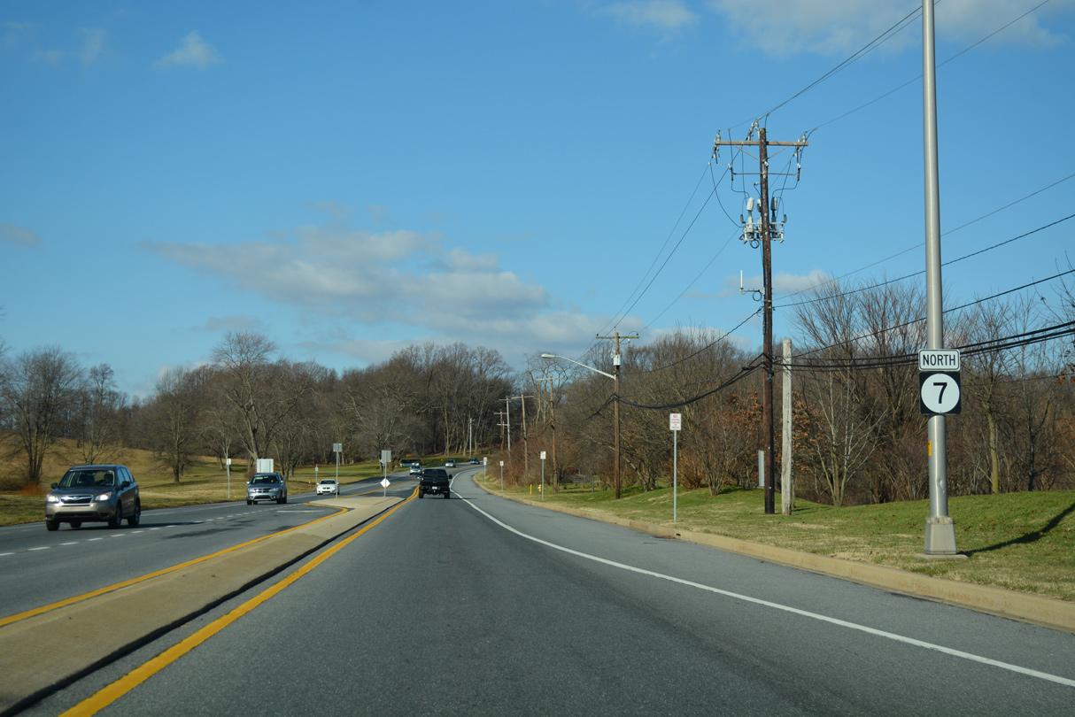
| Limestone Road continues north into Chester County, Pennsylvania as SR 3013 to PA 41 at Kaolin. 12/24/18 |
|
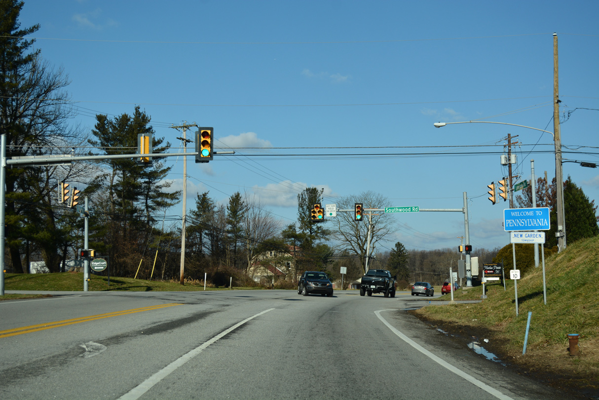
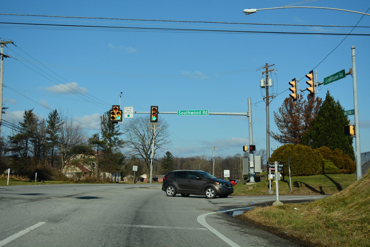
| Southwood Road extends west from Valley Road in Hockessin to Limestone Road just across the state line. 12/24/18 |
|
| Limestone Road (SR 3013) meets PA 41 (Gap Newport Pike) 0.8 miles beyond the state line. PA 41 travels northwest from Hockessin, Delaware to Avondale, Cochranville and U.S. 30 at Gap. 12/24/18 |
04/03/04, 06/16/12, 06/23/12, 12/22/16, 12/30/16, 12/24/18, 12/30/18, 12/19/20, 12/22/20, 12/26/20, 08/18/21, 12/18/22, 12/23/22 by AARoads
Page Updated 01-07-2023.


 North
North


 East
East