|
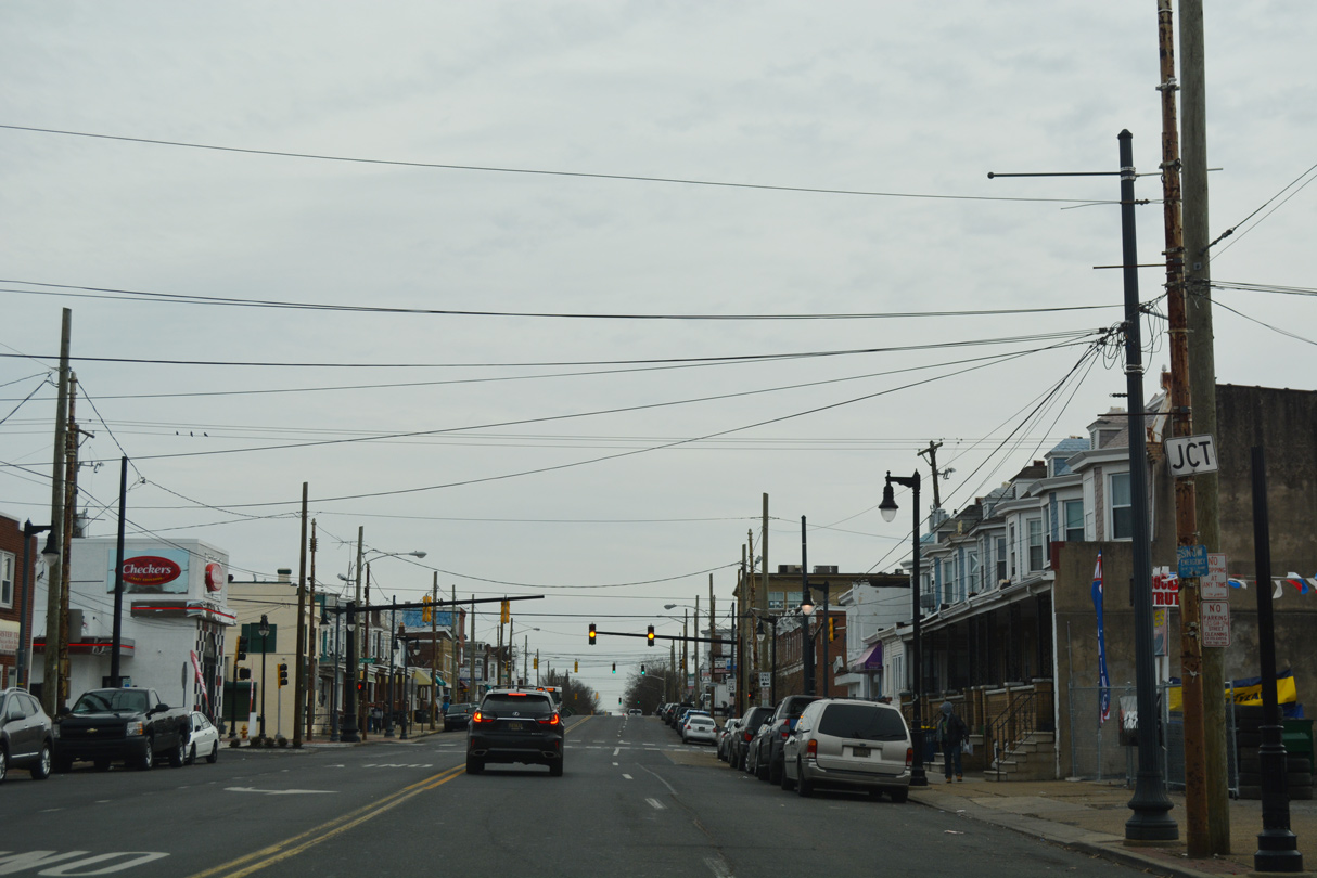
| 4th Street originates in the Westmoreland area of northwest Wilmington. Heading eastward, 4th Street intersects Greenhill Avenue, where it expands to three lanes into the Flats neighborhood. 12/20/17 |
|
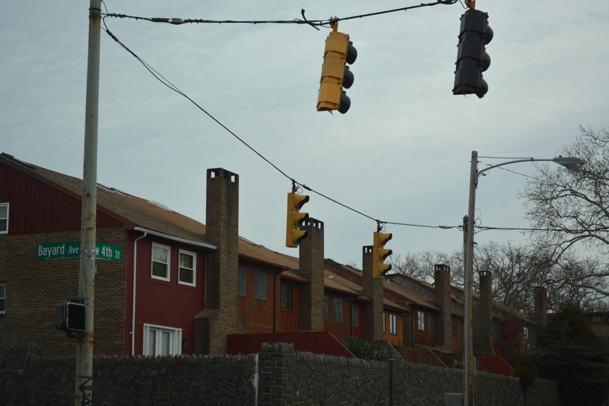
| 4th Street ascends across the CSX Railroad line by Woodlawn Park ahead of the traffic lights at Bayard Avenue. 12/20/17 |
|
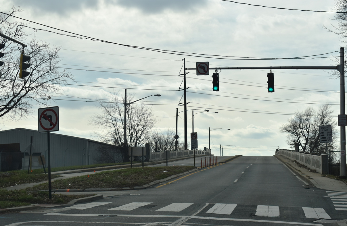
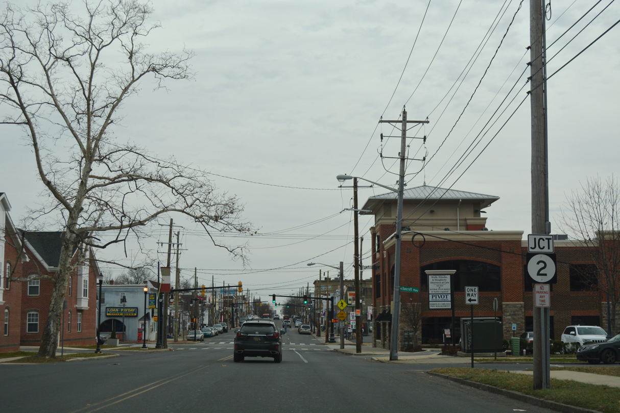
| 4th Street proceeds one block east from Bancroft Parkway to the couplet of SR 2 along Union and Lincoln Streets. 12/20/17 |
|
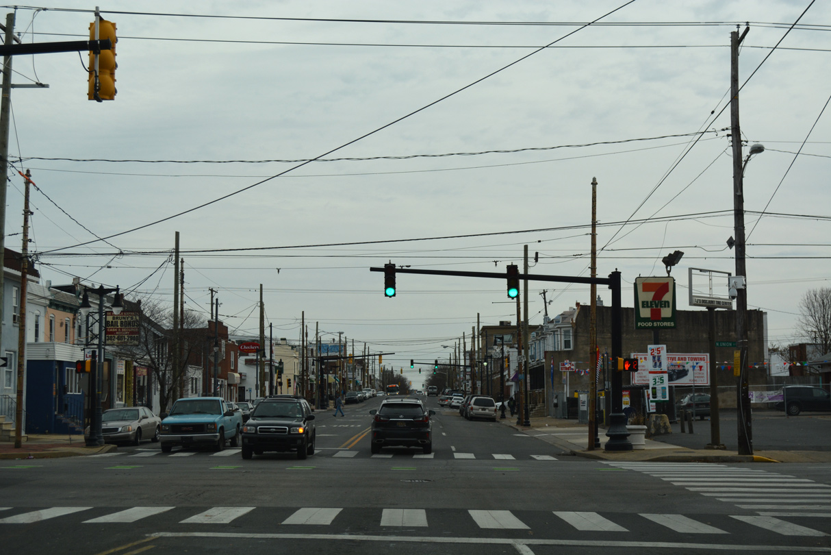
| Forthcoming Lincoln Street leads SR 2 northeast nine blocks to SR 52 (Pennsylvania Avenue). 12/20/17 |
|
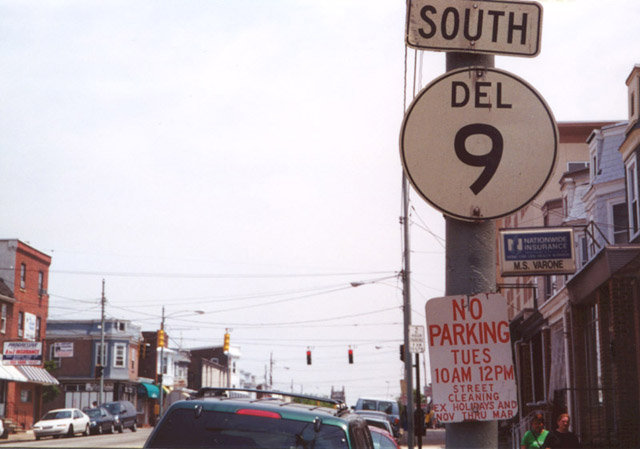
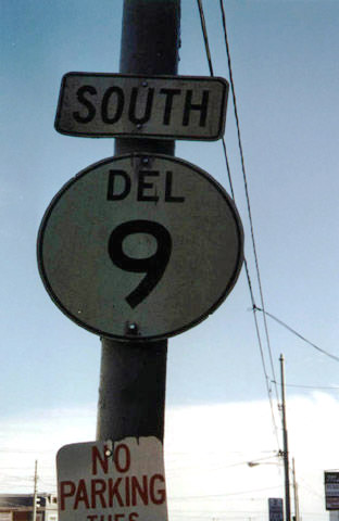
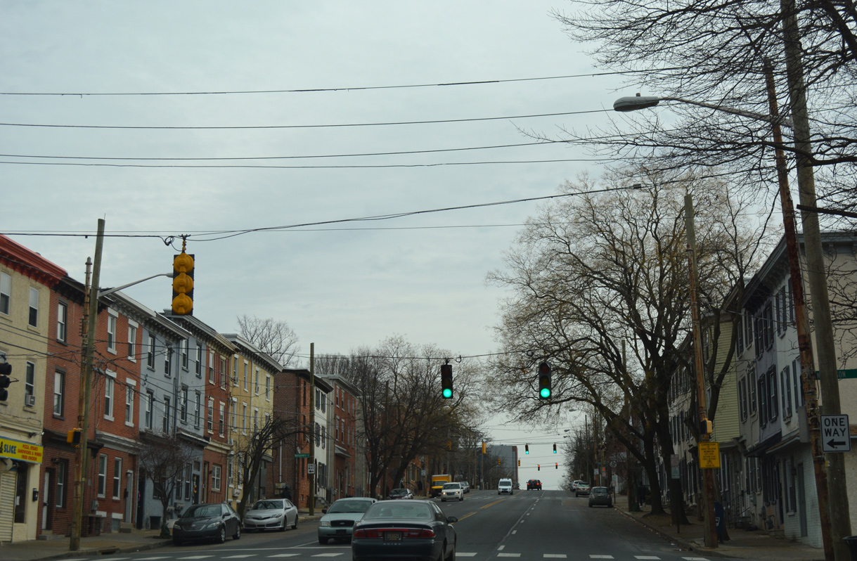
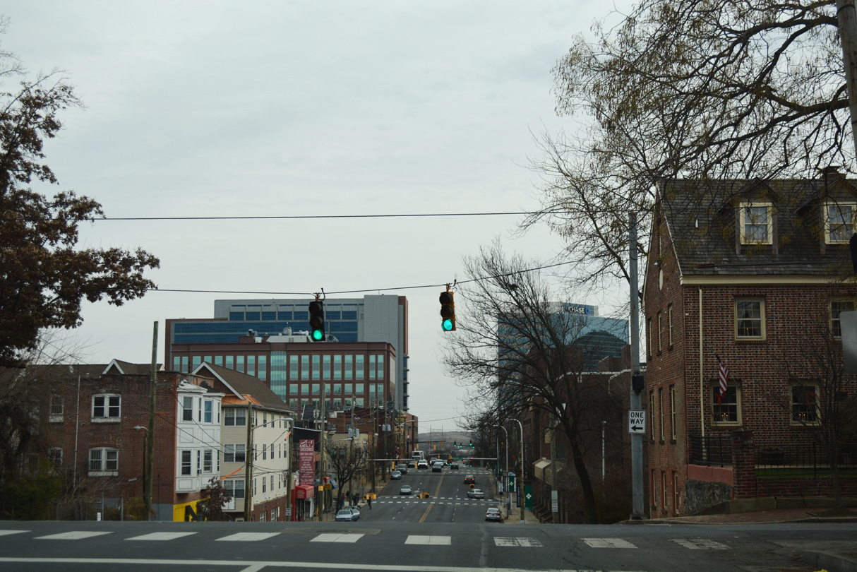
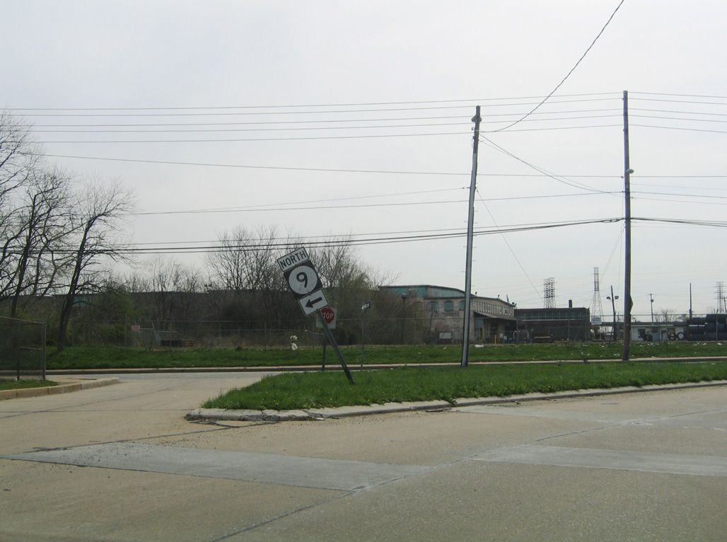
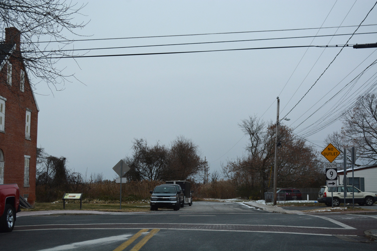
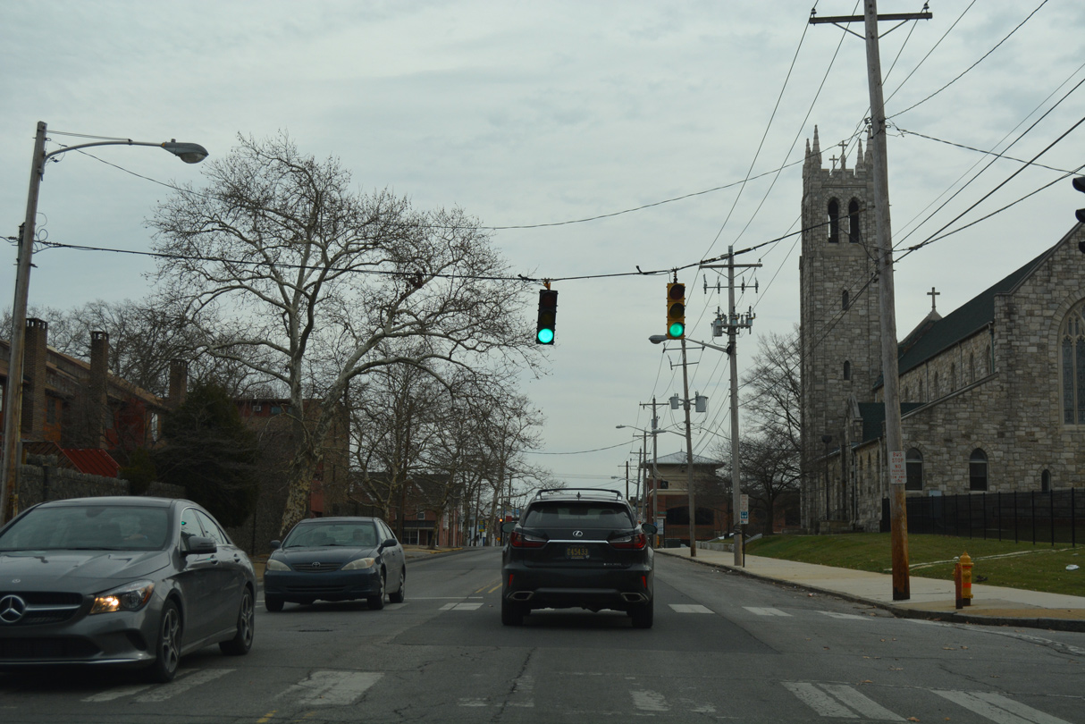
| Union Street enters the Little Italy neighborhood of Wilmington at 4th Street (SR 9). 12/20/17 |
|
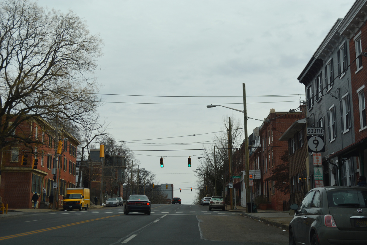
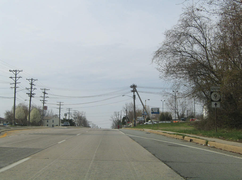
| What was the first confirming marker for SR 9 south was also the last remaining cutout for the route posted statewide. Posted between SR 2 (Lincoln Street) and Scott Street, the assembly was replaced by 2008. 05/12/00 |
|
| The replacement shield for SR 9 south ahead of Scott Street was gone by 2017. 12/20/17 |
|
| Scott Street intersects SR 9 (4th Street) north from the Bayard Square neighborhood and south from Little Italy. 12/20/17 |
|
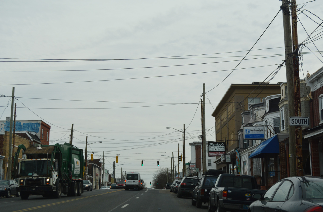
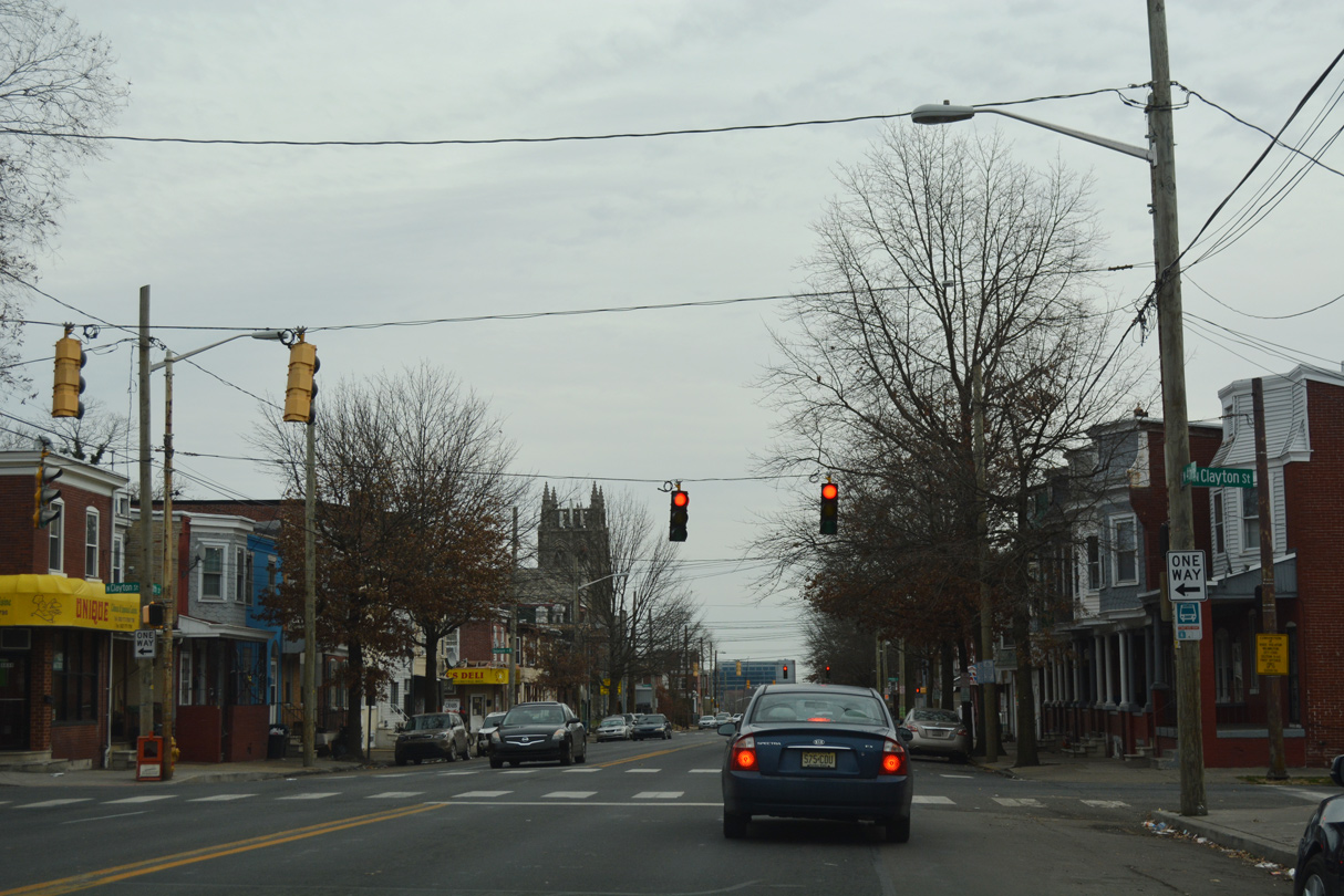
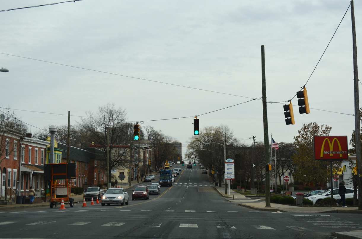
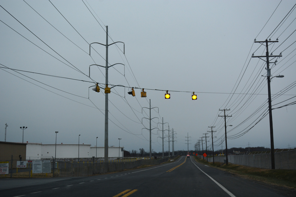
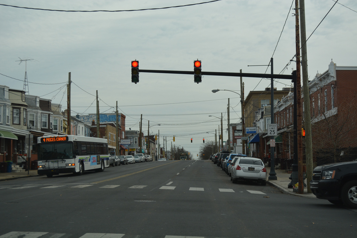
| SR 9 (4th Street) proceeds southeast from the Flats community into the Hilltop neighborhood through signalized intersections with Dupont, Clayton and Rodney Streets. 12/20/17 |
|
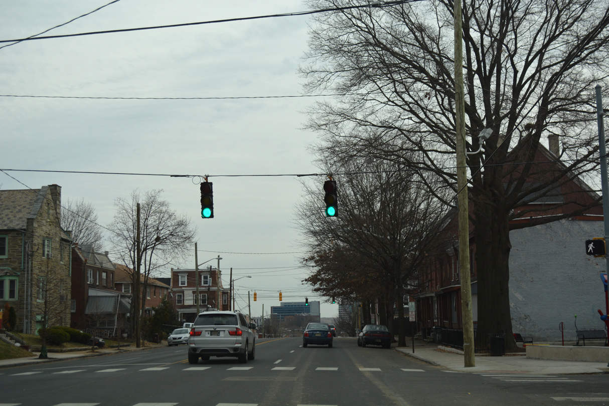
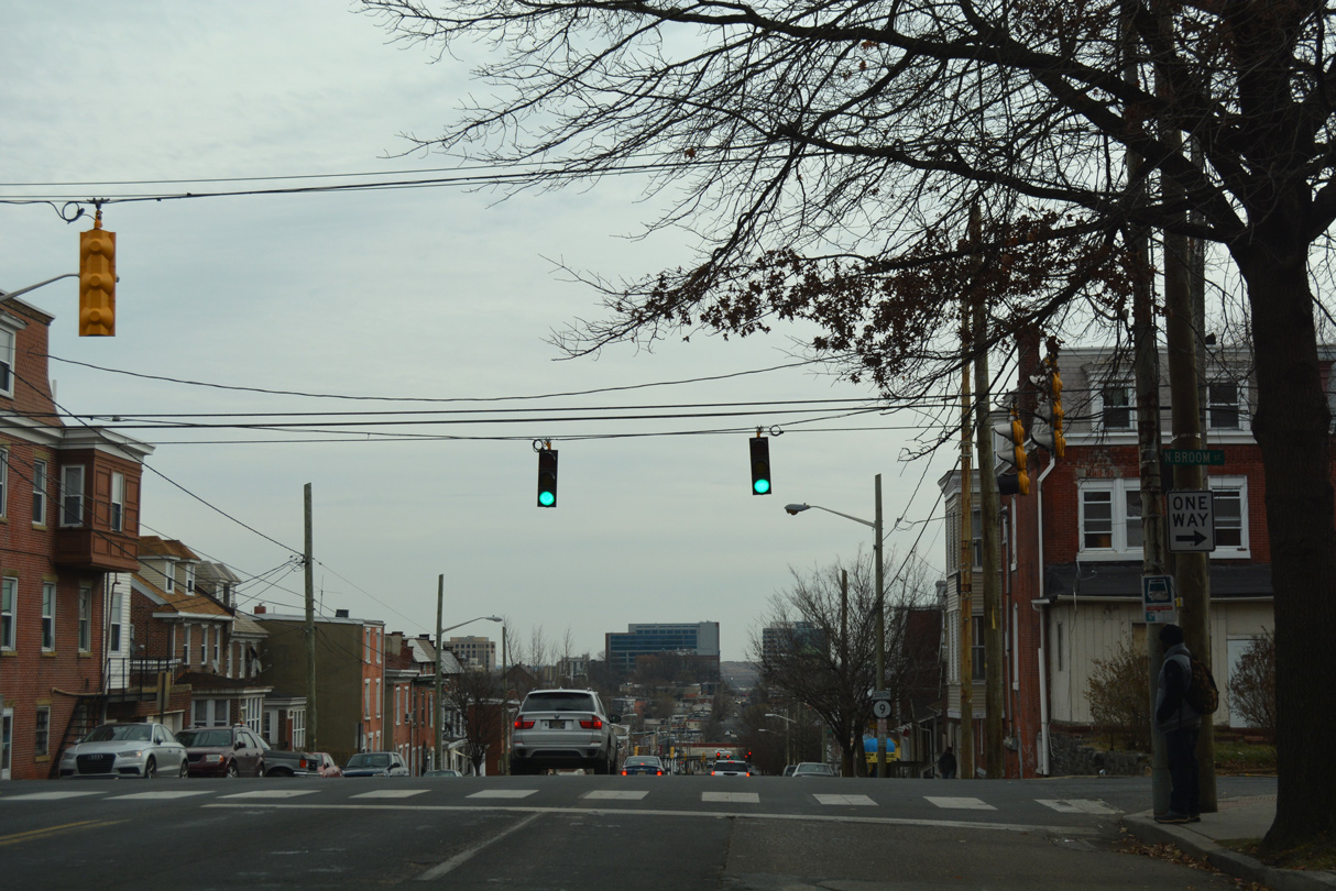
| 4th Street begins a 100 foot descent from Broom Street to Interstate 95 at West Center City. 12/20/17 |
|
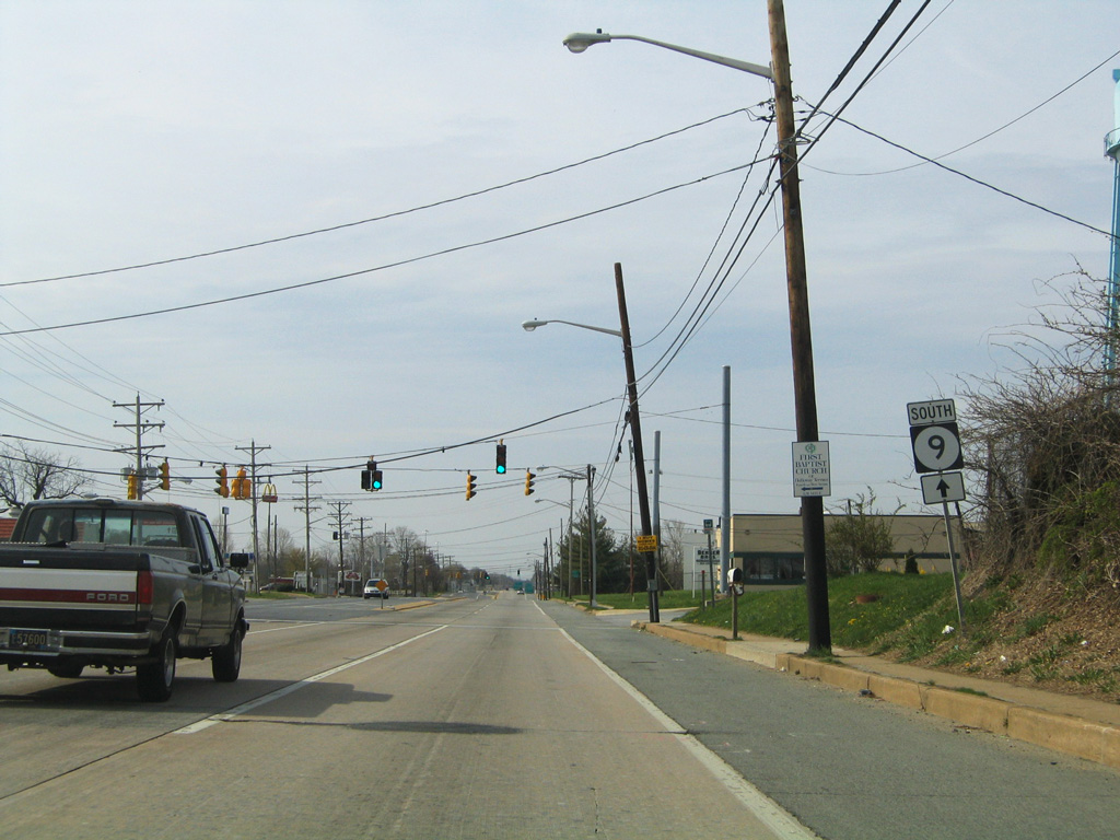
| The second reassurance marker for SR 9 appears between Broom and Franklin Streets along Fourth Street eastbound. 12/20/17 |
|
| The shield posted after Broom Street was previously a cutout. This assembly was removed by March 2004. 12/15/99 |
|
| Franklin Street flows north from the Hedgeville community through Hilltop to Cool Spring. 12/20/17 |
|
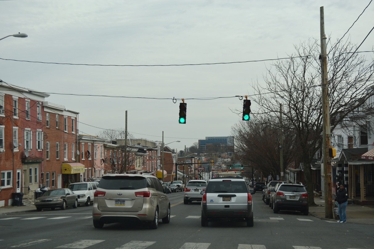
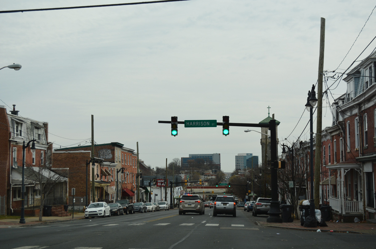
| 4th Street advances one block from Franklin Street to Harrison Street. 12/20/17 |
|
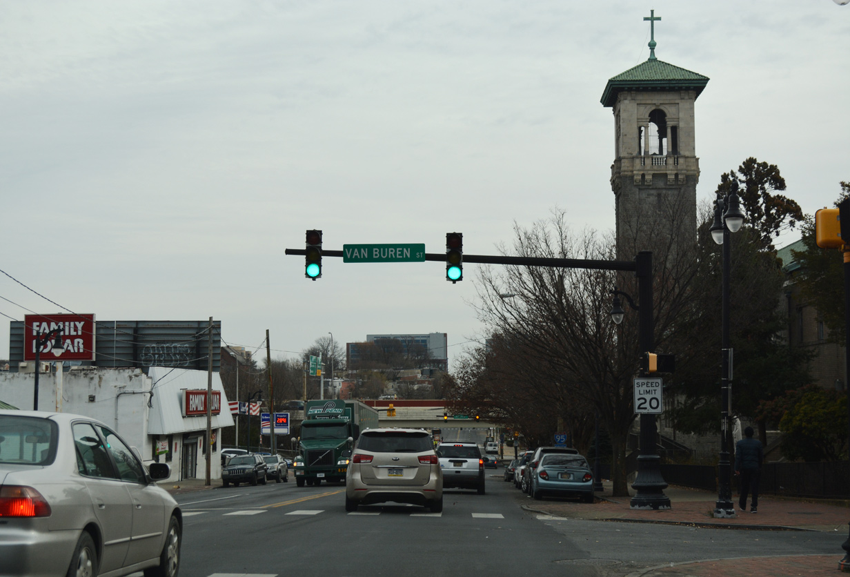
| Bottoming out from the Hilltop community, SR 9 (4th Street) intersects Van Buren Street north to Cool Spring Park. 12/20/17 |
|
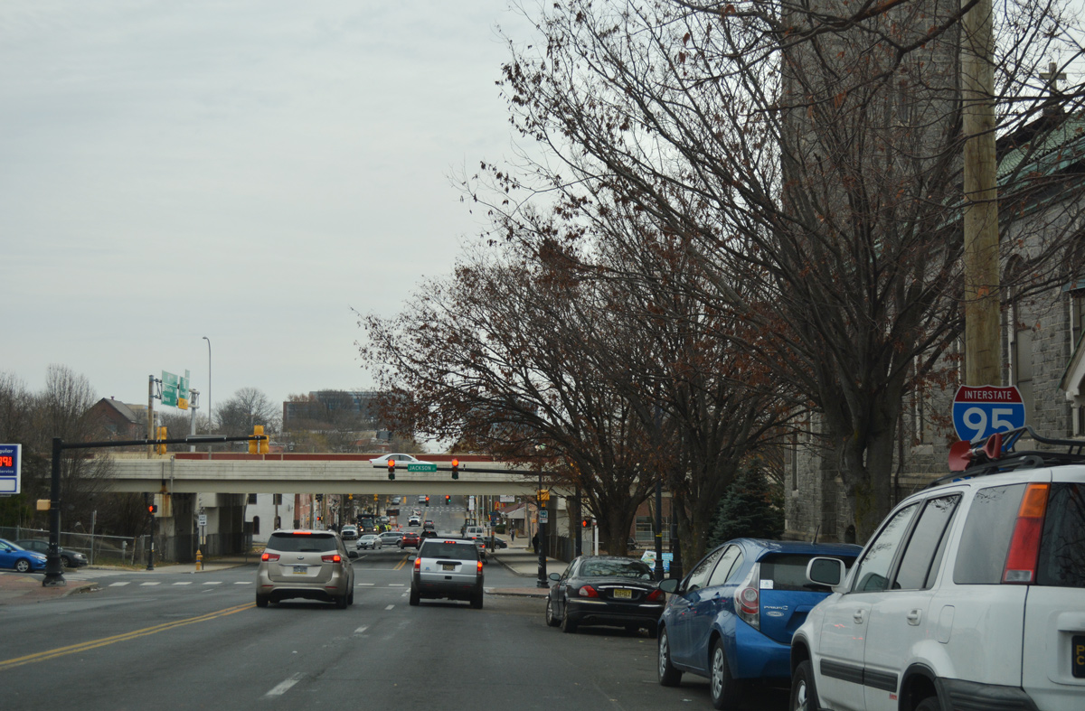
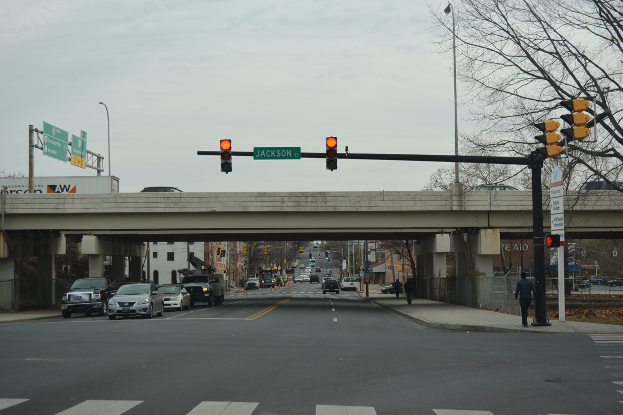
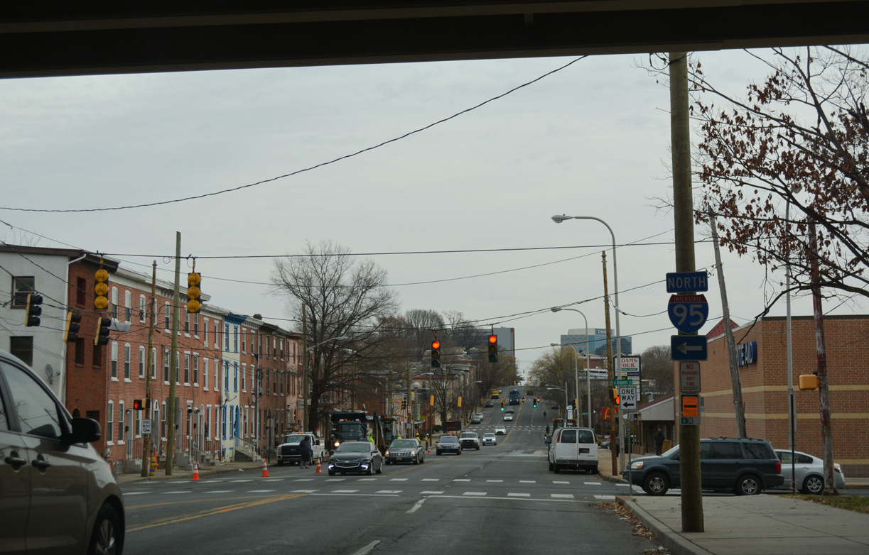
| The southbound on-ramp for Interstate 95 departs from Jackson Street, three blocks from SR 9 (4th Street) at SR 48 (Lancaster Avenue). This ramp will be removed during 2021-24 reconstruction of the Wilmington Viaduct carrying I-95 south between Hedgeville and the Riverfront. 12/20/17 |
|
| An 18 inch trailblazer for I-95 directed motorists from SR 9 (4th Street) south onto Jackson Street. This assembly was replaced by August 2004. 03/21/04 |
|
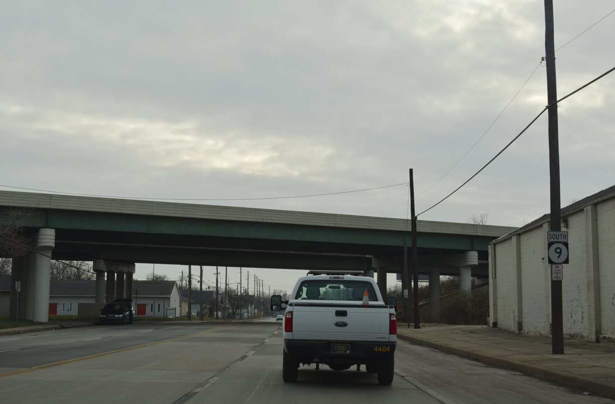
| Passing under the Wilmington Viaduct on SR 9 south between Jackson and Adams Streets. 12/20/17 |
|
| Adams Street comprises the east side frontage street for I-95 northward from SR 4 (Maryland Avenue) to SR 52 (Delaware Avenue) at Happy Valley. A freeway on-ramp departs from Adams at 10th Street. 12/20/17 |
|
| SR 9 (Fourth Street) southbound at Monroe Street and the Adams Four Shopping Center. Monroe Street ends one block to the south and resumes south from 2nd Street (SR 48 west) as the westbound beginning of SR 4. 12/20/17 |
|
| Madison Street extends north from the SR 4 and SR 48 (2nd Street) into West Center City at SR 9 (4th Street). 12/20/17 |
|
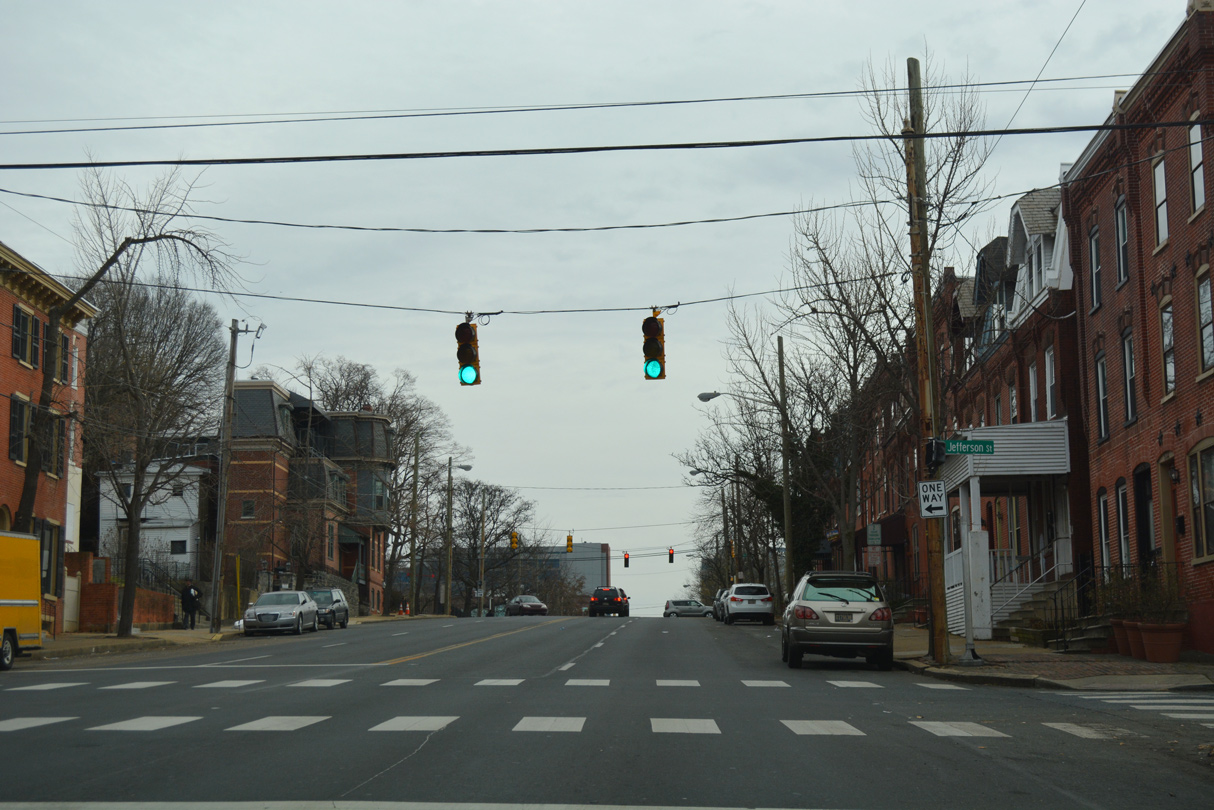
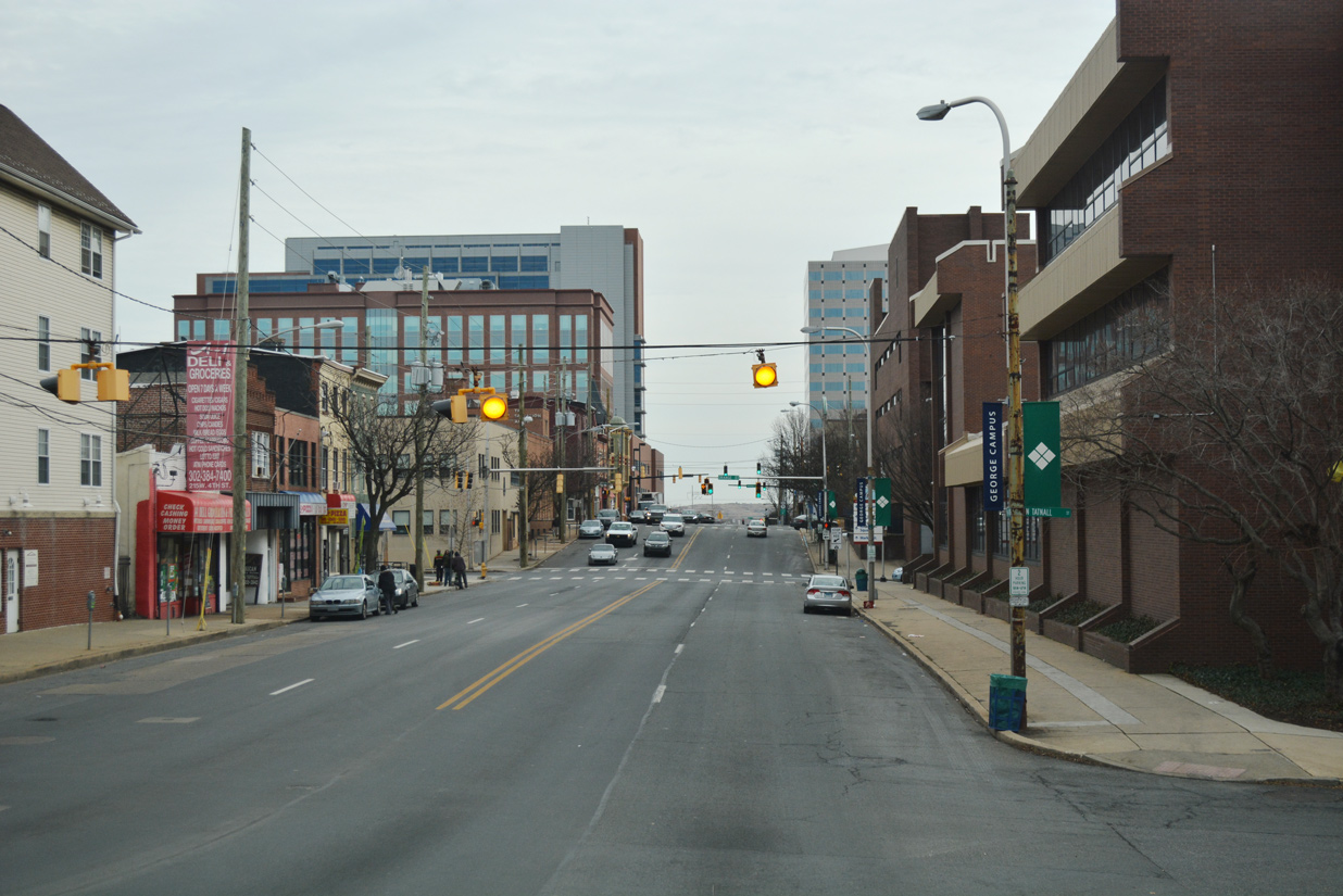
| Fourth Street climbs from West Center City to the Quaker Hill community. A reassurance marker precedes the SR 9 intersection with Jefferson Street north. 12/20/17 |
|
| 4th Street rises 40 feet in elevation from Monroe Street to Washington Street (old SR 4) at Quaker Hill. 12/20/17 |
|
| The Leonard L. Williams Justice Center (New Castle County Courthouse) comes into view along SR 9 (4th Street) southbound at West Street. 12/20/17 |
|
| 4th Street drops 20 feet in elevation to Tatnall Street and the Orlando J. George, Jr. (Wilmington) Campus of Delaware Technical Community College (DTCC). 12/20/17 |
|
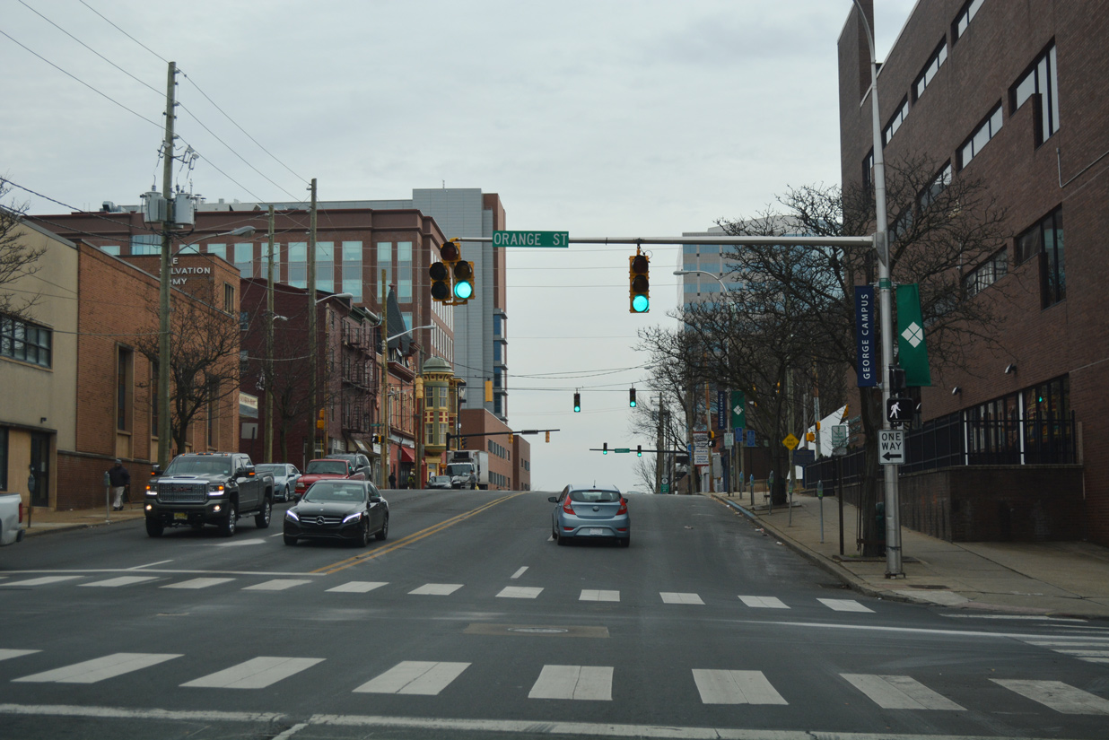
| Orange Street originates at the Christina Riverfront and heads north across 4th Street toward Downtown Wilmington. 12/20/17 |
|
| The succeeding traffic light along SR 9 (4th Street) south is with Shipley Street. 12/20/17 |
|
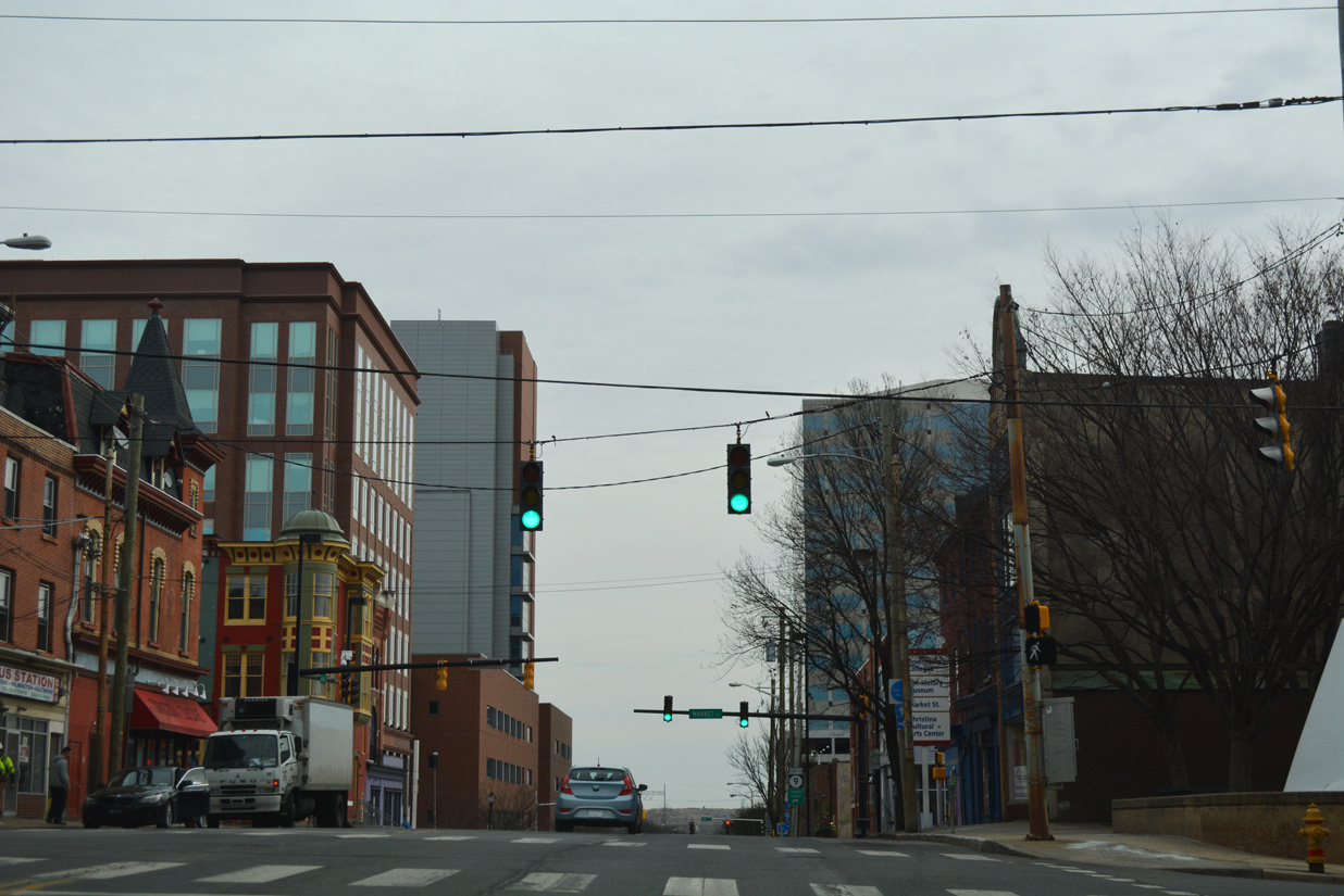
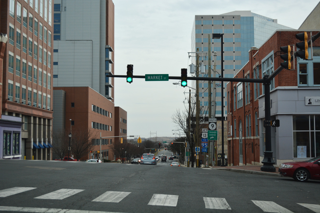
| Entering the LOMA (Lower Market) district, SR 9 intersects Market Street. 12/20/17 |
|
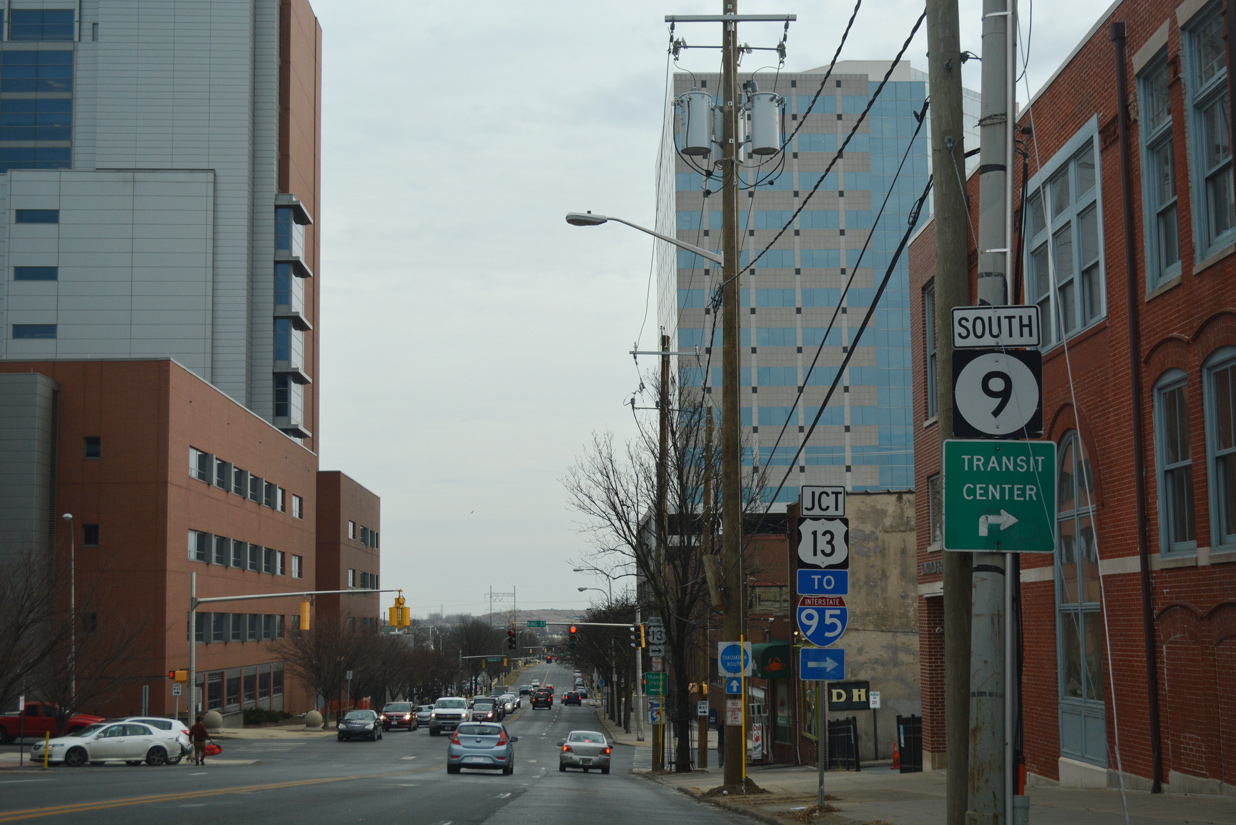
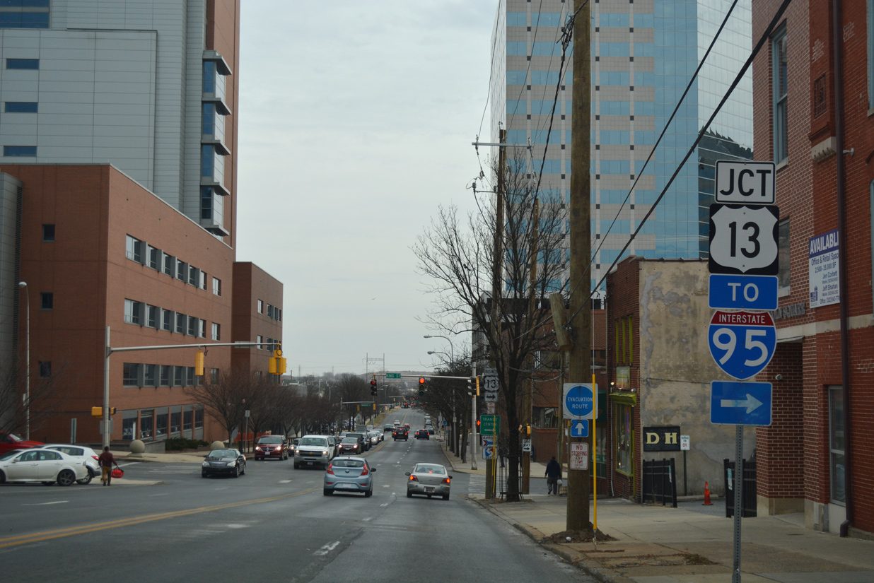
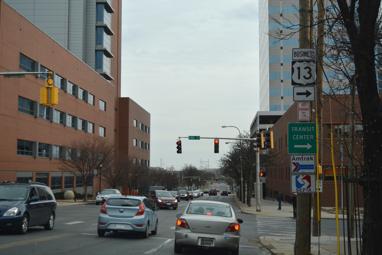
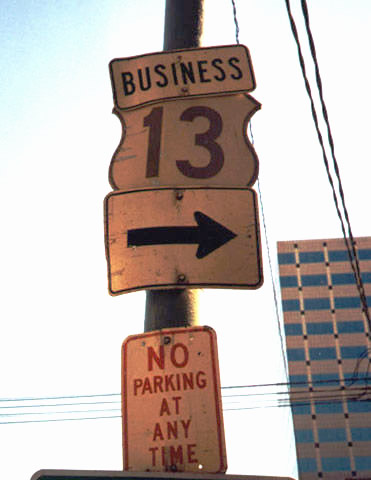
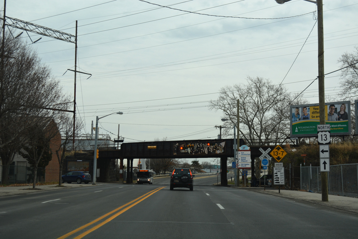
| Approaching U.S. 13 Business (King Street) south and the 2002-completed New Castle County Courthouse complex on SR 9 (4th Street) southbound. 12/20/17 |
|
| This shield assembly omits the Business banner for U.S. 13. King Street takes the southbound business route to 2nd Street (SR 48 west), MLK Boulevard and South Market Street by Wilmington Train Station. 12/20/17 |
|
| U.S. 13 Business travels south from Downtown Wilmington across the Christina River to combine with U.S. 13 (Dupont Parkway) at Interstate 495 near Minquadale. 12/20/17 |
|
| Vintage cutout for U.S. 13 Business formerly posted at the corner of 4th and King Streets. 03/15/00 |
|
| Walnut Street carries the northbound direction of U.S. 13 Business from areas south of the Christina River to Downtown and the Upper East Side. The route is unmarked from SR 9 (4th Street) south. 12/20/17 |
|
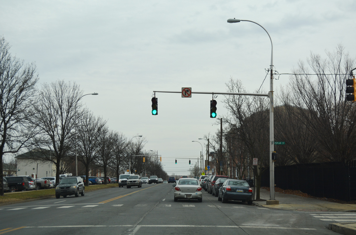
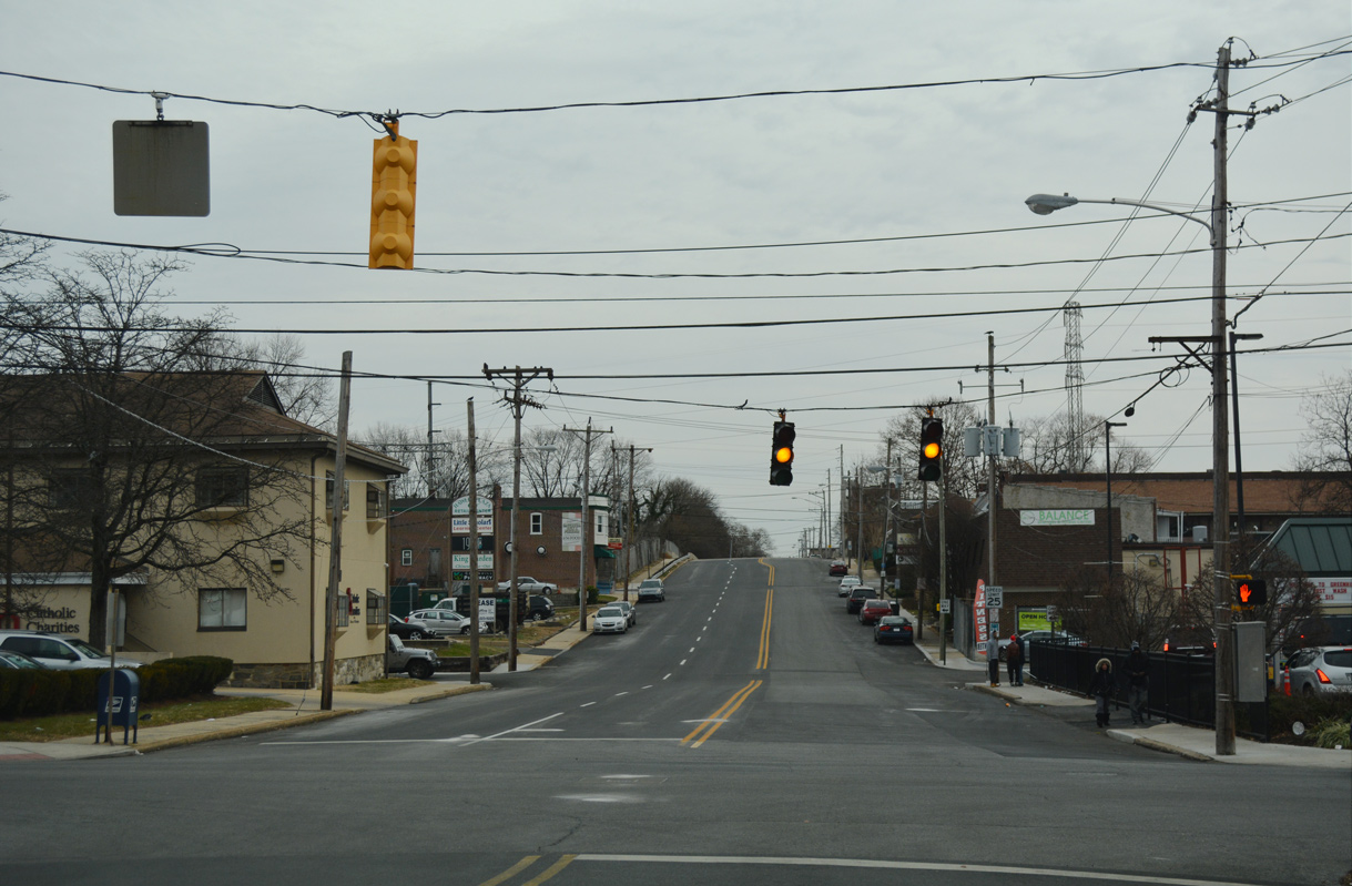
| Several apartment buildings line the north side of Fourth Street from Walnut Street (U.S. 13 Business north) to the SR 9 merge with U.S. 13 south at Spruce Street. Pictured here is the intersection with a segment of Poplar Street. 12/20/17 |
|
| 4th Street east at Lombard Street. Lombard Street leads south from Herman Holloway, Sr. Park and Bancroft Elementary to Front Street and Wilmington Industrial Park. 12/20/17 |
|
| U.S. 13 follows Spruce Street south through East Side, Wilmington to combine with SR 9 on 4th Street east across the Christina River. 12/20/17 |
|
| U.S. 13/SR 9 (4th Street) south intersect Church Street (U.S. 13 north) just ahead of the AMTRAK Northeast Corridor overpass. 12/20/17 |
|
| U.S. 13/SR 9 meet the north end of SR 9A (Christina Avenue) just beyond the Christina River. SR 9A forms a short loop east from Heald Street and New Castle Avenue to the Port of Wilmington and I-495. The SR 9A shield here was missing by 2008. 12/30/18 |
|
| SR 9A lines Christina Avenue southeast to Terminal Avenue and the Port of Wilmington.
Christina Avenue once was a part of MSR 48. The state route used to connect the city of Wilmington with Penns Grove, New Jersey by way of a ferry crossing over the Delaware River. When the Delaware Memorial Bridge opened to traffic in 1951, ferry service was discontinued. SR 48 later was truncated and Christina Avenue redesignated SR 9A. 12/30/18 |
|
| A marker for U.S. 13 was missing from the confirming assembly south of SR 9A. This set of signs was removed entirely by 2007. 04/10/04 |
|
| Heald Street transitions back to two way traffic at the D Street turn off of U.S. 13 northbound. 12/30/18 |
|
| U.S. 13/SR 9 south ascend across the Paul Livingston Bridge above a Norfolk Southern Railroad line and a loop ramp taking SR 9 to New Castle Avenue. 12/30/18 |
|
| SR 9 joins New Castle Avenue south to New Castle. U.S. 13 leaves the Wilmington city limits beyond adjacent Garasches Lane. 12/30/18 |
|
| SR 9 southbound navigates a ramp system below the Paul Livingston Bridge to connect with New Castle Avenue south. Constructed between 1941-42, the Heald Street span was refurbished in 1994. 04/10/04 |
|
| SR 9 south joins New Castle Avenue. New Castle Avenue north returns to Southbridge over an at-grade crossing with the Norfolk Southern Railroad line. 04/10/04 |
|
| SR 9A returns to SR 9 (Terminal Avenue) at the Eden Park Gardens community outside Wilmington. Terminal Avenue connects New Castle Avenue with Pigeon Point Road south to Castlewood and New Castle Industrial Park, and the Port of Wilmington Entrance. 08/31/04 |
|
| A parclo interchange joins SR 9A (Terminal Avenue) with Interstate 495 just east of SR 9 (New Castle Avenue). There is no direct access between the Wilmington Bypass and SR 9 otherwise.
This I-495 shield was removed by 2012. 08/31/04 |
|
| New Castle Avenue maintains four overall lanes from Wilmington Avenue south to the city of New Castle, although long range plans call for a road diet. SR 9 passes under Interstate 495 near the Hamilton Park community in this scene. 12/18/17 |
|
| Rogers Road angles southeast from a bridge over I-495 to SR 9 (New Castle Avenue) at Sutton Lane and the Rose Hill neighborhood. The arterial links New Castle with U.S. 13 (Heald Street) and U.S. 13 Business (Market Street) north to Downtown Wilmington. 04/10/04 |
|
| Southbound reassurance shield posted after the Rogers Road intersection. 04/10/04 |
|
| Lambson Lane spurs east from SR 9 to Simonds Gardens and Holloway Terrace, subdivisions dating back to the 1950s and 1930s respectively. Trucks are restricted from using the arterial east to Delaware River Industrial Park. 04/10/04 |
|
| A compact cloverleaf interchange joins SR 9 (New Castle Avenue) with Interstate 295 & U.S. 40 just west of the Delaware Memorial Bridge. 12/18/16 |
|
| What was the last state named shield for Interstate 295 in Delaware accompanied the southbound on-ramp from SR 9 (New Castle Avenue) until 2001. 05/12/00 |
|
| Approaching the loop ramp for I-295 north / U.S. 40 east on SR 9 (New Castle Avenue) south. U.S. 40 runs east to Atlantic City while I-295 turns north toward Camden. 04/10/04 |
|
| I-295 and U.S. 40 overlap from the nearby Farnhurst interchange with U.S. 13 across the Delaware Memorial Bridge to Deepwater. The twin suspension bridges are tolled in the southbound direction. 12/27/18 |
|
| Cherry Lane stems east from New Castle Avenue and the northbound off-ramp from I-295 to the Delaware War Memorial and Riveredge Industrial Park. 12/27/18 |
|
| Rodney Drive ties into SR 9 (New Castle Avenue) from the Collins Park subdivision. 12/27/18 |
|
| Stamm Boulevard follows Crossroads Shopping Center as the main entrance to the Swanwyck neighborhood to the west. 12/27/18 |
|
| A narrow median separates traffic as New Castle Avenue advances south from Stamm Boulevard by Collins Park and Schoolside Plaza shopping center. 12/27/18 |
|
| Landers Lane connects Moores Lane and the Swanwyck community with SR 9 (New Castle Avenue) acrosss from Riverview Drive into Collins Park. 12/27/18 |
|
| SR 9 reassurance marker posted south after Landers Lane. 12/27/18 |
|
| South of the signal with Castle Hills Drive west and Buttonwood Avenue east, SR 9 (Wilmington Road) wholly enters the New Castle city limits. 12/27/18 |
|
| Rogers Manor Park lines the west side of the four lane arterial by this shield marker. 12/27/18 |
|
| SR 9 (Wilmington Road) converges with the south end of Moores Lane at this traffic light. Moores Lane leads north to Boulden Boulevard by Southgate Industrial Center and Boulden Interchange Park. 12/27/18 |
|
| A Norfolk Southern Railroad line crosses SR 9 at-grade to the immediate south of Moores Lane. This shield was removed by 2012. 04/10/04 |
|
| The succeeding traffic light is located at Municipal Lane west and Anchor Mill Road east to Twin Spans Business Park. 12/23/16 |
|
| SR 9 shifts southwest onto 6th Street and spans the Narrow Dyke Canal. The state route turns again onto forthcoming Chestnut Street. 12/23/16 |
|
| Ferry Cut Off Street forms the initial leg of a bypass for SR 9 around New Castle. The state route was realigned by 1987 to shift traffic away from the historic district. 12/27/18 |
|
| Prior to 1987, SR 273 followed Ferry Cut Off Street and Delaware Streets solo to SR 141 (Basin Road). A reassurance marker remains posted along SR 9 southbound by River Plaza Shopping Center. 12/27/18 |
|
| Extending SR 9 west to Washington Avenue, Delaware Street overtakes Ferry Cut Off Street at River Plaza Shopping Center. Delaware Street leads south through the New Castle historic district to Battery Park on the Delaware River. 12/23/16 |
|
| Approaching the south end of SR 141 (Basin Road) and east end of SR 273 (Frenchtown Road) on Delaware Street west. SR 9 here was lowered to grade level in 1994 when an overpass above an abandoned Conrail railroad line was demolished. 12/27/18 |
|
| SR 9/273 south formerly split at SR 141 (Basin Road), though sign installs in 2018 indicate otherwise. The state route heads west to Hares Corner, Christiana and Newark as part of a multi state route to Rising Sun, Maryland. SR 141 encircles the Wilmington area from New Castle north to Newport, Greenville and Blue Ball. 12/27/18 |
|
| SR 9 (Washington Avenue) angles southeast from SR 141 (Basin Road) and SR 273 (Frenchtown Road) through the Washington Park community of New Castle. 12/15/17 |
|
| Washington Avenue returns SR 9 south to its original alignment through New Castle along 7th Street. 12/15/17 |
|
| Confirming marker posted after SR 9 joins Seventh Street west from Washington Avenue. The state route runs along the north side of Battery Park to Army Creek and the city line. 12/15/17 |
|
| Seventh Street at Center Street in the Dobbinsville community in southwest New Castle. A set flashing beacons were previously used here. 12/15/17 |
|
| Continuing south from Federal School Lane along Ommelanden Park, SR 9 (River Road) becomes rural and crosses Tom Creek. 12/15/17 |
|
| Hamburg Road links SR 9 (River Road) with U.S. 13 (Dupont Highway) at Tybouts Corner to the west. 12/15/17 |
|
| The Delaware City refinery appears along the horizon as SR 9 (River Road) turns south from Hamburg Road to traverse Red Lion Creek and associated wetlands. 12/15/17 |
|
| Southbound SR 9 crosses Red Lion Creek between a substation and industrial sites. 12/15/17 |
|
| River Road passes through the Delaware City oil refinery complex ahead of SR 72 (Wrangle Hill Road) and Clarks Corner Road. 12/15/17 |
|
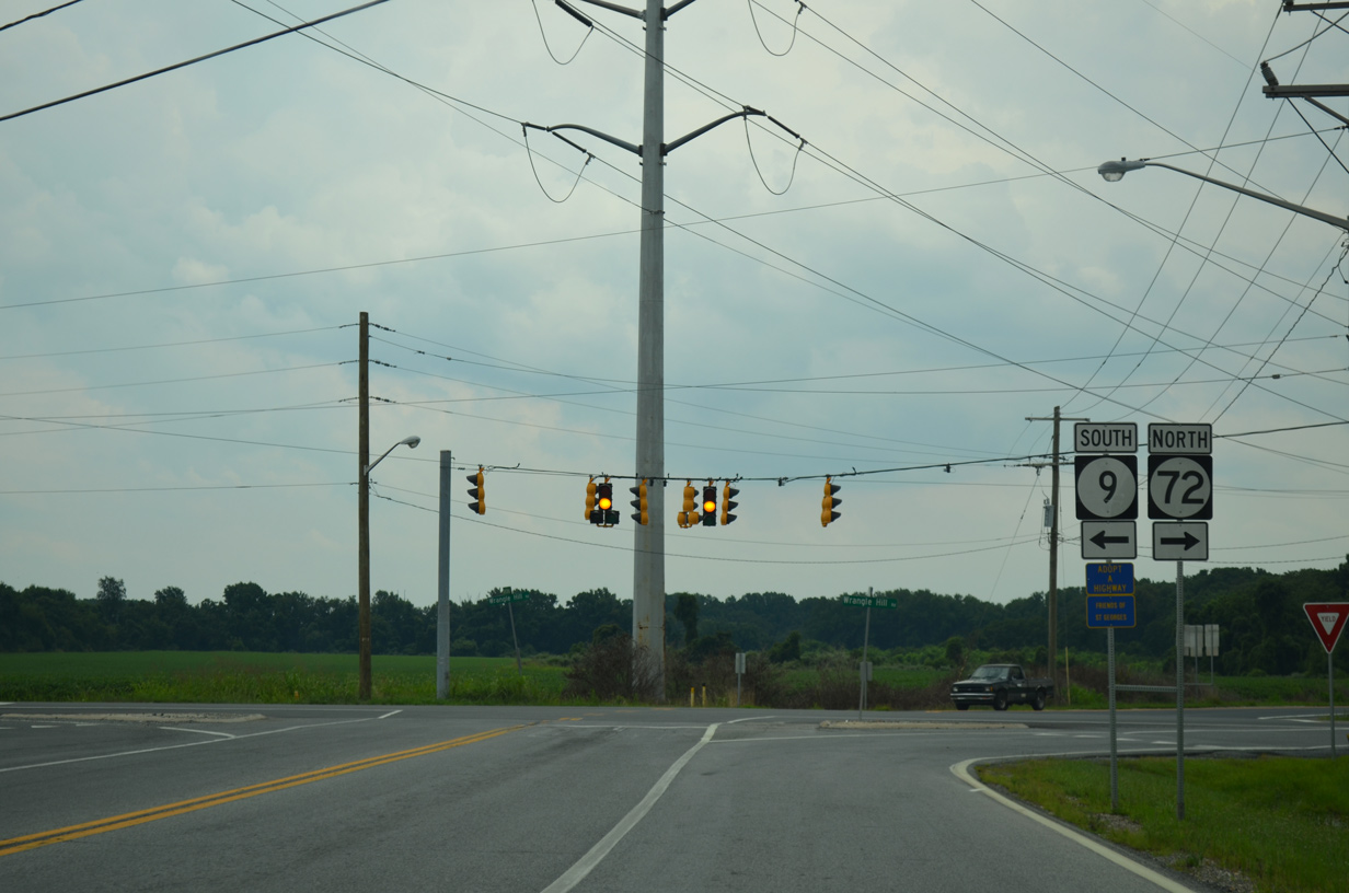
| SR 72 commences a 17.35 mile long route northwest to Newark and the Upper Pike Creek Valley from SR 9, where it turns east from River Road to Delaware City. 12/23/22 |
|
| Clarks Corner Road (Road 378) extends 2.04 miles southwest from River Road and SR 9 to Delaware Street in North St. Georges. SR 72 (Wrangle Hill Road) meets U.S. 13 and SR 1 at Wrangle Hill, 1.50 miles to the west. 12/23/22 |
|
| Southbound confirming marker for SR 9 posted east of SR 72. 06/10/12 |
|
| Advancing south through the Delaware City street grid on SR 9 (Fifth Street). Delaware City lies just north of the Chesapeake and Delaware Canal along the Delaware River. Incorporated in 1851, the city was laid out in anticipation for the construction of the canal. 12/15/17 |
|
| Crossing Dragon Creek, SR 9 enters Delaware City along 5th Street. The speed limit lowers to 25 miles per hour by this point. 12/15/17 |
|
| The lone Delaware City traffic light operates at Fifth and Clinton Streets. Clinton Street travels east to the 3 Forts Ferry Crossing for Fort Delaware State Park, and west to Cox Neck Road. 12/15/17 |
|
| Southbound SR 9 (Fifth Street) at Canal Street and the Delaware City Branch Canal. Canal Street parallels its namesake northeast to Delaware City Marina and Clinton Street. 12/15/17 |
|
| Polktown Place splits with SR 9 to Fort DuPont State Park and the C & D Canal Wildlife Area. Dedicated in 1992, the state park covers 322 acres both west and east of the Reedy Point Bridge. Named for Rear Admiral Samuel Francis du Pont, Fort Dupont was active from the Civil War through World War II. It was turned over to the state of Delaware after World War II. 12/15/17 |
|
| Confirming marker for SR 9 south on the Reedy Point Bridge approach. 12/15/17 |
|
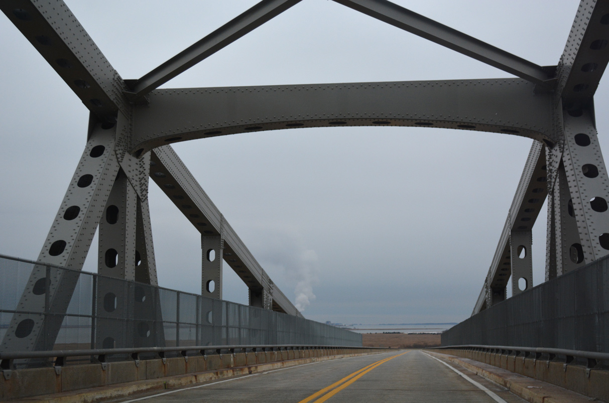
| Opened in 1968, the cantilevered Reedy Point Bridge is named after its geographical location, Reedy Point. 12/15/17 |
|
| The two lane, 26 feet wide span1 carries SR 9 high above the easternmost portion of the Chesapeake and Delaware Canal. 12/15/17 |
|
| Totaling 8,432 feet in length, the Reedy Point Bridge peaks at 136 feet above the C & D Canal.1 12/15/17 |
|
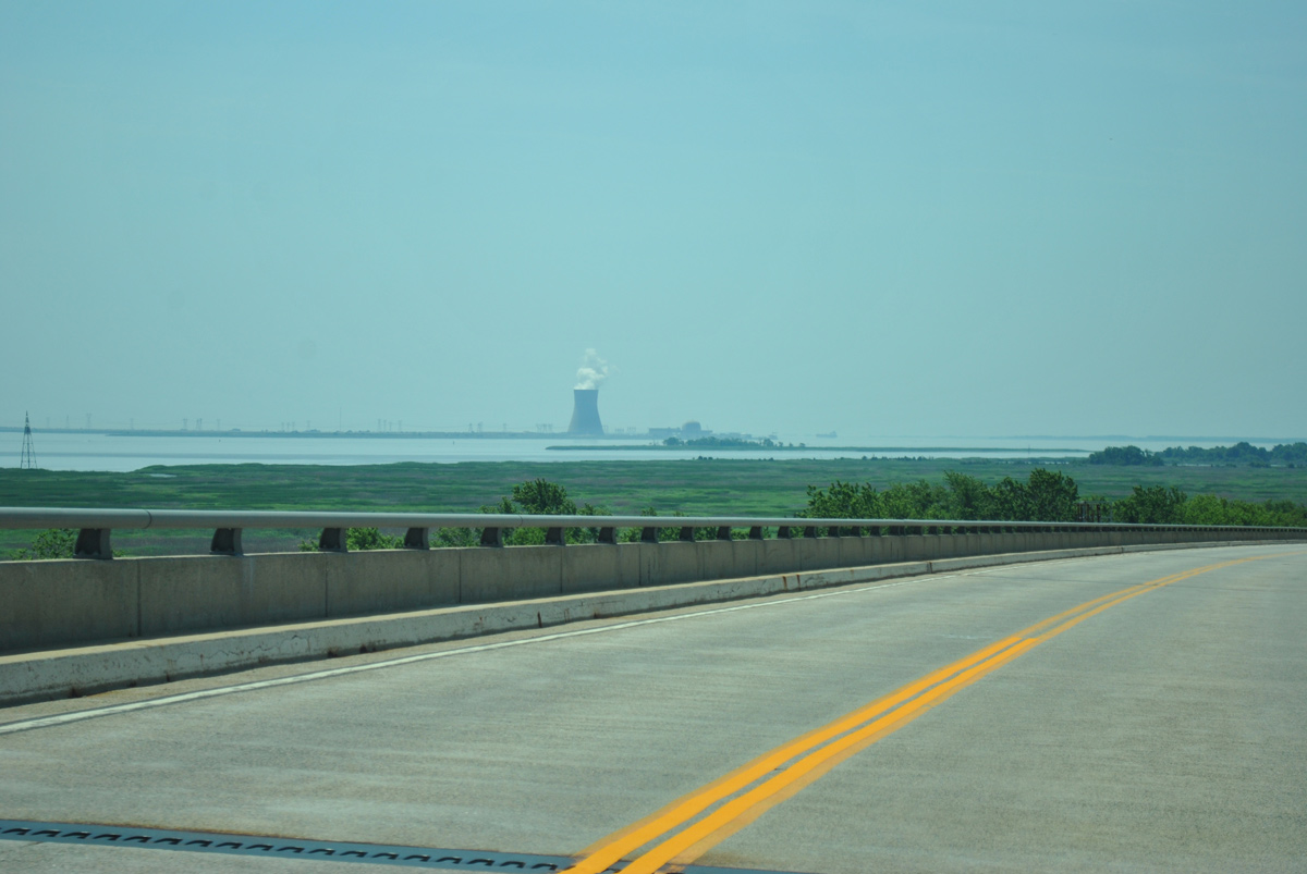
| Looking southward from the Reedy Point Bridge descent at Reedy Island on the Delaware River and the Hope Creek Generating Station in Lower Alloways Creek Township, New Jersey. 06/10/12 |
|
| The Reedy Point Bridge touches down through Augustine Wildlife Area. 06/10/12 |
|
| South Reedy Point Road connects SR 9 with Dutch Neck Road and the C & D Canal Wildlife Area back to the north. 12/15/17 |
|
| SR 9 plies across a causeway above wetlands along St. Georges Creek through St. Augustine Wildlife Area. 12/15/17 |
|
| Entering the riverside community of Port Penn, SR 9 takes Liberty Street south to Market Street east. Market Street extends west to Port Penn Road and U.S. 13 at Biddles Corner. 12/15/17 |
|
| Market Street leads SR 9 east two blocks to Congress Street south in Port Penn. 12/15/17 |
|
| Vacating Port Penn, SR 9 (St. Augustine Road) runs along the Delaware River south to Augustine Beach. 12/15/17 |
Page Updated 01-02-2023.


 South
South