SR 62 overlays a portion of what was SR 41 along Newport Gap Pike between Prices Corner and Belvedere. The state route was created in 1979, when both the Newport Freeway for SR 141 was completed to the east, and SR 41 was truncated northward from New Castle to SR 2. The east leg of SR 62 follows Boxwood Road from ramps with the Newport Freeway by the site of the former General Motors assembly plant to SR 4 (Maryland Avenue) at Richardson Park. An unsigned extension lines Middleboro Road east from Maryland Avenue along Banning Park to Boxwood Industrial Park.
The truncation of SR 41 west from the Kirkwood Highway interchange with SR 141 (Newport Freeway) in 2015 included an array of sign changes in Newport, Belvedere and Prices Corner. The previous west end of SR 62 at Old Capitol Trail was moved northward to the new end of SR 41 (Newport Gap Pike) south at SR 2.
Delaware State Route 62 - 2015 Annual Average Daily Traffic (AADT)
- 23,625 - Old Capitol Trail - Boxwood Road
- 13,149 - Newport Gap Pike to SR 141
- 13,463 - SR 141 to SR 4
- 2,585 - SR 4 to South Dupont Road (SR 100)
- 281 - South Dupont Road to road end
The 3.2 million square foot GM plant at SR 62 (Boxwood Road) and Centerville Road (Rd 333) shut down in 2009. The site sat unused until 2017, when it was purchased for redevelopment by Harvey, Hanna & Associates. Amazon announced on May 19, 2020 that it will open Delaware's third fulfillment center with 820,000 square feet of warehouse space at the location. Commencing operations in Fall 2021, the facility will employee 1,000 workers.1
Sign plans for the interchange joining SR 2 (Kirkwood Highway) and SR 141 (Newport Freeway) in 1970 showed SR 62 acknowledged along Centerville Road adjacent to Prices Corner Shopping Center and Greenbank Road. Plans may have outlined SR 62 extending north along Centerville Road to Faulkland Road (old SR 34) and south to SR 62 along Boxwood Road.
|
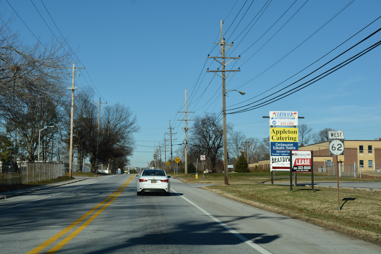
| The Fall 2015 truncation of SR 41 west from SR 141 to Newport Gap Pike resulted in the signing of SR 62 on the previously unmarked stretch from SR 2 (Kirkwood Highway) and Old Capitol Trail. Leading southeast, SR 62 travels between the Cranston Heights community and Prices Corner Shopping Center. 12/23/22 |
|
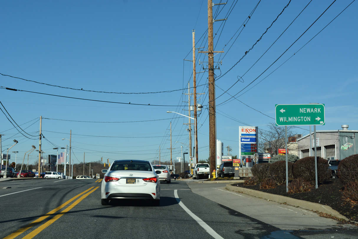
| Old Capitol Trail branches south from SR 2 (Kirkwood Highway) through Marshallton to Centerville Road at Prices Corner. The signalized intersection with Newport Gap Pike was once the west end of SR 62. 12/21/16 |
|
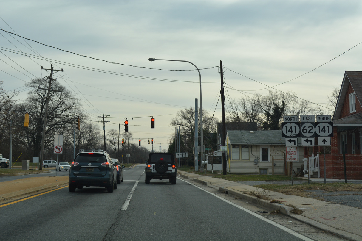
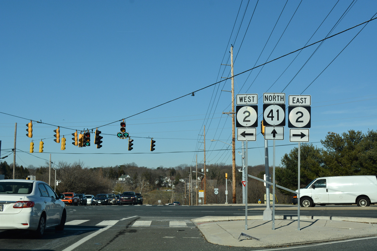
| Continuing south from Prices Corner, SR 62 splits with Newport Gap Pike at Belvedere and the Newport Freeway (SR 141). 12/21/16 |
|
| Newport Gap Pike becomes one way south as the west frontage road for SR 141 south to James Street in Newport. SR 62 turns east onto Boxwood Road en route to Richardson Park and SR 4 (Maryland Avenue). 12/23/17 |
|
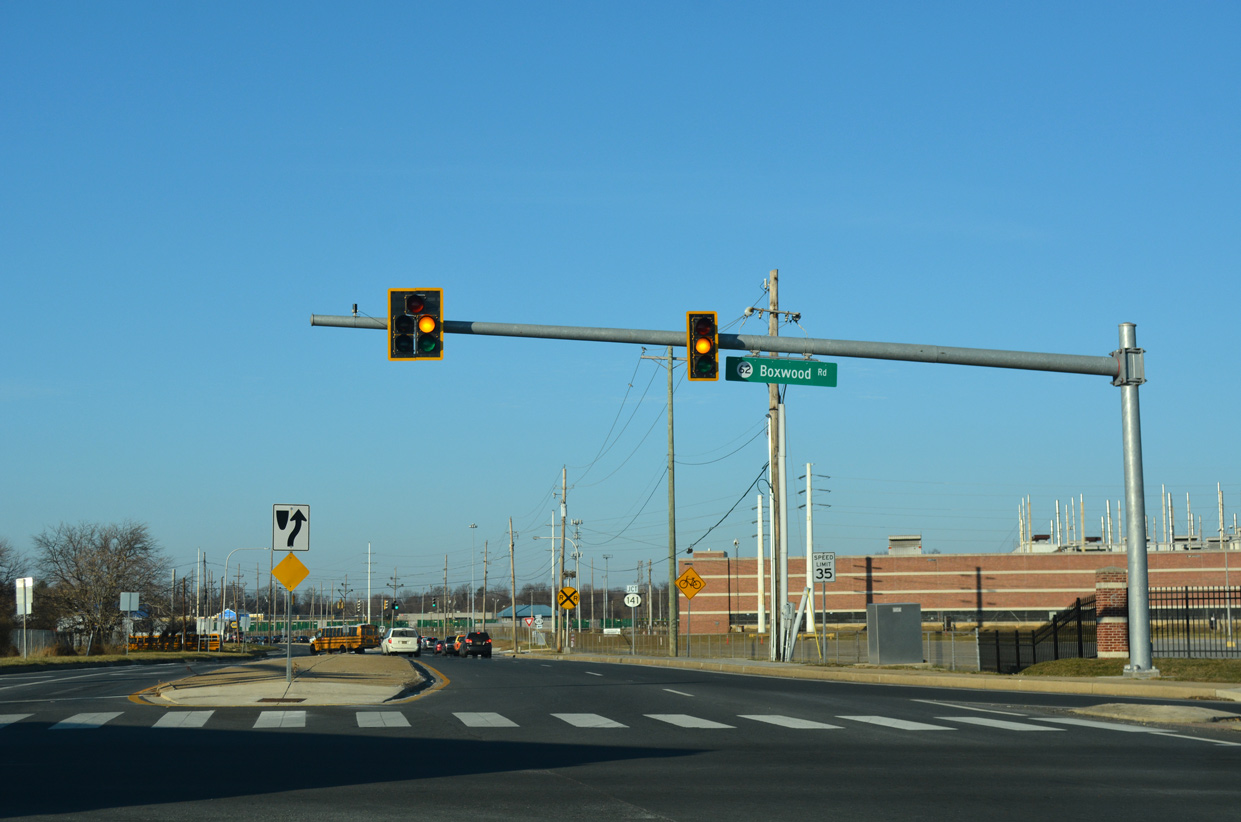
| Boxwood Road crosses over the Newport Freeway ahead of Centerville Road and an Amazon fulfillment center built at the site of the former GM Boxwood Road plant. Centerville Road provides access to SR 141 north toward Greenville and Fairfax. 12/23/17 |
|
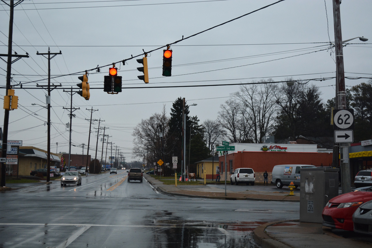
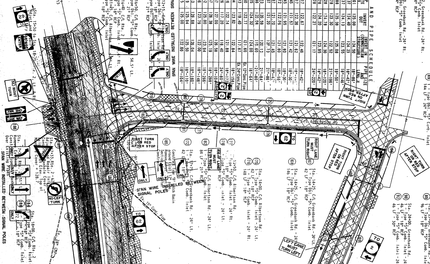
| The General Motors auto assembly plant on Boxwood Road permanently closed in July 2009 after 62 years in operation. Mast arm based traffic lights replaced a span wire array at SR 62 and Centerville Road in 2015. 12/23/17 |
|
| Reassurance marker for SR 62 east posted after Centerville Road north. 12/20/17 |
|
| Succeeding signalized entrances for the Amazon fulfillment center built at the former GM plant site follow over the next 0.4 miles. The first is located at Copa Lane. 12/20/17 |
|
| Augustine Street ties into the second traffic light for the former auto plant site from the Bestfield neighborhood. 12/20/17 |
|
| SR 62 (Boxwood Road) intersects Jackson and Boxwood Avenues at the Woodcrest community. 12/20/17 |
|
| Birmingham Avenue north and Overland Avenue south converge with SR 62 (Boxwood Road) at the ensuing signal eastbound. 12/20/17 |
|
| The signed portion of SR 62 ends at SR 4 by Banning Park. SR 4 follows Newport Pike west to the town of Newport and Maryland Avenue east to Richardson Park and the city of Wilmington. 12/30/16 |
|
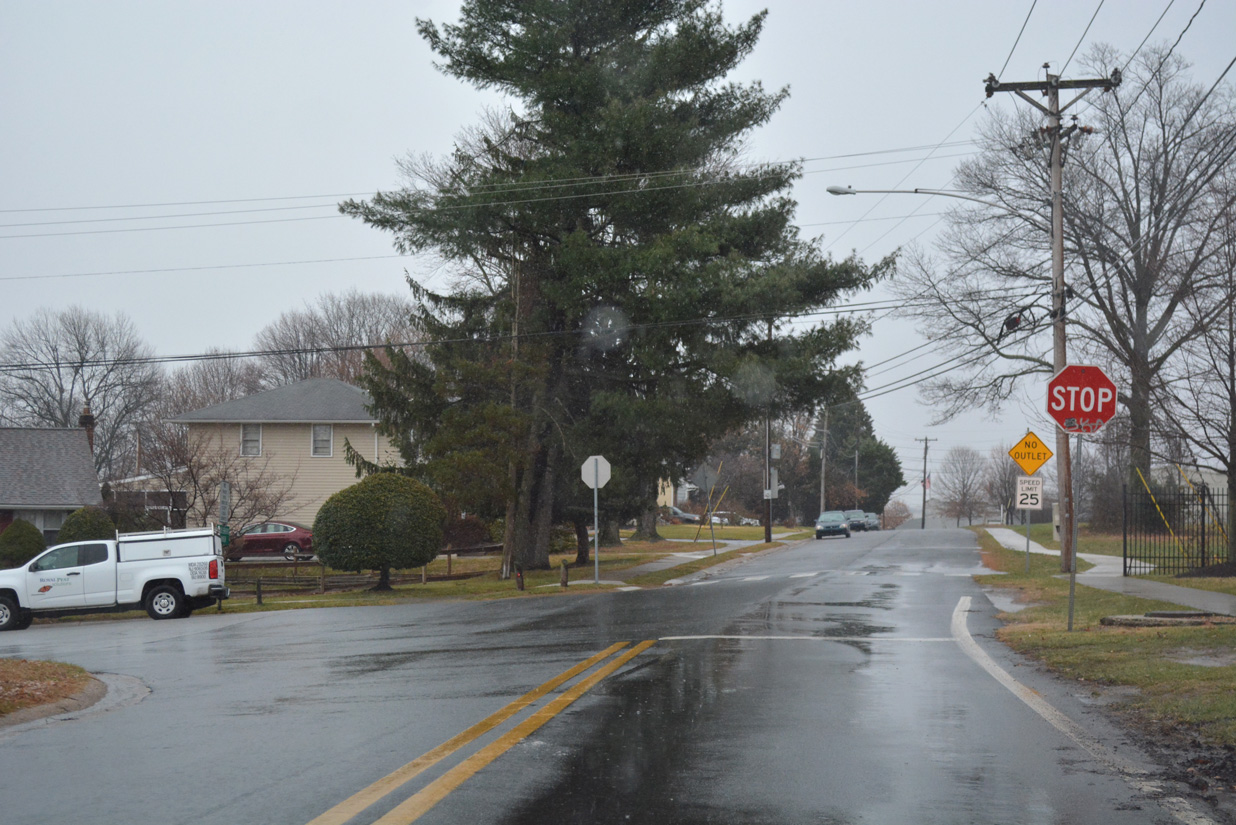
| Middleboro Road east from SR 4 (Maryland Avenue / Newport Pike) represents the unsigned branch of SR 62. The state route extends 0.73 miles to the entrance of Banning Park, Middleboro Manor, Lewis Commercial Center, Middleboro Manor and Boxwood Industrial Park. 12/23/17 |
|
| Dupont Road heads north from Middleboro Road (SR 62) as an unsigned extension of SR 100 to Richardson Park. 12/23/17 |
|
| The first confirming marker for SR 62 west appears as Boxwood Road leads away from SR 4 (Maryland Avenue) by the Hayden Park community. 12/20/16 |
|
| Overland Avenue south and Birmingham Avenue north come together at SR 62 (Boxwood Road) to the immediate west of SR 4. Overland Avenue connects Boxwood Road with the Bellemoor and Elmhurst communites west of Richardson Park. 12/20/16 |
|
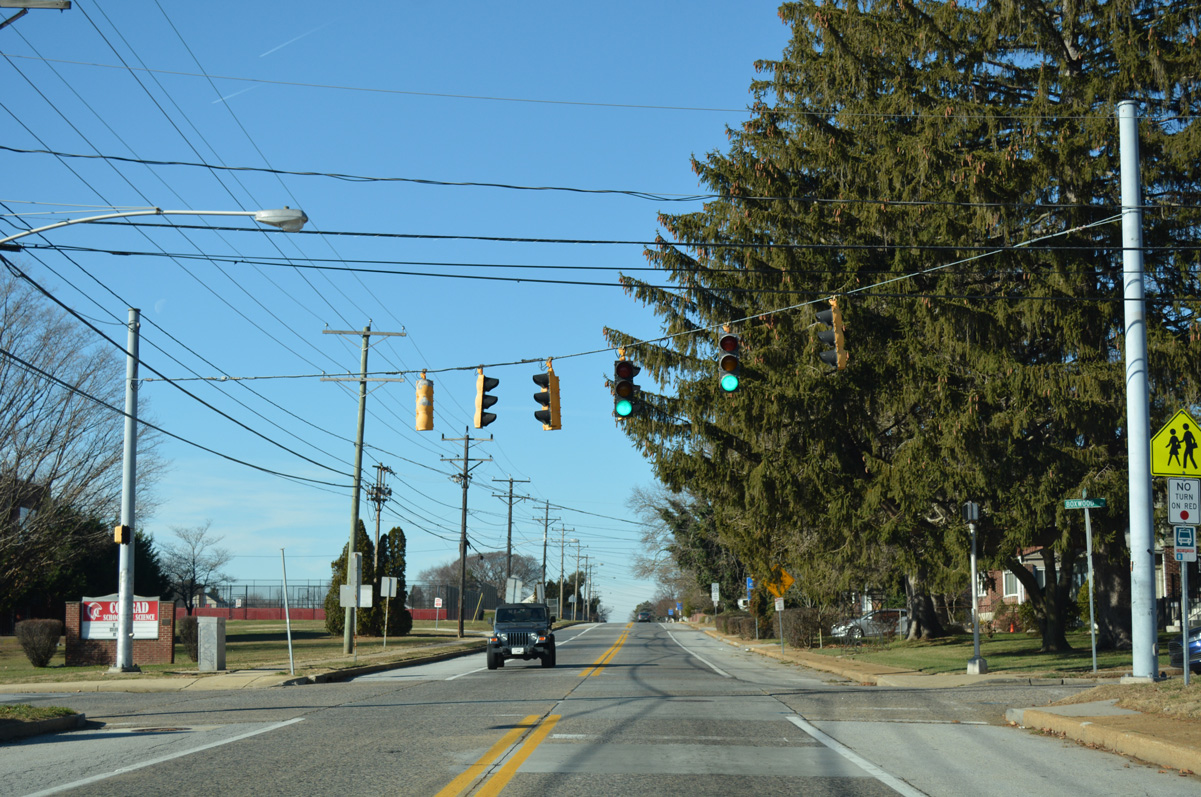
| A short distance further west through the Woodcrest community, SR 62 intersects Jackson Avenue south to Conrad Schools of Science and Boxwood Avenue north. 12/20/16 |
|
| Continuing west, SR 62 (Boxwood Road) passes by the site of the former GM Boxwood Road assembly plant. The east entrance was located across from Augustine Street and the Bestfield subdivision. 12/20/16 |
|
| Opened in 1947, the General Motors auto assembly plant on Boxwood Road closed in July 2009. Traffic lights remain in operation at the second entrance to the site, which now houses warehouse space for an Amazon fulfillment center, across from Copa Lane and the Woodcrest Court community. 12/20/16 |
|
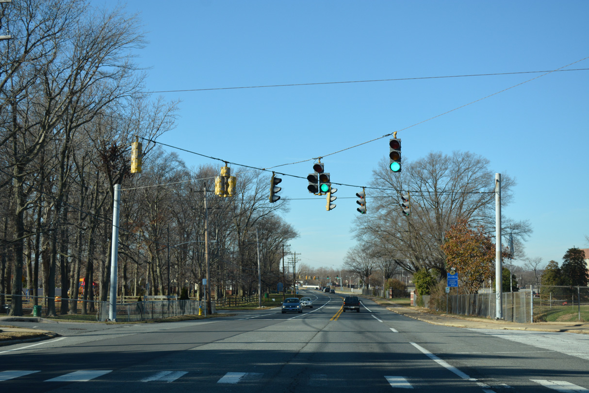
| Shields for SR 141 precede the split diamond interchange joining SR 62 with the Newport Freeway. The ramps with SR 141 north tie into Centerville Road as it extends north from Newport to Prices Corner. 12/20/16 |
|
| SR 141 travels below grade from SR 62 (Boxwood Road) south through the town of Newport. The freeway ends at SR 2 (Kirkwood Highway) one mile to the north. 12/20/16 |
|
| SR 62 turns north onto Newport Gap Pike, the historic alignment of SR 41, from Newport to Prices Corner. 12/22/20 |
|
| Newport Gap Pike becomes one way southbound beyond Boxwood Road to both an entrance ramp for SR 141 south and James Street into Newport. 12/22/20 |
|
| The southbound off-ramp from SR 141 (Newport Freeway) connects with SR 62 (Newport Gap Pike) directly by the Belvedere community. The freeway was completed in 1979, the same year that SR 41 was truncated north to Prices Corner. 12/20/16 |
|
| Advancing north, SR 62 (Newport Gap Pike) passes by Delcastle Technical High School ahead of at-grade crossings with the CSX and Wilmington and Western Railroad lines. 12/20/16 |
|
| What was left of an end shield assembly for SR 62 west at Old Capitol Trail. 12/19/01 |
|
| Old Capitol Trail angles southwest from Centerville Road and Prices Corner Shopping Center to intersect SR 62 (Newport Gap Pike) ahead of Marshallton. Completed in 1941, Kirkwood Highway (SR 2) replaced Old Capitol Trail as the main route between Elsmere and Newark. 12/20/16 |
|
| A new SR 62 end sign assembly was added in conjunction with the Fall 2015 project to drop SR 41 from its concurrency with SR 2 (Kirkwood Highway) west from the Newport Freeway. 12/20/16 |
|
| SR 2 (Kirkwood Highway) represents the main highway linking Newark with Wilmington. The commercial arterial expands to six lanes east through Prices Corner and west to SR 7 (Limestone Road) and the Pike Creek Valley. 12/20/16 |
|
| SR 41 begins and lines Newport Gap Pike northwest from Prices Corner to SR 48 (Lancaster Pike) at Hockessin. The multi state route stretches 28.4 miles from SR 2 (Kirkwood Highway) to U.S. 30 (Lincoln Highway) at Gap, Pennsylvania. 12/20/16 |
|
| Boxwood Avenue south at SR 62 (Boxwood Road) and Jackson Avenue. Truss-arm based signals once operated here, serving adjacent Conrad Middle School. 12/30/16 |
|
| Centerville Road forms an east side frontage road for SR 141 north from James Street in Newport to SR 62 (Boxwood Road). 12/20/17 |
|
| An off-ramp from SR 141 (Newport Freeway) connects with Centerville Road ahead of Boxwood Road (SR 62). 12/20/17, 12/22/17 |
|
| Centerville Road carries two-way traffic south from Prices Corner to SR 62 (Boxwood Road). 04/24/04 |
|
| SR 62 spans the adjacent Newport Freeway west to Newport Gap Pike. Together with Centerville Road north, Newport Gap Pike south comprises the frontage road system for SR 141 between Belvedere and Newport. 04/24/04 |
|
| Old Capitol Trail heads east from Marshallton to meet SR 62 (Newport Gap Pike) at Prices Corner. Old Capitol Trail ends a short distance beyond SR 62 at Centerville, but historically continued into Elsmere. 12/23/17 |
|
| This SR 62 shield alludes to the former signed west end of the state route at Old Capitol Trail. Signs were added for SR 62 to the north on Kirkwood Highway in 1999, and along Newport Gap Pike in 2015. 12/23/17 |
|
| Old Capitol Trail (Road 12) leads 0.36 miles southwest from Centerville Road (Road 333) to SR 62 (Newport Gap Pike) beyond Prices Corner Shopping Center. 12/23/22 |
|
| SR 62 (Newport Gap Pike) ties onto SR 2/41 at Kirkwood Highway, 0.30 miles northwest of Old Capital Trail (Road 12). Newport Gap Pike continues 0.62 miles southeast to Boxwood Road at SR 141. 12/23/22 |
Photo Credits:12/19/01, 04/24/04, 12/20/16, 12/21/16, 12/30/16, 12/20/17, 12/22/17, 12/23/17, 12/22/20, 12/23/22 by AARoads
Connect with:
State Route 2
State Route 4
State Route 41
State Route 141
Page Updated 01-06-2023.


 East
East