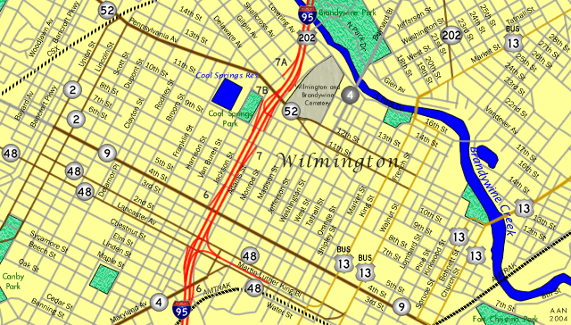
Walkabout Wilmington - A stroll through the city - Highway Guides for Delaware Interstates - U.S. Routes - State Routes

Delaware Highways @ AARoads
Welcome to the Delaware Highways Page
Delaware Interstates Guides and History SR 1 Turnpike History, Guide, Photos Delaware U.S. Highway History and Guides Delaware State Highway Guide and Terminus Gallery Delaware Highway Maps, License Plates, Freeway Exit Lists, Newark Highways, Wilmington Highways Index of all pages included in Delaware Highways Delaware Highways Page - Updates Return to AARoads Main Page
Walkabout Wilmington - A stroll through the city

Walkabout Wilmington - A stroll through the city

A look at the streets, traffic lights, highway signs, and bridges that are a part of the cityscape that is Wilmington, Delaware. The photos below are cataloged by street in order from south to north or west to east.

Wilmington Map - AARoads.com

Additional road related Wilmington photos from the perspective of a pedestrian are located on these guides:

Sixth Street
The second of three original 18" trailblazers remaining for Interstate 95 in the city of Wilmington resides on Sixth Street eastbound between Van Buren and Jackson Streets. The MUTCD phased out these smaller shields in 1961 only three years after they were first approved. First photo taken 03/21/04; second photo taken 04/09/04.
There is a break in Sixth Street between King Street (U.S. 13 Business south) and Lombard Street east of downtown. Pictured here is the end of the one-way street at U.S. 13 Business south. Photo taken 03/30/04.

Seventh Street
Like Sixth Street one block to the south, Seventh Street also prematurely ends at King Street (U.S. 13 Business south) near downtown. The Windham Hotel parking garage facility resides in the path of Seventh Street between King and Walnut Streets (U.S. 13 Business north). Seventh Street resumes one block to the south. Photo taken 03/30/04.
Crossing over Interstate 95 on Seventh Street westbound at Jackson Street in the West Side neighborhood of the city. The camera created the optical illusion that both the red and yellow lights were on simultaneously. Photo taken 04/09/04.
Eighth Street
Three views of the Eight Street westbound intersection with Shipley Street near downtown. Shipley Street composes a southbound only street between Tenth Street downtown and Market Street near the Wilmington Train Station. Photos taken 03/30/04.
Original Interstate 95 Delaware shield posted at the Eighth Street westbound intersection with Jackson Street alongside the suppressed freeway. As of April 2004 only ten state named shields for Interstate 95 remained in the Diamond State. First two photos taken 04/09/04; second photo taken 04/03/04.
Ninth Street
New McCain signals hang at the intersection of Ninth Street eastbound at Jackson Street southbound ahead of the Interstate 95 & U.S. 202 suppressed freeway. The high rises of downtown rise above the horizon. Ninth Street sinks to Monroe Street before ascending upwards again to Washington Street. Photo taken 03/19/04.
Original Interstate 95 northbound overhead posted on Ninth Street eastbound at Adams Street and the Exit 7 northbound off-ramp in the West Side neighborhood of the city. The 1963 guide sign was retrofitted with a new shield in 2000. The panel points toward Adams Street northbound and the Tenth Street on-ramp. Photos taken 03/19/04.
Mast arm traffic signals and four 3M traffic signals once stood in place at the Ninth and Adams Street intersection with the Exit 7 northbound off-ramp. Span wire assemblies take the place of the former configuration now. 3M signals remain in use for the Interstate 95 & U.S. 202 ramp however. The remaining signals are McCain brand installations. Photo taken 06/00.
Ninth Street eastbound at Washington Street west of downtown. Washington Street is one-way southbound between Twelfth Street (Delaware 52) and the Interstate 95 access ramps from Martin Luther King Boulevard. The north-south street was once apart of Delaware 4. Photos taken 03/30/04.
The intersection of Ninth Street eastbound at Shipley Street southbound within downtown Wilmington. Older Eagle signals continue to govern the traffic movements between the pair of one-way streets. Photos taken 03/30/04.
Tenth Street
Tenth Street eastbound at the intersection with Market Street in downtown. Rodney Square encompasses the Market Street block between Tenth and Eleventh Streets. The agora includes the main transit hub for the DART (Delaware Area Regional Transit) bus lines. Photo taken 03/30/04.
Delaware 52 trailblazers on Tenth Street westbound ahead of the U.S. 13 Business (Walnut Street) northbound intersection. Delaware 52 begins its northward journey two blocks to the right via Twelfth Street. Tenth Street converts into a two-way configuration west of Walnut Street. Ahead is the MBNA downtown complex. Photo taken 03/30/04.
Tenth Street westbound at Market Street within the heart of the Wilmington central business district. Decorative lamp posts and lightning fixtures dot the downtown area as part of a cosmetic make over undertaken by the city. Photo taken 03/30/04.
Looking westward at the Tenth and Orange Street intersection in downtown Wilmington. Ahead Tenth Street curves northwesterly becoming Delaware Avenue at the next intersection (Tatnall Street). The junction is four blocks removed from the Delaware 52 southbound departure from the avenue. Photo taken 03/30/04.
The intersection of Tenth and Jackson Streets to the north of Interstate 95. Shrouded by the budding tree is an original Interstate 95 trailblazer pointing toward the Ninth Street and Jackson Street respective on-ramps to the freeway. Photos taken 04/09/04.
Eleventh Street
A sign bridge resides on the block between Adams and Monroe Streets on Eleventh Street eastbound. The Exit 7A off-ramp of Interstate 95 & U.S. 202 forms Eleventh Street at Adams behind the camera. Eleventh Street becomes Delaware 52 southbound three blocks ahead at the intersection with Delaware Avenue and Jefferson Street. From there Delaware Avenue cuts a diagonal across Washington, West, and Tatnall Streets to become Tenth Street. Photo taken 03/19/04.
Thirteenth Street
The exit from Wilmington Hospital via 13th Street eastbound at Washington Street. 30" Eagle signals remain in use at the intersection. Washington Street provides a secondary arterial between Delaware 52 (Twelfth Street) and Baynard Boulevard across the Brandywine Creek. Photos taken 03/30/04.
13th Street eastbound at U.S. 13 Business (Walnut Street) northbound northeast of downtown. Street scaping results in the creation of brick sidewalks, crosswalks, and intersections in the this residential part of town. Photo taken 03/30/04.
Fourteenth Street
1960s Eagle signals posted at the intersection of Thirteenth Street west at Walnut Street north (U.S. 13 Business). The city of Wilmington is slowly phasing out these older signals. Photo taken 03/30/04.
An old style U.S. 13 shield remains in place on 14th Street westbound at French Street east of downtown. The shield not only refers to the mainline of U.S. 13 but also is placed one block south of the current southbound alignment on King Street. Originally the mainline of U.S. 13 utilized French Street to pass through downtown Wilmington. The change to King Street was made in the 1950s and the sign pictured here is grossly out of date. Photos taken 03/30/04.
14th Street westbound at U.S. 13 Business (King Street) southbound on the edge of downtown. King Street provides a three lane arterial between the Market Street bridge over the Brandywine Creek and the Wilmington Train Station. Photo taken 03/30/04.
Delaware Avenue
Delaware Avenue departs Delaware 52 (Pennsylvania Avenue) at Van Buren Street one block north of Jackson Street and Interstate 95. From there the one-way only street intersects westbound only Harrison Street one block to the north and east of Pennsylvania Avenue. At that intersection Delaware Avenue becomes a two-way street. Southbound motorists however must turn right (south) onto Harrison Street due to the orientation of Delaware Avenue north and Harrison Street west. Thus some unusual traffic lights are posted on Delaware Avenue southbound at Harrison Street. These lights always feature a red ball indicating to motorists that they cannot continue south but also green arrows for the right-hand turn. Traffic must stop when only the red ball is displayed. Photos taken 03/30/04.
Two blocks removed from Delaware 52 and Pennsylvania Avenue, Delaware Avenue intersects Franklin Street. Similar to Broom Street two blocks to the north, Franklin Street travels through residential neighborhoods between Maryland Avenue (Delaware 4) and Lovering Avenue. Photos taken 04/01/04.
Broom and Dupont Streets provide the main access points between Lovering Avenue and the Brandywine Park to Delaware Avenue near Trolley Square. The southbound only streets carry two lanes of travel through neighborhoods line with row homes. Photos taken 04/01/04.
Delaware Avenue descends northward toward Trolley Square and Dupont Street at Rodney Street in northwest Wilmington. Rodney Street carries two way traffic within the vicinity of Delaware Avenue. First photo looks northbound; second looks southbound, both taken 04/01/04.
At Trolley Square in Wilmington is the five-way intersection of Delaware Avenue, Clayton Street, and Sixteenth Street. Clayton Street is northbound only and Sixteenth Street is eastbound. The intersection is controlled by 1960s 30" Eagle brand signals. The area is home to several up scale restaurants, bars, and craft shops. Photos taken 04/01/04.
Delaware Avenue and Dupont Street intersect at Trolley Square in northwest Wilmington. The area derives its name from the street car days of the city in the 1920s. Today a small shopping plaza resides where the trolley barn once stood. Adjacent to it the pub Kelly's Logan House, Ciao's Pizza, and Scratch McGoo's among other local venues. Photos taken 04/01/04.
Delaware Avenue northbound at Dupont Street in the Trolley Square vicinity. 1960s 30" ground level Eagle signals control the intersection. In the background is the CSX Railroad overpass. The structure once was a part of a train station and featured sidewalks and a small pavilion for would be passengers. The sidewalk aspect of the bridge was removed in the 1990s. Photo taken 04/01/04.
New traffic signals saw installation at Delaware Avenue and Scott Street in the mid 1990s. Scott Street constitutes a residential street between Fourteenth Street and Wawaset Street near the Brandywine Creek. The traffic light was placed here likely due to the traffic generated by the nearby restaurant Kid Shelleen's Charcoal House and Salloon at 14th and Scott Streets. Photo taken 04/01/04.
Union Street at Delaware Avenue in the Forty Acres section of the city. The signalized intersection is the last for Delaware Avenue northbound and Union Street northbound on their respective paths. Seven blocks of Delaware Avenue remain between Union Street and Rockford Park. Union Street ends in four blocks at Lovering Avenue near the Delaware Art Museum. Photos taken 04/01/04.
French Street
Nestled between the north and southbound directions of U.S. 13 Business (Walnut and King Streets) is French Street north of downtown. The two-lane roadway bisects Walnut and King Streets between Eighth and Sixteenth Streets. Pictured here is the signalized intersection at Fourteenth Street in a quiet residential area. Photo taken 03/30/04.
A section smaller section of French Street exists between the Wilmington Train Station and Second Street (Delaware 48) near the Christina River waterfront. The two-way street provides access to the station from Delaware 48 and U.S. 13 Business northbound (Walnut Street). An Interstate 95 trailblazer directs motorists departing the station onto Delaware 48 westbound for the Martin Luther King Boulevard access ramps to the freeway. Photo taken 03/30/04.
A closer look at the ground level signals at the intersection of French Street northbound and Delaware 48 (Second Street) westbound. Delaware 48 begins one block to the east at Walnut Street (U.S. 13 Business). Photo taken 03/30/04.
Facing downtown Wilmington on French Street at Fourteenth Street. Beyond the 1960s Eagle signals are the high rises of the MBNA downtown banking complex and the French Street end at Eighth Street. Catwalks link the MBNA buildings themselves above French Street. Photo taken 03/30/04.
French Street travels underneath the Wilmington Train Station platform between Front Street and the park area along the Christina River waterfront. Trains depart the station daily for Philadelphia and Washington via AMTRAK and Philadelphia again via the SEPTA R2 Regional Rail line. Photo taken 03/30/04.
Harrison Street
Harrison Street intersects Delaware Avenue one block east and north of Delaware 52 (Pennsylvania Avenue). Delaware Avenue itself splits from Delaware 52 northbound between Pennsylvania Avenue and Harrison Street to the left with one-way northbound traffic. Harrison Street is one-way southbound and ends at Pennsylvania Avenue ahead. Delaware Avenue becomes a two-way road to the right. Thus the traffic signals posted at the intersection of the two highway feature the unique display of a red ball and green arrow for Delaware Avenue southbound drivers. When the green arrows are not illuminated on the northward facing signals than Harrison Street south receives its green phase. Pictured here are three photos of the mast arm and ground level supported signals. Photos taken 03/30/04.
Harrison Street is discontinuous between Delaware 52 (Pennsylvania Avenue) and Tenth Street due to the placement of the Cool Springs Reservoir. The side street resumes its southward trek from Tenth Street to Maryland Avenue (Delaware 4) through the Cool Springs, West Side, and Browntown neighborhoods of the city. Photo taken 03/3/0/04.
Orange Street
Orange Street northbound at Ninth and Tenth Streets in the heart of the Wilmington business district. The mast arm assemblies at Tenth Street were replaced with new ornamental fixtures. The ones at Ninth however remain from the previous era of traffic signals. Photos taken 03/30/04.
Park Drive
Park Drive skims the west banks of the Brandywine Creek between Market & 16th Streets and Lovering Avenue near Trolley Square. The two-lane roadway passes underneath the concrete arch bridge of Washington Street near Wilmington Hospital and the Brandywine Zoo. Photos taken 03/30/04.
The intersection of Park Drive and Van Buren Street occurs in the shadows of the Brandywine Creek Bridge of Interstate 95 & U.S. 202. Park Drive provides a scenic route devoid of commercial trucks along the west banks of the Brandywine Creek through Brandywine Park. Van Buren Street descends from the city street grid into the Brandywine valley to cross the creek itself along a beautiful two-lane bridge. The street ascends into the East Lawn section of the city near Baynard Stadium in Brandywine Park east. Photos taken 03/30/04 & 05/19/07.
Van Buren Street
Views of the Van Buren Street northbound intersection with Delaware 52 (Pennsylvania Avenue) and Delaware Avenue near Interstate 95 & U.S. 202. 30" Eagle brand signals remain in use here although two of them were replaced between 2000 and 2004. Traffic bound for Interstate 95 southbound from Delaware 52 northbound must utilize a loop of Van Buren Street, Gilpin Avenue, and Jackson Street to complete the left-hand movement onto Jackson Street southbound banned at the street itself on Delaware Avenue north. First and second photo taken 04/01/04; third photo taken 12/99.
Van Buren Street southbound at Park Drive within Brandywine Park. Ground level 30" signals govern the traffic movements between the two roadways. Note the signal replacements for the southeast corner assembly. The Interstate 95 & U.S. 202 Brandywine Creek Bridge spans high above the junction and creek above. Photos taken 03/30/04.
Southward view of Van Buren Street and Park Drive intersection. The Interstate 95 & U.S. 202 bridge above enters the city of Wilmington just north of Lovering Avenue. An on-ramp to Interstate 95 northbound exists from Adams Street northbound one block north of Lovering Avenue. Photos taken 03/30/04.
Van Buren Street crosses the Brandywine Creek between Interstate 95 & U.S. 202 and Washington Street. Built in 1906, the Van Buren Street Bridge is 353 feet in length supported by eight arch spans. The bridge was built in an era when the city of Wilmington undertook the City Beautiful Movement. Extra attention was given to the engineering, architectural, and landscaped surroundings to blend the bridge into Brandywine Park aesthetically. Additionally a 48" diameter water main accompanies the bridge linking the Porter Reservoir to the filter station at Sixteenth and Market Streets. DelDOT closed the bridge for major repairs, taking extra care to duplicate the architectural integrity in the process in 1996.1 Photos taken 03/30/04.
Washington Street (Historic U.S. 202 and Delaware 4)
Views of the Washington Street Bridge from the path along Park Drive and the Brandywine Creek east of the span. The arch bridge is 720 feet long and features five spans. Opened on November 24, 1921, the Washington Street Bridge is the only open spandrel arch bridge in the state of Delaware. The span was designed as a memorial to Delaware's war veterans. The four 40' tall pylons of the main span each carry bronze tablets commemorating various wars. In 1919 increased traffic related to suburban development rendered the original 1893 metal deck truss bridge obsolete because of its narrow width. The Walsh Construction Company of Davenport, Iowa and Syracuse, New York was awarded a $747,000 contract to construct the bridge in February of 1920.1
Washington Street Northbound
Washington Street northbound at 13th Street and the entrance to Wilmington Hospital. The city of Wilmington placed two new signals on a span wire over Washington Street to coincide with the older 30" ground level signals. Photo taken 03/30/04.
One block north at the intersection of Fourteenth Street. Newer 30" signals replace the originals at the north end of Fourteenth Street. The street itself is discontinuous because of Wilmington Hospital, the Wilmington and Brandywine Cemetery, and Interstate 95 & U.S. 202. 14th Street begins again from Delaware Avenue between Broom and Franklin Streets. Photo taken 03/30/04.
Northbound on the Washington Street Bridge over the Brandywine Creek and Park Drive. The bridge deck itself consists of a 40-foot wide roadway and 14-foot wide sidewalks on each side.1 A stairway at leads to the river walk and Park Drive from the southwest corner of the bridge. Photo taken 03/30/04.
The north end of the Washington Street Bridge features the split of Washington Street from Baynard Avenue as the north-south arterial between Delaware 202 and Delaware 52. U.S. 202 once used Baynard Boulevard between Concord Avenue and Washington Street. At the time of the photograph crews from Byers Electric were installing new 36" McCain traffic signals. Photo taken 03/30/04.
Washington Street Southbound
The Wilmington skyline rises above the tree line over the Washington Street Bridge to the south. The bridge saw improvements in the early 2000s resulting in new pavement for Washington Street itself, a rebuilt sidewalk, and decorative lamp posts. Photo taken 03/30/04.
Approaching the central business district of Wilmington on Washington Street southbound at Thirteenth Street and the entrance to Wilmington Hospital. Featured here are a couple of green painted 30" Eagle traffic signals from the 1960s. Green signals are not used in Delaware as a rule but are in states such as New York and Louisiana. Photo taken 03/30/04.
Washington Street southbound at junction Delaware 52 north (Twelfth Street) on the edge of the central business district. The northbound only street merges with Delaware Avenue 1.5 blocks south of the Interstate 95 & U.S. 202 suppressed freeway. Note the new parking garage and WSFS bank tower constructed along the north side of Washington Street since 2004! Photos taken 03/30/04 & 12/29/07.
Ninth Street provides a secondary corridor into downtown Wilmington from Interstate 95 & U.S. 202 northbound. The eastbound only street travels four blocks eastward from the Exit 7 off-ramp of the freeway and Adams Street to Washington Street. Photo taken 03/30/04.
Washington Street becomes southbound only south of Delaware Avenue through the West Side section of the city. The two-lane avenue sees traffic signals at Ninth, Eighth, and Seventh Street among others. Depicted here are the 30" traffic signals at Eighth Street. Photos taken 03/30/04.
The intersection of Washington and Seventh Streets. The residential street becomes "Lawyers Row" in the next few blocks. The nickname applies to the road because of the many lawyers offices that line the street between Seventh and Fourth Streets (Delaware 9). Photo taken 03/30/04.
Other Streets and Miscellaneous Photos
16th Street west and U.S. 13 Business northbound part ways at the Market Street bridge over the Brandywine Creek. The split leaves 16th Street to intersection Market Street (U.S. 13 Business) at Park Drive and the Brandywine Park. The one-way street becomes the two-way Park Drive ahead. Photo taken 03/30/04.
Visible from the Van Buren Street Bridge beyond the Interstate 95 & U.S. 202 high-level crossing is the stone arch CSX Railroad bridge and adjacent Augustine Cut Off bridge over the Brandywine Creek. Augustine Cutoff provides a two-lane route between Lovering Avenue and northwest Wilmington to U.S. 202 (Concord Pike) at Blue Ball. The CSX Railroad line slices through Northwest and Hillop Wilmington. Photo taken 03/30/04.
Views of the stone arch bridge of the CSX Railroad line from below. A suspension bridge carries a walkway across the Brandywine Creek adjacent and below the CSX Railroad bridge. The wooden deck links a series of walking paths that line both sides of the Brandywine Creek throughout Brandywine Park. Photos taken by Carter Buchanan (08/10/04).
Looking eastbound from the pedestrian suspension bridge at the Interstate 95 and Van Buren Street Bridges over the Brandywine. Although not visible, a small canal lines the south banks of the Brandywine from here to the Washington Street Bridge. Photo taken by Carter Buchanan (08/10/04).
The underside of the Interstate 95 Brandywine Creek Bridge as it traverses Brandywine Park. Park Drive traverses the hillside along the south banks of the creek. Photo taken by Carter Buchanan (08/10/04).
Broom Street northbound at Delaware Avenue near Trolley Square in northwest Wilmington. Delaware Avenue provides the main route between downtown (Delaware 52) and Rockford Park. Photo taken 04/01/04.
Clayton Street northbound at Delaware 52 (Pennsylvania Avenue) in northwest Wilmington. Two newer signals join four 1970s Eagle brand signals on span wires above the intersection. Photo taken 04/01/04.
Franklin Street northbound at Delaware 52 (Pennsylvania Avenue). Older Eagle signs with 12" red lens and 8" yellow and green lens delineate the traffic flow between the two streets. Photo taken 04/01/04.
One block east of the Delaware 52 (Pennsylvania Avenue) signal is the intersection with Delaware Avenue. Two of the six older signals were replaced by the city of Wilmington in the late 1990s. Ahead is the north end of Franklin Street in three blocks at Lovering Avenue. Photo taken 04/01/04.
Front Street eastbound at Walnut Street (U.S. 13 Business) adjacent to the Wilmington Train Station. U.S. 13 Business descends from the Leo J. Dugan Bridge underneath the Amtrak platform to intersect Front Street. Front Street itself passes under the rail road line en route to Church Street and Christina Park. Photo taken 03/30/04.
The intersection of Lombard Street northbound at Delaware 9 (Fourth Street) in the East Side section of Wilmington. Pictured here is a set of older mast arm assemblies that once existed through the downtown area. Many of these installations have been replaced with new black colored decorative mast arms as part of a city beautification program. Photo taken 03/30/04.
Madison Street northbound at Delaware 48 westbound (Second Street) southwest of downtown. The city has invested time and money into the beautification of the Martin Luther King Boulevard gateway into the city. Included was the replacement of the traffic signal assembly of Madison Street north at Second Street west. Madison Street otherwise provides the main route between the Frawley Stadium and Christina Riverfront area and Delaware 4 & 48. North of Second Street Madison constitutes a side street through the West Side residential area. Photo taken 03/21/04.
Situated next to Rodney Square in downtown Wilmington is the signalized intersection of Market and Tenth Streets. Market Street itself was closed to vehicular traffic in the 1970s until the early 2000s and used as a pedestrian street mall. The mall saw its heyday in the 1980s and since has suffered economic decline. The city of Wilmington is in the process of converting all of the former pedestrian mall back into use as a two-way street. Photo taken 03/30/04.
Market Street southbound at the merge with U.S. 13 Business and Martin Luther King Boulevard (Delaware 48). The two-way street becomes one-way southbound at Delaware 48 as it carries U.S. 13 Business southward out of town. The Amtrak railroad corridor travels above Market Street between Delaware 48 and the Christina River itself. Photo taken 03/30/04.
Rodney Street provides one of the few two-way streets in northwest Wilmington. The street intersects Delaware 52 (Pennsylvania Avenue) in this photograph. The black traffic lights are replacements of older Eagle signals from the late 1990s. Photo taken 04/01/04.
Shipley Street is a side street that bisects the blocks of Market and Orange Street between Martin Luther King Boulevard and Tenth Street. The two-lane street flows in the southbound direction. Pictured here is the junction with Eighth Street in downtown. A short segment of Shipley Street exists between Delaware 48 east and the Wilmington Train Station as well. Photo taken 03/30/04.
Scott Street eastbound at Delaware Avenue near Trolley Square. Several craft shops, eateries, and art galleries line Delaware Avenue between Scott Street and Clayton Street to the south. Photo taken 04/01/04.
West Street northbound at Seventh Street adjacent to the Farmers Market near downtown. Seventh and Eighth Street provides routes to Interstate 95 & U.S. 202 northbound via Adams Street in five blocks. Photo taken 03/30/04.

Sources:
1 - Delaware Historic Bridges, Delaware Department of Transportation.

Page Updated September 23, 2007

All Contents Copyright AARoads