A look at the area roads of the Baldwin County seat of Bay Minette. For coverage of the U.S. and State Routes, see the following guides:
Nicholsville Road
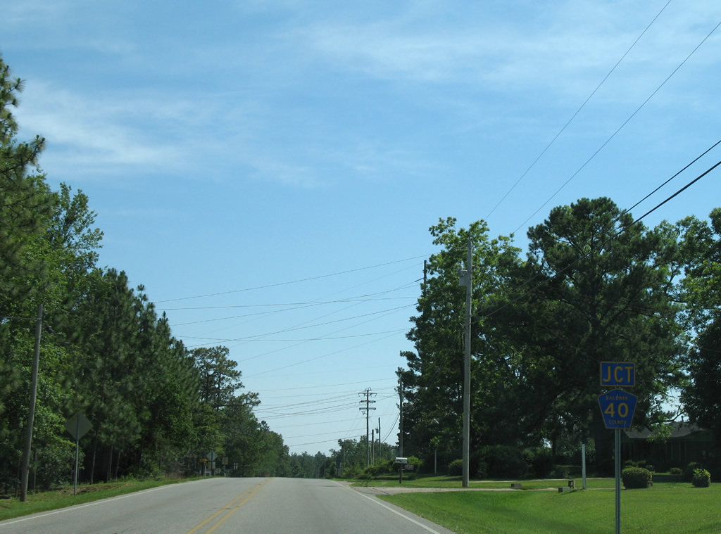
Two sections of County Road 40 serve the Bay Minette area. The western branch follows Whitehouse Forks Road southwest from County Road 138 (Hurricane Road) to Whitehouse Forks and SR 225 near Bromley. Nicholsville Road comprises the eastern section of County Road 40 from Old Daphne Road and Gulf Shores Parkway in south Bay Minette to Brady Road North Extension (County Road 57) a short distance south of Downtown.
|
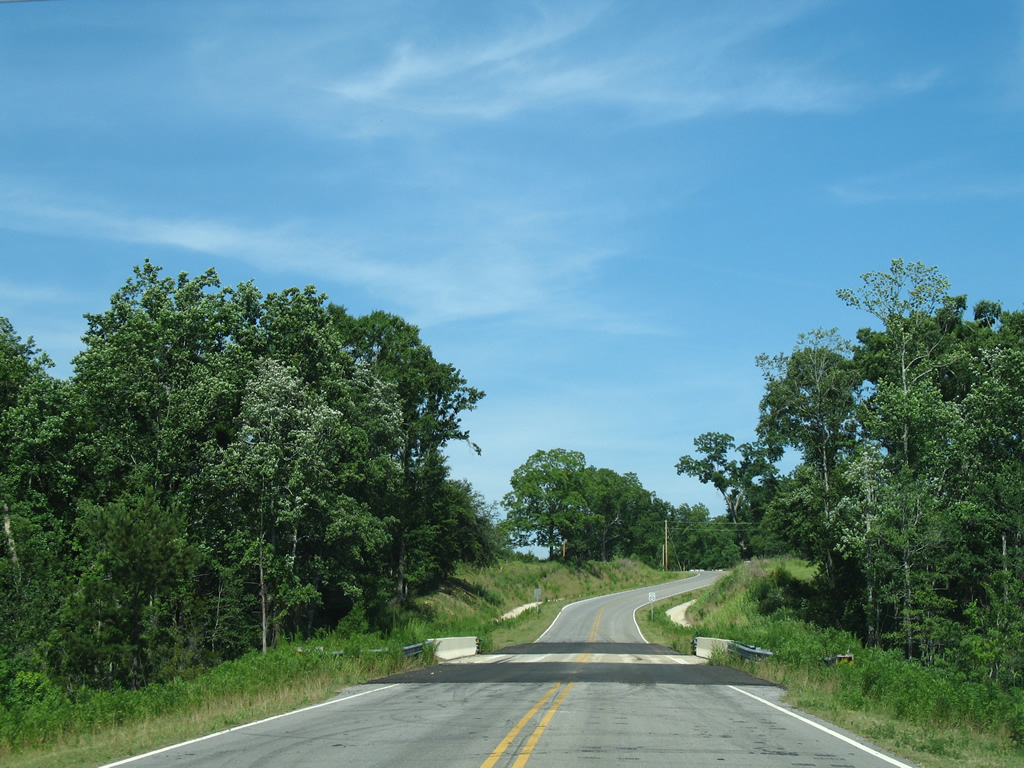
| County Road 40 initially travels southward along Old Daphne Road to make the connection with Nicholsville Road east from Gulf Shores Parkway. Pictured here is an 18 inch pentagon posted just beyond U.S. 31 & SR 59. 06/06/06 |
|
| The only southbound shield posted for County Road 40 along the Nicholsville Road loop exists beyond the Dickman Road intersection as the road exits the Bay Minette city limits. 06/06/06 |
Brady Road North Extension, Pine Grove Road
County Road 57 constitutes a loop from Bay Minette south to Pine Grove. The county road is only signed at the junction with U.S. 31 and SR 59 (Gulf Shores Parkway).
|
| A double flasher operates at the Baldwin County Road 57 (Pine Grove Road) southbound intersection with Brady Road Extension west and Old Brady Road east. Pine Grove lies two miles to the south. 06/06/06 |
|
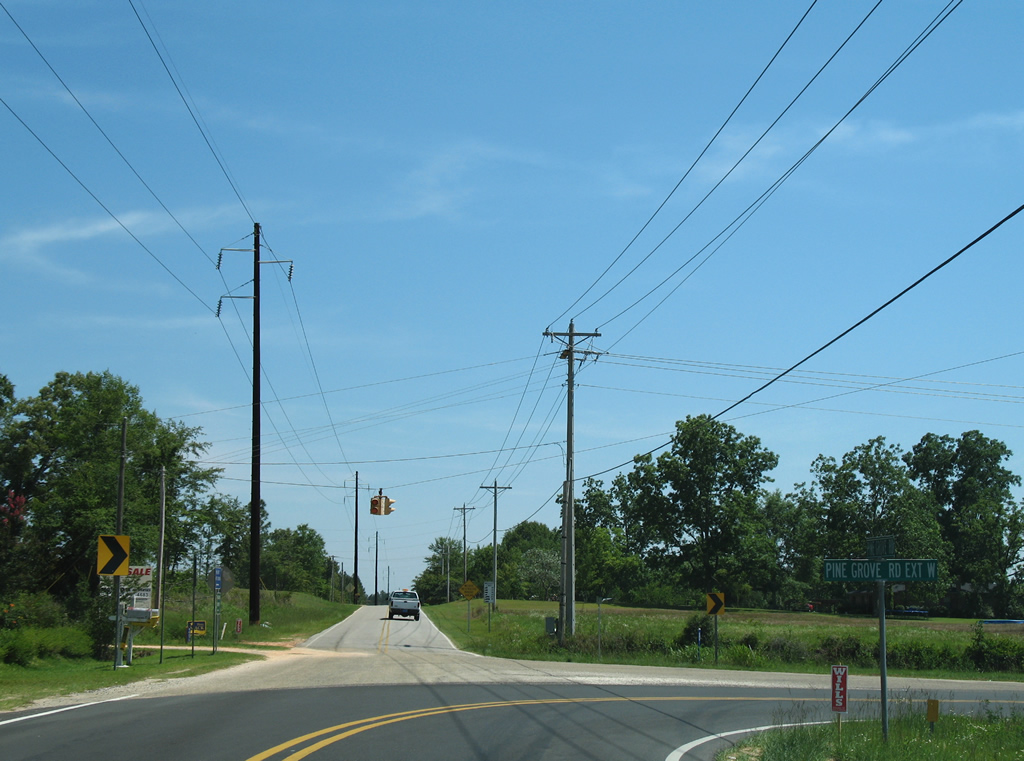
| County Road 57 turns west from Pine Grove Road onto Pine Grove Road Extension. Pine Grove Road south ends near Durban Fork Road by a handful of residences. 06/06/06 |
|
| Traveling west, County Road 57 (Pine Grove Road Extension) crosses the Styx River and ends in 1.25 miles at Gulf Shores Parkway. 06/06/06 |
|
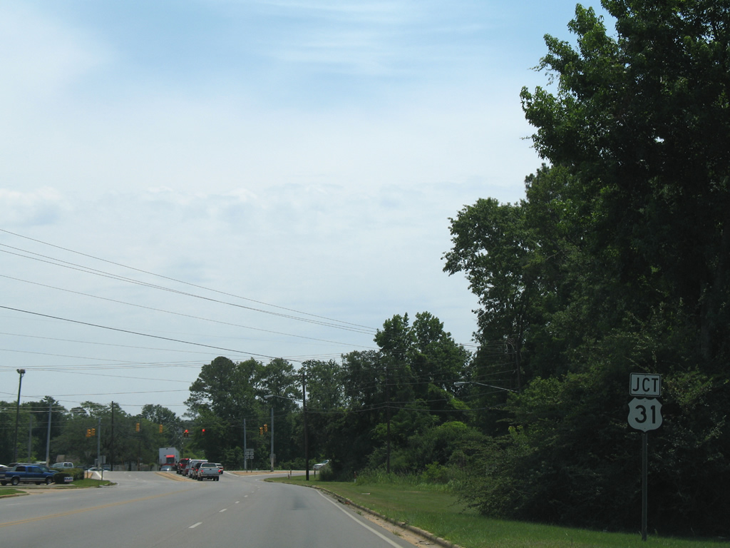
| U.S. 31/SR 59 (Gulf Shores Parkway) venture south to Vangorden and Stapleton and north to a series of industrial parks of south Bay Minette. 06/06/06 |
Rockhill Road
Rockhill Road doubles as Baldwin County Road 58 north 0.9 miles from U.S. 31 (East 2nd Street) to Lee Avenue in northeast Bay Minette. The two-lane road serves a few rural homes.
|
| Reassurance shield posted for County Road 58 as Rockhill Road leaves U.S. 31 in east Bay Minette. 06/05/06 |
|
| Baldwin County Road 58 exits the city of Bay Minette and spans McCurtin Creek near Marks Avenue East. 06/05/06 |
|
| Rockhill Road dog legs southeast and becomes County Road 58 south of Lee Avenue. Pictured here is the first southbound shield. 06/05/06 |
|
| Nearing the end of County Road 58 (Rockhill Road) at U.S. 31 (East 2nd Street) by Bay Minette Cemetery. 06/05/06 |
|
| County Road 58 ends at a three-lane section of U.S. 31 near the CSX Railroad under pass. The US route follows East 2nd Street to Courthouse Square and downtown Bay minette to the west and continues northeast to Perdido and Atmore along a vastly rural drive. 06/05/06 |
Hurricane Road
Originally a state route, County Road 138 links the Douglasville area of south Bay Minette at U.S. 31/SR 59 with Crossroads at SR 225. The state route was transferred to county maintenance sometime after 1982.
|
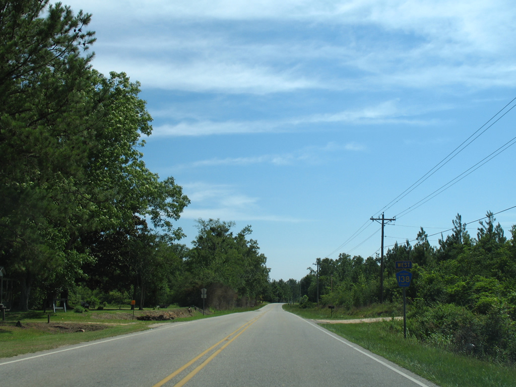
| Baldwin County Road 138 (Hurricane Road) arcs northeasterly from Crossroads to meet CR 39. 06/06/06 |
|
| County Road 39 begins and travels southeast to Whitehouse Forks and Stapleton (U.S. 31/SR 59). This is the western branch of the county road. An eastern branch spurs from Stapleton toward the Styx River. 06/06/06 |
|
| Hurricane Road continues northeast toward Bay Minette from County Road 39. 06/06/06 |
|
| CR 40 follows Whitehouse Forks Road north from a short overlap with County Road 39 to end at Hurricane Road. 06/06/06 |
|
| Eastbound County Road 139 (Hurricane Road) at CR 40 (Whitehouse Forks Road) south. The western segment of County Road 40 leads southwest to SR 225 near Bromley. A second alignment of CR 40 exists along Nicholsville Road in south Bay Minette. 06/06/06 |
|
| Drivers turn eastward on the approach to the Bay Minette city line on County Road 138. Hurricane Road widens to four lanes once in the city. 06/07/06 |
|
| County Road 138 (West Hurricane Road) travels through the Douglasville community of Bay Minette to end at U.S. 31/SR 59 (Gulf Shores Parkway). 06/07/06 |
|
| U.S. 31/SR 59 travel northward approximately one mile to their split at D'Olive Street and southward to Stapleton. Gulf Shores Parkway constitutes a four lane corridor from Gulf Shores to Interstate 65 (Exit 37) near Rabun.
East Hurricane Road spurs to an industrial park beyond the County Road 138 end. 06/07/06 |
|
| County Road 138 begins and carries four overall lanes from U.S. 31/SR 59 (Gulf Shores Parkway) to the Bay Minette city line. Pictured here is the first westbound shield. 06/06/06 |
|
| Curving southward, County Road 138 (Hurricane Road) meets the western branch of CR 40 (Whitehouse Forks Road). 06/06/06 |
|
| County Road 40 leads southward to Whitehouse Forks and CR 39. The route ends at SR 225 near Bromley. 06/06/06 |
|
| Westbound CR 138 turns westerly ahead of Whitehouse Creek from County Road 40. 06/06/06 |
|
| Hurricane Road meanders southwest and next meets the north end of County Road 39. 06/06/06 |
|
| CR 39 heads southward from CR 138 (Hurricane Road) to a brief overlap with CR 40 at Whitehouse Forks and ultimately Stapleton. 06/06/06 |
|
| Traveling the final mile of CR 138 (Hurricane Road) westbound from County Road 39. 04/09/09 |
|
| Approaching the community of Crossroads and SR 225 (Blakeley Road) on Hurricane Road west. 04/09/09 |
|
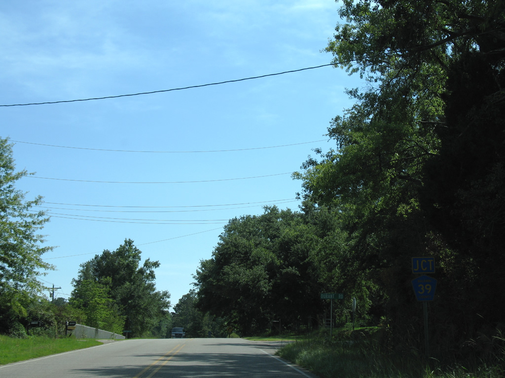
| SR 225 travels north-south 23.91 miles from Spanish Fort to Stockton. Connections with U.S. 31 south to U.S. 90 west lead motorists to Mobile. 04/09/09 |
|
| County Road 138 ends as Hurricane Road becomes CR 86 west across SR 225. County Road 86 links Crossroads with the community of Hurricane and the Mobile-Tensaw Delta Wildlife Management Area along the Tensaw River. 04/09/09 |
D'Olive Street
D'Olive Street originally ended at Shehan Lane just west of the Bay Minette city line. Construction in 2006 extended the road west to Alabama 225 near the community of Carpenter.
|
| D'Olive Street travels over rolling hills with a 55 mph speed limit from SR 225 to a point south of Bay Minette Municipal Airport. 04/09/09 |
|
| Just south of the airport, D'Olive Street nears Honeycutt Creek and sees a speed limit drop to 25 mph. The two lane road remains vastly rural to Dobson Avenue in Bay Minette. 04/09/09 |
|
| Spanning Bay Minette Creek on D'Olive Street Street east near the original road end at Shehan Lane. 06/06/06 |
|
| D'Olive Street leads direct to the north end of the U.S. 31 & SR 59 merge at McMeans Avenue. U.S. 31 follows D'Olive Street east to Courthouse Square in downtown Bay Minette. 06/06/06 |
|
| Construction of the D'Olive Street extension west from a point beyond Bay Minette Creek near Bay Minette Municipal Airport. 06/06/06 |
|
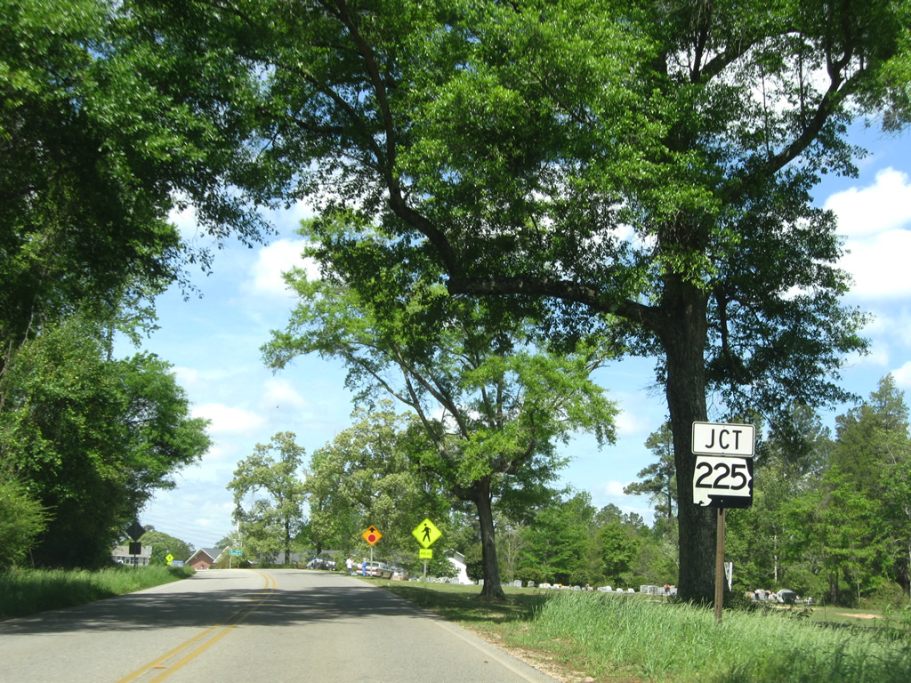
| Approaching the end of D'Olive Street extension at SR 225 near Carpenter. 04/09/09 |
|
| SR 225 leads north to Interstate 65 and Stockton and south to Crossroads and Spanish Fort. 04/09/09 |
|
| Daphne Road northbound curves eastward to become Clay Street in south Bay Minette. A signal flasher advises caution on the curve. 01/01/10 |
|
| Looking at the Baldwin County Courthouse from Hand Avenue south of the signalized intersection with 1st Street. 03/20/09 |
|
| Hand Avenue continues south from Courthouse Square and SR 287 to a CSX Railroad crossing and Stanmeyer Street. A set of old traffic lights hang above the intersection with 1st Street. 03/20/09 |
|
| Northbound Hoyle Avenue at the intersection with U.S. 31 (D'Olive Street). County Road 57 ends as U.S. 31 prepares to enter Courthouse Square to the left. 02/08/06 |
|
| One traffic light per direction hangs above the Hoyle Avenue (County Road 57) intersection with 1st Street outside of Courthouse Square in downtown Bay Minette. Both roads are lightly traveled, though Hoyle Avenue doubles as CR 57 south to industrial businesses south of the CSX Railroad line. 06/06/06 |
|
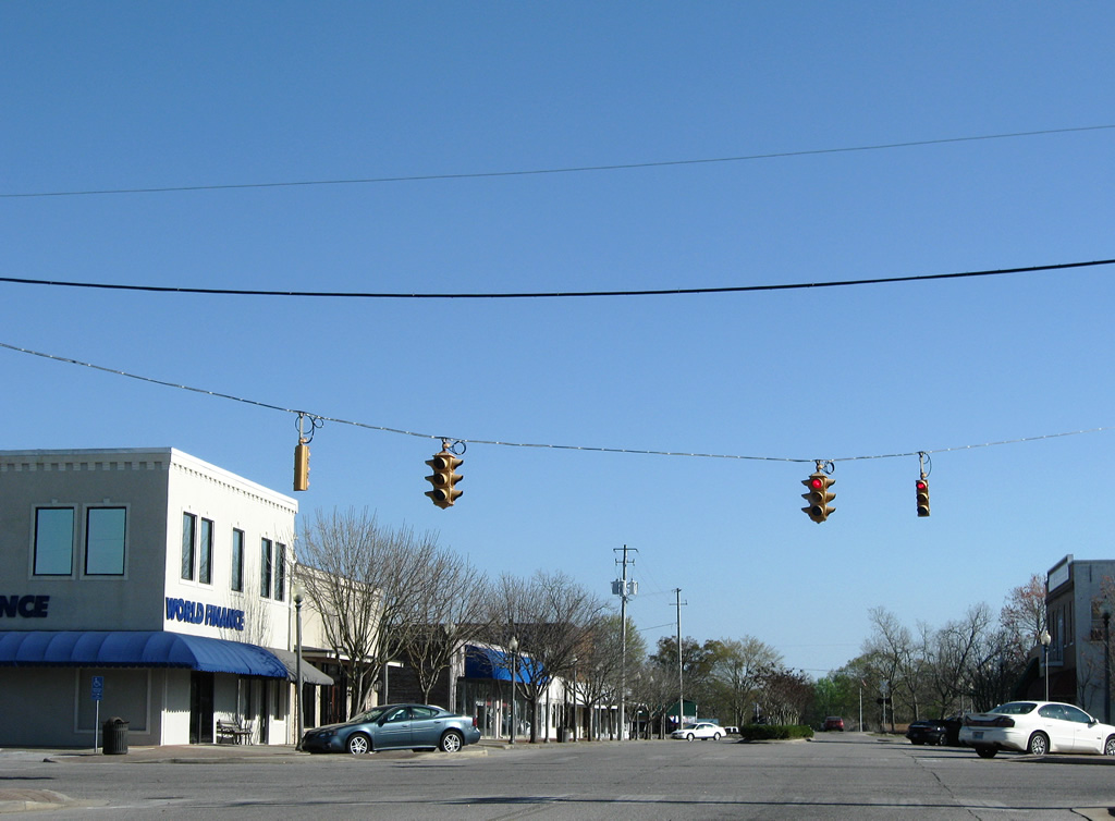
| A set of Crouse Hinds signals hang above the intersection of 1st Street and Hand Avenue, just south of Courthouse Square in downtown Bay Minette. These signals were in full operation at the time of these photos, but were turned into flash mode in 2010. 03/20/09 |
|
| 1st Street eastbound at Hoyle Avenue (County Road 57). 1st Street ends five blocks ahead and basically carries just local traffic between McMillan Avenue and Hoyle Avenue. 02/08/06 |
|
| Westbound 1st Street at the set of one-piece four-way signals over Hand Avenue. 01/01/10 |
|
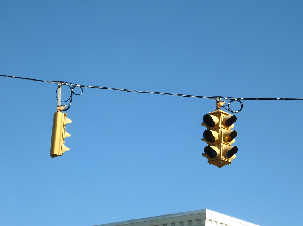
| Closer views of the signals at 1st Street and Hand Avenue in Bay Minette. The four-way signals are Crouse Hinds type D's; the single face signals are Crouse Hinds type M's. 03/20/09 |
Photo Credits:02/08/06, 06/06/06, 03/20/09, 04/09/09, 01/01/10 by AARoads
Connect with:
U.S. 31
State Route 59
State Route 287 - Gulf Shores Parkway / Rabun Road
Page Updated 09-13-2011.