Two portions of County Road 95A are signed in Escambia County. Both represent old alignments of U.S. 29, paralleling the current four-lane route to the east. The southern segment follows North Palafox Street north from where U.S. 29 joins Pensacola Boulevard at Brent to Ensley, Gonzalez and Cantonment.
The northern component of County Road 95A loops 9.11 miles east from U.S. 29 through Cottage Hill, Quintette and Molino. This stretch is vastly more rural than its southern counterpart.
|
| Just north of the I-10 under crossing, County Road 95A (Palafox Street) intersects the west end of Olive Road. Olive Road was originally a part of State Road 290 until a mileage swap turned the route over to the county. Now designated as County Road 290, signs are only posted on intersecting state roads. 03/20/12 |
|
| Signs for SR 290 were removed by fall 2012. The 5.47 mile route of CR 290 lines Olive Road east from Ensley to Ferry Pass and U.S. 90 (Scenic Highway) off Macky Bay. 09/30/12 |
|
| Continuing north from CR 290, County Road 95A (North Palafox Street) enters the Ensley community. 03/20/12 |
|
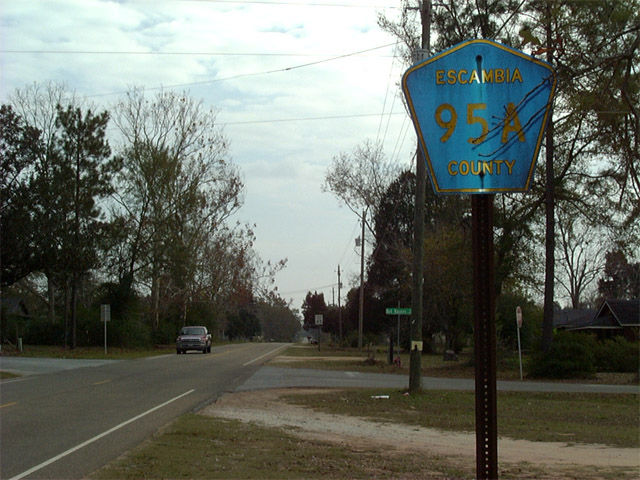
| Leaving the commercialized intersection with U.S. 90 Alternate (Nine Mile Road) on County Road 95A (North Palafox Street) northbound. 06/21/05 |
|
| Traveling north from Kingsfield Road (CR 186) in the Gonzalez area. A CSX Railroad parallels the east side of CR 95A while the back side of shops along U.S. 29 appear to the west. 07/24/11 |
|
| An unmarked intersection joins N. Palafox Street with County Road 749 (Old Chemstrand Road), a 2.25 mile route joining U.S. 29 with Chemstrand Road (former CR 749 south) and a chemical plant along the Escambia River. 07/24/11 |
|
| Escambia County Road 95A becomes more rural north from Gonzalez toward Cantonment. 07/24/11, 02/02/06 |
|
| County Road 95A navigates between U.S. 29 and a CSX Railroad line from Cantonment south into Gonzalez. These reassurance markers appear just south of Kingsfield Road (CR 186), as CR 95A lines a commercial strip fronting adjacent U.S. 29. 07/24/11 |
|
| Ten Mile Road stems west from Pate Street and Greenbrier Boulevard in north Ensley to cross CR 95A (N. Palafox Street) at this traffic light. Heading west, the through road continues through suburban areas to Stefani Road. 07/24/11 |
|
| An unmarked intersection joins County Road 95A south with U.S. 90 Alternate (Nine Mile Road) in Ensley. Nine Mile Road constitutes a busy east-west arterial to Exit 5 of I-10 and U.S. 90 ahead of the Escambia River bridges. 07/24/11 |
|
| South from U.S. 90 Alternate, CR 95A lines the back side of U.S. 29-based retail ahead of an older residential street grid. 07/24/11 |
|
| Hood Drive provides side access into adjacent big box retail while connecting Palafox Street with U.S. 29 (Pensacola Boulevard). 07/24/11 |
|
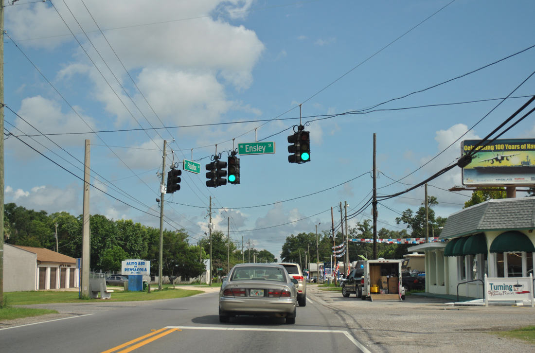
| Ensley Street provides the first of Ensley roads crossing the parallel CSX Railroad line between U.S. 90 Alternate and I-10. 07/24/11 |
|
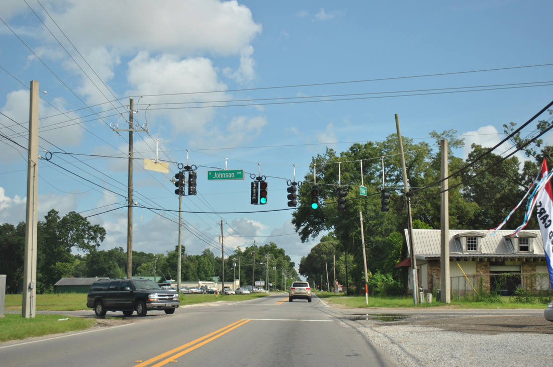
| Johnson Avenue comprises a local street to the west of CR 95A but a through route east to Ferry Pass and Olive Road (CR 290) near Escambia Bay. 07/24/11 |
|
| Olive Road represents the former route of SR 290, from CR 95A east to U.S. 90 (Scenic Highway) at Macky Bay. The east-west route was turned over to Escambia County as CR 290 in 2012. 03/20/12 |
|
| North Palafox Street next spans Interstate 10, just east of the interchange with U.S. 29. 03/20/12 |
|
| SR 742 (Burgess Road) crosses paths with County Road 95A (N. Palafox Street) at a traffic light south of I-10. The state road ends at U.S. 29 just to the west. Burgess Road takes the route east to Creighton Road through northern Pensacola and an end at U.S. 90 near Gull Point on Escambia Bay. 07/24/11 |
|
| Industrial businesses line portions of County Road 95A south from Burgess Road to the merge with U.S. 29. 02/02/06 |
|
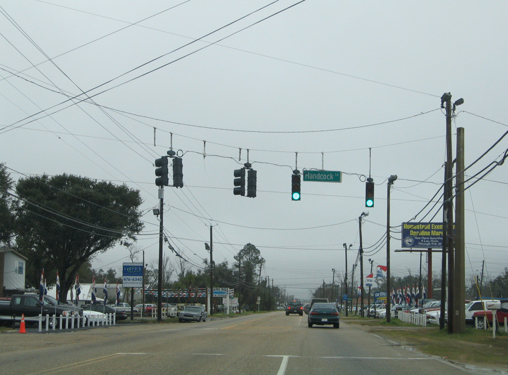
| A traffic light governs the movements between Hancock Lane east to a middle school and subdivisions west of I-110. Note the misspelling on the street sign. 02/02/06 |
|
| Airport Boulevard, upgraded to State Road 750 in 2012, intersects North Palafox Street in the Brent area. SR 750 lines the four to six lane arterial east from U.S. 29 to 12th Avenue at the terminal road for Pensacola International Airport (PNS). 02/02/06 |
|
| The final southbound shield for Escambia County Road 95A resides after Airport Boulevard. North Palafox Street joins U.S. 29 south into Pensacola, but southbound traffic defaults onto Pensacola Boulevard north at the forthcoming end of CR 95A. 02/02/06 |
|
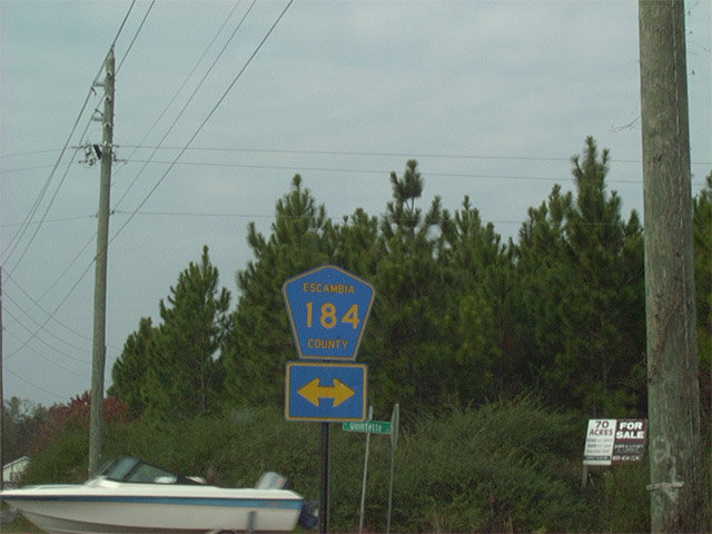
| County Road 184 arcs east from CR 95A to span the Escambia River into Santa Rosa County. The crossing is the only of the Escambia River between U.S. 90 and SR 4 at Century. 12/09/01 |
|
| County Road 95A veers away from the split intersection of Quintette Road (former CR 184) west to U.S. 29 and County Road 184 (Quintette Road) east to Pace. 01/19/13 |
|
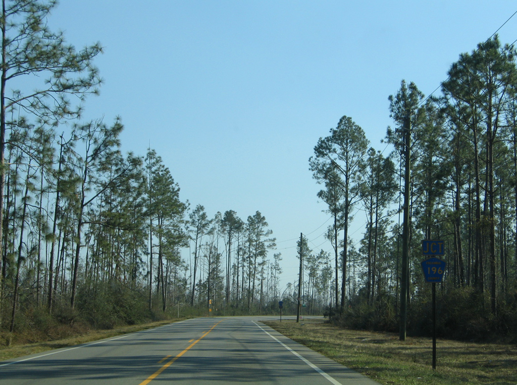
| North through Quintette, Escambia County Road 95A approaches the east end of CR 196 (Barrineau Park Road). 01/19/13 |
|
| Escambia County Road 196 ventures west 7.59 miles from CR 95A to Barrineau Park and CR 99 north near the Perdido River and Alabama state line. 01/19/13 |
|
| Angling northwest, CR 95A continues toward Molino Crossroads from CR 196 (Barrineau Park Road). 07/24/11 |
|
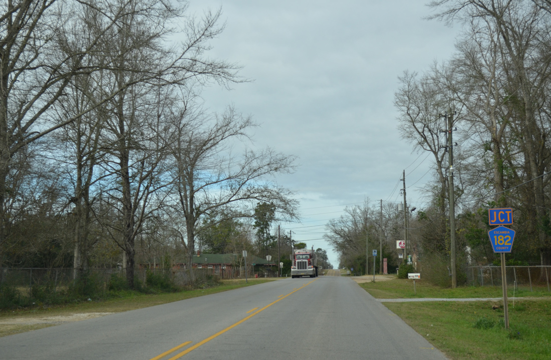
| The Escambia County portion of CR 182 travels 5.91 miles between CR 99, north of Barrineau Park, to the nearby community of Molino. A second section of CR 182 exists in neighboring Santa Rosa County. 01/19/13 |
|
| Leaving CR 182 and the Molino Crossroads community on CR 95A north. 07/24/11 |
|
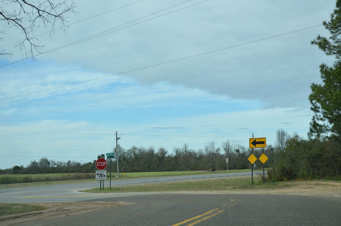
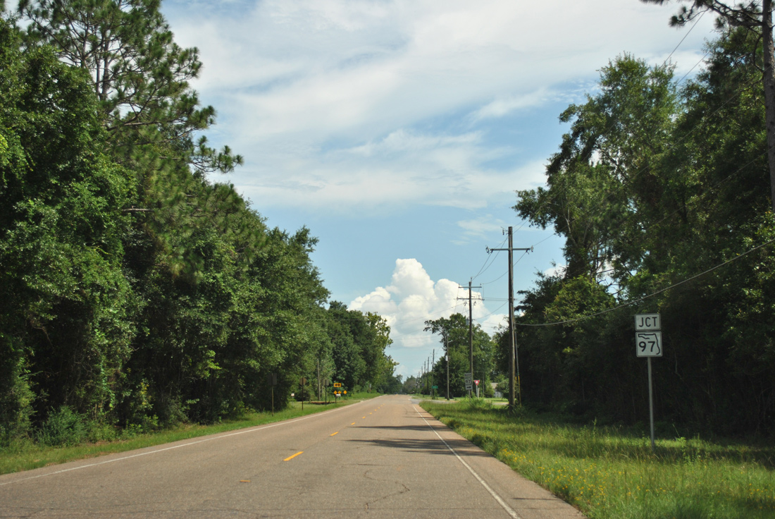
| SR 97 begins from County Road 95A just north of Bet Raines Road in the Molino area. The state road crosses U.S. 29 just to the west. 01/19/13 |
|
| SR 97 peels away from CR 95A north for a 22.51 mile course to Walnut Hill, Davisville and the Alabama state line south of Atmore. SR 97 becomes Alabama 21 at the north end. 07/24/11 |
|
| The last reassurance marker posted along Escambia County Road 95A. 01/19/13 |
|
| CR 95A ends abruptly as U.S. 29 overtakes the original pavement northward to Barth, Bogia, McDavid and Century. 01/19/13 |
|
| County Road 95A branches southeast from U.S. 29 near Barth. A short distance from there is the southern terminus of SR 97. 07/24/11 |
|
| SR 97 follows a rural path south from Alabama 21, south of Atmore, through Davisville and Walnut Hill to end just east of U.S. 29 at CR 95A. 07/24/11 |
|
| South from SR 97, CR 95A enters the Molino Crossroads community. 12/09/01 |
|
| Shield assembly posted for CR 95A south of CR 182 in the Molino area. 02/08/06 |
|
| County Road 95A curves toward the east end of County Road 196 (Barrineau Park Road) north of Quintette. 02/08/06 |
|
| Barrineau Park Road doubles as CR 196 west 7.59 miles to CR 99 north at Barrineau Park. The road crosses into Baldwin County, Alabama west from there. 02/08/06 |
|
| Quintette Road intersects County Road 95A east from U.S. 29 and west as County Road 184. 02/08/06 |
|
| County Road 184 arcs east from CR 95A to cross the Escambia River to northern Pace in Santa Rosa County. The bridge is the first crossing of the Escambia heading south from SR 4 at Century. 02/08/06 |
Photo Credits:12/09/01, 06/21/05, 02/02/06, 02/08/06, 07/24/11, 03/20/12, 09/30/12, 01/19/13 by AARoads
Connect with:
U.S. 29
U.S. 90 Alternate
State Road 97
Former State Road 290 - Olive Road
State Road 742 - Burgess Road / Creighton Road
State Road 750 - Airport Boulevard
County Road 184
Page Updated 03-14-2014.