|
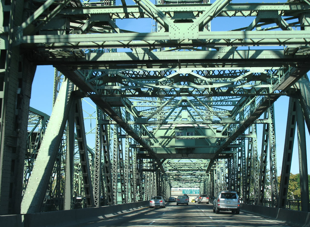
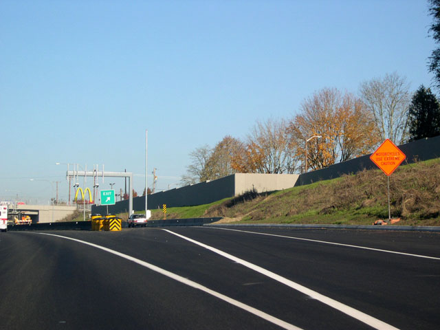
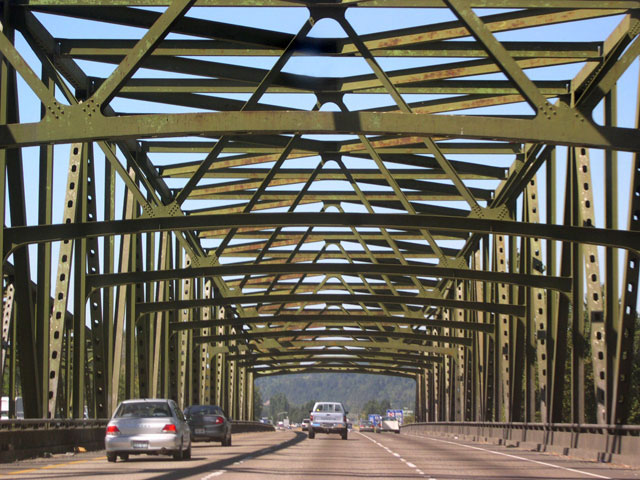
| The Washington state border lines the Columbia River midway between Hayden Island and the Vancouver river side. These views look at the northbound span of the Interstate Bridge at the vertical-lift section.
The Interstate Bridge stretches 3,538 feet across at a height of 72 feet above the Columbia River. When the northbound bridge was added in 1958, both spans were tolled until 1966 construction costs were recovered.6 08/27/06 |
|
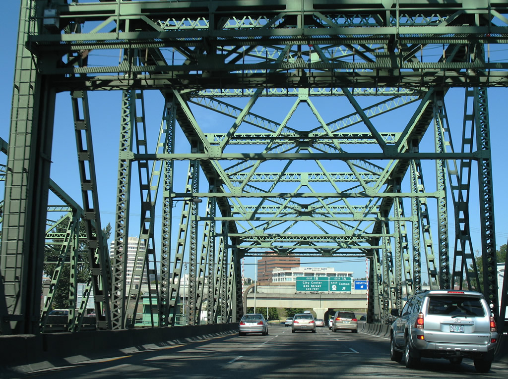
| Motorists taking SR 14 (Lewis and Clark Freeway) at exit 1A should be prepared by remaining in the far right lane while crossing the Interstate Bridge. The exit ramp immediately follows the river crossing. Follow the freeway along the Columbia River to city of Camas, 12 miles to the east. 08/27/06 |
|
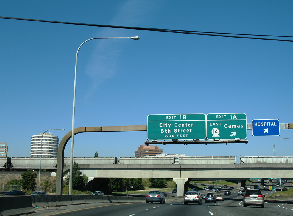
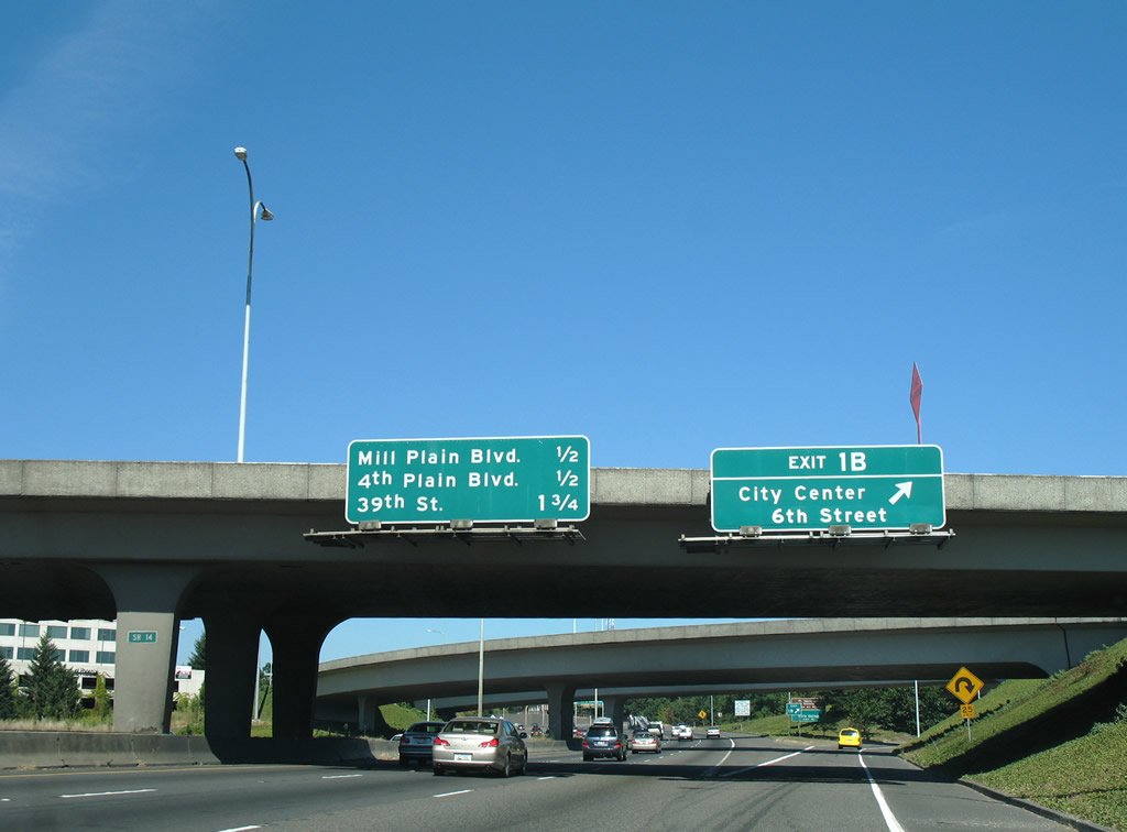
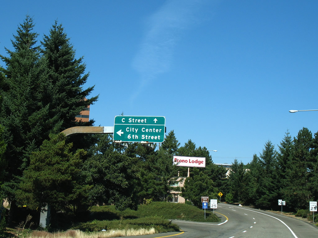
| The exit 1B ramp makes a near 360-degree loop, exiting to 6th Street in downtown Vancouver. 08/27/06 |
|
| Taking Exit 1B, motorists are provided with two options: a left turn onto 6th Street into the Vancouver city center or remaining to the right for C Street north to Evergreen Boulevard and SR 501 (Mill Plain Boulevard / 15th Street). 08/27/06 |
|
| A handful of mid-rise buildings reside within the Vancouver business district. The city of Vancouver was settled in 1825 when the Hudson's Bay company moved its northwest headquarters from Astoria, the town's name honors George Vancouver, a British ship captain who had visited the region in the late 1700s. Under the Hudson's Bay Company, Fort Vancouver was the center of fur trading in the Pacific Northwest. It became part of the Oregon Territory when the U.S. border was extended to the 49th parallel in 1849, and was officially incorporated as the city of Vancouver in 1857.1 08/27/06 |
|
| Remaining along C Street north to Evergreen Boulevard allows motorists access to Fort Vancouver National Historic Site east of Interstate 5. 08/27/06 |
|
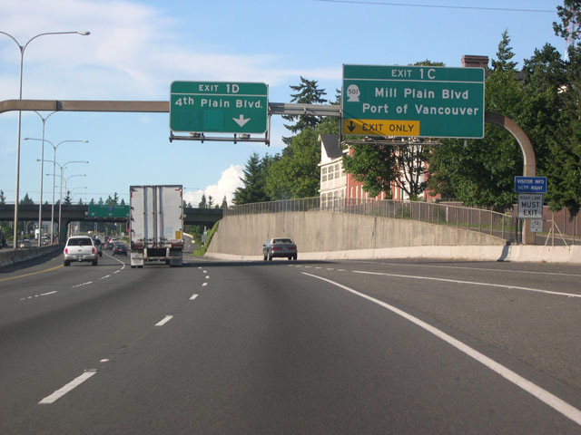
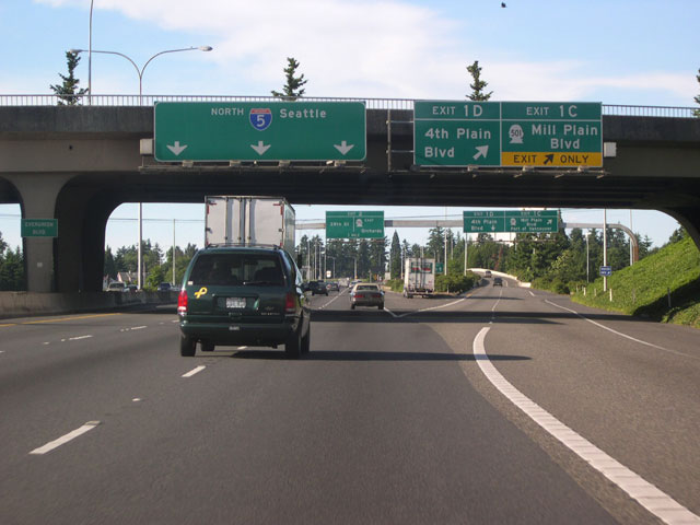
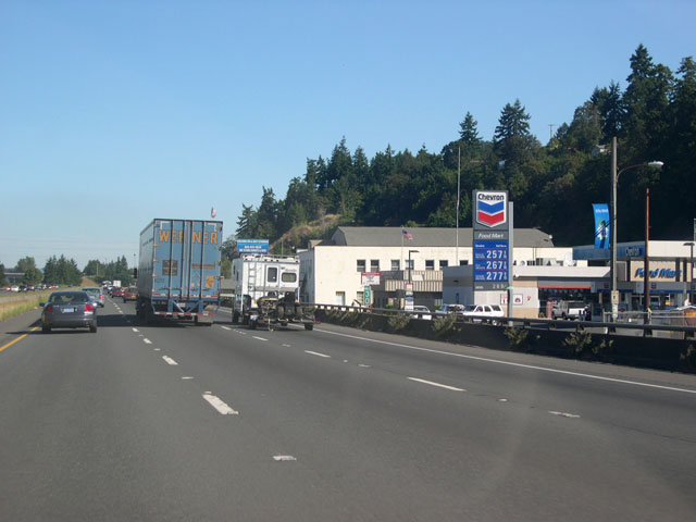
| Exits 1C (Mill Plain Boulevard/Port of Vancouver) and 1D (4th Plain Boulevard) are announced by a pair of signs on this arched sign bridge. The stretch of I-5 through Vancouver has a markedly different feel from the narrow, cramped trip it takes through Portland. It is at least six lanes wide; long, multi-lane exit ramps provide access to surface streets. The arch theme of the sign bridges is echoed by the simple curved shapes of the double arm street lamps that line the median. 06/19/05 |
|
| Interstate 5 meets exits 1C and 1D at fairly wide diamond interchange. The double-lane exit ramp will diverge: the right lane (exit 1C) leads to Mill Plain Boulevard/SR 501 just east of downtown. SR 501 follows Mill Plain Boulevard west through downtown, leading to the Port of Vancouver. Head east on Mill Plain for Fort Vancouver National Historic Site, which can be reached by turning right on Fort Vancouver Way.
The left lane (exit 1D) follows a long distributor lane, crossing over Mill Plain and intersecting with Fourth Plain Boulevard about 3/4 mile from the exit. 06/19/05, 11/19/05 |
|
| This welcome sign on the freeway's east shoulder past the exit 1C/1D ramp is flanked by a floral rendition of the WSDOT logo. 06/19/05 |
|
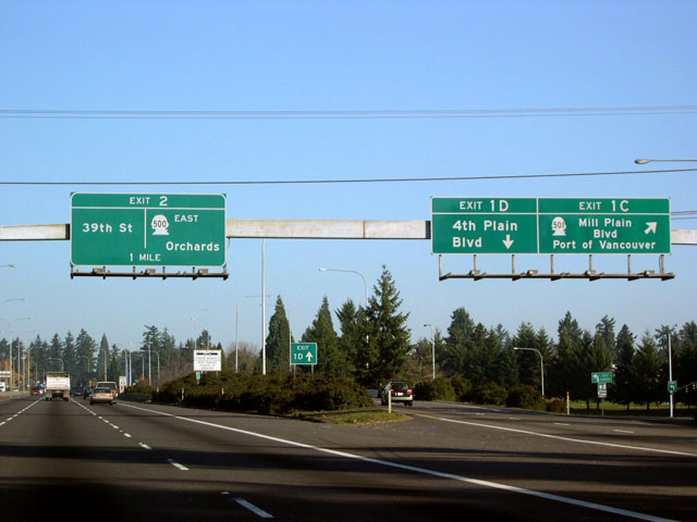
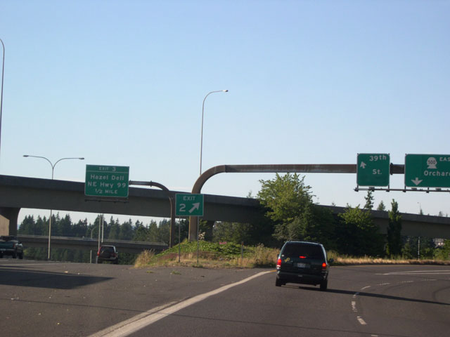
| Exit 2, announced on this pull-through sign, is another double-lane exit, though no "A" or "B" designations are used. 06/19/05 |
|
| A view taken from the exit 2 off ramp. The left lane leads to a signaled intersection with 39th Street, a minor east-west arterial north of downtown; keep right for SR 500. SR 500 starts life as a divided expressway, passing through three signaled intersections before briefly turning into a freeway. The destination city, Orchards, is a heavily populated unincorporated community at the northeastern fringe of Vancouver. 06/19/05 |
|
| A 1/2 mile advance sign for the next exit, exit 3/ Hazel Dell and NE Highway 99, is mounted in front of a flyover ramp carrying traffic from SR 500 to southbound I-5. 11/19/05 |
|
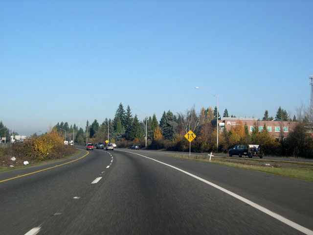
| Past exit 2, I-5 northbound heads into a broad, shallow "canyon" that runs northwest to southeast through much of Vancouver. Designated as the Burnt Bridge Creek Greenway, this swath of intermittently forested and open land boasts miles of hiking and biking trails. 11/19/05 |
|
| Northbound Interstate 5 reaches exit 3, Hazel Dell and NE Highway 99. As is typical for I-5 in Vancouver, the exit-only lane approach to the ramp is relatively long. NE Highway 99 (former U.S. 99), though no longer designated as either a federal or Washington, represents the northern continuation of Vancouver's Main Street. The wide arterial runs north-south through Hazel Dell, a large unincorporated community residing north of Vancouver city limits. In the second image, notice the pedestrian bridge in the foreground, part of the Burnt Bridge Greenway's network of trails. 11/19/05 |
|
| Interstate 5 continues north, passing under the Main Street/Highway 99 overpass. The high-voltage power lines and towers visible along this stretch connect with the Bonneville Power Administration's Ross Complex substation in Hazel Dell. 11/19/05 |
|
| This trio of images shows the approach to the next exit: exit 4, NE 78th Street in Hazel Dell. The first overpass is for the tracks of the Chelatchie Prairie Railroad (formerly the Longview, Portland, and Northern); the second one is for NE 63rd Street. 11/19/05 |
|
| Another double-lane exit is provided for exit 4, NE 78th Street. I-5 travels above grade and meets this east-west arterial in Hazel Dell at a single point urban interchange (SPUI). 11/19/05 |
|
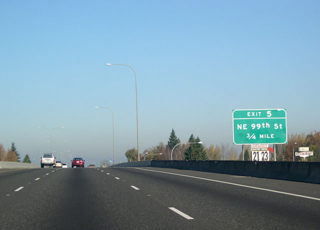
| A 3/4 mile advance sign for the next exit: exit 5, NE 99th Street. 11/19/05 |
|
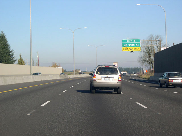
| The lane merging from the 78th Street interchange (far right) will become an auxiliary lane for the NE 99th Street exit. 11/19/05 |
|
| The first two images in this trio show advance signs for exit 5, NE 99th Street. Northbound Interstate 5 reaches exit 5 (third image) at the northern edge of Hazel Dell. As at exit 4, a SPUI handles the exchange of traffic, though exit 5 has a single lane off ramp. 11/19/05 |
|
| Northbound Interstate 5 narrows to two lanes past exit 5. 11/19/05 |
|
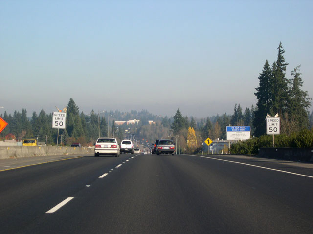
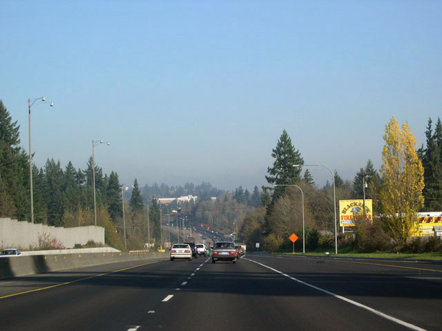
| The final phase of a three-part project to relieve traffic congestion along the Vancouver corridor (WSDOT Bulletin), Interstate 5 is being widened to six lanes plus auxiliaries along a roughly 2 mile stretch between NE 99th Street and the Interstate 205 junction. Though few motorists heed it, the speed limit is lowered to 50 through the construction zone (first image). Slated for completion in spring 2007, the $35.4 million project features new bridges over Salmon Creek for both roadways. Traffic for both directions of I-5 will use the new northbound span (third image) until the southbound span is completed.2 11/19/05 |
|
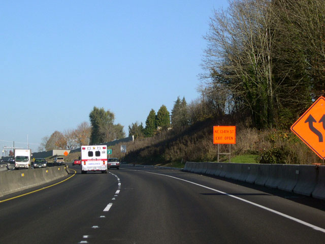
| Interstate 5 continues through the construction zone to exit 7, NE 134th Street. A rather smallish-looking orange sign (first image) announces that the exit is open during construction. Traffic interested in using southbound I-205 should exit here and turn right at 134th Street. There is no direct interchange between northbound I-5 and southbound I-205, but an entrance ramp to I-205 from 134th Street is available. 11/19/05 |
|
| Now clear of the construction zone, I-5 approaches the merge with I-205. The speed limit is back to the normal 60 m.p.h. urban corridor designation. 11/19/05 |
|
| I-5 meets I-205, the eastern bypass through the Portland metropolitan area, at Salmon Creek. The northbound lanes from I-205 join I-5 smoothly and without fanfare. 11/19/05 |
|
| This reassurance shield just past the I-205 merge uses the wide series E Highway Gothic font that shows up on a number of interstate shields in southern Washington. Note the Lewis and Clark trail marker mounted below the shield. 11/19/05 |
|
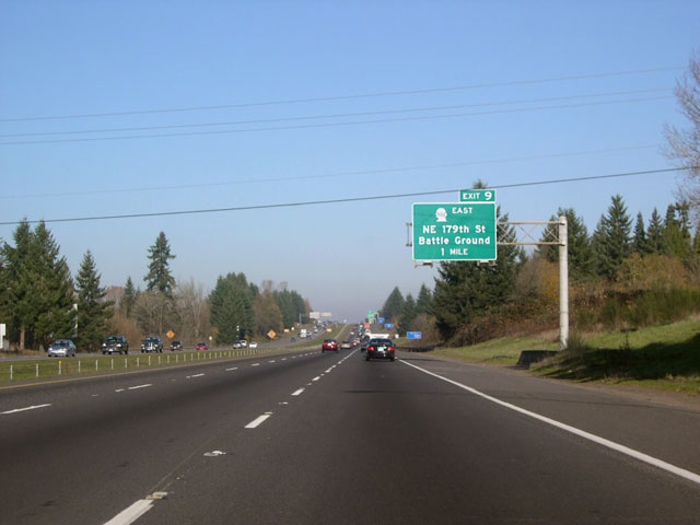
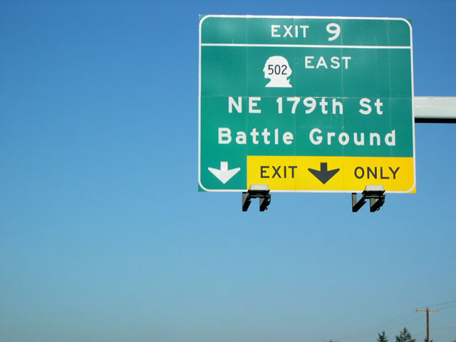
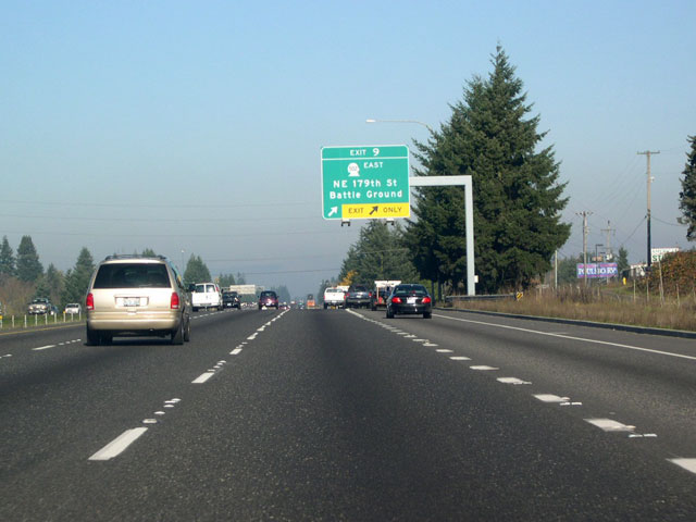
| The next exit along I-5 is exit 9, NE 179th Street and NE 10th Avenue (old SR 502) north to Battle Ground; here is the one mile advance sign. A separate exit number tab, like the one on this sign, is a rare sight along I-5 in Washington. 11/19/05 |
|
| Two sets of overhead signs direct traffic down the long approach to exit 9. The Clark County Fairgrounds and The Ampitheater at Clark County can be reached by turning left on N.E. 179th Street after exiting. Continue north through the intersection with 179th to travel on NE 10th Avenue (former SR 502) for about eight miles to the city of Battle Ground. SR 502 traveled north along NE 10th Avenue for two miles before a routing change at Duluth directed it eastward on 219th Street. This dog-legged arrangement was eliminated when a new extension of SR 502 west from Duluth, connecting the route with I-5 at a new interchange at the Gee Creek Rest Area, opened in October 2008. 11/19/05 |
|
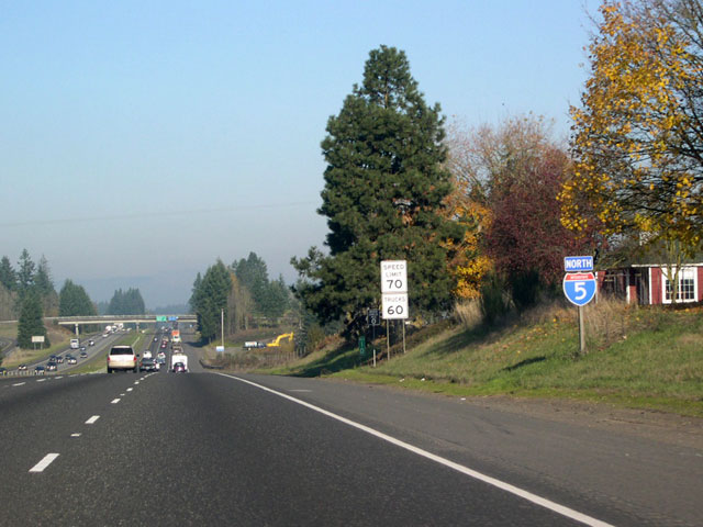
| For the first time since leaving California, northbound Interstate 5 enters a 70-m.p.h speed limit zone. As of 2005, Oregon posts limits on rural interstates no higher than 65 m.p.h. 11/19/05 |
|
| Interstate 5 leaves the greater Portland metropolitan area behind at exit 9 and the landscape becomes more rural. A distance sign for Woodland, Kalama, and Seattle is posted on the 199th Street overpass. 11/19/05 |
|
| The Gee Creek Rest Area resides within the Exit 11 parclo interchange with SR 502 (NE 219th Street). Ramps to NE 219th Street front the facility to the north and east. 11/19/05 |
|
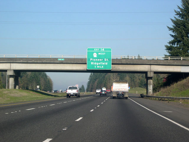
| I-5 remains vastly rural between exits 11 and 14. Here, a one mile advance sign for exit 14, Pioneer Street and Ridgefield, is mounted on the Carty Road overpass. 11/19/05 |
|
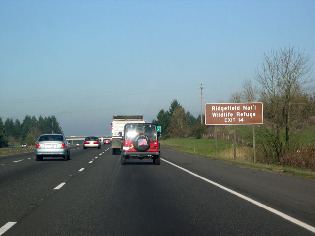
| Approaching exit 14, motorists are greeted by signs announcing camping facilities and restaurants in the vicinity of Ridgefield. Travelers may also be interested in hiking the trails at the Ridgefield National Wildlife Refuge (sign in third image), a 5,150-acre site of marshes, forests, and grasslands that borders the town's western edge along the Columbia River. Established in 1965, the site was created to provide winter habitat for migratory waterfowl.3 11/19/05 |
|
| Northbound Interstate 5 meets SR 501 for a second time at exit 14. Despite appearances, SR 501 isn't a continuous route from Vancouver to Ridgefield. The southern segment heads west and then north out of Vancouver, dead-ending south of the wildlife refuge. The northern spur that connects with I-5 at exit 14 carries traffic west via Pioneer Street to the city of Ridgefield (pop. 2,147 in 2000). Despite its current small size, the town is banking on growth. Recent enlargement pushed the city limits three and half miles east of the town's core across mostly rural land- enough expansion to place the interchange with I-5 well inside the city limits. 11/19/05 |
|
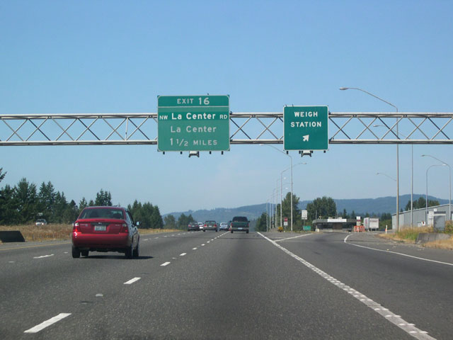
| One and half mile advance sign for the next exit: exit 16, NW La Center Road and the community of La Center. The darker green "patch" for NW LaCenter Road is covering the older NW 319th Street designation. 08/14/05 |
|
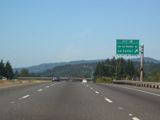
| Interstate 5 meets NW La Center Road at the exit 16 diamond interchange. NW La Center Road travels east for about a mile and half and then bends north into the community of La Center. Located along the east fork of the Lewis River, this tidy little town boasts wetlands, wildlife, greenbelt areas with trails, as well as four mini-casinos. 08/14/05 |
|
| Seventeen miles north of the Oregon border, Interstate 5 still has three lanes for each direction of travel. The northbound roadway drops quite a bit below the southbound one on the approach to the east fork of the Lewis River. 08/14/05 |
|
| A green steel truss span carries the northbound lanes of Interstate 5 across the east fork of the Lewis River south of Woodland. These truss spans are used in many places along I-5 in the Evergreen State. 08/14/05 |
|
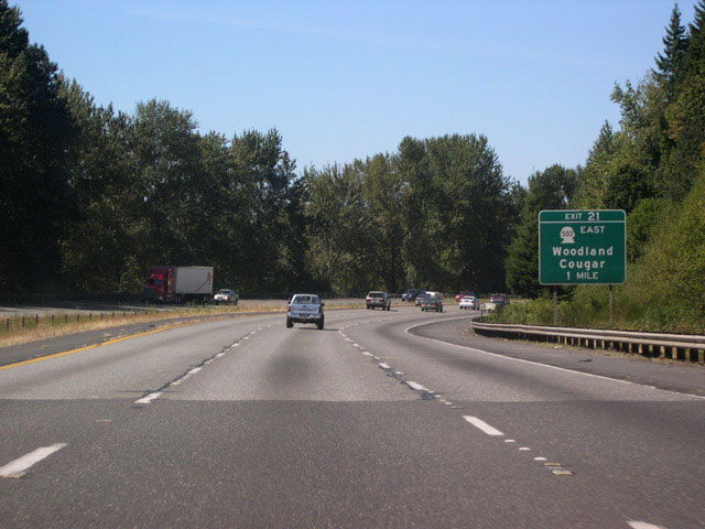
| A one mile advance sign announces the next exit along Interstate 5: Exit 21, SR 503 east to Woodland and Cougar. 08/14/05 |
|
| Just south of Woodland, another set of green steel truss spans now takes I-5 across the Lewis River proper. 08/14/05 |
|
| Yes, Mt. St. Helens National Volcanic Monument can be reached by taking exit 21 and following SR 503 east past Cougar- but this is the long way. This sign advises motorists to "inquire locally" before making the trip. Travelers with a lot of time on their hands will be rewarded with a winding, but highly scenic trip along the volcano's southern and eastern flanks via National Forest Roads 90 and 25. For a more direct route to view the north face and the crater, use SR 504 at exit 49. 08/14/05 |
|
| The Cowlitz county line greets northbound I-5 just prior to the exit 21 interchange. The exit 21 off ramp leads to a signaled intersection with SR 503. This odd-numbered route heads east for 21 miles, but past Lake Merwin the main route is redirected south and eventually ends up in Battle Ground. A spur from 503 continues east past Yale Lake and into the tiny Cascades town of Cougar. 08/14/05 |
|
| Incorporated in 1906, the city of Woodland is home to the Hulda Klager Lilac Gardens National Historic Site. I-5 literally bisects the town; frontage roads line both sides of the freeway, with Pacifc Avenue on the west and, naturally, Atlantic Avenue on the east. Atlantic Avenue merges with I-5 at the north end of town, becoming the de facto exit 21 on ramp for I-5 northbound. 08/14/05 |
|
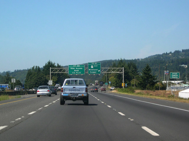
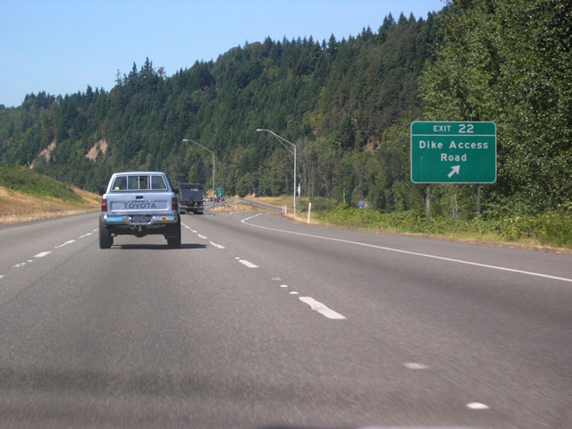
| Dike Access Road passes beneath both roadways of Interstate 5, but access is provided at exit 22. Dike Access Road travels west and connects with Dike Road near the Columbia River. A right turn from the exit 22 off ramp leads back into Woodland via the Old Pacific Highway. 08/14/05 |
|
| Dike Access Road isn't the only thing that passes beneath I-5 at exit 22. The tracks of the Burlington Northern Railroad pass under the southbound lanes and position themselves between the two directions of travel. 08/14/05 |
|
| A distance sign for the next city of interest, Kalama. Distances to Longview and the control city of Seattle are also given. 08/14/05 |
|
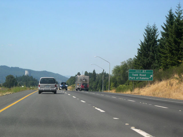
| The next exit along I-5 is exit 27, Todd Road and the Port of Kalama. The tracks of the BNRR have moved west of the freeway at this point and a normal median separates the directions of travel. Todd Road travels roughly east and winds through the hills south of Kalama; west of the freeway, Robb Road (not signed on I-5) leads to Toteff Road and the Port of Kalama. Notice the cooling tower of Oregon's mothballed Trojan Nuclear Power Plant in the background (second image). The tower is scheduled to be demolished in May 2006. 08/14/05 |
|
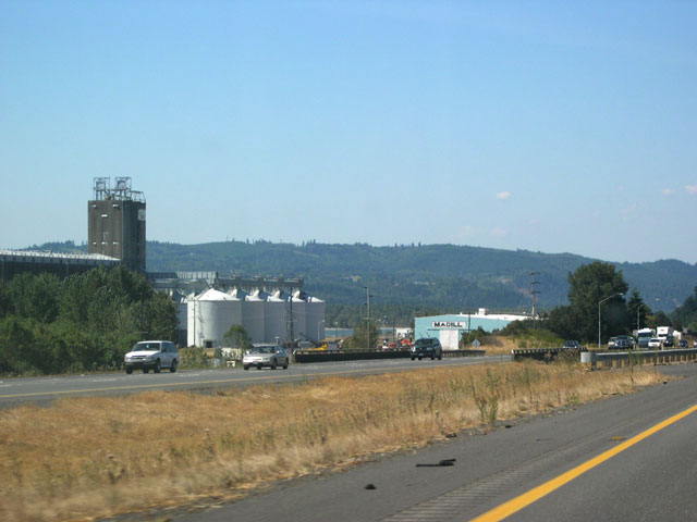
| Grain silos and storage facilities at the Port of Kalama are visible on the west side of I-5. The hills in the background are in Oregon. 08/14/05 |
|
| I-5 travels north to exit 30, Kalama. As in Woodland at exit 21, frontage roads widely separate the southern and northern ramps to and from Interstate 5 at exit 30. The city of Kalama (and the nearby Kalama River) is named for John Kalama, a Hawaiian who settled in the Northwest during the 1830s.4 07/31/05, 08/14/05 |
|
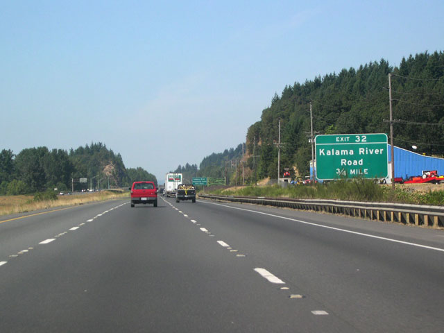
| Immediately north of Kalama is exit 32, Kalama River Road; here is the 3/4 mile advance sign. 08/14/05 |
|
| Exit 32 provides access to Kalama River Road at a diamond interchange. No big shocker here-Kalama River Road follows the course of the Kalama River west into the Cascade Range foothills south of Mount Saint Helens. 08/14/05 |
|
| A distance sign in front of the Kalama River Road overpass supplies distances to the upcoming towns of Kelso and Longview, as well as to Seattle. 08/14/05 |
|
| Another reassurance shield, this one past exit 32, uses the fat-looking series E font. 08/14/05 |
|
| The climate of SW Washington is much the same as that of NW Oregon and vegetation consists of the familiar Douglas-firs, hemlocks, red-cedars, oaks, and maples seen in Oregon. However, the low bluffs that line the Columbia River here impart a very different feel to the surrounding landscape than do the broad, alluvial plains of the Willamette Valley south of Portland. Rocky hillsides, such as this one bordering the eastern shoulder of I-5 near Longview, are also home to madrone trees- broadleaf evergreens that look as if they belong to a much warmer climate. 08/14/05 |
|
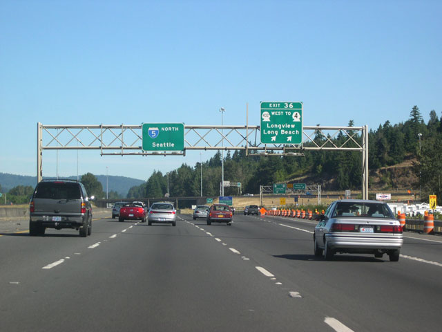
| A one mile advance sign announces Exit 36, Longview and Long Beach. 08/14/05 |
|
| Northbound Interstate 5 reaches the Kelso-Longview area at the Exit 36 parclo interchange. The double-lane exit ramp will diverge, with the left lane heading into Longview via SR 432. The right lane connects with Kelso Drive (Old Pacific Highway south), leading into Kelso. SR 432 (Tennnant Way) heads west as an expressway, where it soon exits off itself and is routed along 3rd Avenue and then Industrial Way. Access to the Lewis and Clark Bridge across the Columbia into Oregon is available by taking SR 433 south at the intersection of SR 432/Industrial Way and Oregon Way. Tennant Way itself continues into Longview. Longview is the first city of significant size encountered since leaving Vancouver.
Longview's history is unique: platted in 1921, the Long-Bell Logging company purchased the site and planned the entire city before construction even began.5 07/31/05 |
Page Updated 09-21-2010.

 North
North