|
| Interstate 5 bypasses Longview, as the town is actually situated a little west of the freeway. Now en route to the Kelso exits, I-5 northbound encounters this distance sign giving distances to Castle Rock, Tacoma, and Seattle. 07/31/05 |
|
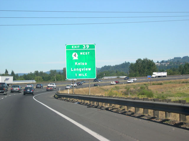
| As this one mile advance sign for exit 39 shows, Longview can still be reached by taking SR 4 westbound at Kelso. The cities of Longview and Kelso face each other from opposite sides of the Cowlitz River, though Kelso extends its borders west of the river a short distance. 07/31/05 |
|
| Here is exit 39, SR 4 westbound at Kelso. This is the Washington's eastern terminus; travel west on SR 4 (Allen Street) to cross the Cowlitz River into Longview. SR 4 continues west from Longview and eventually links with U.S. 101 north of Astoria, Oregon.
Billing itself both as the "Smelt Capital of the World" and "The City of Friendly People," the city of Kelso (pop. 11,895) takes its name from a Scottish town. 07/31/05 |
|
| The second Kelso exit, exit 40, leads to N. Kelso Avenue (former SR 431) on the west side of the freeway, or Holcomb Road on the east side. 07/31/05 |
|
| The first exit after encountered after leaving the Longview-Kelso area is exit 42, Ostrander Road and Pleasant Hill Road. Ostrander Road is a short road that crosses the freeway at exit 42 and links up with Pacific Avenue just east of the interchange. Pacific Avenue runs a parallel course to I-5, intersecting with Pleasant Hill Road a short distance north of exit 42. 07/31/05 |
|
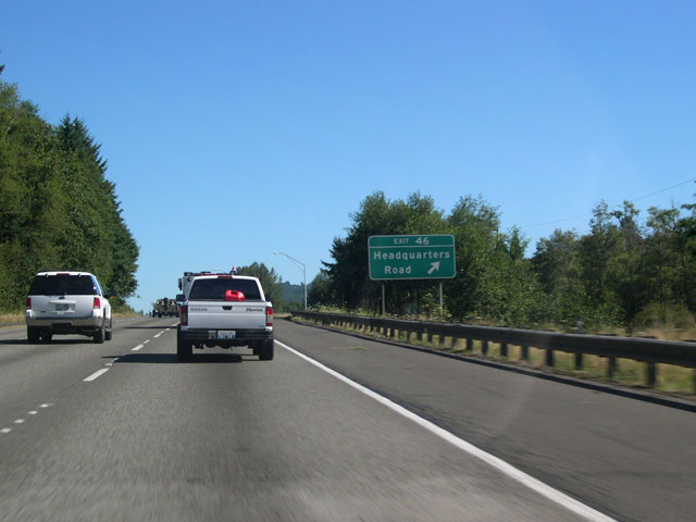
| I-5 travels north to the next interchange, exit 46, Headquarters Road. 07/31/05 |
|
| Northbound reassurance shield posted after Exit 46. The Cowlitz River flows nearby. 09/02/06 |
|
| A one half mile advance sign announces the upcoming I-5 Business Loop at exit 48 in Castle Rock. This is one of the few signed business routes from Interstate 5 in Washington state. 09/02/06 |
|
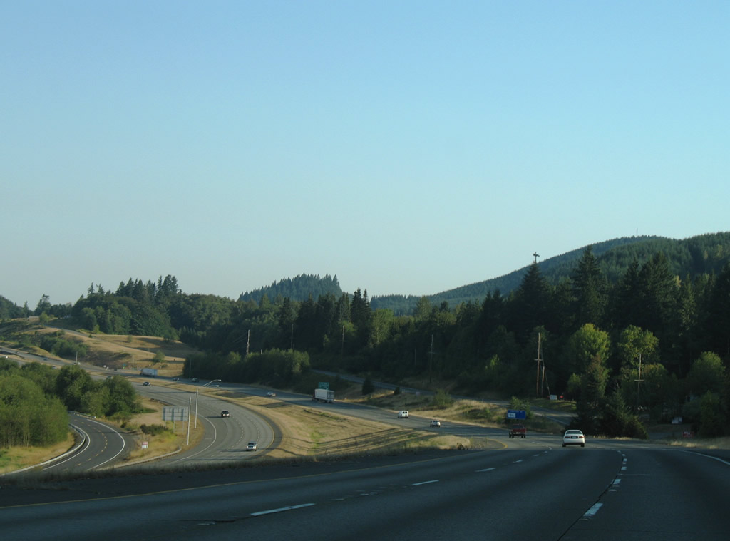
| This northerly view looks at the Interstate 5 mainline near Exit 46. Frontage roads (Pleasant Hill Road south / Bond Road north) and a BNSF Railroad parallel the four lane freeway closely. 09/02/06 |
|
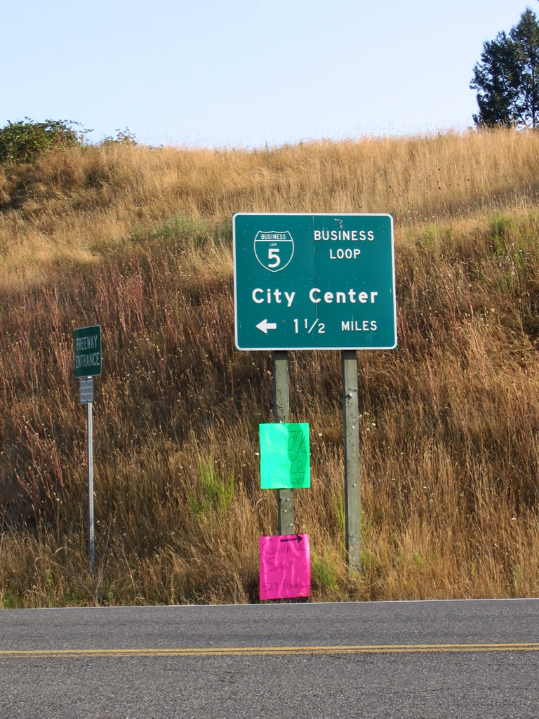
| The Interstate 5 Business Loop departs from the freeway at the exit 48 diamond interchange. From there it heads roughly northwest along Huntington Avenue into the community of Castle Rock. It rejoins I-5 at exit 49, and the road becomes SR 504 east of the freeway. Second image shows a directional sign for the business loop at the end of the exit ramp. One of western Washington's older communities, Castle Rock was incorporated in 1890 and its name derives from a 190-foot high volcanic formation situated at the heart of town. 09/02/06 |
|
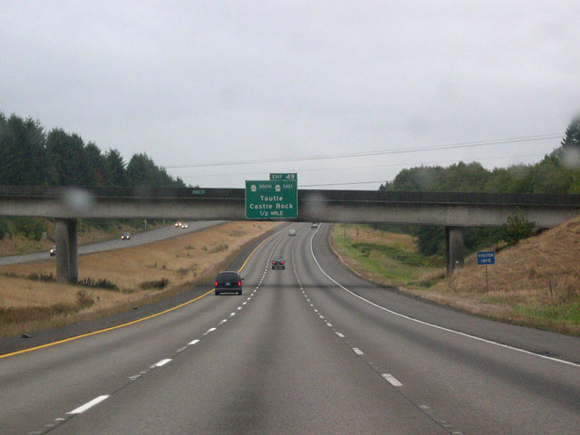
| This 1/2 mile advance sign (first image) for exit 49, Toutle and Castle Rock, is mounted on the Cowlitz Street overpass. Travelers looking for the most tourist-friendly route to Mount Saint Helens National Volcanic Monument should use exit 49 (second image); Castle Rock is the jumping off point for the Spirit Lake Memorial Highway (SR 504). 09/10/05 |
|
| Interstate 5 reaches exit 49, Toutle, Castle Rock, and eastbound SR 504 (Spirit Lake Memorial Highway). SR 504 ranges east from Castle Rock and into the heart of the volcanic monument, terminating at the Johnston Ridge Observatory five miles north of the volcano's crater. Mount Saint Helens is currently active, and delights visitors with periodic small eruptions of steam and ash. Other visitors' centers and attractions are also found along the drive, as is the small town of Toutle, ten miles east of Castle Rock.
SR 411 represents the western continuation of SR 504 at exit 49. It follows Huntington Avenue to Cowlitz Street where it turns west to cross the Cowlitz River. From there, SR 411 roughly follows the western banks of the Cowlitz south back to Kelso. 09/10/05 |
|
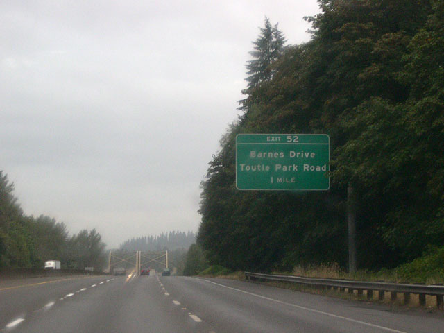
| The next exit along northbound Interstate 5 is exit 52, Barnes Drive and Toutle Park Road. Notice yet another set of steel truss bridges in the background; these carry the freeway over the Toutle River. 09/10/05 |
|
| A diamond interchange provides access to Barnes Drive at exit 52. Barnes Drive travels north to no particular destination, paralleling I-5 on the west. To the south, it becomes the Old Pacific Highway leading back into Castle Rock. 09/10/05 |
|
| A distance sign at Exit 52 gives the distances to U.S. 12, Chehalis, and Seattle. The Toutle River Rest Area lies around two miles north of the interchange. Nestled in a pleasant woodland setting, this is one of the nicer rest areas found along the northbound lanes of I-5 in Washington. 09/10/05 |
|
| Northbound Interstate 5 has been at least three lanes wide since the merge with I-205 back at Salmon Creek; past the Toutle River Rest Area, it narrows to two lanes. 09/10/05 |
|
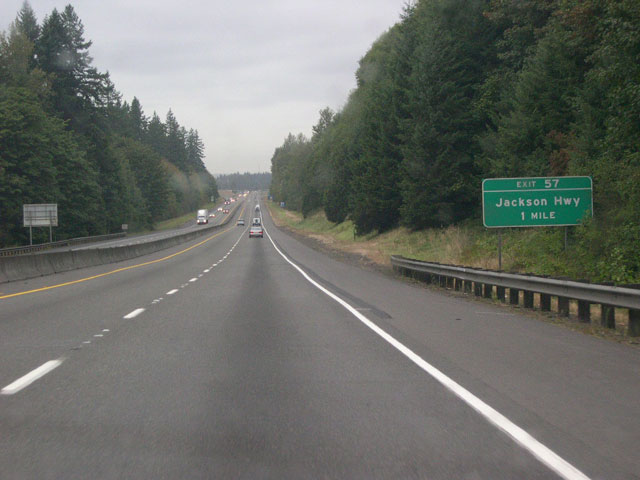
| Exit 57, Jackson Highway, is next up; here is the one mile advance sign. 09/10/05 |
|
| Exit 57 is positioned squarely at milepost 57; Jackson Highway travels northeast from I-5 to rendezvous with SR 505 at Toledo. 09/10/05 |
|
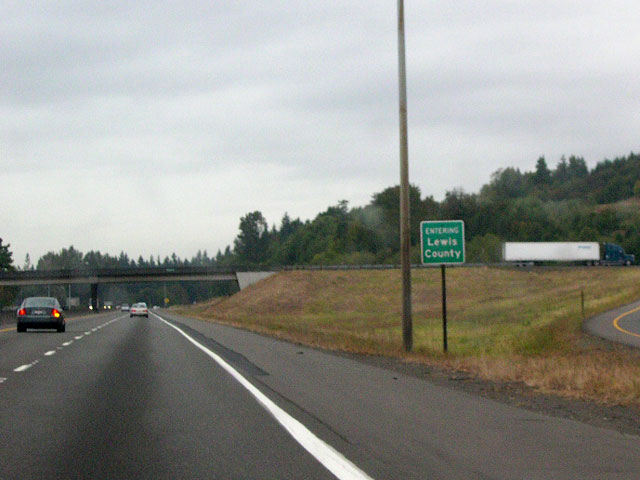
| Northbound I-5 also enters Lewis County at the exit 57 interchange. 09/10/05 |
|
| This I-5 reassurance shield sports a more orthodox series D font. Like most interstate shields in Washington, it is neutered. 09/10/05 |
|
| A one mile advance sign for the next interchange: exit 59 for SR 506, Vader, and Ryderwood. 09/10/05 |
|
| I-5 crosses the Cowlitz River via another set of the now-familiar green steel truss spans (first image); exit 59 is positioned directly after the crossing. Travelers interested in using SR 506 westbound to Vader and Ryderwood must make a hard right turn onto southbound Cowlitz Loop Road. Cowlitz Loop makes a 180, passing under the freeway and heading north to the intersection with SR 506. Vader, named for a German settler and not a Jedi, lies about three miles west along Olequa Creek. 09/10/05 |
|
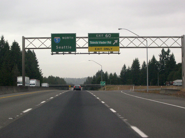
| Missed a chance to see Vader? Motorists may also take exit 60, Toledo-Vader Road. The road represents the northern continuation of SR 506 beyond exit 59. It crosses I-5 at exit 60 and offers a quicker way to Toledo for northbound traffic than does upcoming exit 63. 09/10/05 |
|
| Another distance sign is positioned between Exits 60 and 63, providing distances to U.S. 12, Centralia and Seattle. 09/10/05 |
|
| Exit 63 provides access to the towns of Winlock (west of I-5) and Toledo (east of I-5), both via SR 505. According to roadsideamerica.com, Winlock is home to the "world's largest egg," a 12-foot long, 1,200-lb. fiberglass egg emblazoned with the stars and stripes. Winlock is also home to 1,166 ordinary-sized human residents. 09/10/05 |
|
| Travelers next approach U.S. 12 (Exit 68) to Morton and Yakima. 09/10/05 |
|
| U.S. 12 ranges east to cross the Cascade Range, passing just south of Mount Rainier National Park. The park can be accessed at junctions with SR 7 on the west end, or SR 123 on the east end. The northern entrance to Mount Saint Helens National Volcanic Monument departs from Randle, also along U.S. 12. 09/10/05 |
|
| Northbound Interstate 5 reaches exit 68, U.S. 12 eastbound to Morton and Yakima. Morton is 30 miles distant; Yakima is 137. Once across the Cascade crest, U.S. 12 slowly descends into the dry side of Washington State, where annual rainfall totals are a fraction of those of the west side. 09/10/05 |
|
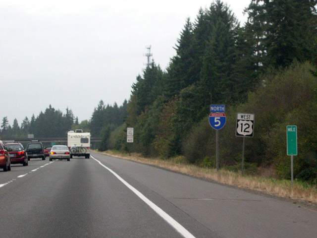
| Northbound Interstate 5 and westbound U.S. 12 share the same pavement for 20 miles before U.S. 12 departs for the coast at exit 88B. Note the curiously blank milepost. 09/10/05 |
|
| We're now less than 100 miles from the Emerald City, as this distance sign shows. Distances are also given to Chehalis and the state capital, Olympia. 09/10/05 |
|
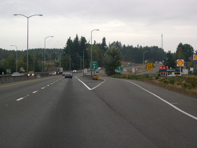
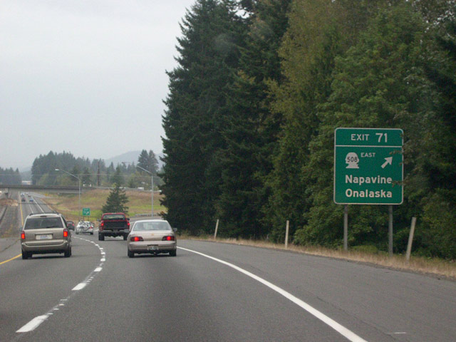
| Exit 71, SR 508 eastbound, Napavine, and Onalaska is the next interchange. Head east on SR 508 for the small town of Onalaska, or turn left at the end of the exit ramp and follow Forest-Napavine Road west to the equally small town of Napavine. SR 508 travels east of the interchange, following a course roughly parallel with U.S. 12, terminating at SR 7 in Morton. 09/10/05 |
|
| Unlike the first set of I-5 / U.S. 12 reassurance shields posted after exit 68, this set shares the same signpost. 09/10/05 |
|
| Exit 72 is for Rush Road. Taking Rush Road south from the interchange leads back to Napavine. 09/10/05 |
|
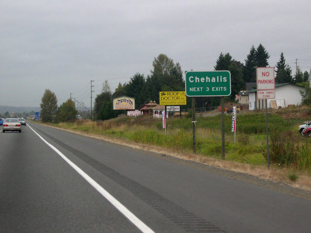
| Heading north from exit 72, Interstate 5 closes in on the twin cities of Chehalis and Centralia. As the freeway gets closer to the Puget Sound population belt, high-voltage power lines crossing the freeway become an increasingly common sight. 09/10/05 |
|
| Chehalis is the Lewis County seat and is the first of two towns that Interstate 5 will now encounter. Situated just east of the Chehalis river, the town's name means "sand." The Confederated Tribes of the Chehalis are based in nearby Oakville. 09/10/05 |
|
| The first Chehalis exit is exit 76, 13th Street. Motorists following 13th Street northeast from the exit will head into town; traveling southwest across the freeway leads to Stan Hedwall Park. 09/10/05 |
|
| This 3/4 mile advance sign announces exit 77, SR 6 west to Pe Ell and Raymond. 09/10/05 |
|
| Interstate 5 travels north where it encounters this sign at exit 77 which, for some reason, is lacking a directional arrow. From exit 77, SR 6 travels west to the Washington coast, passing through Pe Ell and terminating at U.S. 101 in Raymond near the east end of Willapa Bay. Traveling east from the interchange, Main Street leads to the Chehalis city center. 09/10/05 |
|
| The third and final Chehalis exit is found at the north end of town: exit 79, Chamber Way. 09/10/05 |
|
| It's only four miles to the larger town of Centralia, as this sign below the Chamber Way overpass shows. Seattle is now but 86 miles distant. 09/10/05 |
|
| The first Centralia exit is exit 81, northbound SR 507 and Mellen Street. SR 507 heads roughly northeast from Centralia, passing through the towns of Bucoda, Tenino, and Yelm. 09/10/05 |
|
| Interstate 5 enters the city of Centralia at the exit 81 interchange. East of the interchange, SR 507 (Mellen Street) heads into town and is routed down the Pearl Street/ Tower Avenue one way couplet. According to the city's website, Centralia was founded in 1875 by a former slave named--believe it or not--George Washington. 09/10/05 |
|
| A half mile advance sign (first image) announces the last Lewis County exit: exit 82, Harrison Avenue and Factory Outlet Way. Northbound Interstate 5 crosses yet another steel truss bridge, this one spanning the Skookumchuck River, prior to the interchange (second image). 09/10/05 |
|
| I-5 meets exit 82, Harrison Avenue and Factory Outlet Way at a diamond interchange. The stores of the Centralia Factory Outlets are located along Harrison Avenue on both sides of the freeway. 09/10/05 |
|
| Interstate 5 leaves Centralia and crosses the Thurston County line north of exit 82. 10/29/05 |
Page Updated 10-12-2010.

 North
North