|
| The first of two exits within Mountlake Terrace quickly departs Interstate 5 north of the King County line for 236th Street SW. 236th Street SW meanders west to Lakeview Drive at Lake Ballinger and east to the city of Brier. 08/30/06 |
|
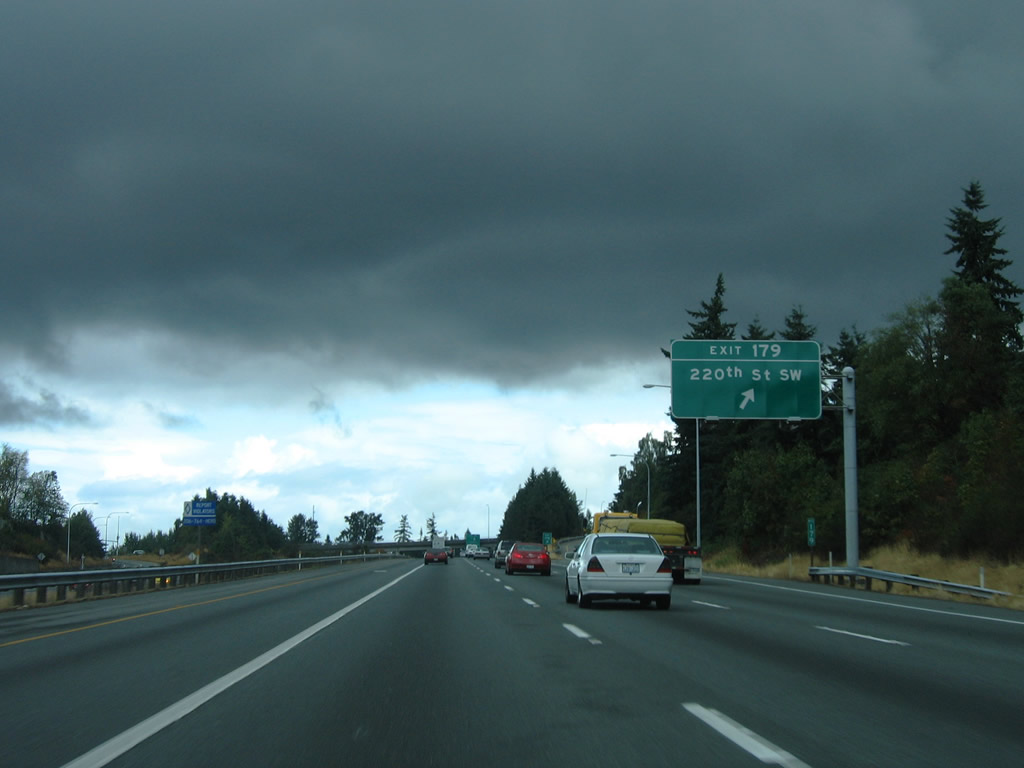
| Interstate 5 continues three quarters of a mile north from 236th Street SW to Exit 179 with 220th Street SW near Seattle Heights in Mountlake Terrace. 08/30/06 |
|
| Northbound at the Exit 179 diamond interchange with 220th Street SW. 220th Street SW ends at 52nd Avenue W to the east and 9th Avenue S in Edmonds to the west. 08/30/06 |
|
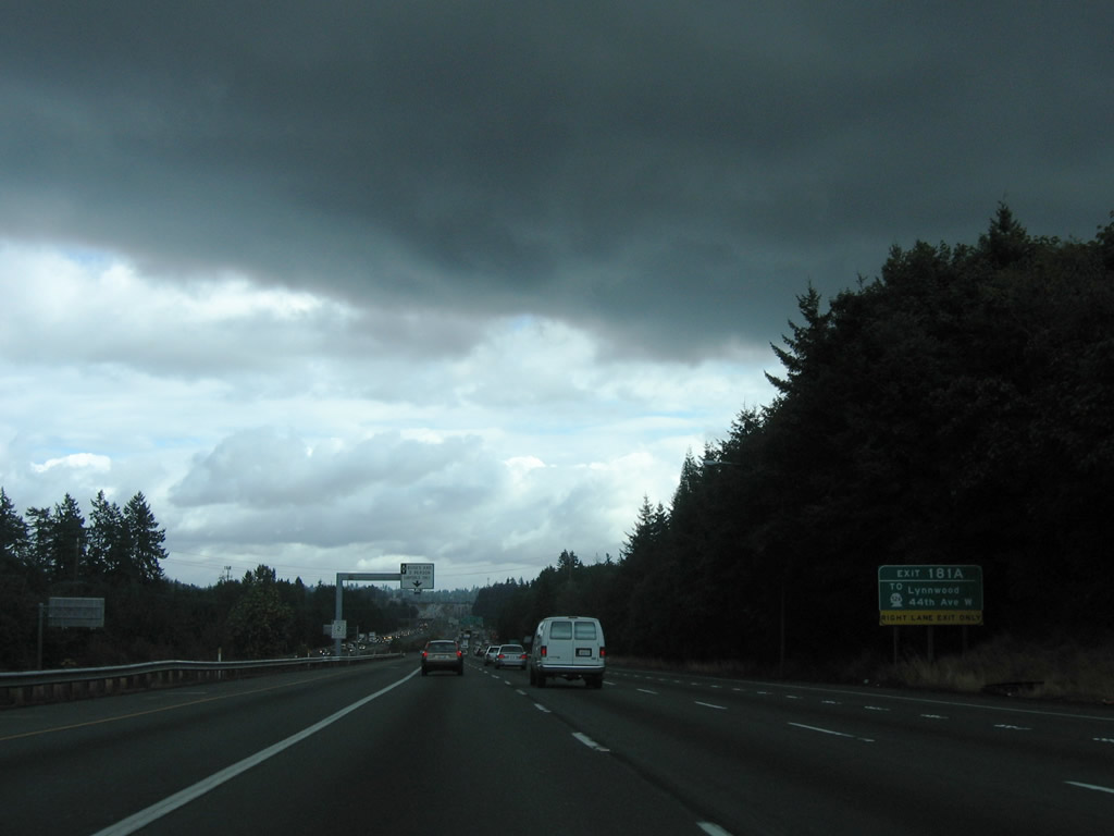
| Originally a split diamond interchange, Exit 181 was expanded into separate ramps for 44th Avenue W (Exit 181A) and SR 524 (Exit 181B) to serve the city of Lynnwood. 08/30/06 |
|
| Interstate 5 bends northeast through Cedar Valley on the approach to the half diamond interchange with 44th Avenue W (Exit 181A). 44th Avenue W exits Mountlake Terrace to cross Interstate 5 south of SR 524 (196th Street SW). The adjacent intersection is home to a bevy of retail. 08/30/06 |
|
| Exit 181A leaves Interstate 5 north for 44th Avenue W. 44th Avenue provides a more direct route to SR 524 (196th Street SW) west for Edmonds and Edmonds Community College. 44th Avenue SW connects Interstate 5 with the city of Brier as well. 08/30/06 |
|
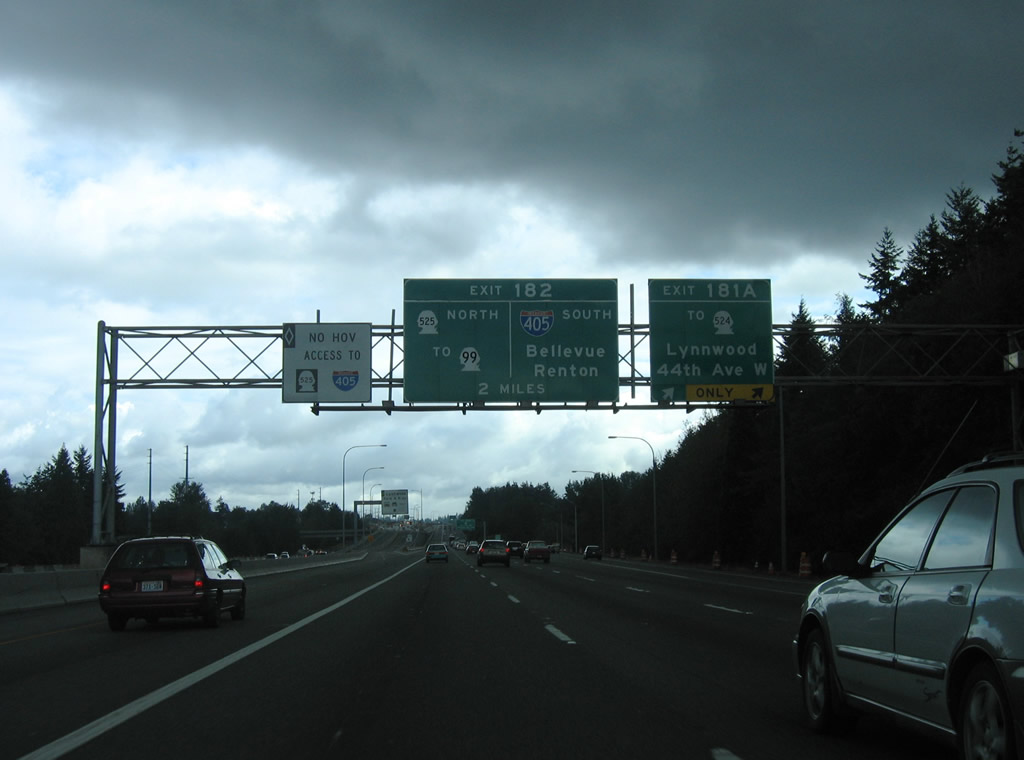
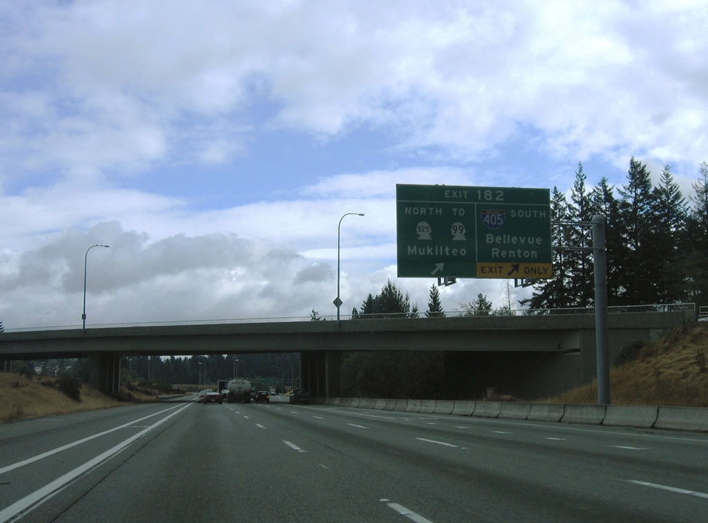
| Posted at the Exit 181A sign bridge is the first guide sign for Interstate 405 south and SR 525 north (Exit 182). Like the south end, Interstate 405 leaves off as a state route freeway spur to the west of Interstate 5. In this case, SR 525 travels 2.76 miles north to an interchange with SR 99. 08/29/06 |
|
| An inverted diamond interchange joins the HOV-2 lanes of Interstate 5 with the Lynnwood Park & Ride facility off 200th Street SW. 08/30/06 |
|
| Exit 181B consists of a six-ramp parclo interchange with SR 524 (196th Street SW) and Alderwood Mall Parkway in Lynnwood. SR 196 constitutes a commercial arterial west to Edmonds and east to the city line. The state route totals 14.68 miles from SR 104 (Sunset Avenue) to SR 522 at Maltby. 08/30/06 |
|
| Motorists taking the Exit 181B off-ramp intersect Poplar Way and Alderwood Mall Parkway south of SR 524. Alderwood Parkway arcs northeast from Interstate 5 to Alderwood Mall and SR 525. Poplar Way meanders south to Brier Road and the city of Brier. 08/30/06 |
|
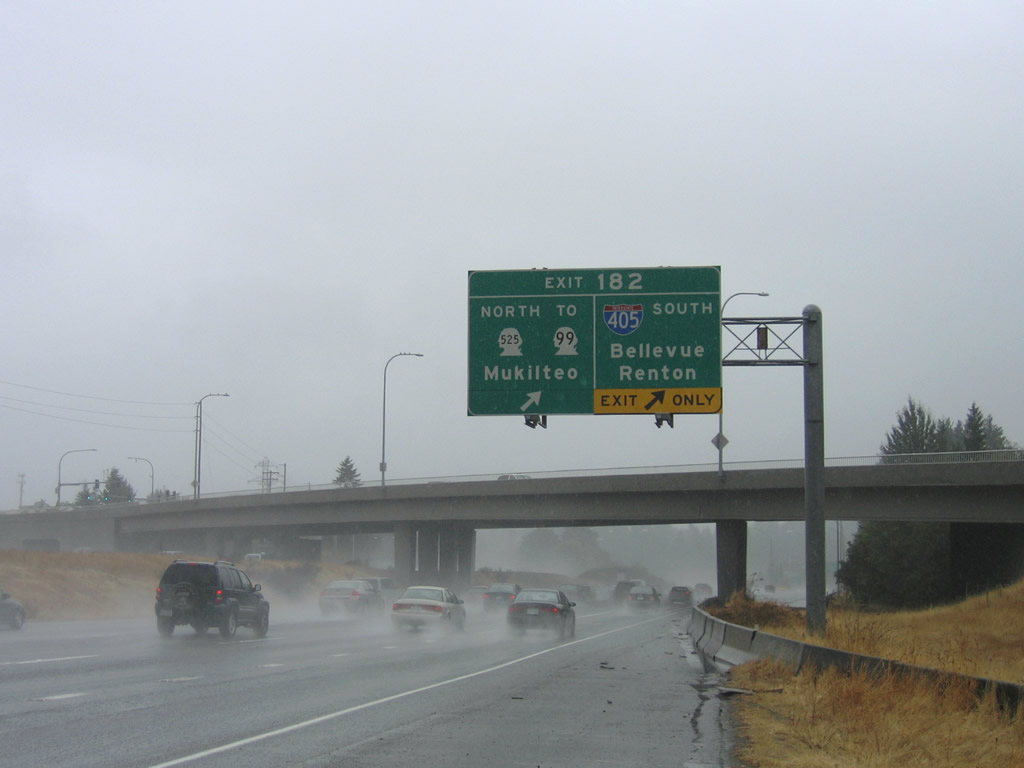
| One half mile south of the joint termini of Interstate 405 north and SR 525 south (Exit 182). Originally a tri-level stack, expansion of the interchange occurred with the 1985 completion1 of the SR 525 freeway north to SR 99 south of Mukilteo. 08/30/06 |
|
| Commuters utilizing the carpool lane may not cross the general travel lanes to access Exit 182. 08/30/06 |
|
| All traffic to Interstate 405 south and SR 525 north departs Interstate 5 in unison via a two lane off-ramp at Exit 182. Interstate 405 loops 30.30 miles southward to Bothell, Kirkland, Bellevue and Renton east of Lake Washington. 08/29/06 |
|
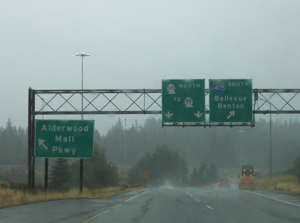
| Alderwood Mall Parkway passes over Interstate 5 north at the Exit 182 ramp departure. SR 525 constitutes a 30.68 mile route from Interstates 5 & 405 to SR 20 on Whidbey Island. The state route utilizes a ferry to make the connection between Mukilteo and Clinton across Possession Sound. 08/30/06, 08/29/06 |
|
| A look at the Exit 182 ramp partition to Interstate 405 and SR 525 from Interstate 5 north. Arrowood Mall lies to the west and is reachable from the state route freeway. 08/29/06 |
|
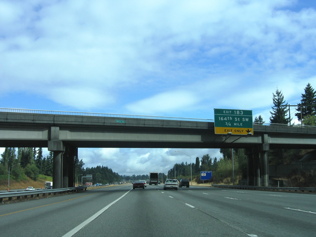
| Interstate 5 enters unincorporated Snohomish County at the stack interchange of Exit 182. 164th Street SW meets the freeway next at a six-ramp parclo interchange (Exit 183). 08/30/06 |
|
| Travelers entering Interstate 5 north from Interstate 405 north form an auxiliary lane for 164th Street SW (Exit 183). 08/30/06 |
|
| 164th Street SW leads west to SR 99 at north Lynnwood and east to SR 527 (Bothel Everett Highway) at Mill Creek. The stretch between 35th Avenue W and Interstate 5 was once a part of SR 525 before the state route shifted to its freeway. 08/30/06 |
|
| Exit 183 leaves opposite a bus-only ramp to the Ash Way Park & Ride facility north of 164th Street SW. 164th Street becomes Mill Creek Road at SR 527 and Wintermutes Corner. 08/30/06 |
|
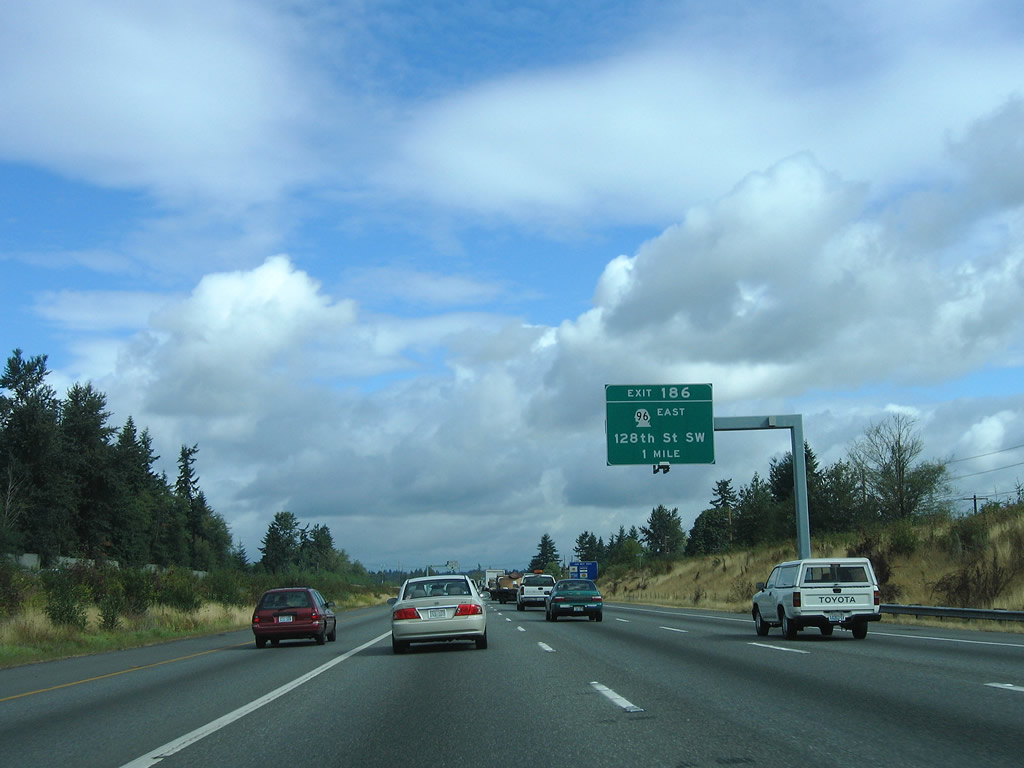
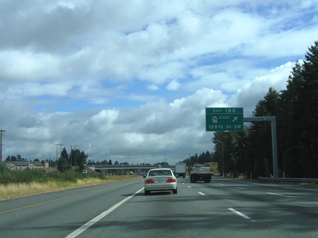
| SR 96 (128th Street) connects Interstate 5 at Exit 186 with Mll Creek to the east. The state route travels just 6.75 miles from the freeway to SR 9 south of Snohomish. 08/30/06 |
|
| Northbound Interstate 5 at the Exit 186 diamond interchange with SR 196 (128th Street SE) to Murphys Corner and Mill Creek and 128th Street NW to Airport Road and Paine Field / Snohomish County Airport (PAE). 08/30/06 |
|
| Interstate 5 travelers enter the city limits of Everett west of Silver Lake. 08/30/06 |
|
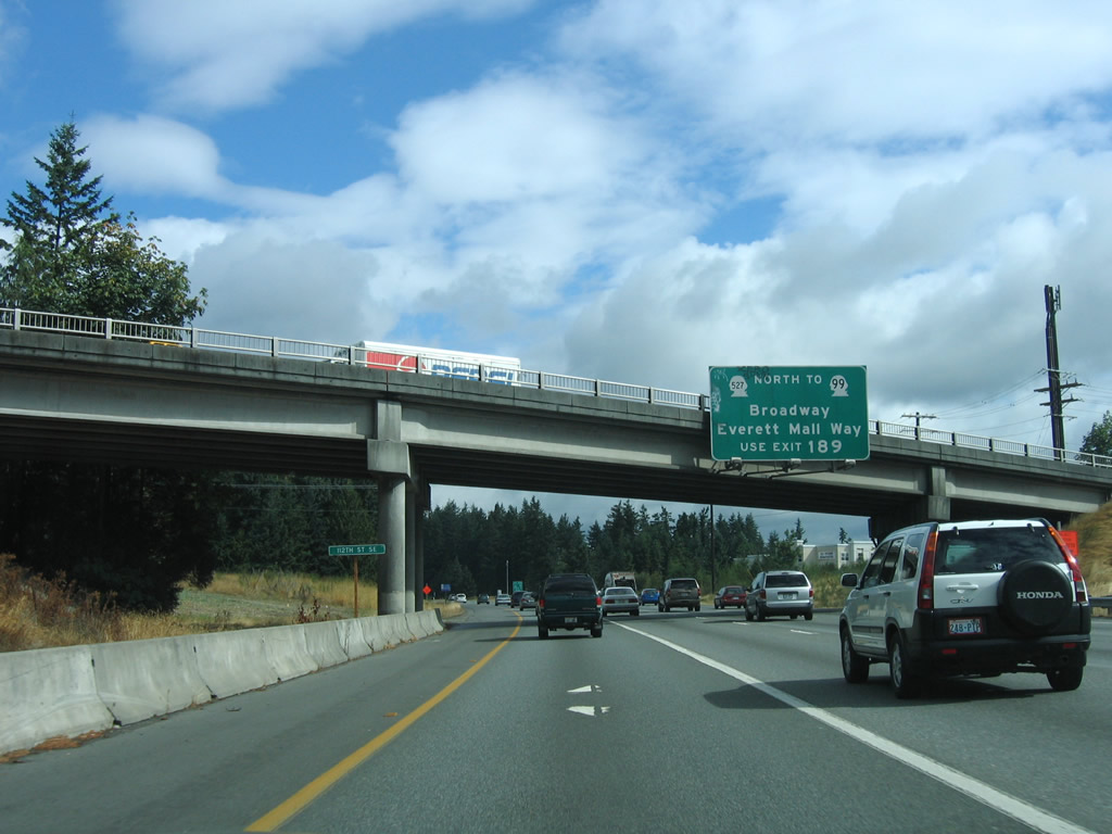
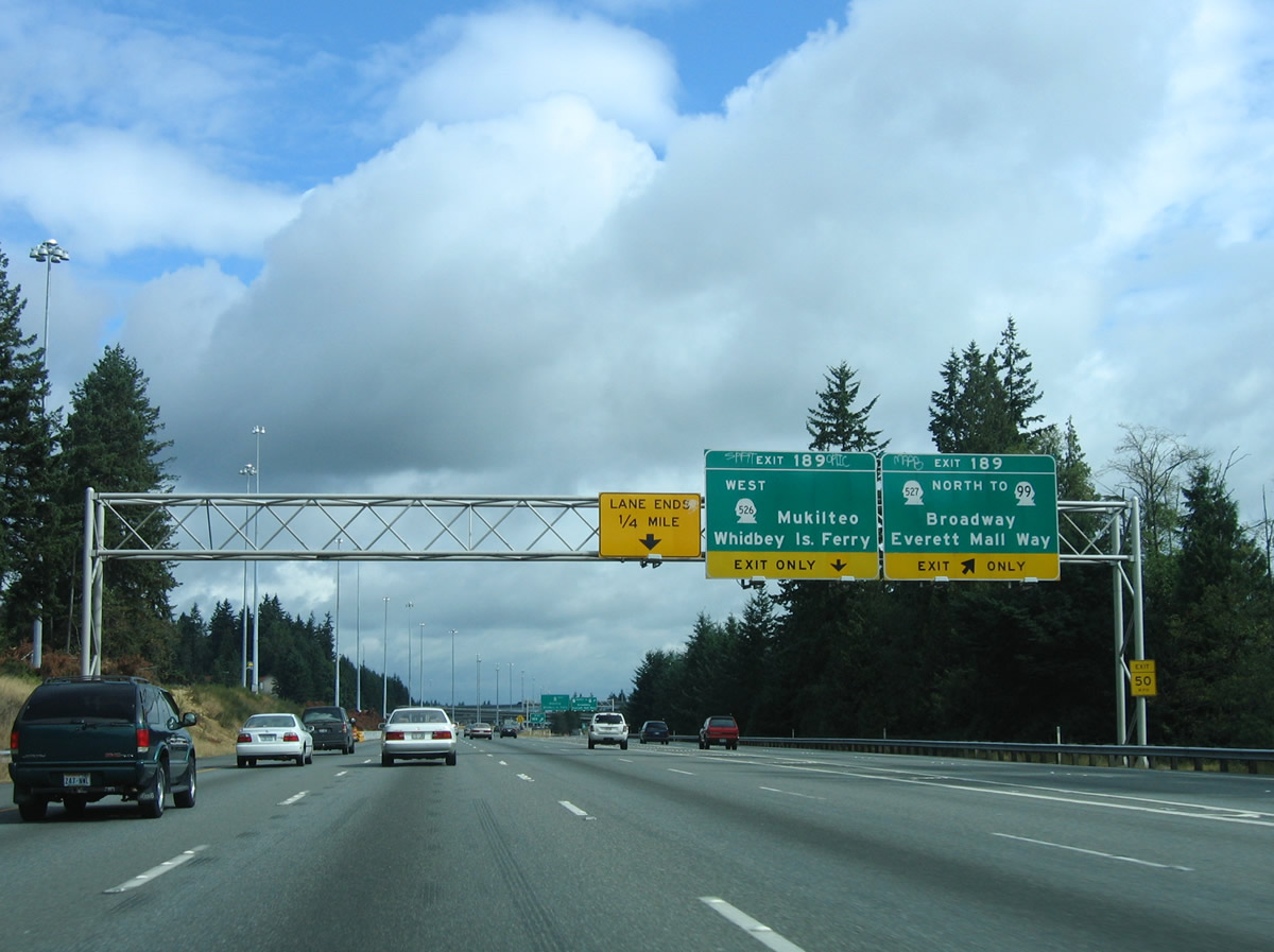
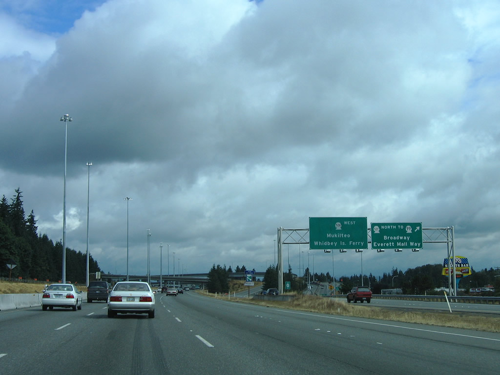
| Next in line for northbound drivers is the Exit 189 directional interchange complex with SR 99 (Broadway / Everett Mall Way) south, SR 526 (Boeing Freeway) west, and SR 527 (19th Avenue). 08/30/06 |
|
| SR 527 follows 19th Avenue north from Murphys Corner and Mill Creek to end at SR 99-526 and Interstate 5 in south Everett. The state route facilitates movements from Interstate 5 north at Exit 189 to SR 99 (Broadway) south to Everett Mall and Broadway north into the Pinehurst community. 08/30/06 |
|
| A two lane ramp leaves Interstate 5 north at Exit 189. Departing first is the ramp to SR 527 (19th Avenue SE) at El Capitan Way. SR 527 winds west over Interstate 5 to end at SR 99 (Broadway) and the Boeing Freeway westbound on-ramps to SR 526. SR 99 ends its 49.13 mile route via Everett Mall Way and Broadway northeast from old U.S. 99 (Evergreen Way) near Intercity. 08/30/06 |
|
| A flyover ramp meanwhile shuttles motorists westward onto SR 526 (Boeing Freeway) to Mukilteo and SR 525 to the Whidbey Island Ferry. SR 526 constitutes a 4.52 mile route that serves the Boeing Company plant of Everett, Paine Field, and SR 525 north from Nelsons Corner. 08/30/06 |
|
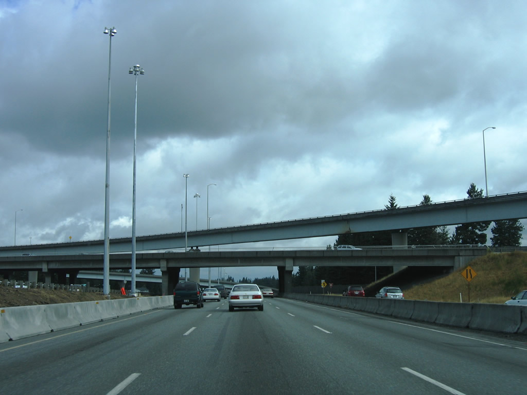
| SR 527 (19th Avenue SE) passes over Interstate 5 below flyover ramps to and from the Boeing Freeway above. 08/30/06 |
|
| The next series of photos show Interstate 5 north during early stages of a freeway expansion project that brought the roadway to five overall lanes (four general purpose, one carpool). An interchange sequence sign highlights the next three Everett interchanges. Exits 192 and 193 serve the city center. 08/30/06 |
|
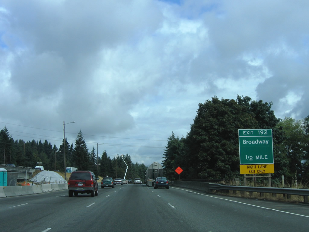
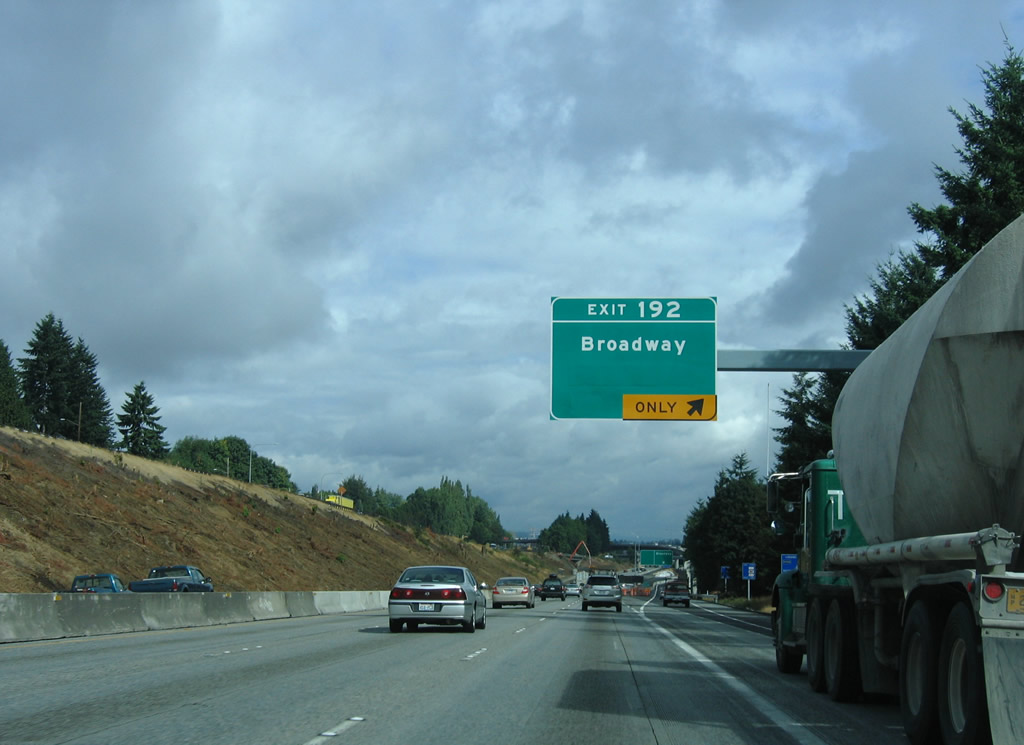
| Temporary guide sign for the one half mile approach to Exit 192 ramps to Broadway north and 41st Street. 08/30/06 |
|
| Construction at Exit 192 shifted the original left side off-ramp to Broadway into an HOV-2 based ramp and added a flyover ramp from the general purpose lanes of Interstate 5 north to the parallel roadway. A large retaining wall now rises along the HOV-2 lanes for Interstate 5 south. 08/30/06 |
|
| Exit 192 partitions into the aforementioned flyover to Broadway and a single point urban interchange (SPUI) with 41st Street). 41st Street comprises a short arterial west to Rucker Avenue (historic U.S. 99). Broadway provides a direct route into downtown. 08/30/06 |
|
| A look at early construction of the SPUI between Interstate 5 and 41st Street in Everett. 08/30/06 |
|
| A half diamond interchange follows between Interstate 5 north and Pacific Avenue (Exit 193). This exit serves Everett Station, the Everetts Events Center, and the northbound beginning of SR 529 (Maple Street north to Everett Avenue west). SR 529 constitutes a 5.88 mile urban loop through Everett to Marysville. 08/30/06 |
|
| Just east of downtown Everett is the eastbound beginning of U.S. 2. U.S. 2 technically begins and ends at parallel SR 529 (Maple Street), but these intersections (California Street west / Hewitt Avenue east) lie next to tri-level stack interchange with Interstate 5 (Exit 194). U.S. 2 spurs east two miles to SR 204 and seven miles southeast to Snohomish along a varying freeway and expressway alignment. Further east, the US highway continues across Stevens Pass to Wenatchee. The western branch of U.S. 2 travels 2,119 miles between Everett and Interstate 75 at St. Ignace, Michigan. 08/30/06 |
|
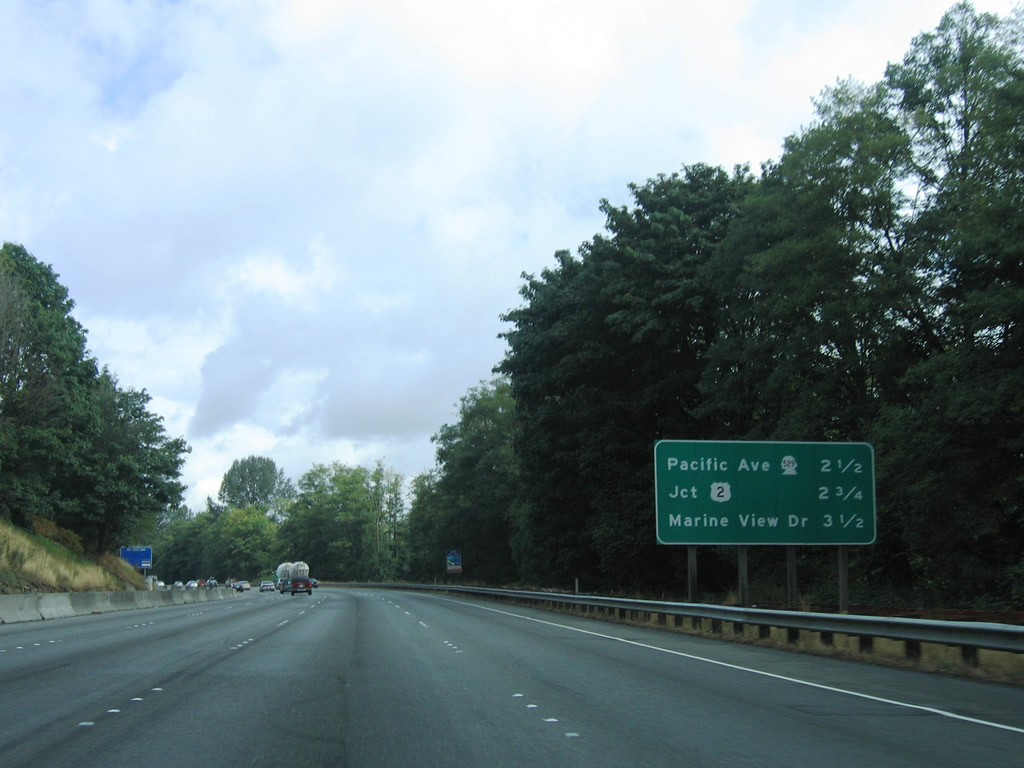
| Interstate 5 travels below grade from U.S. 2 to the Exit 195 half diamond interchange with Marine View Drive and East Grand Avenue. Sign replacements during construction if Interstate 5 eliminated the pull-through panel pictured here and removed Port of Everett from Exit 195 overheads. 08/30/06 |
|
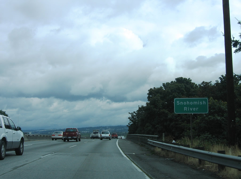
| Marine View Drive winds north along industrial areas of the Snohomish River to the Port at Preston Point. Trucks to U.S. Naval Station Puget Sound and the Port of Everett are directed onto this route, which eventually becomes a part of SR 529 (west of Broadway). Grand Avenue East meanwhile leads south to Everette Avenue by Exit 194. 08/30/06 |
|
| Six lanes of Interstate 5 span the Snohomish River and enter a swampy area of Everett to Steamboat Slough. 08/30/06 |
|
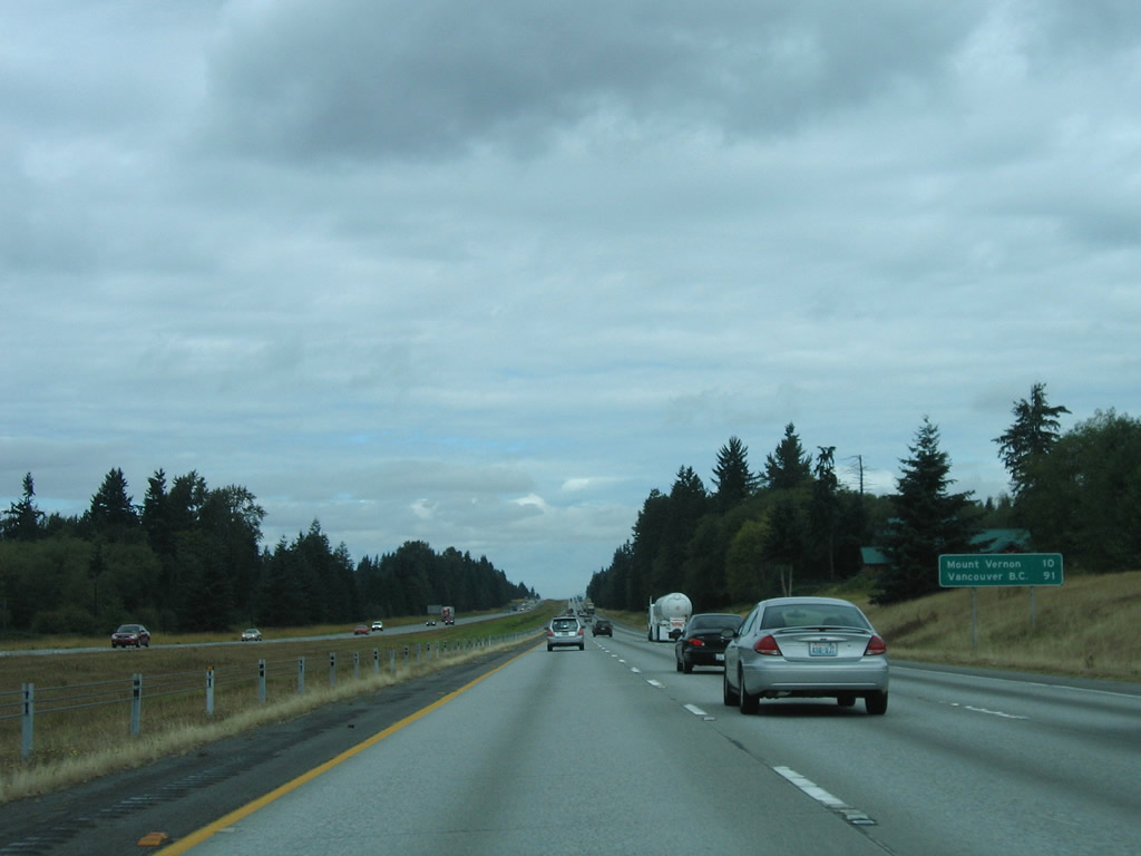
| Nearing the 12th Street NE overpass along Interstate 5 parallel to the Snohomish River. A northbound distance sign lists the distances to the next city, Marysville, the Skagit County seat of Mount Vernon, and Vancouver, British Columbia (via B.C. 99). 08/30/06 |
|
| Four exits serve Marysville, the first of which joins Interstate 5 with SR 528 (4th Street) at Marine Drive NE. 08/30/06 |
|
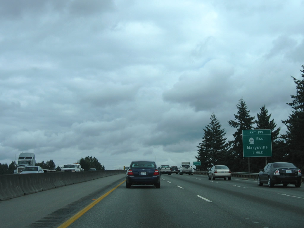
| A partial interchange adds traffic from SR 529 north ahead of the Ebey Slough bridge into Marysville. The added lane defaults into the Exit 199 diamond interchange with SR 528 east and Marine Drive NE west. SR 528 travels 3.46 miles overall between Interstate 5 and SR 9. 08/30/06 |
|
| Exit 199 leaves Interstate 5 for SR 528 (4th Street) east to the city center and Marine Drive NE west to Priest Point Grange and Tulalip along Possession Sound. 08/30/06 |
|
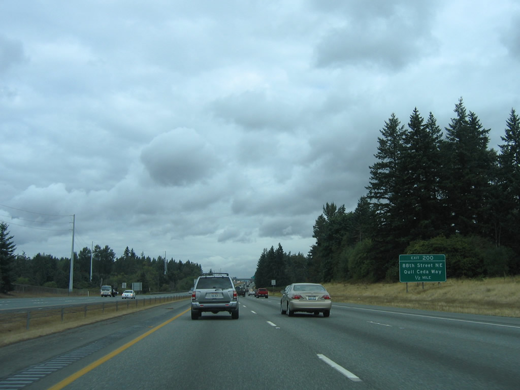
| Interstate 5 straddles the Marysville city and Tulalip Indian Reservation boundary northward through Exit 202. Exit 200 lies ahead with 88th Street NE east and Quil Ceda Way west. A visitors information center is available via Exit 200. 08/30/06 |
|
| 88th Street NE leads east to State Avenue (former U.S. 99) and 67th Avenue NE in Marysville. Quil Ceda Way continues the road west to 27th Avenue NE. Development in the form of the Tulalip Resort Casino, the Seattle Premium Outlets, and traditional big box retail line Quil Ceda Boulevard along the southbound side of Interstate 5. 08/30/06 |
|
| Reassurance marker posted for Interstate 5 after the Exit 200 on-ramp. 08/30/06 |
|
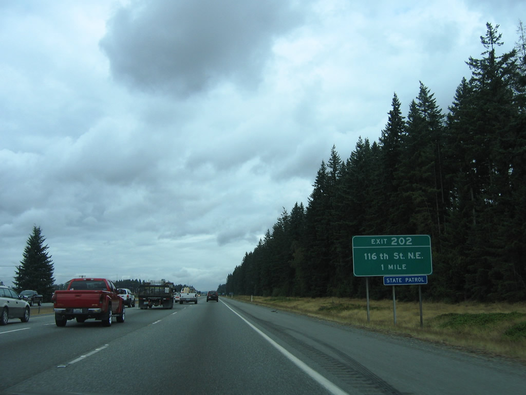
| Meeting Interstate 5 at the Exit 202 diamond interchange is 116th Street NE near Kruse in north Marysville. 08/30/06 |
|
| Exit 202 parts ways with Interstate 5 north at an abandoned railroad overpass for 116th Street NE. The east-west road joins the freeway with 27th Avenue NE and Smoky Point Boulevard nearby. Use Exit 202 for the Navy Support Complex. 08/30/06 |
|
| SR 531 (172nd Street NE) crosses paths with Interstate 5 at the Exit 206 diamond interchange midway between Lakewood and Smokey Point. 08/30/06 |
|
| A 9.88 mile route, SR 531 stems west from SR 9 through Arlington to end at Wenberg State Park. The state route serves Arlington Municipal Airport (AWO) that is home to the WSDOT Aviation Division to the east. 08/30/06 |
|
| Interstate 5 straddles the Arlington city line to the first rest area facility since Federal Way. 08/30/06 |
|
| Rest area facilities are available to both north and southbound Interstate 5 at Arlington. 08/30/06 |
|
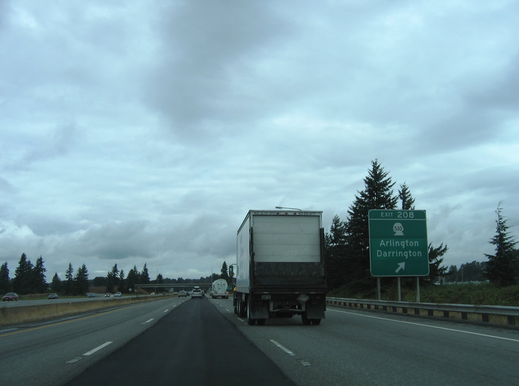
| One mile south of the Exit 208 diamond interchange with the eastbound beginning of SR 530. SR 530 constitutes a 50.52 mile route from Arlington northeast to Darrington and Rockport (SR 20). 08/30/06 |
|
| Northbound at the Exit 208 ramp departure for SR 530 east and Pioneer Highway west. SR 530 meets SR 9 (Hazel Street) 3.84 miles to the east near the Arlington city center. Pioneer Highway (former SR 530) stems west to Silvana and East Stanwood. The stretch of state route west of Interstate 5 was decommissioned in 1991.2 08/30/06 |
|
| 236th Street NE sees a diamond interchange with Interstate 5 between its crossing of the Stillaguamish River and Pilchuck Creek at Exit 210. 08/30/06 |
|
| Spanning the Stillaguamish River along Interstate 5 north. Northbound drivers use a 1971-constructed bridge. Southbound uses a steel through truss bridge built in 1933 as part of original U.S. 99. 08/30/06 |
|
| The next two cities of significance are Mount Vernon in 17 miles and the Whatcom County seat of Bellingham in 44 miles. 08/30/06 |
|
| 236th Street NE winds west to former SR 530 (Pioneer Highway) near Silvana and east to 35th Avenue NE from Exit 210 of Interstate 5. 08/30/06 |
|
| Continuing northwest from the crossing of Pilchuck Creek along Interstate 5 north. 08/30/06 |
|
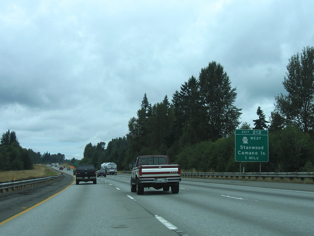
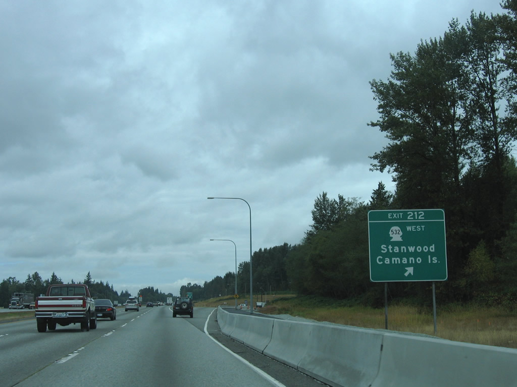
| One mile south of the westbound beginning of SR 532 (Exit 212) on Interstate 5 north. SR 532 constitutes one of two routes to Island County from the Washington main land. 08/30/06 |
|
| A 10.09 mile route, SR 532 spurs west through the city of Stanwood to an endpoint at Terrys Corner on Camano Island. The state route ends at the North Camano and East Camano Drive split to Utsalady and Camano State Park respectively. 268th Street NW otherwise ventures east from Exit 212 to Bryant and SR 9. 08/30/06 |
|
| Interstate 5 maintains a northwest trajectory and next sees a northbound side weigh station. 08/30/06 |
|
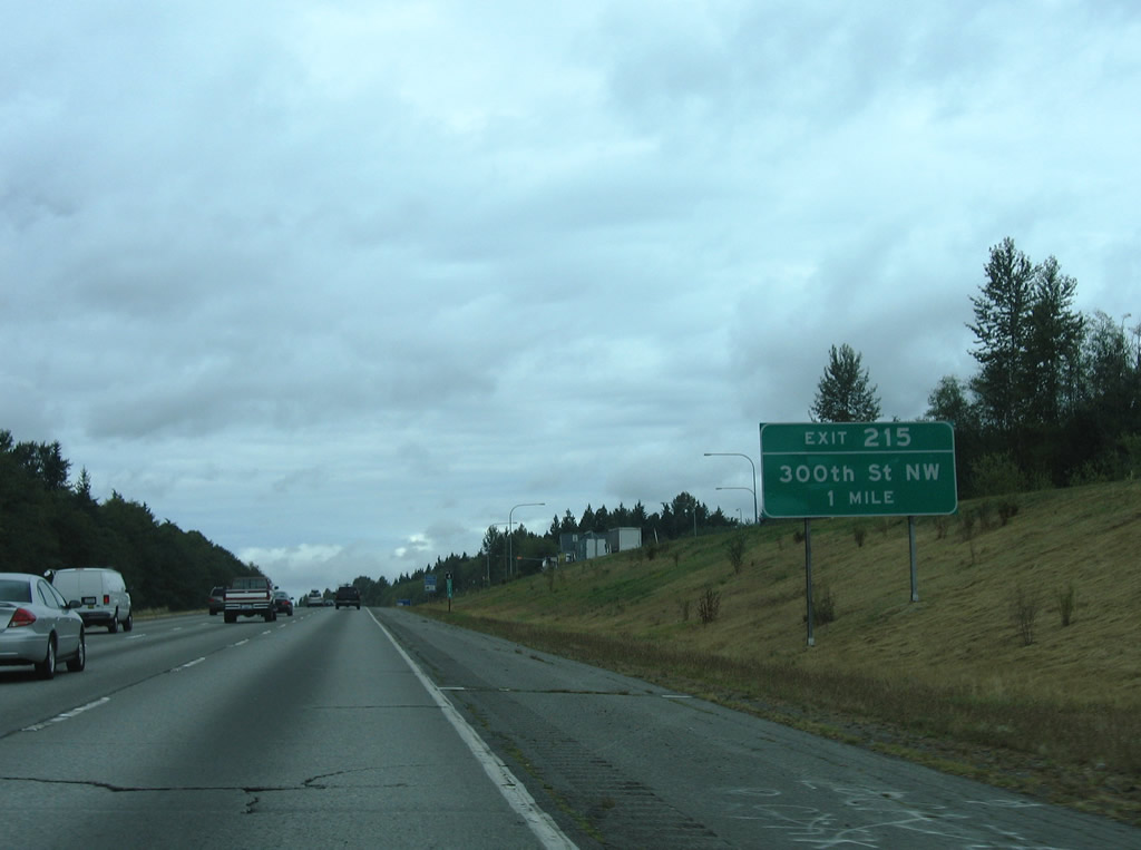
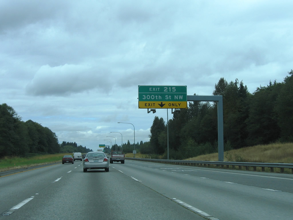
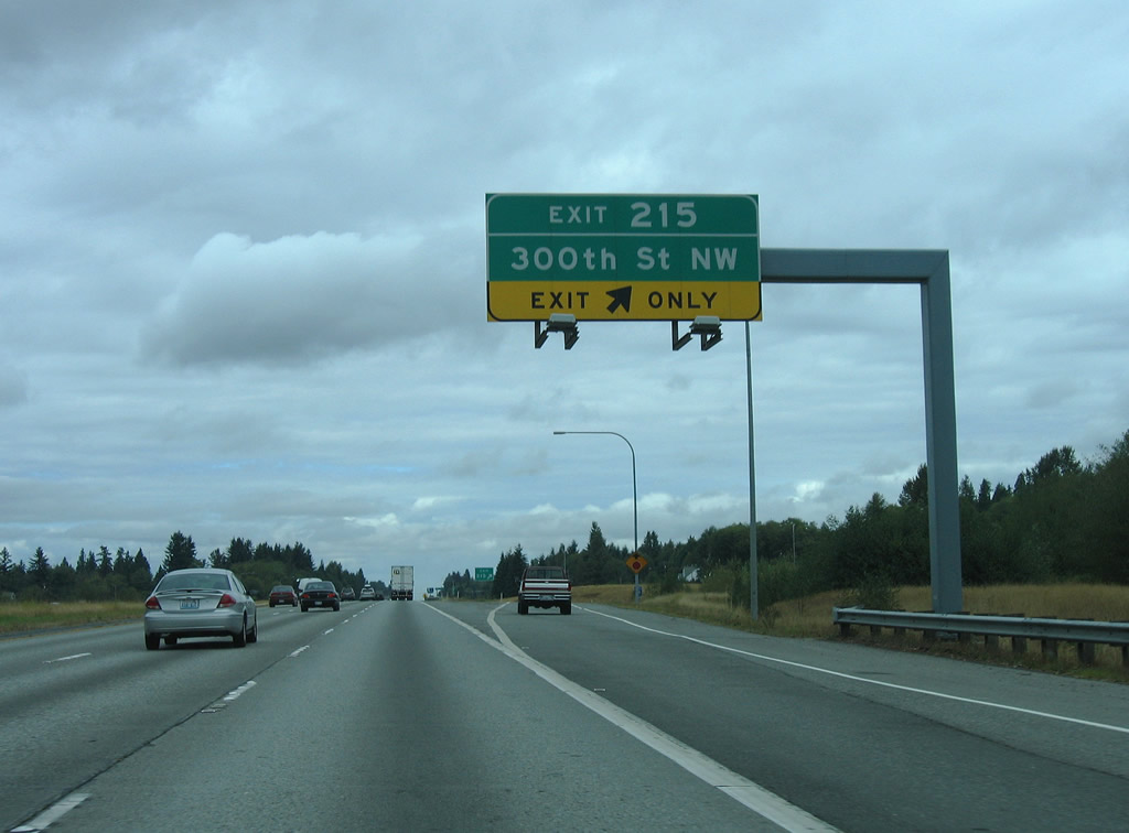
| Exit 215 with 300th Street NW follows at a diamond interchange. 08/30/06 |
|
| The weigh station on-ramp forms an auxiliary lane to Exit 215. 300th Street NW heads west to Pioneer Highway (old SR 530) north of Stanwood. 08/30/06 |
|
| Exit 215 leaves Interstate 5 north for 300th Street NW. Old U.S. 99 lines the westbound side of the freeway and separates segments of 300th Street NW. Eastward, the local road ends at a rural residential area. 08/30/06 |
|
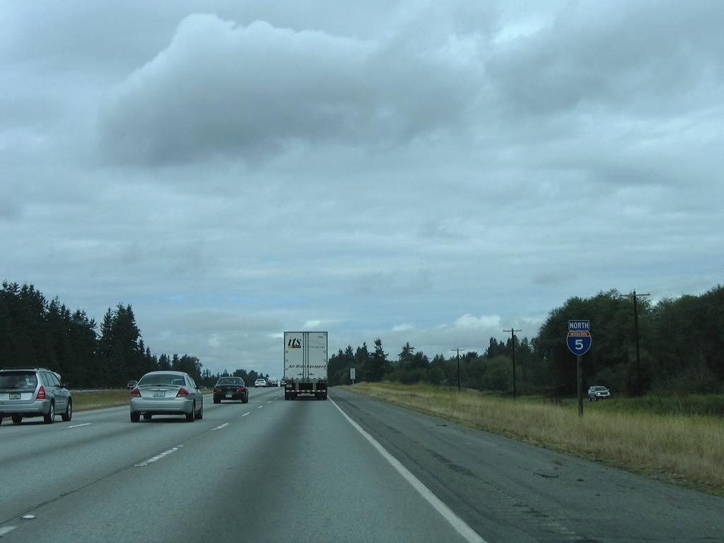
| Now ten miles south of the Skagit County seat of Mount Vernon along Interstate 5 north. Vancouver, British Columbia is within 100 miles. 08/30/06 |
|
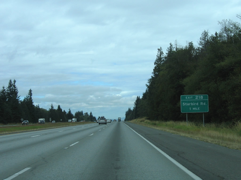
| Starbird Road intersects Interstate 5 at the Exit 218 diamond interchange east of Milltown. 08/30/06 |
|
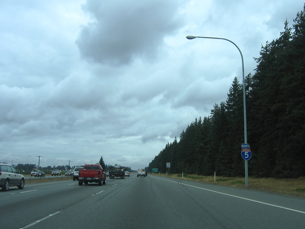
| The 39.89 miles of I-5 through Snohomish County conclude as the freeway enters Skagit County. 08/30/06 |
Page Updated 09-22-2010.

 North
North