Old U.S. 80 (Frontage Road) ties into the diamond interchange (Exit 73) with Aztec Road at Aztec, Arizona from the south. 05/31/21
|
| Old U.S. 80 parallels Interstate 8 from Gila Bend to San Diego, and several of the historic alignments can still be traveled from Exit 54 west to Yuma. The Gila River follows the freeway between Gila Bend and Yuma, but I-8 never crosses it. 12/23/09 |
|
| The speed limit along Interstate 8 between Gila Bend and Dome Valley just east of Yuma is 75 miles per hour. 05/31/21 |
|
| Interstate 8 runs alongside the Union Pacific Railroad west to a diamond interchange (Exit 111) with Citrus Valley Road. 04/07/13 |
|
| Citrus Valley Road stems north from the Frontage Road (old U.S. 80) at Smurr to adjacent agricultural areas and the Gila Bend Indian Reservation. 05/31/21 |
|
| The Gila Bend Mountains rise to the north beyond Citrus Valley. 05/31/21 |
|
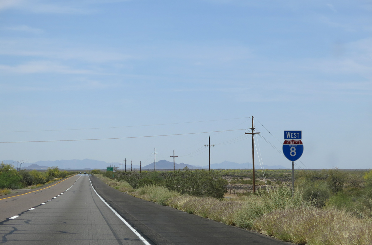
| Interstate 8 continues 286 miles west from Smurr to San Diego, California. 05/31/21 |
|
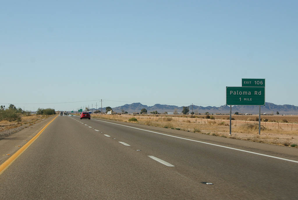
| Paloma Road provides local access to ranches and desert areas, including Theba, which is just south of Exit 106. 12/23/09 |
|
| Much of the area to the south of Interstate 8 is inaccessible as it is part of the Barry M. Goldwater Air Force Range. Access to this vast land is restricted to military purposes and is dangerous due to the presence of ordnance. 04/07/13 |
|
| Westbound Interstate 8 reaches Exit 106 for Paloma Road to Paloma and Theba. 05/31/21 |
|
| The previous distance sign posted beyond Exit 106 omitted Road for Sentinel. 04/07/13 |
|
| Forthcoming Painted Rock Dam Road represents the last in a series of ranch exits for agricultural areas west of Yuma. 04/07/13 |
|
| Painted Rock Road travels 11 miles north to the Painted Rock Dam on the Gila River and the Painted Rock Petroglyph Site, which offers camping, hiking and picnicking. 04/07/13 |
|
| The Painted Rock Mountains are visible to the northwest. They line the Gila River as it winds westward toward the Colorado River. 04/07/13 |
|
| Exit 102 departs I-8 for Painted Rock Dam Road north and old U.S. 80 (Frontage Road) west to the UP Railroad siding of Pieda. This is the last exit for 14 miles. 05/31/21 |
|
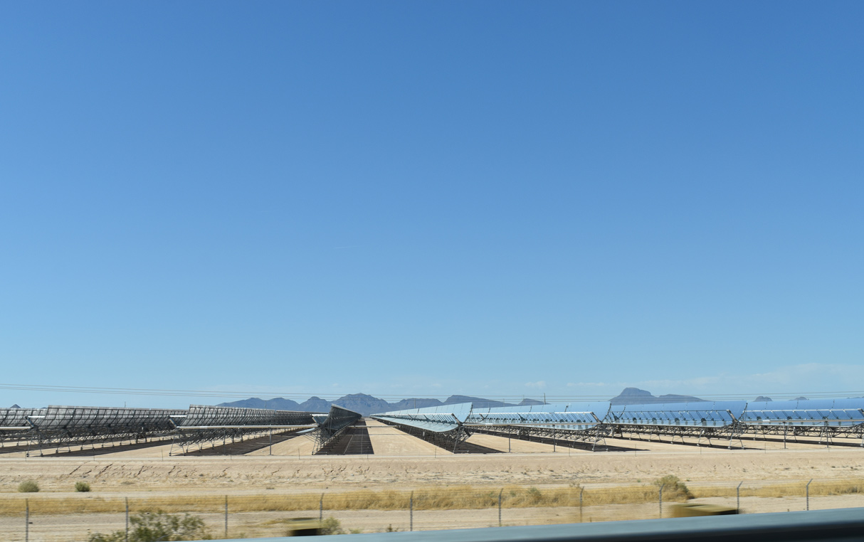
| The Atlantica Solana Generating Station spreads to the north of Interstate 8 and west of Painted Rock Dam Road. 05/31/21 |
|
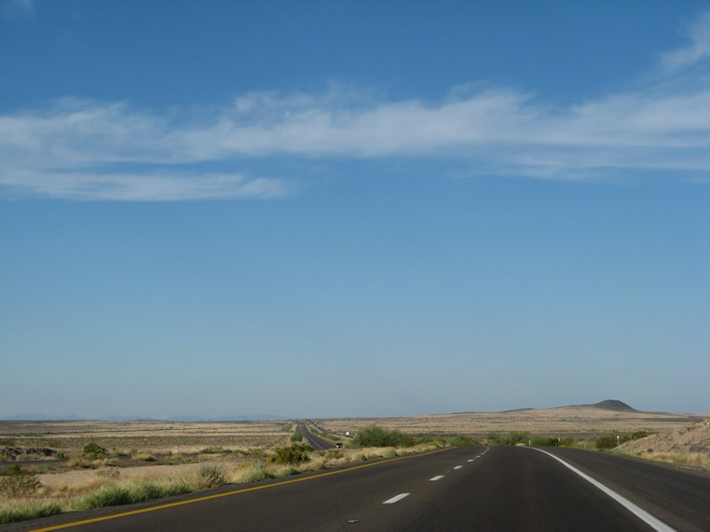
| Interstate 8 continues west through the Sonora Desert and Gila River valley toward Yuma. 05/31/21 |
|
| Interstate 8 traverses desert north of Tarton Flat and south of Sentinel Peak. 03/19/07 |
|
| Interstate 8 west next meets Agua Caliente Road at a diamond interchange (Exit 87) near the community of Sentinel. 04/07/13 |
|
| Agua Caliente Road extends north from Exit 87 to the ghost towns of Agua Caliente and Hyder. Once known as a hot springs and resort community, all that remains of Agua Caliente are several structures dating back from the late 1800s to early 1900s and a dry spring. 04/07/13 |
|
| Located north of the Agua Caliente Mountains in Yuma County, the ghost town of Hyder was the site where George S. Patton trained some of his troops during World War II. Hyder was also the site of an Amtrak train derailment that was caused by terrorism on October 9, 1995, resulting in one death and 78 injuries.1 05/31/21 |
|
| Sentinel is located along a former extant section of Old U.S. 80 near the interchange (Exit 87) with Agua Caliente Road. The community consists of several residences, a school, and a gas station. 05/31/21 |
|
| A vintage gas station lines the northern frontage road (old U.S. 80) at Exit 87 (Agua Caliente Road). The next services are located 20 miles to the west in Dateland. 05/31/21 |
|
| Interstate 8 advances west from Sentinel Plain to the Sentinel Rest Area. 04/07/13 |
|
| Located ahead of Exit 54, the Mohawk Rest Area is located 29 miles further. 04/07/13 |
|
| The Sentinel Rest Area lies near mile marker 85 along Interstate 8 west. 05/31/21 |
|
| Interstate 8 continues west along the UP Railroad by Stanwix Flats. 04/07/13 |
|
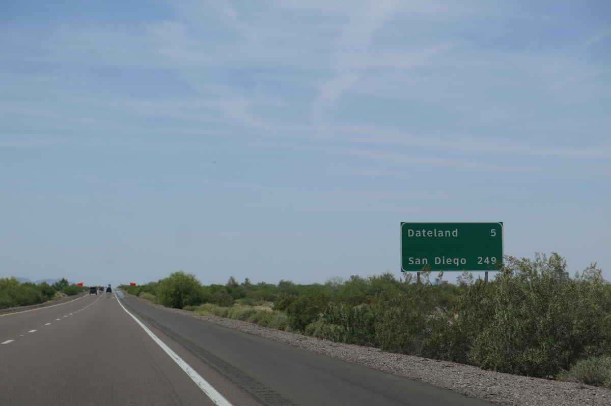
| Located within the San Cristobal Valley, the settlement of Dateland is next along Interstate 8 in 16 miles. 12/23/09 |
|
| Interstate 8 crosses the Yuma County line just west of the UP Railroad siding of Stanwix. 05/31/21 |
|
| The forthcoming diamond interchange (Exit 78) with Spot Road serves local traffic and connects to Stanwix via dirt roads, including extant sections of Old U.S. 80. 12/23/09, 05/31/21 |
|
| Westbound Interstate 8 reaches the ranch exit for Spot Road and Stanwix. 05/31/21 |
|
| A U.S. Border Patrol Checkpoint was active along I-8 eastbound within the exchange at Spot Road on this day. The exact location of the checkpoints vary along the route of Interstate 8. 04/07/13 |
|
| Interstate 8 bee lines west to Exit 73 for Aztec Road beyond Tenmile Wash. 05/31/21 |
|
| No services are available at the Aztec Road exit, but some minor sections of old U.S. 80 can be found on the north side of Interstate 8. 04/07/13 |
|
| Westbound I-8 at the diamond interchange (Exit 73) for Aztec Road. Aztec is another ghost town along the Interstate 8 corridor. 04/07/13 |
|
| Confirming marker posted west at Aztec. 03/19/07 |
|
| Interstate 8 diverges from the parallel Union Pacific Railroad line on the five miles leading to Dateland. The Mohawk Rest Area follows in 16 miles. 04/07/13 |
|
| I-8 meets Avenue 64E at Dateland. The Yuma County road numbering system is based on mileage from Yuma at the western end of the county. Therefore Avenue 64E is approximately 64 miles from the Yuma city center. 12/23/09 |
|
| Dateland is perhaps most famous for its Medjool Dates, but it was also one of General George S. Patton's training camps. Airstrips and related facilities from World War II are still present but are generally no longer in use. 05/31/21 |
|
| Exit 67 leaves I-8 west for Avenue 64E. Agriculture is a major component of the local economy, with dates, citrus and a dairy located in and around Dateland. Dateland is famous for date shakes that can be purchased at the service station on the south side of the freeway. 05/31/21 |
|
| Areas south of Interstate 8 at Dateland fall within the Barry M. Goldwater Air Force Range. The military area continues west along I-8 almost to Yuma. 04/07/13 |
|
| Yuma lies 66 miles west of Dateland. San Diego, California is 242 miles away. 04/07/13 |
|
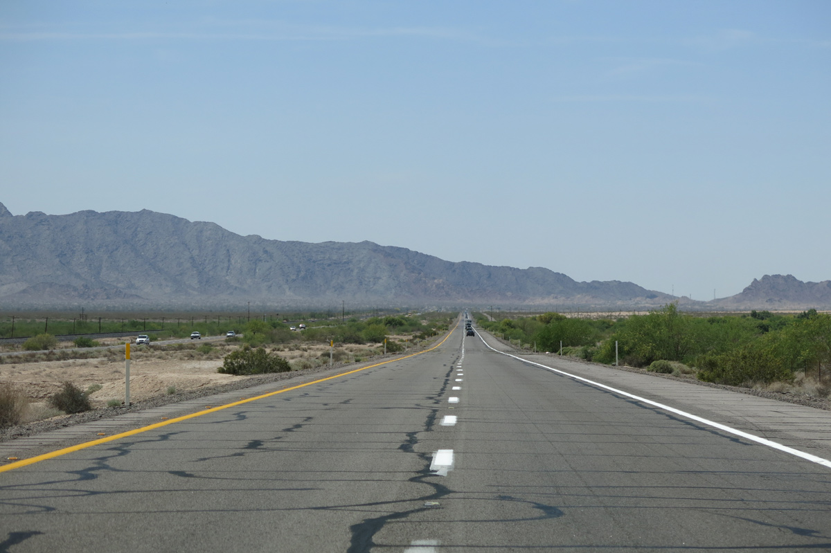
| With the Mohawk Mountains in the background, Interstate 8 shifts southward to again to run alongside the Union Pacific Railroad. 05/31/21 |
|
| Traversing San Cristobal Valley, Interstate 8 advances southwest across San Cristobal Wash to the Mohawk Mountains. 04/07/13 |
|
| The Mohawk Rest Area is the last along Interstate 8 in Arizona. The succeeding facility is the Sand Hills Rest Area, 73 miles to the west in California. 05/31/21 |
|
| Restrooms, vending machines and water are available at the Mohawk Rest Area. 05/31/21 |
|
| The Mohawk Rest Area lines both roadways along Interstate 8 at mile marker 56. 03/19/07 |
|
| Exit 54 departs I-8 west 0.75 miles from the Mohawk Rest Area onto adjacent Old U.S. 80 near Avenue 52E to Mohawk Valley. 04/07/13 |
|
| West from Exit 54 to Dome Valley, old U.S. 80 is an extant paved highway, paralleling the north side of I-8 to the Gila Mountains. Avenue 52E stems north from nearby toward the Gila River. 05/31/21 |
|
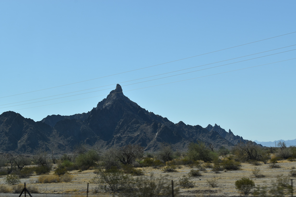
| Mohawk Peak rises to the north of Mohawk Pass along Old U.S. 80 within the Mohawk Mountains. 05/31/21 |
|
| RIRO ramps link I-8 with Old U.S. 80 at Exit 54. Old U.S. 80 parallels the Union Pacific Railroad west into the Mohawk Valley, meeting I-8 again at Exit 21 near Ligurta.
05/31/21 |
|
| Ascending into the Mohawk Mountains from Exit 54, Interstate 8 spans the UP Railroad by this confirming marker. 04/07/13 |
|
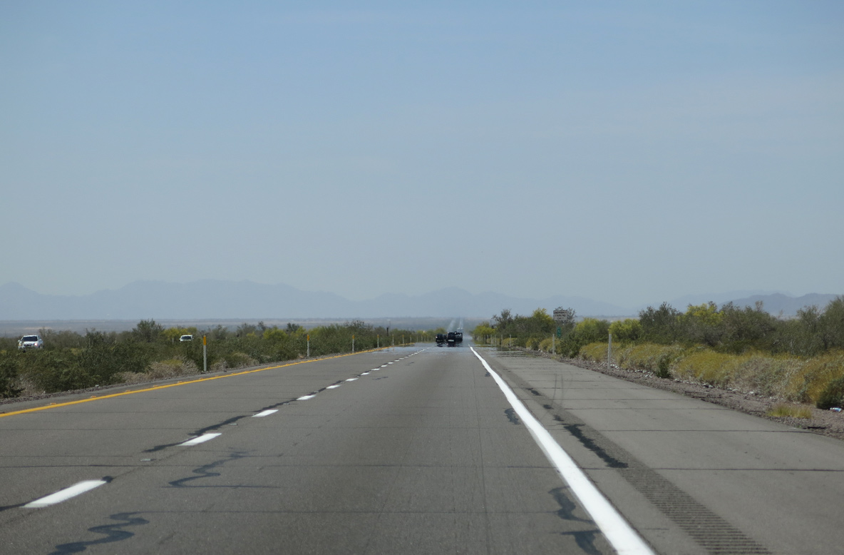
| Progressing 12 miles west to Tacna within the Mohawk Valley, irrigated areas become more common along Interstate 8. 05/31/21 |
|
| Interstate 8 crosses the Mohawk Mountains around an elevation of 600 feet above sea level, the terrain levels out along the ensuing stretch across Mohawk Valley. 04/07/13 |
|
| Some of the desert within the Mohawk Valley is agricultural and heavily irrigated. Annual rainfall is very limited in this arid part of Arizona. 04/07/13 |
|
| Advancing west from Mohawk Wash, I-8 gradually rises from 320 feet above sea level to around 360 feet at Exit 42 for Avenue 40E and Tacna. 04/07/13 |
|
| Avenue 40E links Interstate 8 with adjacent Old U.S. 80 at the Tacna street grid. Home to 637 as of the 2020 Census, gas and food are available at Tacna. 05/31/21 |
|
| Westbound Interstate 8 at the diamond interchange (Exit 42) with Avenue 40E in Tacna. 04/07/13 |
|
| Reassurance marker posted west of Exit 42 at Tacna. 03/19/07 |
|
| Rural grids of residential streets spread south of I-8 and north of Old U.S. 80 along the ensuing three mile stretch to Exit 37 for Avenue 36E. 04/07/13 |
|
| The diamond interchange at Exit 37 joins Interstate 8 with Avenue 36E by the UP Railroad siding of Noah. 05/31/21 |
|
| Located both beyond Antelope Hill and north of the Gila River in a large swath of agricultural land, the settlement of Roll lies 6.4 miles northeast of Exit 37. 04/07/13 |
|
| Much of the land south of Interstate 8 at Exit 37 remains with the Barry M. Goldwater Air Force Range, so it is possible to spot military planes in the vicinity. 05/31/21 |
|
| Interstate 8 west passes south of Wellton Mesa and Radar Hill on the succeeding stretch. 04/07/13 |
|
| Located seven miles ahead, the town of Wellton is the largest population center between Gila Bend and Yuma. 03/19/07 |
|
| Interstate 8 west crosses the Mohawk Canal, which provides irrigation water to the farms, dairies and other agricultural facilities scattered throughout the valley. A very large dairy ranch with herds of cattle can be seen on the north side of parallel Old U.S. 80. 04/07/13 |
|
| A lengthy bridge carries Avenue 33E over Interstate 8 and the Union Pacific Railroad (formerly Southern Pacific Railroad) near milepost 35 and Asher. 04/07/13 |
|
| The Gila Mountains come into view as Interstate 8 advances west to Exit 30 for Avenue 29E at Wellton. 05/31/21 |
|
| Managed by the Wellton-Mohawk Irrigation And Drainage District (WMIDD), Wellton Canal passes under Interstate 8 just ahead of Exit 30. The canal serves various farms and ranches in the Dome Valley-Wellton area. 04/07/13 |
|
| All motorist services are available in Wellton at Exit 30. Founded in 1878 and incorporated as a town in 1970, Wellton is named for the wells drilled by the Southern Pacific Railroad in search of water (hence the origin of the name Well Town). Agriculture, retired seasonal long term visitors, and through travelers keep the economy of the region growing. 05/31/21 |
|
| North to Old U.S. 80 in Wellton, Avenue 29E is William Street. The population of Wellton grew from 1,829 people as of the 2000 Census to 3,083 in the 2020 Census. 03/19/07 |
Page Updated 04-28-2022.

 West
West