
 East
East
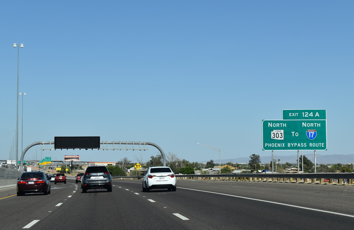
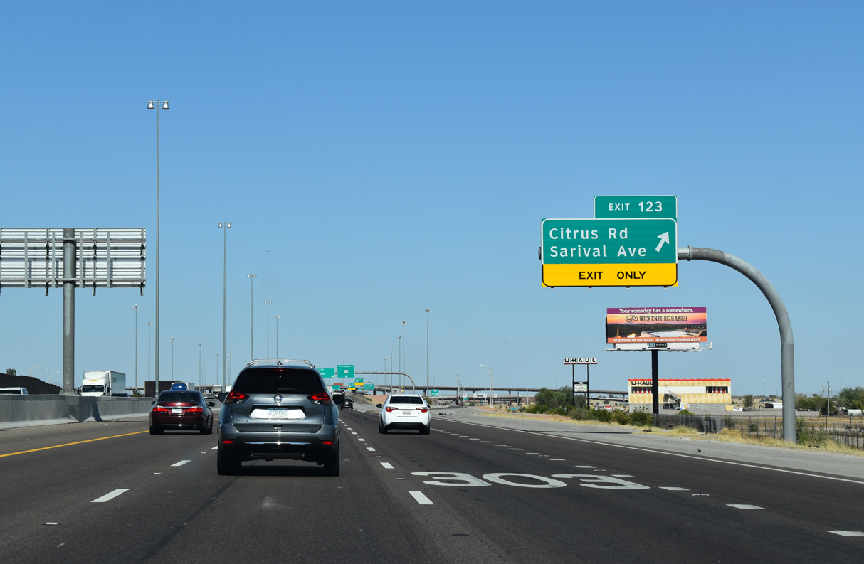
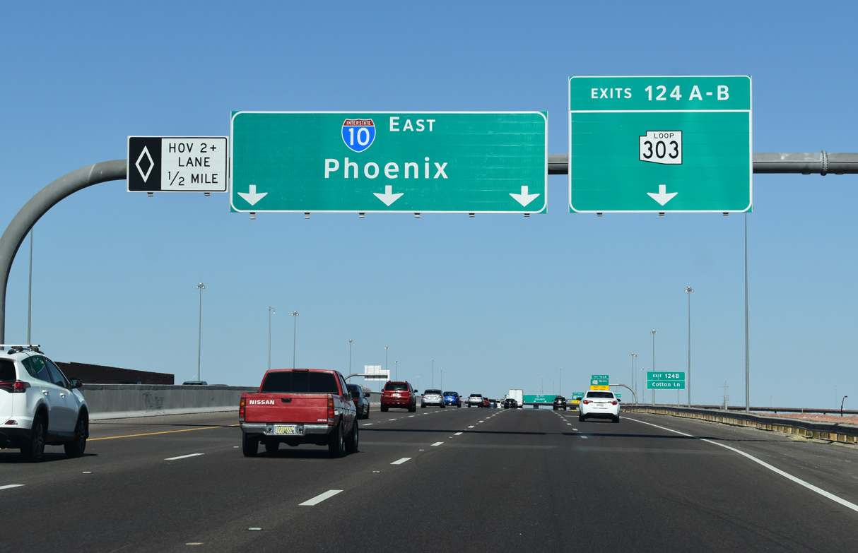
A half diamond interchange (Exit 123) joins I-10 east with Citrus road just ahead of the systems exchange (Exit 124) with Loop 303 (Bob Stump Memorial Parkway).
03/02/19
36.60 miles in length north from Cotton Lane at Canyon Trails Boulevard, Loop 303 provides a bypass route to Interstate 17 north at Exit 221.
05/28/21

03/02/19
05/28/21
Loop 303 travels north to Citrus Park, Wildlife World Zoo, Aquarium & Safari Park, Waddell and Surprise.
05/28/21
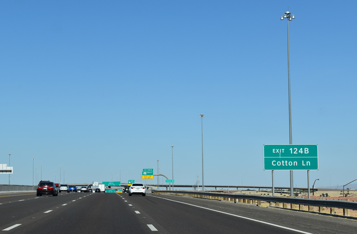
Cotton Lane was realigned as a frontage road due to construction of Loop 303 at Interstate 10. Cotton Lane extends south from the freeway end to the Estrella Mountain Ranch master-planned community.
05/28/21

Together with U.S. 60, Loop 303 connects with U.S. 93 northwest to Kingman and Interstate 11 from Hoover Dam to Las Vegas.
05/28/21

The four level interchange joining Interstate 10 and Loop 303 was completed in October 2017.
05/28/21

05/28/21

05/28/21

05/28/21

05/28/21
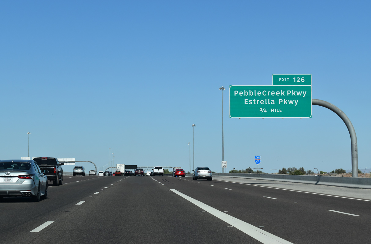
The diamond interchange at Exit 126 joins Interstate 10 east with Estrella Parkway south and Pebble Creek Parkway north.
05/28/21

03/01/19

05/28/21

05/28/21

Estrella Parkway south provides part of a route to Phoenix International Raceway (P.I.R.).
05/28/21

03/01/19

05/28/21

05/28/21

05/28/21

Litchfield Road heads north from the Goodyear city center to the diamond interchange at Exit 128.
05/28/21

Phoenix-Goodyear Airport (GYR) lies just west of Litchfield Road beyond Yuma Road. North of Litchfield Park, Litchfield Road continues to Luke Air Force Base.
05/28/21

03/01/19

Litchfield Road represents the first of five exits from eastbound Interstate 10 for the city of Avondale.
05/28/21

03/01/19

03/01/19

03/01/19

05/28/21
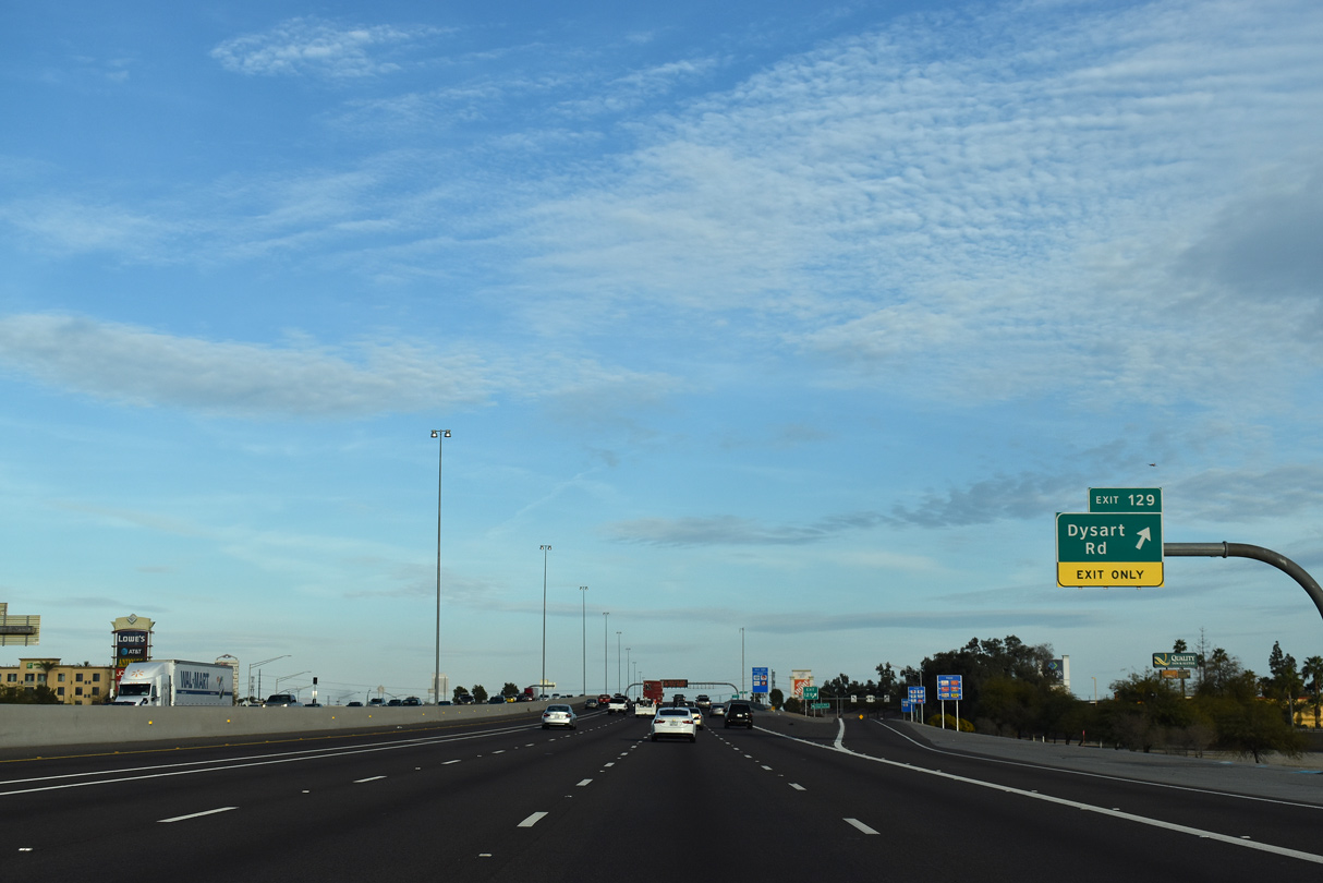
Dysart Road is a commercial arterial separating Goodyear from the city of Avondale at the diamond interchange (Exit 129) with Interstate 10.
03/01/19

03/01/19
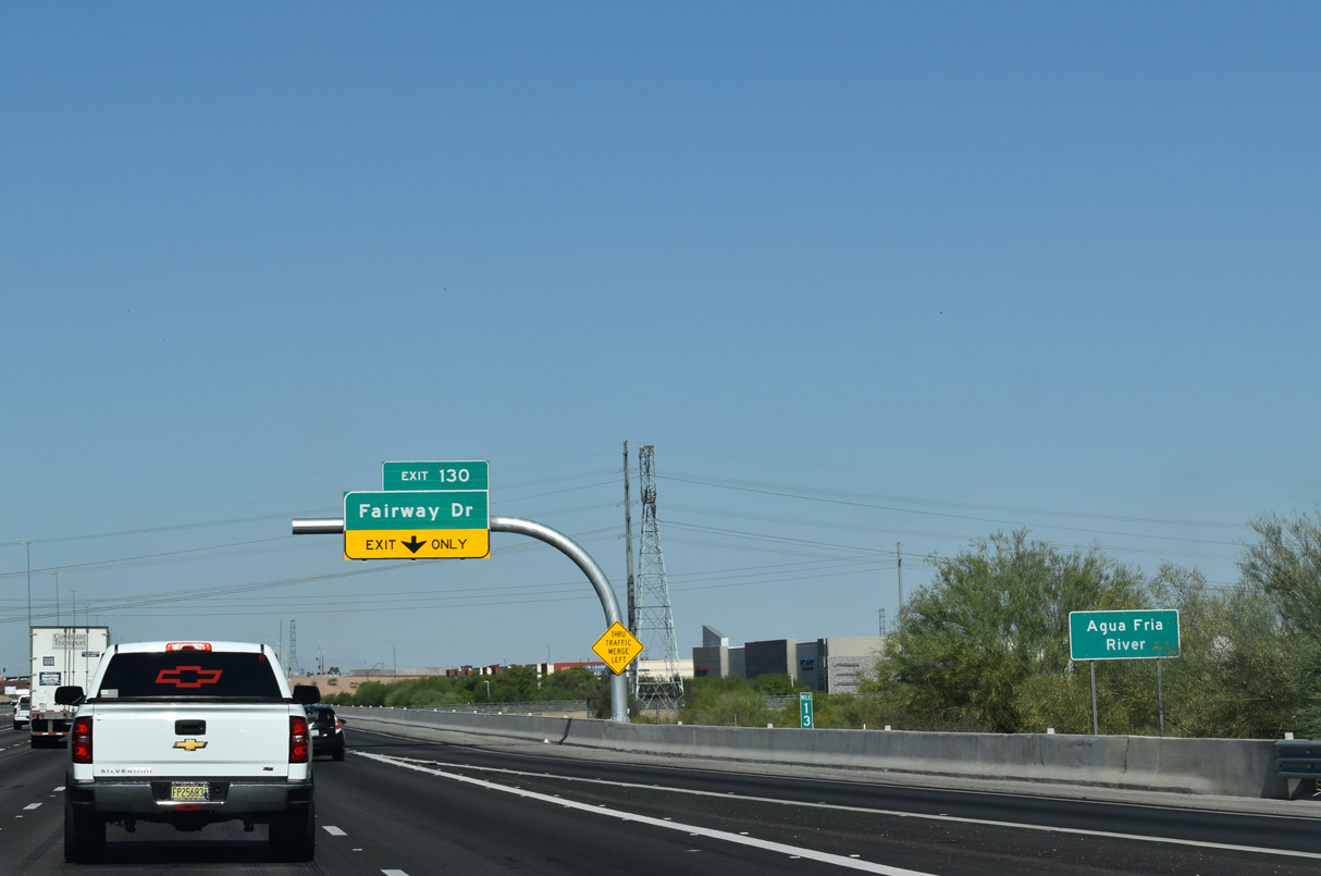
Interstate 10 spans the Agua Fria River just east of Dysart Road.
05/28/21

Costing $30 million, 14 months of construction for the diamond interchange (Exit 130) with Fairway Drive commenced in February 2019.1
05/28/21

05/28/21

05/28/21

Work on the exchange at Exit 130 included widening Fairway Drive from three to five lanes between Garfield Street and Van Buren Street. Manged by the city of Avondale, the final phase of construction was completed on January 25, 2021.2
05/28/21

Construction of Exit 130 included auxiliary lanes between Fairway Drive and exit 131 with Avondale Boulevard.
05/28/21

Avondale Boulevard used to be known as 115th Avenue.
03/01/19

Avondale Boulevard is the last named north to south arterial meeting Interstate 10 east until Tempe.
05/28/21

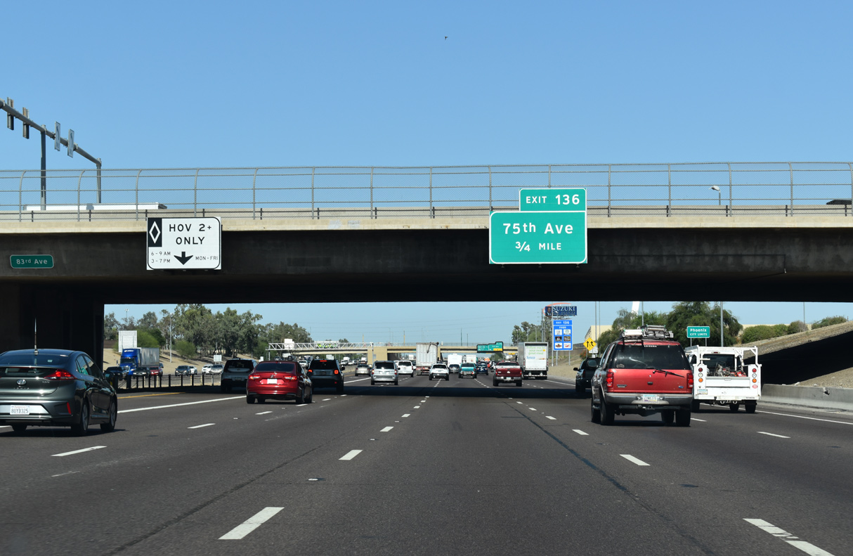
The next three exits are for 107th Avenue, 99th Avenue and Loop 101.
05/28/21

05/28/21

05/28/21

The directional T interchange between Interstate 10 and Loop 101 opened in 2001.
05/28/21
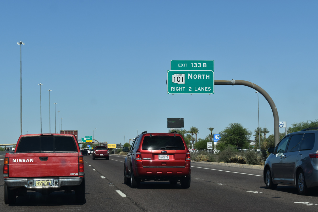
Loop 101 constitutes a 61.01 mile long beltway north to Deer Valley in Phoenix, east to Scottsdale, and south to Loop 202 in Chandler.
05/28/21

The flyover at Exit 133B was restriped for two lanes by 2021.
05/28/21

Interstate 10 enters the city of Tolleson at 99th Avenue, just ahead of Exit 134 for 91st Avenue.
03/01/19

Interstate 10 enters the Phoenix city limits at 83rd Avenue.
05/28/21

03/01/19
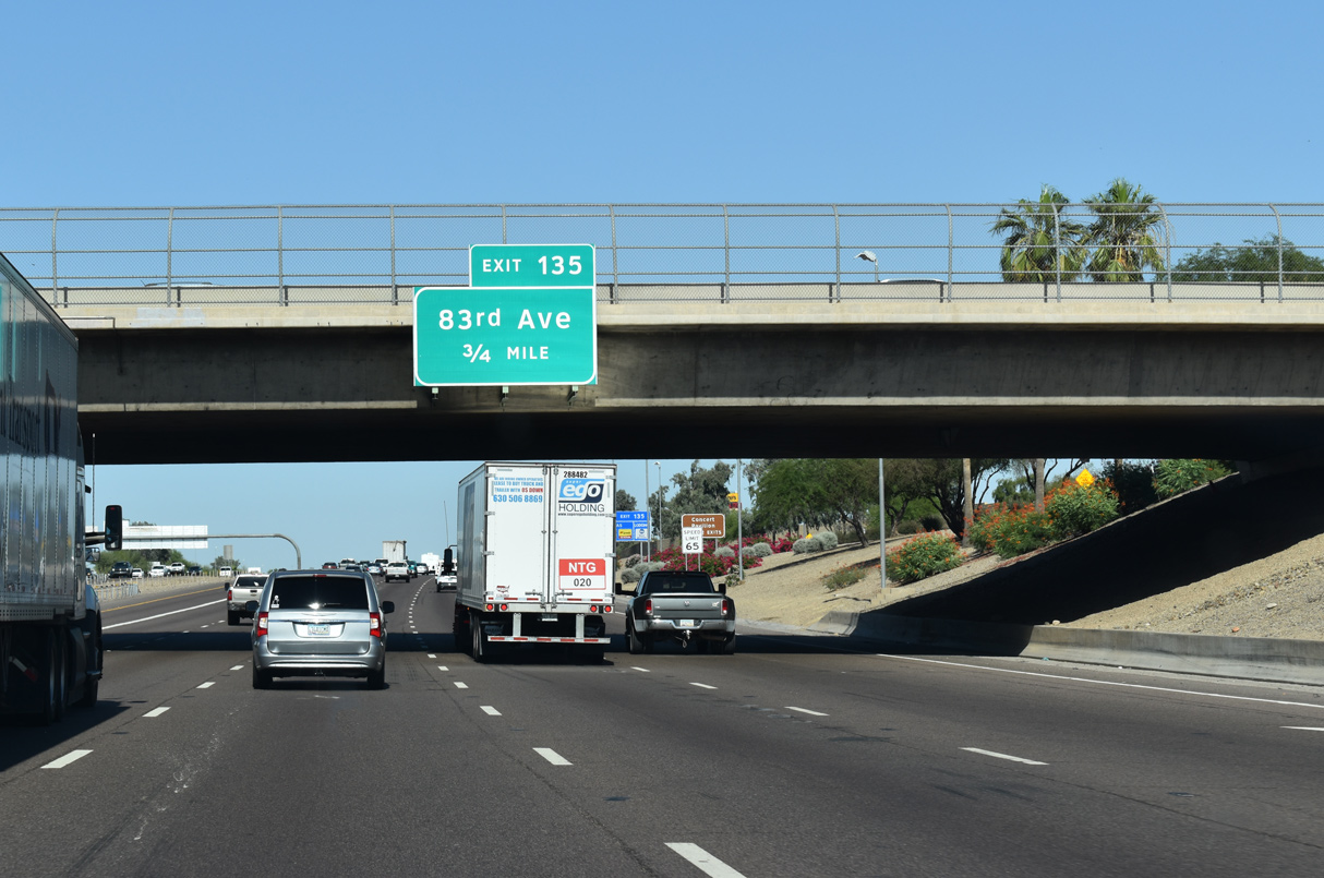
Auxiliary lanes were added to Interstate 10 from 91st Avenue to Exit 135 between 2003 and 2004.
05/28/21

05/28/21

03/01/19

05/28/21
05/28/21

03/01/19

Numbered streets decrement by eight streets per mile in the City of Phoenix.
05/28/21

05/28/21

Sources:
- "New Avondale interchange, I-10 at Fairway Drive, opens on schedule." Arizona Business Magazine, January 27, 2011.
- "Ramp, interchange complete on Fairway Drive/I-10." West Valley View (Goodyear, AZ), January 28, 2021.
Photo Credits:
03/01/19, 03/02/19, 05/28/21 by AARoads
Connect with:
Loop 101
Loop 202
Loop 303
Page Updated 04-08-2022.