
 West
West
Advancing north along the Papago Freeway from I-17/U.S. 60, Interstate 10 next meets Buckeye Road east to Phoenix Sky Harbor International Airport (PHX) at Exit 149.
04/26/17

04/26/17

Buckeye Road west links Interstate 10 with Sky Harbor Circle south to the Sky Harbor consolidated Car Rental facility.
04/26/17
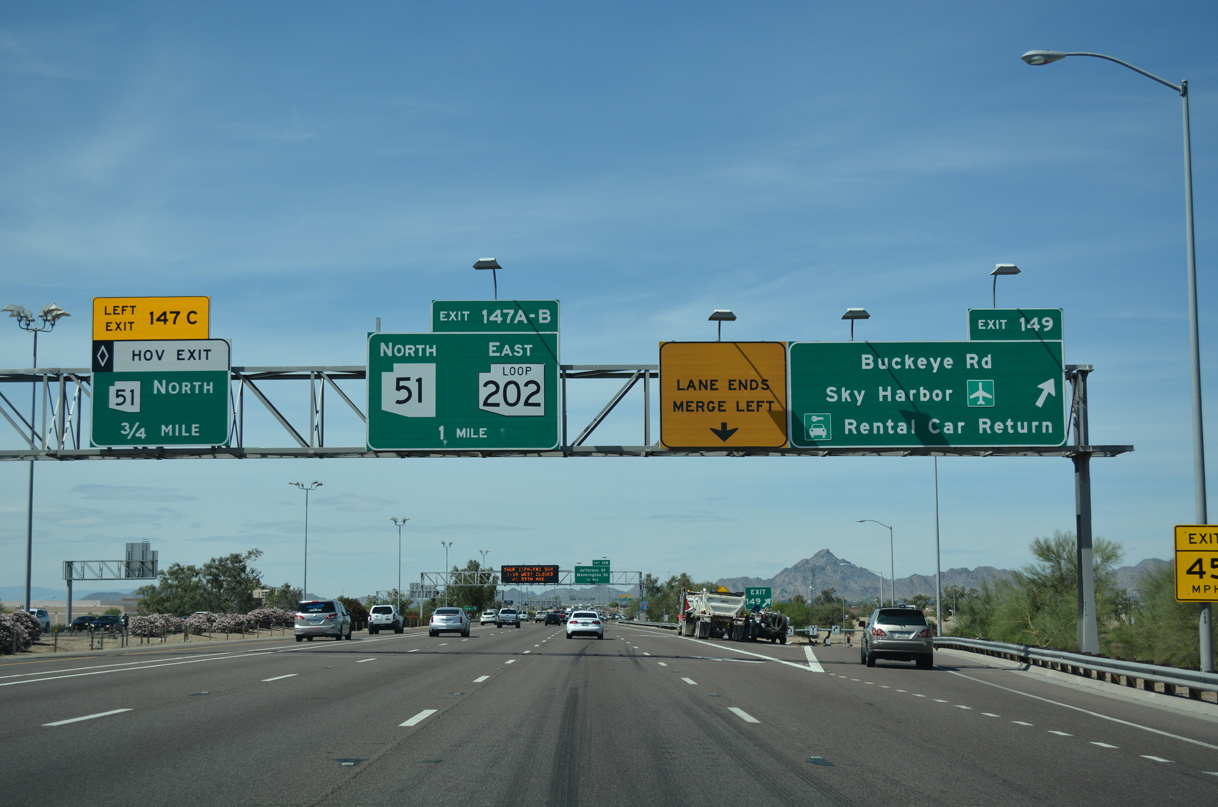
Buckeye Road heads east to the passenger terminal at PHX Airport and west through Central City to become part of Historic U.S. 80. I-10 proceeds one mile north to SR 51 (Piestewa Freeway) and Loop 202 (Red Mountain Freeway).
04/26/17

04/26/17
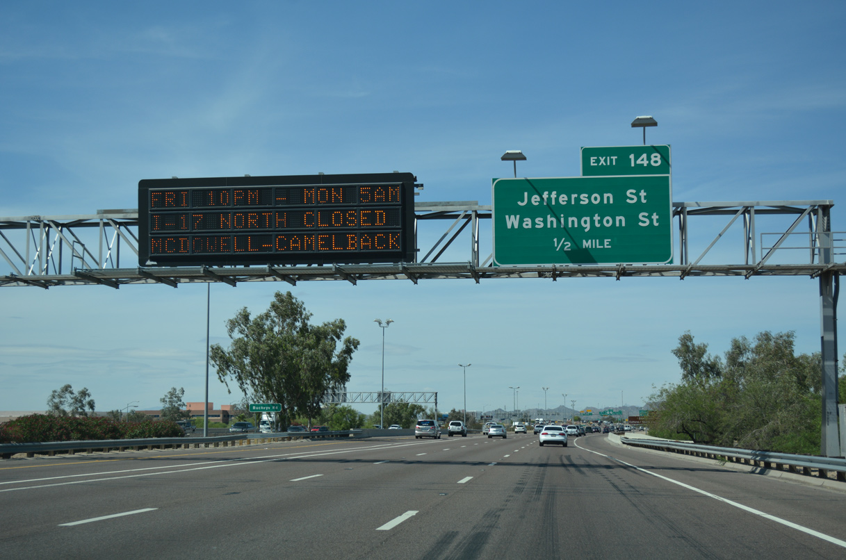
A split diamond interchange at Exit 148 joins I-10 (Papago Freeway) with the couplet of Jefferson Street east and Washington Street west.
04/26/17

Exit 147 separates from I-10 west ahead of Van Buren Street. There is no access to Van Buren Street, which was formerly Business Loop I-10 through Downtown Phoenix as well as U.S. 60.
04/27/17

Confirming marker posted north of the Sky Harbor Circle underpass.
04/27/17

Washington Street leads west to the Phoenix Convention Center, Chase Field (home of the MLB Arizona Diamonbacks) and Footprint Center (home of the NBA Phoenix Suns).
04/27/17

Departing just ahead of Exit 147 A/B, Left Exit 147C links the I-10 HOV lane with the SR 51 HOV lane.
04/27/17

SR 51 (Piestewa Freeway) is a heavily traveled commuter route extending 16.13 miles north from the Mini-stack Interchange with I-10/SR 202 to Loop 101 at Desert Ridge in northeast Phoenix.
04/27/17

The HOV connectors were added to the Mini-stack interchange during reconstruction in 2004. Work lengthened the ramp for Exits 147 A/B a half mile southward.
04/27/17

The four level systems interchange joining I-10 (Papago Freeway), SR 51 (Piestewa Freeway) and the eastbound beginning of Loop 202 (Red Mountain Freeway) is arguably busiest in the Phoenix metropolitan area.
04/27/17

Loop 202 along the Red Mountain Freeway passes south of Scottsdale through Tempe, and parallels the Salt River east around north Mesa.
04/27/17
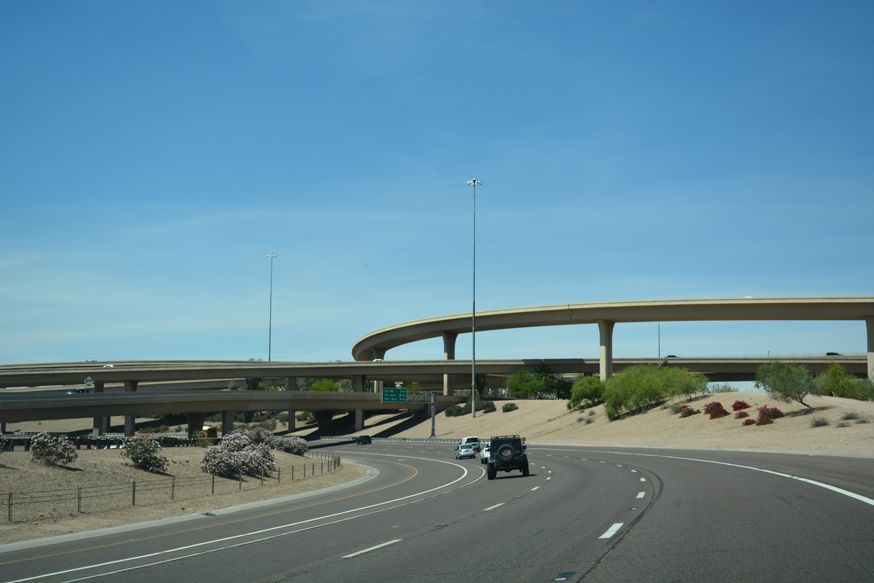
Interstate 10 (Papago Freeway) curves through the Mini-stack Interchange and continues west to the Garfield neighborhood northeast of Downtown Phoenix.
04/27/17
04/27/17

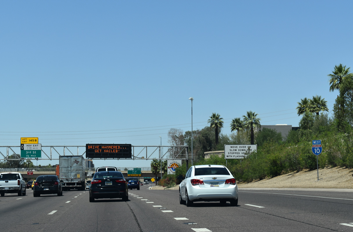
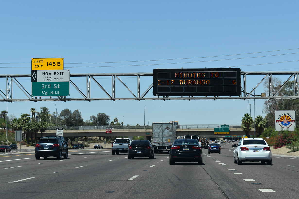
Separating from I-10 one mile ahead, Left Exit 145B joins the HOV lane with N 3rd Street at the East Evergreen Historic District north of Downtown Phoenix.
04/27/17

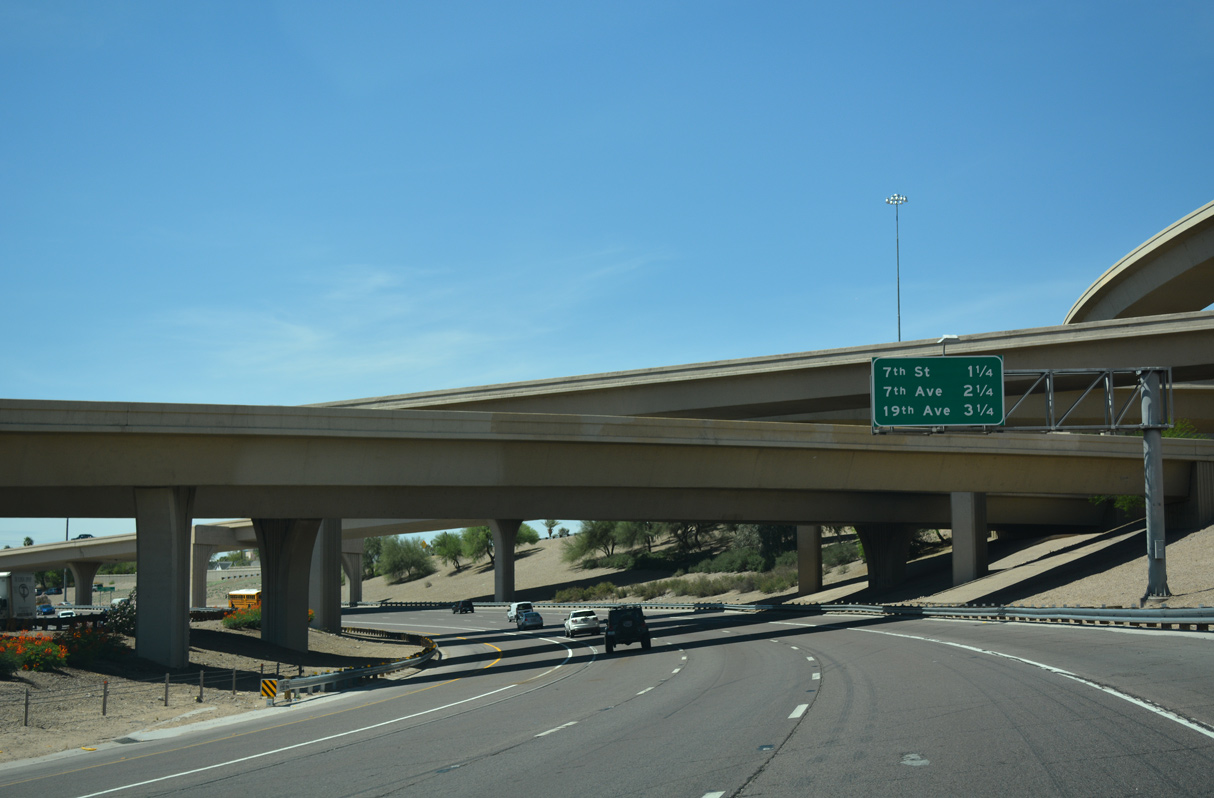
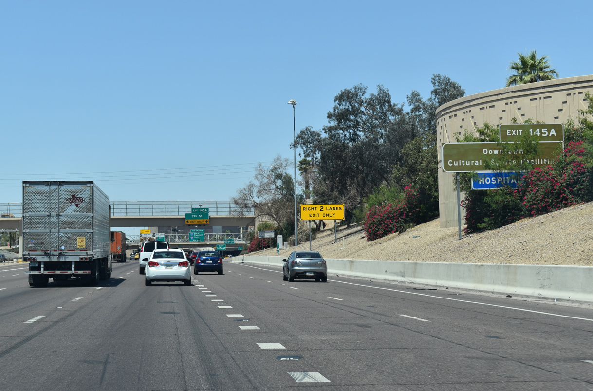
A half diamond interchange (Exit 146) links N 16th Street with Interstate 10 (Papago Freeway) west from the Garfield neighborhood.
05/31/21

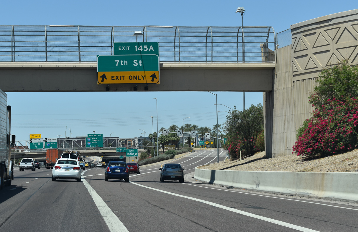
A single point interchange follows at Exit 145A for N 7th Street.
04/26/17
2019 ADOT traffic counts increase to 318,542 vpd along the Papago Freeway between 16th and 12th Streets.
05/31/21
05/31/21

05/31/21
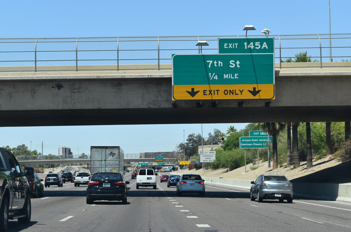
7th Street heads south to the Arizona Science Center and Chase Field along the east side of Downtown Phoenix.
05/31/21

Hazardous cargo is prohibited through the Deck Park Tunnel beyond Exit 145A.
05/31/21
The Arizona State University Downtown Phoenix campus lies north of Arizona Center mall and the financial district.
05/31/21
05/31/21

The Stack interchange (Exit 143 A/B), where I-17/U.S. 60 converge with Interstate 10 again, lies 2.25 miles beyond the HOV ramp to 3rd Street.
04/26/17
05/31/21

Interstate 10 advances west into the Deck Park Tunnel below 3rd Street. The Papago Freeway was designed with the cut and cover tunnel as a mitigation measure for I-10 to be constructed with minimal intrusion to the above street grid.
05/31/21

A bus station was designed with direct exits from the HOV lanes within the Deck Park Tunnel. Gates block access to the unused area at each entrance into the tunnel system. A comparable tunnel is along SR 15 near University Avenue in San Diego, California.
04/26/17

The Deck Park Tunnel falls between 3rd Street and 3rd Avenue, and below Margaret T. Hance Park west of Central Avenue.
04/26/17

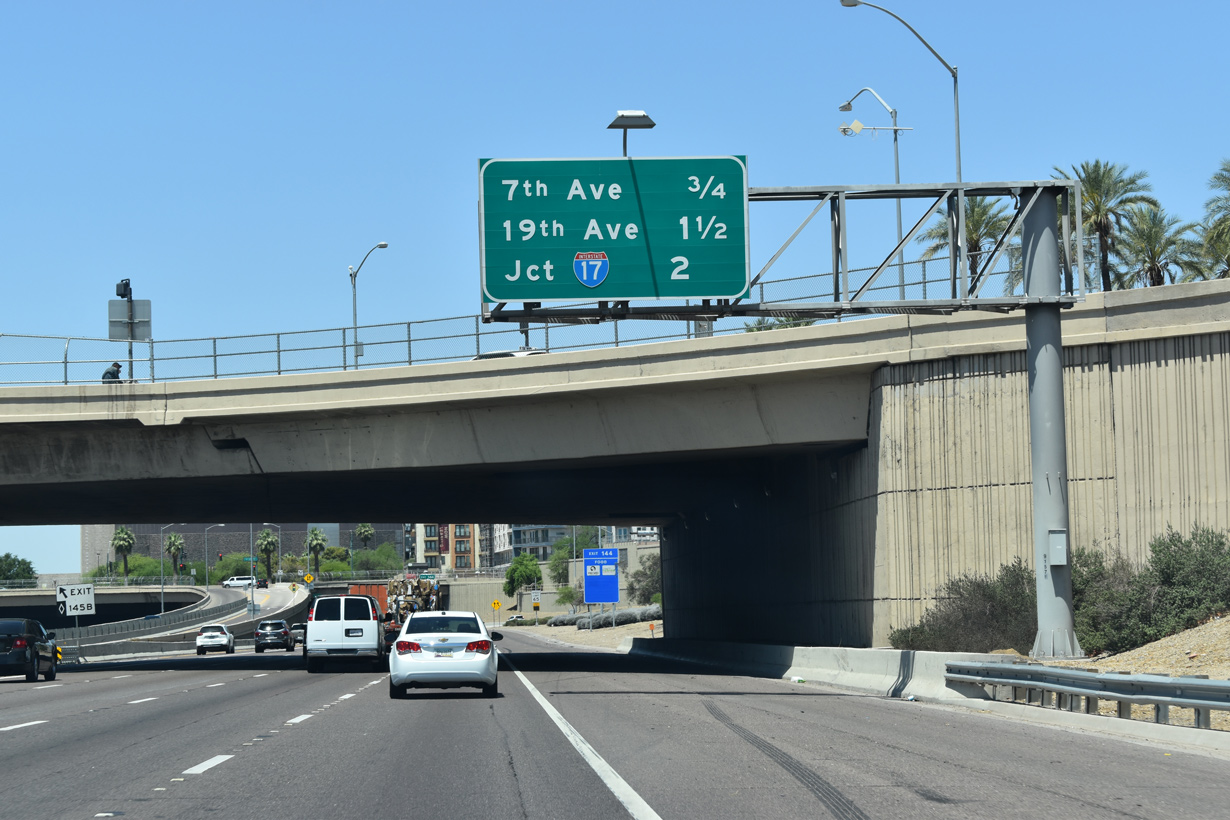
Exit 144 to N 7th Avenue departs from within the Deck Park Tunnel, less than a half mile beyond the 3rd Street over crossing.
05/31/21

7th Avenue runs north from the Papago Freeway to the Willo neighborhood and Encanto Village and south through the west side of Downtown Phoenix.
04/26/17

Interstate 10 emerges from the Deck Park Tunnel through the SPUI (Exit 144) with N 7th Avenue.
04/26/17

Succeeding exits depart from I-10 west over the course of 1.25 miles for 19th Avenue north to Grand Avenue (old U.S. 60) and I-17/U.S. 60 along the Black Canyon Freeway.
04/26/17

04/26/17

19th Avenue leads south to the Arizona State Capitol between Adams Street west and Jefferson Street east.
04/07/13

04/26/17

Unmarked at Exit 143, U.S. 60 parts ways with I-17 north at the ensuing exit with Thomas Road. U.S. 60 shifts onto Grand Avenue there, which originates from N 7th Avenue and Van Buren Street at Downtown Phoenix.
04/26/17

04/26/17

I-17/U.S. 60 encircle Downtown Phoenix to the west and south back toward Phoenix Sky Harbor International Airport (PHX).
04/26/17

Interstate 17 (Black Canyon Freeway) continues north from I-10 and U.S. 60 through Alhambra, North Mountain Village and Deer Valley through north Phoenix.
04/26/17

Interstate 17 connects Phoenix with Flagstaff beyond the Bradshaw Mountains, New River Mountains and Black Canyon.
04/26/17

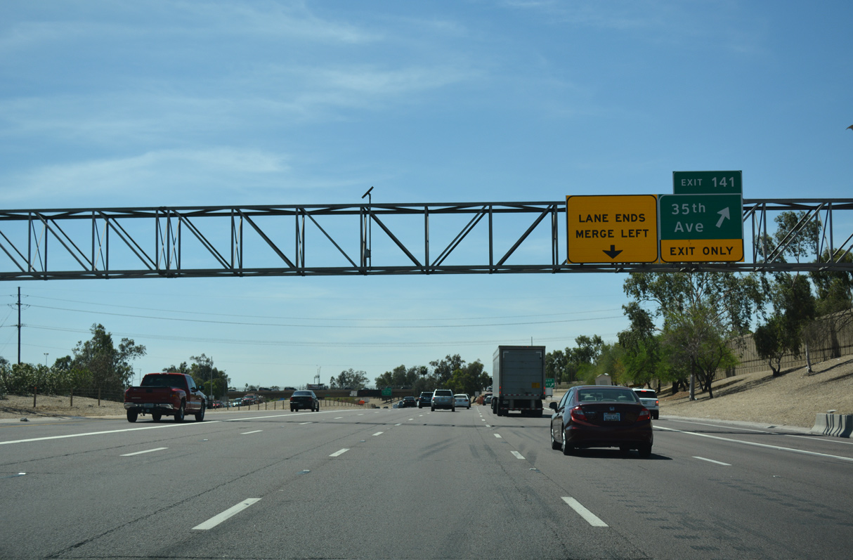
Interstate 10 advances west from The Stack, four level interchange to Exit 141 for N 35th Avenue.
04/26/17

05/31/21

05/31/21

05/31/21

05/31/21

05/31/21
04/26/17

Originally the Phoenix street grid pattern only extended as far west at 43rd Avenue, with areas further undeveloped.
05/31/21
2019-20 construction added seventh lane to westbound Interstate 10 between the 35th Avenue entrance ramp and Exit 140.
05/31/21

05/31/21

05/31/21

05/31/21

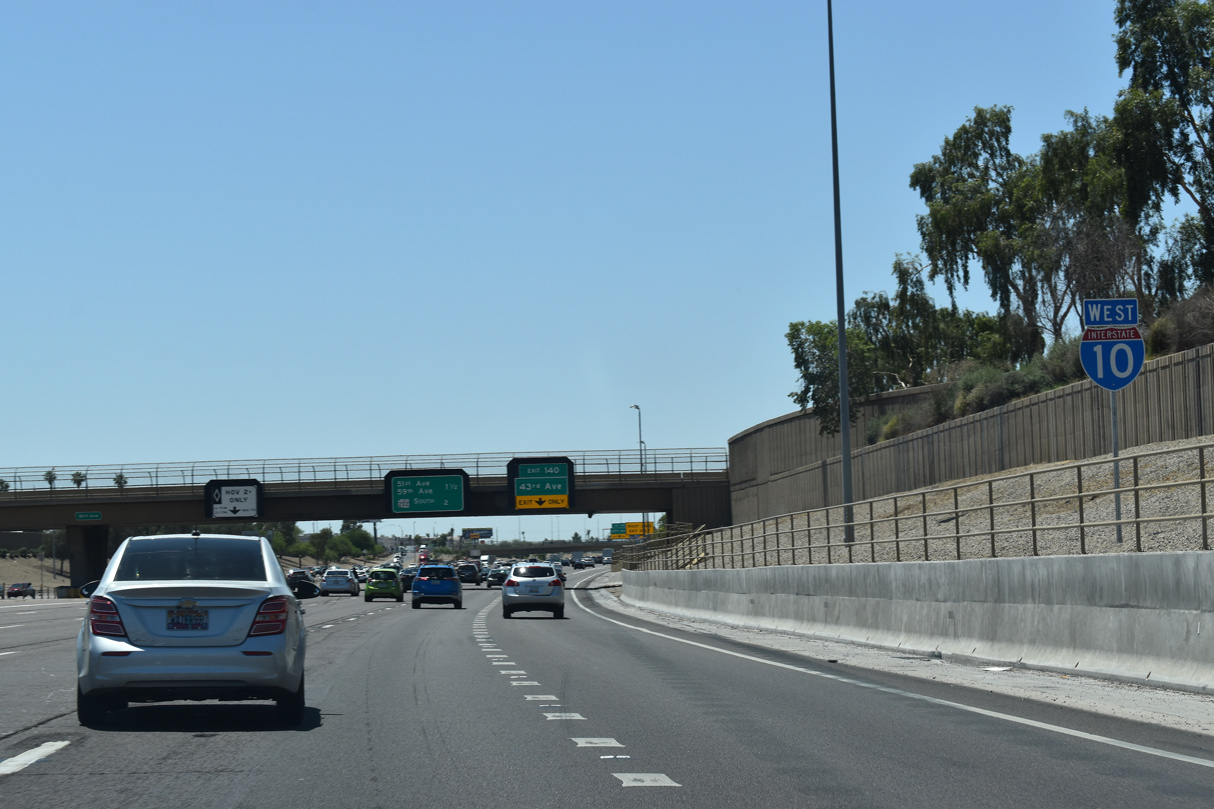
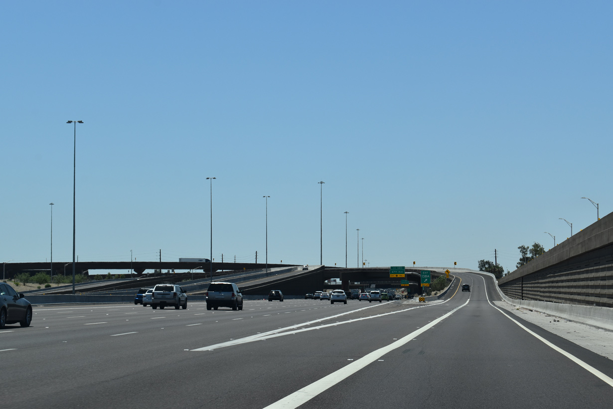
Left Exit 138B links the I-10 HOV lane with the HOV lane along Loop 202 (South Mountain Freeway) south 1.25 miles west of the N 43rd Avenue overpass.
05/31/21
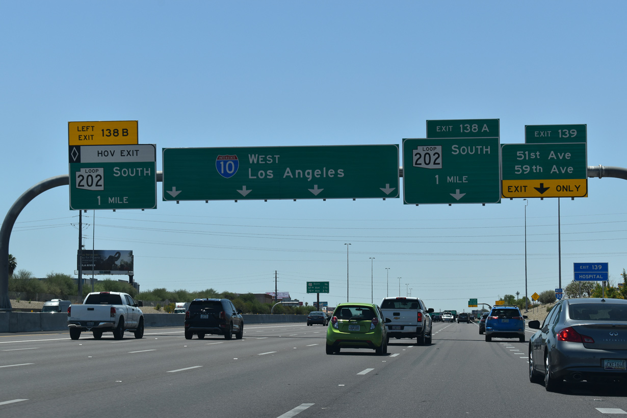
Construction of the directional T interchange (Exit 138 B/A) with the South Mountain Freeway consolidated Exit 139 for 51st Avenue and Exit 138 for 59th Avenue to Maryvale Village into a single ramp.
05/31/21
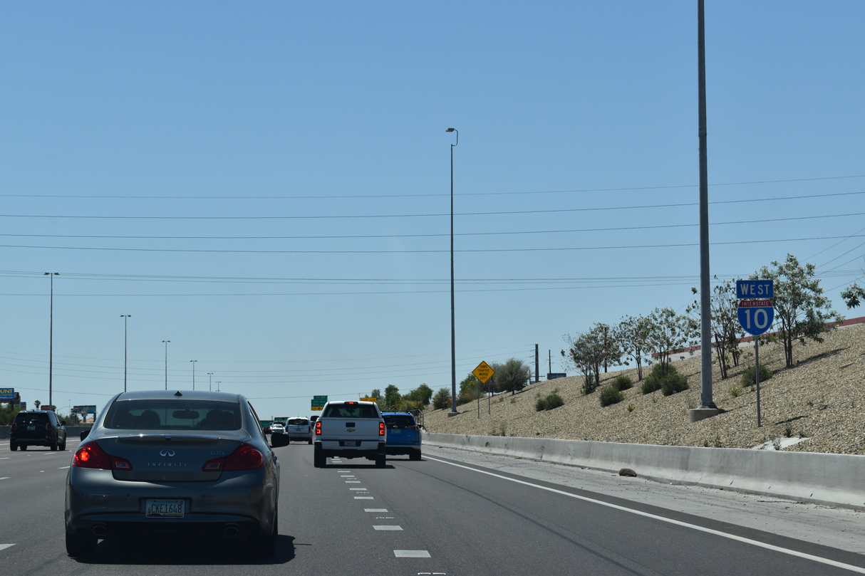
Interstate 10 continues west through Phoenix suburbs developed in the 1950s.
05/31/21

Exit 139 connects I-10 (Papago Freeway) west with N 51st Avenue directly and a service road leading to N 59th avenue by the exchange with Loop 202.
05/31/21
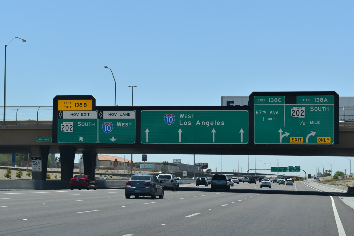
Exit 138A for Loop 202 south and Exit 138C for 67th Avenue depart in quick succession beyond the separation of Left Exit 138B for the South Mountain Freeway HOV lane.
05/31/21

Extending Loop 202 northwest from Chandler and Ahwatukee Foothills Village in southeast Phoenix, the South Mountain Freeway opened to traffic on December 21, 2019.
05/31/21
05/31/21

Eliminating weaving traffic from Loop 202 north, Exit 137 for 67th Avenue was renumbered Exit 138C and relocated eastward to connect with the adjacent service road.
05/31/21

Corresponding with the primary roads on the street grid, exits along Interstate 10 are positioned a mile apart.
04/26/17

Continuing below grade, Interstate 10 west next meets 75th Avenue at a diamond interchange (Exit 136B).
04/26/17

The numbering sequence for the City of Phoenix increases in increments of eight streets per mile.
04/26/17

75th Avenue is one of several arterial streets extending north through Maryvale Village in Phoenix to the city of Glendale.
04/26/17

Left Exit 136A departs from the HOV lane for 79th Avenue north to McDowell Road and Desert Sky Mall.
04/26/17

During peak hours (6 to 9 AM and 3 to 7 PM), Left exit 136A serves only HOV traffic. However it is open to all traffic during off-peak hours.
04/07/13

Interstate 10 leaves the city of Phoenix at 83rd Avenue.
04/26/17

An auxiliary lane was added from the 75th Avenue entrance ramp to Exit 135 in 2003-04.
04/26/17


Photo Credits:
04/07/13, 04/26/17, 04/27/17, 05/31/21 by AARoads
Connect with:
Interstate 17
U.S. 60
State Route 51
Loop 101
Loop 202
Page Updated 04-15-2022.