|
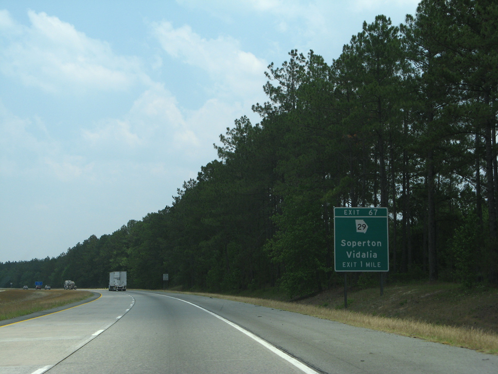
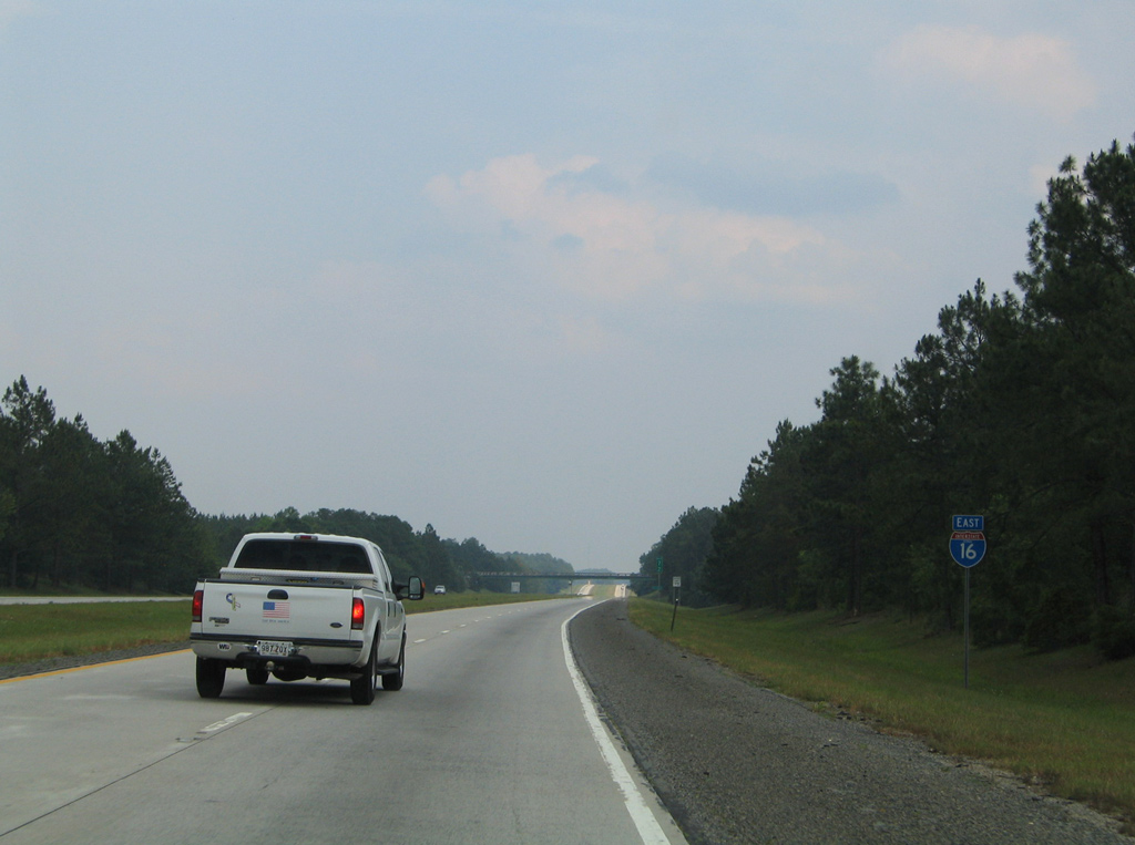
| Interstate 16 arcs eastward from Mercer Creek to a diamond interchange (Exit 67) with SR 29 near the settlement of Rockledge. 05/29/07 |
|
| SR 29 leads southeast from Milledgeville alongside U.S. 441 to Dublin, branching east from there to Minter and Soperton. 98 miles overall, SR 29 combines with SR 15 from Soperton to Vidalia and concludes at U.S. 1. 12/20/08 |
|
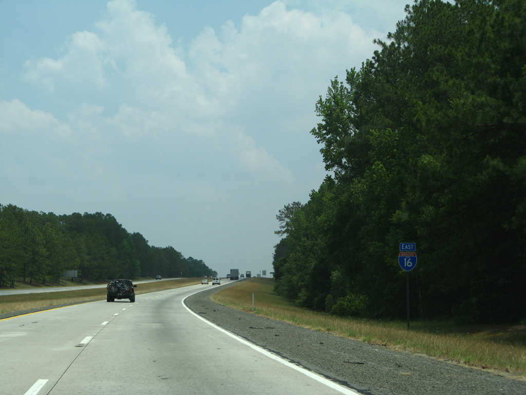
| Eastbound reassurance marker posted for I-16 near Orland. 05/29/07 |
|
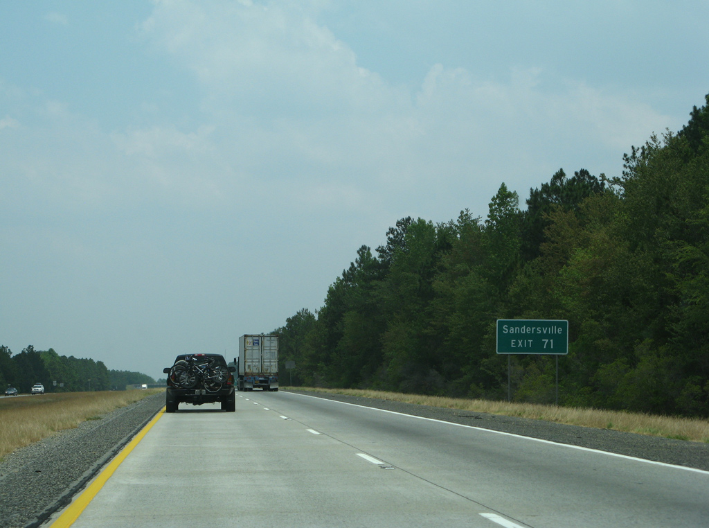
| A wide forested median ensues on the three miles preceding Exit 71 with SR 15/78. Savannah is within 100 miles. 05/29/07 |
|
| SR 15/78 converge with I-16 east at a diamond interchange (Exit 71) in one mile. The two overlap 28.3 miles from Soperton north to Wrightsville. 05/29/07 |
|
| Beyond Wrightsville, SR 15 travels another 19 miles to the Washington County seat of Sandersville. Overall SR 15 stretches 346 miles northward from Florida, south of Folkston, to North Carolina north of Dillard. 05/29/07 |
|
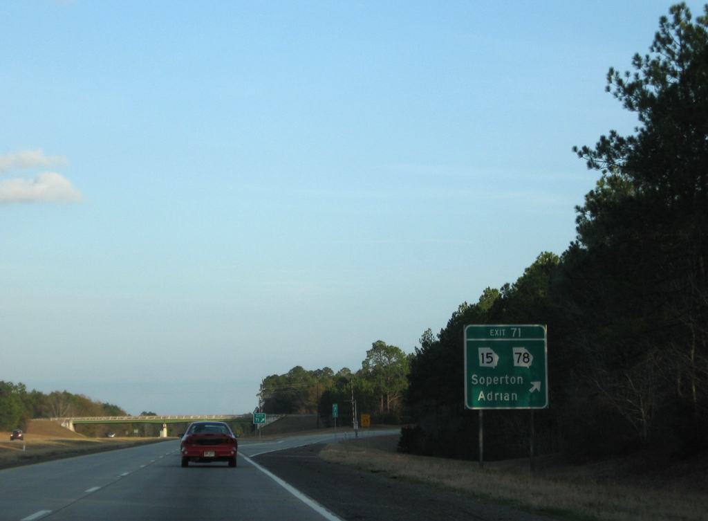
| Exit 71 leaves Interstate 16 for SR 15/78 south to Soperton. Adrian lies six miles to the north at U.S. 80. SR 78 measures nearly 60 miles along an arc between Soperton and SR 17, east of Wadley. 12/20/08 |
|
| Interstate 16 advances east toward Swainsboro and 95 miles to Savannah. 05/29/05 |
|
| Roadways of I-16 diverge around a wooded median on the stretch south of Sand Hill Lake. 05/29/07 |
|
| Crossing Pendleton Creek, Interstate 16 proceeds one mile east to a diamond interchange (Exit 78) with U.S. 221/SR 56 near Gillis Springs. 05/29/07 |
|
| SR 86 passes over I-16 ahead of Exit 78 to U.S. 221/SR 56. U.S. 221/SR 56 overlap southward to Soperton, Mount Vernon and Uvalda. Northward the two split at Gillis Springs for Louisville and Swainsboro respectively. 05/29/05 |
|
| Interstate 16 parallels SR 86 east by Five Points along an otherwise forested stretch. 05/29/05 |
|
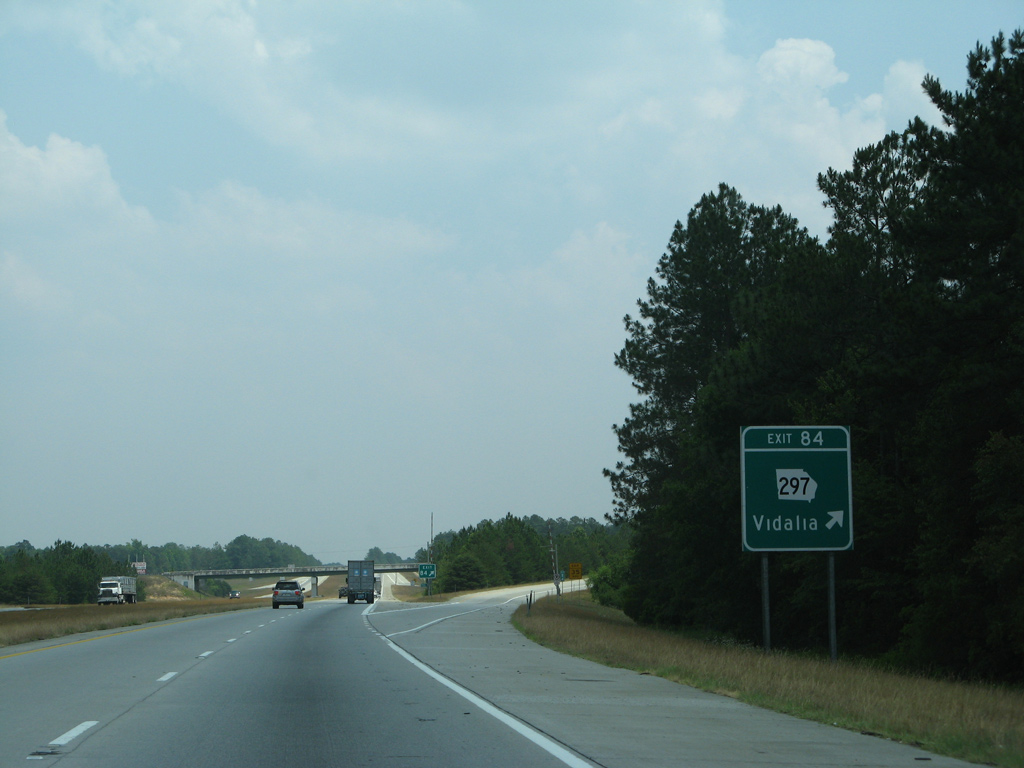
| Vidalia, a city of 10,000 along U.S. 280 known for its onion crop, lies 20 miles to the east and south via Exit 84. Savannah is 89 miles away. 05/29/07 |
|
| SR 297, a 24 mile long highway between Vidalia and the Swainsboro area, crosses paths with Interstate 16 at forthcoming Exit 84. 05/29/07 |
|
| Entering the diamond interchange (Exit 84) with SR 297 on Interstate 16 east. 05/29/07 |
|
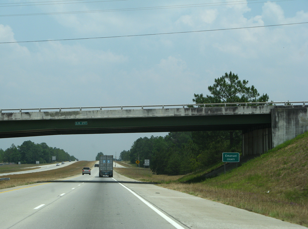
| SR 297 straddles the Emanuel County line south to Pendleton Creek and north to the Ohoopee River. 05/29/07 |
|
| A forested median reappears along Interstate 16 over the hills preceding the Ohoopee River. 12/20/08 |
|
| Spanning the Ohoopee River, a 119 mile long tributary of the Altamaha River flowing south from Washington County, on I-16 east. 05/29/07 |
|
| Interstate 16 crosses over a Heart of Georgia Railroad line one mile west of the diamond interchange (Exit 90) with U.S. 1. 12/20/08 |
|
| U.S. 1 stays well in land over its course through Georgia. U.S. 1 travels north from Folkston to Waycross, Alma, Baxley and Lyons before meeting Interstate 16. North from Exit 90, U.S. 1 continues to Swainsboro, Wadley, Louisville, Wrens and Augusta. 05/29/07 |
|
| Turning more eastward again, Interstate 16 traverses timberland to Aline. GDOT recorded 17,280 vehicles per day (vpd) here in 2012. 05/29/05 |
|
| 76 miles west of Savannah along Interstate 16 east. 05/29/05 |
|
| Crossing into Candler County, east of Jacks Creek and west of the Griffin Ferry Road overpass, on I-16. 05/29/07 |
|
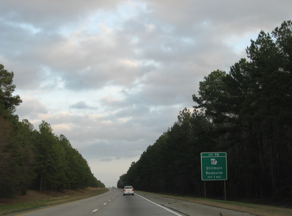
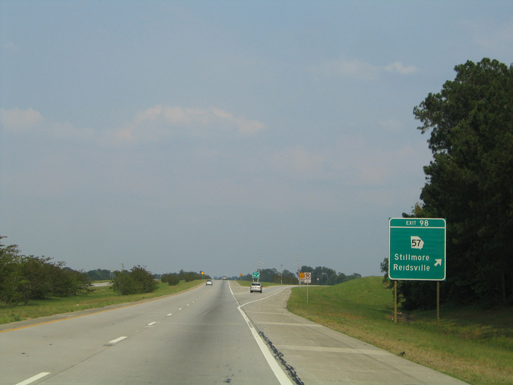
| SR 57, which Interstate 16 was last near outside Macon, crosses paths with the freeway at Aline. The 178 mile long highway runs southward from Exit 98 to Cobbtown, Collins, Reidsville, Glennville and ultimately Eulonia. 12/20/08 |
|
| Gordonia-Alatamaha State Park and Golf Course lies 20 miles to the south in Reidsville via SR 57. SR 57 doubles as the Wiregrass Trail, the scenic route to Georgia's Golden Isles. 05/29/07 |
|
| Exit 98 parts ways with the I-16 mainline for SR 57 northwest five miles to Stillmore. SR 57 intersects SR 46 nearby, which parallels I-16 east from U.S. 1 toward Metter. 05/29/05 |
|
| Metter, seat of Candler County, follows in seven miles along Interstate 16 east. Savannah is just over an hour away. 05/29/07 |
|
| Waters from the Canoochee River flow below Interstate 16 east midway between Exits 98 and 104. The 108 mile long tributary of the Ogeechee River originates southeast of Swainsboro. 05/29/07 |
|
| SR 23/121 overlap 27 miles north through Reidsville, Collins and Cobbtown to Exit 104 and the city of Metter. SR 23/121 also combine in Folkston, far to the south. 05/29/07 |
|
| Part of a multi state highway between Lebanon Junction, Florida and Rock Hill, South Carolina, SR 121 doubles as the Woodpecker Trail, an auto touring route through Georgia. Cultural and natural attractions are part of the drive. 05/29/07 |
|
| Interstate 16 briefly enters the city limits of Metter at the diamond interchange (Exit 104) with SR 23/121 (Lewis Street). Metter Municipal Airport (MHP) lines the south side of the freeway here. 05/29/07 |
|
| SR 129 begins in Metter, taking Leroy Street south from SR 46 (Broad Street) to cross Interstate 16 just east of Exit 104. SR 129 concludes 20 miles to the southeast at Claxton. 05/29/05 |
|
| Interstate 16 kinks southward across Fivemile Creek on the departure from Metter. 05/29/07 |
|
| Farm land spreads along both sides of Interstate 16 southeast toward the Claude Turner Road overpass. 05/29/05 |
|
| Exit 111 with Pulaski-Excelsior Road is a later addition to Interstate 16. The rural highway connects I-16 with the settlement of Excelsior to the south. 05/29/05 |
|
| Excelsior Church Road extends north from the diamond interchange (Exit 111) with I-16 to the town of Pulaski and SR 46. 05/29/07 |
|
| Interstate 16 crosses the Bulloch County line just east of Exit 111. 05/29/07 |
|
| Statesboro, seat of Bulloch County and home to Georgia Southern University, lies 19 miles to the northeast of the ensuing exit on I-16. Savannah is 58 miles away. 05/29/07 |
|
| U.S. 25/301 constitute a four lane highway south to Claxton and Glennville and north to Statesboro, where they split with Business and Bypass branches. A rural diamond interchange (Exit 116) join the pair with Interstate 16 in one mile. 05/29/07 |
|
| Exit 116 leaves I-16 east for U.S. 25/301. Originating in Brunswick, U.S. 25 leads northwest with U.S. 341 to Jesup, U.S. 84-301 to Ludowici and U.S. 301 to Swainsboro. U.S. 25 proceeds north from U.S. 301 to Millen, Waynesboro and Augusta. U.S. 301 continues from U.S. 25 to Sylvania and Allendale, South Carolina. 05/29/07 |
|
| An 11 mile long exit less stretch commences east of U.S. 25/301. This is the longest along Interstate 16. 05/29/07 |
|
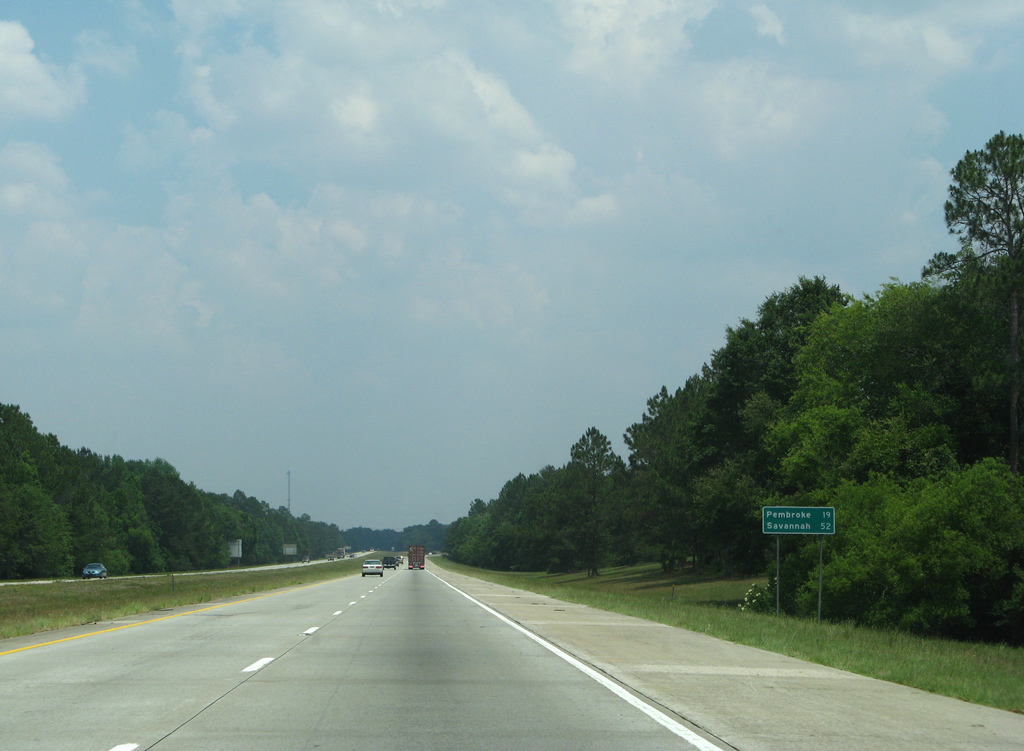
| I-16 east leads 19 miles toward the Bryan County seat of Pembroke and 52 miles to Savannah. 05/29/07 |
|
| Another wide roadway separation along Interstate 16 at Lotts and Little Lotts Creeks. 05/29/07 |
|
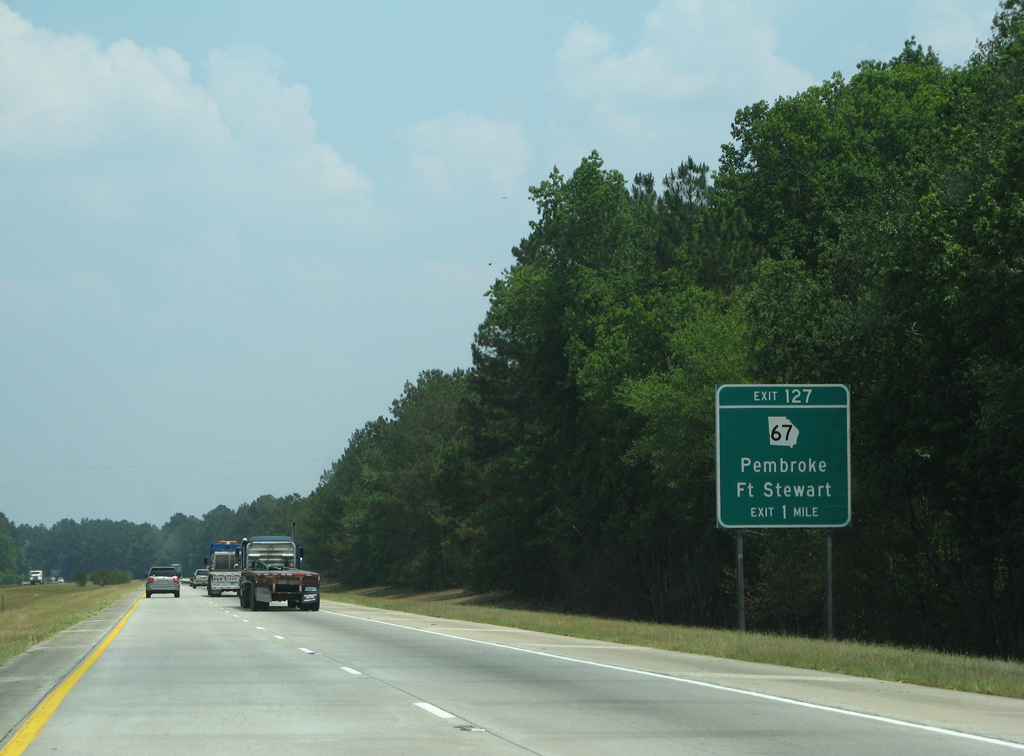
| SR 67 links Statesboro to the north with Pembroke to the southeast as part of a 59 mile long course. SR 67 ends at the boundary of Fort Stewart outside Pembroke. 05/29/07 |
|
| Eastbound I-16 traffic reaches the diamond interchange (Exit 127) with SR 67. SR 67 north intersects the east end of SR 46 ahead of Denmark nearby. The state route runs alongside U.S. 25 from Statesboro to Millen. 05/29/05 |
|
| Interstate 16 sweeps southeast across a number of wetlands areas, starting with De Loach Branch. 05/29/07 |
|
| Interstate 95 appears for the first time on I-16 signage at 31 miles out. Savannah is ten miles east of the exchange. 05/29/07 |
|
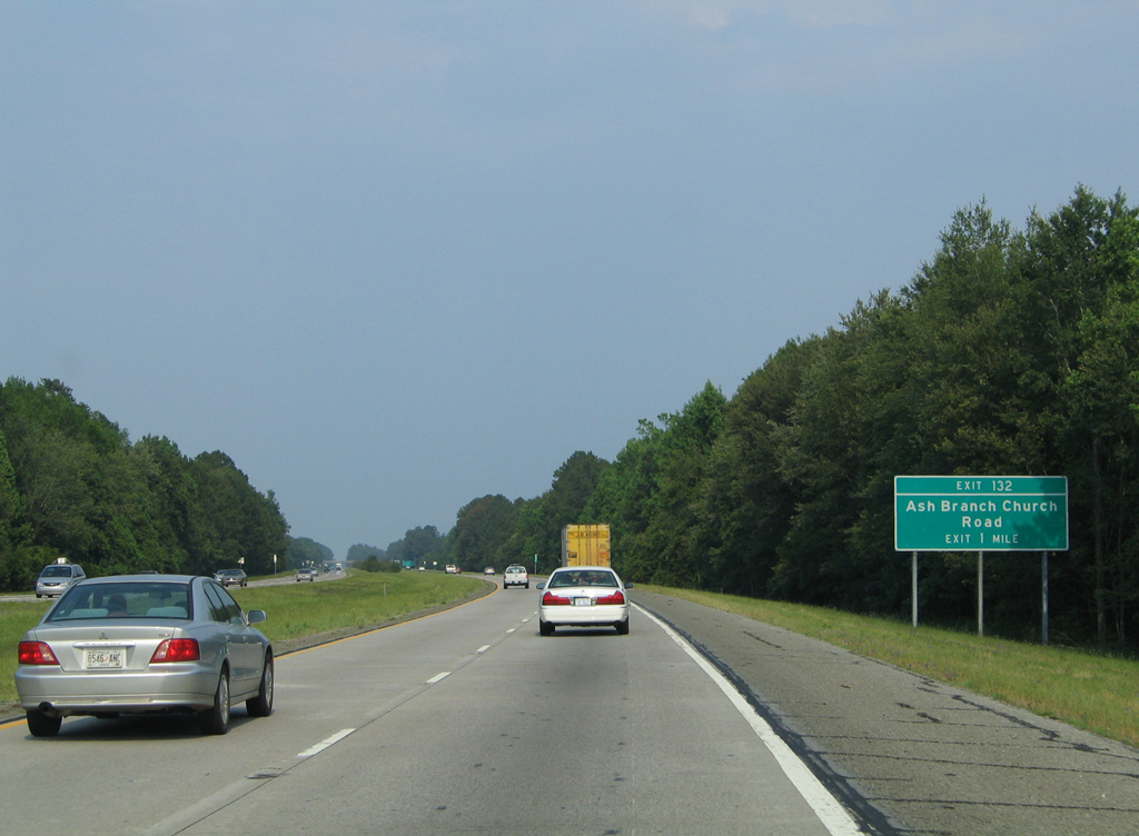
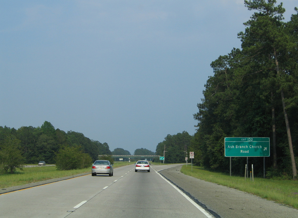
| Ash Branch Church Road leads south 6.2 miles from forthcoming Exit 132 to SR 119 (College Street) in Pembroke. 05/29/05 |
|
| North from Exit 132, Ash Branch Church Road becomes Arcola Road at old SR 46. Arcola Road extends northeast to Akins and U.S. 80/SR 26 near Arcola. 05/29/05 |
|
| SR 119 joins Interstate 16 with Springfield, the Effingham County seat, at the final Bulloch County exit. Savannah is 37 miles away. 05/29/07 |
|
| Interstate 16 east at Moonshine Island, west of Ash Branch and south of Lower Black Creek. 05/29/07 |
|
| SR 119 stems northeast from Pembroke and Fort Stewart to cross paths with Interstate 16 at a diamond interchange (Exit 137) in one mile. 05/29/07 |
|
| Exit 137 departs I-16 east for SR 119. A multi state highway, SR 119 provides the only public route across Fort Stewart to Hinesville to the south. MSR 119 concludes at Riceboro east of there and at Garnett, South Carolina to the northeast. 05/29/07 |
|
| Reassurance marker for Interstate 16 east posted at the SR 119 entrance ramp, just ahead of the Bryan County line. 05/29/07 |
|
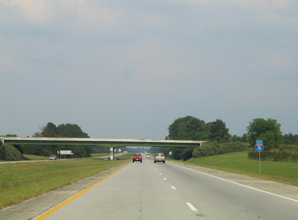
| Interstate 16 runs ten miles across northernmost Bryan County. Included in the Savannah Metropolitan area, the county stretches southeast to the Atlantic Ocean. 05/29/07 |
Page Updated 01-24-2014.

 East
East