
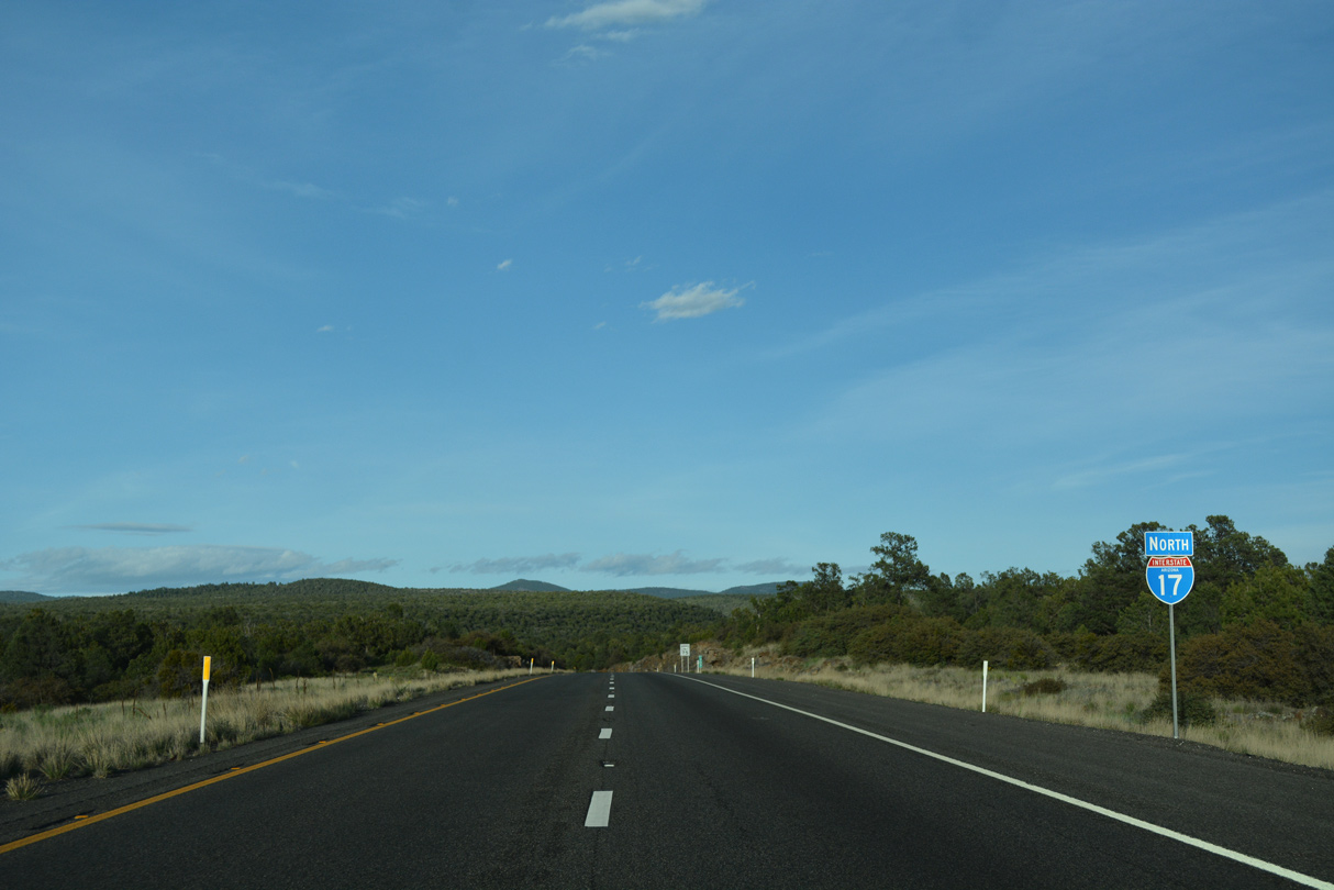
 North
North
04/26/17

Interstate 17 reaches the 5,000 foot mark in elevation northwest of Rarick Canyon.
04/26/17

Interstate 17 continues ascending from Hog Canyon to 5,325 feet above sea level.
04/26/17
04/26/17
04/26/17

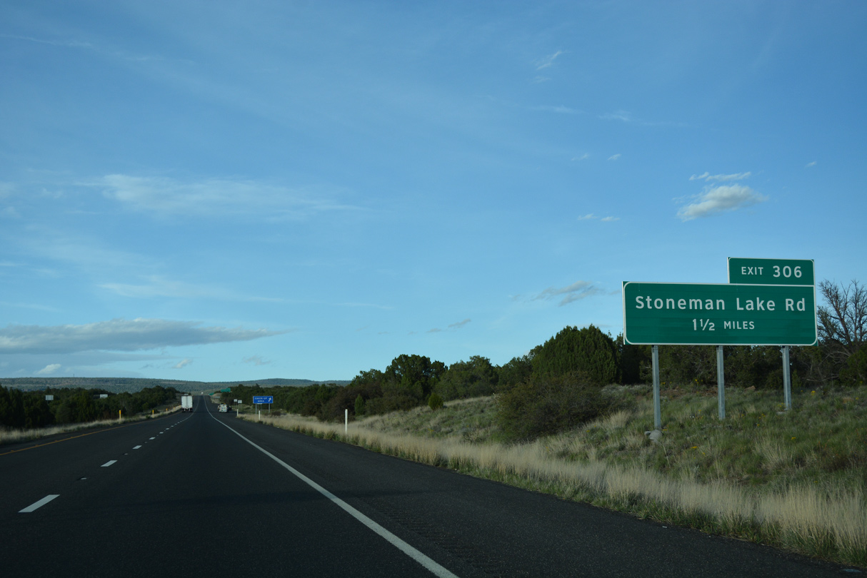
Stoneman Lake Road stems eight miles east from Exit 306 to Stoneman Lake.
04/26/17
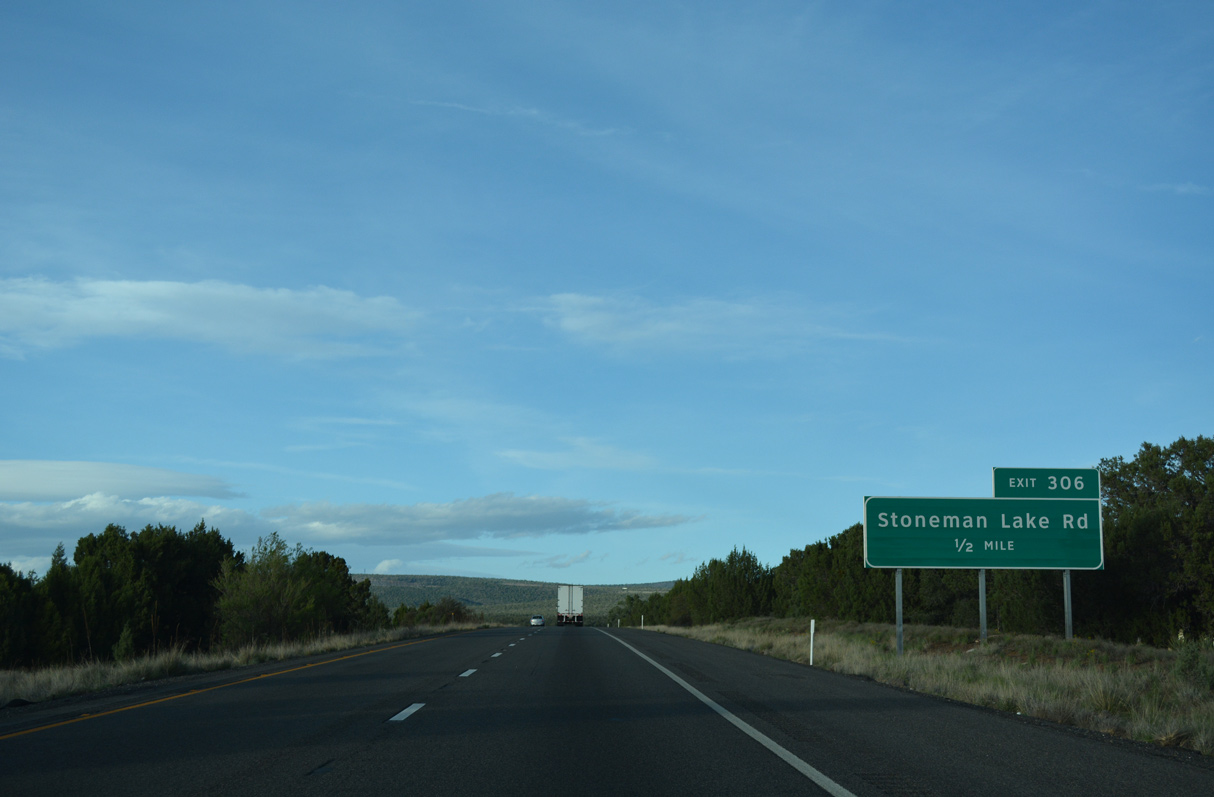
The scrub of the desert is long gone as Interstate 17 passes through Coconino National Forest at Exit 306.
04/26/17

Stoneman Lake Road ties into I-17 at a diamond interchange (Exit 306) between Rattlesnake and Rarick Canyons.
04/26/17
Interstate 17 traverses Rattlesnake Canyon northeast from Exit 306.
04/26/17
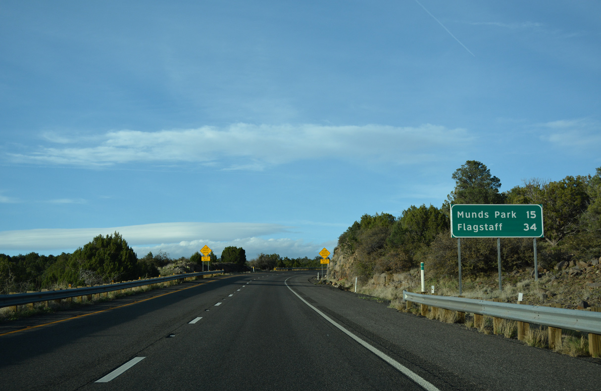
A previous distance sign posted 34 miles from Flagstaff referenced the former Munds Park Rest Area.
04/26/17

Interstate 17 ascends to 6,000 feet above sea level to the north of Red Hill.
04/26/17

Curving northwest from Rattlesnake Canyon, Interstate 17 enters Coconino County and the pine forests of Northern Arizona.
04/26/17

Originally carrying two-way traffic, the northbound roadway is the older of the two for I-17 by Cedar Tank and Pine Tank Canyons.
04/26/17
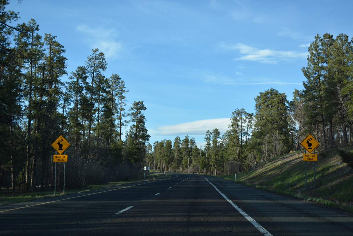
The remaining miles to the Flagstaff area along Interstate 17 fall within elk country.
04/26/17

04/26/17

04/26/17

04/26/17

04/26/17

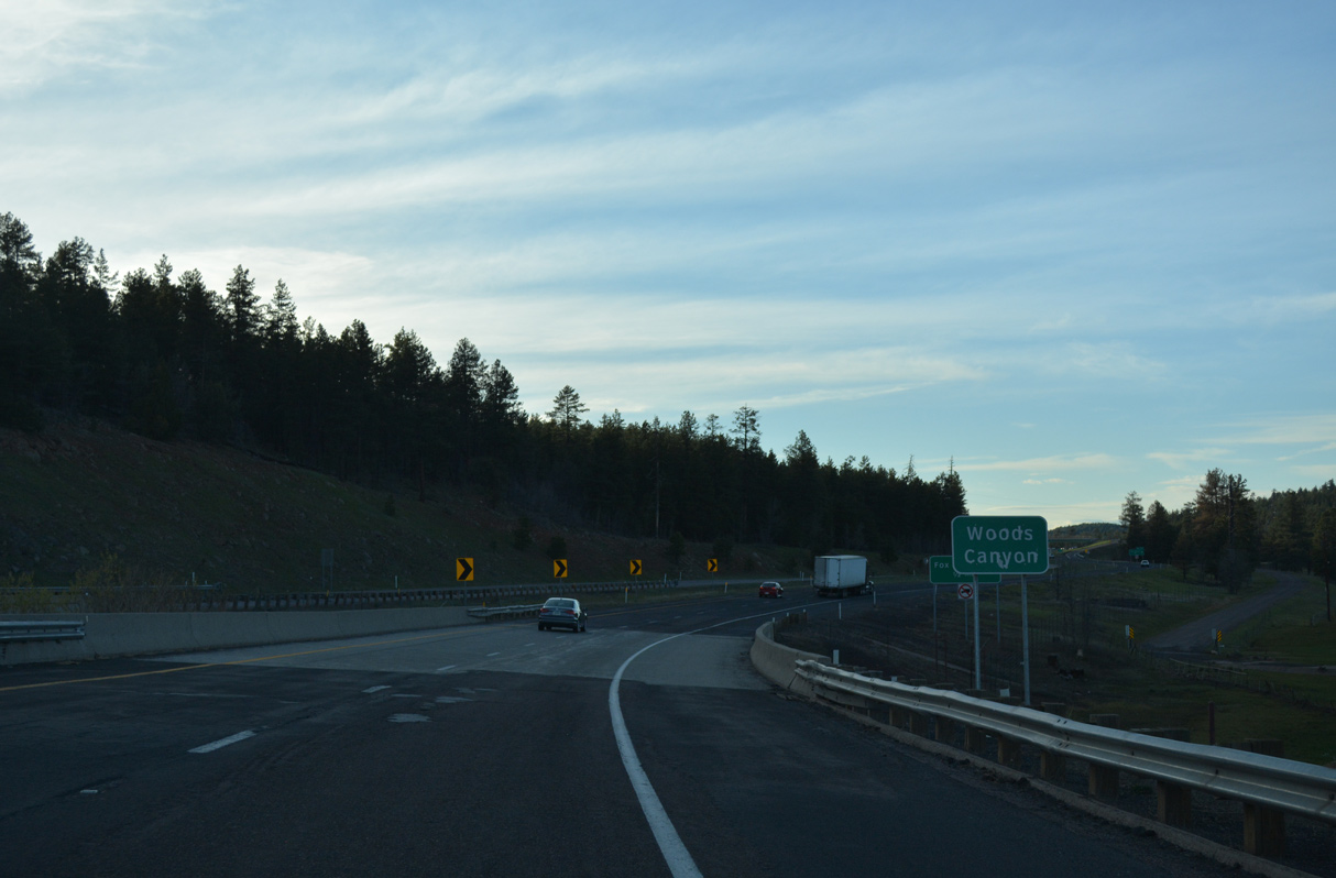
Interstate 17 crosses Woods Canyon ahead of the diamond interchange (Exit 317) with Fox Ranch Road.
04/26/17
04/26/17

04/26/17

04/26/17

04/26/17

Interstate 17 meets Schnebly Hill Road at Exit 320 west of T-Six Mountain.
04/26/17

Schnebly Hill Road meanders southwest to Foxboro Lake and onto Schnebly Hill.
04/26/17

04/26/17

04/26/17
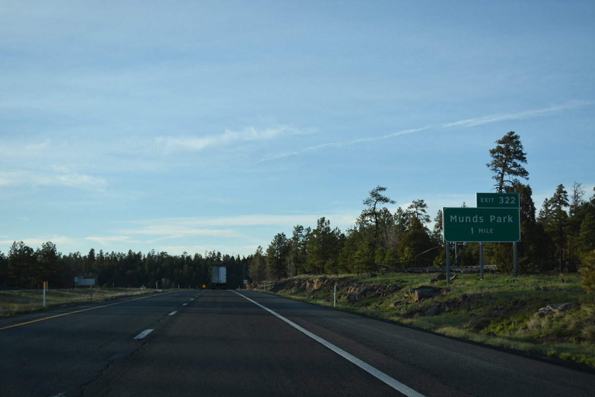
Interstate 17 proceeds north into the unincorporated community of Munds Park at Exit 322.
04/26/17

I-17 spans Munds Canyon ahead of the diamond interchange (Exit 322) with Munds Ranch Road west and Pinewood Boulevard east.
04/26/17

Full traveler services are available at Exit 322.
04/26/17

Pinewood Boulevard extends 1.9 miles east from Exit 322 to Pinewood Country Club golf course and residential areas to Mormon Lake Road (Forest Service Road 240).
04/26/17

04/26/17

04/26/17

I-17 travels 15 miles north from Munds Park to Interstate 40 in Flagstaff.
04/26/17

The shuttered Munds Park Rest Area.
04/26/17

04/26/17
04/26/17

04/26/17

04/26/17

04/26/17
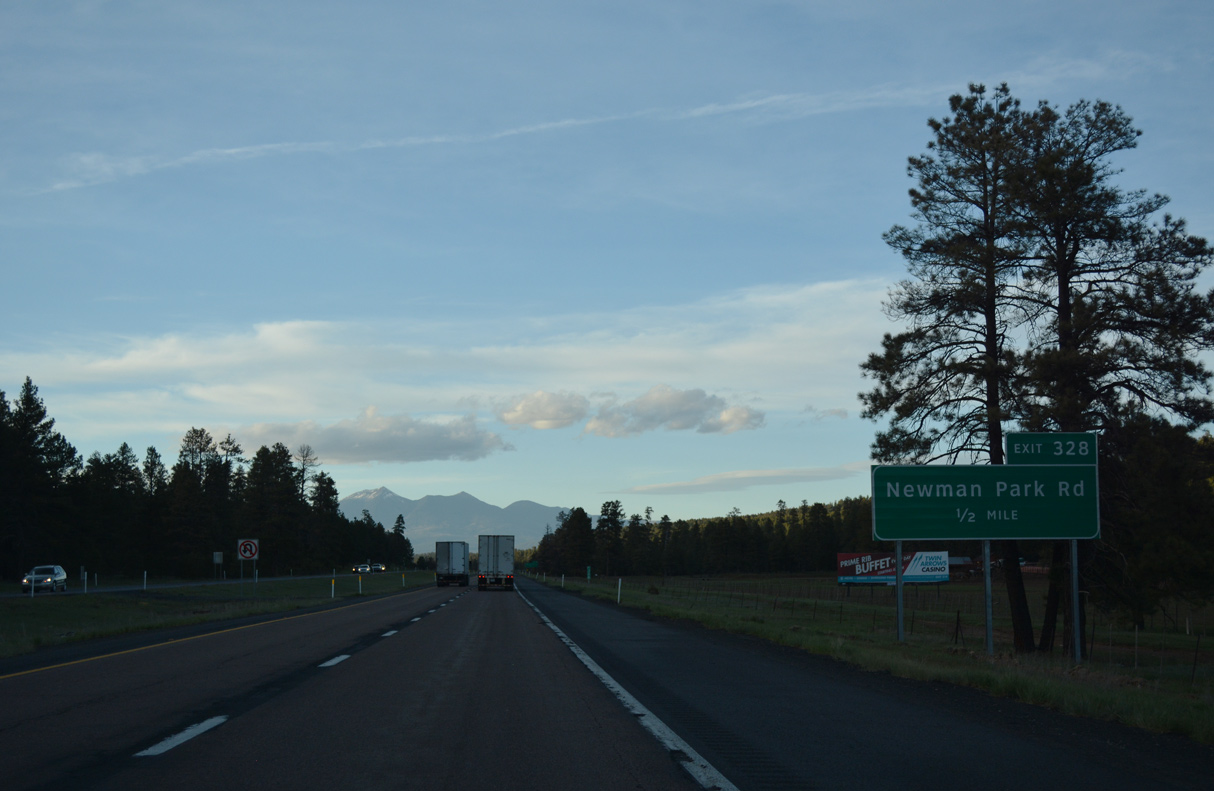
Humphrey's Peak, located north of Flagstaff at an elevation 12,633 feet, appears on the northern horizon preceding Exit 328 for Newman Park Road.
04/26/17

Newman Park lies within a valley east of Smith Butte.
04/26/17

04/26/17

The succeeding exit from I-17 north is for Kelly Canyon Road. Most of these exits provide access to various recreational areas within Coconino National Forest.
04/26/17

Interstate 17 crosses James Canyon just ahead of the diamond interchange (Exit 331) with Kelly Canyon Road.
04/26/17
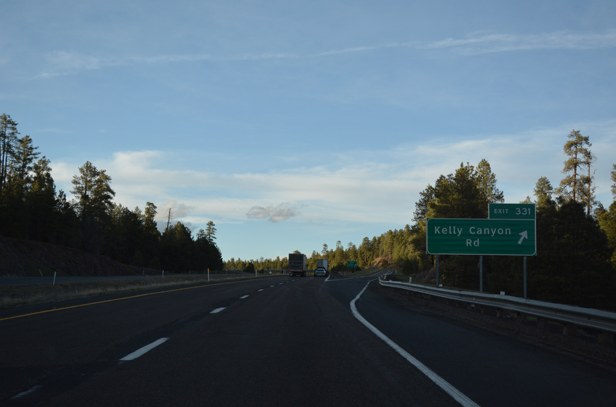
Kelly Canyon Road spurs northwest toward Kelly Canyon.
04/26/17

Interstate 17 is quite unlike the majority of freeways in Arizona due to the stands of native pine trees between Stoneman Lake Road and Flagstaff.
04/26/17

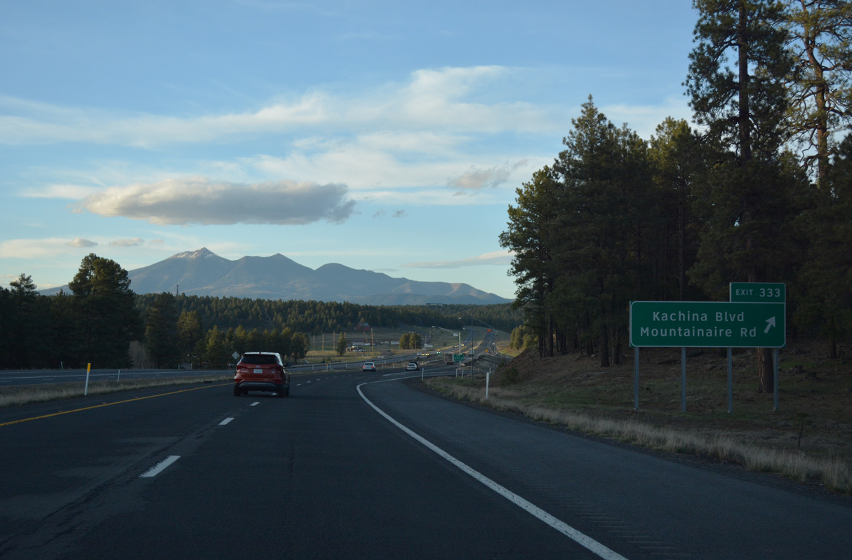
Exit 333 serves the communities of Kachina Village and Mountainaire.
04/26/17

04/26/17
04/26/17
04/26/17

04/26/17
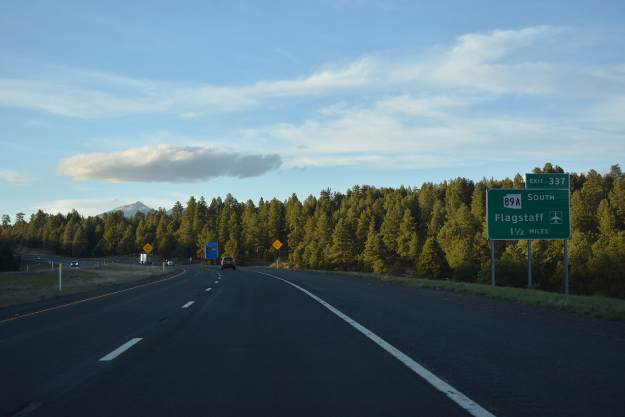
SR 89A travels south through Oak Creek Canyon to Slide Rock State Park, Sedona, Cottonwood, Clarkdale and SR 89 north of Prescott.
04/26/17

The dumbbell interchange at Exit 337 lies west of Flagstaff Pulliam Airport (FLG).
04/26/17

04/26/17

SR 89A measures 83.81 miles overall between Prescott and Flagstaff.
04/26/17

The remainder of Interstate 17 north is within the city of Flagstaff.
04/26/17

Interstate 17 tops out at 7,000 feet above sea level within the exchange for SR 89A south and John Wesley Powell Boulevard east.
04/26/17
 North
North
Suburban development lines the east side of I-17/SR 89A north leading into the systems interchange (Exit 339) with Interstate 40.
04/26/17

SR 89A accompanies Interstate 17 north to the freeway end at Milton Road in Flagstaff.
04/26/17

Exit 339 follows for Lake Mary Road to Lake Mary and Mormon Lake.
04/26/17

U.S. 89 commences north to Page and Kanab, Utah from Business Loop I-40 on the east side of Flagstaff.
04/26/17

Interstate 40 travels east to Winslow, Holbrook, Petrified Forest National Forest, Gallup and Albuquerque, New Mexico.
04/26/17

West from Flagstaff, Interstate 40 follows old U.S. 66 en route to Southern California via Williams, Ash Fork, Kingman and Barstow.
04/26/17

A third lane opens north to Exit 340A. Signed as National Forest Route 3, Lake Mary Road southeast from Exit 339 to Mormon Lake is part of the proposed but unconstructed SR 487.
04/26/17

The cloverleaf at I-17/40 was reconstructed in the late 1990s and early 2000s into a three level, high speed interchange.
04/26/17

Prior to the interchange reconstruction, an end shield for Interstate 17 was posted. Interstate 40 extends as far west as I-15 in Barstow, California, with I-15 south and I-10 west continuing from there to Los Angeles.
04/26/17

Interstate 17 concludes at a half diamond interchange (Exit 341) with McConnell Drive to Northern Arizona University. SR 89A continues along Milton Road, a commercial boulevard, 1.23 miles north to Business Loop I-40/Historic U.S. 66 south of Downtown Flagstaff.
04/26/17

Photo Credits:
04/26/17 by AARoads
Connect with:
Interstate 40
State Route 89A
Page Updated 04-21-2022.