|
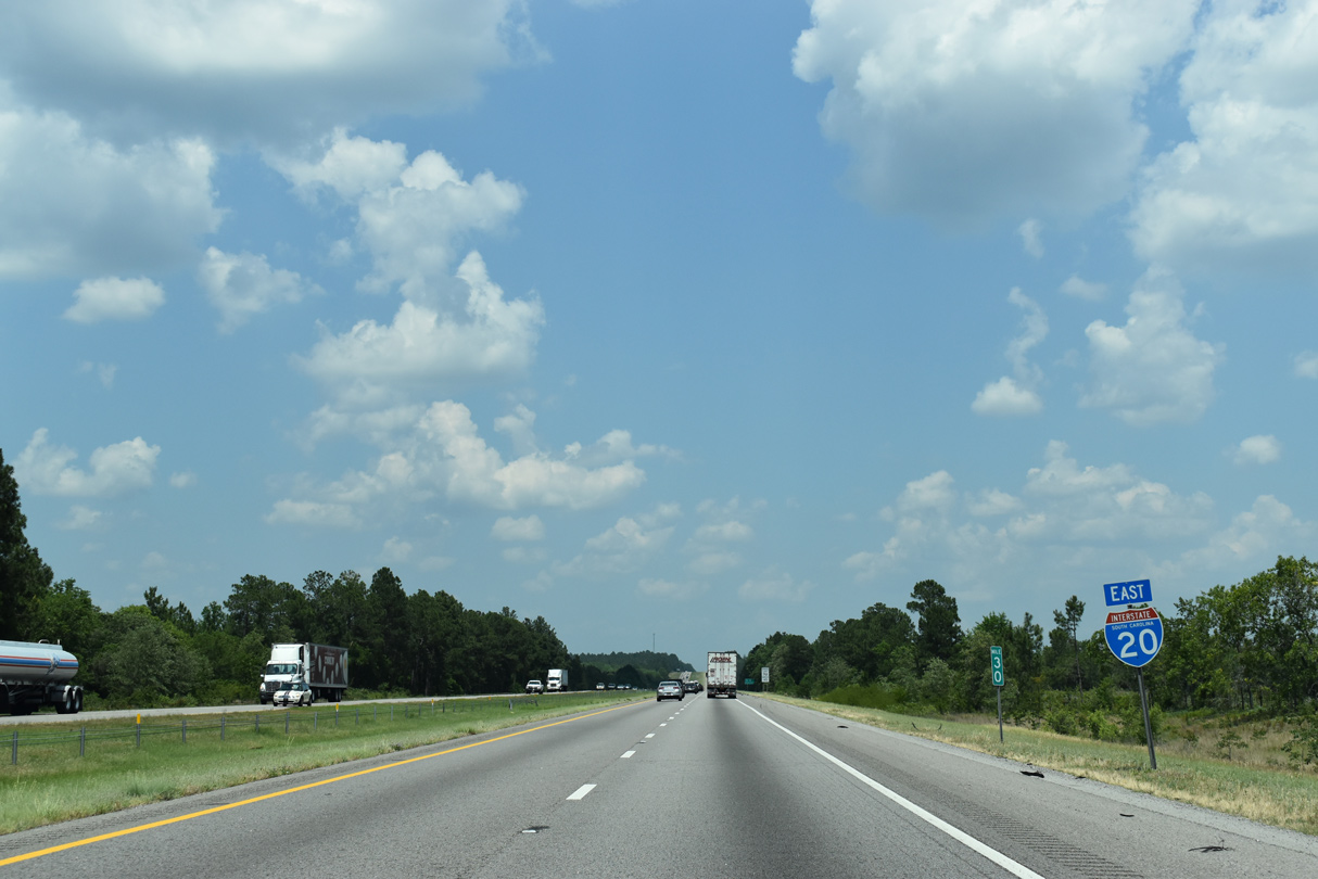
| I-20 straddles the Aiken / Edgefield County line east from the Savannah River by the South Carolina welcome center. An $82.5 million project underway to the first quarter of 2022 replaces the bridges over the Savannah River and expands 1.8 miles of I-20 east to Exit 1.1 04/13/12 |
|
| Exit 1 joins Interstate 20 with S.C. 230 (Martintown Road) in the city of North Augusta. S.C. 230 runs 3.40 miles southeast to U.S. 25/S.C. 121 (Knox Avenue). 04/13/12 |
|
| Entering the six-ramp parclo interchange (Exit 1) with S.C. 230 (Martintown Road) on I-20 east. Northward, S.C. 230 links with the Savannah River National Scenic Highway via Woodlawn Road (Road 53) west to S.C. 28 en route to S.C. 23 beyond Colliers. 04/13/12 |
|
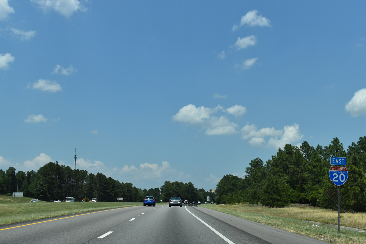
| Interstate 20 throughout the state is the Strom Thurmond Freeway. Signs for the designation stand at Exit 1 along eastbound and after I-95 along westbound. 04/13/12 |
|
| Missing by 2011, the first shield for Interstate 20 east in South Carolina was posted along the stretch just south of the Wando Woodlands subdivision. 06/24/10 |
|
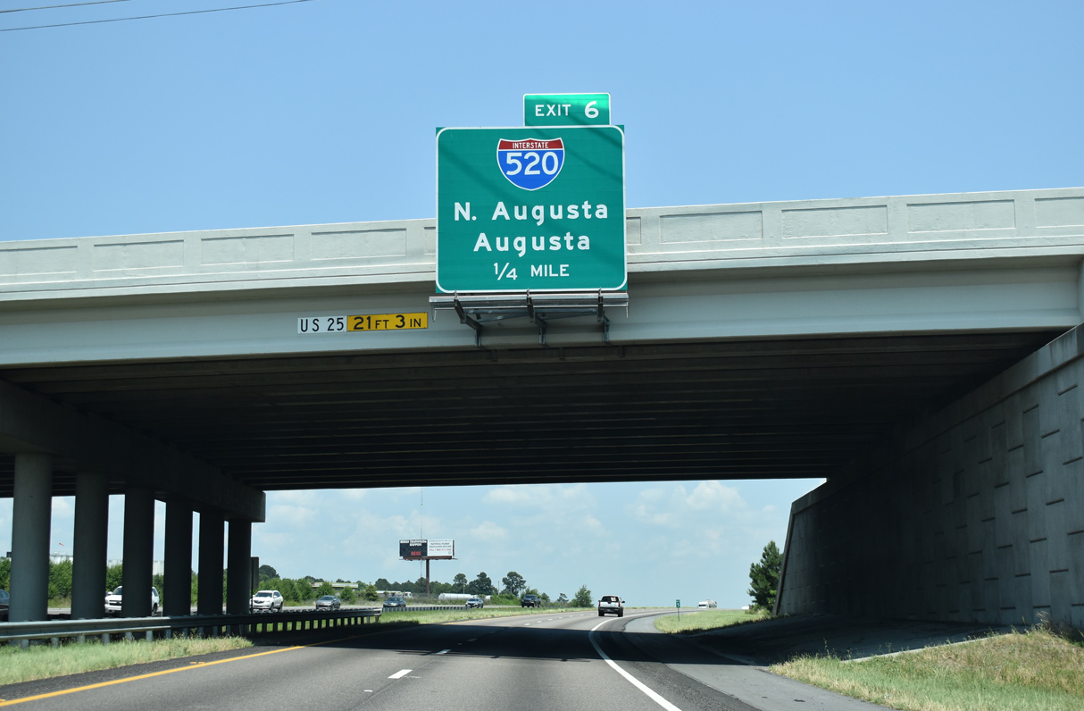
| U.S. 25 heads northeast from Downtown Augusta and North Augusta to meet Interstate 20 at Exit 5 in three miles. Columbia is 67 miles to the east. 05/24/19 |
|
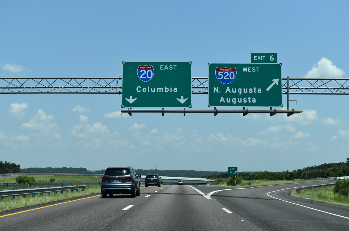
| I-20 advances two miles from the Five Notch Road (Road 45) overpass to Interstate 520. I-520 (Palmetto Parkway) was extended north from Georgia to U.S. 1-78-278 on June 22, 2004, and ultimately to I-20 on December 16, 2009. 05/24/19 |
|
| Construction for the directional T interchange (Exit 6) with I-520 reconfigured adjacent Exit 5 with U.S. 25/S.C. 121 (Edgefield Road) into a diamond interchange with an extended eastbound entrance ramp. S.C. 121 is a multi state route south through the Peach State to U.S. 19/98 near Ingils, Florida. 05/24/19 |
|
| U.S. 25/S.C. 121 (Edgefield Road) travel south to Belvedere and Downtown Augusta and north 13.2 miles to split at S.C. 19 near Trenton. U.S. 25 turns northwest from there six miles to the Edgefield County seat of Edgefield. U.S. 25 overall travels 750 miles from Brunswick, Georgia to the Ohio River at Cincinnati, Ohio. 05/24/19 |
|
| Interstate 520 previously ended at Georgia State Route 28 (Sandbar Ferry Road). It was extended northward to I-20 in an effort to spur economic development on the South Carolina side of the Savannah River. 05/24/19 |
|
| I-520 (Palmetto Parkway) arcs south west to Augusta Regional Airport (AGS). Three interchanges join I-520 with the east side of North Augusta before the beltway crosses into the city of Augusta. 05/24/19 |
|
| A flyover ramp joins Interstate 520 east with I-20 west. 05/24/19 |
|
| Entrance ramps from Edgefield Road and I-520 (Palmetto Parkway) join Interstate 20 east ahead of this shield assembly at Franklin Branch. 05/24/19 |
|
| Graniteville, a suburb of Aiken, is ten miles to the east via I-20 to Exit 11. Columbia is 53 miles further. 05/24/19 |
|
| C & D Landfill appears along the southeast side of Interstate 20 by Rainbow Falls along the stretch crossing Hightower Creek. 05/24/19 |
|
| Bettis Academy Road (Road 144) heads north from Ascauga Lake Road (Road 33) and Graniteville to the diamond interchange at Exit 11. 05/24/19 |
|
| North from Exit 11, Bettis Academy Road continues from Interstate 20 to U.S. 25/S.C. 121 in Edgefield County. 05/24/19 |
|
| Progressing east from Exit 11, I-20 passes north of Sage Valley Golf Club ahead of Sage Mill Branch. 05/24/19 |
|
| Seat of Aiken County, the city of Aiken, seat of Aiken County is 12 miles to the southeast via I-20 and S.C. 19. I-20 remains rural to Exit 51 along the 57 miles to Columbia. 05/24/19 |
|
| Interstate 20 drops over 150 feet in elevation into the valley fed by Horse Creek north of Vaucluse Pond. 06/24/10 |
|
| The first of two diamond interchanges for Aiken lies one mile beyond the Rebel Road overpass. S.C. 19 (Edgefield Highway) heads 5.57 miles south from Exit 18 to U.S. 1/78 (Richland Avenue) in Downtown Aiken. 05/24/19 |
|
| S.C. 19 comprises a 28.75 mile long highway from the Savannah River Site south of U.S. 278 and New Ellenton to U.S. 25/S.C. 121 near Trenton. S.C. 191 connects S.C. 19 at Eureka with Johnston to the north. 05/24/19 |
|
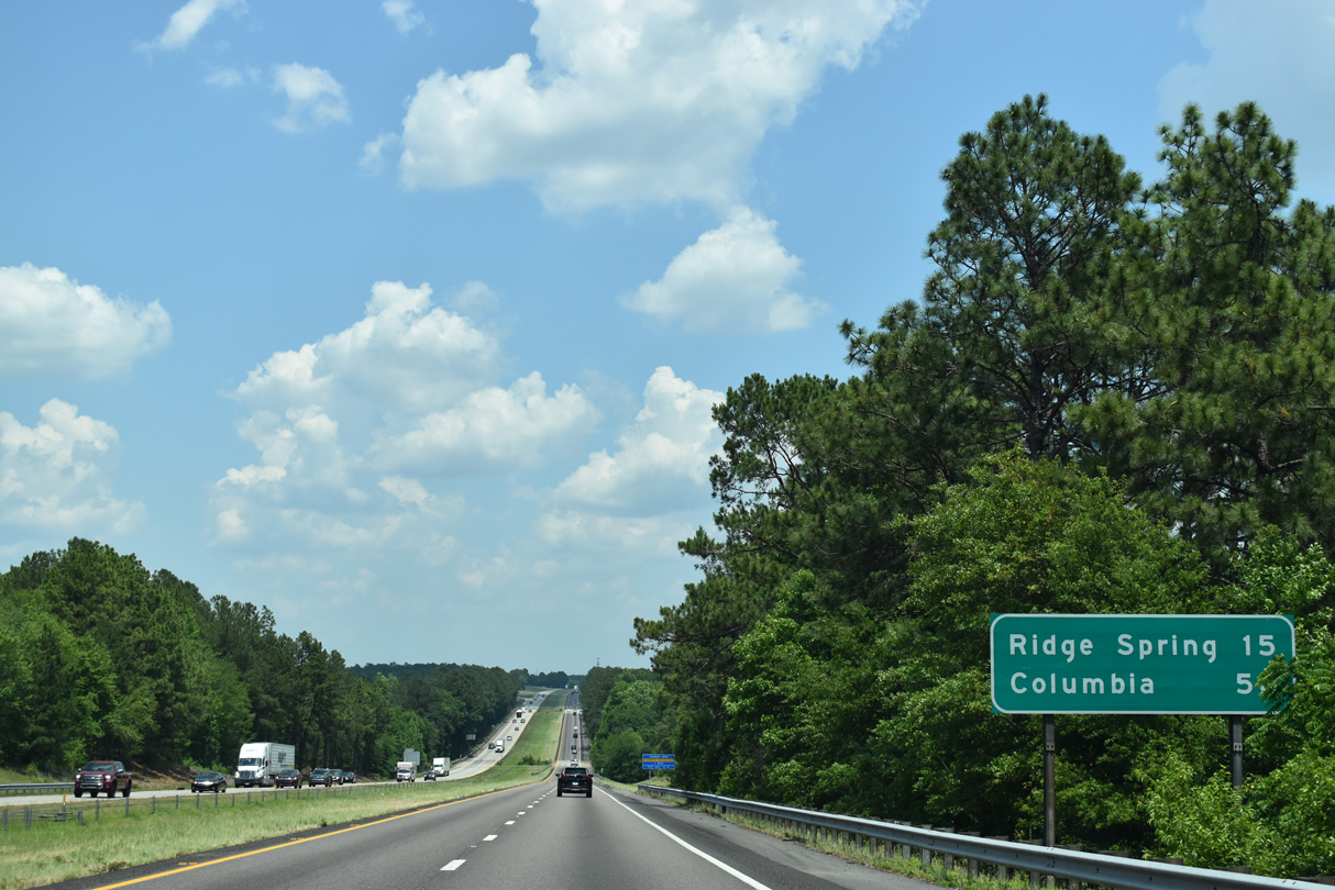
| Continuing east from S.C. 19, Interstate 20 reaches Columbia in 50 miles. 15 miles to the northeast, Ridge Spring is the succeeding exit. 05/24/19 |
|
| A truck parking area lies one mile east of Shaw Creek. Opened in early April 2008, the area was one of seven added along South Carolina Interstates as part of an effort to improve highway safety. 05/24/19 |
|
| The entrance to the truck parking area follows the Gregory Road underpass along Interstate 20 east. 05/24/19 |
|
| U.S. 1 and I-20 meet for the first time at Exit 22 near Aiken Municipal Airport (AIK). U.S. 1 enters South Carolina with U.S. 25-78-278 from Downtown Augusta and turns east from North Augusta alongside U.S. 78 to Downtown Aiken. 05/24/19 |
|
| North from Aiken, U.S. 1 (Columbia Highway) crosses I-20 by the AIK Airport en route to Batesburg-Leesville. S.C. 392 links U.S. 1 with Ridge Spring as part of a route to Saluda via S.C. 23 and S.C. 39. 05/24/19 |
|
| U.S. 1 (Columbia Highway) combines with U.S. 76 (Richland Avenue) west in Downtown Aiken, 7.91 miles to the south. Ridge Spring is 13.3 miles via U.S. 1 (Columbia Highway) and S.C. 392 (Engineer Road) north. 06/24/10 |
|
| Interstate 20 lines a ridge between Little Branch and Big Branch east from Exit 22. This confirming marker was removed by 2014. 06/24/10 |
|
| Wire Road (Road 49) parallels Interstate 20 northeast from Aiken to meet the freeway at a diamond interchange in six miles. Columbia follows in another 40 miles. 05/24/19 |
|
| One mile west of Exit 29 to Wire Road (Road 49) on I-20 east. 05/24/19 |
|
| Wire Road continues 3.29 miles northeast from Foxtown and Interstate 20 to Jones Crossroads, where Road 49 becomes S.C. 391. 05/24/19 |
|
| Interstate 20 bee lines northeast along a long straight away to Long Branch and Oak Grove. 05/24/19 |
|
| S.C. 39 and Interstate 20 come together in two miles at Exit 33. 05/24/19 |
|
| 102 miles in length, S.C. 39 follows an arc north from the Savannah River Site by U.S. 278 near Williston to U.S. 221 south of Laurens. A diamond interchange joins I-20 with S.C. 39 at Exit 33. 05/24/19 |
|
| S.C. 39 (Old 96 Indian Trail) travels 8.02 miles northwest to U.S. 1 in the rural town of Monetta. Wagener is 12 miles to the east. 05/24/19 |
|
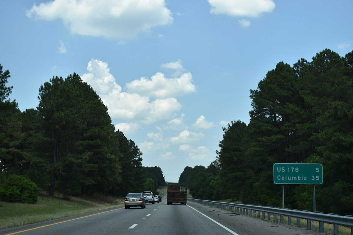
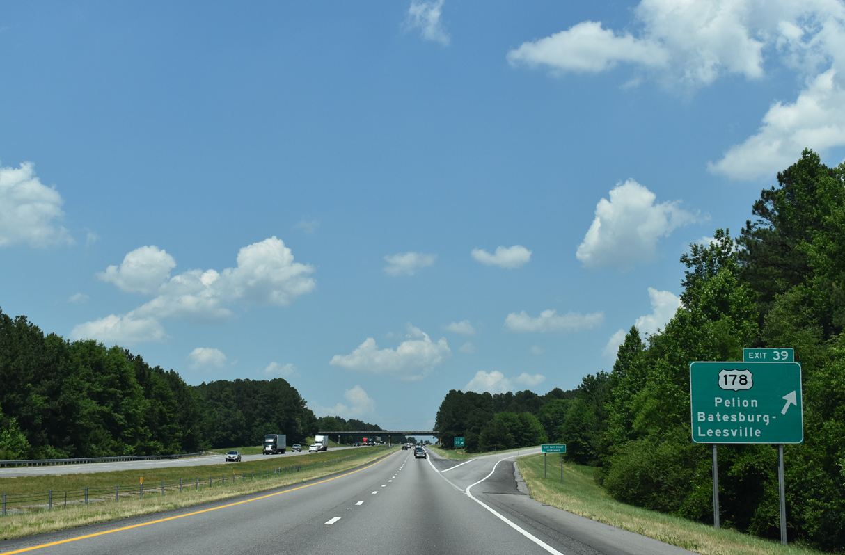
| The ensuing exit along Interstate 20 east is the diamond interchange (Exit 39) with U.S. 178 in five miles. 05/24/19 |
|
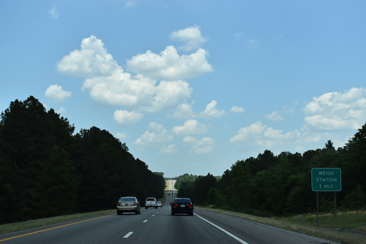
| A weigh station operates along eastbound Interstate 20 beyond Goose Platter Creek. 05/24/19 |
|
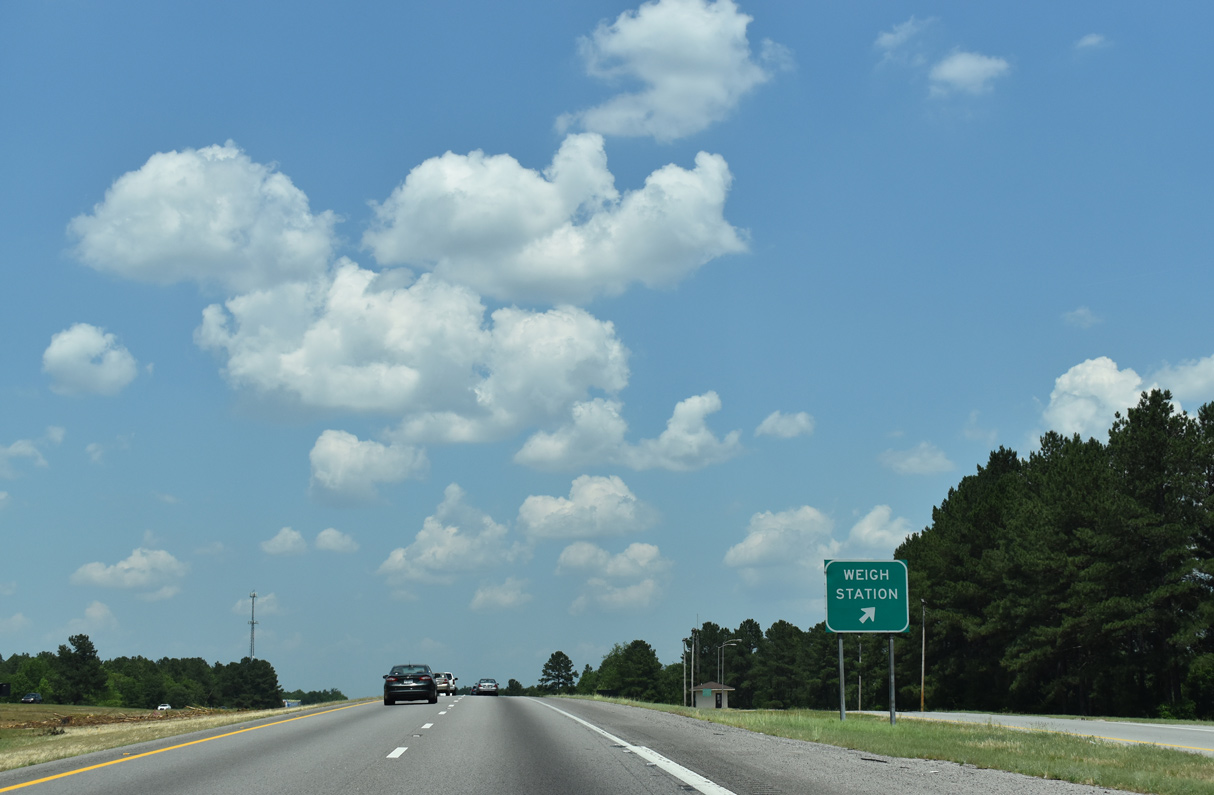
| The weigh station ramp leaves Interstate 20 east ahead of the Huckleberry Farm Road (Road 134) overpass. 05/24/19 |
|
| I-20 lowers toward an area of wetlands surrounding the North Fork of the Edisto River. The North Edisto River separates Aiken and Lexington Counties from Batesburg-Leesville southeast to S.C. 3. 05/24/19 |
|
| U.S. 178 meets Interstate 20 at Exit 39, the first of eight interchanges in Lexington County. Measuring 240 miles in length, U.S. 178 originates in the LowCountry near Dorchester and concludes to the northwest at Rosman, North Carolina. 05/24/19 |
|
| U.S. 178 (Fairview Road) runs 8.24 miles northwest from Exit 39 to U.S. 1 in Batesburg-Leesville, a town formed in 1992.2 Southward, U.S. 178 proceeds 6.23 miles to S.C. 113 and Calks Ferry Road (Road 278) at Fairview Crossroads, and 13.74 miles to S.C. 302 (Pine Street) in Pelion. 05/24/19 |
|
| Lexington is the next major city along the Interstate 20 corridor in 17 miles. Two interchanges precede the Lexington County seat. 05/24/19 |
|
| Road 34 meanders meanders 8.68 miles east from East Avenue in Batesburg-Leesville to a diamond interchange (Exit 44) with I-20 along Pond Branch Road. 05/24/19 |
|
| Gilbert, and adjacent Summit, are towns served by Exit 44 via Juniper Springs Road (Road 37) and other highways leading north from Road 34. Road 34 (Pond Branch Road) continues east from I-20 toward Red Bank. 05/24/19 |
|
| Neely Wingard Road (Road 774) runs along the east side of I-20 along the ensuing stretch. 05/24/19 |
|
| Interstate 20 curves eastward from Pond Branch ahead of a valley across Black Creek. Old Charleston Road (Road 625) spans the freeway beyond mile marker 46. 05/24/19 |
|
| Rest areas along both sides of Interstate 20 in Lexington County closed in 2001. The succeeding facility is 44 miles away at Lugoff in Kershaw County. 05/24/19 |
|
| The former rest areas were located by the Calks Ferry Road (Road 278) overpass. 05/24/19 |
|
| Reaching the suburban outskirts of Lexington, Interstate 20 converges with Longs Pond Road (Road 204) at the diamond interchange (Exit 51) in one mile. 05/24/19 |
|
| Longs Pond Road (Road 204) north links I-20 with the Lexington Michelin plant at Two Notch Road (Road 70). Road 204 extends south 2.31 miles to a roundabout with Nazareth Road (Road 243) and the Long's Pond Estates subdivision. 05/24/19 |
|
| Industrial areas line much of the frontage alongside Interstate 20 eastward through south Lexington. 06/24/10 |
|
| The Lexington city center is another five miles away via I-20 east to S.C. 6 north. Columbia is 19 miles to the east. 05/24/19 |
|
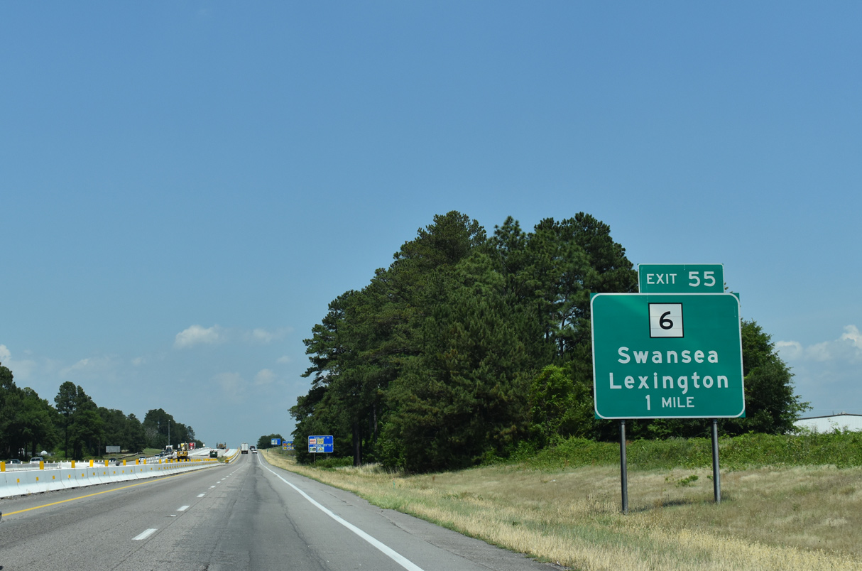
| A parclo interchange (Exit 55) connects S.C. 6 (S Lake Drive) with Interstate 20 east in one mile. S.C. 6 winds 18.83 miles southeast from Exit 55 to U.S. 321 in Swansea. 05/24/19 |
|
| Exit 55 parts ways with I-20 east for S.C. 6 (S Lake Drive). S.C. 6 is a 116 mile long highway that begins at U.S. 76 in Balletine, north of Lake Murray and Lexington, and ends at U.S. 17 Alternate and Moncks Corner in the Lowcountry. 05/24/19 |
Page Updated 09-13-2021.

 East
East