|
| The outer suburbs of Columbia spread east along I-20 to the diamond interchange (Exit 82) with Spears Creek Church Road. Interstate 20 concludes in 60 miles at I-95, five miles from Downtown Florence. 05/24/19 |
|
| Connecting I-20 with S.C. 12 (Percival Road) to the south and U.S. 1 (Two Notch Road) at Pontiac to the north, Spears Creek Church Road mirrors the course of Clemson Road. 05/24/19 |
|
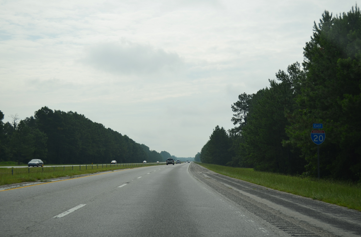
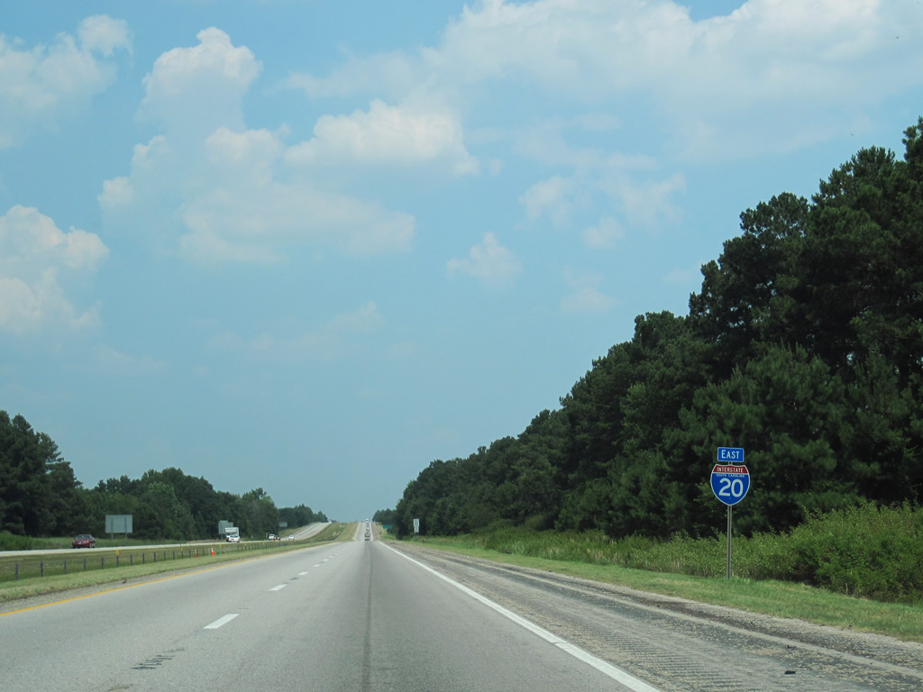
| Interstate 20 reduces to a four lane freeway beyond Exit 82. 05/24/19 |
|
| Eastbound traffic along I-20 proceeds 18 miles east Camden. Florence is an hour away. 05/24/19 |
|
| Interstate 20 east enters Kershaw County ahead of the Highway Church Road overpass. 05/24/19 |
|
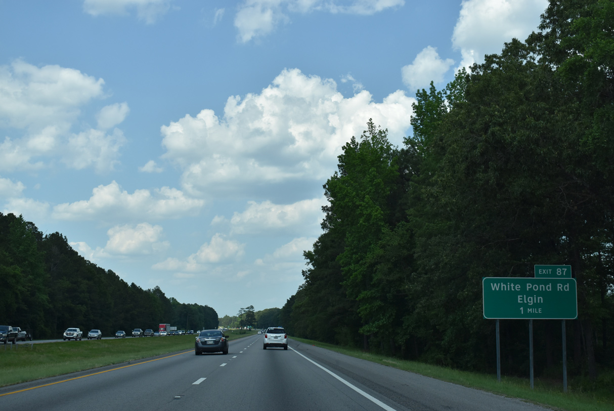
| White Pond Road meets Interstate 20 at the first of four exits in Kershaw County. The road serves the town of Elgin and a number of subdivisions between I-20 and U.S. 1 (Jefferson Davis Highway). 05/24/19 |
|
| Entering the diamond interchange (Exit 87) with White Pond Road along I-20 east. White Pond Road ties into S.C. 12 (Fort Jackson Road) a short distance to the south. S.C. 12 leaves Fort Jackson and parallels I-20 to U.S. 601. 05/24/19 |
|
| Interstate 20 advances east from White Pond Road (Exit 87) to U.S. 601 next. 05/24/19 |
|
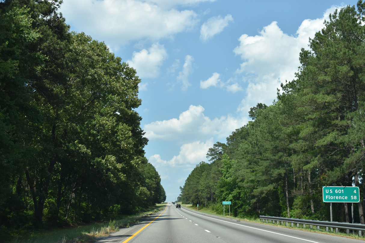
| U.S. 601 and S.C. 12 come together at a parclo B2 interchange (Exit 92) in four miles. 05/24/19 |
|
| U.S. 601 expands into a four lane, divided highway north from I-20 through the community of Lugoff. There the route combines with U.S. 1 along Main Street to Camden. 05/24/19 |
|
| The last rest area for passenger vehicles along Interstate 20 east is the second along eastbound in the state. 05/24/19 |
|
| U.S. 601 runs 181 miles north from U.S. 321 near Tarboro to the state line near Pageland. Overall the route travels 319 miles to Mt. Airy, North Carolina. 05/24/19 |
|
| Heading east from U.S. 601, Interstate 20 passes through an area of wetlands associated with Gillies Creek to the south of Lugoff. 05/24/19 |
|
| Florence lies 53 miles to the east. 05/24/19 |
|
| Rest areas line both sides of Interstate 20 in Kershaw County. 05/24/19 |
|
| A continuation of the Catawba River from North Carolina, the Wateree River originates from Wateree Lake northwest of Lugoff and Camden, flowing 75 miles southward to the Congaree River. 05/24/19 |
|
| East of the Waterlee River, Interstate 20 advances to a diamond interchange (Exit 98) with U.S. 521. U.S. 521 links Camden with the city of Sumter to the south along a 30 mile stretch. 05/24/19 |
|
| Exit 98 leaves I-20 east at Big Pine Tree Creek for U.S. 521 (Sumter Highway). Overall, U.S. 521 travels 172 miles in South Carolina, extending just north of the state line to I-485 in Charlotte. 05/24/19 |
|
| Sumter Highway winds northwest onto Broad Street to U.S. 1/601 in Downtown Camden. U.S. 601 turns north there with U.S. 521 en route to Kershaw. 05/24/19 |
|
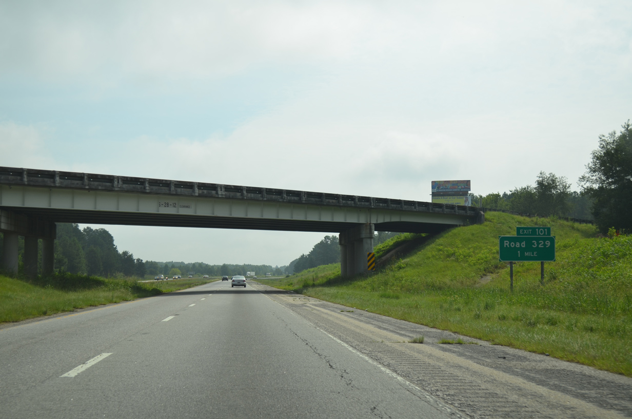
| Continuing east, I-20 progresses three miles to Exit 101 for Road 329 (Dr. Humphries Road) and 47 miles to Florence. 07/28/13, 06/24/10 |
|
| Spanning I-20 one mile from the diamond interchange at Exit 101, Black Raven Road (Road 12) stems southeast from U.S. 521 (Sumter Highway) to Pisgah. 07/28/13 |
|
| Dr. Humphries Road (Road 329) runs 1.82 miles north from adjacent Road 91 (Cleveland School Road) to S.C. 34 (Bishopville Highway) between Paint Hill and Antioch. 07/28/13 |
|
| Cleveland School Road (Road 91) turns northeast across Interstate 20 beyond this confirming marker. 07/28/13 |
|
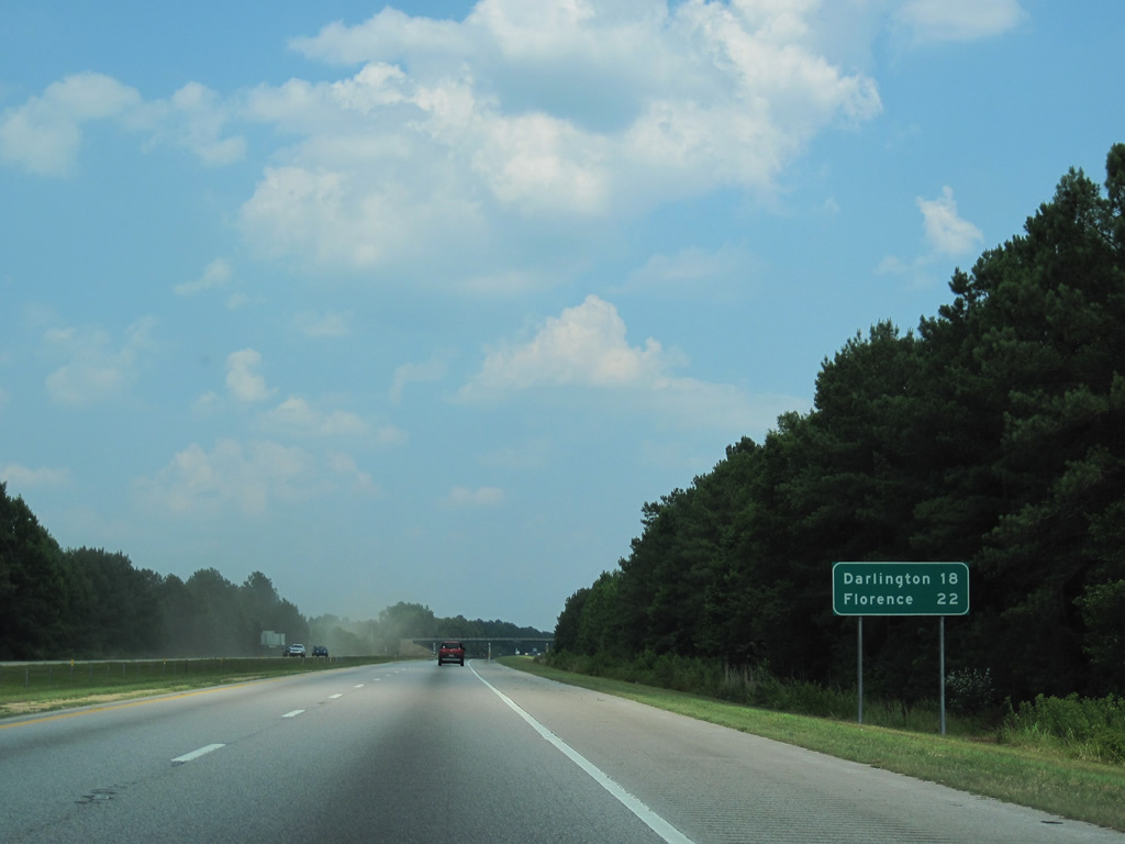
| The succeeding exits along I-20 connect with Bishopville, located 15 miles to the east. Florence is 30 miles beyond the Lee County seat. 07/28/13 |
|
| Seegars Mill Road (Road 562) crosses over Interstate 20 at a western notch of Lee County. I-20 straddles the county line and Road 368 (Westvaco Road) for a short distance before wholly entering the county named after Confederate General Robert E. Lee. 06/24/10 |
|
| A diamond interchange (Exit 108) links I-20 with Road 31, a 0.46 mile long access road between S.C. 34 (Camden Highway) and Jamestown Road (Road 174). 06/24/10 |
|
| Jamestown Road (Road 174) angles southeast from near Exit 108 to U.S. 15 and S.C. 441 at Manville. Adjacent S.C. 34 (Camden Highway) curves northward from near I-20 along a rural course east to Bishopville. 06/24/10 |
|
| Interstate 20 progresses east along a 7.98 mile long stretch through farmland and Scape Ore Swamp. 07/28/13 |
|
| Interstate 20 east travels ten miles to Bishopville and 37 miles to Florence. 07/28/13 |
|
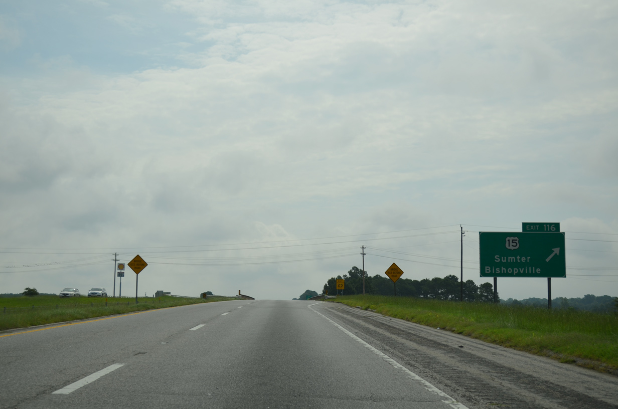
| U.S. 15 (Sumter Highway) and I-20 converge at a parclo B2 interchange (Exit 116) in one mile. U.S. 15 provides one of two routes from I-20 to Bishopville, which lies three miles to the northeast. 07/28/13 |
|
| U.S. 15 continues 14 miles northeast from Bishopville to the city of Hartsville, where it splits with a business loop. Bishopville is home to the South Carolina Cotton Museum. 07/28/13 |
|
| Exit 116 loops away from I-20 to U.S. 15 (Sumter Highway). Originating at U.S. 17 ALT in Walterboro, U.S. 15 overall runs 159 miles north to Bennettsville in South Carolina. 07/28/13 |
|
| U.S. 15 (Sumter Highway) heads 3.43 miles southwest to S.C. 441 at Manville and 18 miles to U.S. 76/378 in Sumter. 07/28/13 |
|
| Passing south of Bishopville, Interstate 20 parallels Gin Branch east to the Black River. 06/24/10 |
|
| Traversing agricultural areas, Interstate 20 proceeds 3.27 miles east from the U.S. 15 entrance ramp to Exit 120 for S.C. 341 (Wisacky Highway). 06/24/10 |
|
| 93 miles in length between Johnsonville and Kershaw, S.C. 341 (E Church Street) angles southeast from U.S. 15/S.C. 34 (Main Street) in Downtown Bishopville to the diamond interchange at Exit 120. 06/24/10 |
|
| Southeast from Exit 120, S.C. 341 (Wisacky Highway) heads 2.8 miles to S.C. 527 at Wisacky and 12.3 miles to U.S. 76 in the town of Lynchburg. 06/24/10 |
|
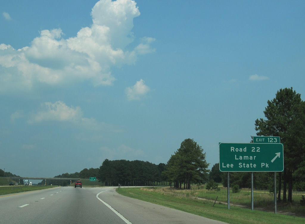
| Interstate 20 enters a portion of Lee State Park across the Lynches River. Exit 123 follows with Road 22 (Lee State Park Road) north to the park headquarters and U.S. 15/S.C. 34 at Shannon Hill. 06/24/10 |
|
| Road 22 meanders 2.27 miles east from the diamond interchange at Exit 123 to the Darlington County line, where Lee State Park Road becomes Road 47 en route to Main Street in the town of Lamar. 06/24/10 |
|
| Darlington and Florence are the last cities served by Interstate 20 eastbound. 06/24/10 |
|
| Interstate 20 east enters Darlington County at Newman Swamp to the northwest of Lamar. 06/24/10 |
|
| A set of truck only rest areas opened for use in early April 2008. These facilities were two of seven added to the S.C. Interstate system in 2008 as part of a safety initiative.1 06/24/10 |
|
| The second truck only rest area along Interstate 20 east lies just beyond Sparrow Swamp. 06/24/10 |
|
| U.S. 401 angles northeast from Sumter through Oswego, Elliot and Lamar to cross paths with I-20 at Exit 131. A 36 mile long highway between Hartsville and Lake City, S.C. 403 (Oates Highway) intersects U.S. 401 just to the south. 06/24/10 |
|
| North from Exit 131, U.S. 401 (Lamar Highway) continues 9.9 miles to U.S. 52 in Darlington. U.S. 52/401 combine north from near Darlington Raceway to Society Hill. S.C. 403 (Oates Highway) heads 7.69 miles southeast from U.S. 401 at Windhams Crossroads to U.S. 76 in Timmonsville. 06/24/10 |
|
| S.C. 340 (Timmonsville Highway), the final mainline exit along Interstate 20 east, lies nine miles from Downtown Florence. 06/24/10 |
|
| S.C. 340 (Timmonsville Highway) runs 10.99 miles northeast from S.C. 403 near Timmonsville to S.C. 34 in Darlington. 06/24/10 |
|
| I-20 east at the diamond interchange (Exit 137) with S.C. 340. Southborough Road (Road 54) and Sally Hill Road (Road 3) radiate outward from a five point intersection with S.C. 340 at Corporation Road at nearby Wallace Crossroads to the westernmost suburbs of Florence. 06/24/10 |
|
| The last confirming marker for Interstate 20 eastbound stands beyond the on ramp from Exit 137. 01/05/19 |
|
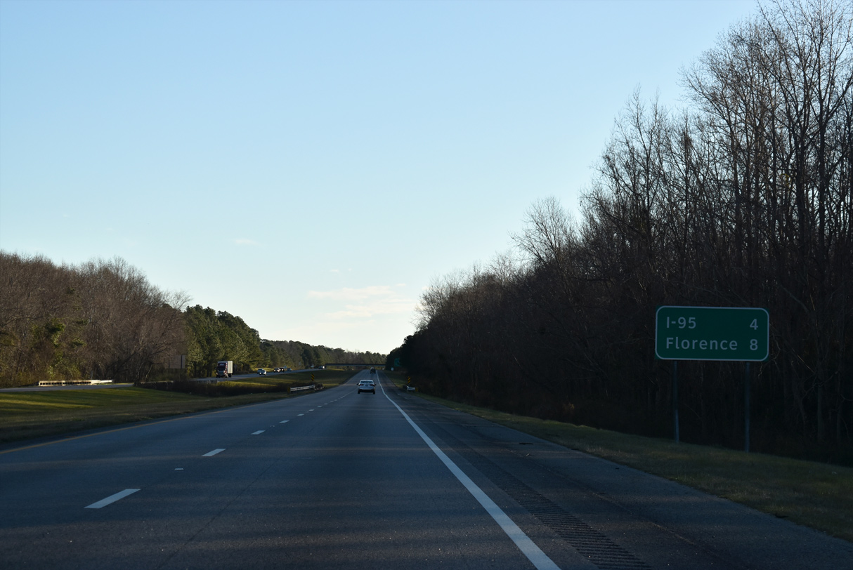
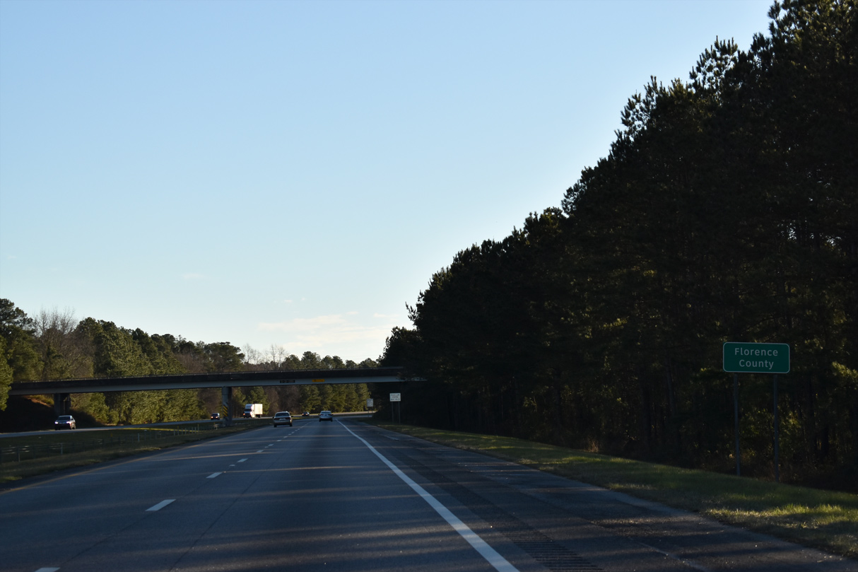
| The remaining four miles of Interstate 20 east span Jeffries Creek and enter Florence County along an uninterrupted stretch to I-95. 01/05/19 |
|
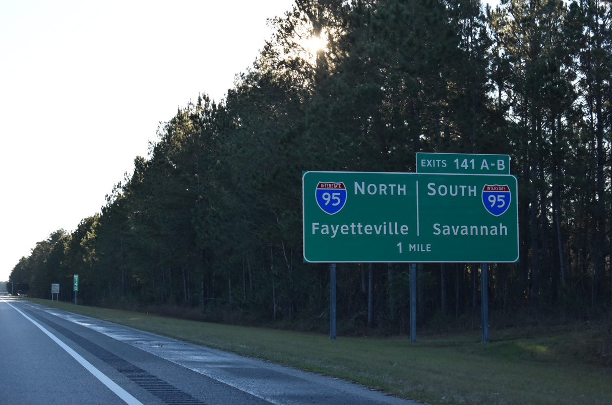
| Two miles west of the directional cloverleaf interchange (Exits 141A/B) with Interstate 95 on I-20 east. 01/05/19 |
|
| Interstate 20 crosses into Florence County ahead of the overpass for Winburn Drive. 01/05/19 |
|
| Myrtle Beach bound traffic is directed onto I-95 north to either S.C. 327 south from Exit 170 to U.S. 76 east or S.C. 38 east from Exit 181 to U.S. 501. Both state highways are part of four lane corridors to the Grand Strand. 01/05/19 |
|
| With mostly regional traffic, Interstate 95 comprises a vastly rural, but well traveled route through the Carolinas. Fayetteville lies 90 miles to the northeast, beyond a short urbanized stretch through Lumberton, North Carolina. 01/05/19 |
|
| Two lanes partition from the east end of I-20 for Exit 141A to I-95 north and Exit 141B to Business Spur I-20 and I-95 south. Business Spur 20 (David H. McLeod Boulevard) extends 2.11 miles east to U.S. 76 (Palmetto Street) in Florence. 01/05/19 |
|
| The mainline of Interstate 20 defaults onto I-95 north at Exit 141A for Fayetteville, Rocky Mount and Richmond, Virginia. Business Spur 20 runs east from Exit 141B to Magnolia Mall and U.S. 76 (Palmetto Street) by Florence Mall. 01/05/19 |
|
| Exit 141B separates from Business Spur I-20 for I-95 south 176 miles to Savannah, Georgia. 01/05/19 |
Page Updated 09-13-2021.

 East
East