|
| Maribel rest area 51 provides 47 car and 20 truck parking stalls. It opened in 1980. 05/30/11 |
|
| The southeasterly course of Interstate 43 takes the freeway east from County J toward the settlement of Cooperstown along adjacent County R (old U.S. 141). 05/30/11 |
|
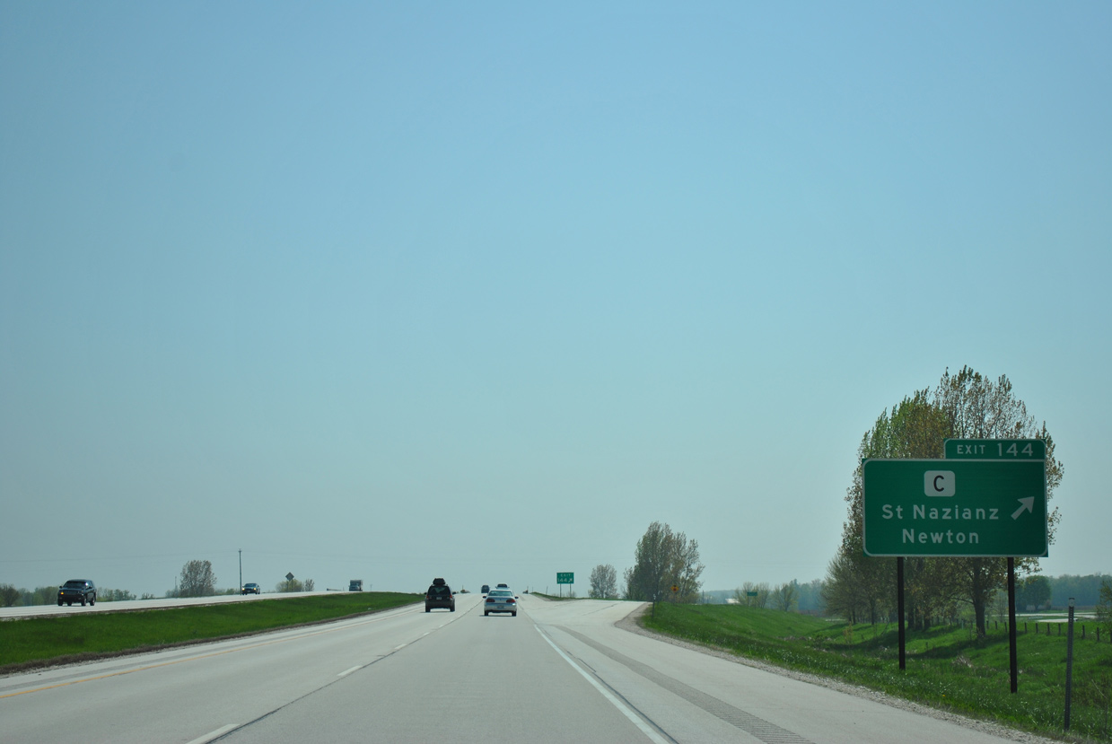
| County Z (Belmar Avenue) east and Wis 147 north come together at a diamond interchange (Exit 164) with Interstate 43 in one mile. 05/30/11 |
|
| Wis 147 constitutes a 15 mile route southeast through Mishicot to Wis 42 in the city of Twin Rivers. County Z extends west from the trunk highway end at I-43 through the village of Maribel to Rosecrans and southern Brown County. 05/30/11 |
|
| Confirming marker posted ahead of the Devil's River State Trail underpass on I-43 south. The 15 mile rail trail heads south from Denmark to Francis Creek and Rockwood. 05/30/11 |
|
| The village of Kellnersville lies three miles ahead via the ensuing exit. Manitowoc is another 17 miles along Interstate 43 south and U.S. 10 east. 05/30/11 |
|
| Forthcoming County K stems west from County R (old U.S. 41) to Kellnersville, Menchalville and Wis 32/57 near Forest Junction. 05/30/11 |
|
| Interstate 43 curves southeasterly to the diamond interchange (Exit 160) with CTH-K. 05/30/11 |
|
| Travelers continue southeast along Interstate 43 to Francis Creek. A diamond interchange (Exit 157) joins the freeway with the west side of the village via County V (Hillcrest Drive). 05/30/11 |
|
| Exit 157 departs Interstate 43 south for County V. County V west ends at County T in 3.5 miles. Eastward, the trunk highway dog legs through Francis Creek alongside old U.S. 141 (Packer Drive) before resuming east to CTH-B north and the village of Mishicot. 05/30/11 |
|
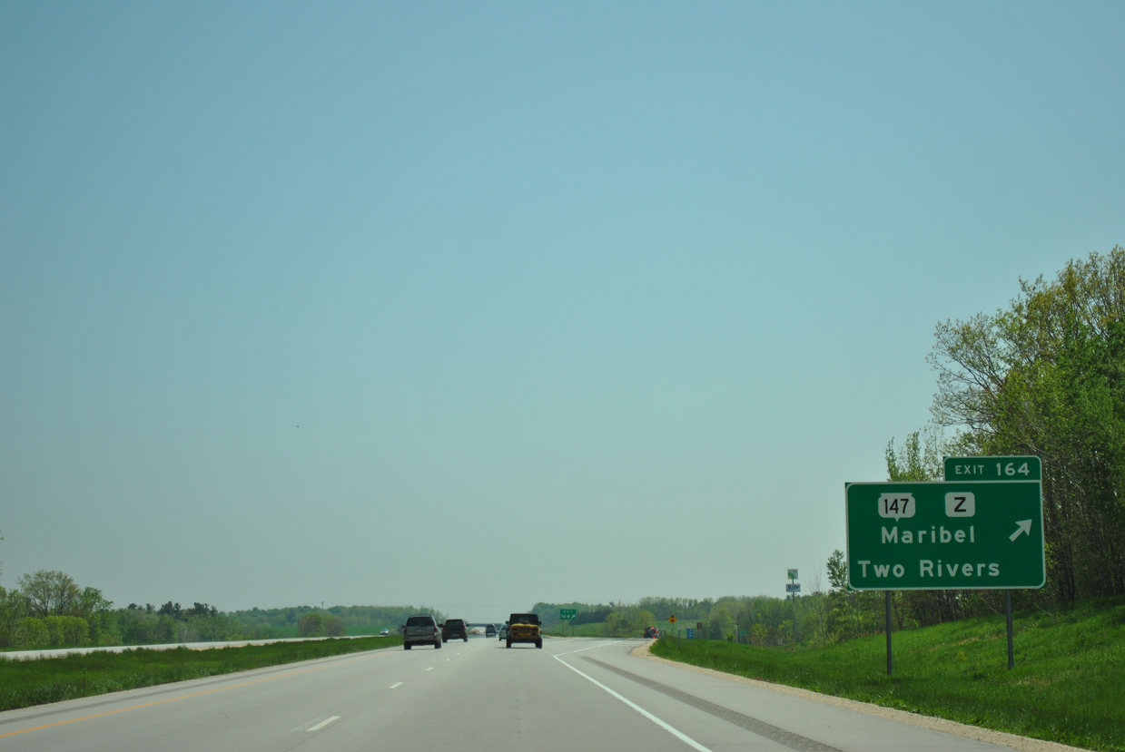
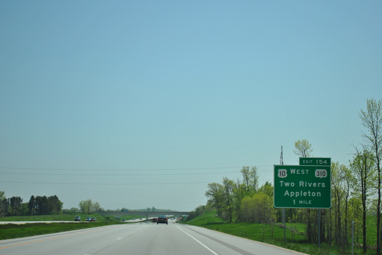
| Leading south from Francis Creek, I-43 next meets U.S. 10 east and Wis 310 west at Exit 154. Designated in the early 1980s in place of County D, Wis 310 provides a direct route to Downtown Two Rivers. 05/30/11 |
|
| U.S. 10 east accompanies Interstate 43 south between Exits 154 and 152. The route formerly took County P (Homestead Road) east from Branch to County R (Rapids Road), which was U.S. 141 south into west Manitowoc. 05/30/11 |
|
| Entering the diamond interchange (Exit 154) with U.S. 10 and STH-310 along Interstate 43 south. U.S. 10 ventures west to Whitelaw, Reedsville and Brillion on the 40 mile drive to Appleton. 05/30/11 |
|
| U.S. 10 shifted to an overlap with Interstate 43 when the freeway opened along the west side of Manitowoc. 05/30/11 |
|
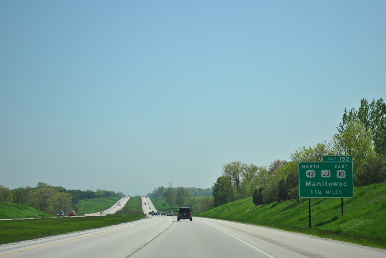
| The freeway sinks toward a crossing of the Manitowoc River on the one mile approach to Exit 152 with U.S. 10 east / Wis 42 north and County JJ. 05/30/11 |
|
| Wis 42 overlaps with U.S. 10 from the couplet of 8th and 11th Streets in Manitowoc along an expressway west to Exit 152. The state trunk highway uses I-43 to bypass the city south to Exit 149. Prior to the completion of Interstate 43, Wis 42 ran in tandem with U.S. 141 (Rapids Road) south from U.S. 10 to U.S. 151. 05/30/11 |
|
| A rural diamond interchange connects Interstate 43 with the west end of the U.S. 10/Wis 42 expressway linking Exit 152 with Rapids Road (CTH-R). The expressway opened in tandem with this stretch of I-43.
County JJ stems west from the exchange to the settlements of Clarks Mills and Collins and County PP outside Potter in Calumet County. 05/30/11 |
|
| I-43/Wis 42 angle southeast into the Manitowoc city limits beyond the Canadian National and Custer Street (CTH-CS) under crossing. The freeway runs between an industrial park and the Manitowoc County Fairgrounds ahead of Exit 149 with U.S. 151 (Calumet Avenue). 05/30/11 |
|
| U.S. 151 begins in Downtown Manitowoc to the east. The 337 mile route generally travels southwest from Lake Michigan to Cedar Rapids and Interstate 80 in Iowa. West from I-43, the US route travels along two lane rural roadways to Chilton and Lake Winnebago. Further south, U.S. 151 encircles Fond du Lac along an expressway bypass as part of a high speed route leading southwest to Madison. 05/30/11 |
|
| Signs for Wis 42 were covered up at this time. The state trunk highway takes U.S. 151 west briefly before branching southwest to Osman and Howards Grove. 05/30/11 |
|
| Continuing south from the commercial south side of Manitowoc, Interstate 43 returns to rural environs on the 21 mile drive to Sheboygan. Milwaukee still remains over an hour away. 05/30/11 |
|
| County CR (old U.S. 141) parallels Interstate 43 just to the east through Clover as they both progress south to County C. CTH-CR south ends opposite CTH-U east of Exit 157 and a mile north of unincorporated Newton. 05/30/11 |
|
| County C travels 16.4 miles across Manitowoc County from County LS off Lake Michigan to the east and the village of St. Nazianz and Wis 67 to the west. The initial 1.25 mile segment west is the former alignment of U.S. 141. 05/30/11 |
|
| Interstate 43 passes just west of Newton as it parallels a Canadian National Railroad south toward Cleveland. Old U.S. 141 followed a stair stepped route along what is now Center Road, County F and Westview Road. 05/30/11 |
|
| A south side weigh station operations along Interstate 43 beyond the County E underpass. 05/30/11 |
|
| Center Road passes over Interstate 43 as the freeway swings west to bypass the village of Cleveland. A diamond interchange (Exit 137) follows in one mile at County XX (North Avenue). 05/30/11 |
|
| County XX meanders west 13.8 miles across southern Manitowoc County to Wis 67 on the Kiel city limits. East from Exit 137, CTH-XX zig zags to CTH-LS near the shore of Lake Michigan. 05/30/11 |
|
| Reassurance marker posted for I-43 south ahead of the Cleveland Road overpass. 05/30/11 |
|
| Interstate 43 advances southward between the city of Sheboygan and village of Kohler over the next 13 miles. Milwaukee is now 66 miles away. 05/30/11 |
|
| Travelers cross into Sheboygan County amid farm fields north and south of County Line Road. 05/30/11 |
Page Updated 06-09-2016.

 South
South


 East
East