The Joplin Business loop is the western most Business route for Interstate 44 in both Missouri and overall. The 11.89 mile route begins at Exit 6 where Missouri 86 ends at Hearnes Boulevard. Joining Missouri 43 north from I-44, the business loop follows Hearnes Boulevard to Main Street (north from 32nd Street) along a commercialized boulevard to Downtown Joplin. It is along this stretch (28th to 20th Streets) that the May 21, 2011 EF5 tornado crossed Main Street, leveling the majority of homes and businesses in a swath as wide as one mile from the western end of Joplin east to Interstate 44 near Interstate 49 south and Missouri 249 north.1
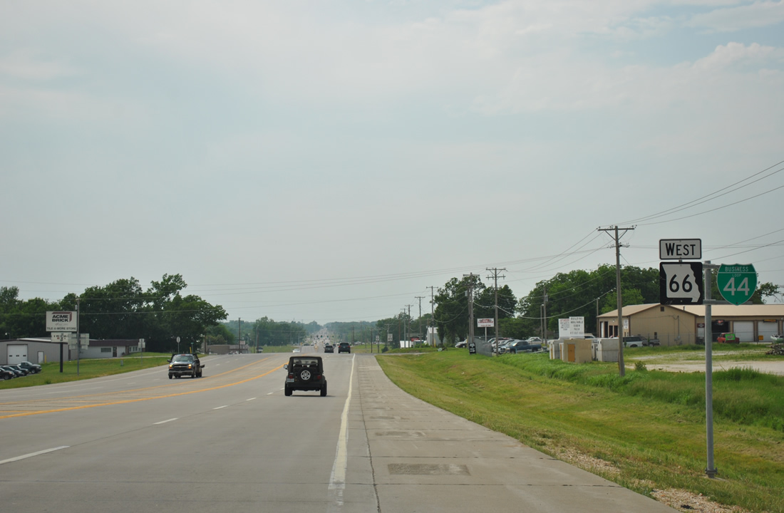
Once in the Joplin central business district, Business Loop I-44 parts ways with Missouri 43 (Main Street) to combine with Missouri 66 east along 7th Street. Missouri 66 is Historic U.S. 66 leading west to Galena, Kansas and Historic U.S. 66 Bypass east from Main Street to Range Line Road. Business Loop I-44 follows MO 66 east to intersect the 2012-designated Business Loop I-49 (Range Line Road) by Northpark Mall and Missouri 249, a 6.17 mile freeway leading south to Interstates 44 and 49 and north to Missouri 171 & Business Loop I-49. The business loop ends at a wye interchange formed between Cimarron Road (frontage road) and I-44 at Scotland.
|
| Business Loop I-44 east and Missouri 43 north conclude a 3.4 mile overlap at the intersection of Main and 7th Streets in Downtown Joplin. Business Loop I-44 joins Missouri 66 east from Joplin to Duquesne and Duenweg. 05/04/12 |
|
| Reassurance markers posted for Business Loop I-44 & Missouri 66 east of their diamond interchange with the Missouri 249 freeway. The pair intersect Prosperity Avenue ahead, which shifted eastward when the MO 249 exit was constructed. 05/04/12 |
|
| Leaving the city of Duenweg, Business Loop I-44 & Missouri 66 enter a diamond interchange with Missouri 249, a 6.17 mile north-south freeway. 05/04/12 |
|
| Missouri 249 was constructed to January 2009 from the exchange between Interstates 44 and 49 to the south and Business Loop I-49 & Missouri 171 at Carterville to the north. 05/04/12 |
|
| Missouri 249, also known as the Range Line Bypass, continues north from Business Loop I-44 & Missouri 66 to Newman Road, east of Missouri Southern State University, and Zora Street over the next two miles. 05/04/12 |
|
| Continuing west from MO 249, Business Loop I-44 & Missouri 66 travel a four lane arterial toward the Joplin suburb of Duquesne. 05/04/12 |
|
| Kenser Road ventures south from an industrial park at Kenser Lane north to connect Business Loop I-44 with a number of rural residential streets and East 20th Street. 05/04/12 |
|
| Travis Acres Road connects Business Loop I-44 & Missouri 66 with parallel Newman Road. Newman Road and the business loop follow section lines exactly one mile a part. 05/04/12 |
|
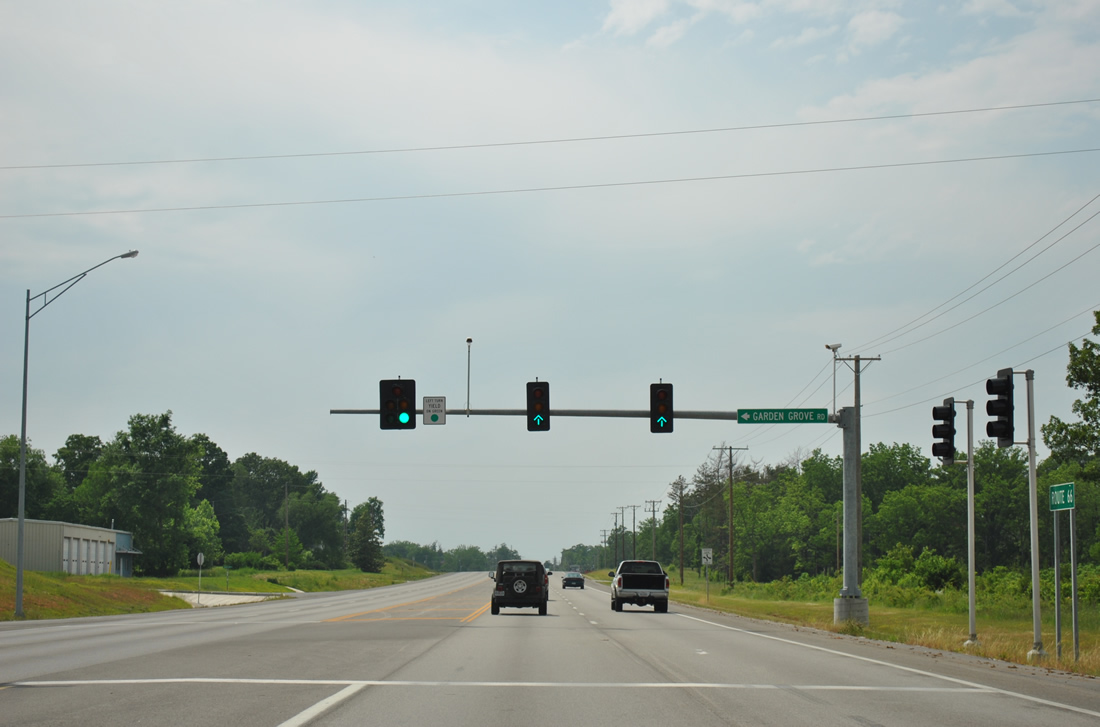
| Garden Grove Road meets Business Loop I-44 & Missouri 66 (East 7th Street) at the next traffic light beyond Turkey Creek. The neighborhood road angles southeast to East 13th Street. 05/04/12 |
|
| Entering the incorporated city of Duquesne, which was home to 1,763 as of the 2010 census. 05/04/12 |
|
| Duquesne Road travels south from Business Loop I-44 & Missouri 66 (East 7th Street) to the Duquesne city center and Route FF (East 32nd Street). Motorists turning onto the road north reach Missouri Southern State University in over a half mile. 05/04/12 |
|
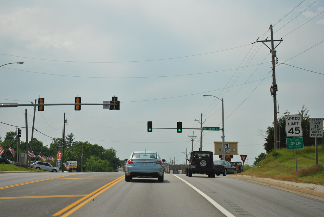
| Business Loop I-44 & Missouri 66 (East 7th Street) cross the Joplin city line from Duquesne ahead of Northpark Lane. Northpark Lane leads north to Northpark Mall, which lines the east side of Business Loop I-49 (Range Line Road). 05/04/12 |
|
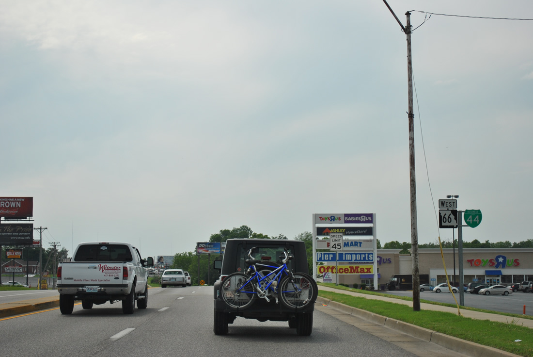
| Big box retail fronts the northeast and northwest quadrants of the intersection between Business Loop I-44 & Missouri 66 (East 7th Street) with Business Loop I-49 (Range Line Road). The four business loops for Interstate 49 in Missouri were established in place of U.S. 71 Business on December 12, 2012 when the U.S. 71 freeway between Pineville and Kansas City was renumbered as I-49. 05/04/12 |
|
| Geneva Avenue ties into the retail area along Business Loop I-44 & Missouri 66 from the south as a residential street. East 6th Street joins from the north as a retail access road. 05/04/12 |
|
| Business Loop I-49 follows Range Line Road south 2.5 miles to Interstate 44 at a diverging diamond interchange (DDI). The cloverleaf interchange was converted to a DDI during road work between summer 2012 and October 17, 2013. 05/04/12 |
|
| U.S. 71 Business, now Business Loop I-49, travels a 22.48 mile route south to Exit 33 of I-49 and north to Webb City, Carterville and Carthage. 05/04/12 |
|
| Business Loop I-44 & Missouri 66 (East 7th Street) lower from Business Loop I-49 to cross a Missouri and Northern Arkansas Railroad line at Leonard Park. 05/04/12 |
|
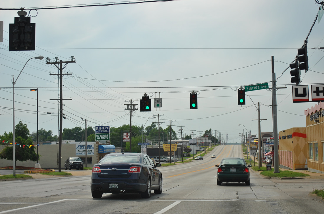
| East 7th Street becomes more urban west from the railroad line to Downtown Joplin. Florida Avenue meets Business Loop I-44 & Missouri 66 at this traffic light. The avenue north from Utica Street to Zora Street was a part of the Historic U.S. 66 alignment from Joplin northeast to Webb City. 05/04/12 |
|
| A pair of reassurance markers follow the East 7th Street intersection with Brownell Avenue. Commercial frontage lines Business Loop I-44 to Downtown. 05/04/12 |
|
| Westbound Business Loop I-44 & Missouri 66 at Highland Avenue. 05/04/12 |
|
| St. Louis Avenue leads south from East 7th Street to Murphy Boulevard Park and Connecticut Avenue through a neighborhood hard hit by the May 22, 2011 EF5 tornado. Northward, St. Louis Avenue becomes Prairie Flower Road to MO 171 near Joplin Regional Airport (JLN). The portion of St. Louis Avenue between Broadway Street and Euclid Avenue was an original U.S. 71 Business loop and also the Historic U.S. 66. 05/04/12 |
|
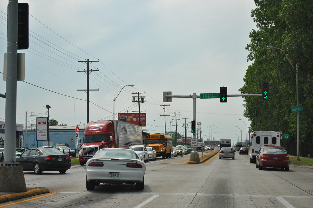
| Business Loop I-44 & Missouri 66 gain a concrete median by the Joplin Plaza shopping center. Illinois Avenue north and Murphy Boulevard south come together at a signalized intersection along this stretch. 05/04/12 |
|
| Another set of shields for Business Loop I-44 & Missouri 66 west reside by Ewert Park ahead of Minnesota Avenue. 05/04/12 |
|
| Four lanes of East 7th Street ascend to pass over a Kansas City Southern Railroad line and Joplin Creek. 05/04/12 |
|
| Lowering from the railroad underpass, Business Loop I-44 & Missouri 66 enter the Joplin central business district. Pennsylvania Avenue elevates over former Frisco railroad tracks just north of this traffic light. The viaduct was constructed between winter and May 1929 at a cost of $100,000.2 05/04/12 |
|
| Business Loop I-44 & Missouri 66 (East 7th Street) progress two blocks further to their split at Missouri 43 (Main Street). 05/04/12 |
|
| Virginia Avenue is the westernmost of the state named avenues in Joplin. The north-south avenue travels just three blocks south from Business Loop I-44 & Missouri 66 and six blocks north. 05/04/12 |
|
| Missouri 43 follows Main Street through the heart of Downtown Joplin. Business Loop I-44 west accompanies the route south for the return to I-44 while MO 43 north continues to Airport Drive and Joplin Regional Airport (JLN). Historically U.S. 71 Business also followed Main Street north to Broadway Street and south to 32nd Street. 05/04/12 |
|
| Missouri 66 follows West 7th Street from Business Loop I-44 and Missouri 43 (Main Street) to Chitwood and Galena, Kansas. Historic U.S. 66 took this course west to Baxter Springs, Kansas and Quapaw, Oklahoma. 05/04/12 |
|
| A Business Loop I-44 assembly directs motorists from Missouri 43 south onto South Main Street or East 7th Street. Shields for both MO 43 and 66 were missing. 05/04/12 |
|
| Main Street constitutes a four lane boulevard south from Downtown Joplin to Interstate 44 at Shoal Creek Drive. Pictured here is the traffic light at 8th Street. 05/04/12 |
|
| Missouri 43 south reassurance marker posted between 8th and 9th Streets. 05/04/12 |
|
| 9th Street crosses paths with Business Loop I-44 & Missouri 43 (Main Street) east from Maiden Lane and west from Murphy Boulevard. 05/04/12 |
|
| 10th Street parallels a BNSF Railroad line across Main Street at the next traffic signal. 05/04/12 |
|
| 15th Street connects Business Loop I-44 & Missouri 43 with residential areas beyond the commercial strip of Main Street. The street ends at Business Loop I-49 (Range Line Road) to the east. 05/04/12 |
|
| The first set of shields for both Business Loop I-44 west & Missouri 43 south are posted after 15th Street. 05/04/12 |
|
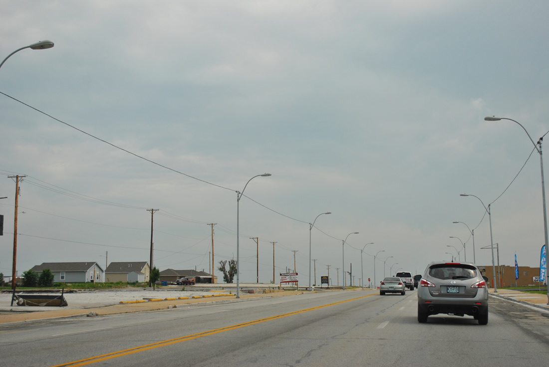
| Business Loop I-44 west & Missouri 43 (Main Street) south at 20th Street. A mural painted here commemorates those lost during the May 27, 2011 tornado and encourages recovery efforts by the community since then. 05/04/12 |
|
| The scope of the damage from the EF5 tornado in May 2011 was quite evident along Business Loop I-44 south from 20th Street to 28th Street. 05/04/12 |
|
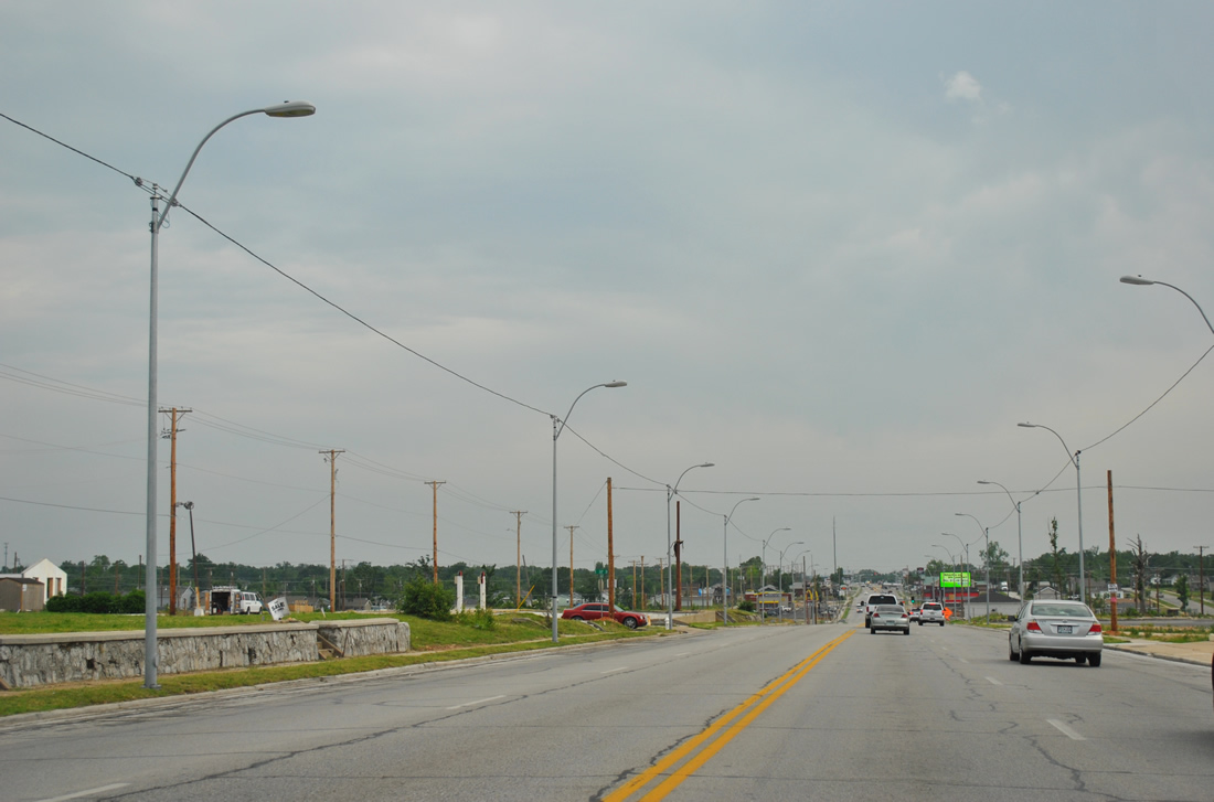
| Approaching the signalized intersection with 26th Street along Main Street south. 05/04/12 |
|
| Route FF follows East 32nd Street from Business Loop I-44 west & Missouri 43 (Main Street) south. 05/04/12 |
|
| Route FF totals 11.15 miles from Main Street east to Missouri 59 near Fidelity. Locally 32nd Street leads west to Freeman Hospital West and Newton Road along the Jasper / Newton County line and east to Sunnyvale and a sprawling industrial area at Gateway Drive. 05/04/12 |
|
| Business Loop I-44 west & Missouri 43 cross the Newton County line ahead of Shoal Creek Drive. 05/04/12 |
|
| The last shield of Business Loop I-44 west. Main Street becomes Hearnes Boulevard in Newton County. 05/04/12 |
|
| 41st Street joins Business Loop I-44 & Missouri 43 with the Dennis Acres community to the east. 05/04/12 |
|
| Lowering to the diamond interchange with Interstate 44 along Business Loop I-44 west & Missouri 43 (Hearnes Boulevard) south. 05/04/12 |
|
| Missouri 43 joins Interstate 44 west for 2.5 miles to Exit 4 for its continuation south to Seneca. Missouri 86 begins and continues Hearnes Boulevard south from I-44 toward Spring City and Racine. 05/04/12 |
|
| Business Loop I-44 ends as Missouri 43 departs for Interstate 44 west to Galena, Kansas, the Will Rogers Turnpike and Tulsa, Oklahoma. 05/04/12 |
|
| Passing under the Interstate 44 mainline, Missouri 86 (Hearnes Boulevard) approaches the eastbound on-ramp for Springfield. 05/04/12 |
|
| Interstate 44 journeys east 5.6 miles to combine with Interstate 49 north. Springfield is a 71 mile drive while the east end of I-44 is 286 miles away in St. Louis. 05/04/12 |
Page Updated 10-29-2013.