|
| Interstate 59 leaves the exchange with I-12 and I-10 at Slidell along an 11 mile course northeast to Pearl River County, Mississippi. This is the first northbound shield. 05/09/15 |
|
| The town of Pearl River lies three miles to the north of Slidell along a Norfolk Southern Railroad line at U.S. 11 and LA 41. Hattiesburg, a regional service center in southeastern Mississippi, lies 75 miles away. 05/09/15 |
|
| Interstate 59 parallels LA 1090 (Military Road) northward from Slidell to Pearl River. The two routes meet at a diamond interchange (Exit 3) where U.S. 11 north joins I-59. 05/09/15 |
|
| One half mile south of Exit 3 to Pearl River. LA 1090 ends at Exit 3, completing a 4.5 mile course northward from U.S. 190 (Gause Boulevard). 05/09/15 |
|
| Exit 3 parts ways with Interstate 59 north for U.S. 11 (Concord Boulevard) southbound to LA 41 (Watt Road) and LA 3081 at Pearl River. LA 41 begins nearby and ventures north to Hickory and Bush while LA 3081 follows Main Street (old U.S. 11) to the Pearl River town center. 05/09/15 |
|
| LA 1090 (Military Road) heads south from I-59 and U.S. 11 through the suburban outskirts of eastern Slidell. 05/09/15 |
|
| U.S. 11 combines with Interstate 59 north from Pearl River to the Nicholson interchange (Exit 1) in Mississippi. 04/20/12 |
|
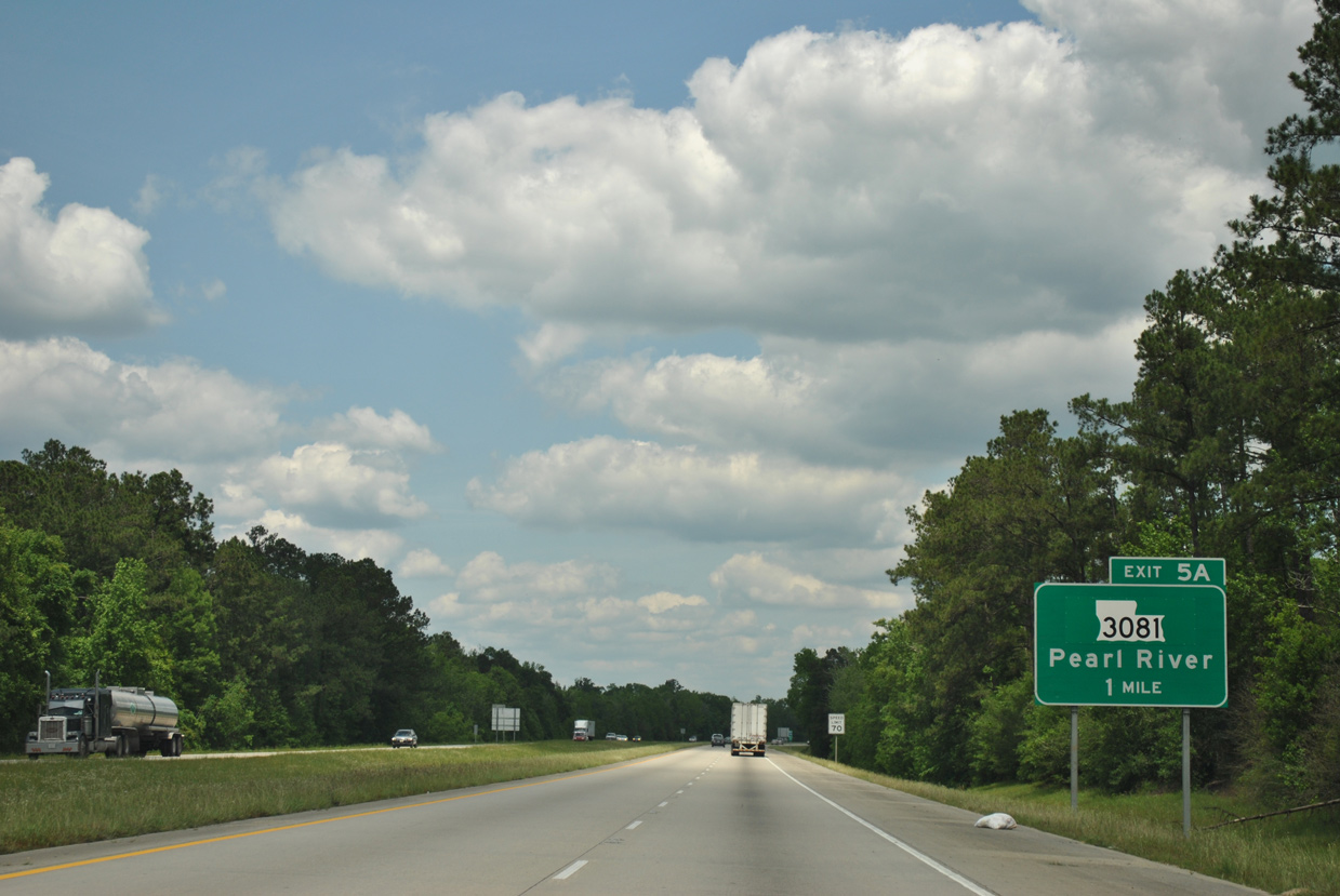
| LA 3081 follows Main Street / Old Highway 11 northeast through Pearl River to a folded diamond interchange (Exit 5 A) with I-59/U.S. 11. 04/20/12 |
|
| Exit 5A with LA 3081 (Pump Slough Road) lies just south of the West Pearl River. LA 3081 was realigned over the easternmost portion of LA 41 Spur. 04/20/12 |
|
| Motorists using Exit 5A join a service road (Pump Slough Road) that loops under I-59 at the West Pearl River to intersect LA 3081 on the west side of the interchange. 04/20/12 |
|
| LA 41 Spur extended 2.5 miles northwest from LA 3081 along Pine Street to Hickory Street and LA 41 north. The state highway was decommissioned. 06/15/01 |
|
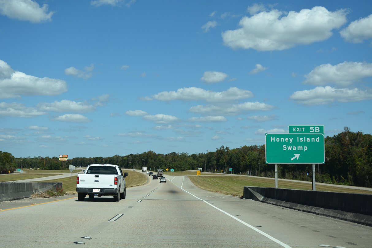
| I-59/U.S. 11 span the West Pearl River a half mile from Exit 5 B for Honey Island Swamp. 10/12/16 |
|
| Exit 5 B comprises a folded diamond interchange with service roads north of the West Pearl River. These roads connect with a handful of fish camps and Pearl River Wildlife Management Area via Old U.S. 11. 10/12/16 |
|
| The final set of northbound I-59/U.S. 11 shields in Louisiana stand just inside the Pearl River town limits. 10/12/16 |
|
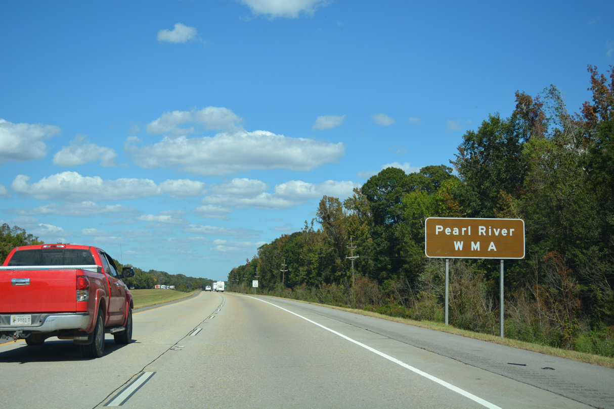
| Interstate 59 travels through portions of Pearl River Wildlife Management Area to milepost nine. 10/12/16 |
|
| Hattiesburg is an hour drive north along Interstate 59. Distance to the state line is referenced in lieu of Picayune, the seat of Pearl River at Exit 4. 10/12/16 |
|
| One half mile ahead of the folded diamond interchange (Exit 11) at the Pearl River Turnaround on I-59/U.S. 11 north. 10/12/16 |
|
| Pearl River Turnaround (Exit 11) serves Bogue Chitto National Wildlife Refuge and Holmes Bayou Trail. 10/12/16 |
|
| Exit 11 leaves I-59/U.S. 11 north for Atlas Road to an adjacent quarry, Honey Island Swamp Road and Holmes Bayou Trail. 10/12/16 |
|
| Crossing the Pearl River, I-59/U.S. 11 advance one half mile north to their split at Highway 607 and the community of Nicholson, Mississippi. 10/12/16 |
Page Updated 03-29-2019.

 North
North


 North
North