|
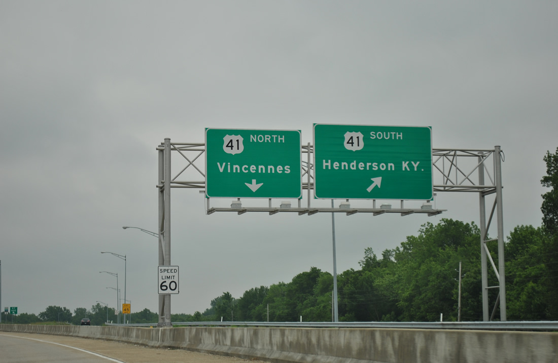
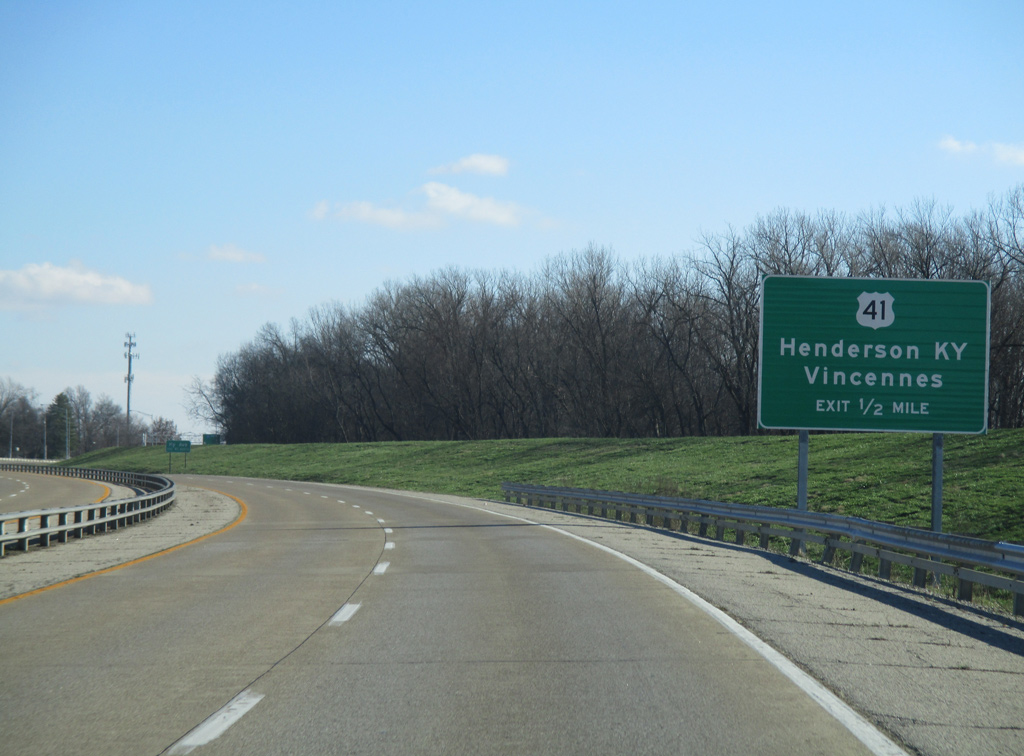
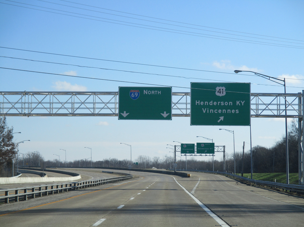
| Veterans Memorial Parkway leads southeast from Riverside Drive and the Ohio River waterfront to join Downtown Evansville with Interstate 69 north and U.S. 41. U.S. 41 goes for 280 miles from Northwest Indiana through Kentland, Attica, Rockville, Terre Haute, Vincennes and Evansville before it heads across the Ohio River into Henderson, Kentucky, providing a link to the Audubon and Pennyrile Parkways. 01/01/16 |
|
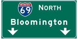
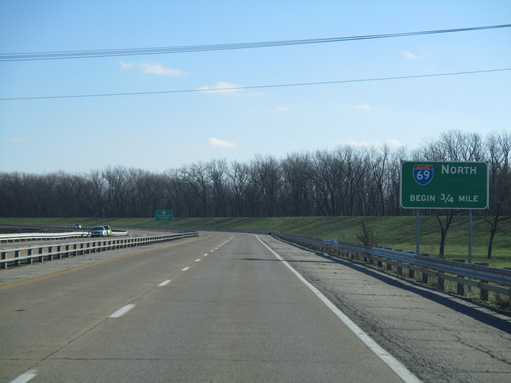
| Interstate 69 begins its northward trek to Bloomington in three quarters of a mile from this spot along the Veterans Memorial Parkway. The upcoming southern terminus for Interstate 69 is only temporary pending on the construction of a new bridge over the Ohio River. Upon completion, the bridge spanning the river will be the final southern end of the interstate in Indiana. 01/01/16 |
|
| Veterans Memorial Parkway is a controlled-access roadway from Shawnee Drive southeast to the cloverleaf interchange with I-69 north and U.S. 41 south to Henderson, Kentucky. 01/01/16 |
|
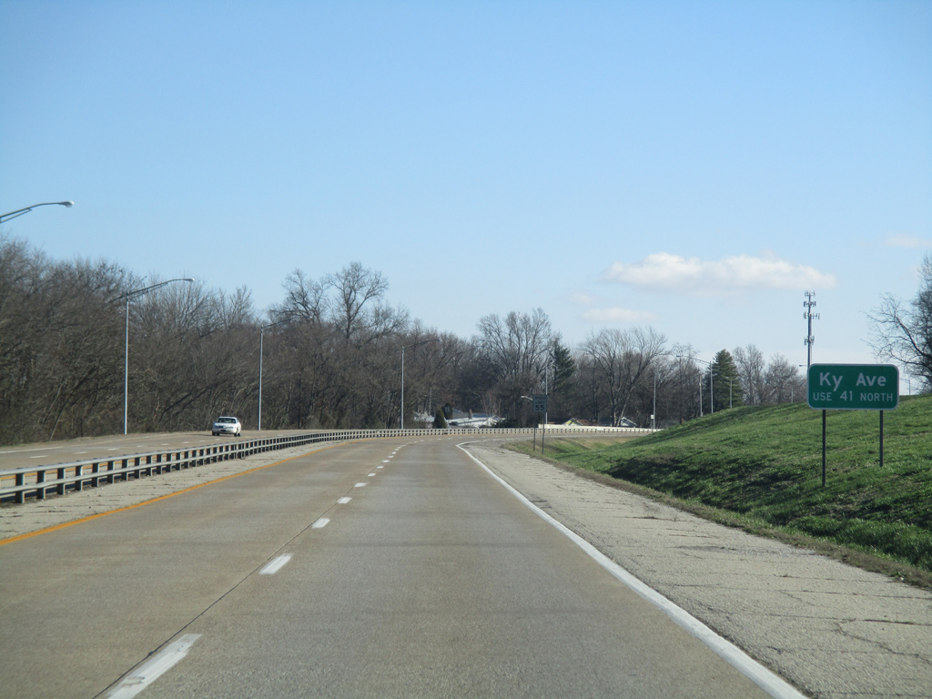
| Kentucky Avenue (former U.S. 41 Business) originally ended at U.S. 41 where the southbound to westbound Veterans Memorial Parkway ramp exists now. There is no direct access to the northward leading street; instead motorists are directed to u-turn using the loop ramps along the northbound lanes of U.S. 41 to reach the westbound off-ramp to Kentucky Avenue. 01/01/16 |
|
| Interstate 69 starts at the point where the Veterans Memorial Parkway partitions with a collector distributor roadway to U.S. 41. On November 15, 2013 it was announced that I-69 would replace I-164, the spur from I-64 to U.S. 41. Signs were replaced along the highway to reflect the new designation by late 2014. 01/01/16 |
|
| Traffic bound for the Ohio River bridge of U.S. 41 south leave the eastbound c/d roadway. U.S. 41 enters a congested and commercialized stretch between the bridge's south end and Pennyrile Parkway at U.S. 60. Interstate 69 officially picks up along the Pennyrile (Breathitt) Parkway from Henderson to Nortonville. 05/27/11 |
|
| The first northbound Interstate 69 shield posted in Indiana. I-69 maintains four lanes for its entire 114 mile course northeast to SR 37 in Bloomington. The stretch from U.S. 41 to I-64 is named for former Indiana Governor Robert D. Orr, who was from Evansville and helped to get to I-164 built. 01/01/16 |
|
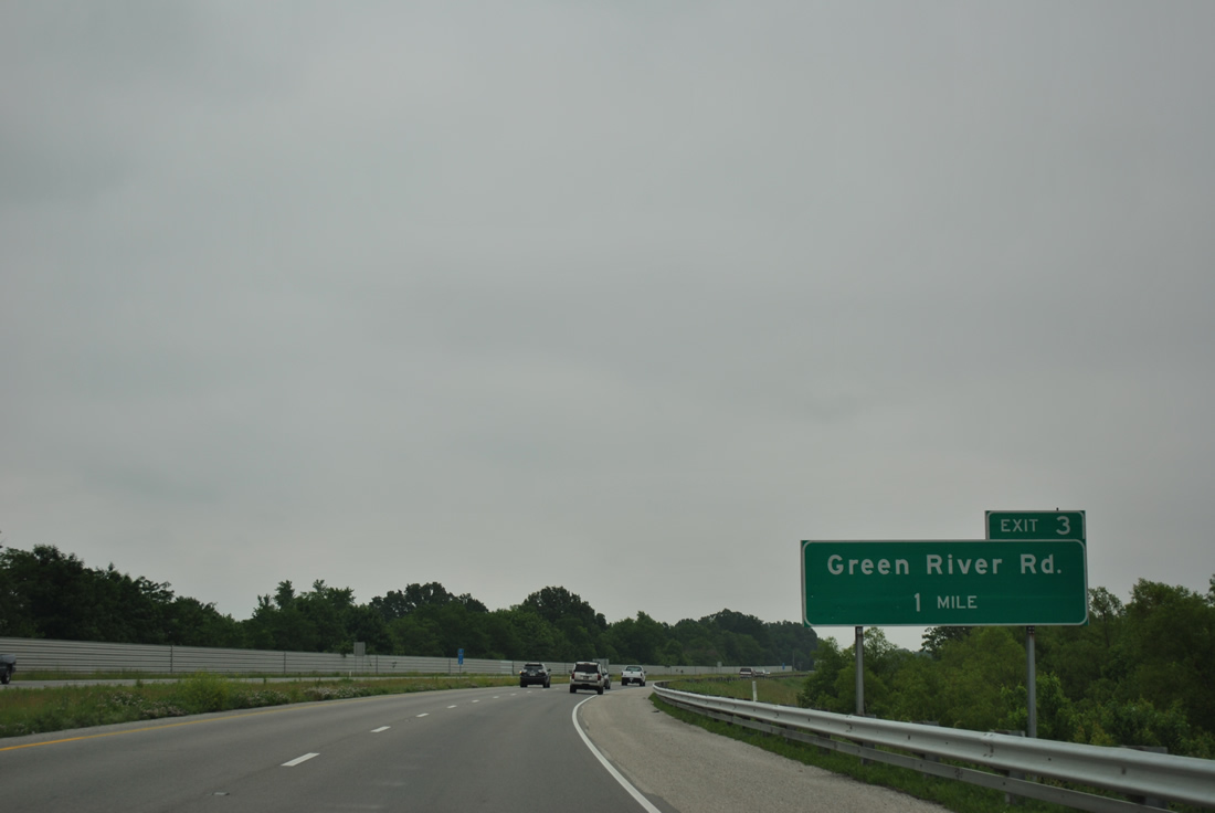
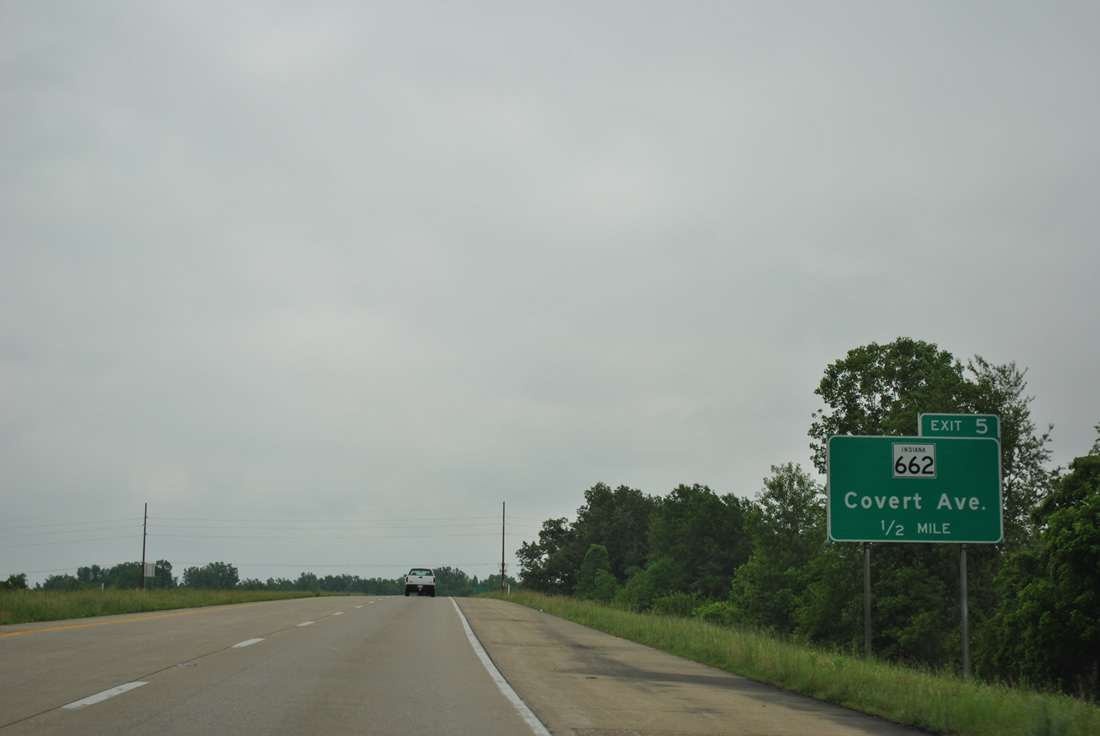
| The initial five miles of I-69 leads east along the southern edge of Evansville, acting as a buffer between the city and Ohio River flood plains. The first two exits along I-69 are at Green River Road (1 1/2 miles) and Covert Avenue/SR 662 east (4 miles). I-64, 19 1/4 miles away to the north, is the main "control" for I-69, a remnant from the former I-164. 05/27/11 |
|
| Green River Road begins at Old Green River Road amid open fields to the south of the parclo interchange (Exit 3) with I-69. 05/27/11 |
|
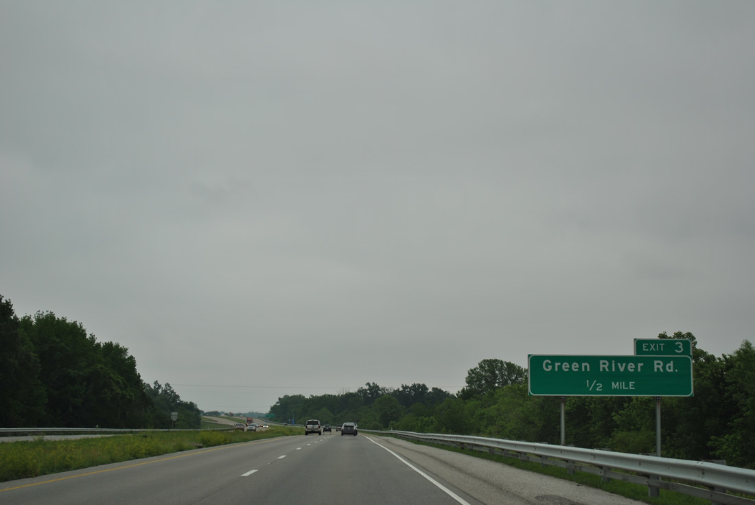
| One half mile west of Exit 3 and Green River Road. Green River Road parallels the freeway northward from Evansville to Daylight and Petersburg Road (old SR-57). 05/27/11 |
|
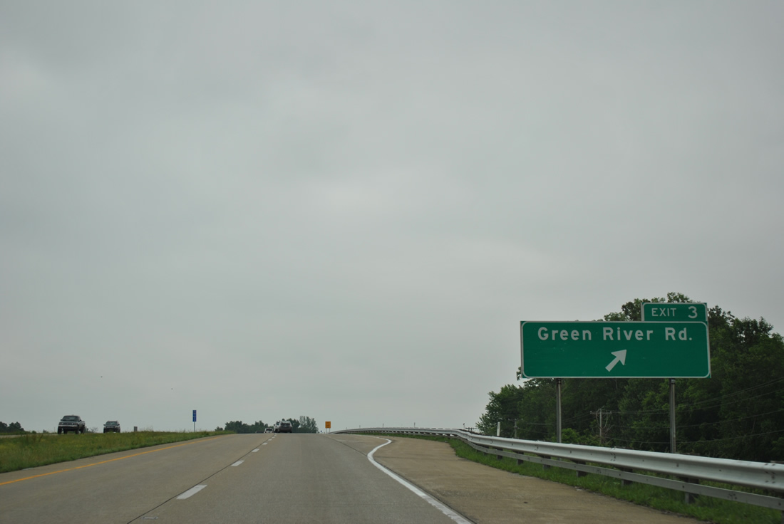
| Exit 3 departs from I-69 north. Green River Road comprises a major north-south thoroughfare that goes through the heart of the Eastside commercial district and past the Eastland Mall and Washington Square Shopping Center. 05/27/11 |
|
| East of Exit 3, I-69 turns toward the northeast as it approaches Exit 5 (Covert Avenue/SR 662 east). Around this area, a new terrain routing of I-69 will tie into the freeway from a new bridge across the Ohio River. 01/01/16 |
|
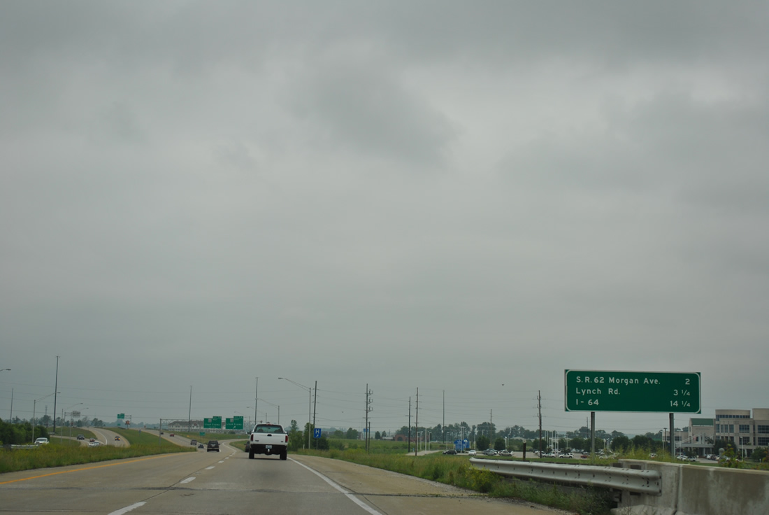
| Covert Avenue/SR 662 East (Exit 6) is 1 1/4 miles away, with the succeeding interchange at the Lloyd Expressway (SR 66). Interstate 64 is 16 1/2 miles away. 05/27/11 |
|
| A sound barrier wall, the first built in Indiana, abuts Interstate 69 as it crosses Pollack Avenue on its eastward trajectory toward Exit 5. 10/19/09 |
|
| Interstate 69 briefly enters Warrick County as it reaches Exit 5, serving Covert Avenue and SR 662 east. 05/27/11 |
|
| Covert Avenue heads west across the south side of Evansville, going as far as U.S. 41. Newburgh Road heads north from Exit 5 as well, connecting with Lincoln Avenue west as a former alignment of SR 662. Interests to Angle Mounds State Historic Site are directed onto Stacer Road south to Pollack Avenue from nearby. 05/27/11 |
|
| Once a longer highway that connected Evansville with Newburgh, a couple of miles to the east, SR 662 was reduced to a one mile spur connecting I-69 with Ellerbusch Road at the Newburgh corporation limits. The Ohio River Scenic Route exits Interstate 69 onto SR 662. 05/27/11 |
|
| Forthcoming SR 66 runs 151 miles from New Harmony on the Wabash River through Evansville, around Newburgh and through Tell City and Leavenworth, to U.S. 150 northwest of Louisville. 05/27/11 |
|
| All Interstate 69 shields along the former I-164 use north/south cardinal directions. I-164 shields used north/south cardinal direction banners only from Exit 5 to Interstate 64. 01/01/16 |
|
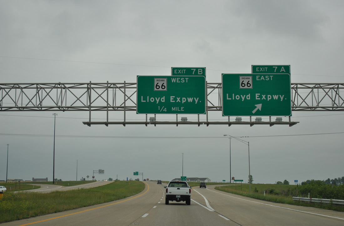
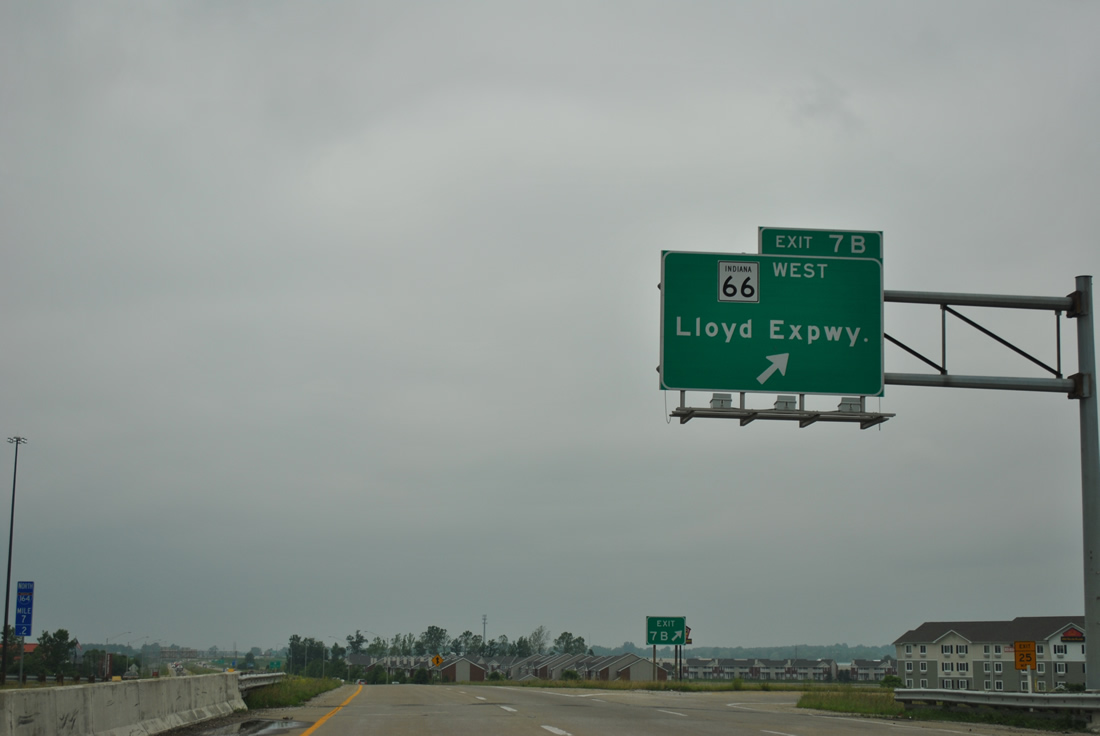
| Exit 7 between Interstate 69 and the Lloyd Expressway (SR 66) is a busy cloverleaf interchange. 05/27/11 |
|
| I-69 advances beyond the Lloyd Expressway two miles to Morgan Avenue (SR 62), 3 1/4 miles to Lynch Road, and 14 1/14 miles to Interstate 64. 05/27/11 |
|
| Exit 7A leaves I-69 north to SR 66 (Lloyd Expressway) east. Suburban development lines all four quadrants of this exchange and SR 66 is commercialized from Eastland Mall across Interstate 69, with growth continuing along open land to the Newburgh bypass. 05/27/11 |
|
| Lloyd Expressway (SR 66) is a well traveled crosstown highway completed in 1988. Varying as an elevated highway or controlled-access arterial, the expressway carries SR 66 west to U.S. 41, and SR 62 west from U.S. 41. 05/27/11 |
|
| Interstate 69 reenters Vanderburgh County on the approach toward Exit 9 (Morgan Avenue/SR 62). This area of Evansville grew in part due to the original construction of I-164 on the eastern side of the city. 05/27/11 |
|
| Oak Grove Road spans Interstate 69 beyond this northbound reassurance marker. Cross Pointe Boulevard parallels the freeway along this stretch to the west serving a number of business parks and retail. 01/01/16 |
|
| A folded diamond interchange (Exit 9) joins I-69 with SR 62 (Morgan Avenue) in a half mile. SR 62 goes for 227 miles from the Wabash River in Posey County eastward toward Evansville where it then heads toward Chandler and Boonville in Warrick County on its route toward the Falls City area, Madison and Cincinnati. 05/27/11 |
|
| The ensuing exits are with Lynch Road in 1.5 miles followed by Boonville-New Harmony Road in seven miles and Interstate 64 at 12 1/2 miles. 05/27/11 |
|
| Exit 9 loops away from Interstate 69 north to SR 62 (Morgan Avenue). SR 62 is a four lane expressway northeast to Chandler and Boonville, the county seat of Warrick County. To the west, Morgan Avenue is a four lane highway to U.S. 41/SR 66. 05/27/11 |
|
| Old Boonville Highway (former U.S. 460) passes over Interstate 69 on the half mile approach to the folded diamond interchange (Exit 10) with Lynch Road. This interchange was built in the 2000s to coincide with the expansion of Lynch Road to four lanes from the interstate to U.S. 41. Lynch Road provides an alternate route across the northern suburbs of Evansville to take traffic off of Morgan Avenue. 05/27/11 |
|
| Lynch Road was extended to the east to connect with SR 62 and Epworth Road. Evansville Regional Airport (EVV) can be reached from Lynch Road. 10/19/09 |
|
| Beyond Exit 10 (Lynch Road), I-69 takes on a rural character as it continues northward along the boundary of Vanderburgh and Warrick Counties. 05/30/16 |
|
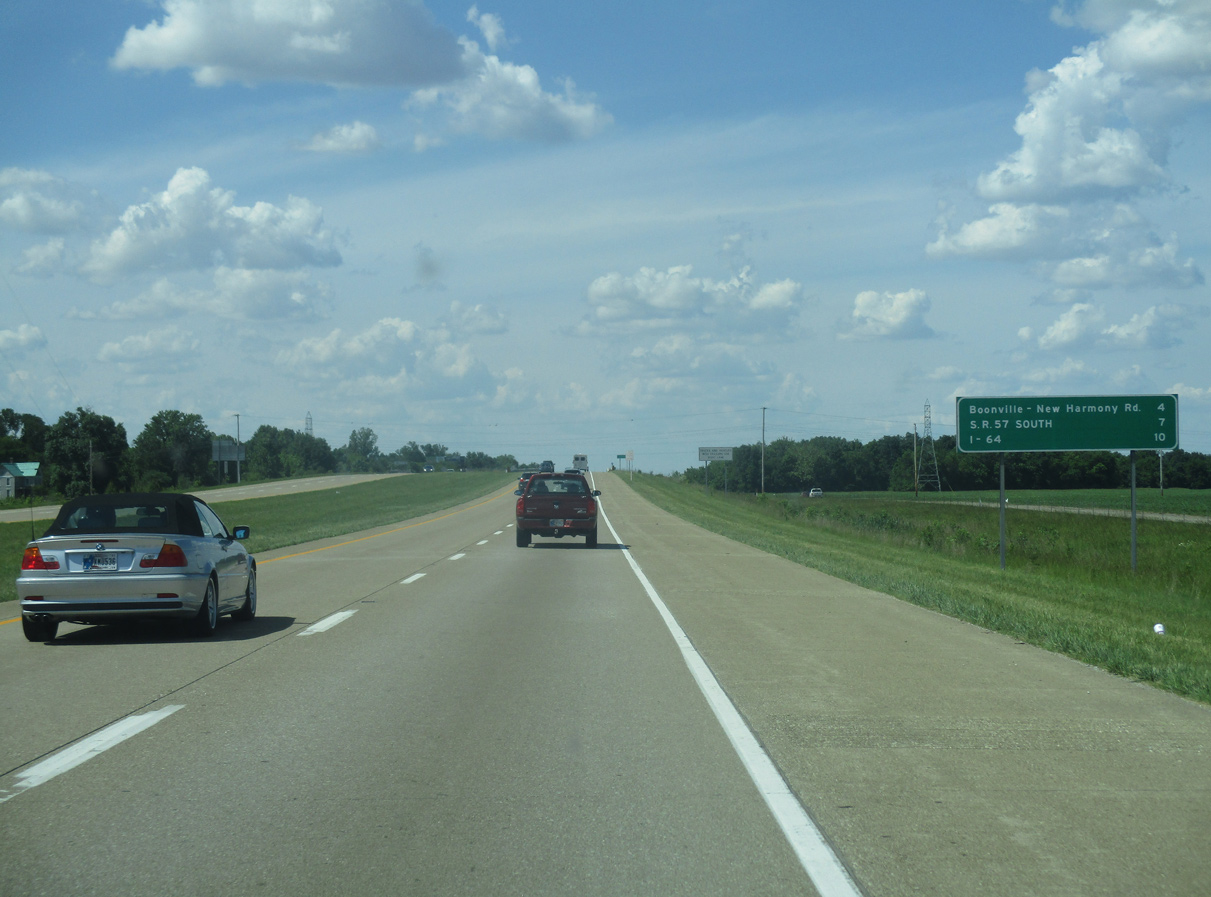
| The next exit for Boonville-New Harmony Road is 4 miles away. SR 57 South is seven miles away and Interstate 64 is reached in ten miles. 05/30/16 |
|
| Interstate 69 nips a corner of Warrick County just beyond the crossing of Pigeon Creek. 05/30/16 |
|
| I-69 reenters Vanderburgh County en route to Exit 15. 05/30/16 |
|
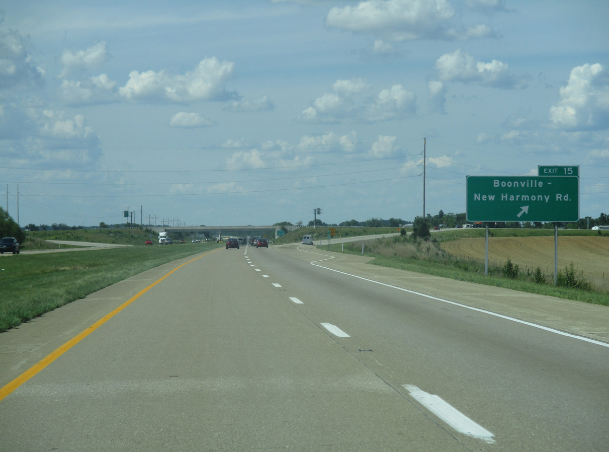
| Exit 15 (Boonville-New Harmony Road) is one mile away. Boonville-New Harmony is a rural country road that connects Boonville with New Harmony along a winding stretch. 05/30/16 |
|
| Boonville-New Harmony Road provides a link with the area of Daylight just west of the exchange at Exit 15 and the community of Darmstadt at U.S. 41. 05/30/16 |
|
| A diamond interchange links I-69 and Boonville-New Harmony Road at Exit 15. 05/30/16 |
|
| Interstate 69 parallels a transmission corridor northward from Bluegrass Creek to I-64. The freeway remains generally rural outside of some industrial development along the west side at Elliot. 05/30/16 |
|
| The succeeding exits from I-69 northbound are for SR 57 south and Interstate 64. 05/30/16 |
|
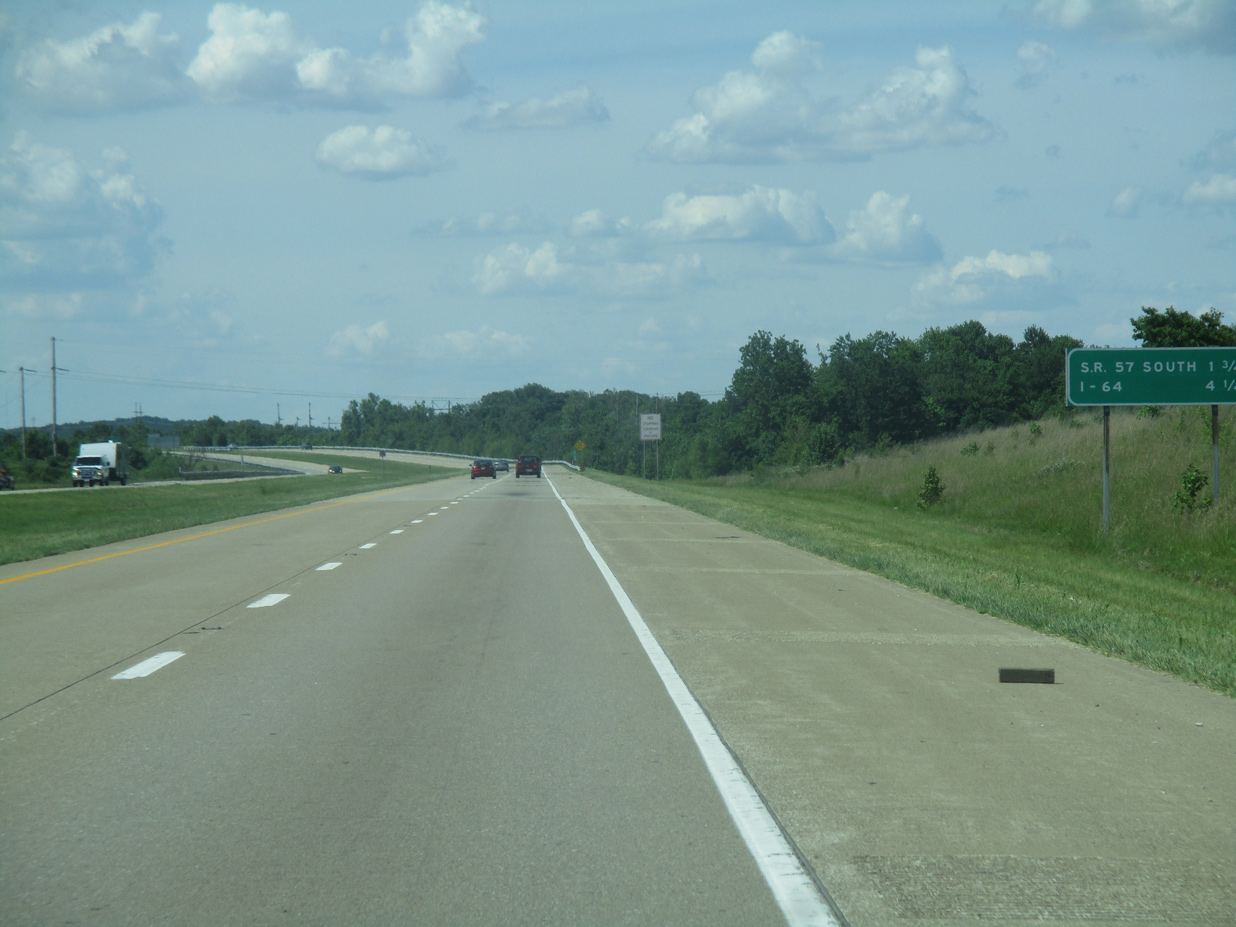
| One mile south of the wye interchange (Exit 18) with access to SR 57 south. 05/30/16 |
|
| SR 57 goes for 80 miles from U.S. 41 north of Evansville through Petersburg and Washington and an end at SR 67 near Worthington. Interstate 69 follows the SR 57 corridor to Washington. 05/30/16 |
|
| The community of Elberfeld can be reached from Exit 18 via several county roads to the northeast of the exchange. 05/30/16 |
|
| Exit 18 ties into the intersection of SR 57 at Old Highway 57 north. SR 57 north combines with I-69 at an adjacent wye interchange northward to Exit 22 with SR 68 by Wheatonville. 05/30/16 |
|
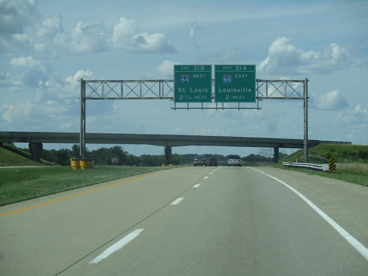
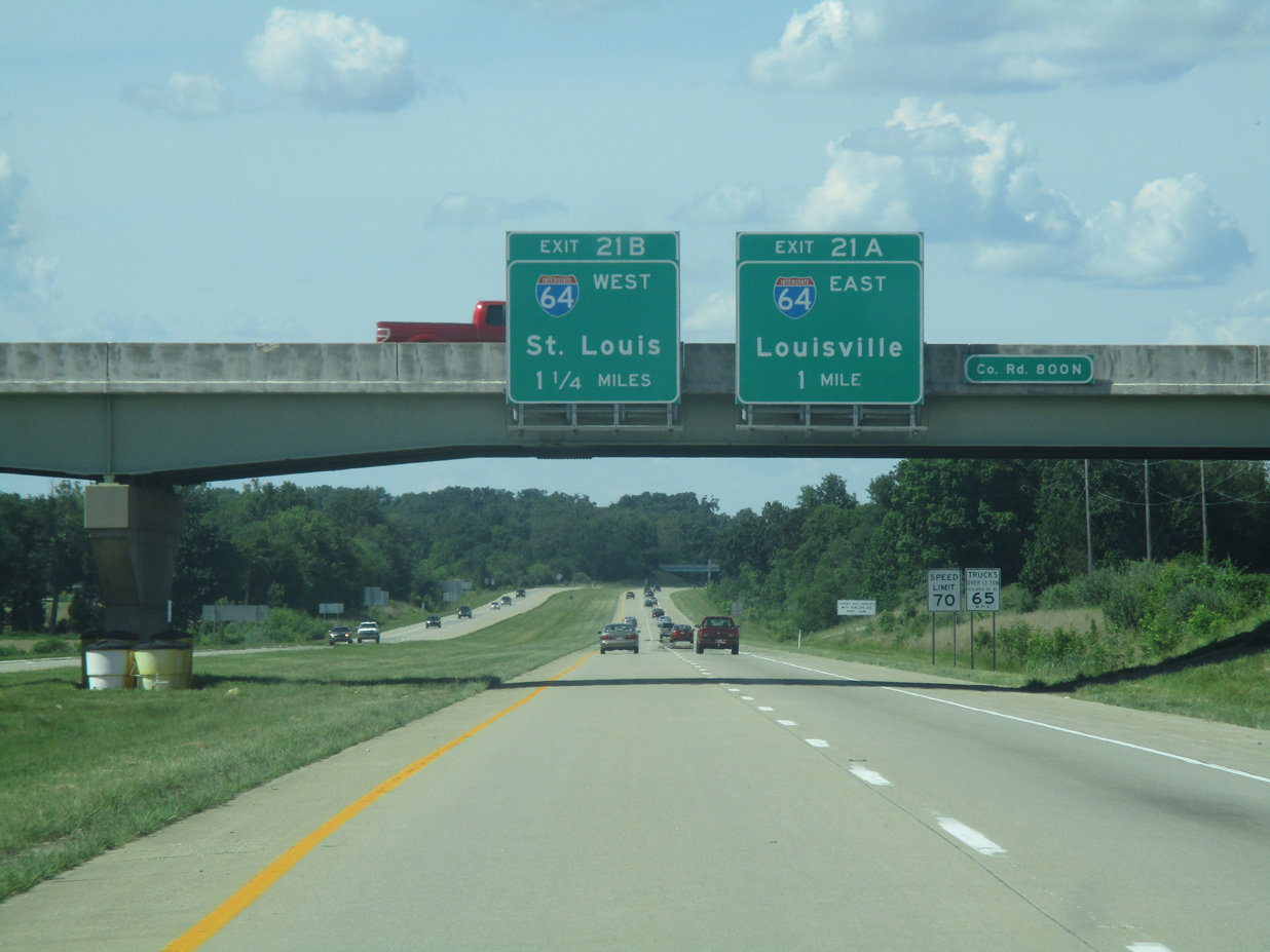
| I-69/SR 57 advance north to Exits 21-B with Interstate 64. I-64 goes for 954 miles from Wentzville, Missouri east through St. Louis, Louisville, Lexington, Charleston, and Richmond before ending in Chesapeake, Virginia. 05/30/16 |
|
| Construction of then-Interstate 164 replaced the original diamond interchange between SR 57 and I-64, and a portion of the SR 57 alignment. SR 57 is not acknowledged at this confirming marker. 05/30/16 |
|
| One mile south of the cloverleaf interchange (Exits 21A/B) with Interstate 64 along I-69/SR 57 north. I-64 is generally a rural route across southern Indiana, with the exception of the Falls City area. I-64 travels 123 miles from the Wabash River near Griffin to the Sherman Minton Bridge at New Albany. 05/30/16 |
|
| Exit 21A turns off of I-69 north toward I-64 east in the direction of Louisville. The former I-164 officially ended here while I-69 began its new southern alignment across Indiana. As of early 2016, I-69 does not have a control city for northbound traffic; though it is all but assured it will be either Bloomington or Indianapolis. Previously Petersburg occupied the space beneath I-69/SR 57 on the guide sign. 05/30/16 |
|
| Exit 21B loops onto I-64 west to Mount Vernon, Illinois and St. Louis, Missouri. Interstate 69 was initially extended north two miles on September 29, 2009 when this cloverleaf interchange was realigned to connect two freeways. Prior to that, SR 57 continued as a two lane highway to the northeast. 05/30/16 |
|
| I-69/SR 57 enter Gibson County at the exchange with Interstate 64. 05/30/16 |
Page Updated 04-18-2020.


 North
North