|
| A transmission corridor crosses Interstate 69 just west of the Wells County line in rural eastern Huntington County. 11/06/11 |
|
| Traveling due south parallel to the Wells County line, Interstate 69 approaches a northbound side rest area. 11/06/11 |
|
| Interstate 69 kinks southwest and passes by Markle at the Exit 286 diamond interchange with U.S. 224 (Markle Road west / Logan Street east). 11/06/11 |
|
| U.S. 224 journeys west from Exit 286 to end at U.S. 24 in Huntington. Eastward, the 287 mile route continues to Uniondale, Decatur, Akron and New Castle, Pennsylvania. 11/06/11 |
|
| Reassurance marker of Interstate 69 south posted ahead of the Wabash River. 11/06/11 |
|
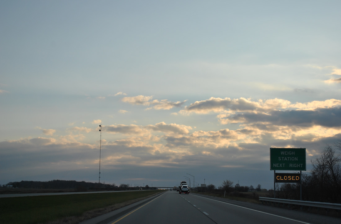
| A set of weigh stations, of which only the southbound side is used, reside ahead of the SR 124 overpass of Interstate 69 near Plum Tree. 11/06/11 |
|
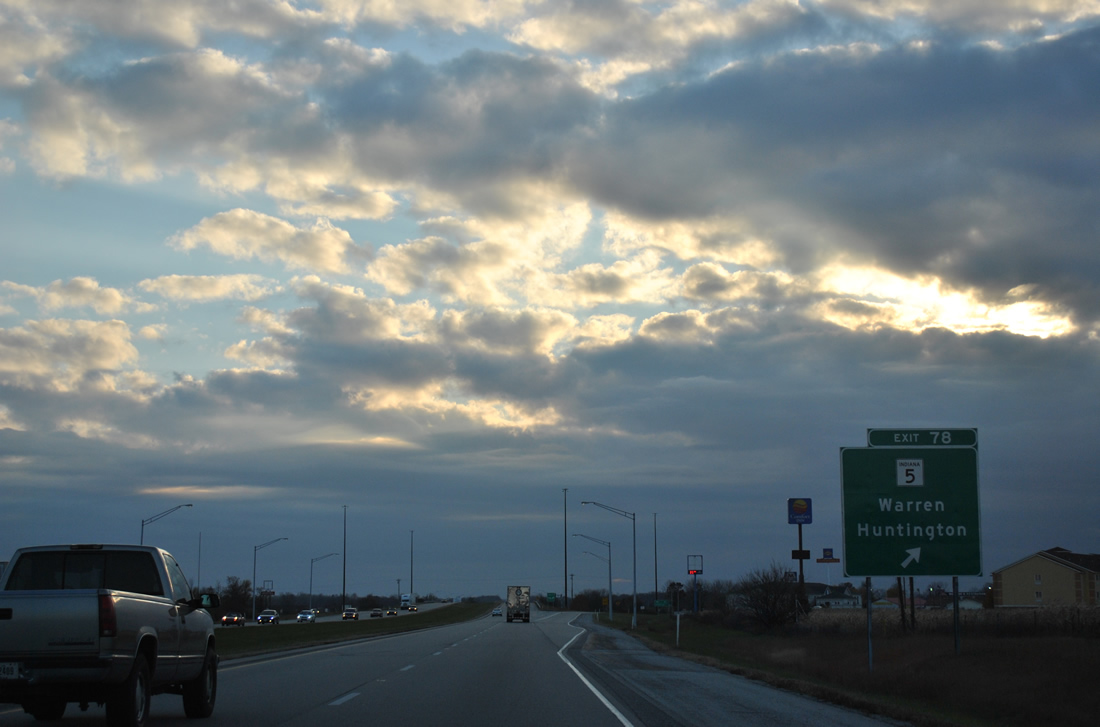
| SR 5 angles southeast from Huntington, Majenica and SR 124 to meet Interstate 69 at a diamond interchange (Exit 278) in one half mile. 11/06/11 |
|
| Exit 278 leaves Interstate 69 south for SR 5 (Warren Road). SR 5 continues 3.3 miles to Warren where the state road turns west to meet Interstate 69 again at Exit 273. 11/06/11 |
|
| Approaching the Salamnie River along Interstate 69 southbound. Marion, the Grant County seat, is 19 miles to the southwest, followed by Anderson in 51 miles and the capital city in 88 miles. 11/06/11 |
|
| SR 5 south combines with SR 218 west from Warren for a 4.7 mile overlap that includes the Exit 273 diamond interchange. 11/06/11 |
|
| State Road 218 exists in two portions; the eastern segment ties into Interstate 69 as part of a 49.9 mile stretch from La Fontaine (SR 15) east to Warren, Poneto, Berne and the Ohio state line (SR 707). The western segment totals 41.6 miles between Delphi and Santa Fe. 11/06/11 |
|
| SR 5 turns south from ISR 218 nearby and crosses Interstate 69 for a third time (without direct access) en route to Van Buren. SR 5 continues to Arcana and SRa 22, where the 96 mile route ends. 11/06/11 |
|
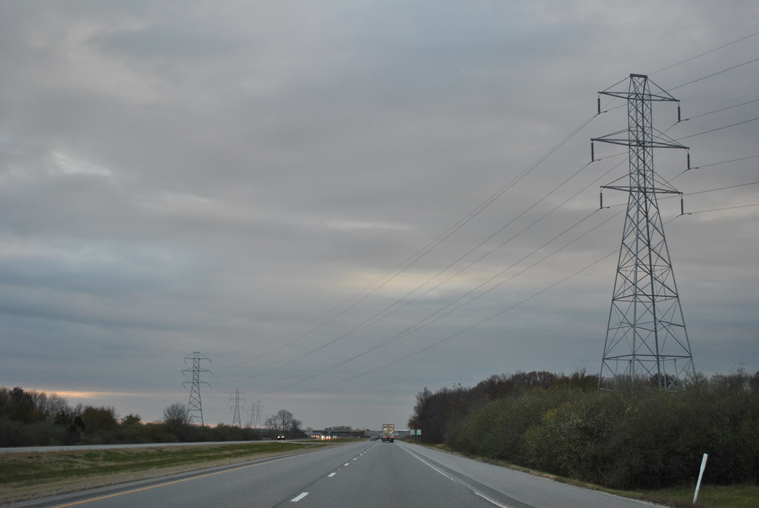
| Another power line corridor mingles with Interstate 69 in Huntington County. The corridor originates as a substation near Roanoke and parallels I-69 southward toward Exit 264 before branching westward to Marion. 11/06/11 |
|
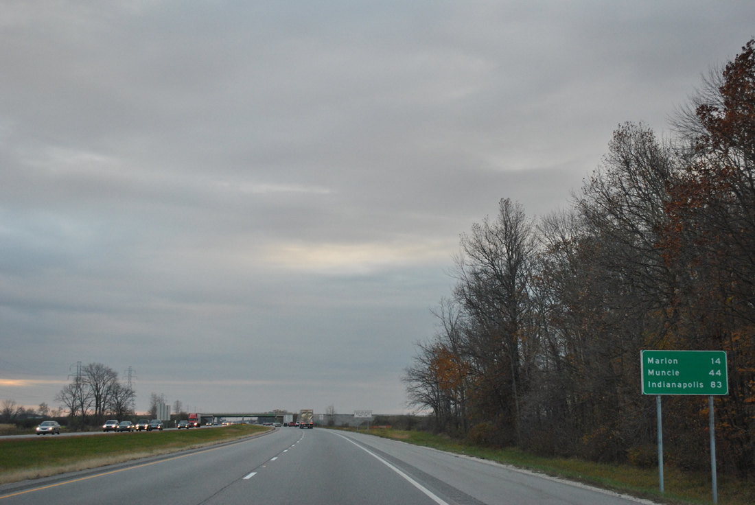
| Marion is 14 mile drive south via Interstate 69 and the SR 18 expressway west. Muncie debuts on southbound signage at 44 miles (via SR 332 east). 11/06/11 |
|
| Just beyond the SR 5 over pass near Van Buren is the Grant County line across Interstate 69 south. 11/06/11 |
|
| Leading due south again, Interstate 69 meets SR 18 at a diamond interchange (Exit 264) in one mile. SR 18 is a 141.1 mile route from the Illinois state line, west of Fowler, to U.S. 27 at Bryant. 11/06/11 |
|
| SR 18 ventures 6.7 miles west to downtown Marion, where the route splits into a one way street couplet of 3rd and 4th Streets. 11/06/11 |
|
| A pair of truck stops lie at the otherwise rural crossroads of Interstate 69 and SR 18. Eastward the state road crosses SR 5 in 2.5 miles and reaches Montpelier in 14.5 miles. 11/06/11 |
|
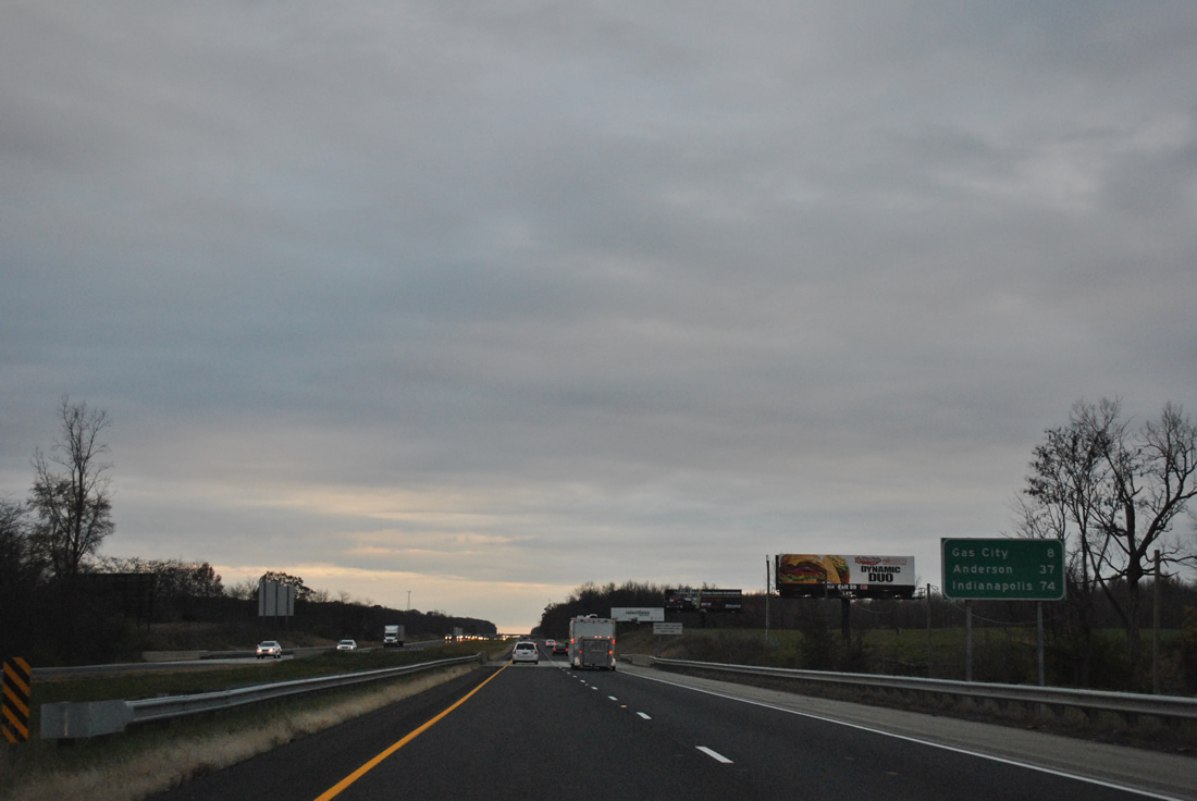
| Southbound distance sign posted between Tippey Ditch and Lugar Creek along Interstate 69 southbound. Gas City is next community of interest at eight miles out. Indianapolis is 74 miles to the southwest. 11/06/11 |
|
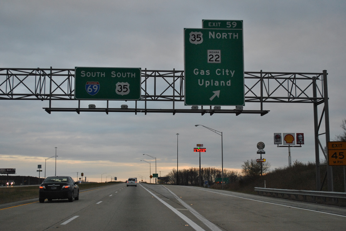
| U.S. 35 south and SR 22 meet Interstate 69 at the second Grant County interchange in one mile (Exit 259). The two overlap west 4.3 miles to Gas City and 29 miles overall to Kokomo. 11/06/11 |
|
| U.S. 35 originally followed Wheeling Pike south from Jonesboro to Matthews, Wheeling and Stockport. This alignment was dropped from the state system when the US highway was relocated onto SR 22 east, Interstate 69 south, and SR 28 east from Exit 245. 11/06/11 |
|
| Entering the diamond interchange (Exit 259) with U.S. 35 north and SR 22 on I-69 south. SR 22 comprises a 50.6 mile route from nearby Upland to Burlington, west of Kokomo. U.S. 35 toals 210 miles in Indiana from the outskirts of Michigan City to an exit of the state with Interstate 70 at Richmond. 11/06/11 |
|
| Continuing south, Interstate 69 near approaches Fairmount in eight miles. 11/06/11 |
|
| Interstate 69 and U.S. 35 share 14.4 miles of pavement while Old U.S. 35 (Wheeling Pike) crosses over the tandem ahead of Exit 255. 11/06/11 |
|
| Spanning the Mississinewa River, a 120 mile waterway flowing west from Darke County, Ohio into the Wabash River near Peru. 11/06/11 |
|
| SR 26 crosses Interstate 69 & U.S. 35 at the final Grant County interchange (Exit 255), 5.2 miles east of Fairmount and six miles southwest of Upland. 11/06/11 |
|
| A 150.1 mile state road, SR 26 travels the width of the state between Illinois near Ambia and Ohio east of Bellfountaine. 11/06/11 |
|
| A diamond interchange facilitates the movements between Interstate 69 and SR 26 at Exit 255. SR 26 angles northeast to meet SR 5 on the 11.5 mile drive to Hartford City. Westward, SR 26 continues from Fairmount to Kokomo and Lafayette. 11/06/11 |
|
| Muncie and Anderson are almost equidistant from Interstate 69 & U.S. 35 south in southern Grant County. Indianapolis is now less than an hour away. 11/06/11 |
|
| Interstate 69 & U.S. 35 south kink southwest across the abandoned Cardinal Railway to enter Delaware County. 11/06/11 |
|
| The final rest area ahead of Indianapolis follows in rural Delaware County. Both north and southbound facilities were rebuilt in the late-2000s. 11/06/11 |
|
| Shields for Interstate 69 and U.S. 35 south follow the rest area on-ramp. 11/06/11 |
|
| U.S. 35 parts ways with Interstate 69 south for an overlap with SR 28 east to Anthony and Muncie. SR 28 west travels 6.5 miles to Alexandria and 15 miles to Elwood. 11/06/11 |
|
| Only one panel for the Exit 245 diamond interchange was present at the time of these photographs for U.S. 35 south and SR 28. U.S. 35 enters the Muncie area with SR 3 on the north side of town to share an expressway bypass with SR 67 to the east. Beyond Muncie, U.S. 35 continues southeast to Blountsville and Richmond and overall to Interstate 64, west of Charleston, West Virginia. 11/06/11 |
|
| Staying well west of Muncie, Interstate 69 remains rural on the 18 mile drive to Anderson. 11/06/11 |
|
| SR 332 represents the second connection between Interstate 69 and Muncie at the diamond interchange of Exit 241. 11/06/11 |
|
| Much of the 7.6 mile route of SR 332, between Interstate 69 and Tillottson Avenue in Muncie, consists of expressway grade roadway. SR 332 is the main route to the city that is home to Ball State University. 11/06/11 |
|
| Exit 241 departs Interstate 69 south for SR 332 (McGalliard Road) east to Muncie. McGalliard Road continues west to become County Road 800 North en route to SR 9 and 128. SR 128 commences a 10.8 mile route west to Frankton and SR 13 there. 11/06/11 |
|
| Interstate 69 remains rural to Daleville in southwest Delaware County. 11/06/11 |
|
| Interstate 465, the Indianapolis Beltway, appears for the first time on Interstate 69 southbound signage 14 miles northeast from Anderson and 41 miles from the freeway end. 11/06/11 |
|
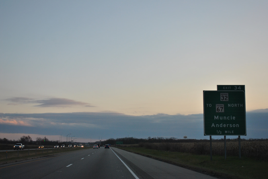
| One mile north of the Exit 234 interchange complex with SR 32 (Main Street) and SR 67 (Commerce Road) north at Daleville. 11/06/11 |
|
| SR 32 goes for 156.8 miles across Indiana overall. Locally the state road joins Interstate 69 with Chesterfield to the west and Daleville to the east. 11/06/11 |
|
| SR 67 is a 199.3 mile route from the Ohio state line, northeast of Portland, to Vincennes. Within Delaware County SR 67 follows the Muncie Bypass, a four lane expressway leading east from Interstate 69 to SR 3 and U.S. 35. 11/06/11 |
|
| Exit 234 utilizes a collector distributor system between a folded diamond interchange with SR 32 (Main Street) and a diamond interchange with Commerce Road (SR 67 north to Muncie). 11/06/11 |
|
| The ramp to SR 32 (Main Street) departs the c/d roadway almost immediately after Exit 234 partitions from Interstate 69 south. SR 32 continues west to the Chesterfield town center and Anderson, where the route combines with SR 9 along Scatterfield Road. County Road 67 (old SR 67) stems west from the adjacent off-ramp to parallel a CSX Railroad en route to Hoosier Park Horse Racing Track and Casino and SR 236 (53rd Street). 11/06/11 |
|
| South of Exit 234, SR 67 south is multiplexed with Interstate 69 and will remain so until Exit 222. 11/06/11 |
|
| Although Anderson is served by the next two exits, Pendleton is listed as the next community along Interstate 69 at 16 miles. Fortville is the next community at 23 miles with Indianapolis 44 miles further away. 11/06/11 |
|
| Interstate 69 enters Madison County around the 32 mile marker. 11/06/11 |
Page Updated 01-26-2012.

 South
South


 South
South