|
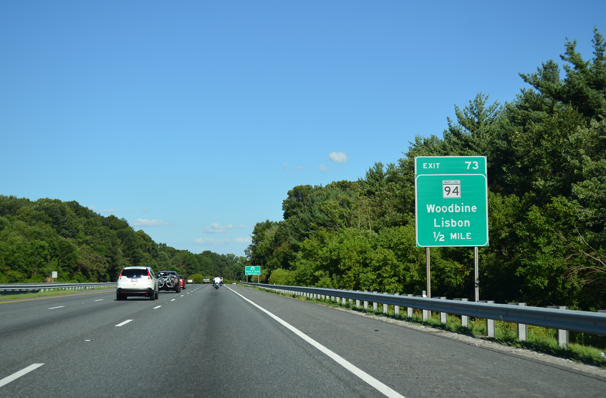
| One mile west of the diamond interchange (Exit 73) with MD 94 (Woodbine Road) at the Watersville Road overpass on I-70/U.S. 40 east. 08/04/13 |
|
| MD 94 travels just 6.25 miles overall, between Old Frederick Road to the north and the Montgomery County line (Patuxent River) to the south. 08/04/13 |
|
| Eastbound I-70/U.S. 40 at the Exit 73 off-ramp to MD 94 (Woodbine Road) at Lisbon. Woodbine Road extends north from the nearby state route end to Woodbine on the Carroll County line. Florence lies three miles to the southwest along MD 94 otherwise. 08/04/13 |
|
| I-70/U.S. 40 continue east through rural areas between Old Frederick Road to the north and MD 144 (Frederick Road) to the south. 08/04/13 |
|
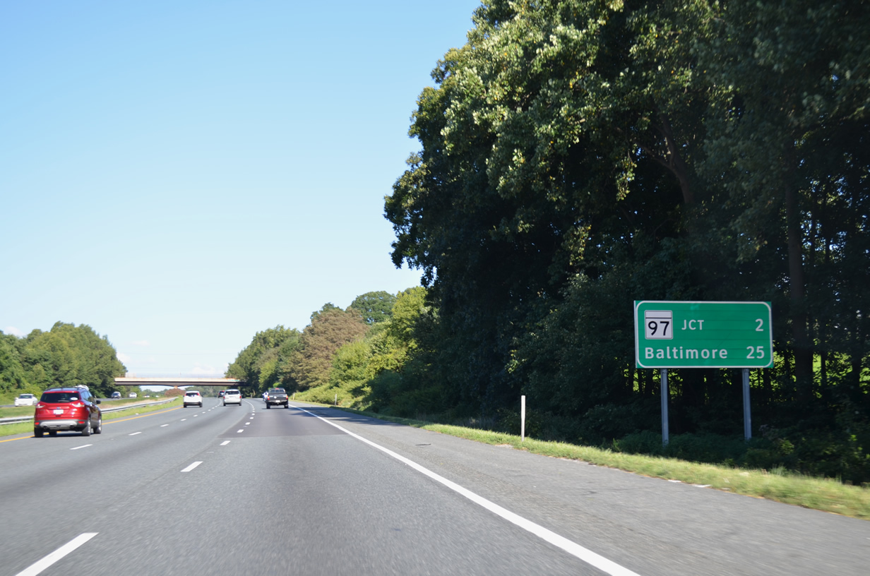
| A diamond interchange joins I-70 with MD 97 in two miles at Exit 76. Baltimore lies 23 miles further. 08/04/13 |
|
| MD 97 constitutes a multi-state route with PA 97 to Gettysburg, traveling 55.27 miles in Maryland south to U.S. 29 in Silver Spring. 08/04/13 |
|
| Exit 76 leaves Interstate 70 east & U.S. 40 east for MD 97 north to Westminster, the Carroll County seat, and south to the Montgomery County suburban community of Olney. 08/04/13 |
|
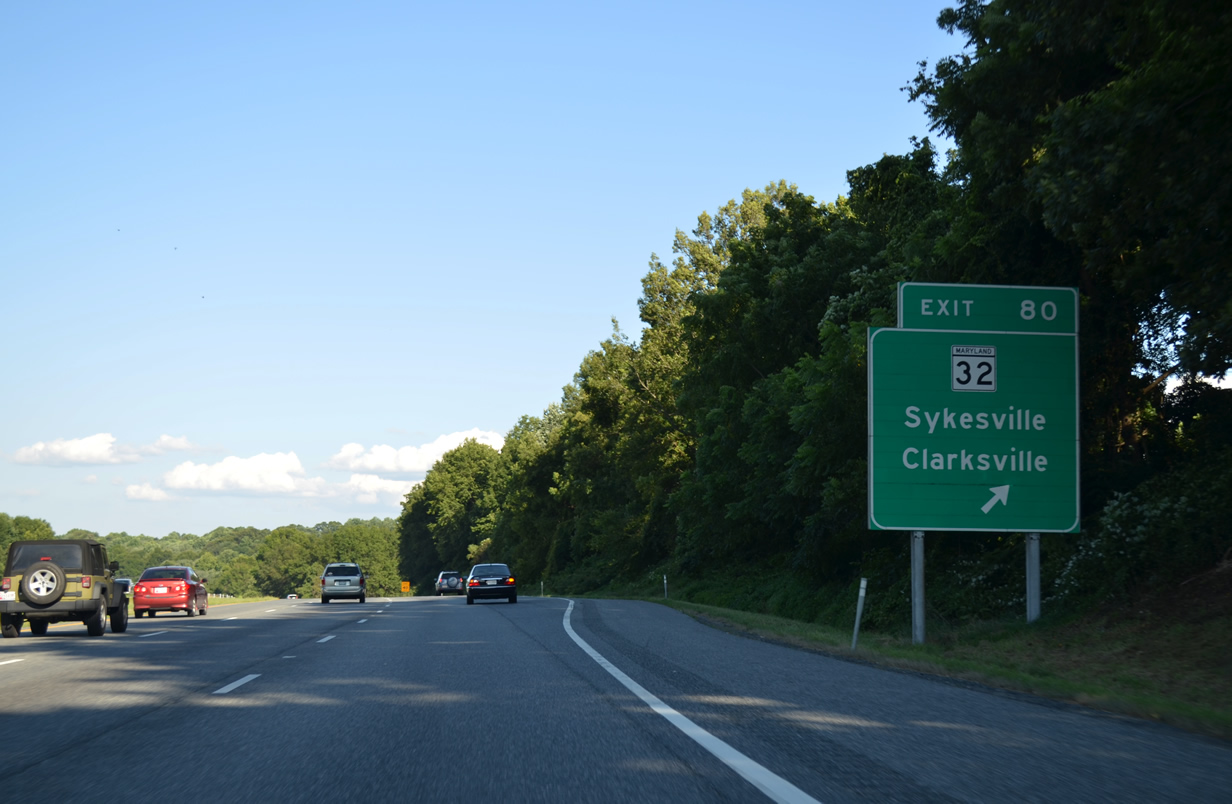
| Heading east from Cooksville, I-70/U.S. 40 remains rural another 2.5 miles to MD 32 (Exit 80). 15 miles of the Interstate remain to the Baltimore Beltway. 08/04/13 |
|
| MD 32 (Sykesville Road) sees a diamond interchange (Exit 80) with I-70/U.S. 40 in one mile. 08/04/13 |
|
| Exit 80 lies just north of the MD 32 (Sykesville Road) crossroads with MD 144 (Frederick Road) at West Friendship. MD 144 follows old U.S. 40 west back to the Howard County Fairgrounds and east to Mayfield. 08/04/13 |
|
| An overall 51.79 mile route, MD 32 originates to the north at Westminster, traveling south to the town of Sykesville and Exit 80. The state route curves southeast to become a limited access highway at Clarksville. Named the Patuxent Freeway, MD 32 proceeds from the Columbia area to Jessup, Fort Meade, Odenton and Interstate 97. 08/04/13 |
|
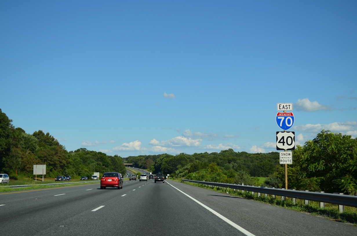
| The final shield assembly for the I-70/U.S. 40 overlap that commenced in Frederick. 08/04/13 |
|
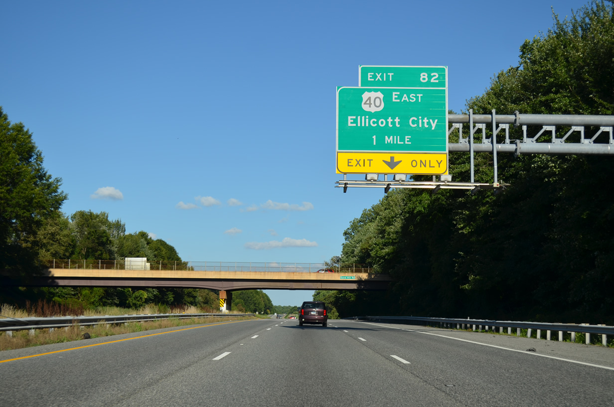
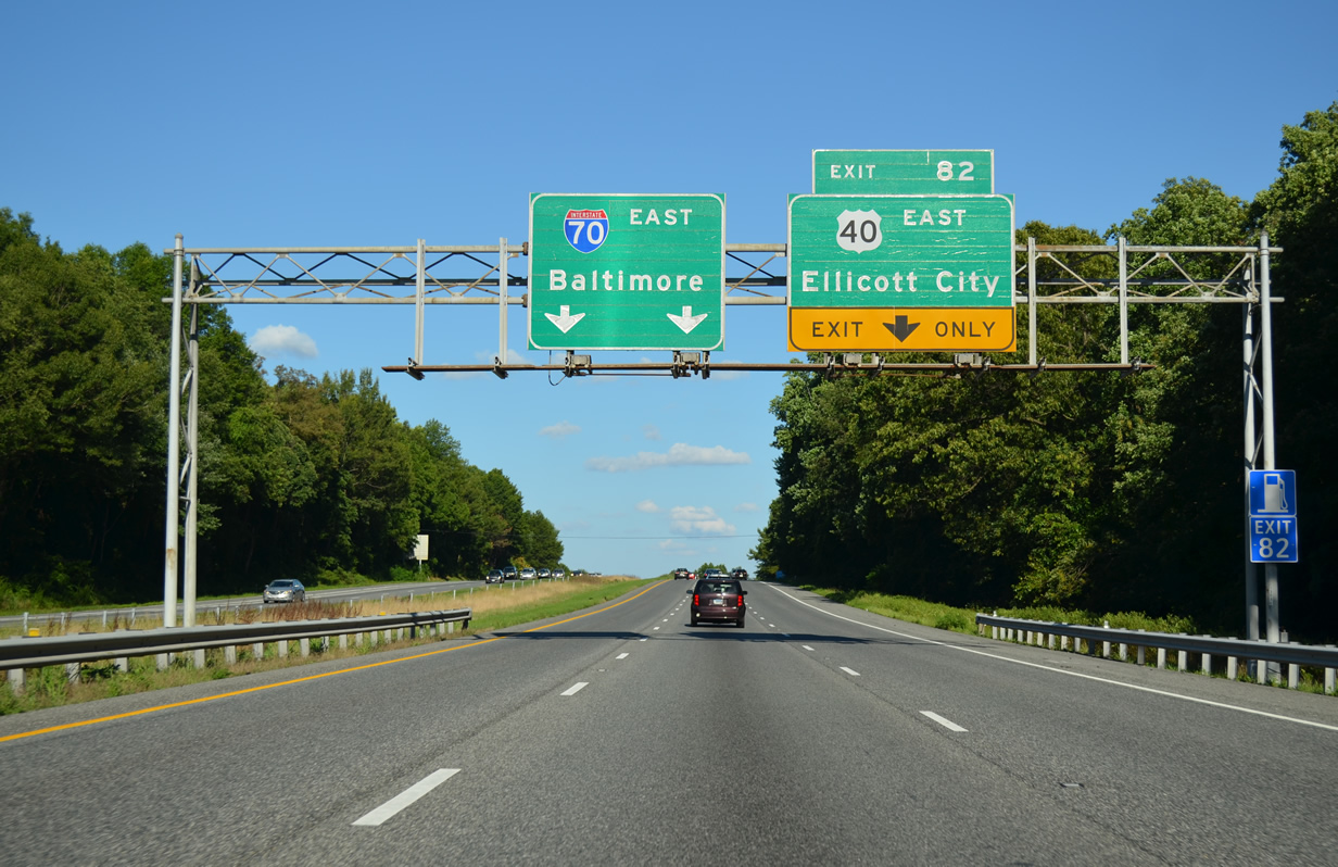
| The forthcoming wye interchange (Exit 82) with the departing U.S. 40 is the first of two exits for Ellicott City along Interstate 70 east. 08/04/13 |
|
| Interstate 70 reduces to two through lanes at the split with U.S. 40. U.S. 40 follows a four lane route southeast three miles to Pine Orchard and six miles to U.S. 29 at unincorporated Ellicott City. 08/04/13 |
|
| The final two exits of Interstate 70 east are with other freeways. Thus no services are available for the remaining nine miles of Interstate highway. 08/04/13 |
|
| U.S. 40 parts ways with Interstate 70 for the final time at Exit 82 near Mayfield. The two commingled since Empire, Colorado. U.S. 40 (Baltimore National Pike) otherwise ties into MD 144 (Frederick Road) at Old Orchard, before branching away from the state route again along a commercial arterial through the Ellicott City area. 08/04/13 |
|
| A lone reassurance marker for Interstate 70 lies immediately east of Exit 82 before the U.S. 40 westbound overpass. 08/04/13 |
|
| A half diamond interchange (Exit 83 from I-70 west) joins Marriotsville Road with Interstate 70 east ahead of this shield assembly. 08/04/13 |
|
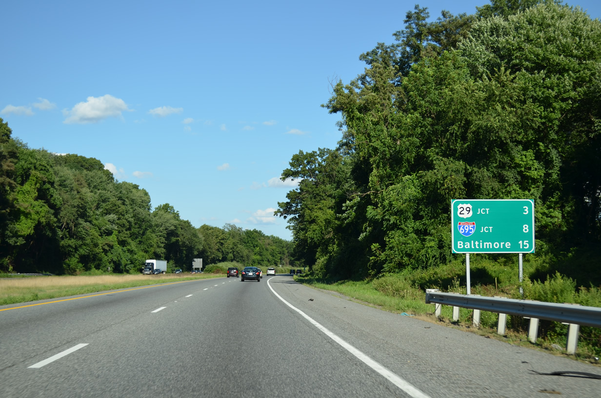
| Eight miles of Interstate 70 remain to Interstate 695. Downtown Baltimore is another seven miles, though that mileage statistic may reference the unconstructed I-70 east into the city. 08/04/13 |
|
| U.S. 29 crosses paths with Interstate 70 at a directional cloverleaf interchange (Exits 87A/B) in two miles. The US highway travels a freeway southward to the Montgomery County line. 08/04/13 |
|
| Traveling 1,036 miles overall, U.S. 29 journeys southwest from the Baltimore area to Washington, DC; Charlottesville and Lynchburg, VA; Greensboro and Charlotte, NC; Spartanburg and Greenville, SC; Athens and Atlanta, GA; Opelika and Auburn, AL; and Pensacola, FL. 08/04/13 |
|
| Suburbans areas encroach along Interstate 70 from adjacent Old Frederick Road (MD 99) and St. Johns Lane as the freeway nears the Exit 87A off-ramp to U.S. 29 south. The U.S. 29 freeway passes through Ellicott City en route to Columbia and Burtonsville. The route travels 25.91 miles overall in Maryland to the DC line at Silver Spring. 08/04/13 |
|
| U.S. 29 north ends immediately north of Exit 87B at Old Frederick Road east and Rogers Avenue west. MD 99 begins there and takes Old Frederick Road west to MD 32 at Slacks Corner. 08/04/13 |
|
| A sign bridge for Exit 87 was removed between 2008 and 2011, leaving temporary signage for U.S. 29 south. 08/04/13 |
|
| A loop ramp (Exit 87B) joins the final half mile of U.S. 29 north to MD 99 (Old Frederick Road) west and Rogers Avenue east. Originally U.S. 29 overlapped with U.S. 40 to end in the city of Baltimore. 08/04/13 |
|
| The former bridge mounted sign for Exit 87B onto U.S. 29 (Columbia Pike) north. 08/27/05 |
|
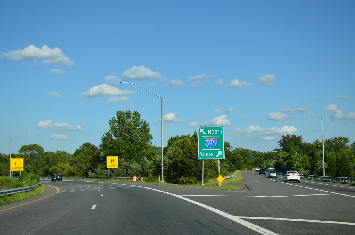
| Rogers Avenue meanders south from U.S. 29 to U.S. 40 (Baltimore National Pike) beyond this auxiliary sign for the upcoming junction with Interstate 695 at Exit 91. Motorists bound for Camden Yards, home of both the Baltimore Orioles and Baltimore Ravens, should take I-695 south (outer) to I-95 north. 08/04/13 |
|
| The last eastbound reassurance marker posted along the 2,151 mile route of Interstate 70. 08/04/13 |
|
| The final distance sign precedes Interstate 695 by three miles. Downtown is referenced at 11 miles out.
A sign replacement made after 2005 decreased the distance to I-695 by one mile 08/04/13 |
|
| Drivers span the Patapsco River and enter Baltimore County along Interstate 70 east. 08/04/13 |
|
| Interstate 70 crosses Patapsco Valley State Park as it enters Baltimore County. While in the park, Main Park Road passes over the freeway two miles west of the symmetrical stack interchange (Exit 91) with the Baltimore Beltway. The two mile guide sign originally displayed RIGHT LANES. 08/04/13 |
|
| Winding east, this advisory sign alerts motorists to potential congestion in and near the Exit 91 stack interchange. There is no alternative at this point but to continue to I-695 otherwise. 08/04/13 |
|
| An end sign installed by 2000 references I-695 as the conclusion for Interstate 70. The 1.95 mile extension beyond I-695 to Security Boulevard (Exit 94) and the I-70 Park and Ride facility was formally dropped from the Interstate system at the AASHTO Spring 2014 meeting. 08/04/13 |
|
| Interests to Thurgood Marshall Baltimore-Washington International Airport (BWI) or the Port of Baltimore should take Interstate 695 south to I-95 as well. 08/04/13 |
|
| A dump truck hit one mile sign bridge for Interstate 695 (Exit 91B/A) on the morning of August 15, 2009, ultimately leading to it coming down. Replacement signs omit the continuation of I-70 east onto Cooks Boulevard for Security Boulevard (MD 122) and the I-70 Park & Ride Lot. 08/27/05, 08/04/13 |
|
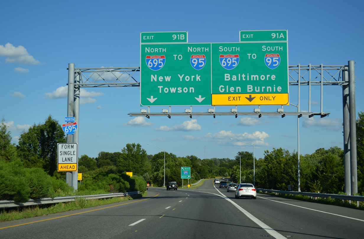
| Two lanes prepare to depart for I-695 (inner) north to I-95 north for New York and one lane for I-695 south to I-95 north to Downtown Baltimore. A single lane continues onto the I-70 spur onto Cooks Boulevard. 08/04/13 |
|
| Exit 91 partitions into ramps for the inner loop of Interstate 695 to Pikesville and Towson and the outer loop to Catonsville and Lansdowne. While Interstate 695 is a busy commuter route, it doubles as the through route from I-70 to Interstates 83 and 95 due to its cancellation within the city of Baltimore. 08/04/13 |
|
| The remaining portion of Interstate 70 travels the highest level of the four lane stack above I-695. Construction downgrades the remaining freeway east to MD 122 into a two lane parkway (Cooks Boulevard) as part of the Red Line subway line being built into Baltimore. 08/04/13 |
|
| Exit 91 partitions into high speed ramps for Interstate 695. Overall I-695 encircles Baltimore along a 51.46 mile route east to Parkville, Essex and Dundalk to the east. 08/04/13 |
|
| Exit 91B quickly reduces to a single lane through the stack. 08/04/13 |
|
| Speed limits drop initially to 55 and than 40 miles per hour as I-70 leaves the systems exchange with I-695. 08/27/05 |
|
| Exit 94 joins the east end of I-70 with Security Boulevard (MD 122) west and Cooks Lane southeast to U.S. 40 (Edmondson Avenue). 08/27/05 |
|
| One half mile from the end of Interstate 70 at Franklintown and the Baltimore city line. 12/30/08 |
|
| Exit 94 is a three quarter cloverleaf interchange with MD 122 (Security Boulevard) at a Park & Ride lot. Traveling 2.96 miles west to Rolling Road, MD 122 begins at the city line from Cooks Lane east of Forest Park Avenue. 08/27/05, 12/30/08 |
|
| An on-ramp joins the I-70 Park & Ride area from MD 122 west ahead of the loop back to the westbound freeway. 12/30/08 |
|
| Looking westward from the bus loop by Gwynns Falls Park at I-70's end. The original lanes of the six lane freeway were converted into a parking lot. 06/17/00 |
|
| This view looks east from the exit of the park and ride lot toward Gwynns Falls Trailhead. 06/17/00 |
|
| Trailblazers for I-70 west and I-695 direct motorists exiting the park & ride lot and from the MD 122 entrance ramp to the westbound freeway. 06/17/00 |
Page Updated 06-08-2014.


 East
East